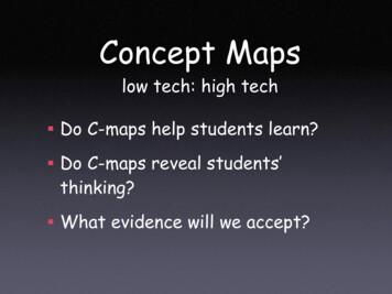
Transcription
Maps andCartographyGIS Research & Map CollectionMaps Tutorial:The Elements of a MapBall State University LibrariesA destination for research, learning, and friends
The Map: A Geographer’s MostImportant Tool Maps are important in geographybecause they show how differentfeatures are related.Maps are used by various types ofpeople and professions for manydifferent purposes.All maps, however, share thesame common elements.
The Elements of a Map TitleLegendScaleDirectionalIndicatorInset Maps
The Elements of a Map: Title The most important element of themap for acquiring informationefficiently is the title.The title identifies the map area andthe type of map.Cartographers may list the titlesimply or artistically.
The title of this bird’s-eye-view map ispredominant: Muncie, Indiana, 1884.Indiana, 1884, GRMC, Ball State University Libraries).(Muncie,
Titles of maps typically appear at the top of themap, but not always. (Maine Coast Map, Maine GeographicBicycling Maps, 1989, GRMC, Ball State University Libraries).
The title of this pictorial map of Indiana wascreated to match the artistic design of the map.(A Map of Indiana Showing Its History, Points of Interest, 1967, GRMC,Ball State University Libraries).
Another artistically-created map title: A Map ofMiddle Earth. (A Map of Middle Earth from An Atlas of Fantasy,1979, J.B. Post, Atlas Collection, Ball State University Libraries).
This festive map title for a map of Hawaiicontinues the artistic theme: Principal Islands ofHawaii. (Principal Islands of Hawaii, 1973, GRMC, Ball StateUniversity Libraries).
The Elements of a Map: Legend Another important feature on a mapis the legend or map key.Information needed to read a map isfound in the map legend.Most maps use symbols or colors torepresent different geographicfeatures. The map legend helpsdetermine what the symbols andcolors mean.
This is a basic map legend featured on a map ofIndiana. This type of legend or key is commonfor identifying features of maps. (Indiana: “The HoosierState,” 1983, GRMC, Ball State University Libraries).
Sometimes colors are used to identify certainareas on a map. On this map, the differentcolors shown in the legend represent areas ofspecific types of land use in Africa. (Africa’sEnvironment and Economy, Student Atlas of World Politics, 2006, AtlasCollection, Ball State University Libraries).
This colorful legend identifies the cathedrals,castles, battle sites, and ancient families of Ireland.(Historical Map of Ireland, 1969, GRMC, Ball State University Libraries).
This legend simply identifies the roads of Texas,but the cartographer chose to be creative in thedesign of the legend to add character to the map.(Texas Guide Map, 194-, GRMC, Ball State University Libraries).
Cartographers also use creative symbols on maps.The crowns on this map represent winners of theMiss Universe pageant, while the purple identifiescountries with contestants in the beauty pageant.(The State of Women in the World atlas, 1997, Atlas Collection, Ball StateUniversity Libraries).
The Elements of a Map: Scale Almost all maps have scales.Scales compare a distance measuredon the map to the actual distance onthe surface of the earth.Scales appear on maps in severalforms, but most cartographers drawa line scale as a point of reference.
Scale, continued A map displaying the entire surface of theearth with all the continents and oceanswould be drawn at a larger scale. A scaleon this type of map would be drawn inthousands of miles and kilometers.A map of the White House, however, mayhave a scale with distance determined infeet.The two maps described above maybe the same size on paper—only theirscales are different.
This map scale shows the distance on the map of1500 miles/kilometers. The scale is also translatedto how many miles are represented in one inch onthe map. (National Geographic Soccer Unites the World, 2006, GRMC, BallState University Libraries).
Ancient cartographers created very artistic maps,and the elements of the maps could be quiteelaborate and colorful. This map scale issurrounded by a decorative border and compass.(Floridae Americae Provinciae: Recens & Exactissima Descriptio, 1564,engraved reproduction, GRMC, Ball State University Libraries).
This scale from a historical map of Kentuckyfeatures an image of George Washingtonsurveying the land. (Kentucky: The Dark and Bloody Ground,An Historical and Geographical Map of the State of Kentucky, 1933, GRMC,Ball State University Libraries).
Another simple scale showing the distance inmiles in relation to the map of Europe. (World ofSherlock Holmes map from An Atlas of Fantasy, 1979, J.B. Post, AtlasCollection, Ball State University Libraries).
The Elements of a Map:Directional Indicator Another common map element is adirectional indicator. A directionalindicator on a map helps determinethe orientation of the map.Some cartographers place an arrowthat points to the North Pole on themap. This is a “north arrow.”Other maps indicate direction byusing a “compass rose,” with arrowspointing to all four cardinaldirections.
Ancient cartographers drew elaborate, artisticdirectional indicators—most commonly a compassrose. (Floridae Americae Provinciae: Recens & Exactissima Descriptio,1564, engraved reproduction, GRMC, Ball State University Libraries).
This simple compass rose features a Kentuckycardinal and an arrow pointing north. (Kentucky: TheDark and Bloody Ground, An Historical and Geographical Map of the Stateof Kentucky, 1933, GRMC, Ball State University Libraries).
This compass rose was featured on a map ofIndiana history. The young girl is pointing eastand west while her feather serves as a northarrow. (Liberty Elementary School’s Indiana, 1974, GRMC, Ball StateUniversity Libraries).
This compass rose featuring Tinkerbell is displayedon a map of the Disneyland theme park. (Walt Disney’sMagic Kingdom, Disneyland U.S.A., Anaheim, California, 1964, GRMC, BallState University Libraries).
The Elements of a Map: InsetMaps Some maps feature inset maps—smaller maps on the same sheet ofpaper.Inset maps provide additionalinformation not shown on the largermap.Inset maps are drawn at a larger,more readable scale.Inset maps usually feature areas ofinterest related to the larger map.
Inset maps are commonly used on tourist/travelmaps. The inset maps above feature suburbs ofBrisbane, Australia, and a map of the city’s trainroutes. (Lonely Planet’s Brisbane & Gold Coast, 2002, GRMC, Ball StateUniversity Libraries).
This inset map displays terrorist attacks that have takenplace in Israel and its neighbors. This information wouldnot have been easily read on the larger world map. (WorldTerrorism: A Reference Map, 2002, GRMC, Ball State University Libraries).
The larger map above is a modern map of theNile Valley. The inset map shows the ancientEgyptian Empire in the same area. (National GeographicThe Nile Valley: Land of the Pharaohs, 1963, GRMC, Ball State UniversityLibraries).
The larger map of Shakespeare’s Britain featuresinset maps of Stratford-Upon-Avon and a bird’s-eyeview map of London. (National Geographic Shakespeare’s Britain,1964, GRMC, Ball State University Libraries).
Geography is the study anddiscovery of the world, and maps area critical component of geography.Learning more about cartographyand the common elements of mapswill enhance the understanding ofthe world.Maps really are a geographer’s mostimportant tool.
For more information about any of themaps or atlases shown or the tutoriallesson Maps and Cartography: TheElements of a Map, please contact theGIS Research & Map Collection, BallState University Libraries, at (765)285-1097.Visit the Webpage atwww.bsu.edu/library/collections/gcmc/Ball State University LibrariesA destination for research, learning, and friends
Click here to complete this mc/feedbackform/Ball State University LibrariesA destination for research, learning, and friends
inset maps of Stratford-Upon-Avon and a bird’s-eye-view map of London. (National Geographic Shakespeare’s Britain, 1964, GRMC, Ball State University Libraries). . Ball State University Li