Transcription
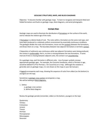
GEOLOGIC STRUCTURES, MAPS, AND BLOCK DIAGRAMSObjective: To become familiar with geologic maps. To learn to recognize and interpret tilted andfolded formations and faults on geologic maps, block diagrams, and aerial photographs.Geologic MapsGeologic maps are used to illustrate the distribution of formations on the surface of the earth,and to indicate the relative age of the rocks.A formation is a distinct body of rock. The rocks within a formation are the same rock type, andhave been produced in a relatively uniform environment by essentially continuous conditions.The geologist divides the rocks into formations, traces out the contacts between the formations,and draws them on a map. The boundary between two adjacent formations is termed a contact.If deposition of sediments was continuous while two adjacent formations were being produced,the contact is conformable, that is, no time is missing between the two formations. If someinterval of time is missing between adjacent units, the contact is an unconformity.On a geologic map, each formation is different color. Use of proper symbols conveysapproximate geologic ages. For example, the Coconino Sandstone, which is Permian in age,would be labeled Pc (P for Permian, c for Coconino) on a map. (Although this notation isgenerally seen on geologic maps, it is not shown on the maps in your lab manual.)A legend accompanies each map, showing the sequence of rocks from oldest (on the bottom) toyoungest (on the top).Sometimes a geologic cross-section accompanies a map.We will be looking at block diagrams.1. Define:a. geologic cross section:b. define block diagram:Review the geologic periods (remember, oldest on the bottom, youngest on the ermianPennsylvanianMississippianDevonian
SilurianOrdovicianCambrianThe abbreviations for the periods of the geologic time scale:
Structural GeologyTilted FormationsFormations that have been tilted look like thin "stripes" on a geologic map. Tilted formations aredefined by their strike and dip.2. Define:a. Strike—b. Dip-Remember that dip cannot be measured from a map. It is measured at the outcrop with aBrunton Compass (or a planimeter or clinometer, like we did on the Woodstock Dome fieldtrip).You can see the dip on a cross section, or on a block diagram, along the front or side.Note: One way to determine the direction of dip is to think “If I rolled a ball down the top of theformation (the contact), in which direction would it roll?”Cardboard Model 1 (Block Diagram)Let's look at Cardboard Model 1. Print out the model and then fold the model like a box. (Cutout the rectangle and then cut the diagonal lines at the 4 corners to help you fold it). Rememberthat the top of this block diagram is the geologic map, and the sides are the cross-sections.3.Note that these formations are forming “stripes” on the geologic map, indicating that theformations are tilted. (You can see that they are, in fact, tilted, on the front of the blockdiagram). What is the strike of all the formations on Cardboard Model 1 (i.e. Which way are they“heading” on the geologic map)?a. North-Southb. East-Westc. North-West/South-Eastd. North-East/South-West4.What is the dip of the Devonian, Mississippian and Pennsylvanian and Permian ageformations? (Remember, to see the dip, look on the cross section--in this case, the front of theblock diagram). You should be able to measure with your protractor, or estimate an angle of dip,as well as give the direction. Notice that the Ordovician and Cambrian age formations have adifferent dip. They are vertical beds (90o dip).a. Dipping east, 5 degreesb. Dipping west, 25 degreesc. Dipping north 50 degreesd. Dipping south, 60 degrees
Now we will look atFolded Structures – Anticlines and SynclinesLet's review anticlines and synclines:Synclines --Trough shaped folds Matching “stripes” (formations) mirrored on either side of a center formation (on ageologic map) Younger beds in the center Limbs dip toward the axisAnticlines --Arched shaped folds Matching “stripes” (formations) mirrored on either side of a center formation (on ageologic map) Older beds are in the center Limbs dip away from the axis
Practice drawing in the top or sides of the images above, depending on what you were given.Then use them to answer the following questions.
Look at Fig. A5.Is this fold an anticline or a syncline? Remember the letters stand for the geologic periods.a. Anticlineb. Syncline6.What age are the youngest rocks, and where are they located on this fold?a. Mississippian, on the outsideb. Mississippian, in the centerc. Silurian, on the outsided. Silurian, in the centere. Devonian, on the sidesLook at Fig. B7.Is this fold an anticline or a syncline?a. Anticlineb. Syncline8.What age are the oldest rocks, and where are they located on this fold?a. Mississippian, on the outsideb. Mississippian, in the centerc. Silurian, on the outsided. Silurian, in the centere. Devonian, in the middleLook at Fig. D9.Notice that because there are matching “stripes” of formations, mirrored on either side ofa center, this is either an anticline or a syncline. Which is it?a. Anticlineb. Syncline10.How do you know? (Extend the lines above the top and connect them with theirmatching unit this is what it would have looked like before erosion)a. Oldest rocks are on the outsideb. Oldest rocks are in the centerLook at Fig. E.11. Here you are given the map, and need to draw in the cross-section on the front. 1. By lookingat the strike and dip symbols, and the symbol for the fold, what type of fold is drawn here? Whichis it?a. Anticlineb. Syncline
Look at Fig. K. Here you are given the map, and need to draw in the cross-section on the front.12. By looking at the ages of the formations, is this fold an anticline or a syncline?a. Anticlineb. Syncline
Plunging FoldsSometimes folds plunge into the earth (their axial plane is tilted). A plunging fold will make a Vpattern on a geologic map (figures below).Remember these rules:Syncline--V patterns points in direction opposite of plunge.Anticline--V pattern points in the direction of plunge.Look at Fig. F in the first group of images used for the previous questions. This is an example of aplunging fold.13. By looking at the strike and dip symbols in Fig. F, and the symbol for the fold, what type offold is drawn here? (Hint Is it dipping towards the center or away from the center?)a. Plunging Anticlineb. Plunging Syncline
Domes and BasinsDomes are upwarped structures which form a circular map pattern. In a dome, the oldest bedsare in the center and the formations dip away from the center. Basins are downwarpedstructures which form a circular map pattern. In a basin, the youngest beds are in the center andthe formations dip toward the center.14.Look at Figure J. Determine whether this is a dome or a basin.a. Domeb. Basin15.Look at Figure L. Determine whether this is a dome or a basin.a. Domeb. Basin
16. Look at this figure. Use the key provided, keeping in mind that the units are listed youngestto oldest. Is this a dome or a basin? This is a complex geologic setting and more than 1 geologicevent affected the rocks, resulting in contradictory strike and dip symbols so be sure to look atthe ages of the rock. View on the computer screen in color too.a. Domeb. Basin
17. Is this figure a dome or a basin?a. domeb. basinDip-Slip Faults18. Define:Fault-Hanging wall (also called the headwall) Footwall Normal Fault-Reverse Fault-Remember these rules for Dip-Slip faults: The fault always dips toward the hanging wall. On a geologic map, if two different formations meet on either side of a fault, the side withthe older rocks always moved up.
If the hanging wall moves down with respect to the foot wall, the fault is normal. If the hanging wall moves up with respect to the foot wall, the fault is reverse. (Note that for Rules 3 and 4, it does not matter which side of the fault actually moved, or ifboth sides actually moved, only what the relative direction of movement was).Here you see Fault D in cross-section19. Is Fault D a normal or a reverse fault? (Hint: Determine which side is the hanging wall and ifit moved up or down with respect to the footwall).a. normalb. reverseOn this cross-section below, movement is not indicated by black arrows, but you can match theformations across the fault to see how they were displaced.20. Is Fault H in image above a normal or a reverse fault?a. normalb. reverse
For these questions, look at the colors of the layers on the computer screen if printed out inblack and white.Look at Fig. G back in the original sets of images that were used for question 12.21. Is this fault a normal or reverse fault?a. normalb. reverseLook at Fig. H back in the original sets of images that were used for question 12.22. Is this fault a normal or reverse fault?a. normalb. reverseStrike-Slip FaultsStrike-slip faults are characterized as being “right lateral” or “left lateral”. Standing on one side ofthe fault, look across the fault and notice to which side objects seem to have moved in respect toyou. It doesn’t matter which side of the fault you stand on.Look at Fig. I back in original sets of images used for question 12.23. Is this a right-lateral or left-lateral strike-slip fault?a. right-lateralb. left-lateralLook at the figure below that shows a portion of the San Andreas Fault. This figure showsevidence of fault motion. Notice the roads, small streams, and small features of the landscape.Geologists have inferred that the San Andreas fault is an active fault and that the blocks of rockon either side of the fault are moving
24. Geologists have inferred that the San Andreas Fault is an active fault and that the blocks ofrock on either side of the fault are moving. Using the start of Wallace Creek on the NorthAmerican Plate and the continuation of Wallace Creek (runs under the words in Pacific plate),determine if the San Andreas Fault is a right-lateral or left-lateral strike-slip fault?a. right-lateralb. left-lateral25. How much has the San Andreas Fault offset the present-day channel of Wallace Creek?a. approx. 70-90 metersb. approx. 2 kilometersc. approx. 10 metersd. 1 inch Notice the small dry valley in the lower-left part of the photograph. Infer how this valleymay have formed. You can see this on Google Maps or Google Earth. Look up OriginalWallace Creek bed in California.26. In Google Earth, search for 38 04 36.00N 109 55 26.61 W and zoom to an eye altitudeof 20,000 ft, make sure to note your geographic location. (hint: re-read the section in thecourse content unit on Faults and in this lab manual)a. You are looking at the surface expression of many fault lines (fault scarp) with the hangingwall occupying the valleys and the foot wall representing the plateaus, what kind of faults arethey?
b. What would we call these paired features?c. What type of stress created these features?27. Search for 22 48 45.63S 117 20 12.85E and zoom to an eye altitude of 25 miles. Thisfeature is caused by the folding of rocks.Imagine you are a geologist trying to determine what is going on in the area. How could youtell if this large bullseye structure is a dome or a basin (State whether this is a dome or basin,and give two different ways to tell them apart)?Examine the feature 10 miles southwest of the previous feature. Is this fold horizontal orplunging, how can you tell?
Cardboard Model 1 (Block Diagram) Let's look at Cardboard Model 1. Print out the model and then fold the model like a box . (Cut out the rectangle and then cut the diagonal lines at the 4 corners to help you fold it). Remember that the top of this block diagram is the geologic map, and the sides are the cross -sections. 3. Note that these formations are forming “stripes” on the geologic .
