Transcription
PART 3ADVANCELAND NAVIGATION
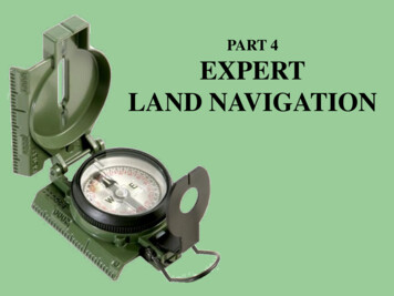
PART 3 Advance Land NavigationUSING THEMILITARYLENSATICCOMPASS
PART 3 Advance Land NavigationWARNINGThis presentation is intended as aquick summary, and not acomprehensive resource. If youwant to learn Land Navigation indetail, either buy a book; or getsomeone, who has the knowledgeand skills, to teach you in person.
PART 3 Advance Land NavigationNOTETo get the ideas across presented onthese slides, many figures, pictures,and calculations may not be to scaleand may be exaggerated for clarity.
PART 3 Advance Land NavigationNote:Prior to being issued any training *equipment, you willbe required to sign a “statement of liability” agreeingto pay for anything you damage or lose.All items will be inspected and inventoried prior toyour signature and at the end of the training day too.If you do not intend to sign this statement, then youmay be denied training.* You may use your own equipment.
PART 3 Advance Land NavigationAny Questions?
PART 3 Advance Land NavigationBREAK TIME
PART 3 Advance Land Navigation. . . and now on with the . . .PRESENTATION
PART 3 Advance Land NavigationLAND NAVIGATION WITH MAPAND LENSATIC COMPASS
PART 3 Advance Land NavigationLAND NAVIGATIONWhy Learn Land Navigation? Training and practicing land navigation on footprovides the following everyday navigation (how not to get lost) benefits;- Tracking present location (Where am I ?)- Determining Distance (How far is it and am I there yet ?)- Sense of direction (Where do I want to go and where am I actually going ?)- How to read a topographic map (Do I understand the map ?)-Terrain and map association (What hill or river am I looking at ?)- Spatial skills (Can I mentally visualize the landscape in 3D ?)- Planning safe, practical routes (Take a long safe route or a short risky route ?)- And more Navigational skillsThe best way to learn LAND NAVIGATION is to get "dirt time", that is, get out there with a map and compass!Navigation is not about finding yourself after you are lost (although that’s what happens sometimes); it’s aboutkeeping track of your position as you move away from a known point. As you move you have to remaincognizant of the terrain you are leaving, of the terrain you are passing, and of the terrain that is ahead.Navigation in the wilderness means knowing your starting point, your destination, and your route to get there.These skills will allow you to venture farther off the beaten path than you ever thought before.
PART 3 Advance Land NavigationTHIS PRESENTATION IS DIVIDED INTO FOUR PARTSPART 1Basic Land Navigation The Lensatic Compass The Topographic Map The Land and Map AssociationPART 2Intermediate Land Navigation Making Sense of Direction Tracking Present Location Determining Travel DistancePART 3Advance Land Navigation Planning to Navigate Navigation Methods to Stay On Course Additional Skills of Land NavigationPART 4Expert Land Navigation Navigation in different types of Terrain Night Navigation Sustainment
PART 3 Advance Land NavigationAny Questions?
PART 3 Advance Land NavigationPART 3ADVANCE LAND NAVIGATION Planning to Navigate– Description– Planning Navigate to Stay on Course– Description– Staying on Course Additional Navigation Skills– Description– Additional Skills
PART 3 Advance Land NavigationPLANNING TO NAVIGATEDESCRIPTIONEVERY TIME you enter a wilderness area, familiar or not, alone orin a group, you should prepare as though you were going in alone.In spite of rules for following the leader’s decisions, or those ofthe majority, and rules for keeping the group together (as well asrules for not going alone) the plain truth is that in the wilderness anindividual is potentially a unit of one.Always “BE PREPARED”. Leaders have been known to fail, andthe group’s best of intentions do not always keep a group together.Example, in a group of three - one of them sustains a seriousinjury and the other must stay with the injured person, while thethird person goes for help. The third person now becomes anavigator, regardless of whether or not the person was one. Enjoying the great outdoors means navigating, perhaps camping overnight and then moving on again. It is important to have all the right equipment, and have a travel plan, with safety always in mind.Planning ahead (research) can prevent future frustration. To do this, you must think about the following.– The Group or traveling alone (individual strengths and weaknesses, physical and mental needs)– Equipment (essentials and comforts)– Safety (rules to follow, emergency plans)– Responsibilities (group or traveling alone)– The terrain (a detailed map study, weather)– Route selection ( practical routes, alternate routes, the group type)
PART 3 Advance Land NavigationAny Questions?
PART 3 Advance Land NavigationPLANNING TO NAVIGATEGROUPGROUP or ALONE Choose your group carefully (unless it is a family trip) - if people are stubborn, inflexible and finicky athome, they will be even more so in the wilderness. Leader - a group must elect a leader, who should asses the capabilities of each individual before makingplans to travel. A leader must have competence and the skills to lead a group. Above all, the leader mustat all times avoid the appearance of indecision. Leadership - is very difficult, especially under the pressure of Life-or-Death situation, and particularly ifsome people, within the group, are unwilling to be led. There are four types of leadership and all are equally important. Designated Leadership - taking responsibility for the group, motivating and guiding the grouptoward its goals, and determining how the group will achieve these goals. Group Leadership (Active Followership) - supporting and following the designated leader,and participating in ―group decision making‖ by giving input and seeking clarity. Peer Leadership - the team works together and supports each other in achieving groupgoals, and each team member sees what needs to be done and does it. Self Leadership - each person takes care of themselves, so they can take care of the group,and everyone shows personal initiative and character. Individual strengths and weaknesses – must be carefully and privately considered by the leader,whose plan of action will be determined by what the group as a whole is capable of doing. Each individualmust know and except their own strengths and weaknesses. Physical and mental needs – the group will have a better time if its needs are met and stays together;its integrity maintained through good, caring, leadership. Like medications, eyewear, hearing aids,socializing, feeling needed, eliminate boredom, etc.
PART 3 Advance Land NavigationPLANNING TO NAVIGATEGROUP or ALONEALONE The more experience you have navigating and camping with others, the better qualified you are to go italone. Remember, all of your experiences, good and bad, become more intense when you are alone. Trekking the wilderness alone for any number of reasons entails much greater risks from theconsequences of injury or becoming lost than trekking with a group does. These are risks that you personally and willingly accept for the rewards of solitude. Ironically, the reward for trekking solo is a heightened awareness of potential dangers and a stricteradherence to safety concerns. A person who has spent a vast amount of time in the wilds alone, is more careful than a person who hassomeone to watch their back. You look at the cliff a little longer before deciding if it’s safe to climb. Or find a safer spot to cross ariver. Individual strengths and weaknesses – you must know and except your own strengths andweaknesses. Physical and mental needs – you must asses your own needs, like medications, eyewear, isolation,boredom, etc. A solitary wanderer becomes more conscious about leaving a note behind.
PART 3 Advance Land NavigationAny Questions?
PART 3 Advance Land NavigationPLANNING TO NAVIGATEEQUIPMENTESSENTIALS Without a doubt the single most important item in your gear is YOU. A clear, cool head (mind) atop a body in good physical and mental condition. An adventurous spirit. And good common sense. How much gear is needed? Just enough to stay dry, warm, and nourished. A light pack will allow forincreased awareness and enjoyment of the surroundings while in route to your destination. Individuals - must have these twelve (12) essential items in a daypack.1. A PLAN - never travel without it.5. Whistle2. Map6. Personal first-aid kit3. Compass7. Insect repellant/sun screen4. Pocket knife8. Matches, waterproof Backpacking (campsite essentials)1. Tent & tarp4. Individual stove & fuel2. Sleeping bag & pad5. Water purifier3. Eating / cooking utensils6. Extra clothing9. Emergency rain gear10. Flashlight11. Water12. Food7. extra food8. toiletries9. binocularsGroups - any additional gear for the group to complete their goals. Carrying these extra items will bedistributed among the group as evenly as possible by weight.COMFORTS What are comforts? Non-essential gear not listed above, such as a chair, radio, pillow, reading book, etc. Determine the comfort gear that YOU NEED to maintain your personal level of security and comfort.Also, note that you must carry your own personal comfort gear.
PART 3 Advance Land NavigationAny Questions?
PART 3 Advance Land NavigationPLANNING TO NAVIGATESAFETY Leave copies of your plans, destination and schedule, with a family member or Ranger Station. Always carry your daypack, with the twelve essentials, with you. In a group - pace the hike to the slowest member of the group. STAY TOGETHER, start as a group, hikeas a group and end as a group. Always use the buddy system. Each member should study the planned route on the map and have their own copy of the map & route. The group should come up with safety rules that are adhered to and enforced by all. In a group - when navigating, divide responsibilities. SCOUT – selecting the best path (footing), avoiding dead falls, loose rocks, etc. NAVIGATOR – makes sure the SCOUT stays on course. HEAD COUNT – at intervals stops the group and the group does a head count. EQUIPMENT – at intervals (during head count) perform group and personal equipment inventory. EVERYONE - keep a lookout for hazards, and keeps all persons in visual and talking range. When a group or lone navigator cannot know for certain where they are going, they had better be certainof where they have been. They must in some way remain oriented to their base camp, the trail head, orsome other point which means food and shelter (safety). Check your approximate location on the map and try to compare its markings with yoursurroundings. Do this every 30 minutes to an hour. Sooner, if the group desires. Bad weather or unexpected hazards, turn back and return to base camp (safety). DO NOT take any risk. Pre-trip equipment check; make sure everything works and that you know how to use it.
PART 3 Advance Land NavigationPLANNING TO NAVIGATESAFETYTHE RULE OF THREE’S3 SECONDS – (MIND) the time you have to decide to escape or take action on an immediate danger.3 MINUTES – (AIR) the average time you can survive without breathable air.3 HOURS – (SHELTER) without it, time before you start dying from hypothermia (cold) or hyperthermia (heat).3 DAYS – (WATER) the time before dehydration can claim your life because lack of water.3 WEEKS – (FOOD) the time before you cannot do any daily necessary task because of lack of food.3 MONTHS – (HOPE) the time without meeting anybody else before a solid depression catches you.
PART 3 Advance Land NavigationAny Questions?
PART 3 Advance Land NavigationPLANNING TO NAVIGATERESPONSIBILITIES Alone you have the responsibility to keep yourself physically and mentally alert, aware, and safe. In a group everyone needs a responsibility; this gives a person the satisfaction of belonging to a team. In a group - when navigating, divide responsibilities and rotate the responsibilities.* * * It is possible for one person to hold more than one position if need be. * * * # 1 SCOUT (point man) – selects the best path (footing), avoiding dead falls, loose rocks, hazards.DOES NOT go fast and after an obstacle waits and allows everyone to catch-up before moving on. # 2 NAVIGATOR (compass) – ensures the SCOUT/group stays on course, with map and compass. # 3 LEADER – at intervals stops group for rest period, keeps all group members within visual andtalking distance. Makes sound decisions at a moment’s notice, taking into consideration the currentsituation as well as all possible contingencies. Consults with the ASSIST LEADER. # 4 PACE COUNT – keeps track of how far the group has traveled by pace count and time. # 5 ASSIST NAVIGATOR (compass) – ensures the group stay on course, with map and compass. # 6 ASSIST PACE COUNT – keeps track of how far the group traveled by pace count and time. # 7 HEAD COUNT / EQUIPMENT – during rest period ensures the whole group does a head count,a personal equipment inventory, and takes in nourishments (water and food). # 8 REAR (Assist Leader) – keeps a lookout for hazards from behind and makes sound decisionsat a moment’s notice. If someone in the back of the group needs to stop, relays message to Leaderto halt group. Consults with the LEADER.NOTE – primary and assistant positions must compare findings with each other, to verify results.Navigator-to-Navigator (on course) and Pacer-to-Pacer (travel distance)
PART 3 Advance Land NavigationPLANNING TO NAVIGATERESPONSIBILITIESGROUP OF EIGHTSCOUTGROUP OF FOURSCOUT / NAVIGAT0RNAVIGAT0RLEADERPACE COUNTASSIST NAVIGATORLEADER / PACE COUNTASSIST NAVIGATOR / PACE COUNTHEAD COUNT / EQUIP / REARGROUP OF THREESCOUT / NAVIGAT0RASSIST PACE COUNTLEADER / PACE COUNTHEAD COUNT / EQUIPNAVIGATOR / EQUIP / REARREAR
PART 3 Advance Land NavigationAny Questions?
PART 3 Advance Land NavigationPLANNING TO NAVIGATETHE TERRAINTERRAIN Review park brochures, internet photos, maps, and all other sources, to get a visual of the landscape. Detailed map study – take a good look at the map before you pack for the wilderness. It will show you treasures and obstacles along the way. A great ridge top for a breathtaking view. A challenging water crossing. Elevations can tell you where you may encounter snow (high elevations) in early summer. Contour lines will show steep or gentle slopes on a planned route. Maybe you need special equipment to cross difficult terrain. Seasonal considerations. Rainy Season – has that small stream turned into a raging flooded uncrossable river? Dry Hot Season – that water hole or small stream you planned to take a rest at, is it dried up? Are there dangers of seasonal wildfires? Timing is everything. What can be an easy low water stream crossing in the early morning can become a dangerous orimpassable river by the afternoon. That swamp full of bugs in the morning may be easier to navigate in the evening high winds.
PART 3 Advance Land NavigationPLANNING TO NAVIGATEROUTE SELECTIONROUTE SELECTIONThere are two types of routes. A route that fits the group or solo person – physical and hiking skills are limited. No experience. A group or solo person that fits the route – the route is so challenging and requires special skills. Will it be a loop route (point ―A‖ to ―A‖) or a one-way route (point ―A‖ to ―B‖)? Select a group and routes with the right qualifications. What type of group is it? Informal (friends) or formal (paying customers, educational class)? What are the goals of each group member? Do they want to be there or do they have to be there? What is the experience level of each member? Are there group members that can lead and manage the group? What is the physical condition of each member? Are there health issues among the group? Plan the routes at a level that will be fun, educational, challenging, and safe for everyone. Use binoculars –they save a lot of legwork. Survey the area from different vantage points, trying tounderstand where streams and rivers flow, lay of the hills, terrain footing and obstacles, etc. Scanning – scan very slowly, looking hard into, rather than at, the terrain. Expect the unexpected. Select routes that can be modified for unseen situations. Bad weather Trail conditions Broken equipment Injuries, etc
PART 3 Advance Land NavigationAny Questions?
PART 3 Advance Land NavigationSTAYING ON COURSEDESCRIPTIONThe difference from classroom into thewilderness is the difference between THEORYand PRACTICE.The wilderness is not crisscrossed withreference grid lines, like a map, to aid thenavigator.There is difficulty encountered in holding toa selected course under conditions where theobjective cannot be seen. Wilderness navigation is a DISCIPLINE when traveling off the beaten path. To stay on course DO NOTrely on your ―sense‖ of direction. You must rely on your compass and all navigation techniques availableto you.– Human reference point– Making a reference point– Baselines– Thumbing the map
PART 3 Advance Land NavigationSTAYING ON COURSEHUMAN REFERENCE POINT1.Navigator #1 stays stationary, while navigator #2 goes ahead to the limit of visibility. With binoculars and walkie-talkies, the distance can be further.2.Then navigator #1, with compass in hand at desired azimuth, signals navigator #2 to move left or righttill navigator #2 is aligned with compass azimuth bearing.3.Navigator #1 catches up with navigator #2 and the process is repeated.NAVIGATOR #2NAVIGATOR #1NOTEBy keeping track of distance as well as the direction of each zig & zag while traveling, and doing some carefulmap work, the group will have a running assessment of their approximate location.
PART 3 Advance Land NavigationSTAYING ON COURSEHUMAN REFERENCE POINTEven though this is a slow process, it is very effective when needed.NAVIGATOR #2MOVETHISWAYNAVIGATOR #1MOVETHISWAYONCOURSEMOVEAHEADSTOPI WILLCATCHUPWITHYOU
PART 3 Advance Land NavigationSTAYING ON COURSEMAKING A REFERENCE POINTAs a lone navigator, this is an alternate method to the ―human reference point‖ when resources are available.However, it is time consuming to assemble.1.At your current position, pile up rocks or other landscape debris laying around.2.Ensure it is large enough to be seen from a long distance away on your route.3.Set your desired azimuth, say 125º and calculate your back azimuth (125º 180º 305º back azimuth).4.Walk as far as you can on your desired azimuth 125º, occasionally looking back to the reference pointand checking the back azimuth 305º to the reference point, as you walk forward.5.Move left or right to maintain the back azimuth 305º, which keeps you on course, eliminating lateral drift.REFERENCE POINT305º BACKAZIMUTH
PART 3 Advance Land NavigationAny Questions?
PART 3 Advance Land NavigationSTAYING ON COURSEBASELINES ADVANCEDAzimuths can serve as baselines that let you explore a ―trail less‖ area from your camp sight.1.2.3.4.5.6.7.8.You create a baseline with the first azimuth measured from your camp (starting point) to a landmark (58º peak 1).Taking a second azimuth landmark (340º peak 2) fixes the campsite’s exact location on the first azimuth baseline.With the cross azimuths written down you’re free to wander around the area.You explore the area and sight on peak 1 to find your azimuth is 354º, which puts you east of the baseline.You head west towards the baseline till your azimuth to peak 1 is 58º, which puts you on the baseline.Now you are at the baseline of 58º, but which way to turn, to go to camp? West or east?You sight on peak 2 to find your azimuth is 38º, which puts you west of camp, so you turn east.Walk the 58º baseline till peak 2 is 340º, if you don’t stray off the baseline, you will reach the camp sight.NOTETo avoid getting offcourse from thebaseline, remember tomake use ofintermediate landmarksalong the baseline,keeping close track ofdeviations as you makethem, and correct for anydetours, get back to thebaseline as soon aspossible.
PART 3 Advance Land NavigationSTAYING ON COURSEBASELINES ADVANCEDGoing somewhere you cannot see - You want totravel to a destination beyond a group of hills.1.On the map; mark your start and finish points.2.Choose the best route between them and drawthe route legs.3.Using a protractor; determine the route legazimuths on the map and estimate distancebetween each leg of the route.4.Locate features or landmarks on the map that willhelp you identify each leg junction on arrival;such as junction 1 (hill at 139º and hill at 185º)MN azimuth on the compass or use ―Pace & TimeCount‖.5.Write them down on the map or on a paper andfollow your bearings (BASELINES).NOTEIf you have MN LINES drawn on the map, align theprotractor to a MN LINE and get the MN azimuth, youDON’T have to do any MN conversions for compass.START
PART 3 Advance Land NavigationSTAYING ON COURSEBASELINESADVANCEDHERE IS ANOTHER EXAMPLEHere you use intermediate landmarks asLEG ( x ) JUNCTIONS. LEG 1 starts at base of hill LEG 2 starts between two hills LEG 3 starts between three landmarks( stream, ridge spur, and hill ). LEG 4 starts between two orchard fields andends at road junction. Note: ―CP‖ stands for ―Check Point‖. ANYvisual land mark reference, to ensure youare still on the right course to your goal.CP1 between hillsCP2 church buildingCP3 orchard field
PART 3 Advance Land NavigationAny Questions?
PART 3 Advance Land NavigationSTAYING ON COURSETHUMBING THE MAPgoalIt is a great technique that will keep you from getting lostor confused. As you gain skill, it becomes a greattechnique for increasing your travel speed as well! It isbased on maintaining map contact.1.Fold the map so it is more manageable. (see map foldingtechniques – Part 1 Basic land Navigation)2.Find your location on the map.3.Hold your map in one hand with your thumb close behindyour location (don't cover it up).4.Shift your thumb on the map as you progress on the ground.5.When you come to an obvious feature on the map and on theground, shift your thumb to mark your new location.6.Keep your thumb on your map as a "You Are Here" markerand you'll save yourself lots of time and confusion!NOTEIt is mostly used for ―Orienteer Trail Racing‖. But this can be usedfor normal navigation. And there are other ways to thumb themap, i.e. use a pencil to quickly mark your location, as you travel.Shiftthumbnowyou arehereShiftthumbXyou arehere
PART 3 Advance Land NavigationAny Questions?
PART 3 Advance Land NavigationADDITIONAL NAVIGATION SKILLSDESCRIPTIONYou already have been given Land Navigation techniques to giveyou a good start in becoming a competent navigator. You havelearned how to operate your own lensatic compass with a map andother LAND NAVIGATION TECHNIQUES in Parts 1 and 2 of theselessons, plus “Part 3 Advance Land Navigation” skills.Here you will find additional wilderness navigation SKILLS THATWILL GREATLY AID YOU in navigating the wilderness and improveyour Land Navigation experience level. These additional skills, when used, will provide you with essential data. Information that will aid you inmaking necessary decisions in various situations.— Estimating how much daylight is left— Binoculars with internal compass & rangefinder— Estimate distance with Lensatic Compass MILS— Conserve energy Rest break durations, 4 minutes or 30 minutes, and why Rhythmic breathing The ―Rest Step‖ Walking sticks— Blisters— Weather prediction
PART 3 Advance Land NavigationADDITIONAL NAVIGATION SKILLSESTIMATING DAYLIGHTKnowing the TIME of sunrise and sunset for the area you are hiking and having a watch with you issomething you should know and have. Example; sunrise is 6:30am and sunset 7:15pm, you have 12 hrs 45mins of daylight. And with a watch, while hiking, you can know how much daylight is left before it gets dark.However, if you do not know the TIME of sunrise and sunset, you can calculate the hours of daylight leftwith your hands. Reaching your destination before it gets dark is important. To estimate when the sun willdisappear behind a hill, ridge, horizon, or canyon floor. . .1. Hold both your hands at arms length, palms facing you and fingers horizontal.2. Line up the bottom of the sun with the top of the upper finger with one hand, and the other hand lined up tothe bottom of the other hand.3. Count the number of fingers to the horizon.4. Every finger is about 15 minutes of daylight left before sunset.2 hours30 minutes1 hour and 30 minutes
PART 3 Advance Land NavigationAny Questions?
PART 3 Advance Land NavigationADDITIONAL NAVIGATION SKILLSBINOCULARS WITH COMPASS & RANGEFINDER This item is a luxury, BUT is a very useful luxury. The compass alone is a quick way to find An azimuth to a very far away distant landmark. The range finder is very easy to use and the data received from it is invaluable.
PART 3 Advance Land NavigationADDITIONAL NAVIGATION SKILLSBINOCULARS WITH COMPASS & RANGEFINDERIMPORTANT: Always remember that theDistance and Object Size scales are in a ―ratio‖to each other. When you add ―0’s‖ to one, youmust add an equal number of ―0’s‖ to the other.
PART 3 Advance Land NavigationADDITIONAL NAVIGATION SKILLSBINOCULARS WITH COMPASS & RANGEFINDERWhen the object size is known, its distance is determined as follows:1. Look through your binocular and place the horizontal reticle line at the base of the object.2. Count the number of reticle divisions from the base to the top of the object. (In the example on theprevious slide, the top of the lighthouse comes to 2.5 on the Reticle Scale)3. Rotate the Calculator Dial and place this number (2.5) at the Angle Index Mark4. Assuming you know that the height of the lighthouse is 100 ft., look below the Angle Index Mark and findthe object size on the scale labeled ―Object Size‖. In this example, use ―10‖.NOTEThe object size divisions are from 1 to 20. In dealing with an object that is100 feet, mentally add a zero to the 10 indicator on the object size scale.5. Now read the distance scale directly beneath the object size. It is 400 but remember, because you addeda ―0‖ to the ―10‖ in Step 4, you must add a zero to the 400. Thus, the distance from you to the lighthouseis 4000 feet.When distance to the object is known, its size is determined as follows:1. Count the reticle divisions occupied by the object2. Rotate the Calculator Dial, so that the Angle Index Mark points to the number from the reticle scale .3. Look at the Distance Scale, and find your known distance to the object (for example, 4000 feet, or 400 onthe scale). The number on the Object Size scale that is opposite this distance indicates the size of theobject (for example, 100 feet).
PART 3 Advance Land NavigationADDITIONAL NAVIGATION SKILLSBINOCULARS WITH COMPASS & RANGEFINDER( Using binocular ring calculator ) Map indicates Landmark is 100 yards wide.Landmark covers 4 marks on binocular scale.You are 1000 yards away from landmark.At your current speed, 30-40 minutes away. Both hikers are about 5’4‖ tall.Hiker covers 1½ (1.5) marks on binocular scale.Hikers are 950 feet (316 yards) away from camp.10-15 minutes before they reach camp.2 3 4 5 6.NOTEdrawings andbinocular dialnumbers areexaggeratedfor clarity.Follow thebinoculardinstructionmanual.
PART 3 Advance Land NavigationADDITIONAL NAVIGATION SKILLSBINOCULARS WITH COMPASS & RANGEFINDER( Using binocular tick mark MILS and formula ) Range (distance) W . mmW (H)W (H)RR m is the angular width (height) of the object in MILS.Each tickmark is 5mils m W (H) is the width (height) of the object in meters. R is the range or distance in thousand (1000) meters.Landmark is 92 meters (100yds) Widthbinocular total tick mils is 40mils92W . 40m 2.3 x 1000 meters 2300 meters (2.3Km or 1½ miles)Height Width R x m10mils 5milsWidth
PART 3 Advance Land NavigationAny Questions?
PART 3 Advance Land NavigationADDITIONAL NAVIGATION SKILLSESTIMATING DISTANCE WITH COMPASS MILS (Technique 1)This technique is used with landmark information Range (distance) W . mLandmark is 92 meters (100yds) Width Width R x mAzimuth of the left side of landmark is 5200milsAzimuth of the right side of landmark is 5300milsCompass mils is 5300 – 5200 100mils92100 0.92 x 1000 meters 920m (1,006yds)5200milsmW (H)W (H)RR m is the angular width (height) of the object in MILS. m W (H) is the width (height) of the object in meters. R is the range or distance in thousand (1000) meters.5300mils
PART 3 Advance Land NavigationAny Questions?
PART 3 Advance Land NavigationADDITIONAL NAVIGATION SKILLSESTIMATING DISTANCE WITH COMPASS DEGREESThis technique is good to use when you DO NOT HAVE A MAP. A Lensatic Compass is the best type of compass to use, it is easy to sight a landmark and is accurate.1.2.3.4.You see a far away hill that you want to know the distance to, so you take a bearing reading to a spot on the hill. (Example 75 degrees)You then walk perpendicular (right angle) to a measured distance. (Example 100 meters)Then take another bearing reading to the exact same spot on the hill. (Example 80 degrees)Next find degree difference and use the calculation to get the distance to the hill.Deg .4831.5401.6001.6641.732Deg 828.6368957.2909080 degrees75 degrees11.430 (85 deg)100 meters1143 metersd ((Tan (90 - (A -B))) x Ref
LAND NAVIGATION Why Learn Land Navigation?-Tracking present location-Determining Distance-Sense of direction-How to read a topographic map-Terrain and map association-Spatial skills-Planning safe, practical routes-And more Navigational skillsThe best way to learn LAND NAVIGATION is to get "dirt time", that is, get out there with a map and compass! .
