Transcription
FIRE WEATHERPRODUCT & SERVICE GUIDEFORMUCH OF VERMONT & NORTHERN NEW YORKNATIONAL WEATHER SERVICEBURLINGTON, VT2022(Updated 4/8/2022)Prepared by:Eric EvensonFire Weather Program LeaderNational Weather Service Burlington, VT1
TABLE OF CONTENTSSection PageNWS Burlington, VT Fire Weather Product & Service Guide Overview . 3NWS Burlington Contacts . 4Digital Forecasts and Services . 5Fire Weather Planning Forecast (FWF) . 6NFDRS Point Forecasts (FWM) . 10Red Flag Program (RFW) . 121. Red Flag Event/State Liaison. 122. Red Flag Criteria . 133. Fire Weather Watch . 144. Red Flag Warning . 145. Special Weather Statement . 156. Fire Weather Area Forecast Discussion . 15Spot Weather Forecasts (FWS) . 161. What is a Spot Forecast and Who Can Request One . 162. How to Request a Spot Forecast . 173. Feedback and Validation . 19HYSPLIT Trajectories . 20Incident Meteorologist Request and Decision Support Services . 21Appendices PageA. Map of NWS Burlington county warning area divided by fire weather zone . 22B. Example of NWS Burlington graphical fire weather forecasts . 23C. Example of Hourly Weather Graphs with Fire Weather Elements . 24D. Example of Fire Weather Planning Forecast (FWF) . 25E. Example of NFDRS Forecast (FWM) . 30F. Example of Fire Weather Watch (RFW) . 31G. Example of Red Flag Warning (RFW) . 32H. Example of Spot Forecast Webpage . 33I. Example of Incident Location and Type Selection Webpage . 34J. Example of Detailed Incident Request Form Webpage . 35K. Example of Spot Forecast Monitor Webpage . 37L. Example of Spot Forecast Request (STQ) . 38M. Example of Spot Forecast (FWS) . 39N. Example of HYSPLIT Model Trajectories Forecast . 412
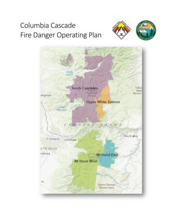
Product & Service Guide OverviewThis document serves as a user guide for fire weather products and services provided bythe National Weather Service (NWS) office in Burlington, Vermont. Details of each productand how to find or request it have been provided with product examples found in theAppendix.For specific procedural and policy information regarding the delivery of these products andservices as well as fire weather program goals and details of partner responsibilities see theNWS Burlington Fire Weather Annual Operating Plan (AOP).The National Weather Service Fire Weather Program provides forecast and warningservices in support of fire management and control operations, leading to the effectiveprevention, suppression, and management of forest and rangeland fires. The majorobjective of the Fire Weather Program is to provide a service which will meet themeteorological requirements of federal and state wildland management agencies in theprotection and enhancement of the nation's forests and rangelands.The NWS in Burlington agrees to furnish routine forecasts and warnings according to theneeds of the fire weather community throughout the entire year although the typical fireweather season for northern New York and much of Vermont starts in mid-late March andcontinues through mid-November. The coverage area for the NWS Burlington fire weatherprogram is the four northern counties of New York (Saint Lawrence, Franklin, Clinton, andEssex) and the Vermont counties of Grand Isle, Franklin, Chittenden, Addison, Rutland,Windsor, Orange, Washington, Lamoille, Orleans, Caledonia, and Essex. Per the request ofour fire weather users the coverage area in Vermont as of 2022 is now by Fire DangerRating Area (FDRA). The areas served by NWS Burlington are Champlain Valley, NorthernTaconics, South Central Greens, Lower Connecticut River North, Central Vermont, andNortheast Vermont. A map of the coverage area is located in Appendix A.3
NWS Burlington ContactsActing Meteorologist-in-Charge (MIC): Peter BanacosWarning Coordination Meteorologist (WCM): Scott WhittierFire Weather Focal Point: Eric EvensonTo obtain fire weather services mentioned in this plan, local, state, or federal officials maycontact NWS Burlington, Vermont.Phone: 802-658-0207Email: Eric.Evenson@noaa.govWritten requests should be addressed to:National Weather Service BurlingtonAttn: Eric EvensonBurlington International Airport1200 Airport DriveBurlington, Vermont 054034
Digital Forecasts and ServicesNational Digital Forecast Database (NDFD) grids are created by NWS forecasters and usedto produce a wide variety of products and services for fire weather support. The fire weathergraphical forecasts created by NWS Burlington for northern New York and much of Vermontcan be found at the following link with an example of the web page found in Appendix .php#tabsAdditional tools that can be of assistance to help determine the timing for a spot forecastrequest are: Hourly Weather Graphs with Fire Weather Elements (Example Appendix C):https://forecast.weather.gov/gridpoint.php?site btv&TypeDefault graphicalWeather Activity ?site btvPoint Forecast te BTV&product PFM&issuedby BTVNWS Burlington has a dedicated fire weather webpage where users can access anabundance of fire weather information including the AOP, graphical forecasts, textforecasts, fire weather guidance and request a Spot forecast. The webpage is found at thislink: https://www.weather.gov/btv/firewxAll of these tools and products are accessible nationwide through the national fire weatherwebpage: https://weather.gov/fire/NWSChat LiveChat with NWS Burlington meteorologists 24/7 with NWSChat. This is exclusive to Federal,State or Local Government partners and Media. Users need to set up an account withusername and password for access and select WFO Burlington VT as the primary office.Once logged in select Burlington (BTV) Chat (btvchat) from the Chatrooms dropdown list.https://nwschat.weather.gov/5
Fire Weather Planning Forecast (FWF)NWS Burlington has fire weather forecast responsibility for northern New York and much ofVermont. This area is made up of Fire Weather Zones usually combined into five groups.These zones are areas considered to be climatologically homogeneous, and the forecastrepresents conditions across the zone. The daily Fire Weather Planning Forecast (FWF) willbe available on the NWS Burlington fire weather webpage.https://www.weather.gov/btv/firewxThe fire weather season for northern New York and much of Vermont typically starts in midlate March and continues through mid-November although exact start/end times will bedetermined each year through coordination with our partners. The forecast is routinelyissued once daily between 4:00 am and 6:00 am during the fire weather season, but isupdated as needed. During the winter months the FWF will be suspended, but fire weatherdata will still be available via the hourly weather graph and other graphical products onweather.gov/btv.An example of a Fire Weather Forecast is shown in Appendix D of this document.Components of Routine Fire Weather ForecastHEADLINE – A headline is required when a Fire Weather Watch or Red Flag Warning is ineffect. This will include the watch/warning type, geographical area, reason for issuance, andeffective time period. The headline will also be included in the appropriate zone grouping. Inaddition, a headline will also be used for non-watch/warning periods to highlight situationsor trends which may become a factor in fire weather operations.DISCUSSION - This is a brief discussion of the weather systems impacting northern NewYork and much of Vermont through the forecast period. It may, for example, also describesignificant trends in temperature, humidity and winds for the next several days. Thediscussion will precede the actual forecast parameters.Tabular Data - Will be provided for the three or four periods depending on issuance time.Three periods “Today, Tonight, Day 2” will be included for morning or early afternoonissuances or four periods “Tonight, Day 2, Day 2 night, Day 3” will be included for lateafternoon and evening issuances, which typically occurs when a fire weather watch or redflag warning are issued. The data for the tables will be derived from forecast informationinput into the Gridded Forecast Editor (GFE) matrix and will include cloud cover,precipitation (probability, type, amount, duration, start time, and end time), temperature, 20foot winds, humidity, Haines index, lightning activity level (LAL), mixing height, transportwinds, and ventilation rate averaged within each of the fire weather zone groupings.CLOUD COVER CLR (clear) . 0 to 6 percent coverageMCLEAR (few clouds) . 7 to 31 percent coveragePCLDY (scattered clouds) . 32 to 69 percent coverage6
MCLDY (broken clouds) . 70 to 94 percent coverageCLOUDY (overcast) . 95 to 100 percent coveragePRECIP CHC - presented in a Percentage of Probability, expressing the probability ofmeasureable precipitation occurring at any point within the forecasted area during thespecified time.PRECIP TYPE - Precipitation will be expressed as one of the following types:NONE, DRIZZLE, RAIN SHOWERS, TSTMS, FRZ DRZL, FRZ RAIN, SLEET,SLEET/RAIN, SNOW, SNOW/FZRAMAX/MIN TEMP - The maximum daytime or minimum nighttime temperature for each of the3 time periods. Temperature is given in whole degrees Fahrenheit.AM WIND / PM WIND - Morning/Afternoon 20 foot winds expressed in wind direction (oneof the eight points of the compass) and wind speed (in miles per hour)PRECIP AMOUNT – Average amount of precipitation in hundredths on an inch.*Calculated as an average of forecasted precipitation within each fire weather zone.PRECIP DURATION - The duration of the precipitation event in hours.PRECIP BEGIN - The onset time of precipitation to the nearest whole hour.PRECIP END - The ending time of precipitation to the nearest whole hour.HUMIDITY (%) - Relative Humidity range - minimum relative humidity expected during theday, and the maximum at night.HAINES INDEX (HI) - A measure of moisture and stability. This ranges from 2 to 6, which isa sum of two components, a temperature difference (categorized 1 to 3), and amoisture/dew point difference (also categorized 1 to 3).HI Value Qualitative Term2 or 3 VERY LOW4 LOW5 MODERATE6 HIGHThe HI has been related to fire behavior, such that the higher the value, the better thechance of seeing large, plume dominated fire development. There are different optionsof the Haines index, each customized for elevation. NWS Burlington will be using the lowelevation option.7
LAL - Lightning activity level category. Typically it relates to the maximum coverage oflightning strikes expected within any 1 hour time frame during the forecast period. We havemodified the LAL to relate to the areal coverage of thunderstorms. Values range from 1 to 6.1: No thunderstorms (0% coverage)2: Isolated thunderstorms (1-14% coverage)3: Widely scattered thunderstorms (15-24% coverage)4: Scattered thunderstorms (25-54% coverage)5: Numerous thunderstorms (55% coverage)6: Dry thunderstorms with little or no rain ( 15% coverage)* Dry lightning is rare in the eastern United States, but common in the western U.S.MIXING HGT - Maximum depth to which mixing of the lower atmosphere will occur. Thiscan be a difficult parameter to forecast. This is done by estimating the maximumtemperature and lifting it dry adiabatically until it reaches the forecast sounding temperature.Generally during the summer, if neither a low-level inversion nor warm air advection arepresent, daytime heating will produce a well-mixed atmosphere of 4000 to 7000 feet indepth. The more unstable the atmosphere, the greater the mixing height.TRANSPORT WIND - The average wind from the surface to the mixing height. Aftercalculating the mixing height, the average wind direction and speed within that layer iscalculated.VENTILATION RATE – This is a simple calculation of the mixing height multiplied by thetransport wind speed. There is no definitive classification of Ventilation Rate. It is acombination of mixing height and transport wind. Generally, when the mixing height islow and transport winds are light, the Ventilation Rate will be poor. The VentilationRate will be calculated only for the daytime periods.The best procedure to manually calculate the ventilation rate is to multiply the mixing heightin thousands of feet by the transport wind speed (mph). These numbers are placed in thegeneral Fire Weather Forecast. The table below is only a guide.100000 and up.(corresponds to Excellent)61000 - 100000.(corresponds to Good)41000 - 60000.(corresponds to Average)21000 - 40000.(corresponds to Fair)20000 or less.(corresponds to Poor)Examples: A) Mixing height 4500 feet, Transport Wind Speed 20 mph.4500 x 20 90000B) Mixing height 2500 feet, Transport Wind Speed 10 mph2500 x 10 250008
KEETCH-BYRAM DROUGHT INDEX (KBDI) - Keetch-Byram Drought Index (KBDI) is anindex used to determining forest fire potential. The drought index is based on a daily waterbalance, where a drought factor is balanced with precipitation and soil moisture (assumedto have a maximum storage capacity of 8-inches) and is expressed in hundredths of an inchof soil moisture depletion. The drought index ranges from 0 to 800, where a drought indexof 0 represents no moisture depletion, and an index of 800 represents absolutely dryconditions.REMARKS – Any additional significant information can be included here which relates tothat particular fire weather zone. (I.e. Timing of wind shift, frontal passage, etc.)EXTENDED FORECAST – This is the forecast for days 3 to 7. This includes weather typeand temperatures with winds forecast out to day 7. This information is taken from our publiczone forecast.OUTLOOK 8 TO 14 DAYS – A general temperature and precipitation outlook with trendscompared to normal. Forecast is from the NWS’ Climate Prediction Center.Forecast UpdatesDuring the fire weather season, forecasters will closely monitor weather conditions andissue an updated forecast if conditions are expected to deviate significantly from the mostrecent forecast. An updated fire weather forecast should be issued only when any of thefollowing criteria are met:1. Red Flag criteria met, but were previously not anticipated.2. Observed wind is 10 mph or greater than forecast, and the direction differs by two ormore compass points (based on 8 compass points).3. Relative humidity, originally forecast to be greater than 30 percent, is now expected to beless than 30 percent.4. Numerous thunderstorms, where none were previously forecast.5. The occurrence (or non-occurrence) of precipitation will significantly differ from theforecast.6. Any unexpected weather conditions that will significantly impact fire service operations.(unexpected wind shifts, etc.)The internet link for the NWS Burlington Fire Weather Forecast is:https://forecast.weather.gov/product.php?site btv&product FWF&issuedby BTVForecast Backup ResponsibilitiesIn the event NWS Albany is unable to produce their fire weather forecasts, watches and/orwarnings, NWS Burlington is their backup. In that role, we would produce their forecasts(ALBFWFALY) with a line in the MND Header stating that the product was produced byNWS Burlington, VT. And if we are unable to produce our fire weather forecasts, watches,and/or warnings, NWS Albany will produce these products.9
NFDRS Point ForecastsThe National Fire Danger Rating System (NFDRS) measures wildfire danger. The NWS rolein NFDRS is that of forecasting weather parameters for input which when combined with fireweather community input (fuel moisture, etc.) allows the NFDRS software to predict the nextday’s fire danger rating.NWS Burlington is responsible for inputting weather parameters (ALBFWMBTV) into theNational Fire Danger Rating Forecast. An example can be found in Appendix E. Theseforecast parameters are generally valid for the next day at 1300 LST, except someparameters (for example max/min temperature and RH) cover a range of time as indicatedbelow. NWS Burlington issues this forecast during the mid-afternoon hours. Updates are notrequired.The forecast is for the nine Remote Automatic Weather Stations (RAWS) sites in ourforecast area. These locations are as follows:VERMONT430501 - Essex Junction, VT (Chittenden County)Elevation: 340 ft. 44.5078 N 73.1153 WOwner: State of Vermont431301 - Sweezy (Mt. Tabor) (Danby), VT (Rutland County)Elevation: 668 ft. 43.33 N 73.16 WOwner: Green Mountain National Forest430601 - Lake Elmore, VT (Lamoille County)Elevation: 1200 ft. 44.5422 N 72.5266 WOwner: Green Mountain National Forest/VT Department of Forests, Parks & Recreation430402 - Nulhegan (near Island Pond), VT (Essex County)Elevation: 1243 ft. 44.7700 N 71.7017 WOwner: U.S. Fish and WildlifeNEW YORK300311 - Schroon Lake, NY (Essex County)Elevation: 820 ft. 43.8711 N 73.7519 WOwner: New York State Forest Rangers300191 - Schuyler Falls, NY (Clinton County)Elevation: 650 ft44.6 N 73.6 WOwner: New York State Forest Rangers10
300892 - Brasher Falls, NY (Saint Lawrence County)Elevation: 300 ft. 44.8 N 74.8 WOwner: New York State Forest Rangers300891 - Wanakena, NY (St Lawrence County)Elevation: 1500 ft. 44.1469 N 74.9006 WOwner: New York State Forest Rangers300312 - Mt VanHoevenberg, NY (Essex County)Elevation: 2000 ft. 44.2195 N 73.9184 WOwner: New York State Forest RangersThe FWM Forecast format is as RHL1L2DDSS,,TXTNRXRNP1P2FNFDRS Station Identifier {for example, 301101}Year Month Day (forecast valid date which is next day)June 8th, 2005Time (forecast valid time 1300 hours/1PM). Does not change.Weather Codes:0 - Clear5 - Drizzle1 - Scattered clouds6 - Rain2 - Broken clouds7 - Snow/sleet3 - Overcast8 - Showers4 - Fog9 – ThunderstormsDry Bulb TemperatureRelative HumidityLightning Activity Level (period 1300 LST day of issuance to 2300 LST hours)*See FWF section for description of LAL codes.Lightning Activity Level (period 2300 LST to 2300 on the next day)Wind direction (N, NE, E, SE etc.)Wind speed (10 minute average in MPH)Between SS and TX commas are needed to hold the place for 10 hour fuelmoisture values which the NWS does NOT forecast at this time. Space isheld for the time being.Maximum temperatureMinimum temperatureMaximum relative humidityMinimum relative humidityPrecipitation duration (1500-0600 LST period) in whole hoursPrecipitation duration (0600-1300 LST period) in whole hoursWet Flag "Y/N" (Used to define if fuels at 1300 LST are forecasted to be wet.The wet flag will typically be set as N unless there is a 70% chance or higherof weather codes 5, 6 or 7 in the forecast.)11
RED FLAG PROGRAMRed Flag EventA red flag event is the combination of a critical fire weather pattern and significantlydry fuels. This combination could lead to the occurrence of large and dangerous wildfires.Since the potential for Red Flag conditions does not exist without receptive fuel conditions,knowledge of existing fuel conditions is essential. While Red Flag conditions may vary foreach fire weather district, the purpose of the Red Flag Program is to alert land managementagencies to developing weather conditions that, when coupled with critically dry wildlandfuels, could lead to dangerous fire behavior. It is important to point out that High FireDanger by itself does not necessarily result in Red Flag conditions. Red Flag generallyreflects how fires may behave after they are ignited, while fire danger specificallyrelates to the likelihood of fire development.From NWS Directives 10-401:Forecasters will issue Fire Weather Watches/Red Flag Warnings when the combination ofdry fuels and weather conditions support extreme fire behavior. These conditions alert landmanagement agencies to the potential for widespread new ignitions or control problemswith existing fires, both of which could pose a threat to life and property.Vermont State LiaisonNWS Burlington acts in the role as Vermont state liaison in collection of fuel information forthe entire state of Vermont. This is part of an effort to streamline coordination with our fireweather users and NWS Albany.NWS Burlington will have fuel information available for Bennington and Windham countiesas well as for the rest of Vermont, as provided by the Vermont Department of Forests,Parks and Recreation.When NWS Burlington coordinates with representatives of Vermont Forests, Parks andRecreation about fuel conditions, forecasters should ask them about the state of the fuels inNWS Albany’s portion of Vermont in addition to our area of responsibility.NWS Burlington will share this information with NWS Albany via phone or NWSChat andplace the information in the station worklog so that others may reference it.NWS Albany can contact NWS Burlington for the fuel information when dealing withpotential red flag events, instead of having to contact the Vermont users. NWS Albany isstill free to contact users directly if they require additional information. This process shouldmake collaboration easier when trying to determine if any fire weather headlines may berequired.12
Red Flag CriteriaNWS Directives 10-401 states that both fuel and weather parameters are importantconsiderations. It suggests the following weather criteria also be considered:a.b.c.d.e.Lightning after an extended dry periodSignificant dry frontal passageStrong windsVery low relative humidityDry thunderstormsThus, in the NWS Burlington Fire District, elements considered critical for red flag consist ofa combination of:a. Meteorological parameters (winds, relative humidity, etc),b. Long term dryness (past rainfall and Keetch-Byram index), andc. Vegetation status.NWS Burlington shall use the following sets of criteria to determine when a red flag warningwill be issued for particular zones. Note there are two different criteria based primarily uponthe season. Forestry personnel will inform us of which vegetative stage we are in.**ALL FACTORS HAVE TO BE MET IN ORDER TO HAVE A RED FLAG EVENT**When in Vegetative Stage I & II (cured & pre green-up Spring/Fall)Winds sustained or with frequent gusts above 25 mph (for at least 2 hours), andRelative Humidity at or below 30% (for at least 2 hours), andPartner confirmation of dry/receptive fuelsWhen in Vegetative Stage III (green Summer)Winds sustained or with frequent gusts above 25 mph (for at least 2 hours), andRelative Humidity at or below 30% (for at least 2 hours), andRainfall amounts for the previous 8 days of less than 0.25 inches, andKeetch-Byram Drought Index values of 300 or greater with partner confirmation ofdry/receptive fuelsNote: NWS Burlington does not have any temperature criteria or restrictions for issuing aFire Weather Watch or Red Flag Warning.13
Fire Weather WatchA Fire Weather Watch (ALBRFWBTV) is issued when there is a high potential fordevelopment of a Red Flag Event (per directives 10-401). The watch may be issued for theentire area or selected portions. The watch will remain in effect until it is cancelled, orupgraded to a Red Flag Warning, or expires. An updated RFW product will be issued aswell as an updated routine fire weather forecast to reflect these changes.Fire Weather Watch issuance for the first period is NOT allowed. Fire Weather Watchesshould be issued 18 to 72 hours in advance of the expected onset of criteria (2nd periodon). And fire weather watches should not be issued for marginal events.When a watch is issued, a headline needs to be included in the daily Fire Weather PlanningForecast (ALBFWFBTV) and an appropriate ALBRFWBTV statement is required. Theheadline should state something similar to the following (ensure time, location, and reasonfor are mentioned):.FIRE WEATHER WATCH FOR TUESDAY IN THE CHAMPLAIN VALLEY OF VERMONTAND NORTHERN NEW YORK FOR STRONG WINDS AND LOW HUMIDITY With the issuance of a Fire Weather Watch, an additional statement ALBRFWBTV will beissued. This product will describe in more detail, the areas, reasons and timing for thewatch. This product will also be issued as needed to upgrade or cancel the watch, or toprovide additional information. See Appendix F for an example of a Fire Weather Watch.Red Flag WarningA Red Flag Warning is issued to warn of an impending or occurring Red Flag Event. It isissued when both fuel and weather parameters will meet Red Flag criteria within 24 hours.If a Red Flag Warning is issued, this information can be included in the fire weather sectionof the Area Forecast Discussion (AFD). A Red Flag Warning may or may not be precededby a Fire Weather Watch. The warning will be issued via ALBRFWBTV and contain aheadline and basis for the warning issuance. A Red Flag Warning headline will also beincluded in the affected areas daily routine Fire Weather Planning Forecast. A Red FlagWarning will be cancelled via a ALBRFWBTV product if subsequent information indicatesthat the conditions are no longer expected to develop or have changed. See Appendix G foran example of a Red Flag Warning.In some synoptic situations, weather conditions meeting warning criteria may exist forportions of a two day period, with only a break of several hours where red flag criteria arenot met. In these situations, it is less confusing for fire agency customers if a Red FlagWarning or Fire Weather Watch is issued for the entire period, as opposed to issuing andcancelling warnings and watches each time weather conditions go into and out of warningcriteria. If a Red Flag Warning or Fire Weather Watch is issued in this fashion, thediscussion portion of the warning must contain explicit information regarding the short termperiods(s) when critical conditions will subside.14
Special Weather StatementIt is NWS Burlington office policy, based upon user input, to refrain from issuing statementsfor High or Extreme Fire Danger conditions. The Fire Danger is something that is calculatedand posted each day at state and national parks. Their determination is based on localmeasurements, leaning heavily toward various fuel moistures. Media inquiries concerningthe specific fire danger should be directed to the appropriate State Division of Forestry.On rare occasions, the fire weather community may request that we help get the word outabout their fire danger calculations. In these cases, the lead forecaster may decide to issuea statement, if requested by the forestry officials. This statement would incorporate portionsor all of the information received from the fire weather community. The fire dangerinformation should be attributed to the user agencies providing us with the information.DRY FUELS AND LOW RELATIVE HUMIDITIES WILL INCREASE FIRE WEATHERCONCERNS THIS AFTERNOON Fine fuels remain very dry across all of northern New York and Vermont according to theVermont Department of Forests, Parks, and Recreation and the New York State Department ofEnvironmental Conservation. This combined with minimum relative humidity values in the 20 to30 percent range and northwest winds in the 10 to 20 mph range will lead to fire weatherconcerns this afternoon.Given these expected weather conditions any fires that do start could spread quickly, burnintensely, and be difficult to contain. In Vermont consult your local Fire Warden before doing anyopen burning. And in New York remember a burn ban is in place through May 14th which meansopen burning is not allowed. Fire Weather Area Forecast DiscussionThe Area Forecast Discussion (AFD) focuses on the most significant weather issuesaffecting a NWS office’s forecast area over the next seven days. During heightened fireactivity a fire weather section (.FIRE WEATHER.) will
NWSChat Live Chat with NWS Burlington meteorologists 24/7 with NWSChat. This is exclusive to Federal, State or Local Government partners and Media. Users need to set up an account with username and password for access and select WFO Burlington VT as the primary office.
