Transcription
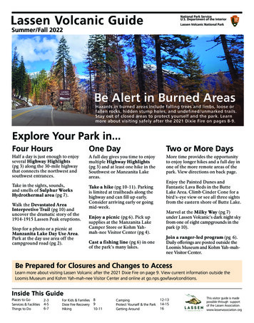
Lassen Volcanic GuideNational Park ServiceU.S. Department of the InteriorLassen Volcanic National ParkSummer/Fall 2022Be Alert in Burned AreasHazards in burned areas include falling trees and limbs, loose orfallen rocks, hidden stump holes, and undefined/unmarked trails.Stay out of closed areas to protect yourself and the park. Learnmore about visiting safely after the 2021 Dixie Fire on pages 8-9.Explore Your Park in.Four HoursOne DayTwo or More DaysHalf a day is just enough to enjoyseveral Highway Highlights(pg 3) along the 30-mile highwaythat connects the northwest andsouthwest entrances.A full day gives you time to enjoymultiple Highway Highlights(pg 3) and at least one hike in theSouthwest or Manzanita Lakeareas.More time provides the opportunityto enjoy longer hikes and a full day inone of the more remote areas of thepark. View directions on back page.Take in the sights, sounds,and smells of Sulphur WorksHydrothermal area (pg 7).Take a hike (pg 10-11). Parkingis limited at trailheads along thehighway and can fill up early.Consider arriving early or goingmid-week.Walk the Devastated AreaInterpretive Trail (pg 10) anduncover the dramatic story of the1914-1915 Lassen Peak eruptions.Stop for a photo or a picnic atManzanita Lake Day Use Area.Park at the day use area off thecampground road (pg 2).Enjoy a picnic (pg 6). Pick upsupplies at the Manzanita LakeCamper Store or Kohm Yahmah-nee Visitor Center (pg 4).Cast a fishing line (pg 6) in oneof the park's many lakes.Enjoy the Painted Dunes andFantastic Lava Beds in the ButteLake Area. Climb Cinder Cone for abird's-eye view or see all three sightsfrom the eastern shore of Butte Lake.Marvel at the Milky Way (pg 7)under Lassen Volcanic's dark night skyfrom one of eight campgrounds in thepark (p 10).Join a ranger-led program (pg 6).Daily offerings are posted outside theLoomis Museum and Kohm Yah-mahnee Visitor Center.Be Prepared for Closures and Changes to AccessLearn more about visiting Lassen Volcanic after the 2021 Dixie Fire on page 9. View current information outside theLoomis Museum and Kohm Yah-mah-nee Visitor Center and online at go.nps.gov/lavo/conditions.Inside This GuidePlaces to GoServices & FacilitiesThings to Do2-34-56-7For Kids & FamiliesDixie Fire RecoveryHiking8910-11CampingProtect Yourself & the ParkGetting Around12-1314-1516This visitor guide is madepossible through supportof the Lassen Association.www.lassenassociation.org
Places to GoNorth2021 Dixie Fire AreaPacific Crest TrailInformation siteWheelchair-accessibleDesignated Wilderness AreaHiking trailRanger stationFood serviceUnpaved roadSelf-guided trailCell service areaCampgroundTrailheadPicnic areaPrimitive campsiteTH02 Kilometers1012 MilesButte LakeVolcano Adventure CampButte LakeLost CreekButte Lake13NorthwestEntranceFantasticLava BedsCinder ConeChaos Crags14PaintedDunesLoomis MuseumDay Use AreaHot RockTH H12Cluster LakesFantasticLava BedsManzanita & Summit LakesManzanita Lake CampgroundESnag LakeDevastated Area1110TH Summit LakeTwin LakesSummit Lake North*Lassen PeakSummit LakeSummit Lake SouthTerrace, Shadow& Cliff LakesSouthwest8Horseshoe LakeLake HelenJuniper LakeEmerald Lake6 Bumpass HellLittle HotSprings Valley2 Sulphur WorksMill Creek FallsKohm Yah-mah-neeVisitor CenterColdBoilingLake9KingsCreekAccess may be limited dueto impacts of the Dixie Fire{CDrakesbad Guest RanchDevils KitchenWarner ValleyJuniperLakeJuniper LakeTHBoiling SpringsLakeSouthwest EntranceGetting AroundAn area map on page 16 includes distances and traveltimes from nearby communities as well as directions tothe Butte Lake, Warner Valley, and Juniper Lake areas.SW Southwest Area 6700 ft (2042 m) elevationThe steep, rugged terrain in the Southwest Area offersdramatic vistas, moderate to difficult hikes includingLassen Peak Trail, and access to the best-knownhydrothermal areas in the park: Sulphur Works andBumpass Hell.ML Manzanita Lake Area (plus Summit Lake)5800 ft (1768 m) elevation 6700 (2042 m) elevationLocated in the northwest corner of the park, ManzanitaLake offers the most amenities and is popular withcampers and families. The largest campground in thepark is a short walk from Manzanita Lake, the CamperStore, and Loomis Museum. The popular SummitLake Campgrounds are located 12 miles southeast ofManzanita Lake.2Warner ValleyKings Creek Falls SouthwestAccess may be limited dueto impacts of the Dixie FireMount HarknessTerminalGeyserBL Butte Lake Area 6100 ft (1859 m) elevationThis remote landscape is dominated by the jaggedFantastic Lava Beds and barren Cinder Conevolcano. The hike to its summit is both challengingand unforgettable. The campground and day usearea provide a great base for hiking, backpacking,swimming, and boating. Plan an hour drive time fromthe Northwest Entrance.WV Warner Valley Area 5600 feet (1707 m) elevationThis narrow valley was heavily impacted by the 2021Dixie Fire. View the status and conditions of facilitiesand trails outside park visitor centers or online atgo.nps.gov/lavo/conditions. Plan a 90-minute drive timefrom the Southwest Entrance.JL Juniper Lake Area 6790 feet (2070 m) elevationThis remote, high-elevation landscape was heavilyimpacted by the Dixie Fire. View the status andconditions of facilities and trails outside park visitorcenters or at go.nps.gov/lavo/conditions. Plan a90-minute drive time from the Southwest Entrance.
Highway HighlightsThe 30-mile Lassen Volcanic National Park Highway connects thenorthwest and southwest entrances of the park. Plan for an hourdrive-time without stops. Travel the highway in either direction andenjoy numerous roadside highlights.Highway Highlights match numbered markers along the road.Markers also correspond to stops in the audio tour and road guide.26Sulphur WorksFollow a sidewalk to the park's most accessible hydrothermal area.Brokeoff Volcano VistaCan you spot the rim of the former Brokeoff Volcano in the remnantpeaks that surround you? The parking area also serves as the BumpassHell Trailhead and is often full.Roadside Audio TourLearn as you drive the park highway.Download and listen through theNPS Mobile App, the Lassen AudioTours podcast, or MP3 files fromgo.nps.gov/lavo/audio.Printed Road GuideThe printed guide Lassen VolcanicNational Park: Auto Tours, Trips, andTrails offers a more in-depth autotour.Purchase an audio tour CD or theprinted road guide at park storesin the Kohm Yah-mah-nee VisitorCenter or Loomis Museum or atlassenassociation.org.8Lassen Peak Parking Area and ViewpointExperience the majesty of Lassen Peak from the highest point on thepark road at 8,512 feet.9Kings Creek Meadow Scenic Pull-outGet your camera ready for this popular stop where Kings Creekmeanders through an expansive meadow at the foot of Lassen Peak.Drive with CareNorth Summit Lake Picnic Area and Loop TrailEnjoy a picnic, walk, or swim along the north and west shores ofSummit Lake. Parking is available in pullouts outside the North SummitLake Campground entrance. Use pullouts to enjoy the view.*10 Hat CreekDon't miss this area's fantastic fall colors. Use the crosswalk to accesshidden Hat Creek meadow. Can you tell what animal used to live here?11 Devastated AreaDiscover the story of devastation and forest recovery following LassenPeak's 1915 eruption on this short, self-guided walk.12 Hot RockSnap a photo with this several-ton rock that photographer B.F. Loomisreported was too hot to touch after it was ejected from the crater ofLassen Peak in 1915. Protect wildlife byadhering to postedspeed limits. Pull over if taking your time; thereare no passing lanes in the park.Give 3 Feet to BicyclistsCalifornia law requires drivers givethree feet as they pass bicyclistson the road. Can't give three feet?Treat the bicyclist as you would avehicle in front of you and wait topass until you can give three feet.13 Sunflower Flat, Nobles Emigrant TrailStep foot on a spur of the California National Historic Trail.14 Chaos Crags and Jumbles Scenic Pull-outImagine a rock slide racing nearly 100 miles an hour down the slopes ofthis group of dome volcanoes.Recently ViewedNPS Mobile AppSave Lassen Volcanic for Offline UseThe NPS App is the new official app forthe National Park Service with tools toexplore more than 400 national parksnationwide. Download at go.nps.gov/app.Once you have downloadedthe app, toggle the buttonon the Lassen Volcanic homepage to save for offline use.Internet access is extremely limited in the park.3
Services & FacilitiesKohm Yah-mah-nee Visitor CenterLoomis MuseumManzanita Lake Camper StoreMost services and facilities are accessible daily June through September. Fall hours and seasonal closures begin in mid-October. Thereare two visitor centers in the park. The Kohm Yah-mah-nee Visitor Center is located at the Southwest Entrance and the LoomisMuseum is located one mile from the Northwest Entrance. Food is available at the Kohm Yah-mah-nee Visitor Center and theManzanita Lake Camper Store, which also offers camper services and unleaded gas.SW Kohm Yah-mah-nee Visitor CenterExplore exhibits, purchase souvenirs, or enjoy a casualmeal at this year-round visitor center. The 20-minutepark film plays on the hour and half hour.ML Loomis MuseumPark information is available outside the museum inthe Loomis Plaza. Educational items are available at theLassen Association store inside.Lassen Café & GiftML Manzanita Lake Camper StoreLocated at the entrance to the Manzanita LakeCampground, the store offers camping supplies, gifts,hot and cold food, gasoline, showers, and laundry.An ATM is located inside the Camper Store.Browse the gift shop for souvenirs including arts andcrafts from local artists or enjoy café offerings.Lassen Association StoreOpen during visitor center hoursBrowse books, maps, trail guides, videos, andeducational gifts at the Lassen Association store.All profits benefit the park.Wi-FiFree Wi-Fi is available at the Kohm Yah-mah-neeVisitor Center. You must open a browser and agreeto terms of use to connect to NPS Visitor WiFi. Pleasenote that bandwidth is very limited during the summermonths and service may be slow or unavailable duringbusy times.Electric Vehicle Charging StationTwo level 2 electric vehicle chargingstations are available in the Kohm Yahmah-nee Visitor Center parking area.Payment is accepted only through thefree Liberty Hydra app. Please moveyour vehicle when charging is completeto allow others to use it. Learn more atgo.nps.gov/lavo/transport.Showers and LaundryCoin-operated showers and laundry machines areavailable at the Manzanita Lake Camper Store. Achange machine is located in the laundry room.GasolineUnleaded gas is available behind the Manzanita LakeCamper Store. Gas may be purchased with a creditcard 24 hours a day. Note that there is no gas availablewithin 30 miles of the Southwest Entrance.Dump StationA dump station is located on Manzanita LakeCampground Road. Fee is 8. Holders of Senior andAccess passes receive a 50% discount.ML Lassen CrossroadsThis open-air pavilion highlights features of the Lassenregion. The site offers large vehicle parking and can beused for carpooling into the park. The site is open dailybetween 7 am and 3 pm and gated at all other times.Be Prepared for Changes Due to COVID-19 ResponseFacilities may be impacted by COVID-19 response. We appreciate your flexibility and understanding as we continue toadapt and modify operations for the safety of both staff and visitors.4
Entrance FeesYour park fees provide funding for park projectsthat improve and enhance the park for all visitors.Manzanita Lake camping cabinPassPhones and Cell ServiceCell service (AT&T and Verizon) is very limited in the parkand surrounding areas. View spots with limited coverageon the map on page 2. Pay phones are located outside theManzanita Lake Camper Store and the Loomis Museum(payment by calling card only). An emergency phone islocated in the Kohm Yah-mah-nee Visitor Center 24-hourvestibule.Lost and FoundLeave a found item or report a lost item at the Kohm Yahmah-nee Visitor Center or Loomis Museum.LodgingCostValid for 1-7 DaysVehicle Pass 30Motorcycle Entry Pass 25Individual Entry Pass 15Annual PassesLassen & Whiskeytown Pass 55Valid one year from monthof purchase at Lassen Volcanic andWhiskeytown National Recreation Area.Interagency Pass 80Valid for entrance to all federalrecreation sites for one year frommonth of purchase.FreeLodging is available within numerous communities aroundthe park (see map on pg 16).Military PassAvailable to active duty militarymembers and their dependents.(in-person only)WV Drakesbad Guest RanchThis historic ranch is closed this season for repairs followingthe 2021 Dixie Fire.4th Grade PassFreeML Manzanita Lake CabinsRustic, 1-room, 2-room, and bunk cabins are available. Forreservations call (866) 999-0914 or visit lassenlodging.com.Check-in inside the Manzanita Lake Camper Store.Available to all U.S. 4th graders with avalid Every Kid Outdoors paper pass.Lifetime PassesAccess PassAvailable to U.S. citizens or permanentresidents with permanent disabilities.Senior PassLifetime pass for U.S. citizens orpermanent residents age 62 or over.Free (in-person) 10 (by mail) 80 (in-person) 90 (by mail) 20 (one year)Access for People with DisabilitiesA complete list of accessible services and recreation opportunities is available at visitor centers andonline at go.nps.gov/lavo/access.ôTrails with access for users with limited mobility include: Devastated Area Interpretive Trail (withaudio description), Sulphur Works hydrothermal area, and Lassen Crossroads information area. Accessible campsites are available at Manzanita Lake, Summit Lake North, and Butte LakeCampgrounds. Accessible camping cabins are available at Manzanita Lake.Assisted Listening Devices are available for auditorium and amphitheater presentations. Audiodescription is available for the park brochure, visitor center exhibits, and the park film. A brailleversion of the park brochure is also available. Ask a ranger for assistance.5
Things to DoSummit LakeLake Helen picnic areaRanger-led ProgramsInformation about daily program offerings will beposted outside the Loomis Museum and Kohm Yahmah-nee Visitor Center, when available.Field SeminarsDelve into nature photography in a two-day workshopor take a guided hike with Lassen Volcanic hikingbook author Tracy Salcedo. Reservations are highlyrecommended. Course fees directly benefit the park.Learn more at go.nps.gov/lavo/seminar.HikingClimb volcanoes, marvel at hydrothermal areas, explorelakeshores, and so much more. Choose from a selectionof easy to strenuous day hikes listed by park area onpages 10 and 11.SwimmingThe high-elevation lakes in the park offer a refreshingreprieve from summer heat. Entering thermal watersis prohibited and extremely dangerous (learn more onpage 7). Tread Lightly on Lakeshores and Wetlands.Help protect these sensitive habitats by staying on hardsurfaces and off of flowers. Learn more on page 15.PicnickingEnjoy lunch at any of the scenic spots along the parkhighway, or find a picnic table at Kohm Yah-mah-neeVisitor Center, Lake Helen, Manzanita Lake, KingsCreek Picnic Area (charcoal disposal available), ButteLake (charcoal grills available), or along the northernshore of Summit Lake.BackpackingExpect temporary trail closures in the eastern portionof the park. Learn more on page 11.Experience WildernessVenture just beyond the highway to enter LassenVolcanic Wilderness and experience nature at itswildest. 75% of the park is designated Wilderness andis managed to minimize human influence and preservenatural conditions. View Lassen Volcanic WildernessArea on the park map on page 2.6Paddle boarders on Butte LakeWildflower ViewingBlooms appear May through September in parkmeadows and valleys, and along lakeshores. View awildflower guide at go.nps.gov/lavo/flora or purchaseone at Lassen Association stores (pg 4). Learn how youcan help foster park wildflower populations like therare Lassen Paintbrush on page 15.BikingBikes are welcome on roads and parking areas (noton hiking trails). There are no bike trails in the park.Helmets are highly recommended for adults and arerequired under California law for children age 17 andyounger. Biking on the park highway is recommendedonly for experienced riders; there are no shoulders orbike lanes. Road cyclists must ride single file and beattentive to passing vehicles that may not be aware ofcyclists. Bicyclists may also use the gravel roads intoButte and Juniper Lake areas and Warner Valley road(13 miles pavement then 3 gravel). See map on page 16.BoatingBoating is popular on Manzanita Lake, Butte Lake,Summit Lake, and Juniper Lake. Only non-motorizedwatercraft are permitted. Put in and take out isrestricted to designated boat launches at Manzanitaand Butte Lakes. Watercraft are not permitted onBoiling Springs Lake, Emerald Lake, ReflectionLake, and Lake Helen. Children under 13 years of agemust wear a Coast Guard-approved life jacket.Fishing2022 California free fishing days: 7/2 and 9/3California fishing regulations apply to all areas withinthe park. A California license is required; childrenunder 16 years of age do not require a license. Fishingis not permitted at Manzanita and Butte Lake boatlaunch areas or in Manzanita Creek above ManzanitaLake (to protect nesting birds, spawning fish, and theirhabitats). Fishing in Manzanita Lake is limited to catchand release with artificial lures (no bait) and a single,barbless hook only. Lakes with trout species include:Manzanita, Butte, Horseshoe, Ridge, Terrace, Summit,Snag, and Crystal. Creeks with fish include: NorthFork Bailey, North Arm Rice, Hat, Hot Springs, Kings,Summit, and Grassy.
Milky Way over Manzanita LakeStargazingYou can enjoy Lassen's dark night skies anywhere youfind open sky. Bumpass Hell and Devastated parkingareas offer wide views of the sky and are located justoff the park highway. Lake Helen, Manzanita, Summit,and Reflection Lakes often offer spectacular, mirror-likereflections of the starry sky. The darkest nights affordthe best views of the Milky Way—the cloud-like stretchof stars that crosses the sky from east to west. Forthe best experience, dress warmly and use flashlightsminimally, your eyes will adjust to the darkness andstars will appear brighter.Explore the AreaSubway CaveThis 1/3-mile, self-guided loop begins on top of a lavaflow before descending down into a lava tube, namedfor its similarity to a subway tunnel. Bring a flashlightand wear sturdy shoes; the cave is completely dark andthe floor is rough and jagged. View the map on page 16for directions from the Northwest Entrance (15 mi /20 min) to the trailhead in Lassen National Forest.Burney FallsThe 129-foot Burney Falls is the centerpiece of nearbyMcArthur-Burney Falls Memorial State Park. Thewaterfall and stream are fed by large springs that arecommonly associated with areas covered by recentlava flows. The park is located 43 miles north of theNorthwest Entrance on SR-89 (55 min) and charges anentrance fee.Sulphur Works hydrothermal areaHydrothermal AreasLassen Volcanic National Park contains eighthydrothermal (hot water) areas. The roaringfumaroles, thumping mudpots, boiling pools, andsteaming ground in these areas are produced whenwater is heated by magma three miles underground.These features are related to active volcanism andare indications of the ongoing potential for furthereruptions.Sulphur Works is easily accessed via a short, pavedwalk along the park highway, near the SouthwestEntrance.The 16-acre Bumpass Hell basin is the largesthydrothermal area in the park. Get there via themoderate, 3-mile round-trip hike from the parkhighway (pg 9).Cold Boiling Lake is a dying hydrothermal area thatis better described as a cool, bubbling lake. Get therevia an easy, short hike from the park highway (pg 9).Access to the more remote Devils Kitchen, BoilingSprings Lake, and Terminal Geyser may be limited dueimpacts of the 2021 Dixie Fire.You can often see steam rising in Little Hot SpringsValley and below Pilot Pinnacle from overlooks alongthe park highway in the Southwest Area. There areno trails to these areas.Volcanic Legacy Scenic BywayOne of only 42 All American Roads in the nation,this 500-mile route connects Lassen Volcanic andCrater Lake national parks. The volcanic activity ofthe Cascade Mountain Range has created uniquegeological formations that can only be seen in this partof America. Learn more at go.nps.gov/VLSB.Circle of DiscoveryA circle of seven national park sites within northernCalifornia and Southern Oregon contains a vast arrayof resources from America's oldest trees and deepestlake to hydrothermal areas, ice caves, and dramaticwaterfalls. Learn more at go.nps.gov/COD.Don't Get BurnedFor your safety, stay onestablished boardwalksand trails. Ground inhydrothermal areas can looksolid but may actually be athin crust hiding pools ofacidic, boiling water or mud.Visitors have been severelyinjured traveling off-trail inpark hydrothermal areas.7
For Kids & FamiliesThe following activities and destinations are particularly suited toyoung children and their families. The Manzanita Lake Area is themost popular destination for families who enjoy the large, adjacentcampground; proximity to easy hiking trails; and selection of rangerled activities. Summit Lake, Butte Lake, and Warner Valley areas alsooffer good family-friendly camping and recreation opportunities.FacilitiesKids and adults alike enjoy the exhibits inside the KohmYah-mah-nee Visitor Center and Loomis Museum. LassenAssociation bookstores inside both visitor centers offereducational materials including activity books, guidebooks,and more. Gift shops inside the Manzanita Lake CamperStore and Kohm Yah-mah-nee Visitor Center offer souvenirsand treasures for little ones. The soft-serve ice cream conesoffered at both locations are especially popular on hot days.Hiking TrailsYoung and new hikers alike tend to enjoy trails with shorterdistances, gentler terrain, or limited elevation change. Lookfor hikes with easy to moderate difficulty in the day hikeslist on pages 10 and 11. Not listed is a short half-mile looparound Reflection Lake. This route (not a defined trail in allsections) offers fantastic views of Lassen Peak and ChaosCrags and is a shorter alternative to the 1.8-mile ManzanitaLake loop. Just outside the park, Subway Cave Trail (pg 7)offers an unforgettable hike through a lava tube.Other ActivitiesYou can enjoy swimming and water play in any parklake, but not in hydrothermal areas (pg 7). Manzanita andSummit lakes offer the shallowest and warmest water.Take a nature walk and explore the park your own way.Choose a pullout off the park highway or start walking fromyour campsite and explore! Let your young adventurer leadthe way as you listen for birds, look for wildlife, smell thewildflowers, and touch and feel nature's textures.Information about daily ranger-led program offerings willbe posted outside the Loomis Museum and Kohm Yah-mahnee Visitor Center, when available.Become aJunior RangerAge 4 and YoungerOur youngest explorers arewelcome to participate in ourChipmunk Club. Kids can learnmore about wildlife in the parkand earn a Chipmunk Clubsticker. Pick up a ChipmunkClub card at the LoomisMuseum or Kohm Yah-mah-nee Visitor Center.Ages 5 to 18Complete the Junior Rangeractivity booklet or participatein a Junior Ranger program toearn a Lassen Junior Rangerbadge. Pick up a JuniorRanger activity booklet atthe Loomis Museum or KohmYah-mah-nee Visitor Centerand then choose from a variety ofactivities while learning more aboutLassen Volcanic National Park.Ranger Tip: Be sure to plan enough time toreturn your booklet to a visitor center duringbusiness hours. The park does not mail badges.Free Parks Passfor Fourth GradersGet and print your pass ateverykidoutdoors.gov. Useyour printed pass or tradeit in for a pass card forfree entrance for you andyour family to all federallands and waters through August 31.Volcano Adventure CampLassen's designated youthcamping facility, VolcanoAdventure Camp, supports lowcost group camping experiencesby reducing the amount ofequipment required andproviding necessary amenitiesfor first-time campers. Learnmore at go.nps.gov/VAC.8
Dixie Fire RecoveryThe Dixie Fire started on July 13, 2021 approximately 40 milessoutheast of Lassen Volcanic. By the time it was fully containedon October 26, the fire reached a total size of 963,309 acres,making it the largest single fire in California history.Most areas west of and adjacent to the park highway are openwith minimal impacts. Temporary closures are in effect in easternportions of the park to allow for repair or rehabilitation workand reduce risk to visitors and damage to park resources. Thismay include Warner Valley, Juniper Lake, and portions of LassenVolcanic Wilderness between Butte and Juniper lakes. Viewcurrent information outside the Loomis Museum and Kohm Yahmah-nee Visitor Center.The park is prioritizing efforts to open high-use trails within theburn footprint as soon as possible. Trails will open in sectionsas crews clear hazards including fallen trees andcomplete restoration or repair work.18% 49%73,240 park acres69% of park area12 park structures destroyed/damagedUnchangedLow to ModerateHighVegetation Burn Severity Post-Fire33%The Lassen Resilience silkscreen print by Chico artistJake Early features Lassen Peak and a mosaic of wildfireeffects. Sales of the limited edition print benefit parkDixie Fire recovery and education efforts. Prints areavailable at park stores or at lassenassociation.orgThe Dixie Fire footprint covers 69% of LassenVolcanic, however effects within the park aremore moderate than in other areas of the fire.Weather, firefighting efforts, and 30 years of fuelreduction helped to slow the fire's progressionthrough the park and resulted in more variedlevels of burn severity.Views from the highway highlight the fullspectrum of fire effects within the park. Inthe Southwest Area, the Mill Creek drainagecontains the striking results of high-intensity fire.Below Reading Peak, the forest exhibits a morenatural mosaic of mixed fire effects.Areas burned by the Dixie Fire can aid thereturn of natural patterns of wildfire. Park firemanagement activities support regular cycles ofsmaller, natural wildfires that contribute to foresthealth and reduce the risk of catastrophic fire.Wildfire is one of many powerful forces thatshape this park formed by volcanoes, carvedby ice, and altered by hydrothermal activity.Lassen Volcanic is itself a story of resilience toldthrough its continuous cycles of regenerationand renewal.Thank You For Your SupportThe Lassen Park Foundation provides support to preserveand interpret the special natural and cultural resources ofLassen Volcanic National Park and its environs for futuregenerations. Become a Friend of Lassen by contributing tothe Lassen Park Foundation (donationsare tax-deductible) or participatingin fundraising events like the annualDiscover Lassen event.(530) ndation.orgLassen Association stores offer books, maps, and educationalgift items about the natural and cultural history of Lassen.All profits benefit the park and support efforts such as: Art programs Dark Sky Festival Reach Higher Trail Challenge Junior Ranger ProgramBecome a member today andsupport your national park.(530) oo.com9
HikingThere are over 150 miles of trails in Lassen Volcanic and each one offers its own reward. Below is a selection of day hikes in thepark. Information about additional trails including backpacking routes is available at park visitor centers.Which Trail is Right For You?Choose a trail that fits the lowest level of fitness and ability within your group. Turn around if you feel tired or weak.Average Level of Difficulty: EasyModerateModerately StrenuousStrenuousElevation change is the difference from beginning and ending elevation and is not a cumulative total of gain or loss.u Self-guided Interpretive Trailô Wheelchair Accessible Trail Parking limited; arrive early or visit on weekdaysManzanita and Summit Lakes AreaLevel ofDifficultyRound-tripDistance (mi)ElevationChange (ft)Manzanita LakeEasy, mostly flat trail wraps around Manzanita Lake. Superb views of Lassen Peak andChaos Crags. Great for birdwatchers, wildflower enthusiasts, and families. You can pickup this loop trail from the boat launch area or behind the Loomis Museum.1.50Manzanita CreekTrail climbs gently through firs and pines; switchbacks to a meadow alongsideManzanita Creek; then ends in a meadow with views of Eagle Peak, Vulcan's Castle andLoomis Peak. Trailhead at end of Manzanita Lake Campground road.7.01,110Lily Pond Interpretive Trail uEasy trail skirts Reflection Lake and a lily pond. A trail brochure and corresponding postshighlight the plants and trees in the area. Trailhead across from the Loomis Museum.0.60Chaos Crags and Crags LakeClimbs gently through forest along thinly forested edge of Chaos Jumbles. The trailcontinues down a steep path to the lake which is often dry in the summer. Trailhead 0.1miles after turnoff to Manzanita Lake Campground.4.0850Devastated Area Interpretive Trail ô uAccessible path with signs about the effects of the 1915 Lassen Peak eruption. Excellentfor families or those unable to take longer trails. Trailhead at Devastated parking area.0.50Paradise Meadow Trail follows a creek up a narrow ravine and ends at a meadow lined by talus cliffs.Trailhead across highway from Hat Creek Meadow.2.8700Cinder Cone uExposed path of sand-like loose cinders skirts the Fantastic Lava Beds and the PaintedDunes before climbing steeply to the summit with spectacular views of Lassen Peak andthe eastern park. Trailhead to the right of Butte Lake boat ramp.4.0846Butte Lake ShoreThis easy trail affords excellent views of Fantastic Lava Beds, Cinder Cone, and ProspectPeak. Glimpses of Lassen Peak are also visible from the e
More time provides the opportunity . to enjoy longer hikes and a full day in . one of the more remote areas of the . park. View directions on back page. Enjoy the Painted Dunes and . Fantastic Lava Beds in the Butte . Lake Area. Climb Cinder Cone for a bird's-eye view or see all three sights from the eastern shore of Butte Lake. Marvel at the .