Transcription
GV191.42.18C361 ,4 '/),
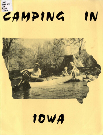
CAMPINGThis Directory was prepared by the Iowa Developme nt Comm ission with the cooperationof the State Conserva tio n Comm ission, Iowa Highway Commission, County ConservationBoards, Municipalities, U.S. Corps of Engineers, Private Camp;rou nd owne rs andoperators, Iowa Mobile Home Ass n. a nd the following campi ng directory publishers:Wooda ll , Campgrounds Unlimited, Camping Maps U . S .A., Barcam Publishing,Campground Atla s , Trailer Life, Mob lle Homes Manufacturers Assn,This Directory is intended to assist the genera l camping public and co nta ins listings ofboth PUBLIC and PRIVATE fac ilities known to exist as a result of survey questionnaires.The listings do not constitu te an endorsement by the Iowa Deve lopment Commission .Discrepancies are reqretted a nd any corrections should be direct ed to the Tourism andTrave l Division , Iowa Development Commission , 250 Jewett Buildi ng , Des Moines, Iowa,50309.INFORMATION ABOUT THIS DIRECTORY{This directory is used in the same general manner as any other camping dire ctory.)Definitions of some of the symbols and categories used . . .CG Index No. campground index number (map reference).County Number, Name and Ma p Reference Number counties are lis t ed a l phabetica lly .Ownership""(S) St a t eStat e Conserva tion CommissionE . 7th and Court, Des Moines, Iowa 50308(CP) "" Corps of EngineersU . S . Corps of EngineersClock Tower Bldg . , Rock Island, Ill.(C) CountyCounty Conservation BoardCounty Courthouse, Iowa (County seat marked with a star)(M)EMunicipal{P) ""' PrivateC ity Hall, Iowa {Town name shown in listing)Address as shown in the listingIt should be noted that some of the addresse s in the listing differ fromthose shown above . Those in the lis ting should, therefore, be used.Location re lated to highways or tow n . Look for signs or make local inquiry .Map Reference"" map r.1argin numbers and lette rs to help loca te counties on the map.Facilities "" "X" means provided or available .A bl ank box indicates non-existent or unknown.A number is quantity provided, U known .Fees a re charged for some facilities--usually nominal so not shown.If facilities are not evident, ask superinte ndent or operator.INIOWA(1968)Activities "" "X" means available o n the s ite or nearby.A blank space means no n- exi s tent {usually ava ilabl e in town) .A number is mileage to the activity if within reasonable distance.Fee minimum amount charged pe r unit per ni ght {vol :::: voluntary donation).Seaso n dates campground open (from - - to).Time Limit "" in days.Land Acres "" tota l devoted to camping {includes overflow).Tent Spaces "" individual number {may include tent trailer, pickup camper) .TT Spaces travel trailer, pickup camper , motor home.Pr Primitive Facilities which include water and pit toilets.Hookups "" individual connections {water may be central hydrant and not connection).Sewage Dump on- s ite disposal for self- contained uni t s.Flush Toilets if not marked "X", pit type o nl y.Shower s {H hot water, C "" col d water o nly).Tables 1 ea i s one table per unit, other number means total number of tables .Insect Control ""grounds treated for insects. Some CG are insect-free.Area Lighted some light present.Road Paved concr ete or blacktop .Stores and Sezvice groceries, gas, etc.Refreshments snack bar, cafe, concession, e t c.Swim "" may be pool , l ake or river.Fish may be pond, lake or river .Boa t "" may be pond, lake or river .Pets Allowed PLEASE keep o n a leash and under restrictive control.Lake Acres useable sudace area of lake in acres .Mobil e Home Parks usually will accommodate overnight guests if space is ava il able .Some QQ not provide spaces fo r tents. This, if known, is indicated by "0" under"Tent Spaces" in the li stings.Camping is not permitted in highway rest areas . Camping in State Parks a nd Preservesis permitted o nl y in the areas designated . Mos t individual spaces are unassigned -fir st come, firs t served:- - a lthough specific areas of a park are usually indicated.Playground equipment may be available in municipal and private campgrounds.Obsezve a ll rules and regulations as well as good camping etiquette. This wll l makeyour stay more sa f e and pleasant. Please don't be a litterbug -- either in the campgrounds or upon the highways. Use the trash receptacles provided or a litterbag.Take nothi ng but pictures, leave nothing bu t footprints.Speed Limits for autos pulling trailers:Under 28 fee t and under 4, 500 pounds 55 MPH maximum.Over 28 feet and over 4, 500 pou nd.s 40 MPH maximum.We hope you enjoy your visit and drive carefully so that you can return -- SOON.
FA C I LI T IESA CTIVITIESNAME (OWNER) - MAILING ADDRESSLOCATION DIRECTIONS. "'. . .s !. !. c:l ADA IRI234s62M0 b"Ccc1::9Nodaway Lake CG (M) Greenfield - Ia . 92 - W. edge cityMeadow Lake (S) - 5 mi. N . , 1 mi. E. GreenfieldCity Park (M) Adair- I- 80, exi t, N . 1/4 mi.Melvin Memoria l Park (M) Adair- in townCity Park (M) Orient - in townLone Tree Trailer Court {P) Greenfield - in townADAMS5 S/1-9/302S1020!.SO S/ l-10/ 1s20308Lake Binder (M) Coming - in townReservoir (M} Corning - in town3ALLAMAK EEB 22Mt. Hosmer Park (M) Lansing - in town312j l.SOCamp-on-a-Farm (P) Rt. 2, Postville - 2 ml. N. of Postville on Ia, 51French Creek (S) - 8 mi. W., 2 mi. N. LansingYellow River Forest (S) - vicinity of Waukon JunctionBall Park (M) Lansing - i n town4as2 .s S/!S- ll/ 1S/1-10/3Andy Mountain CG (P) Harpers Ferry -1/2 mi. S . of Harpers Ferry, Ia . 364rIS10ISso s!S63 3 X X H X X leXX !SX X leXI(XXp .APPANOOSEp16AUDUBONK8r·S XXXX XXv lXX2 2 XXX3/4XXXCurtis MH Park (P) 1423 Haynes , Centerville - in town, Ia. 60Roadside Park (M) Udell - in townWhistler's MH Park (P) Centerville - in town on Ja. 605VolAlbert Park CG {M) Audubon- in bwn, U.S . 71Littlefield Pa rk (C) Audubon - 5 mi. E. , 2 mi. S . of Exira on County Road JPlow in the Tree Park (P) Exira - 1 mi. S. of Exira, U . S. 71Legion Park (P) Exira - in NVISTA8 4-82 0p r141XXXXXX20XISX283May-Sep1XX2S27S222XXXl. scl. SlXX2-424114S/l- ll/ 1S/!S-10;12SO14402Spg. -FallE8X HX X eXX7X4XXXXXXXX24 leXXX2X 2XXXxli2302SXXX4 X XXX0XexexXsl XX2 X X24 X XeelXXXXXXXrsoXX XXX X XXXXXXXX X X XX X 1 1 XXI I X X22XXXXXXXXXXH X X leXssX X HXlxex23XXXXXXXXXX1:66XXll sv, l - t64 4 X X X XXXXXX XXXXXX X XX X XXXX2 2 2208012034XXXX62 2 2XX X X XX 161 IXXXXXX s1620GI18Buffalo Creek Area (C) Hazleton - 1 mi. E. of Winthrop on U.S . 20Fontana Park (C) Hazleton - 1 mi. S. of Hazleton on Ia. 150Lime Creek Area (C) Hazleton - 1 1/2 mi. N. E. of Brandon, N . of Ia. 283Quasqueton Vet . Mem. Par k (M) Q uasqueton - in townCutshaw Bridge (S) - 1 1/2 mi. W., 1/2 mi. S . of LittletonTroy Mil l s (S) 2 mi. N., 2 mi. E. o f WalkerKings Ct. (P) Hazleton - 3 mi. S. on Ia . 150Kirkville MH (P) Independence - i.n townBUENA880 X80 X6I10 26May-Oct/lS-10/lS/l-ll/1Northwoods (C) Sumner - 1 mi. N. of SumnerAlcock Park (M) Frederika - in tow nSweet Marsh (S) - 1 mi. E. TripoliSouth Park (M) Tripoli - i n townChapin Memorial Park (M) Tripoli - in townRiverview MH Ct. (P) Janesvill e- in town W . on U.S. 21810I180l. oc12BREMER4/1-10/ 1 141.0(AA- S Ranch Camp (P) Ogden- 2 mi. E. U.S. 30 & 3 1/2 mi. N .E . (N .E. of Ogden)Town Park (M) Pilot Mound - in townLedges (S) Madrid - Ia. 164 6 mi. S. of Boone9sU lim edXX0X 18Indian Hills Rec. (C) Waterloo - 2 1/2 mi. E. LaPorte CityJaycee Park (M) Evansdale - i n townCounty Park (C) Waterloo - in GilbertvilleMartin Park CG (M) Waterloo - U.S. 218 & Fletche r Ave nueBlack Hawk Park (C) Rt . 3, Blk. Hawk Pk. , Cedar Falls, I mi. W. l mi . N . of CedarFall sGeo. Wyth Mem . {S) Cedar Falls - between U.S . 20 & Cedar River adj. Cedar FallsCedar Falls Police Playground {P) Cedar Falls- in town E. on U.S. 20Green Acres Mob. VUl. (P) Cedar Falls - 1 mi. E . o n U.S. 20Hope Martins Park (P) Waterloo - in town S. off U.S . 218Martin Park (P} Waterloo - in town on U.S. 218River Forest MH Park (P) Waterloo- 2 mi. E. off U.S . 20Ace Fogdall, Inc. (P) Hwy. 218 & Rownd St., Cedar Falls - in townBOONE24L01 /H "'Warner CG (P}Vinton - in townHannen Park (C) Bl airstown - 4 mi. SW of Blairstown on County RoadDudgeon Lake (S ) - 1 mi . N. of Vinton464'ft;-W/'1XXXXX0XXX X XXX X XX60XXp ./1-1 0/1 6XSunrise Camp Area (M) Box 432, Storm Lake - in townLinn Grove {M) Linn Grove - in townBuena Vista Co . Park (C) Rembrandt - 2 1/2 mi. S. of PetersonTown Park (M) Sioux Rapids - in townLak eside Park (M) Lakeside - in townWarden Park (M) Newell - in t ownThe Pines Tr. Villa (P) Storm Lake - in townS . E. on U.S . 71 and Ia. 5S/3'fi bX10s2SO0ISXXXX2X2s72 2 230 IX272XXXX7 7 7XXXHl lel lellXXXeX2XXXXXXXXXX X XX XX2XXXXXXXXXX3000
FACILITIESACTIVITIESNAME (OWNER) - MAILING ADDRESSLOCATION DIRECTIONSc 0GI12BUTLERE16I2314CALHOUN17910111819202122XXXXX XXX28XXXleXXXXXXXXXXXXXXXXXXXX9GCity Park (M) Rockwell City - in townRainbow Bend (S) - 2 mi . S , of Lake CityTowhead Lake (S) - 2 mi . S., 7 mi. W. PomeroyHildreth Tr. C t. (P) Rockwell City - 1 mi. W, at Jet. U.S . 20 and Ia. 178CARROLLMCASSu.s.14 2294830XJxXXu7 "'"'527402XXXXXXXXKampgrounds of Iowa, Inc. (P) Box 336, We st Liberty- I-80, West Liberty exit, S.W.C01 2 5-f4/l-H/J oMassillon (M) Massillon - in townKochs Meadow Lake (P) Tipton, R. R. #J - Tipton exit I- 80, 2 mi . N. , 2 1/2 mi. E. ,I. 5014/l-10/15 1431/4 mi. N., Co. Rd . M106350X2550X58CERROI. 00 /1-11/l1.001.50 /1-U/1JGORDOc2414M. M. McNlder Park (M) Mason City- 6 blks.N.on U .5.18 on Kentucky Drive, 1 blk .W. on Birch DriveWilkinson Pioneer Park (C) Mason City - S . edge Rock FallsShell Rock River Preserve (C) Mason City - 2mi . S., 1 1/2 mi. E. of Rock FallsUnn Grove Park (C) .Mason City - W. edge RockwellClear Lake (S) Clear Lake - Ia. 106, 2 mi. S. of Clear LakeMcintosh Woods (S) Clear Lake - U.S . 18, 3/4 mi. E. of VenturaTourist Park (M) Clear Lake - 15th Avenue and S . Shore DriveDarraH's Trailer Park (P) P.O . Box 232, Clear Lake- Ia . 106 S. Shore Drive nearTouristvllle MarinaPennington Tr. Ct. (P) Rt. 4, Mason City - 3 mi. N. of Mason City on U.S. 65Rayburn MH Ct. (P) Mason City- 2 mi. S . on U.S. 65Parad ise Camping (P) Nora Springs - 7 1/2 mi. S . W . of Nora SpringsCHEROKEELarson Lake (C) Cherokee- 2 mi. E. and 1/2 mi. N. of AureliaRanney Knob Access {C) Cherokee - 1/2 mi. S. W. of WashtaBarnes Access (C) Cherokee - 5 mi. N . E. of CherokeeMeriden Roadside Park (C) Cherokee - on Ia. 3, 1 mi . W . of MeridenMartin Access (C) Cherokee - 4 mi. E. , 3/4 mi. S . of LarrabeeStieneke Access (C) Cherokee- 3 mi. N.E. of WashtaCherokee Park (P) Cherokee - S. of town on U.S. 59CHICKASAWE1.00 5/l- 10/l31'-prU-OctVol. prii-Oct1'-prll-Oct!.501.005/l-11/l2.0 !April-Dec7 537 597 5014141.50CLAYc4XXXXX54102335I0X30 0····ltrXX4CXI 41 XXX I IXXX XI IX H XXX131414II14161016XXXXXX24Jx2X HXeXxl ax60 2 2 2X HXX3XXXX XXXXXXXXX88XXXXXXXXXXX XXXX X XX X X XXXXX.XXX X1212 XX 36433643X 3643XX X X 3643X69IXI3XX XXXX XXXXXXXXXX XXX X XXX X XX862X2 212Osceola East Park Lake (M) Box 239, Osceola - 1 mi . E. Jet . U.S. 34 & U . S. 69, onu. s ' 34City Park (M) Murray - in town6Spencer CG (M) Spencer - 3 blks ., from U . S. 71 & 18 at S . end of bridgeBarringer Sl ough (S} - 2 mi. W. , 1 mi. N. of RuthvenTrumbull Lake (S) - 1 mi. W., S mi. N. of RuthvenSmiths Sl ough (S) - 5 mi. N. W . of RuthvenTown Park (M) Fostoria - in townModern Trailer Ct. (P)715 S. Grand , Spencer- U.S. 71, S . end of SpencerCLAYTONElkader Rec. Park (M) Elkader - in townHo ney's Marina {M) Boy Scouts, Guttenberg - in townD 232,0( !15 - 9/15726X X HX30XX eX XXXp p p 2.0(Mar-Nov1. 00 5/15-Fall3142020425III 0551854,5yXXXXXX2060XXXX X X X720121602130XX 16X 171X8XX6 X 5X XXX5 XX XXX XX XI X3 3X 3XXXXXXXXXX XXX X XXXXXX XX I XX He X XX2 545 245I18IX XXX XXXXX"f1 r " ' 11 ' " X: X X54Haus Park (C) P.O. Box 311, New Hampton- E. edge N . WashingtonHoward Woods (C) P . O. Box 3ll, New Hampton -1 1/4 mi. N . W . Nashua (in Floyd Co.)Saude Park (C) P. 0 . Box 311 , New Hampton- 5 mi. E., 1/2 mi. N. JerichoTwin Ponds (C) P. 0 . Box 311, New Hampton - 2 mi. S. , 3 mi. E. IoniaChickasaw Mill (S) - 2 mi. W. of IoniaAlta Vista Park (M) Alta Vista - in townRest Area (M) Fredericksburg - in townTown Park (M) Fredericksburg - in townMH Country Ct. (P) New Hampton - 2 mi. S . on U . S . 18 and U.S. 63CLARKE100 100XXXXX020!.501414IC23XXX X X X XXXXXXXXXXXX2 2 22021414CEDARXHXXXXXX67Sunnyside CG (M) 1004 Walnut, Atlantic- W. edge of city on U.S. 6Cold Springs Pk (S) Box 32 , Atlantic - 1 mi. S . of LewisLake Anita (S) Rt. il, Anita - 3/4 mi. S. of Anita on Ia. 148Victory Pk (M) Anita - in town16IXX2X ay-Oct.35X2ISwanLake (S) Carroll- 1 mi. S .W. of Carroll, 1 1/2 m1. E . ofU . S. 71, 2 mi.S orRiverside Pk (C) Carroll - r:. edge Coon RapidsWillow Creek Pk. (C) Carroll - E . edge Manning Ia. 141Hobbs Pk (C) Ca rroll - 11/2 mi. S . W . of Lanesboro via Ia. 286Merritt Pk (C) Carroll - 2 mi . E. & 4 mi . N . of GliddenCarroll Access {S) 2 mi. S . of LanesboroGraham MH Pk (P) Carroll- E. of town off U . S .3015I pg.-FollCamp Comfort (C) Greene - 4 mi. S. E . of GreeneBig Marsh {S) - 5 mi . N. of ParkersburgPerrin Park (M) Greene - in townRoadside Park (M) Alli son - in townCity Park (M) Aplington - in townGreene Rec . Park (C) Greene - in town13"' I5 1111XH0X H X X eX X XXC X XI X0XXX X XX X XXXX2lx6
fA C ILITI ESA CT IVITI ESNAME (OWNER) - MAILING ADDR&SSLOCATION DIRECTIONS. "'.c Town Par k (M) Garber - in townVol ga Park (M) Volga - in townPikes Peak {S) McGregor - 3 mi . S. E . of McGregorSchool Grounds (M) Clayton - in townSunnyview Tr. Ct . (P) Guttenberg - 1 mi. S . on U.S. 52Spook Cave (P)McGre or-1214XXXX04/15-11/19 mi. N .W . on U.S . 18CLINTON23I5I. SOJ26XArrowhead Hunt & Consv . Club (P) Rt. 1, Box 28, Goose Lake - 1 mi. W . , 2 mi . S.XXX249X /1-11/150X628X X14 X X 4XGoose Lake/1-10/1Bulgers Hollow (Cp) Rock Island, illinois - 4 mi. N. of ClintonXxxxx4 414XGoose Lake (S) 1 mi . W. of Goose LakeCRAWFORD24635/30- 9/7Crystal Lake Country Club (P) DeWitt- 3 1/2 mi . W. on Lake RoadPerkins MH Ct . (P) DeWitt - 1 mi. W . on U . S. 30Cedar Heights (P) Hwy. 67 & 17th Ave., Camanche- in town on U . S. 672,00XX X XX XXX XXX X XX6XCharter Oak Town Park (M) Charter Oak - in townSchleswig Park (M) Schleswig- 5 blks . E. of U . S . 59Ballantine MH Park (P) Denison- in town on U . S. 30 East2526DALLASKIITown Park (M) Linden - 1 blk. W. of Post OfficePrairleVllJage (P) Booneville- 1-BOexittota. 90, 2m!. S.E. of VanMeter, 7m1 . W.of 1-35Pioneers Campground (P) R. R. #1, Woodward- 21/2 mi . S.E . of Woodward on Ia. 141pDAVISDECATURXX2.02.018Eldon Game Area (S) - 3 mi. S . W. of EldonLake Wapello {S) Drakesville- Ia. 273, 6 mi. W . of DrakesviJle27X2871.50p1356Nine Eagles (S) Davis City- County Road, 6 mi. S.E. of Davis City28DELAWAREG23I. 00 /15 -1 0/141/42 . 50May-Oct .14I .SO6/1- 10/15/1-11/15/1-11/15/1-10/1Hartwick Point (P) R. R. #1, Delhi- 21/2 mi. S . W . of Del hiForest Vill a Resort (P) Dundee- 2 mi. N. of Dundee (Backbone SP)Backbone (S) - Dundee - Ia. 410, 4 mi . S . W . of Struwberry Point (2 CG)Clair View Acres (P) Delhi - 4 ml. W. of town] . P. Ranch (P) Delhi - 3 mJ. W. of townMaple Resort (P) Delhi- 4 mi. W .of townTegeJers Lake (P) Dyer sville -1/2 mi. W . on U.S . 20DES29MOINES0DICKINSONB35X05/1- 9/414 145/31-9/11482 . so1.50 !VlS-IQIISEmerson Bay Access (S) - l mi. N. of W. OkobojiHales Slough (S) - 4 mi. N . E. of Orleans]emmerson SlolJ} h (S) - 1 1/2 mi. W . of Spirit LakeKettleson Hogsback (S) - 3 mi. N . o( Spirit LakeLower Gar Lake (S) - 1/2 mi. S. of Arnol ds ParkMarble Beach (S) - 2 mi. N . W .of OrleansMlnnewashta (S) - edge Arnolds ParkPrairie Lake (S) - 2 mi . E. , 1 mi. N. of Arnolds Pa rkS pdng Ru n (S) - 4 mi. E. , J ml. N . of Arnolds ParkTrappers Bay Access (S) - 1 mi . W . of Lake Pa rk1.50Gull Point (S) Milford - W . side of W . Okoboji ay-Oct.City Park (M) Lake Pa rk - in townCity Park (M) Arnolds Park - Ln townI. soLincol n Park Resort (P) Arnolds Park - S . Arnol ds Park , 2 bl ks. W . U . S . 713 . 00 /l::'flf/1White Oaks CG (P) Rt. 1, Milford- 2 mi. N . of Milford on U . S . 71I. 00 5/15- 10/1Shadyrest Tr. Ct. (P) P . 0 . Box 26, Arnol ds Park - in Arnol ds Park 2 bl ks. E. of U.S. 71 2 . 00Gerk ' s Resor t (P) Spirit Lake- Jn town3 . 00 May-OctChal strom Beach C t. (P) Spirit Lake- 3 mi. S . E. on U . S. 71Smiths MH Park & Sales (P) OkoboJI - In town on U . S. 71Orr's Camp Wlnakawin (P) Arnol ds Park- 1/2 mt. E. of townI. so 5/1- 10/1535G0s2sXXX XX XXXXX X4XXXXXX X XX XXC1 XXXX 125XXX1040X607320X2SsoX X X XXXX2IX X H X X 1e X XX X X X X X Xr.145X X f X3 1020 253 04 3004X12XX4X f2X f'X 1eX f' X X 1e10Xso 4 4 420 2626 X 12 X6633ICXXXXXX f08 1026 30 25 ISX15XXXXXXXXHXleXXIXX XXX24Table Mound MH Ct. (P) 379 S .Grandview, Dubuque - 1 mi. S . of Dubuque on Kerrigan105/1-1 0/13,0010XXX4710 X 58143788XXXXXXXXX 1400XXX XXX X X X X3788X X X X X X X X X3788XXX X X 1 II 3939X XXX X XI I X 3788RoadMassey Marina (C) Dubuque- 9 mi. S. of Dubuque, U.S. 52 markedCamp 20-Wes t (P) 1320 Rhomberg Ave. ,Dubuque - 2 1/2 mi. W. of the Iowa-Illinoisbridge on U . S. 20Mu d Lake (C ) Dubuque- Ia . 3, 6 mi. N. of Dubuque, Ball tow n Roa dTall Corn Acr es (P) Cascade - 4 mi. E. of Cascade o n U . S. 151Riverview Park (M ) Dubuque - o n isl and in DubuqueXr.r.r.r.r.r.r.r.r.r.r.r."' ,:\1'b.DUBUQUE .6 2 6 X X X455614xxxxxxxxxxxxxxxxX 21eX H X X leX H XXI6Nordstrom ' s Beach-Martna (P) Box 342, Spirit Lake- 4 mi. S . E . of Spirit Lake onE. shore of E . Lake OkobojiCen ter Lake Access (S) - 2 mi. W., 1 mi. S. of Spirit LakeChristopherson Sl ough (S) - 3 mi. N . of SuperiorDiamond Lake (S) - 5 mi. W., 2 1/2 mi. N. of Orleans31us3035 123ISE. Okoboji (S) - E. edge Okoboji910111213141516171819202122232425X24Lower & Upper Augusta Skunk River Access (C) Burlington - 7 ml. S. of BurllngtonU . S . 61, W . 41/2ml.C ha utauqua Park (C) Burlington - 1 1/2 mi. E. of MediapolisLa Veine ' s MH Ct. (P) Burlington- 1 mi. W. on U . S. 34304sJ. 4sXXXXXXXX X XXX XX
FACILITIESACT I VITIESNAME (OWNER) - MAILING ADDRESSLOCATION DIRECTIONS32EMMET9A10Tuttle Lake Cam p Area (C ) Armstrong - 2 mi. N . & 2 mi. . of Dolliver5678910I owa Lake (S) - 7 mi. N . of Armstrong1213141516Ryan Lake (S) - 2 mi. S ., 1 mi . W . of GruverTwelve Mile Lake (S) - 4 mi. W., 1 mi. S . of Walli ngfordWest Swa n Lake (S)- 2 mi. S ., 1 mi. E. of GruverFort Defiance (S}- Estherville- Ia . 9 & 245 ,1 mi . S .W . of EsthervilleCozy Grove Mot e l & Tr. Park (P) 1704 Hwy. 9 E., Esthervill e - in townFAYETTEFLOYDD123456789101136FRANKLINSpg .- Falc162504/l-11/13839p1.51. 5010G16GUTHRIEK9Gct -. 5.01. 00GRUNDYHANCOCK72105142452.01. 00 5/l-11/11. 001. 505320 X32 X X X X X147·rc8XX6401520XX510XX98114l/2211464121.00 4/1-10/ 11. 00 4/ 1-1 0/11.00 4/1-10/ 15/1-11/114141496151.001. 001414XX1215XX612exX X HX2XXXXXXX1 8XX1 1 1 1 1 1 1 1 X160X X XXXXXXX·1"l4035XX X3010 1525 XX X623232!X7XX X XX XXX XXXXXIX X XXX IlxXXXX XXXXXX H X X eX XXXXX XXXX X 1XX X XX130XXXX XX X X3X XXXX IXXXX221049X4 4867XX X HI Xlx3XeeeXX'lX XXXX X XX XXXXX XXX XXXX52 202 X X HX106XX8424 6 XX XXX H XXXXX X XXXI X!'128868rXXXXX XXX32 2 2X X70X X4X XX X XXXXX X X3X2F .27XXXp X XX XX X13Little Wa ll Lake (C) Webster City - 1 1/2 mi. S. of Jewell o n U . S . 69Bell s Mill Par k (C) Webster Cit y - 5 mi . N . E. of StratfordBriggs Woods Pa rk (C) Webster City - 3 mi. S . of Webster City, Ia. 60Ci t y of Webster City (M) We bster City - in town414777777Chautaqua Park CG (M) Jefferson - 3 blks . W . of Ia . 17 in S . W . part of cityDunbar Sl ough (S) - 2 mi. W . , 3 mi. S . of Scr antonMartin Community Park (M) Rippey - in townPaton Tr , Court (M) Pa ton - in townSpring take (S) - Grand Junction - 2 mi. W ., 2 mi. N . of Grand JunctionAlvord ' s MH Ct. (P) Grand Junction- in town on U . S . 30HAMILTON5714May- Se tGREENE4X XH14Good Egg Park (M) Stuart - in townC ity Park (M) Casey - i n townMenl o Park (M) Menlo - in townBays Branch (S)- 2 mi . N . , 2 mi . E. of PanoraLakin Sl ough (S) - 2 mi . E. of Yal eSpringbrook (S) Guthrie Center - Ia. 25 & 384, 7 mi . N . of Guthrie CenterMitchell Park (M) Guthrie Center - in townLions Rest Area {C) Bagley - Ia . 141 , E. edge of town4010Town Park (M) Thurman - in townForneys Lake (S) - 2 1/2 mi. N .W . of ThurmanRiverton Area (S) - I mi. W. of RivertonWaubonsie (S) Hamburg - Ia . 2 & 239, 7 mi . S .W . of SidneyManti Park (C ) S idney - 2 mi. S., 1 mi. W . of ShenandoahPin ky's Glen (C ) Sidney - 3 mi. W . of Tabor on County Road M3730XXXE4X5/1-11/ 12.0Latime r Consv . Park (C - M) Latimer- in townBeeds Lake {S) - Hampton - 3 ml. N. W . of HamptonToft Park (C) Hampton - 1/2 mi . N . 1:. of OowsMallory Memoria l Park (C) Hampton - 4 1/2 mi . S . , 2 mi . W . of HamptonRobinson Memorial Pa rk (C) Hampton- 1 mi. N. , 1 mi. E. 1/2 mi. N . of HamptonGalvin Memoria l Park (C) Hampton - S. edge of Sheffiel dPopejoy Conservation Park (C) Hampton - in PopejoyBurkley Park (C ) Hampto n - 2 mi. W . of GenevaWest Ford (C) Hampto n - 3 mi . N . , 8 1/2 mi . r: . of HamptonAl exa nder Consv . Park (C ) Hampt o n - in Al exanderHandorf Roadside Park (C ) Hampton - 8 mi . E. of Hampton on Ia . 3FREMONTl/220Mill Dam Park (C ) C harl es C ity - in Nora Spr ingsMa the r s Woods (C ) Charl es City - 2 1/2 mi . S . of Nor a Spri ngsCounty Park (C ) Charl es City - 2 mi. N. of Nora SpringsWaverly Hill (M) 407 Riverside Drive, Charles City - U . S. 218 in Charl es CityIdlewild Access (S) - 10 mi. , N. W . of Charl es CityCity Park (M) Marbl e Rock - in townStar MH Park (P) Charles City - 2 ml . W. on Ia . 1435XX141. 01. 5Klock ' s Is l a nd Park (M) Fayette - in townTown Park (M) Arlington - in townBig Rock Access (S) - 1 mi. E. of FayetteGrannis Creek (S ) - 5 mi. E. of F yetteLions Park (M} West Union - in townTwin Pines Village (P) West Unio n - in town34X20r.Birge Lak e (S) - 1 mi. N . , 3 mi. W . o f DolliverCheever Lake (S) - 2 mi. S . , 1 1/2 mi. W . of EsthervilleCunningham Slough (S) - 6 mi. E. of WallingfordEas t Swan Lake (S) - 3 mi . W . , 2 ml . S . of Mapl e HillFour Mile Lake (S) - 2 1/2 mi. W . o f Es th e rvilleGrass Lake (S) - 1 mi . S. , 2 mi . E. of HuntingtonHigh Lake (S) - 5 mi. E. of WallingfordIngham Lake (S) - 5 mi. E , of Wallingford113380XXXXXX4. 00Ringsted Tra il e r Court (M) Ringsted - in townXXXXXX XXX X XXX27X X X X X1:X XXX X XXXX273X X XXX300XX13Ell sworth C ollege Park (C) Crystal Lake - 1/ 2 mi. N . of Crystal Lake, off Ia. 111Pilot Knob (S) Forest City - 4 mi. E. , l mi. S . of Fore s t City161 0X XXX95XXXXXI5
F ACI LIT IESACTIVIT ) E Sw0,NAME (OWNER) - MAILI NG ADDRESSLOCATIO N DIRECTIONS.cg . HARDIN15G4445HARRISONKApr.-Oc t4849501 ."XXXXXXXX 0 .c "'X43 X X X X HX HXX HXX2(11'0 U 0 30XXXXXXXXXXXX X X XXXX X XX X X X XXX!X11XXX10163XXIf1I54XX XXX4282 . 50 !'l 415X XX22XXXXGeode (S) Danv ill e - 4 mi . S . W . of Danv illeOakla nd Mill s (S) Mount Pl eas a nt -Ia . 133, 4 mi. S .W . o f Mount Pleasa ntGree n MH (P) Mount Pl easa nt - 1 mi. E. off U . S . 34Saunders Pa rk (M) Mou nt P leasant - in townHOWARDB186/1 - 9/ 30Apr- Oct./ 15-1 (1115/ 15- 1()115/15 -1 Q/15HUMBOLDTC ity Pa rk (M) Bode - In townE201081 1/117214XXXIDAK20H2610023/ 15-1 (1115XIC XXXXX4'0e4X6 6 X65XXXXI1 X X X XXXX; 1:w1r150XX XX1XX X XXXXXXXX XX5 401Ma y-NovG46 IIMoore head Pioneer Pa r k (C ) Ida Grove -l mi. W . of Ida Grove o n U. S . 59- la . 175Hw y . 20 Res t Area (C) Ida Grove - 2 mi. W . of Galva on U . S . 20Municipal Pa rk (M) Ida Grove - i n townMu n ic i pal Pa rk (M) Ba rtle Creek - in townIOWA277/ 1-1 0/ 31Ol d Settle rs Pa rk (M) U vermor e - in t ownGo tch Pa rk (S) Da kota C ity - 2 mi. S . E. of HumboldtIza a k Walto n- Oak da le C ha p . (P) Britt- Ia . 60 nea r RenwickWa gon Wheel Tra il er Court (P) Humboldt - i n town47141434/1-Fall0 I " " 8 0 8Chester C a mp (M) Ches ter - in townLake Hendricks (C ) C resco- 1 mi. N . 1/4 mi. E. of RicevUleVern o n Springs (C) Cr esco - 2 1/2 mi . S. W . o f CrescoLidt ke Pa rk (C) Cre s co - 1 mi. N . o f Lime Spri ngsFlore ncev ill e Pa rk (C ) Cresco - 9 ml . N . of CrescoDavi s Corne rs Roa d s ide Pa rk (C ) C resco - 9 mi . W . o f Cresco, U . S . 63 & Ia . 9Bea dle Park (M) Cresco - ln tow n on Ia . 9Larry' s Tra ile r Court (P) R. R. 2 , Cresco - i n t own46'0w0Nobles Lake (S) - 3 mi . W . , 3 mi . S . of Missouri Va ll eyTown Pa rk (M) Pisgah - in tow nEhl e rt' s - Easy Pk . .Ct. (P) Mi ssouri Vall ey - 1/2 mi. E. on U . S . 30Seel e ys Vac . & Tr. Ct. (P) Logan - U . S . 30 , S . edge o f tow nHENRY 401. 501. 50j h 1;;w; I .,e :l mI ,. 8 w .,If. w ,g gw"'c :a ::E W t% -"w g .5 ,: w ll .c!lu ,.G) "' 5"' 1 i i: I 1 '2 :3. :l . 1:: 1:: 1. 50Ia . River Co nsv . Im p . Cl ub (P) St eamboat Rock - W . edge of town acros s riverHardin City Acces s (S) - 5 ml. N . W . of Steamboa t RockUpper Pine take (S) El dora - Ia . ll B, 1 mi. N.E . of EldoraLower Pine La ke (S) Eldora - Ia . 11 8 , 1/2 mi. N . E . of El doraOwa sa Park (M) R . R. 2 , Iowa Fa ll s - i n town of OwasaTown & Coun try MH Park (P) El dora - i n tow n N . off la . 57 Wes tSunrise Mob. Village (P) Iowa Fa ll s - I mi. E. of townWes tside Trailer Pa rk (P) Iowa Fa ll s - 2 mi . W . off U . S . 2043"'.I IIEagl e Lake Pa rk (C) Britt- 3 mi. E. , 1 mi. N. of BrittTown Pa rk (M) Corwith - in town42w0"'80:; "XX2CX3 3 XX XXXxl)XXXX X122X X1 1 X X XRandol ph Access (S)- 5 1/2 mi. S . E. o f Belle Plai neVictor Park (M) Vic tor - in t ow nSta r Inn CG (P) Vic tor - in t ownJACKSON35/ 1-10/1Pl easant Creek (C p) Rock ( s t and , Illinoi s- 3 1/2 mi. S . of BellevueGree n I s l and (S ) - N . Sabu laBellevue {S) Be lle vue - U . S . 52 , S . of Bellevu eMa quoke ta Caves (S) Maquoketa - Ia . 130, 7 mi . N. W . of Maq uoke taRiver Pa rk (M) Sabula - in t ownSabula La ke (M) Sabul a - i n tow nHorses hoe Po nd Park (C ) Maquok eta - S . edg e MaquoketaFairlane trail er Court (P) 212 E. Locu s t - Maquoketa - i n tow n on Ia . 641lxX X X XX10XXXXXXr.1. 0014XX1. 0014XX552.54XX X XXXX X XXXXXX10 100 XXXXXi'K 15JASPERCorn Valley CG - KOA (P) Rt. 1, Newton- I- 80 Co . Rd . "W" exit , 1 mi. N . , 1/3 mi. E.Kellogg Game Area (S) - 1 1/2 mi. E. o f Kell oggRock Creek (S) Kellogg - 3 mi . N . , 3 mi. E, o f Ke ll oggAnchorag e Tra il e r Park (P) Newto n - in townConstance Trail e r Court (P) Newto n - 2 mi. W . on U . S . 6515253JEFFERSON020JOHNSONK21Cora l v Ul e Reservoir - Cor ps of Eng i neers - Rock Is land , Illi noi sSa ndy Beach- 10 mi. from dam on N .E . s horeTurkey Cre ek Heig hts - at Adm in . Bl dg . E. e nd o f damWest Overlook Area - N .W . end of damMid River Pa rk - near U . S . 218Sugar Bottom - 4 mi . fro m dam o n E. shoreLa ke Ma cBride (S) Solo n - la . 382, 4 ml . W . of Sol o nJONES5/ 1-10/15/ 1-1 0/15/ 1-1 0/15/1- 10/ 15/ 1- 10/ 1141414141414101010May- Oct.1141201. 50H23City Pa rk (M) Mo ntice llo - i n tow nCentral Pa rk (C) Scotch Grove - 3 mi. W . of Center Ju nctio n off Ia . 3820tXX1010490052456208X X 'XX1X H XXC XXXXXX XX XXX X X X XXXXXX XXX X XX X X XX X XXXXXX XXXXXXXXXXXXXXXXXI69 50125I
25436879111012141315171618192021222324ABLEGENDMap Symbols@Inters tate Marker8U. S. Marker@State Marke rIILewis and Clark Trail.cD I nter stat e Rest Areas Rest Area (electrified) EGreat River Road*Hiawa tha Pioneer Trail (north )Hiawatha Pioneer Trail (south)Rest Area (non- elec .)County 5161718192021247232526R
F ACILI T IESACTIV I TIESNAME (OWNER) - MAILING ADDRESSLOCATION DIRECTIONSMuskrat Slough (S) - 2 mi . W. of OlinPicture Rocks (S) - 4 mi . S . E. of MonticelloWapsipinicon (S) Anamosa - U . S . 151, adjoins AnamosaWaps l e Park ( M) Oxford Junction - in townTown Park (M) Ons l ow- Jn townGoods MH Court (P) Montice llo - 1 mi . N. J: . on U . S . 1515455MKOSSUTHc IICounty Park (C) Algona - 3 mi . N . of Algo na on U.S . 1695/I- H)i'3 ICi t y Park (M) LuVerne - in townC ity Park (M ) Bancroft - in townBuffalo Creek (S) - 3 mi . N . E . of Burt5/I-10/ 1LEE28I 3014141. 501. 00XX20X X X XX X X X XXX10XIXXX1e423030 464XXleleXXX X X XXX X XXXX3530 33XleXX X X XXX!I20. 50. 50.501, 00 5/1-1 0/1" "! ·,X H XII!X1. 00 5/1-10/15 141414I414XXX207I4X XX X232X1. 00 5/1-10/15 141. 00 5/1 -I 0/15XXXXX021I6XX XXX5 5Xle1.00 :;/27-L.D y I45/1-1 0/1I4159018,IX221 00X2235I XXXXX X XIXXXXX XXX X1810p p 1.001.50XVo l.1. 50I47015XX XXXX2XXXX 3 200X1420072X XXX1XXXXXXX XA2X XX XX5/1-1 0/IIs l and Pa r k (M) Rock Rapids - in townRoadside Par k (M) Rock Rapids - W . edge townC ity Park ( M) Larchwood - in townCity Park (M ) Inwood - in townC ity Park (M) Alvord - in townBill' s Trailer Court (P) Rock Rapids - in townInwood CG (P) In wood - 1 mi. N . W . of Jet. U . S . 18 and Ia. 26XXxl XX121. 00IX614XX6l. SOApr . -Sep.1. 50M10X141. 50MCounty Park (C) Rt. 2 , Knoxville - W . edge city 1/4 mi. S . o f I a . 60 - 92Swimming Pool Park (M) Pe ll a - in townBig Rock Park (M) Pella - in townPleasant Park (P) Pl easantvill e - in townMill er MH Park (P) Knoxville - 1 mi . N . on Park DriveRoozeboom MH Park (P) Knoxville - 1 mi. E . of tow n1212XX03XX6XXX5,2 82 226 23 3 3xi e5 X X X XX9/1- 11/ I2X 2XXX3XleXX6XX22XX102514600622622X HXXX6151. 00H XX HXXX17Park View (P) New Sharo n- E. of town 1/2 mi.Lake Keoma h (S ) Oskal oosa - la. 371, 5 mi. E. of Oskal oosaOskal oosa MH Park (P) Oska loosa - 1 1/2 mi . N . W , on Ol d Ia . 163S hady Lodge Tra il e r Park (P) Oskal oosa - in townXX X1. 50 / 1-11/15/1 -11/1MXXXX XCity Park (M) W inters et - in townPammel (S) Winterset - Ia. 92 & 162 , 5 mi. S . W . of W inte rsetSunrise Tra il er Park & CG (P) Winterset - in townWinterset Cabin Ct. & Mo b. H, Par k (P) Winte rse t- in townMaple Leaf MH Park (P) Winte rset - 1/2 mi. N. on U.S. 169MARIONXXXXX H00H . Farm (P) R. R. 2 , Russe ll- 4 mi. S. of RussellRed Haw (S) Rt. 1, C hariton- 1 mi. E. of Chariton, U . S . 34S t e phe ns Forest (S) Charito n - 2 mi . S . W . of LucasMAHASK
Indian Hills Rec. (C) Waterloo - 2 1/2 mi. E. LaPorte City Jaycee Park (M) Evansdale - in town County Park (C) Waterloo - in Gilbertville Martin Park CG (M) Waterloo - U.S. 218 & Fletcher Ave nue F 9 8 22 16 8 19 18 Black Hawk Park (C) Rt . 3, Blk. Hawk Pk. , Cedar Falls, I mi. W. l mi . N . of Cedar Falls 6 Geo. Wyth Mem .


