Transcription
National Association of Geoscience TeachersPacific Northwest SectionPresidentDerek Turner, Douglas Collegeturnerd1@douglascollege.caVice PresidentCraig Nichol, University of British ColumbiaCraig.Nichol@ubc.ca2nd Vice PresidentCrystal Huscroft, Thompson Rivers Universitychuscroft@tru.caSecretaryJodie Harnden, Sunrise Middle Schooljharnden@pendletonsd.orgTreasurerZachery Schierl, Yakima Valley Collegezschierl@yvcc.eduNewsletter EditorsAndy Buddington, Spokane Community College,Andy.Buddington@scc.spokane.eduFrank Hladky, Washington Geologic Surveyfrank.hladky@dnr.wa.gov & fhladkys@gmail.comState CouncilorsAK Sonia Nagorski , University of Alaska, Juneausanagorski@alaska.eduLeeAnn Monk, University of Alaska, Anchoragelamunk@alaska.eduIDShawn WillseyCollege of Southern Idahoswillsey@csi.eduOR Steve Carlson, Portland State Universitynativelement@me.comHal Wershow, Central Oregon Community Collegehwershow@cocc.eduBCTodd Redding, UBC Pentictontredding@okanagan.bc.caWA Andy Buddington, Spokane Community Collegeandy.buddington@scc.spokane.eduWeb-site coordinatorFrank Hladky, North Bend, Oregonfhladkys@gmail.comOEST CoordinatorJodie Harnden, Sunridge Middle School,jharnden@pendletonsd.orgPast President, Hillary GoodnerPage 1Fall 2021Greetingsfrom thePresidentDerek Turner,Section President,Douglass CollegeAs everyone knows,this past year and ahalf has been achallenging time forGeoscienceeducators. As we hopefully get closer to theend of the pandemic, many of our members areteaching online, while others are able to beback in the field with students. Here in BritishColumbia, most of our instruction is back tobeing in person. While it’s been a bit strange tohave hallways full of students again, I find thatteaching online for over a year has made memore appreciative of small things, like beingable to point to a sample instead of an onlinemodel and how much easier I find an in persontest to an online one. Mostly though, I’vemissed field work with students. I wasfortunate to be able to lead a modified fieldschool this past summer and was remindedimmediately of how much I love being outsidewith students and how much more engagedstudents are when they can explore an outcropinstead of a screen. We all still have a long wayto go in this pandemic, but it was inspiring tobe reminded of how lucky we are to teachGeoscience.As the leaves change color, I am often amazedat how fast the Fall flies by. Wasn’t the firstNAGT Pacific Northwest Section
week of class just a couple of weeks ago?! Thispace of change has been mirrored in oursection, with several familiar faces moving onand new members stepping up to get moreinvolved. In particular, I would like to thankPast-President Hillary Goodner and formerSecretary and Treasurer Eriks Puris, for theirhard work and leadership over the past fewyears. I would also like to thank our new andreturning executive, Craig Nichol, CrystalHuscroft, Jodie Harnden and Zach Schierl. Ifyou’re interested in getting involved, considerbecoming a section officer. We currently haveseveral vacancies in different states andprovinces.Throughout the pandemic, our section hascontinued to be an active resource for ourmembers. We held workshops, visited virtualfield sites and even had a very well attendedonline meeting. While it wasn’t quite the sameas our traditional meetings (unfortunately nowinery tour like in Penticton!), it was great tosee some posters and presentations, and to talkwith many of you for the first time in too long.Please consider joining us for our June 2022meeting in Pendleton Oregon. This wassupposed to be held in 2020, so I’ve beenlooking forward to the field trips for two yearsnow! I hope to see you there so we can sharestories of how we’ve gotten through the pastcouple of years and what we can look forwardto in the future.Virtual Geology Field Trip of YakimaCounty, Washingtonby Zach SchierlYakima Valley Collegezschierl@yvcc.eduAfter attending the Third Thursday FocusGroup with Tara Laidlaw in January, I decidedto create a virtual geology field trip of YakimaCounty for my geology and physical sciencestudents using Google Earth Projects. Here atYVC, our geoscience courses are still beingoffered 100% online, so I've used this the pasttwo quarters as the "capstone" lab for myPHSCI 112 course, which focuses on thegeology, weather, and climate of YakimaCounty. I plan to integrate it into my onlineGEOL 101 course this quarter. Initially I usedmostly existing photos and videos, however Iam slowly working on recording my own shortvideo clips into order to create a more cohesivenarrative from start to finish.Overall, the field trip has been well-received bystudents, though I'm still working out some ofthe technical glitches. The biggest challenge Ihave encountered is some students not havingenough internet bandwidth to run Google Earth.Equity issues relating to internet access havebeen a major concern for us here at YVCduring the pandemic, as many of our studentsPage 2NAGT Pacific Northwest Section
live in very rural areas without access to highspeed internet or cellular data service.Beginning this quarter however, students areable to access campus once again (albeit on alimited basis) so I am hopeful that will make iteasier to all students to access the virtual fieldtrip going forward.If you would like to check out the field PszUVizUebwV59QGTbCO1lUXeU?usp sharingand then click on "Present" to launch the fieldtrip. I wanted to share this as a concreteexample of how Tara's presentation could beapplied to geology, but also to get feedbackfrom the section as this is still very much awork in progress! I would appreciate hearingany comments or criticism you have.GeoGirls is run in partnership between theUSGS Cascades Volcano Observatory andMount St. Helens Institute. Started in 2015,GeoGirls provides an impactful outdoorlearning opportunity to share knowledge aboutMount St. Helens, volcano hazards, monitoringtechnologies, science careers and hazardeducation. The entire program takes placewithin the area affected by the 1980 eruption ofMount St. Helens. GeoGirls is looking forvolunteers from the scientific community to beinvolved!GEOGIRLS ROCK!by Gina RobertiMt. St. Helens InstituteRecruiting scientists for a STEM-BASEDOUTDOOR PROGRAM AT MOUNT ST.HELENS that encourages and supports thenext generation of scientists, GeoGirls is a 5day, 4-night multi-generational geology andtechnology camp for middle and high schoolage girls (cis and trans gender) at Mount St.Helens.Our guest scientists lead science field activitiesfor the participants, teach in the field, serve oncareer panels and join our geology-themeddance party. For geoscience educators, studentsand professionals interested in being involved,please complete our Science Mentor
volunteer recruitment form. For anyquestions or more information about theGeoGirls program, contact staff at the e.org. The GeoGirls program was featured inthe Geological Society of AmericaConnects 2021 meeting.Learn more about the GeoGirls programon the Mount St. Helens Institutewebsite.Featured articles about GeoGirls: GeoGirls: Confidence Erupts from aCamp at a Volcano Summer camp atMount Saint Helens empowers girls withscience, confidence, and fun - EOSMagazine “Science is Amazing”: GeoGirls ExploreMount St. Helens During OutdoorScience and Technology ProgramUSGS Burst their balloon, GeoGirls will find aworkaround, Mount St. Helens fieldcamp nurtures know-how in geology,technology- The Columbian MagazineNews From Alaskaby Sonia NagorskiUniversity of Alaska SoutheastThe Alaska Coastal Rainforest Center ishosting a virtual event with the BritishConsulate General in San Francisco onMonday, October 25th from 1:30-3:00 pmAKDT, called: “Changing Forests, ChangingOceans: Climate Change Impacts andSolutions in Southern Alaska.” This willconsist of several presentations by regionalexperts on southeast Alaska’s changing climateand impacts on salmon, forests, and marineecosystems. Discussion follows and willinclude specific mitigation and Y8SU-3BZkmzZ.Another upcoming conference is the AlaskaTribal Conference on EnvironmentalManagement (ATCEM), from November 1519, and also virtually. It is organized by theAlaska Native Tribal Health Consortium and isan annual gathering that brings together Tribes,Non-Profits, Rural Municipal and BoroughCommunity Leaders, State and Federalorganizations, to address the uniqueenvironmental concerns facing Alaskancommunities. Topics include: Solid Waste,Water Resources & Public Infrastructure, MyChanging Climate, Air Quality & HealthyHomes, Community Sustainability, andContamination Support (CS and Brownfieldcombined). Registration and other informationis available at: https://www.atcemak.com/.NAGT AK councilor Sonia Nagorski will begiving a presentation on microplastics at theATCEM conference. In the past few years,Sonia has worked with students to measurePage 4NAGT Pacific Northwest Section
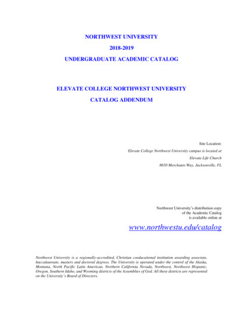
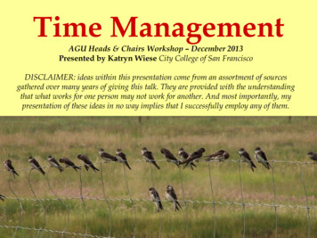
microplastics in the Juneau area. Methods formeasuring microplasticsare not yetstandardized and there is a wide variety oftechniques and associated expenses. A simpleand low-budget way to look for microplasticsin water that can be accomplished withstudents involves collecting water in a cleanglass or stainless steel bottles followed byfiltration and microscope examination. Sonia’sstudents focused on collecting rainwater, whichinvolved the added step of setting out a glassmason jar with a stainless steel food funnel( 5) to sort out large debris (photo) andwaiting until sufficient rain water collected.Next, the water samples are processed througha filter, which requires either a hand pump oran electric vacuum pump. A standard griddedfilter of 0.7 um or larger works well. Then, useeither a dissection or compound microscope toexamine the filters. I recommend using thefreely downloadable “Guide to MicroplasticIdentification” by MERI to help withidentifying fibers and particles. All sample setsshould have multiple procedural blanks tomeasure contamination. Students were verysurprised with how many microplastic fiberswere present in the samples, and the projectcaptured students’ interests because of thevisual clarity of the contaminants, somethingnot achievable by most chemical analyses.Two rainwater collectors (mason jars with funnels) set outfor microplastic collection in Juneau.Oregon Geology!The Central Oregon Geoscience Society(COGS), based in Bend, OR continues to hosta monthly lecture series on the 4th Tuesday ofthe month. The lectures are livestreamed viaZoom and are available to the public for free(non-members welcome!)Upcoming talksinclude:Evaluation of slip history and Holoceneactivity on faults in the StrawberryMountains by Andrew Dunning of PSU (10/26at 7pm) andTectonic evolution of the Cascadia margin insouthwest Oregon during the past 55 millionyears by Rebecca Dorsey of OSU (11/23 at7pm). COGS hopes to resume field trips in thenear future; these are members-only, so checkout cogeosoc.org and consider becoming amember!More From Central Oregon!COCC Geology Professor Hal Wershow willbe giving a talk entitled Climate Resilience inCentral Oregon on Tuesday, November 2, at6:30pm at COCC in Bend, OR.Between record heat waves, horrific smoke anddebilitating drought, we are all experiencing theanticipated effects of climate change first-hand.And while the situation is clearly dire, there isstill opportunity to rewrite our climate future.Geology professor Hal Wershow will examinehow our climate in Central Oregon has alreadychanged and then share projections for what wecan expect for the rest of the 21st century.After reviewing the science, he will transitioninto climate resilience; in other words, what
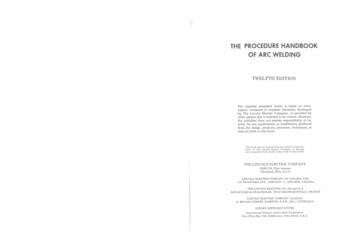
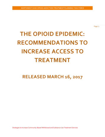
can we do in our community to diminish theworst impacts and adapt to the inevitablechanges.This presentation will be livestreamed, and alimited number of in-person tickets areavailable. Get your tickets e-in-central-oregon-tickets171485526827Tobacco Root Geological Society(TRGS) Field Conference Reportby Shawn WillseyCollege of Southern IdahoThe 46th Annual TRGS Field Conference washeld on July 29 to Aug 1, 2021 at the LostRiver Field Station run by Idaho StateUniversity (ISU). The field station lies in theLost River Valley, near US 93, and beneath thetowering Lost River Range which includesIdaho’s tallest mountain, Borah Peak (12, 662ft). ISU uses the field station for their fieldcamp and also rents it to other research andeducation groups.Page 6ISU’s Lost River Field Station near Mackay, Idaho provideda great venue and basecamp for multiple field trips in thediverse geology of central Idaho.The station offers abundant tent sites, parking,and a centralized building with tables, chairs,workstations, showers, restrooms, and acommercial kitchen. The field station’s locationwas ideal for the conference as it providedproximity to an array of field trip destinationsin diverse geologic settings ranging frommetamorphic core complexes to glacialoutwash deposits to Eocene magmatism to ahistoric mining district.Friday morning of the conference consisted ofgreetings and introductions by organizers PaulLink and Dave Pearson of ISU. An interestingand entertaining history of the field station andISU’s field geology program through the yearswas presented. Katie McDonald of theMontana Bureau of Mines and Geology waspresented with the 2021 TRGS HammerAward for her distinguished achievement in thestudy of Northern Rockies geology. The rest ofthe morning was filled with technicalpresentations and a brief lunch. Four field tripswere offered for the remainder of the day: (1) atransect across the Cordilleran orogenic beltalong Trail Creek Road led by Paul Link andNAGT Pacific Northwest Section
Brad Burton; (2) an investigation of dip anglechanges on the Lost River Fault led by PaulWetmore and Chuck Connor; (3) the geologyand history of the Empire Mine led by KeianMoran and Ryan McDermott; and (4) a look atthe evidence for the Big Lost River Flood ledby Glenn Thackray.Saturday dawned cloudy and somewhatthreatening as participants ate breakfast andprepared for another round of exceptional fieldtrips. James Vogel and others led a strenuous6-mile hike high into the Pioneer Mountains toexamine structural relationships of themetamorphic core complex while ZacheryLifton led participants to observe the LostRiver fault and the 1983 fault scarp. On and offrain occurred throughout the afternoon, but theamazing geology kept folks engaged. A cateredBBQ dinner capped off a great field day.The final conference day on Sunday includedthree field trips: (1) an examination of thekinematics and structures in the Pioneer faultzone led by Elizabeth Petrie and BradfordBurton; (2) a trip led by Dave Pearson and PaulLink to the Leaton Gulch area near Challis, partof the Beaverhead impact structure; and (3) anoverview of the diverse Eocene Challisvolcanic rocks.TRGS field conference participants take a break after asteep 3-mile hike into the Pioneer Mountains.NEW Ice Age Floodscapes!The latest in the awesome Ice Age Floodscapesdrone video series by Bruce Bjornstad,Oregon’s famous Bellevue Erratic: The Bellevue Erratic:https://www.youtube.com/watch?v 5ep7vu4a2sIf you want to view this entire incredible series,go lling the Beartooth Rangeby Andy BuddingtonSpokane Community CollegeThe Beartooth Mountains of southwesternMontana are a Laramide block uplift of
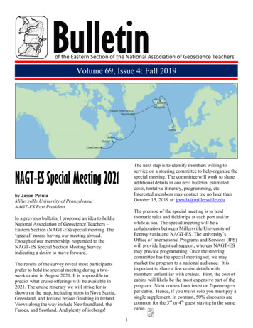
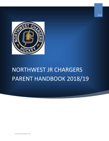
Precambrian basement, subdivided into fourdistinct domains or blocks: the main Beartoothmassif, the North Snowy Block, the StillwaterBlock, and the South Snowy Block (Mogk, etal., 2020). In general, the range is aPrecambrian paradise, dominated by Archeancrystalline basement rocks of the WyomingProvince; mostly metamorphosed TTGgranitoids, migmatites, and lesser supracrustalrocks.Mary Lake, Beartooth RangeUpper Cloverleaf Lake and Beartooth Plateau.Our hike was within the southern portion of themain Beartooth Block with meta-granitic rocksthe dominate theme. Less voluminous wereisolated pendants of high-grade metasedimentsalong with mafic dikes and sills.Beginning at Island Lake (southeastern part ofthe range), we worked our way to thenorthwest along the Beartooth Plateau.Pleistocene glaciation of the plateau hascreated deceivingly rugged country!Deformed Archean orthogneiss.Starting with 45 lbs. packs at 9500’ elevationtested our physical abilities to the max! Butbeing above tree line, off trail wanderingallows one to experience the countless lakesand remote scenery. Yes, this was a very hot,dry year but the plateau is dotted with so manylakes that fresh water was never an issue. Noflowers however, just rocks, rocks, and morerocks!Mogk, D.W., Mueller, P.A., and Henry, D.J., 2020, TheArchean Geology of Montana: in Geology of MontanaMBMG Special Publication 122, vol. 1.Page 8NAGT Pacific Northwest Section
Migmatitic paragneiss with garnets and aluminosilicates.Goat Lake from the Beartooth Plateau.More GEOGIRLS ROCK!
From the FieldLower Paleozoic sediments of Beartooth Butte (distance) from Beartooth PlateauPage 10NAGT Pacific Northwest Section
Great unconformity, Box Canyon, Ouray, Colorado
College of Southern Idaho swillsey@csi.edu test to an online one. Mostly though, I've OR Steve Carlson, Portland State University nativelement@me.com fortunate to be able to lead a modified field Hal Wershow, Central Oregon Community College hwershow@cocc.edu BC Todd Redding, UBC Penticton tredding@okanagan.bc.ca