Transcription
Workshop ReportA monitoring system for heat and mass transports in the South Atlantic as acomponent of the Meridional Overturning CirculationEstancia San Ceferino, Buenos Aires, ArgentinaMay 8, 9, and 10, 2007Prepared by Silvia L. Garzoli, Alberto Piola,Sabina Speich, Molly Baringer, Gustavo Goni,Kathy Donohue, Chris Meinen, Ricardo Matanoand with valuable comments from all participants.1
SummaryThis workshop gathered scientists from Argentina, Brazil, France, Germany, Italy, Russia,Uruguay, United Kingdom, and the United States (Appendix I) to foster collaborations and todiscuss the design and implementation of an observational system to monitor the SouthAtlantic’s branch of the Meridional Overturning Circulation (SAMOC). The workshop wasfinancially supported by the NOAA Climate Program Office and US CLIVAR. After reviewingand discussing existing modeling and observational efforts in the South Atlantic Ocean it wasconcluded that they are inadequate to monitor the MOC and ensuing discussions were focused onthe design of an observational array that was adequate for this purpose. Plans were established tocoordinate modeling efforts, and existing and future observations in the Drake Passage, in theregion between South Africa and Antarctica, and on a zonal transect nominally across 30 S.The main recommendations from the workshop can be summarized as follows:1. Modeling results indicate the need to increase observations not only in the choke points butalso in the interior of the South Atlantic, where water mass transformations occur and largediscrepancies exist between different models and between models and observations. Therefore, itis imperative to sustain and expand the existing basin wide observations (i.e. Argo, surfacedrifters, high density XBT programs) and satellite altimetric missions with sufficient spatial andtemporal resolution to resolve mesoscale features. The group also endorsed collaboration withthe Aquarius-SAC D and Soil Moisture and Ocean Salinity (SMOS) programs that will provideremote observations of salinity on a basin wide scale.2. The Drake Passage and the region south of South Africa are key chokepoints for the AntarcticCircumpolar Current (ACC). Heat, salt, mass, freshwater, nutrients and other oceanic propertiesare transported between the Atlantic, Pacific and Indian Oceans, with consequences for globalclimate. A better understanding and quantification of the ACC variability and the Agulhasleakage on a range of timescales, and on how these changes impact lower latitudes, is sorelyneeded. In particular this knowledge will help to design a monitoring system that might becapable of measuring heat and salt fluxes. These properties are transported equatorward in theSouth Atlantic and they impact on the characteristics of the waters contributing to the upper limbof the MOC in the North Atlantic. Therefore, there is also a need to routinely measure meridional2
mass, heat and fresh water transports in the South Atlantic. Present and planned observations inthe two key chokepoints mentioned above and along a basin-wide zonal line in the SouthAtlantic, should be sustained and further enhanced.3. Monitoring systems should be able to transmit data in time scales of about 3 to 6 months(equivalent to ‘real-time’ for climate-scale signals) for climate model assimilations and should beable to collect full water column measurements. Therefore, it was recommended to develop newcost effective technology to allow near real-time observations over the full depth of the ocean.4. A strong recommendation was made to collaboratively analyze the different data sets andmodel products presently available and soon to be obtained, as well as to conduct processmodeling studies and Observing System Simulation Experiments (OSSEs) to determine the mostadequate and cost effective monitoring system for the MOC in the South Atlantic for climatetime-scales.IntroductionThe South Atlantic Ocean (SAO) is unique in its role as a nexus for water masses formedelsewhere and in-route to remote regions of the World Ocean. Its mean meridional circulationinvolves a deep, southward, flow of cold and salty North Atlantic Deep Water (NADW) alongthe eastern coast of South America and, in the interior of the basin, a compensating northwardflow that is a mixture of warm and salty surface waters and cooler and fresher AntarcticIntermediate Waters (AAIW) (Fig. 1). This circulation pattern, in which warm waters flowtowards the equator and cold water towards the pole results in an equatorward heat flux. In fact,the South Atlantic is the only major ocean basin that transports heat from the poles towards theequator. Although this anomalous heat flux was recognized by the middle of the last century(Model, 1950), the sources for the upper return flow that make this heat flux possible are still indispute (Gordon, 1986; Rintoul, 1991). Understanding of the roles of these sources is made moredifficult due to the water mass changes that occur within the SAO; relatively cold and freshbottom waters derived from the Southern Ocean mix and upwell into the NADW layer andtherefore also contribute to the vertical exchanges in the Atlantic MOC. Observations indicatethat a portion of the SAO upper waters are produced locally (e.g., Stramma and England, 19993
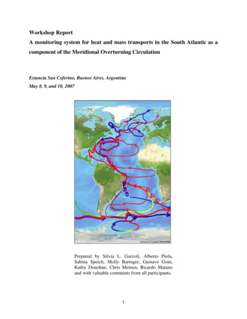
and references therein), but most of the SAO upper waters are thought to originate in the Pacificand Indian oceans. The relative importance of each of these sources as well as the mechanisms ofentrainment are still under debate.Figure 1: Pathways of the overturning circulation in the Atlantic Ocean that represents the large-scaleconversion of surface waters (red arrows) to deep waters (blue arrows in the Southern Ocean; dashed blue linearrows North Atlantic Deep Water) that have global impacts. The Atlantic overturning circulation has manycomplex and interacting parts (e.g. rings, inter-basin and inter-ocean exchanges) but the most important aspect isthe large heat it carries and its apparent sensitivity to the hydrological cycle and climate change (adapted from”Charting the course of the Ocean Science in the United States for the next decade”, 2007, to include AntarcticBottom Water). Graphics: R. Lumpkin, NOAA/AOML.The Drake Passage and the Agulhas Retroflection Region are the main gateways for theentrainment of surface waters from the Indian and Pacific basins into the South Atlantic’s surfacewaters (Stramma and England, 1999; Boebel et al., 1999; De Ruijter et al., 1999). These watersare first funneled into the South Atlantic’s subtropical gyre and then are diverted to the northernbasin by strong mean currents and highly energetic eddies. The South Atlantic subtropical gyre4
salinity would be lower if its Sverdrup transport were closed by the relatively fresh SouthAtlantic Current rather than the salty subtropical waters entrained from the Indian Ocean via theAgulhas leakage (Gordon, 1986). Within the South Atlantic these water masses are significantlyaltered by local air-sea interactions and diapycnal fluxes, particularly in regions of intensemesoscale variability such as the Argentine Basin and the Cape Basin (Stramma and England,1999; Sloyan and Rintoul, 2000). Thus, the South Atlantic circulation not only transportsremotely formed water masses but also modifies them. The importance of these contributions tothe MOC has been highlighted by paleoclimate studies linking changes in the South Atlanticinterocean exchanges to abrupt climate changes (Duplessy and Shackleton, 1985; Weijer et al.,2002; Peteers et al., 2004). Furthermore, MOC variability can be linked to the equatorward heattransport in mid latitudes that operates over longer time scales than surface fluxes, and hencecould provide some predictability for climate. In the South Atlantic, changes in the heat transportacross 30S are first noticed in the circulation of the eastern boundary. It has been shown bymultiple experiments that a freshening in the North Atlantic induces a surface warming in theBenguela upwelling region (e.g. Stouffer, 2006). This can be understood by the deepening of thelocal thermocline due to a decreased equator-to-subtropics surface density gradient that affectsthe surface wind-driven circulation (Fedorov et al 2007, Barreiro et al 2008). The coastalupwelling region may thus be key for the indirect monitoring of the changes in the AtlanticOcean heat transport.The location of the SAO, at the crossroad of the MOC, has motivated several efforts to estimatethe interocean exchanges, but the lack of data, the extent of the boundary region, and thevariability of the flow has hindered most of these efforts (e.g., de Ruijter et al., 1999). Theuncertainty about the South Atlantic interocean exchanges is particularly evidenced by the rangeof disparate estimates of its northward heat flux, which vary from a maximum of 0.88 PW to aminimum of -0.23 PW (Fu, 1981; de las Heras and Schlitzer, 1999; Garzoli and Barringer, 2007).Such a broad spread not only reflects a lack of data but also the deficiencies in the methods ofcalculation. Bennett (1978) pointed out that since hydrographic cross-sections cannot resolvemesoscale structures, the sections underestimate the total heat flux due both to their neglect ofthe eddy component (both barotropic and baroclinic) and due to their misrepresentation of thestructure of boundary currents. These limitations are particularly relevant to the South Atlantic5
because of its high eddy activity and the presence of strong boundary currents on both sides ofthe basin (e.g., Gordon and Haxby, 1990; Garzoli and Gordon, 1996; Richardson and Garzoli,2003; Matano and Beier, 2003; Fu, 2006). The coupling between the South Atlantic andcontiguous basins and its contribution to the climate variability over South America and Africa atclimatically important time scales can also be addressed based on analysis of numericalsimulations. Global and regional models with increasing resolution and large coverage havebeen developed and analyzed (e.g., Stammer et al., 2006; Tokmakian and Challenor, 1999;Speich et al. 2007) and are useful for studying the present and past circulation in the SouthAtlantic, and its connection to the MOC and global climate, and also to predict its futureevolution. However, the limitations imposed by lack of observations is compounded by thedeficiencies of state-of-the-art simulations to reproduce the path of the Agulhas eddies or theformation of the Zapiola Anticylone, which are thought to contribute significantly to the SouthAtlantic’s interocean exchanges and its water masses transformations.In spite of its climatic importance, there is no observational system in place to monitor the SouthAtlantic’s interocean exchanges in a sustained mode. There are, however, individual efforts todocument the circulation in portions of its natural chokepoints (Drake Passage, Cape Basin).None of these efforts have previously been coordinated, nor were these systems designed forlong-term monitoring purposes. Based on these considerations the participants of the SAMOCworkshop agreed on the need to improve our assessments of the South Atlantic’s interoceanexchanges. Discussions were directed towards the design of a monitoring system for the AtlanticMOC of the South Atlantic. Plans were established to coordinate existing and future observationsin the Drake Passage, in the region between South Africa and Antarctica, and on a zonal line atnominally 30 -35 S. The group also noted the need to increase observations in the interior of thebasin to document the processes responsible for the known water mass transformations. As a stepin this direction the group strongly endorsed the continuation of the Argo Program, which is theonly global source of subsurface data in the open ocean and away from the tropics. The groupalso strongly endorsed the continuation of satellite altimetric mission and considered importantthe success of, and collaboration with, the Aquarius-SAC D and Soil Moisture and OceanSalinity (SMOS) programs. Also stressed was the need to collect data in poorly sampled regionsof the South Atlantic to allow the assessment of the strengths and weaknesses of numerical6
models to improve the next generation of numerical simulations. Two areas of particular concernare the Argentine Basin and the region just to the west of the Walvis Ridge. The study of theformer should bring a deeper understanding of the contributions of the Brazil/MalvinasConfluence and the Zapiola Anticyclone to the local water mass conversions. The study of theregion just west of the Walvis Ridge should help us to understand the structure of the Agulhaseddies after they leave the Cape Basin and their potential impact on northward heat and massfluxes in the South Atlantic.The group recommendations are described in detail in the following three sections which reflectthe organizational structure of the SAMOC workshop, namely: a) Pacific-Atlantic interoceanexchanges, b) Indian-Atlantic interocean exchanges, and c) tropical-subtropical interoceanexchanges. During the breakout group sessions a recompilation of all current and proposedobservations was made (Figure 2). Deployment locations were adjusted to optimize the effortsthrough collaborations that derived from the workshop discussions. Appendix I includes a list ofparticipants. Appendix II contains a summary of the reports from the breakout groups. Copies .aoml.noaa.gov/phod/SAMOC/.7attheworkshopwebpage:
Figure 2. Map of the South Atlantic and Southern Ocean, including the two principal choke point regions, theDrake Passage and south of South Africa, with the current and proposed locations of instrument deployments andthe institutes leading the corresponding associated projects.Session 2.1: Inter-ocean exchanges: Pacific/AtlanticReporter: Kathy DonohueThe Antarctic Circumpolar Current (ACC), the world’s largest current, carries large quantities ofmass, heat, and salt around the Southern Ocean.Within each ocean basin, the ACC interactswith lower-latitude circulation and therefore it moves water properties between the Atlantic,Pacific, and Indian Oceans. The nature of this interaction has consequences for local, regional,and global ecosystems and climate. The property divergence within any particular ocean basin, ameasure of the ACC-basin exchange, requires knowledge of the chokepoint transports. DrakePassage is the Pacific-Atlantic chokepoint. The present observational effort in Drake Passage isdiverse, both spatially and scientifically (Table I and Figure 2, lower left panel). Here we brieflyreview Drake Passage programs in the context of future sustained monitoring and organize the8
measurements in terms of sampling strategy:irregular ( 2 weeks sampling interval),continuous, and remote surface sampling from satellites. We assess the present effort in DrakePassage as adequate for mass-transport monitoring on time scales up to interannual. In the future,efforts in Drake Passage must evolve from process-oriented experiments to a sustainedobservation system.Synoptic hydrographic surveys provide snapshot estimates of heat, freshwater and nutrientfluxes. A distinct benefit of these surveys is the typically high-horizontal resolution with fulldepth sampling of a suite of observations. Several hydrographic lines have been repeatedannually or biennially across the Drake Passage. Lead by UK scientists, the SR1b line has beenoccupied annually since November 1993. In 2008, the A21 line will be occupied in lieu of aSR1b section php).Additionally, theRussian Artic and Antarctic Research Institute (AARI) participate in biennial repeat DrakePassage sections in odd-numbered years. The US/UK Diapycnal and Isopycnal MixingExperiment in the Southern Ocean (DIMES) program will conduct Drake Passage sections in2010 and 2011 (http://dimes.ucsd.edu/). It is important to note that Drake Passage transportexhibits variability on the order of tens of Sverdrups on weekly, seasonal, and interannual timescales; as a result synoptic sections will not provide reliable annual or interannual transportestimates (Meredith and Hughes 2005, see also the Meredith abstract from this workshop).Thus, hydrographic surveys are not sufficient for a stand-alone monitoring effort.9
Irregular samplingAutonomousProfiling floats (Argo)Lagrangian floats (DIMES)Animal-borne profiling (Southern Elephant Seals as Oceanographic Samplers(SEaOS) and other regional efforts)ShipboardAnnual synoptic hydrographic surveys (Russia, DIMES, UK)Repeat Expendable Bathythermograph (XBT), Acoustic Doppler Current Profilers(ADCP), PCO2 (US R/V Gould programs)Continuous MonitoringIn situBottom pressure recorders (UK)Tide gauges (UK)Current meter moorings (French)Inverted echo sounder with pressure gauges and current meters (US)Global Monitoring from satellite missions:Sea heightGravitySea Surface TemperatureSea Surface SalinitySurface WindsTable I: Summary of observational efforts in Drake Passage. A summary of current and proposed observations areshown in Figure 2 and Figure AII-1.Autonomous monitoring has been proven over the past few years to dramatically increase spatialand temporal data distribution. For example, Argo profiling floats access remote regions withlittle or no seasonal bias. In Drake Passage, 4 to 5 Argo floats are being released quarterly. InDecember 2007, approximately 30 ice-capable iridium Argo floats will be released in theBellinghausen Sea and they are expected to flow though the southern portion of Drake Passage.The US NSF-funded DIMES program also has an extensive float program. The tracer release10
area will be seeded with floats in both 2009 and 2010. Also 75 isopycnal RAFOS floats will bedeployed in 2009 and again 2010 and 5 EM-APEX floats. RAFOS floats will be launched intriplets to measure horizontal dispersion. Floats will have 2-year missions and will map out flowin the Scotia Sea. Over the next few years there will also be animal-borne CTD profiles, forexample the SEaOS program, http://biology.st-andrews.ac.uk/seaos/index.html, utilizingelephant seals as oceanographic samplers.Dedicated programs coordinated along repeat ship tracks yield systematic and sustained in situobservational programs. Three programs exist using the R/V Gould. The R/V Gould is a majorresearch platform for ocean and climate studies, and it is also the principal supply vessel for theU. S. Antarctic Program research station at Palmer Station, Antarctica. The R/V Gould routinelytravels from Punta Arenas, Chile to the Antarctic Peninsula region, crossing the Drake Passage 2to 4 times per month. A six-time-a-year XBT/XCTD survey has been in operation since 1996 (PIJanet Sprintall). A shipboard acoustic Doppler current profiler measures upper-ocean current oneach Drake Passage crossing on the R/V Gould twenty times per year (1999-2004 upper 300 mvertical range; 2004-2009 upper 1000 m vertical range) (PI Chereskin/Firing). Surface pCO2 hasalso been measured 2002-2008 on each crossing (PI Sweeney). Another repeat section program,CANOPO (Southern Hemisphere Constellation, project name: The Role of the Atlantic Sector ofthe Southern Ocean in CO2 Sequestration), is a collaboration between Italy, Argentina, andFrance consisting of repeat XBT/XCTD 2004-2007 aboard the Argentine icebreaker M/V php?lang en), . These measurements extend beyondDrake Passage and into the undersampled area of the Weddell Sea to reveal the importance ofboth vertical heat fluxes and the interaction between fronts and biology in the Weddell SeaBottom pressure recorders and tide gauges provide a useful way to monitor Drake Passagetransport, in particular because they do not alias high-frequency signals. The UK Acclaimprogram o.html) has brought together thesemeasurements with modelling and satellite altimeter research. Drake Passage transport varies ona range of timescales: subseasonal (forced by the Southern Annual Mode and remotely forcedcontinental shelf waves), seasonal, and interannual. Changes in transport are mainly barotropicfor the subseasonal and seasonal time scales whilst interannual variability is reflected in the11
baroclinic (steric) transport. Two bottom pressure recorders, ND2 and SD2 were first deployedduring WOCE at the northern and southern sides of Drake Passage, respectively. Nearly 20years of data exist with funding for another 5 years secured. A new tide gauge as part of GLOSSat South Georgia Island will come on line shortly.Some in situ time series can be referenced to altimetry-derived sea surface height, therebyextending the time series back to 1992. This has been done in the Malvinas Current (PI C.Provost) and in the Brazil Current (PI G. Goni). Additionally as part of a collaborative effortbetween LOCEAN (PI C. Provost), KORDI (PI J-H. Lee), and AWI (PI E. Farhbach) ten tallcurrent meter moorings have been deployed along Jason track #106 at 9 cross-over points withan additional mooring in the Yanghan Basin. The full 10-mooring array has been in the watersince February 2006 and will be recovered in April 2008.Five to six moorings will beredeployed in the Yaghan Basin and recovered in September 2009.An array of C-PIES (Current and Pressure recording Inverted Echo Sounders) will be deployedin November 2007 for a period of four years to quantify the transport and dynamics of theAntarctic Circumpolar Current in the Drake Passage. Two short current meter moorings will alsobe deployed for one year along the northern continental shelf to help evaluate the vertical andtemporal structure associated with continental shelf waves. The C-PIES array consists of atransport line and a local dynamics array. The transport line has resolution of 45-65 km and itwill be used to determine the seasonal and annual transport, the lateral and vertical transportpartitioning and to recommend a minimal long-term monitoring array design for the future (PIsChereskin, Donohue and Watts).Topics for discussion in the working group included: How do we move from process studies to sustained and effective monitoring? What are the observational gaps? (For example, how do we measure transport and waterproperties (T, S) with same resolution? Do we need to a better understanding ofcontinental shelf wave propagation?) What are the models telling us? (variability vs mean) How will we use models (process or prediction)?12
What model validation needs to be done? Is there a role for models to synthesize data?Session 2.2: Interocean Exchange: Indian-Atlantic OceanReporter: Gustavo GoniIn this session results were presented from observations, numerical models and theoreticalstudies on water exchange between the Indian and the Atlantic oceans. A particular focus wasgiven to the most dynamical active regions with regards to these exchanges, the Cape Basin andthe Southern Ocean south off Africa. It was agreed that any one single measure cannot resolvethe intricate processes that occur in the Cape Basin, nor monitor the complex oceanic frontssouth of Africa. It was argued that the key element when designing the observing system in thisregion of the South Atlantic is to better understand the time and space scales of measurementsand the type of observations that need to be done. Present and future observations should beused to assess model capability to represent the observed dynamics. The physics behind theprocesses is also critical to understand the models and to justify and design future observations.South of Africa, the Agulhas leakage is the main conduit of inter-ocean exchange. It occursmainly by means of Agulhas rings and a small contribution from a mean flow leakage. Theserings carry large amounts of salt and heat. Altimetry observations reveal that there is a strongyear-to-year variability in the shedding of rings, which on average transport from 0.5 Sv to 1.5Sv in each ring, with 1 to 6 rings shed per year (Goni et al., 1997) (Figure 3).13
Figure 3. Altimeter-derived geostrophic transport of the Agulhas Current. The peaks in the transport values areusually associated with the shedding of an Agulhas ring.The potential of altimetry fields should be exploited by blending these data with those fromobservations from other platforms. For example, statistical analysis between sea height anomalyfields and the depths of the isotherms in the south Atlantic indicates that the Agulhas Currentvertical thermal structure below the mixed layer depth may be investigated using altimetryobservations, where correlations coefficients above 0.7 over most places exist between thevariability of the sea height anomalies and that of isotherm depths within the thermocline waters(Figure 4, left panel).Likewise, the correlation between along-track sea height anomalygradients and across-track drifter-derived geostrophic currents suggests that altimetry fields canbe used to estimate the geostrophic velocity and transports of the Brazil and Agulhas Currents(Figure 4, right panel). Statistical analysis using altimetry observations, although not accurate asactual observations, are shown to be practical and to provide helpful spatial information tomonitor the variability of certain parameters and to carry out model validations.The development of regional high-resolution numerical simulations has allowed the scientificcommunity to investigate dynamical processes suspected to play a key role on the AgulhasCurrent retroflection, Agulhas rings shedding and Indo-Atlantic interocean exchange. Numericalsensitivity experiments show that smoothing of the bathymetry produces larger leakage of IndianOcean waters into the South Atlantic. Also, the leakage appears to be very sensitive to the openboundaries mean field applied. (Figure 5; from Speich et al. 2006, 2007).14
Figure 4. (left) Correlation coefficient between altimeter-derived sea height anomalies and the depth of the 8ºCisotherm obtained from XBT and profiling float observations between 1993 and 2006. (right) Correlationcoefficient between sea height anomaly gradients and drifter derived (Ekman removed) surface velocities between1993 and 2006. Superimposed are the trajectories of drifters during a 10-day period in March 2006. Areas of highcorrelation coefficient can be used to estimate surface velocities from altimetry where there are no surface drifterobservations.These numerical studies suggest that the separation of the Agulhas Current from the continentoccurs because of the radius of curvature of the slope du to the high current inertia. The amountof Indian Ocean water that flows into the South Atlantic is sensitive to the latitude of the eddyshedding, the boundary conditions, beta effect, as well as the existence of topography featuressuch as the Agulhas Plateau. Interocean transport values may range between 4 Sv (beta 0) and56 Sv when the Agulhas Plateau is removed. Mean values ranging between 25 and 15 Sv occurfor a realistic configuration, the Indo-Atlantic leakage depending now on model resolution andopen boundaries thermodynamical fields.15
SSHSSTFigure 5. The Agulhas retroflection and rings in several sensitivity runs within a ROMS. The smoother bathymetryproduced a larger leakage of Indian Ocean waters into the South Atlantic, as reproduced by sea surface height(SSH) and sea surface temperature (SST) fields.Additionally, the variable leakage produced by the Agulhas rings was suggested to be stronglyinfluenced by the coastal slant within a nonlinear analytical model. It was also hypothesized thatthe shift to the north in the zero wind stress curl position alone could not be sufficient to blockthe leakage, as rings would still exist. It is therefore suggested that the particular shape of theAfrican coastline is responsible for the varying leakage, high in the present day situation and lowduring periods of glaciation (Figure 6).The regional study also suggests that nonlinear interactions in the Cape Basin are very importantin the convergence and mixing of water masses of different origins, and therefore they influencethe properties of water finally injected into the South Atlantic. The relative vorticity appears tobe the most appropriate variable for the method to isolate the structure of eddies (Figure 7). Thisway it is possible to determine the water masses composition and evolution of such features.16
Figure 6. (left) Diagram of the Agulhas Current and its retroflection. It is hypothesized that, due to a northwardshift in the position of the vanishing wind stress curl, the retroflection during the glaciation periods occurred in alower latitude where the orientation of the coast line is close to meridional (situation I). During the presentday, theretroflection occurs farther to the south, where the coastline inclination is almost zero (Situation II). It is alsohypothesized that almost no ring detachment would occur in situation I. However, many rings would detach insituation II. (right) Southeast Atlantic sea surface temperature (in ºC) at the Cape Basin Region core situated at35ºS and 18ºE, for the past 36,000 years as determined by Pale Oceanographic proxies (adapted from Peeters,2004). Note the dramatic increase in temperature in the end of each glaciation period (vertical shaded blue). Theseincreases are attributed to an increase in ring production, which induces a transfer of warm and salty Indian Oceanwater to the colder South Atlantic (Peeters et al, 2004).Preliminary results show that local processes are very important to modify Agulhas ringsproperties. Water masses from the Southern Ocean, the South Atlantic and from the Africancontinental slope mix with Indian waters. The next step is to precisely evaluate the mixingtogether with the involved processes. This will allow the determination of the water masses thatare even
the Aquarius-SAC D and Soil Moisture and Ocean Salinity (SMOS) programs that will provide remote observations of salinity on a basin wide scale. 2. The Drake Passage and the region south of South Africa are key chokepoints for the Antarctic Circumpolar Current (ACC). Heat, salt, mass, freshwater, nutrients and other oceanic properties

