Transcription
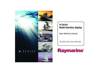
81314-1 A Series Reference Guide.book Page 1 Thursday, August 28, 2008 9:23 AMA-SeriesMulti-function displayUser reference manualA50, A50D, A57D, A70 and A70D models
81314-1 A Series Reference Guide.book Page 2 Thursday, August 28, 2008 9:23 AMTrademarks and registered trademarksAutohelm, HSB, RayTech Navigator, Sail Pilot, SeaTalk and Sportpilot are UK registered trademarks of Raymarine UK Limited.Pathfinder and Raymarine are UK registered trademarks of Raymarine Holdings Limited. 45STV, 60STV, AST, Autoadapt, Auto GST,AutoSeastate, AutoTrim, Bidata, G-Series, HDFI, LifeTag, MarineIntelligence, Maxiview, On Board, Raychart, Raynav, Raypilot, RayTalk, Raystar, ST40, ST60 , Seaclutter, Smart Route, Tridata andWaypoint Navigation are trademarks of Raymarine UK Limited.All other product names are trademarks or registered trademarks oftheir respective owners. Raymarine UK Ltd. 2008Document number: 81314-1Date: August 2008
81314-1 A Series Reference Guide.book Page 3 Thursday, August 28, 2008 9:23 AMContentsImportant information. 9Split screen pages.26Warnings and Cautions . 9Emergencies and warnings . 27Electronic charts . 10Man overboard .27Chapter 2:Using the display. 13Alarms .27Introduction . 14Chapter 3:Waypoints . 29System overview . 14Introducing waypoints. 30Core System . 14Using Waypoints . 31Extended System. 15The waypoint toolbar .31Applications. 16Creating waypoints.31First time use. 17Controls. 19Navigating to waypoints .32View / edit waypoint details .33Moving waypoints.34Operation . 20Erasing a waypoint .35Powering the display ON/OFF . 20Waypoint groups . 35Cursor . 20Panning and zooming . 20Chapter 4:The chart application . 37Display lighting and color. 21Chart safety and requirements . 38Additional screen information. 22Safety .38Setup menus. 24The chart . 39Dialog boxes . 24Your position .40Displaying applications. 25Moving around the chart.40Selecting a page set . 25Autoscale.40Selecting an application page. 25Navigating to a specific point. 413
81314-1 A Series Reference Guide.book Page 4 Thursday, August 28, 2008 9:23 AMCreating a route .42Chapter 5:3D chart application . 63Following a route .44Safety and system requirements . 64Editing routes .45Safety. 64Timed routes .46Requirements. 64Course deviation indicator .473D chart operation . 64Using tracks .48Editing and deleting tracks .48Measuring distance, range and bearing .49The controls . 65Active and Planning modes . 65Changing the view . 66Making the view clearer . 67Chart presentation .51Using the standard and 3D charts together . 68Chart layers .513D view locator . 68Vectors and arrows .51Chart synchronization . 69Chart mode and orientation .52Aerial photography overlay . 70Chart detail .53Journey planning .54Tide and current information .54Chapter 6:Fishfinder application . 71Bathymetric information.56The fishfinder screen . 72Details of objects and features .56How the fishfinder works . 72Details of ports, port and business services .57Pilot book information .57Panoramic and aerial photographs .58Chart setup .59Datum .60Chart offset and cartography setup .604Setting up the 3D chart . 70Interpreting the Fishfinder image . 73Bottom indications. 73Factors influencing the readout. 73Fishfinder Pre-set operation. 74Preset display modes. 74Chart scale .62Changing the depth range . 78Alarms .62Range shift. 78A-Series display - User reference manual
81314-1 A Series Reference Guide.book Page 5 Thursday, August 28, 2008 9:23 AMPresentation options . 79Tropical storm data.92Gain and power . 79Lightning.92Power setting . 80Surface observation stations .92Dual / Single frequency view . 80City forecasts.92Measuring depth and distance. 81Wind .93Adjusting the scroll mode and speed. 82Waves .93Placing waypoints . 83Surface pressure .94Fishfinder alarms. 83Fishfinder Setup Menu . 84Screen settings . 84Transducer settings . 86Viewing data for a specific position .94Animated weather graphics. 94Viewing weather reports. 95Watchbox warnings .95Displaying marine watchboxes.96Chapter 7:Sirius weather (US only) . 87Troubleshooting. 96System requirements . 88Weather application setup. 96Using Sirius Weather . 88Creating a weather page . 88Chapter 8:Sirius Audio (US only). 99The weather display. 88Using Sirius Radio. 100Specifying meteorological elements . 89Tuning to a channel.100Moving around the weather map . 89Browsing channels .101Placing waypoints . 89Scanning channels .101Weather symbols . 89Hiding or showing channels and categories.101Precipitation (NOWRad) . 90Presets .102Storm Cast. 90Parental locking. 103Sea surface temperature (SST). 91Entering passwords.103Canadian radar . 91Favourite song alerts. 103Tracking storms . 915
81314-1 A Series Reference Guide.book Page 6 Thursday, August 28, 2008 9:23 AMChapter 9:Navtex .105Messages and alarms . 116Setting up Navtex .106Safety messages . 116Selecting message alert categories .106AIS alarms . 116The Navtex message window .106Active alarm list. 116Managing Navtex messages .107Chapter 11:Data and Engine monitors. 119Sorting the message list .107System requirements . 120Chapter 10:AIS .109Background information .110Classes of AIS data .110Setting up AIS .111Engine requirements. 120Data monitoring requirements. 120Data application . 120Selecting the data application page . 120Preset data panels . 121Using AIS .111Engine monitor . 121AIS status icons.111Setting up the engine monitor . 121AIS Layer.112Preset engine monitor panels . 122The AIS screen.112Temperature and fuel units .
Raymarine Ltd. declare that the A- Series Multifunction Displays are in compliance with the essential requirements of EMC directive 2004/108/EC. The original Declaration of Conformity certificate may be viewed on the relevant product page at www.raymarine.com Product disposal The Waste Electrical and Electronic Equipment (WEEE) Directive requires the recycling of waste electrical and elec .


