Transcription
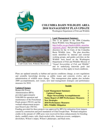
COLUMBIA BASIN WILDLIFE AREA2010 MANAGEMENT PLAN UPDATEWashington Department of Fish and WildlifeCrab Creek Arm, Potholes ReservoirLand Management SummaryThis is an update to the 2006 ColumbiaBasin Wildlife Area Management Planhttp://wdfw.wa.gov/lands/wildlife areas/management plans/ that provides managementdirection for the 14 Units of the ColumbiaBasin Wildlife Area. The plan describesneeds identified by internal and externalworking groups, and guides activities on theWildlife Area based on the WashingtonDepartment of Fish and Wildlife Mission of“Sound Stewardship of Fish and Wildlife”and its underlying statewide goals andobjectives as they apply to local conditions.Plans are updated annually as habitat and species conditions change, as new regulationsand scientific knowledge develop, as public issues and concerns evolve, and asadministration of wildlife areas change. This management plan update also includes2009 accomplishments, new issues, new land management strategies and performancemeasures for 2010.InsideUpdates/ChangesBonneville PowerLand Management Summary1Administration (BPA)Updates/Changes1provided approximatelyMajor Stewardship Accomplishments2 166,000 for operation andStatus Report of 2009 Performance Measures3maintenance of the FrenchmanNew Strategies5Ponds project (TD-01) and the2010 Performance Measures6wetland enhancement projectBPA Wildlife Mitigation7near Desert Lake (TD-02).Funding provided for these projects was approved by BPA for mitigation from impactscaused by construction and pool inundation of Chief Joseph Dam. Wetland mitigationcredits in the amount of 1,000 acres were received for these enhancements for breedingducks, sandhill cranes, rails, black-necked stilts, American avocets, sandpipers,dowitchers, Wilson’s snipes, Wilson’s phalaropes, and black terns.1
The U.S. Bureau of Reclamation (BOR) has identified the most favorable alternativeroute to feed irrigation water from Billy Clapp Reservoir to the Potholes Reservoir as theCrab Creek channel, which includes major portions of the Gloyd Seeps Unit of theColumbia Basin Wildlife Area. This Potholes Supplemental Feed Route (PSFR) is apart of the larger Columbia River Water Management Program that seeks to bettermanage water for late summer downstream water users. Wildlife Area and DistrictWildlife Management staff has devoted a considerable amount of time this past yearassisting in the development of a plan on how best to manage the water. Because thePSFR is a part of the Columbia River Water Management Program and involves theBureau of Reclamation and the Washington Department of Ecology, the Department ofFish and Wildlife’s Habitat Program has taken the lead in developing the plan. ThePSFR plan will provide perennial water to the Middle Crab Creek, an area that hashistorically been ephemeral at best. Naturally occurring flows within this reach isnormally flash floods, early in the spring, with slow dry down. The supplementalirrigation water feed will turn the reach into perennial flows, with flows of up to 500cubic feet per second (cfs) for the March 15 through June 15 period, and approximately40 cfs for the remainder of the year. Obviously, these new flow regimes will drasticallychange the management of the Gloyd Seeps Unit. The management plan is expected tobe completed in 2010, water is expected to be turned on in 2011.The sharecrop agreement on the Gloyd Regulated Access Area was discontinued afterattempts to harvest last year’s crop were stymied by the arrival of an industrious beaverfamily. Dam building and the resultant flooding prevented the soil on the Spud Fieldfrom drying enough to support equipment, and the harvest was a complete loss. Theflooding also prevents any tillage or mowing operations as well, severely limiting ourmoist soil management options and impacting the quality of the waterfowl hunting.A wetland enhancement project was initiated on the Gloyd Seeps Unit by the DistrictWildlife Biologist. The Mansfield Pond project will replace a non-functional watercontrol structure, allowing manipulation of the water within Mansfield Pond for moistsoil management activities. With the growth of desirable vegetation, the water level willbe raised, flooding the vegetation to attract waterfowl during the hunting season.Major Stewardship AccomplishmentsMoist soil management projects withinthe Frenchman Ponds and Winchesterwetland enhancement projects produceddesirable early-successional stage wetlandvegetation. Invasive weedy vegetationwas controlled with herbicides and mowing.Water control structures were operatedto flood the wetland cells just prior to the fallwaterfowl hunting season.Columbia Basin Shrub/Steppe2
Wildlife Area Assistant Manager, Brian Cole, initiated a 10-year sharecrop agreement forreplacement of two aging irrigation circles on Unit 75 of the Upland Wildlife RestorationUnit. The maintenance and repair of the old circles were using all the rental incomecoming from lessee. The new lease allowed the lessee to provide ten years of leasepayments up front, which was then used to purchase the new equipment.In response to Wildlife Area concerns, BOR provided funding to hire temporary help toinventory noxious weed populations along the feed route. Weeds found includeDalmatian toadflax (Linaria vulgaris), perennial pepperweed (Lepidium latifolium), and afew species of knapweed (Centaurea spp.). The presence of these noxious weeds withinor adjacent to an irrigation water delivery system will be a vector for weed spreading andmust be addressed before the supplemental feed route is used. WDFW has expressed ourconcerns to the BOR and the Grant County Weed Board, and indications are the weedswill be controlled.The District Team decided to close the south gate on the main road through the QuincyLakes Unit of the Wildlife Area in a reaction to the intolerable level of vandalism.Access personnel spent a considerable amount of time sand blasting graffiti from theouthouses, replacing signs “tagged” by the local gangs and picking up litter. WildlifeArea staff moved barrier rocks into place to prevent off road travel and illegal access andcamping.The budget and scope of work for the next eight years were proposed for funding fromBPA and presented to their Interagency Scientific Review Panel.Banks Lake Unit3
Status Report of 2009 Performance Measures2009 Performance MeasureStatus of PerformanceMeasureExplanation of Progress,2010 Related Activity,and/or CommentsMaintain, relocate, or removewinter upland bird feeders asappropriate.Maintain irrigated tree andshrub plots.Completed through winter2009.On-going, continue in 2010.Completed through summer2009.On-going, continue in 2010.Operate water controlstructures at FrenchmanPonds (TD-01) wetlandsimprovement project.Completed with filling in thefall of 2009, maintainedwater level through winterand drained February 2010.On-going, continue in 2010.Conduct moist soilmanagement activities on 40acres at Frenchman Ponds(TD-01) project.Completed 16 acres of moistsoil management. Naturallyoccurring, desirablevegetation abundant.Conduct moist soilmanagement activities onapproximately 20 acres in theWinchester Restricted AccessArea.Maintain 80 acres ofwaterfowl habitat at DesertLake (TD-02) wetlandsimprovement project.Control vegetation on theshoreline of Westlake PondsCompleted 22 acres of moistsoil management.A mix of millet andsmartweed were planted.Crop failed, smartweed seedwas broadcast again in latewinter in test plots. Ongoing, continue in 2010.A mix of millet andsmartweed were planted.On-going, continue in 2010.Operate water controlstructures to create shallowopen water.Mow tall emergentvegetation on the WinchesterRestricted Access Area(WRAA).CompletedOn-going, continue in 2010.Completed, berms werechecked for repair needs,herbicides and mowing wereused to control undesirablevegetation.CompletedOn-going, continue tomaintain berms, controlundesirable vegetation in2010.Completed4Problem beaver damsresulted in less than totalsuccess at the Winchester andGloyd RAAs. On-going,continue in 2010, look forsolutions to beaver problems.Continue as needed annually.
Weed control, with emphasison Phragmites and flag leafiris.Fire control and trainingPost islands within PotholesReservoir to reducedisturbances to colonialnesting birds.Develop interpretive signs forthe wildlife-viewing trail onthe Sprague Lake Unit.Restrict camping and vehicletravel on the Quincy LakesUnit.CompletedMaintained fire breaks,applied herbicides to accessroads and parking areas toreduce fuel load. Managerand Assistant attended RedCard recertification.Staff shortage preventedcompletion.Progress was made, howeverstaff shortage preventedcompletion.CompletedMaintain shop, office, andequipment for safe andeffective workplace.Exhibit A to the BOR 25year agreement.Completed through 2009Water service contract withBORGrazing and agriculturallease administration.Information was provided tothe BOR.On-goingNot completed.On-going, Phragmitesspreading at an alarming rate.Continue in 2010.On-going, WA staff willcontinue to maintainfirebreaks, road shouldersand parking areas. Managerand Assistant will attend RedCard recertification.Will strive to accomplishannually with help from theDistrict Wildlife Biologistand staff.Will strive to accomplishwith help from the DistrictWildlife Biologist and staff.Placed barrier rock andposted signs to prevent illegaloff road vehicle travel andcamping outside establishedcamping areas.On-going, continue for 2010Continued working oncompletion, complicationsinclude BOR’s purchasingadditional lands as part of theSupplemental Feed Route.Continue to work towardcompletion.New StrategiesThe wildlife area plan identifies many strategies or activities to address the agenciesstrategic plan goals and objectives, why the area was purchased, habitat conditions,species presence, and public issues and concerns. The following updated strategies havebeen added to respond to previously unaddressed or new issues or changes on the wildlifearea. New strategies may also be in response to adaptive management as staff evaluatethe impacts of past management activities.5
Agency Objective: Protect, Restore and Enhance Fish and Wildlife and TheirHabitats.1. Manage upland habitatsA. Strategy: Rehab weed patches totaling approximately 55 acres on theSteamboat Rock Peninsula on the Banks Lake Unit.Agency Objective: Provide Sound Operational Management of WDFW Lands,Facilities and Access Sites.1. Maintain equipment, signs and other materials important formanagement and protection of the wildlife areas.A. Strategy: Develop signage for new fishing restrictions at SpragueLake and post in a manner that facilitates enforcement.2010 Performance MeasuresManage to increase upland game bird populations: Maintain 20 populations of California valley quail with supplemental winterfeeding. Maintain approximately 115 acres of irrigated tree and shrub plots.Manage to attract migrating waterfowl: Operate water control structures to develop approximately 130 acres ofattractive waterfowl habitat at the Frenchman Ponds (TD-01) wetlandsimprovement project. Conduct moist soil management activities on approximately 20 acres in theFrenchman Ponds project to improve waterfowl habitat. Conduct moist soil management activities on approximately 20 acres in theWinchester Restricted Access Area to improve waterfowl habitat. Maintain the 80 acres of waterfowl habitat at the Desert Lake (TD-02)wetlands improvement project by maintaining berms, and controllingundesirable vegetation and fish. Operate water control structures on the Winchester Regulated Access Area(4), Frenchman Ponds (8), Gloyd Farm Unit, and Spud Field to create shallow,open water.Manage shallow ponds: Mow 5 acres of tall emergent and shoreline vegetation on the WinchesterRegulated Access Area of the Desert Unit and flood to create shallow openwater.Manage weeds: Continue with aggressive weed control program on all units of the ColumbiaBasin Wildlife Area with an emphasis on Phragmites. Utilize funds providedby the Migratory Bird Stamp and Print program for additional Phragmitescontrol. Rehab weed patches on the Steamboat Rock Peninsula.6
Provide fire control on agency lands: Maintain 3 miles of fire-breaks on the Potholes Reservoir and Banks LakeUnits. Reduce/eliminate fuel load along access roads and parking areas on all unitswith herbicides.Provide recreation compatible with fish, wildlife, and habitat protection: Release pen-raised pheasants for hunting opportunities on the Gloyd Seeps,Lower Crab Creek, Priest Rapids, and Upland Wildlife Restoration Units.Maintain facilities to achieve safe, efficient, and effective management and use of thewildlife area: Maintain shop, office, and all equipment to provide a safe and effectiveworkplace. Finalize Exhibit A of the 25-year management agreement with the Bureau ofReclamation Finalize the water service contract with the Bureau of Reclamation todocument the WDFW use of water for wildlife habitat.Citizen Advisory Group InputNoneInformation for BPA’s Wildlife Mitigation ProgramThe Bonneville Power Administration provides funding for the development andmaintenance of wetland habitat at the Frenchman Ponds project (TD-01) and the wetlandenhancement project near Desert Lake (TD-02), within the Desert Unit of the ColumbiaBasin Wildlife Area. For these wetland habitat enhancements, BPA received mitigationHabitat Unit (HU) credits towards their overall Wildlife Mitigation Debt for theColumbia River hydroelectric system.Progress towards the obligation is assessed through the use of periodic surveys based onstandardized Habitat Evaluation Procedures (HEP) for the focal species: breeding andmigrating ducks, sandhill cranes, rails, black-necked stilts, American avocets, sandpipers,dowitchers, Wilson’s snipes, Wilson’s phalaropes, and black terns. By measuring avariety of habitat features, HEP surveyors apply habitat models for the focal species toarrive at a numerical figure between 0 and 1 that quantifies the habitat quality for aparticular focal species. This figure is known as a Habitat Suitability Index (HSI). Thefigure is then multiplied by the area habitat being evaluated and expressed as a HabitatUnit, the basic currency of HEP.Reports/Proposals/PlansSince 2002, the Bonneville Power Administration has provided funding for a portion ofthe Desert Wildlife Area. Consequently, numerous reports, funding proposals, and workplans have been produced. By following the links below, the interested reader can finddetailed information on a variety of topics that the wildlife area is engaged in.7
General Information on the Mitigation ProjectThe 2010 – 2012 Funding Proposal submitted to the Northwest Power and ConservationCouncil in January 2009 details the Desert Wildlife Area’s history, land purchases, andrationale for mitigation and focal oposal.asp?id 1010Additional information describing BPA’s role in mitigation and crediting can be found onthe BPA t.aspxManagement ActivitiesThe 2010 – 2012 Funding Proposal Narrative submitted to the Northwest Power andConservation Council in January ives/1010.docThe 2010 – 2012 Funding Proposal submitted to the Northwest Power and ConservationCouncil in January sal.asp?id 1010Monitoring and EvaluationThe 2010 – 2012 Funding Proposal Narrative submitted to the Northwest Power andConservation Council in January ives/1010.docFunding StrategyThe 2010 – 2012 Funding Proposal submitted to the Northwest Power and ConservationCouncil in January sal.asp?id 1010Contacts:Greg FitzgeraldWildlife Area Manager(509) 765-6641WDFW Ephrata Office(509) 754-4624Want to see the full plan?http://wdfw.wa.gov/lands/wildlife areas/management plans/8
COLUMBIA BASIN WILDLIFE AREA 2010 MANAGEMENT PLAN UPDATE Washington Department of Fish and Wildlife Land Management Summary This is an update to the 2006 Columbia Basin Wildlife Area Management Plan . control structure, allowing manipulation of the water within Mansfield Pond for moist soil management activities. With the growth of desirable .