Transcription
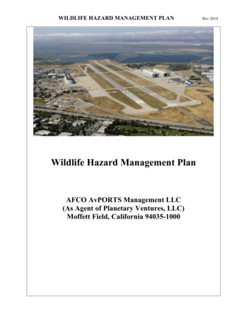
U.S. Fish and Wildlife ServiceColumbia River Fish and Wildlife Conservation OfficeAquatic Invasive Species Monitoring atLower Columbia River Basin National FishHatcheries using eDNA and Visual SurveysProgress Report: 2021Jennifer Poirier and Julianne HarrisU.S. Fish and Wildlife ServiceColumbia River Fish and Wildlife Conservation OfficeVancouver, WA 98683
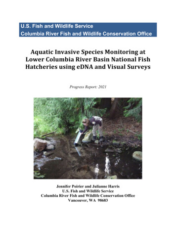
On the cover: Conducting a visual survey for New Zealand mudsnail at Spring Creek NationalFish Hatchery. Photo by Jen Poirier.DisclaimersThe findings and conclusions in this report are those of the authors and do not necessarilyrepresent the views of the U.S. Fish and Wildlife Service.The mention of trade names or commercial products in this report does not constituteendorsement or recommendation for use by the federal government.The correct citation for this report is:Poirier, J. and J. Harris. 2021. Aquatic Invasive Species Monitoring at Lower Columbia RiverBasin National Fish Hatcheries using eDNA and Visual Surveys. Progress Report: 2021Columbia River Fish and Wildlife Conservation Office, Vancouver, Washington (USA), 12PP.
Aquatic Invasive Species Monitoring at Lower Columbia River BasinNational Fish Hatcheries using eDNA and Visual SurveysProgress Report: 2021Work funded byU.S. Fish and Wildlife Serviceand Authored byJennifer Poirier and Julianne HarrisU.S. Fish and Wildlife ServiceColumbia River Fish and Wildlife Conservation Office1211 SE Cardinal Court, Suite 100Vancouver, WA 98683October 2021
National Fish Hatcheries (NFHs) produce fish that provide commercial and recreational fishingopportunities, fulfil tribal trust and mitigation responsibilities and contribute to the recovery ofthreatened and endangered species. Managing the threat of aquatic invasive species (AIS) is oneof the ongoing challenges hatchery managers face. Fish hatcheries may be more susceptible toAIS invasion given their stable environment (i.e., water flow, temperature) and increased nutrientoutput. Many hatcheries are also located in close proximity to popular river access points such asboat ramps and hiking trails where AIS may be spread by recreational activities. Routinehatchery operations including the transport of fish or eggs to another hatchery, the movement offish distribution equipment (e.g., fish hauling truck, tank, nets, transfer water) and fish stocking,each have the potential to introduce or spread AIS to new waterbodies or between hatcheryfacilities (ANSTF 2007). The U.S. Fish and Wildlife Service (USFWS) has widely adopted theuse of Hazard Analysis and Critical Control Point (HACCP) planning to prevent the introductionand spread of invasive species through human-mediated pathways. These plans often recommendregular visual inspections of hatchery facilities and grounds to potentially detect AIS before theybecome established within a facility or inadvertently spread to new areas. Early detection is themost important, yet most challenging aspect of AIS management. Discovery of a new AISinfestation can be particularly difficult if the organism is small, cryptically colored or occurs in ahabitat that is difficult to sample effectively. Traditional survey techniques may not reliablydetect invasive species when an infestation first occurs, or abundance is low. A more sensitivedetection tool such as environmental DNA (eDNA) can be employed in addition to visualpresence/absence surveys to increase the chances of early detection.A variety of invasive plants, animals and pathogens potentially threaten NFH management andoperations. This ongoing study has primarily focused on the early detection of New Zealandmudsnail (NZMS), a small nonnative snail that has directly impacted hatcheries in the upperColumbia River (Ringold State Hatchery) and Snake River (Hagerman NFH). The USFWSColumbia River Fish and Wildlife Conservation Office (CRFWCO) has performed annual visual(presence/absence) surveys for NZMS at lower Columbia River Basin NFHs since 2006 (seeAllard and Olhausen 2007a, 2007b; Hogle 2009; Poirier 2012; Poirier 2014). In 2015, eDNAsampling was incorporated into the annual survey (Poirier 2015; Poirier 2017; Poirier and Harris2018) and in 2021, we broadened the scope of eDNA sampling to test for zebra mussels, quaggamussels, northern pike and common carp in addition to NZMS. The primary objectives of thisstudy are to 1) conduct visual surveys and eDNA sampling at six National Fish Hatcheries andthree reference locations to detect the potential presence of NZMS and four other high-risk AISand 2), examine the detection probability of eDNA sampling using a multiscale occupancymodel (see Kéry and Royle 2016). Early detection of AIS may improve the success oferadication efforts or prevent the establishment and unintentional spread of invasive species toneighboring hatchery facilities and/or stocking locations.Six lower Columbia River Basin NFHs were surveyed for AIS in 2021 including: Carson, EagleCreek, Little White Salmon, Spring Creek, Warm Springs and Willard National Fish Hatcheries(Figure 1). Visual presence/absence surveys were conducted over a two-week period in earlySeptember. Survey locations focused on areas perceived as likely AIS introduction points (e.g.,
headwater springs, water intake and outflow structures) as well as locations identified byhatchery personnel. Baseline habitat characteristics (e.g., temperature, maximum water depth,dominant substrate type, dominant aquatic vegetation, percentage aquatic vegetation cover) werealso recorded at each sample site. A single field biologist visually inspected up to a 20-m longsection of stream upstream and/or downstream of each survey location for approximately 10minutes. Surface substrate was manually flipped over at random intervals, aquatic vegetation wassifted through by hand and surfaces of hatchery structures (i.e., pipes, intake/outflow grates,concrete walls, dam boards and log booms) were closely examined (visually and by hand) forNZMS and mussels. While searching for invasive mollusks, we also conducted a generalinventory of native freshwater snail species present at each sample locationEnvironmental DNA sampling was conducted over a two-week period in early September,following protocols described in Goldberg and Strickler (2017). One or two sites (i.e., hatcheryintake grate, raceway/fish ladder outflow, and/or abatement pond outflow) were surveyed at eachNFH using the eDNA technique. A total of three water samples were collected at each site.Samples were taken inside or in the immediate vicinity of hatchery structures and were balancedspatially along the perimeter or width of structures (i.e., left side, middle, right side). Sterile 0.5LNalgene bottles were rinsed three times with water from the sample site, submerged until full andplaced in a cooler with ice for transport to the CRFWCO laboratory. Environmental DNA watersamples were filtered in the CRFWCO laboratory within two hours (or less) of collection.Individual samples were poured into a 250ml disposable filter funnel and strained through a0.45µm cellulose nitrate membrane using a peristaltic pump. When a total of 500ml had beenfiltered, the funnel was removed from the flask and the membrane disk was carefully folded andplaced in a sterile 2.0ml vial with 100% ethanol. Samples were labeled with a unique site codeand stored at room temperature until they were sent to Washington State University eDNAlaboratory for analysis. A single field negative water sample was also collected at each eDNAtest site and processed in the same manner as field samples to assess the potential for samplecontamination associated with handling and transport. Field negatives were collectedimmediately following the collection of field samples and consisted of filling a sterile 0.5LNalgene bottle with distilled water and placing it in the cooler on ice alongside field samples.To validate the performance and reliability of our AIS early detection monitoring efforts, visualsurveys and eDNA sampling was also conducted at three reference locations with documentedNZMS presence: Burnt Bridge Creek, lower Deschutes River, and the Columbia/Kalama River.A total of 28 intake and outflow sites were visually surveyed at six lower Columbia River BasinNFHs in 2021. Native freshwater mollusks were present in 20 (71%) of sites sampled. Surveyorsobserved freshwater snail from six unique families and ten genera, as well as a freshwaterbivalve from the family Sphaeriidae (Table 1). Menetus opercularis (button sprite) was the mostcommon snail observed, present in 8 different locations at three NFHs (Carson, Little WhiteSalmon, and Spring Creek), while Juga (Juga) sp. was the most abundant snail genera observedat NFHs. The diversity of species was highest at Carson, Spring Creek, and Warm SpringsNFHs, each with five snail species. There were no freshwater snails observed at Willard NFH. In
general, hatcheries with the highest diversity and relative abundance of native snails had habitatdominated by silt, sand, or cobble substrates, and submerged aquatic vegetation covering 50%of the survey area (Table 2). No NZMS were observed at lower Columbia River Basin NFHs.However, we did find the nonnative snail Radix auricularia (big-ear radix) at the Drano Boatramp (Little white Salmon NFH) and around the perimeter of the abatement pond at WarmSprings NFH. The nonnative clam Corbicula fluminea (Asian clam) was also observed at theentrance of the adult fish ladder at Spring Creek NFH.Five sites were visually surveyed at NZMS reference locations. New Zealand mudsnail wereobserved in two of the five locations in 2021 (Burnt Bridge Creek and Columbia/Kalama River).Notably, this is the first year NZMS were observed in the Columbia/Kalama River location sincevisual surveys began in 2017. Relative NZMS abundance was moderate to low in Burnt BridgeCreek ( 20 snail/m2) and very low in the Columbia/Kalama River ( 1 snail/m2). Most NZMSwere observed on submerged vegetation or on the underside of cobble. No NZMS were observedin the lower Deschutes River, though eDNA sampling has detected the snail at this location since2017. We suspect NZMS abundance is very low, or they may be located deeper in the channelwhere it is difficult to survey effectively.A total of 52 eDNA samples were taken at National Fish Hatcheries and NZMS referencelocations in 2021. Environmental DNA samples were sent to the Washington State eDNAlaboratory for analysis and results will be available in spring 2022. Occupancy modeling resultswill be available in summer 2022.The monitoring and surveillance efforts conducted by the CRFWCO under this project providevaluable early detection data for NZMS and other AIS of concern at lower Columbia BasinNFHs. An efficient and reliable AIS monitoring program is critically important as hatcheries facethe ongoing threat of invasive species introductions that could potentially threaten infrastructure,increase maintenance costs, and adversely impact routine hatchery operations. This study adds tothe growing body of work that demonstrates the applicability of eDNA as an AIS monitoringtool to accurately detect an organism that is otherwise difficult to detect in low densities. Ourwork also demonstrates the value of occupancy modeling as a tool to evaluate and compare AISearly detection sampling methods and provide increased confidence that our current AISsampling procedures are sufficient to detect NZMS and other AIS at NFH intake and outflowlocations.Literature CitedAllard, D. and S. K. Olhausen. 2007a. Memorandum: New Zealand Mudsnail Survey. UnitedStates Fish and Wildlife Service. Columbia River Fisheries Program Office.Allard, D. and S. K. Olhausen. 2007b. Memorandum: New Zealand Mudsnail Survey. UnitedStates Fish and Wildlife Service. Columbia River Fisheries Program Office.
ANSTF (Aquatic Nuisance Species Task Force) and National Invasive Species Council. 2007.National management and control plan for the New Zealand mudsnail (Potamopyrgusantipodarum). Aquatic Nuisance Species Task Force. Available athttp://www.anstaskforce.gov/control.php (accessed December 2014).Goldberg, C. S. and K Strickler. 2017. eDNA Protocol for Sample Collection. WashingtonState University and University of Idaho collaborative report.Hogle, J. 2009. New Zealand Mudsnail Surveys at Lower Columbia River Basin National FishHatcheries. United States Fish and Wildlife Service. Columbia River Fisheries ProgramOffice annual progress report.Kéry, M. and J. A. Royle. 2016. Applied hierarchical modeling in ecology: analysis ofdistribution, abundance, and species richness in R and BUGS. Volume 1: Prelude andStatic Models; Academic Press: Amsterdam, The Netherlands, 2015; p. 808.Poirier, J. 2012. New Zealand Mudsnail Surveys at National Fish Hatcheries within the LowerColumbia River Basin 2011. Columbia River Fisheries Program Office.Poirier, J. 2014. New Zealand Mudsnail Surveys at National Fish Hatcheries within the LowerColumbia River Basin 2014. Columbia River Fisheries Program Office.Poirier, J. 2015. New Zealand Mudsnail Surveys at National Fish Hatcheries within the LowerColumbia River Basin 2015. Columbia River Fisheries Program Office.Poirier, J. 2017. New Zealand Mudsnail Surveys at National Fish Hatcheries within the LowerColumbia River Basin 2016. Columbia River Fisheries Program Office.Poirier, J. and J. Harris. 2019. Aquatic Invasive Species Monitoring at Lower Columbia RiverBasin National Fish Hatcheries using eDNA and Visual Surveys. Columbia River Fishand Wildlife Conservation Office 2018 Annual Report.
lLegend Confirmed NZMS Presence r - - ' - - - - - - - 02.55National Fish Hatchery10 Kilometersi.u.LLJ.uJFigure 1: Map of USFWS National Fish Hatcheries surveyed for NZMS and distribution of NZMS populations in the lower ColumbiaRiver, 2021.
Table 1: Summary of freshwater mollusk genera observed at lower Columbia River National Fish Hatcheries, 2021.Freshwater Mollusk GeneraSurvey LocationCarson: fish ladder/ raceway laflumineaXHydrobiidaeColligyrusgreggiFluminicola gyrinaPlanorbidaePlanorbellasubcrenataXXXCarson: Tyee Springs headwatersEagle Creek: Hatchery ladder outflowEagle Creek: upper raceway nionidaeJuga (Juga) sp.Unknown peaclamOregonfloaterXXXXCarson: earthen pond outflowCarson: hatchery intake grateMenetusopercularisXXXXEagle Creek: microfilter channelEagle Creek: hatchery intake grateXLittle White Salmon: intake grateLittle White Salmon: Baily SpringsXLittle White Salmon: clarifierXXLittle White Salmon: hillside springsLittle White Salmon: Stairway springs (2)XLittle White Salmon: Drano Lake boat rampXXXXXSpring Creek: hillside spring #1XXXSpring Creek: hillside spring #2Spring Creek: hillside spring #3Spring Creek: hillside spring #4XSpring Creek: raceway & fish ladder outflowXXXWillard: hatchery intake grateWillard: hatchery trash rack #1Willard: hatchery trash rack #2Willard: hatchery water settling pondWillard: lower raceway outflowXWarm Springs: hatchery intake grateXXWarm Springs: fish ladder outflowWarm Springs: abatement pondBurnt Bridge: 65th pedestrian bridgeXXXXDeschutes River: under Celilo HighwayXDeschutes River: btwn Celilo Hwy & boat rampColumbia R.: Kalama R. Sportsmans launchColumbia R.: South of launch near mouth Kalama R.Rock Creek: upper Rock CreekXXXXXXXXX (shells)XXX
Table 2: Habitat characteristics at lower Columbia River National Fish Hatcheries and three locations with verified NZMS presence,2021.DateSurveyedNational FishHatcherySite DescriptionSurveySurvey EndBegin TimeTimeMax Depth Dominant(m)SubstrateTemp ( C)Dominant% Aq. Veg.AquaticCoverVegetationSample methodsusedeDNA sonAdult ladder outflow9:14 AM9:55 AM5.00.744111,2,59/15/2021CarsonEarthen pond outflow10:00 AM10:08 AM9.00.800001,59/15/2021CarsonIntake grate10:12 AM10:20 AM5.02.0 1132,59/15/2021CarsonTyee Springs headwater10:27 AM10:37 AM4.50.194231,59/17/2021Eagle CreekFish ladder outflow9:02 AM9:14 AM7.00.604001,2,59/17/2021Eagle CreekUpper raceway outflow9:20 AM9:25 AM7.00.564001,2,59/17/2021Eagle CreekMicrofilter channel9:28 AM9:33 AM6.52.0 0002,59/17/2021Eagle CreekIntake grate9:36 AM9:46 AM6.50.804001,2,59/17/2021Little WhiteIntake grate9:06 AM9:17 AM4.02.0 concrete0029/14/2021Little WhiteClarifier outflow9:23 AM9:30 AM4.50.384001,29/14/2021Little WhiteBailey Springs9:34 AM9:39 AM6.00.3050059/14/2021Little WhiteHillside Springs9:47 AM9:52 AM7.50.1040059/14/2021Little WhiteStairway Springs (South)9:58 AM10:03 AM7.00.2052259/14/2021Little WhiteStairway Springs (North)10:06 AM10:10 AM9.50.1050059/14/2021Little WhiteDrano Lake boat ramp10:20 AM10:42 AM16.00.604111,2,59/16/2021Spring CreekHillside Spring #1 (West)9:14 AM9:18 AM7.00.200001,59/16/2021Spring CreekHillside Spring #29:20 AM9:28 AM5.00.810001,29/16/2021Spring CreekHillside Spring #39:30 AM9:38 AM5.00.150221,59/16/2021Spring CreekHillside Spring #4 (East)9:40 AM9:46 AM5.01.100001,2,59/16/2021Spring CreekAdult ladder outflow (Columbia R.)9:58 AM10:13 AM16.00.904001,2,59/13/2021WillardLower raceway outflow9:35 AM9:45 AM3.50.605001,29/13/2021WillardIntake grate (adjacent pool)9:53 AM10:00 AM3.00.701001,29/13/2021WillardTrash rack #110:02 AM10:08 AM3.01.101002,59/13/2021WillardUpper H2O settling pond10:09 AM10:15 AM3.00.180001,59/13/2021WillardTrash rack #210:16 AM10:21 AM3.00.5800029/20/2021Warm SpringsIntake grate9:18 AM9:29 AM7.50.450141,2,59/20/2021Warm SpringsAdult ladder outflow9:37 AM9:43 AM8.00.414002,59/20/2021Warm SpringsAbatement pond outflow9:50 AM10:00 AM9.50.650141,5ISubstrate TypeAquatic Vegetation Type% Aquatic Veg. CoverSample Method0 silt,clay,organic material ( 0.059mm)0 No vegetation0 No vetatation1 wading1 Sand (0.06-1mm)1 Submerged1 0-25%2 aquascope2 Gravel (2-15mm)2 Emergent2 26-50%3 hand net3 Pebble (16-63mm)3 Floating3 51-75%4 D-net4 76-100%5 Tactile4 Cobble (64-256mm)5 Boulder ( 256mm)6 visualNative SnailGeneraObservedNonnativeSnail 20210000000000201021
DateSurveyedSample AreaSite DescriptionMax Depth DominantSubstrate(m)Temp ( C)Dominant% Aq. Veg.AquaticCoverVegetationSample methodsusedeDNA taken(Y/N)YYYYYY11:10 AM11:30 AM11.00.600121,59/22/2021Columbia RiverNorth of sand launch8:32 AM8:52 AM14.00.801111,29/22/2021Columbia RiverNorth of Kalama River mouth8:58 AM9:20 AM14.00.501111,59/17/2021Burnt Bridge Cr. 65th ped. BridgeSurveySurvey EndBegin TimeTime9/21/2021Deschutes River Under Celilo Highway9:20 AM9:35 AM11.00.750111,2,59/21/2021Deschutes River Btwn Celilo Hwy & boat launch9:40 AM9:56 AM11.00.750141,59:25 AM9:50 AM10.00.504211,59/24/2021Rock CreekUpper Rock CreekISubstrate Type0 silt,clay,organic material ( 0.059mm)Aquatic Vegetation Type0 No vegetation% Aquatic Veg. Cover0 No vetatationSample Method1 wading1 Sand (0.06-1mm)1 Submerged1 0-25%2 aquascope2 Gravel (2-15mm)2 Emergent2 26-50%3 hand net3 Pebble (16-63mm)3 Floating4 Cobble (64-256mm)5 Boulder ( 256mm)3 51-75%4 D-net4 76-100%5 TactileNative SnailGeneraObservedNonnativeSnail GeneraObserved411112201010
U.S. Fish and Wildlife ServiceColumbia River Fish and Wildlife Conservation Office1211 SE Cardinal Court, Suite 100Vancouver, WA 98683U,S.FISH & WILDLIFESERVICE October 2021www.fws.gov/columbiariver
Columbia River (Ringold State Hatchery) and Snake River (Hagerman NFH). TheUSFWS Columbia River Fish and WildlifeConservation Office (CRFWCO) has performed annual visual (presence/absence)surveys for NZMS at lower Columbia River Basin NFHs since 2006 (see Allard and Olhausen 2007a, 2007b; Hogle 2009; Poirier 2012; Poirier 2014). In 2015,eDNA
