Transcription
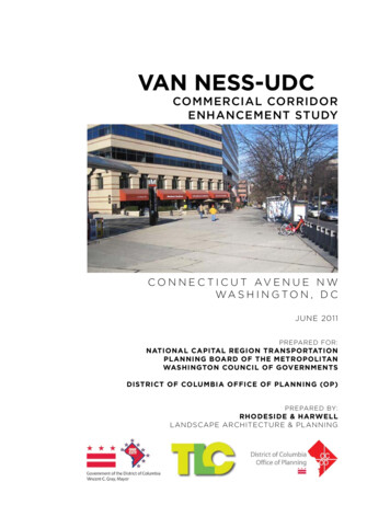
VAN NESS-UDCCOMMERCIAL CORRIDORENHANCEMENT STUDYC O N N E C T I C U T AV E N U E N WWA S H I N G TO N , D CJUNE 2011PREPARED FOR:NATIONAL CAPITAL REGION TRANSPORTATIONPLANNING BOARD OF THE METROPOLITANWASHINGTON COUNCIL OF GOVERNMENTSDISTRICT OF COLUMBIA OFFICE OF PLANNING (OP)PREPARED BY:RHODESIDE & HARWELLLANDSCAPE ARCHITECTURE & PLANNING
ACKNOWLEDGEMENTSThe Van Ness-UDC Metro Commercial Corridor Enhancement Studywas funded by a 2011 Metropolitan Washington Council of GovernmentsTransportation Land-use Connections Grant to the District of ColumbiaOffice of Planning (DCOP). During the study, DCOP sought the activeinvolvement and participation of DC government agencies, officials,area residents, property owners, ANC Commissioners and the University of the District of Columbia.CITY OFFICIALSVincent GrayMayor, District of ColumbiaMary ChehCouncil Member, Ward 3Advisory Neighborhood Commission ANC 3F: 3F01 Adam Tope 3F02 Karen Perry 3F03 Karen Beiley 3F04 Tom Whitley 3F05 Roman Jankowski 3F06 Cathy Wiss 3F07 Bob SummersgillHarriet TregoningDirector, DC Office of PlanningGeraldine GardnerAssociate Director, DC Office of Planning2
PROJECT MANAGEMENT STAFFOffice of PlanningAndrea Limauro, Neighborhood Planning Coordinator, Ward 3Consultants:Rhodeside & Harwell, IncorporatedLandscape Architecture & PlanningElliot Rhodeside, FASLA, DirectorDeana Rhodeside, Ph.D., DirectorLucas Bonney, RLA, Landscape ArchitectSPECIAL THANKS TO:A special thanks to Sarah Crawford at the Metropolitan WashingtonCouncil of Governments for her guidance and support. Thanks to theDDOT and DDOE staff that have provided input and comments throughout the Study process.Thank you as well to all of the University of the District of Columbia(UDC) administrators, Department of Architecture staff, and studentswho actively participated in the conceptual design and communityoutreach processes. A very special thanks to the following: Ralph Belton, Chairperson, UDC Division of Urban Architecture andCommunity Planning Wanda Briscoe, UDC Architecture Student Jill W. Comstock, UDC Architecture Student Carlos M. Diaz, UDC Architecture Student Ameer S. McCall, UDC Architecture Student3
4
CONT EN TSIN TR ODUCTI ON / SUMMARY OF WORKACKNOWLEDGEMENTS . . . . . . . . . .INTRODUCTION . . . . . . . . . . . . . . . .PROJECT LOCATION . . . . . . . . . . . .PURPOSE OF THE PROJECT . . . . . .PROJECT GOALS . . . . . . . . . . . . . . .COMMUNITY PROCESS . . . . . . . . . .SUMMARY OF DESIGN APPROACH. 2. 6. 6. 610. 11. 11C HA PTER 1: I NVENTORY & ANALYSI SINVENTORY & ANALYSIS . . . . . . . . . . . . . . . . . . . . . . . . . 14C HA PTER 2: OPPORTUNI TI ESLOW IMPACT DEVELOPMENT (LID) OPPORTUNITIES .STREETSCAPE & PLAZA OPPORTUNITIES . . . . . . . . . .AREA “A” OPPORTUNITIES . . . . . . . . . . . . . . . . . . . . . .AREA “B” OPPORTUNITIES . . . . . . . . . . . . . . . . . . . . . .AREA “C” OPPORTUNITIES . . . . . . . . . . . . . . . . . . . . . .STREETSCAPE & PLAZA PRECEDENT IMAGES . . . . . . 23. 28. 30. 32. 34. 36C HA PTER 3: GUI DELI NES & RECOMMENDAT IONSLID STREETSCAPE IMPROVEMENT PLAN . . . .LID STREETSCAPE TYPE 1 . . . . . . . . . . . . . . . . .LID STREETSCAPE TYPE 2 . . . . . . . . . . . . . . . .LID STREETSCAPE TYPE 3 . . . . . . . . . . . . . . . .SIDE STREET IMPROVEMENTS PLAN . . . . . . . .PRIVATE PLAZA IMPROVEMENTS PLAN . . . . .CORRIDOR IMPROVEMENTS SUMMARY PLAN. 41. 44. 46. 48. 50. 58. 70COMMENTS FROM STAKEHOLDER MEETING #1 . . . . .COMMENTS FROM CHARRETTE MEETING #2 . . . . . . .2010 COMPREHENSIVE PLAN EXCERPTS . . . . . . . . . .EXISTING UTILITY PLAN (PROVIDED BY DDOE) . . . . .VEAZEY TERRACE CONCEPT (BY GOROVE/SLADE) .PROPOSED UDC STUDENT CENTER PLAZA (BY LAI). 74. 76. 78. 80. 8182A P P ENDI X5
INTRODUCTIONThe Van Ness-UDC Metro Commercial Corridor Enhancement Study wasfunded by a 2011 Transportation/Land-Use Connections Technical AssistanceGrant received by the District of Columbia Office of Planning (DCOP). Theproject was funded by the National Capital Region Transportation PlanningBoard of the Metropolitan Washington Council of Governments, who retainedRhodeside & Harwell, planners and landscape architects, to collaborate withDCOP staff and community stakeholders on this study.PROJECTLO C AT I O NThe project area comprises a segment of Connecticut Avenue, NW, boundedby Albemarle Street to the north and Tilden Street to the south. The projectarea extends one block to both the east and west of Connecticut Avenue inorder to incorporate the adjacent side streets. See the Project Location Map(right).PURPOSE OF THE PROJECTSeveral earlier planning studies, including in particular the NeighborhoodSustainability Indicators Pilot Project (NSIP), identified specific issues voicedby residents within the project area. Issues include: Poor pedestrian safety at crosswalks Interrupted pedestrian and bicycle accessibility Lack of pervious surfaces Unfriendly and unattractive public spaces Mediocre architectureIn addition, the recently updated 2010 Comprehensive Plan identifies severalpolicy recommendations that are relevant to public space and streetscapedesign within the District of Columbia. The current study responds to some ofthese streetscape policy initiatives. A full listing of these policies is located inthe Appendix of this report.6INTRODUCTION
PROJECT LOCATIONSTUDY BOUNDARYPROJECT AREAINTRODUCTION7
HEALTHY STREAM BANK ALONG SOAP STONE CREEK(below 29th Street NW and Audubon Terrace NW)EXISTING SOAP STONE CREEK OUTFALL(untreated stormwater discharge from streetscape)SOAPSTONE VALLEY PARK:EVIDENCE OF SEVERE EROSION8SOAPSTONE VALLEY PARK:EVIDENCE OF SEVERE EROSIONFENWICK BRANCH TRIBUTARY OF ROCK CREEK(untreated stormwater discharge carries trash from streetscape)
PURPOSE OF THE PROJECT (continued)At the beginning of the study, the project team posed the following questions:Q1: How can innovative Low Impact Development (LID) designs beincorporated along the retail strip and in recessed plazas to enhance thevisual appeal of the existing architecture as well as the shopping experience?Q2: What design standards could be adopted to make the retail strip moreattractive?Q3: What kind of bicycle and pedestrian infrastructure can be created toimprove residents’ access to Metro and to the corridor’s various retailestablishments?Q4: How can the University of the District of Columbia’s plaza on ConnecticutAvenue be redesigned with Low Impact Development (LID) technologiesso as to reduce stormwater related pollution, while better serving as anappropriate entrance to the campus and a central meeting place for thecommunity?Severe erosion in the adjacent Soapstone Valley Park has been caused overtime by the over-abundance of stormwater surface runoff from adjacent streets,sidewalks, and plazas within the Van Ness-UDC Connecticut Avenue StudyArea and beyond. Evidence of this erosion can be seen in the existing photos(left). The image at the top illustrates what a healthy stream valley looks like.The application of LID streetscape techiniques along the Connecticut Avenuecorridor could be a major solution to the erosion problem.The US Environmental Protection Agency (EPA) defines Low ImpactDevelopment (LID) as an “approach to land development (or re-development)that works with nature to manage stormwater as close to its source as possible.LID employs principles such as preserving and recreating natural landscapefeatures, minimizing effective imperviousness to create functional and appealingsite drainage that treat stormwater as a resource rather than a waste product.There are many practices that have been used to adhere to these principlessuch as bioretention facilities, rain gardens, vegetated rooftops, rain barrels,and permeable pavements. By implementing LID principles and practices, watercan be managed in a way that reduces the impact of built areas and promotesthe natural movement of water within an ecosystem or watershed. Applied on abroad scale, LID can maintain or restore a watershed’s hydrologic and ecologicalfunctions. LID has been characterized as a sustainable stormwater practice bythe Water Environment Research Foundation and others.”(Source: US Environmental Protection Agency (EPA) Website: www.epa.gov)INTRODUCTION9
PURPOSE OF THE PROJECT (continued)Introducing LID techniques to the corridor will not only benefit the community’senjoyment of the streetscape but, more importantly, will improve theenvironmental health of the local watershed, the Potomac River, and theChesapeake Bay.Therefore, the main purpose of this study has been to investigate ways toimprove the streetscape environment along this section of Connecticut Avenue,NW, through the application of LID techniques and principles. The guidelines& recommendations provided in this report directly reference the Public RealmDesign Manual (PRDM), which was developed by The District Office of Planning(OP) and District Department of Transportation (DDOT). The PRDM is a“summary of the District of Columbia regulations and specifications for thedesign of public space elements.” (PRDM, June 2010).This study does not provide detailed streetscape design or constructiondocumentation. In addition, this study does not recommend specific furnishings,paving materials, or plant species. The final recommendations presented atthe end of this report are suggestions only, and are not intended to be built asshown.Depending on funding and other considerations, this document will be used toguide either the development of a single corridor-wide streetscape constructionproject, or the development of several LID demonstration projects. This studywill also guide the design review of private sector streetscape improvements.PROJECTGOALSThe following goals were used at the first community meeting to inspire thediscussion of a vision for the Connecticut Avenue corridor: Explore LID design techniques and identify implementation opportunitiesalong the corridor in order to create a more sustainable urban environment. Provide recommendations for revitalizing public spaces along the corridor inan effort to encourage community gathering, stimulate pedestrian activity, andincrease retail use. Establish streetscape typologies that will improve the identity and aestheticquality of the corridor. Improve pedestrian and bicycle connections between the Van Ness-UDCMetro station, existing businesses, and adjacent communities and institutions.10INTRODUCTION
COMMUNITYPROCESSThe study process was informed by the following meetings with stakeholders,students and the public:Meeting #1 - February 8th, 2011:Steering Committee & Stakeholders Kick-offMeeting #2 - March 14th, 2011:Charrette Concept Development with Steering Committee, Residents,Stakeholders & StudentsMeeting #3 - April 13th, 2011:Work Session with UDC Students to refine the preferred conceptMeeting #4 - April 27th, 2011:Public Open House with Steering Committee, Residents,Stakeholders & StudentsThe primary message received from the meetings with stakeholders, communitymembers, and students was to improve the safety along the corridor and thequality of public spaces, while also improving the overall sustainability of thepublic realm. A full summary of all meeting comments is provided in theAppendix.SUMMARYOFDESIGNAPPROACHThe following is an overview of what was discovered during the corridor studyprocess and how it was translated into a clear design approach.The Van Ness-UDC Connecticut Avenue corridor is comprised of several plazas,broad streetscapes, and large intersections. Due to the corridor’s closeproximity to Soapstone Valley Park, which eventually drains to Rock Creek, thePotomac River, and the Chesapeake Bay, this study has focused on identifyingways that Low Impact Development (LID) can provide the basis for designimprovements along the corridor. With an abundance of impervious pavementwithin the public right-of-way (ROW), there is great opportunity to showcasethe potential for employing LID techniques and initiatives along this corridor.In the Guidelines & Recommendations section of the report, the design teamhas identified specific areas where these improvements can be made.INTRODUCTION11
12
C H AP T E R 1INVENTORY &A N A LY S I S13
CHAPTER 1:INVENTORY &A N A LY S I SThe Inventory & Analysis Chapter identifies the most important physical andenvironmental elements found within the corridor. Throughout the process ofdocumenting each existing condition category, the team identified the areasthat are critical to change in order to improve stormwater management andupgrade the overall corridor streetscape. Most of the information was acquiredfrom aerial photography analysis, site visits, DC Government databaseinformation, and previous planning studies.Inventory & Analysis Maps:1. Hardscape (Impervious Surfaces)2. Softscape (Pervious Surfaces)3. Topography & Hydrology4. Transportation & Pedestrian Mobility5. Metrorail Infrastructure (Underground)6. Streetscape CharacterInventory & Analysis Maps Summary:As apparent in the Hardscape Map (right), there is an overabundance ofimpervious surfaces along the corridor. In contrast, the Softscape Map (nextpage) reinforces the lack of pervious surfaces mainly within the civic core area,which allows more runoff to quickly flow unchecked into the stormwater systemand onto the waterways of Soapstone Valley Park. In addition, the rollingtopography and steep slopes, as indicated on the Topography & HydrologyMap (page 17), results in even faster runoff during heavy rain events. Thecombination of these conditions creates a greater risk for erosion in theadjacent stream valley.The remaining three maps document existing pedestrian conditions, Metrorailunderground infrastructure, and general streetscape character along thecorridor. This information helped to inform the development of the “streetscape& plaza opportunity areas”, which are detailed in the next chapter.14INVENTORY & ANALYSIS
HARDSCAPE [IMPERVIOUS SURFACES]KEY:EXISTING BUILDINGIMPERVIOUS SURFACE (HARDSCAPE)DRIVE WAY / PARKING LOTROADWAYINVENTORY & ANALYSIS15
SOFTSCAPE [PERVIOUS SURFACES]KEY:EXISTING TREE CANOPYTURF / GROUNDCOVER / LOW SHRUBSEXISTING GREEN ROOF16INVENTORY & ANALYSIS
TOPOGRAPHY HYDROLOGYKEY:ROADWAY: DIRECTION OF DRAINAGE FLOWPLAZA / SIDEWALK: DIRECTION OFDRAINAGE FLOW HP ELEVATION: HIGH-POINT LP ELEVATION: LOW-POINTPERVIOUS SURFACE: MORE H2O INTERCEPTION,COLLECTION & FILTRATIONIMPERVIOUS SURFACE: LESS H2O INTERCEPTION,COLLECTION & FILTRATIONINVENTORY & ANALYSIS17
TRANSPORTATION PEDESTRIAN MOBILITYKEY:METRORAIL LINE (UNDERGROUND)FUTURE BICYCLE BOULEVARDEXISTING SIGNED BIKE ROUTESIGNALIZED INTERSECTIONS[WITH PEDESTRIAN COLLISIONS]18INVENTORY & ANALYSISMMETRORAIL STATIONBUS ROUTE(TEMPORARILY DISCONTINUED)BUS ROUTEBUS STOP(TEMPORARILY DISCONTINUED)BUS STOPEXISTING PAVING / SIDEWALK(Source: RCWII Livability Study)EXISTING PLANTING
METRORAIL INFRASTRUCTURE [UNDERGROUND]KEY:METRORAIL TUNNELMETRO AIR VENTS (WITH VENT SHAFT)METRORAIL STATIONMETRO SUBSTATION (WITH EASMENT)METRO ELEVATORINVENTORY & ANALYSIS19
EXISTING STREETSCAPE CHARACTERKEY:CORPORATE CAMPUSRESIDENTIALCIVIC PLAZARETAIL PLAZA / STRIPNEIGHBORHOOD OFFICENEIGHBORHOOD MIXED-USE OFFICE / COMMERICAL20INVENTORY & ANALYSIS
INVENTORY & ANALYSIS21
22
CHAPTER 2OPPORTUNITIESThe Opportunities Chapter merges the variouslayers of information collected in the Inventory& Analysis Chapter and identifies the specificareas along the corridor that represent potentialstreetscape improvement sites.This chapter is divided into two sections:1) Low Impact Development Opportunities; and2) Streetscape & Plaza Opportunities.23
CHAPTER 2: OPPORTUNITIESLOW IMPACT DEVELOPMENT (LID)OPPORTUNITIESThe LID Opportunity Areas map (right) illustrates the direction ofsurface water runoff as initially shown on the Existing Conditions Map:Topography Hydrology. This map also indicates the locations wherewater runoff could be intercepted, collected, and then filtered before itenters the stormwater piping system that leads to the Soapstone ValleyPark and, eventually, to Rock Creek and the Potomac River.All of the LID Opportunity Areas for Stormwater Interception are locatedwithin the Connecticut Avenue right-of-way, which is owned andmaintained by the District of Columbia. Therefore, it is required that allstormwater runoff be collected from publicly owned space, whichincludes the 1) “public parking” area; 2) sidewalk area; and 3) tree box /furnishing area, as defined in the Public Realm Design Manual (June2010).The precedent images on the following pages show various techniquesand types of LID streetscape installations in a variety of urban settings.Specific LID recommendations are provided in the next Chapter.24
LID OPPORTUNITY AREASROADWAY: DIRECTION OF DRAINAGE FLOWPLAZA / SIDEWALK: DIRECTION OF DRAINAGEFLOW HPELEVATION: HIGH-POINT LPELEVATION: LOW-POINTPERVIOUS SURFACE: MORE H2O INTERCEPTION,COLLECTION & INFILTRATIONIMPERVIOUS SURFACE: LESS H2O INTERCEPTION,COLLECTION & INFILTRATIONPAVING / SIDEWALKBUILDING ROOFDRIVEWAY / PARKING LOTROADWAYPOTENTIAL LOCATION FOR LID STORMWATER INSTALLATION[INTERCEPTION, COLLECTION & INFILTRATION]OPPORTUNITIES25
PRECEDENT IMAGES: LID STORMWATER FEATURES26OPPORTUNITIES
PRECEDENT IMAGES: LID STORMWATER FEATURESOPPORTUNITIES27
CHAPTER 2: OPPORTUNITIESSTREETSCAPE & PLAZA OPPORTUNITIESParallel to identifying specific LID opportunities along the corridor, theteam developed three (3) streetscape typology opportunity areas,which are shown on the Streetscape Typology Opportunity Areas map(right). These typologies were developed using the Existing StreetscapeCharacter Map, which initially categorized the study area into diversearchitectural themes, streetscape types, and spatial uses.These streetscape typologies or “themes” can help to guide andorganize future LID improvements, while creating a clear and unifiedcorridor identity.The next few pages document the specificopportunities and issues found within each area.The streetscape and plaza opportunities exercise gave the team a betterunderstanding as to which types of LID streetscape improvements wereappropriate to the character and context of each area.28OPPORTUNITIES
STREETSCAPE TYPOLOGY OPPORTUNITY AREASOPPORTUNITIES29
AREA A: EXISTING STREETSCAPE PHOTOSTILDEN STREET (WEST)UPTON STREET (EAST)VAN NESS STREET (WEST)AREA A: EXISTING INTERSECTION PHOTOSVAN NESS STREET (EAST)AREA A: “CORPORATE CAMPUS / RESIDENTIAL” OPPORTUNITIES30OPPORTUNITIES
AREA A: EXISTING CONDITIONS - CROSS SECTION #A-1SUMMARY:A R E A ‘A’ ST R E E TS C A P EOPPORTUNITIESThis southern-most portion of the study area is defined by large shade trees,narrow sidewalks, corporate park space, a variety of homes, neighborhoodschools and small businesses. The existing photos and cross section help toillustrate these qualities.Due to the abundance of large existing trees, opportunities for re-structuringthe streetscape to help improve stormwater quality are somewhat limited.Streetscape Opportunities for Area ‘A’ include:1) Improving plantings and grading within the existing tree strip. The existingcompacted lawn areas between the sidewalk and curb allow water to flowunchecked into the stormwater catch basins along Connecticut Avenue. Byreplacing the existing lawn in the tree strip with groundcover plants andcarefully re-grading the soil with a concave cross section (to collect water),water runoff could be slowed and infiltrated into the groundwater table beforeentering the stormwater system.These ideas are explained and illustrated further in Chapter 3: Guidelines &Recommendations.OPPORTUNITIES31
AREA B: EXISTING STREETSCAPE PHOTOSAREA B: “CIVIC PLAZA” OPPORTUNITIES32OPPORTUNITIES
VAN NESS STREET (WEST)WINDOM PLACE (WEST)VEAZEY TERRACE (WEST)VAN NESS STREET (EAST)WINDOM PLACE (EAST)VEAZEY TERRACE (EAST)AREA B: EXISTING INTERSECTION he central portion of the study area is defined bylarge plazas, broad sidewalks, the Metrorail stationentrances, various office buildings, restaurants, andretail establishments. The existing photos andcross section help to illustrate these qualities.Opportunities for Area ‘B’ include:1) Increase tree planting and LID planting areas alongConnecticut Avenue in order to allow stormwater runoffto be intercepted and filtered before continuing intothe stormwater system.Most of the impervious pavement within the studycorridor occurs within this area. Therefore, there isgreat opportunity for improvement using LIDtechniques in this area.2) Increase streetscape furnishings and elements atexisting plazas and along sidewalks in order to create amore attractive shopping environment for visitors andresidents.AREA B: EXISTING CONDITIONS - CROSS SECTION #B-1 AT UDC PLAZA (LOOKING NORTH)OPPORTUNITIES33
AREA C: EXISTING STREETSCAPE PHOTOSWINDOM PLACE (WEST)WINDOM PLACE (EAST)YUMA STREETALBEMARLE STREETAREA C: EXISTING INTERSECTION PHOTOSAREA C: “RETAIL / MIXED-USE STREETSCAPE” OPPORTUNITIES34OPPORTUNITIES
AREA C: EXISTING CONDITIONS - CROSS SECTION #C-1AREA C: EXISTING CONDITIONS - CROSS SECTION #C-2SUMMARY:AREA ‘C’ OPPORTUNITIESThe northern portion of the study area is definedby small shops, a hotel, schools, and various largeresidential buildings. The existing photos and crosssection help to illustrate these qualities.Opportunities for Area ‘C’ include:1) Increase tree planting and LID planting areas alongConnecticut Avenue in order to allow stormwaterrunoff to be intercepted and filtered before continuinginto the stormwater system.2) Create a continuous tree planting strip alongConnecticut Avenue.3) Increase streetscape furnishings and elements atexisting plazas and along sidewalks in order to createa more attractive shopping environment for visitorsand residents.These ideas are explained further in Chapter 3:Guidelines & Recommendations.OPPORTUNITIES35
CHAPTER 2: OPPORTUNITIESSTREETSCAPE & PLAZA PRECEDENTIMAGESDuring the development of the Corridor-wide Opportunities, the teamcollected various precedent images of successful streetscapes, parks,and LID installations in urban settings as a way to illustrate the greatpotential for the Connecticut Avenue corridor.36OPPORTUNITIES
PRECEDENT IMAGES: URBAN PLAZA ELEMENTSOPPORTUNITIES37
PRECEDENT IMAGES: STREETSCAPE ELEMENTS38OPPORTUNITIES
PRECEDENT IMAGES: WATER, PLANTS & ART FEATURESOPPORTUNITIES39
40
CHAPTER 3GUIDELINES &R E CO M M E N DAT I O N SThe Guidelines & Recommendations Chapterorganizes the corridor into three distinctimprovement plans:1) LID Streetscape Improvements Plan2) Side Street Improvements Plan3) Private Plaza Improvements PlanAll recommended improvements are thensummarized in the Corridor ImprovementsSummary Plan at the end of this chapter.41
C H A P T E R 3 : G U I D E L I N E S & R E CO M M E N DAT I O N SLOW IMPACT DEVELOPMENT (LID) STREETSCAPEIMPROVEMENTS PLANAll recommended LID Streetscape Types (1, 2, and 3) are located withinthe public right-of-way (ROW) and are summarized on the pages thatfollow. Each LID streetscape type was determined based on thefollowing conditions:1. The existing dimensions of the streetscape and public space available2. The condition, size, and number of existing shade trees3. The existing topography and location of stormwater drains4. The existing streetscape characterAdditional illustrations and details of each LID Streetscape Type areprovided on the pages that follow. Please note that all sidewalk pavingmaterials, planting materials, and furnishing types referenced in thisreport are for illustrative purposes only. Specific material types selectedfor this corridor shall conform to all DDOT Streetscape Standards.During this study’s process, London Pavers were selected as thepreferred paving material for this study area (commercial areas only).Any changes or omissions to this selection in the future shall be reviewedand approved by DDOT.EXISTING TREES TO BE PRESERVEDAll existing street trees (except those that are diseased or dead) arerecommended to be preserved and protected. Some small street treesmay need to be removed in locations where LID Stormwater InfiltrationPlantings are recommended (See Streetscape Type “A”, page 44). Allproposed street tree locations are shown on the LID Streetscape PlanEnlargements in the pages that follow.PLAN KEY:STREETSCAPE TYPE 1: TREE PIT PLANTING EXTENSIONS - See pages 44-45 for detailsSTREETSCAPE TYPE 2: BIO-INFILTRATION PLANTING (LID) - See page 46 for detailsSTREETSCAPE TYPE 3: IMPROVED GROUNDCOVER (IN TREE STRIP) - See page 47 for detailsSTREETSCAPE TYPE 3: IMPROVED PLANTS (RESIDENTIAL LANDSCAPE)EXISTING TREES TO BE PRESERVED42GUIDELINES & RECOMMENDATIONS
LID STREETSCAPE IMPROVEMENTS PLANGUIDELINES & RECOMMMENDATIONS43
SUMMARYLID STREETSCAPETYPE1Streetscape Type 1 is applied to areas where existing trees prevent thefull excavation that is needed for advanced constructions of LID biofiltration tree plantings (as is illustrated by Streetscape Type 2). TheType 1 plan enlargement (below) recommends the planting of additionalstreet trees, in some cases between existing street trees, yet stillconforming to standard tree spacing as stated in the Public RealmDesign Manual. Furthermore, the addition of groundcover or low shrubswithin the tree box area will help to intercept stormwater on its way tothe stormwater system.The existing conditions photo (top right) illustrates the abundance ofpaving that currently exists between street trees. The conceptualvisualization (bottom right) shows an increase in the amount of pervioussurface: additional trees, low shrubs, and groundcover to help interceptrunoff currently flowing unchecked into the gutter and storm system.NOTE: All streetscape annotations shown below are referenced in theDistrict’s Public Realm Design Manual (June 2011). The manual defines“Public Parking” as the area between the sidewalk and property linedevoted to public open space and greenery (within the public right-ofway). This space is part of the City’s park and open space system andNOT intended for vehicular parking. Public space regulations thatgovern this area also apply to private property behind building restrictionlines. These areas are often perceived as private landscapes that createa continuous park-like setting along public City streets.LID STREETSCAPE TYPE 1: PLAN ENLARGEMENT44GUIDELINES & RECOMMENDATIONS
EXISTING VIEW: SIDEWALK NEAR METRO WEST STATION(LOOKING NORTH)LID STREETSCAPE TYPE 1: CONCEPTUAL VISUALIZATIONGUIDELINES & RECOMMENDATIONS45
SUMMARYLID STREETSCAPETYPE2Streetscape Type 2 (below) is applied to sections of the streetscapethat have fewer existing trees or an increased potential for future redevelopment. For example, the streetscape in front of the future UDCStudent Center Plaza has the opportunity to be improved as a result ofthe potential adjacent re-development.In some cases, there is additional space available to implement LIDStreetscape Type 2 if the streetscape is re-configured or re-aligned, asis illustrated in the Side Street Improvements Plan section (starting onpage 50).LID STREETSCAPE TYPE 2: PLAN ENLARGEMENT46GUIDELINES & RECOMMENDATIONS
LID STREETSCAPE TYPE 2: TYPICAL CROSS SECTIONGUIDELINES & RECOMMENDATIONS47
SUMMARYLID STREETSCAPETYPE3Streetscape Type 3 is applied to areas where existing trees prevent thefull excavation that is needed for advanced constructions of LID biofiltration tree plantings (as is illustrated by Streetscape Type 2). MostType 3 conditions occur in the Corporate Campus / Residential area ofthe corridor, which has 4-6’ wide existing sidewalks and large existingstreet trees.The existing lawn (shown below) between sidewalk and curb allowswater to flow unchecked into the stormwater gutters alongConnecticut Avenue.EXISTING VIEW: RESIDENTIAL STREETSCAPELID STREETSCAPE TYPE 3: IMPROVED PLANTINGS48
Improved plantings along the existing tree strip:Replacing the existing lawn and carefully re-grading the soil with a concavecross section (where possible) would improve interception and filtering ofrunoff before entering into the stormwater system.CONCEPTUAL VIEW: STREETSCAPE TYPE ‘C’ PLANTINGSLID STREETSCAPE TYPE 3: IMPROVED PLANTINGSGUIDELINES & RECOMMENDATIONS49
C H A P T E R 3 : G U I D E L I N E S & R E CO M M E N DAT I O N SSIDE STREET IMPROVEMENTS PLANImprovements to three (3) of the side streets along the west side of thestudy area are featured in this section, which can serve as models forother side streets in the study area. The pedestrian crossings at VeazeyTerrace, Windom Place, and Yuma Street are detailed on the pages thatfollow. All recommendations utilize the proposed LID StreetscapeTypes 1, 2, and 3 as presented in the previous section.PLAN KEY:SIDE STREET IMPROVEMENTS10 VEAZEY TERRACE - PEDESTRIAN CROSSING (See pages 52-53 for details)11 WINDOM PLACE - PEDESTRIAN CROSSING (See pages 54-55 for details)12 YUMA STREET - PEDESTRIAN CROSSING (See pages 56-57 for details)50
121110SIDE STREET IMPROVEMENTS PLANGUIDELINES & RECOMMENDATIONS51
SUMMARY:VEAZEY TERRACESIDE STREET IMPROVEMENTSThe existing sidewalk crossing at Veazey Terrace currently allows pedestrians to diagonally cut acrossthree lanes of traffic, resulting in significant vehicular-pedestrian conflicts (see existing photo, below).The conceptual visualization (below) illustrates the potential to encourage pedestrians to cross along thesidewalk, thus creating fewer conflict points with vehicles. To reinforce this movement, LID bio-filtrationplantings are suggested in the space acquired from the proposed removal of the solo vehicle turn laneonto Connecticut Avenue (turning south). Roadway engineering concepts are provided by Go
SPECIAL THANKS TO: A special thanks to Sarah Crawford at the Metropolitan Washington . EXISTING UTILITY PLAN (PROVIDED BY DDOE) . . . . . .80 VEAZEY TERRACE CONCEPT (BY GOROVE/SLADE) . . 81 PROPOSED UDC STUDENT CENTER PLAZA (BY LAI) 82. 6 . proximity to Soapstone Valley Park, which eventually drains to Rock Creek, the Potomac River, and the .