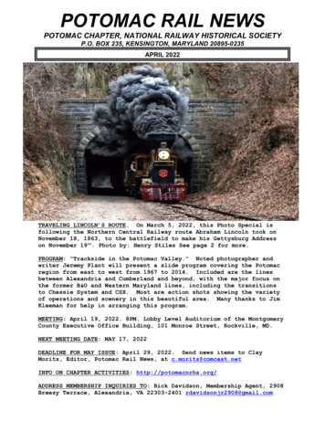
Transcription
Metropolitan WashingtonCouncil of GovernmentsPotomac River Rescue, Assistance, andEmergency Incident Response PlanApproved by the COG Fire Chiefs CommitteeMetropolitan WashingtonCouncil of GovernmentsMay 2020Updated 5/20/20
COG POTOMAC RIVER RESCUE, ASSISTANCE, AND EMERGENCYINCIDENT RESPONSE PLANPURPOSEAn emergency occurring on the Potomac River presents a host of unique rescue, assistance,and coordination challenges. The water environment presents a threat to those in andaround the river to include; life safety hazards, the terrain adjacent to the river limitsaccessibility, and hazardous material exposure and environmental conditions intensify inthe maritime environment. These challenges are exacerbated by limited resources in amulti-jurisdictional environment, resulting in a need for seamless interoperability in everyresponse.Because of these unique circumstances, public safety agencies with jurisdiction on thePotomac River, its tributaries, or adjacent lands, signatory of the Metropolitan WashingtonCouncil of Governments (MWCOG) Mutual Aide Operations Plan (MAOP) agree torespond in a coordinated manner as outlined in this response plan.SAFETY FIRSTThe Potomac River is a hazardous force that deserves one’s constant respect. Each year,three to six drownings and several boating emergencies take place. When incidents happen,local, state, and federal agencies must act swiftly and efficiently to mitigate life-threateningcircumstances and protect property.Personal Protective Equipment (PPE): All responders shall be equipped with personalflotation and appropriate protective equipment to limit exposure to cold, heat, and weatherrelated injuries. Agencies are encouraged to develop a standard for hypothermia protectivegear. When the human body is submerged in water, heat is lost approximately 26 timesfaster than it is on dry land, making hypothermia one of the greatest dangers to a personwho enters the water.DEFINITIONS AND STANDARDSOutfitting regional organizations with the right equipment and dispatching resources basedon capabilities is paramount to ensuring a resilient region and effective responses. TheNational Fire Protection Agency (NFPA), National Association of State Boating LawAdministrators (NASBLA), United States Coast Guard (USCG), Federal EmergencyManagement Agency (FEMA), Operational Safety and Health Administration (OSHA),and other accreditation providing organizations define standards with which all responseagencies should comply. The definitions section of this this document, provided inEnclosure (1) identify a small selection of those standards which are referenced throughoutthis text, but agency administrators are reminded to reference the national and regionalstandards when designing their response capabilities.1
COG POTOMAC RIVER RESCUE, ASSISTANCE, AND EMERGENCYINCIDENT RESPONSE PLANExisting Plans and Agreements: There are several existing plans and agreements thatinfluence the way response agencies interoperate on the Potomac River. Because most ofthe existing plans and agreements not specifically developed for the maritime environment,this plan serves to link the existing documents and specify where maritime responsesrequire unique procedures. Where applicable, these references will be noted and italicized.RESPONSIBILITY AND JURISDICTIONJurisdiction over the Potomac River is held concurrently by the United States Coast Guardfor the entire length of the river; by the State of Maryland for the river upstream anddownstream of the District of Columbia; and by the Commonwealth of Virginia for waterscontained inside point-to-point Virginia shorelines.For the purposes of rescue, assistance, and emergency response, these boundaries do notlimit responders; rather indicate the Authority Having Jurisdiction (AHJ), which isaccountable for ensuring prudent action is taken to resolve the incident.Geographical Division: The Potomac River is over 400 miles long, and the fourth largestriver along the Atlantic coast of the United States. COG extends partnerships throughapproximately 103 miles of this waterway including the boundary line between the Upperand Lower Potomac, which are fundamentally different geographical areas. Lower Potomac: The tidal (navigable) or Lower Potomac lies below Little Falls asthe head of navigation and extends to the mouth of the Chesapeake Bay. For thepurposes of this plan, and in accordance with the U.S. Coast Pilot vol.3 - 51st edition,2018, the Chain Bridge, 1/2 mile downstream of Little Falls, at approximately Mile101 on the Potomac River is the head of tidewater navigation, and is the delineationbetween the Upper and Lower Potomac. In this plan, the Lower Potomac refers onlyto those waters within the reaches of the COG region, and will therefore extend tothe Rt. 301, Governor Harry Nice Bridge at Mile 44. Upper Potomac: The non-tidal (non-navigable) portion of the Potomac River,typically known as the Upper Potomac extends north from the Chain Bridge at Mile101 to the confluence of the northern and southern branches of the Potomac River inGreen Spring, WV. For the purposes of this plan, the Upper Potomac refers only tothose waters within the reaches of the COG region, and will therefore extend to theRt. 15 Point of Rocks Bridge, which connects Frederick County, MD to LoudounCounty, VA at approximately Mile 147 of the Potomac River.NOTEResponses on the Lower and Upper Potomac are fundamentally different. This plan willspecify where an agreement, policy, or method differs.2
COG POTOMAC RIVER RESCUE, ASSISTANCE, AND EMERGENCYINCIDENT RESPONSE PLAN Jurisdictional Resources: The District of Columbia (DC) Metropolitan PoliceDepartment (MPD) Harbor Patrol, DC Fire and Emergency Medical Services(FEMS), and the USCG maintain fully staffed and dedicated boat crews forimmediate vessel response 24/7/365. However, many jurisdictions maintain singleassets and varying levels of staffing/availability. A listing of assets and responsepostures on the Lower Potomac River is provided in Enclosure (2) to assist inresponse planning.INCIDENT COMMAND SYSTEMBecause the river serves as a jurisdictional boundary and each jurisdiction has varying levelof response capabilities, each response on the Potomac River requires multi-agencycoordination. Use of the National Incident Management System (NIMS) IncidentCommand System (ICS) will help provide a systematic response process to the federal,state, local, non-governmental, and commercial entities/agencies who share responseauthorities and responsibilities on the Potomac River.Approximately 80% of responses share common principles, which is the ICS structure mostpersonnel are familiar with as published in the National Capital Region (NCR) ICSHandbook. The modular nature of ICS allows for the 20% difference to be tailored tounique situations such as search and rescue, recovery, salvage, firefighting, pollutionresponse, and mass casualty in a maritime environment. Incident Commanders (IC) shouldalso be aware that these activities often lead to investigations, enforcement, and otherlonger-term initiatives and should therefore take care to preserve the scene.Command and Control: Command of an incident is determined by several factors includingJurisdiction, Capability, and situational awareness. Marine Officers and crews are trained,experienced, and capable of handling most minor incidents and coordinating the initialresponse for a significant response. In this agreement, we authorize the firstcapable responder on-scene, which qualifies as an operations boat,regardless of jurisdiction, to assume initial Incident Commander (IC). Transferring Command: It is important to note, however, that the initial IC couldbe easily and quickly overwhelmed and must be prepared to transfer commandwhen appropriate. Upon relinquishing command, the initial IC is typically wellsuited to serve as the Marine Operations Division Supervisor. Considerations for an appropriate IC include: unications, internet/mobile data terminal, etc. Vessels: Stability of the platform, adequate staffing to handle ownvessel’s navigation and command duties. Land Based: Familiarity with navigational area and understandingof available Maritime Resources.3
COG POTOMAC RIVER RESCUE, ASSISTANCE, AND EMERGENCYINCIDENT RESPONSE PLANRESPONSE CONSIDERATIONSIncident Commander: The first boat to arrive on-scene, which meets the qualifications ofan Operations Boat, regardless of jurisdiction, assumes Command. The initial IC willtypically handle the entire incident but when an incident is not resolved immediately, acommand structure must be implemented.The IC is responsible for the overall management of the incident to include determinationof the incident objectives, establishing the priorities, and establishing an appropriate ICSorganization and Incident Command Post (ICP). Incident Command Post: The ICP of a maritime incident should be at a locationaccessible by maritime response assets. Considerations for an appropriate ICP include: Proximity to Incident Access to Waterway via Boat Launch, Marina, Sea Wall, etc. Unified Command (UC): Upon establishment of an ICP, all agencies withjurisdiction should be invited to join the Unified Command (UC) and allparticipating agencies invited to send a representative to enhance interoperability.NOTEA listing of adequate maritime incident ICP and Staging areas is provided in Enclosure(3) to assist the IC in response planning.Maritime Incident Standard Objectives/PrioritiesWhile the objectives of an incident will vary, the priorities generally involve safety,assisting victims, controlling the incident, and conservation of property. The IC shouldconsider the following priorities when responding to a maritime incident. Protection and Safety of all Personnel: Implement operational risk managementprinciples and only take necessary risks. The loss of life is never acceptable. Wherethe probability of saving a life exists, damage to rescue equipment is acceptable,and where that probability diminishes into a possibility, less risk is acceptable.When conducting recovery operations or rescuing property, no moderate or highlevel of risk is acceptable. Prompt removal and treatment of injured and endangered victims: Where allvictims can be recovered promptly every effort should be made to quickly transferthe victims to Emergency Medical Services (EMS) units for treatment. When the4
COG POTOMAC RIVER RESCUE, ASSISTANCE, AND EMERGENCYINCIDENT RESPONSE PLANarriving Search and Rescue Units (SRU) do not immediately resolve the report ofdistress they must begin to follow Search and Rescue procedures. Control and containment of the incident: When needed, the IC should direct capableSRUs to provide a safety zone around the incident to protect rescue personnel fromtraffic and to protect citizens from the hazards contained within the incident. Whenthe incident involves a sunken vessel, fire, or mass casualty there is often a needfor pollution or hazardous material response. Conservation of property: All capable response assets are authorized to performrescue operations which aim to prevent the loss or damage of property. However,operations for the sole purpose of salvage or recovery should only be performedwhen the activity involves saving a life, prevention of environmental damage, or toremove hazards to navigation. Belonging to a public agency includes aresponsibility to minimize the possibility of competition or interference withcommercial enterprise, therefore salvage and routine towing operations should becontracted by the responsible party (RP) through an appropriate service provider.Expanding Incidents: Each incident type discussed in this plan present a unique design forcommand and control. Most incidents will classify as a Type 5 or Type 4 event with asimple response structure. However, in the event of a Type 3, Type 2, or Type 1 incidentit may be necessary to expand command, control, and communications. Incident Type Characteristics (from least –type 5 – to most – type 1 – complex): Type 5: The incident can be handled with one or two single resources withup to six personnel. Command and General Staff positions (other than theIncident Commander) are not activated. Incident is contained within thefirst operational period and no written Incident Action Plan is required. Type 4: Command and General Staff function are activated (only if needed).Several Single resources are required to mitigate incident. Limited to oneoperational period in the control phase. No written Incident Plan is requiredfor non-HazMat incidents. A documented operational briefing incompleted. Type 3: When capabilities exceed initial response, the appropriate ICSpositions should be added to match the complexity of the incident. Someor all of the Command and General Staff positions may be activated, as wellas Division or Group Supervisor and/or Unit Leader level positions. AnIncident Management Team (IMT) or incident command organizationmanages initial action incidents with a significant number of resources, andan extended response incident until containment/control is achieved. The5
COG POTOMAC RIVER RESCUE, ASSISTANCE, AND EMERGENCYINCIDENT RESPONSE PLANincident may extend into multiple operational periods and a written IncidentAction Plan may be required for each operational period. Type 2: Regional and/or national resources are required to safely andeffectively manage the operations. Most or all Command and General Staffpositions are filled. Operations personnel typically do not exceed 200 peroperational period and the total does not exceed 500. The agencyadministrator/official is responsible for the incident complexity analysis,agency administrator briefings, and written delegation of authority. Theincident is expected to go into multiple operational periods. A writtenIncident Action Plan is required for each operational period. Type 1: National resources are required to safely and effectively managethe operations. All Command and General Staff positions are activated, andBranches need to be established. Operations personnel often exceed 500 peroperational period and total personnel will usually exceed 1,000. There is ahigh impact on the local jurisdiction, requiring additional staff for officeadministrative and support functions. The incident may result in a disasterdeclaration. The incident is expected to go into multiple operational periods.A written Incident Action Plan is required for each operational period. Span of Control: The type of incident, nature of the task, hazards and safety factorsand distances between personnel and resources all influence span of controlconsiderations. NIMS suggests that effective span of control on incidents may varyfrom three to seven, with five being optimal. Each section below will addressspecific ICS suggestions for expanding incidents.COMMUNICATIONSThe most critical aspect of an effective response is communications. Beginning with thecollection of initial reports, notification of all available and capable resources, and finallycommunications among those resources.NOTENotification and Dispatch procedures for maritime incidents are under developmentthrough the COG PSAP working group. Specific capabilities, technology, and procedureswill be expanded upon in Appendix A of this plan.Initial reports should be collected as quickly and completely as possible with a focus oncollecting five critical pieces of information displayed in Figure 1 which are imperative tosizing up the incident and dispatching the correct resources to the correct location.1. Location/ Positionof Emergency[ ] Lat/Long[ ] Geographic Reference6
COG POTOMAC RIVER RESCUE, ASSISTANCE, AND EMERGENCYINCIDENT RESPONSE PLAN2. Number of PersonsOn Board3. Nature ofEmergency:Adults:Children:Total:(are any people in the water?)4. Description of VesselMake/Type:Name:Length:Color:5. Have all persons on board the vessel put on Personal Flotation Devices / adequate numberof PFD’s available? Y / NFFigure 1Notifications to maritime emergency responders must be prompt and comprehensive. It isimperative that all applicable jurisdictions, utilizing all available means are notified. U.S. Coast Guard Notification is critical during any maritime emergency. In additionto holding many Federal Authorities with civil responsibilities, the USCG’s solemission is to protect the users of the waterway, defend against threats delivered bythe waterway, and protect the waterway itself. Upon notification of the USCG, thefollowing notifications/communications will occur: Emergency Broadcasts are issued to the public and response agencies viaVHF-FM CH16. Urgent Marine Information Broadcast (UMIB) notifies thepublic of an emergency, in which they may be in the vicinity of, andable to assist immediately or provide critical information toauthorities. Safety Marine Information Broadcast (SMIB) notifies the publicof a danger, in which they may be near, and advises them to stayclear. Marine Assistance Request Broadcast (MARB) notifies thepublic of a mariner in need of non-emergency assistance, in whichthey may be able to provide to prevent an emergency fromdeveloping. Direction Finding (DF) on VHF-FM 16: In the tidal or Lower PotomacVHF-FM 16 is the primary hailing and distress frequency for vessel-tovessel communication and the U.S. Coast Guard. These transmissions aremonitored and recorded 24 hours /day with direction finding (DF)capabilities through the Rescue 21 (R-21) Nationwide Network. SAROPS: Search and Rescue Optimal Planning System (SAROPS) is aMonte Carlo-based software system used by the Coast Guard for maritimesearch planning. SAROPS uses thousands of simulated particles generatedby user inputs in a graphical user interface. SAROPS was designed to7
COG POTOMAC RIVER RESCUE, ASSISTANCE, AND EMERGENCYINCIDENT RESPONSE PLANeffectively use higher resolution gridded environmental data to providesuperior accuracy in search object drift. Computer program used to assist on-scene search and rescue assetsby directing them to areas maximizing probability of success inlocating victims. Able to generate search pattern summaries and search effectivenessreports. Can be initiated by USCG-NCR at the request of the IncidentCommander or On-scene-coordinator. Public Safety Access Point (PSAP) Notification and Dispatch procedures serve as themost commonly leveraged method of notification and dispatch on the Potomac River.It is imperative that the PSAP strive to ascertain the nearest capable response assetsavailable for dispatch. To facilitate this: A list of existing maritime resources and their response posture is includedin Enclosure (2). U.S. Coast Guard Station Washington shall update anddistribute this list annually to all agencies and PSAPs. All agencies will provide updated capabilities and availability posturesannually to Stationwashington@uscg.mil when requested. Charles County has developed an integrated Geographic InformationSystem (GIS) layer and will update and distribute annually to all NCRPSAPs. GIS layer available here: https://arcg.is/04frvb. All PSAPs will upload GIS layers into their Computer Aided Dispatch(CAD) system and incorporate this product into their dispatch procedures. If a natural CAD relationship between organizations does not exist, PSAPswill set automatic notifications through CAD Email. Any notification method not listed but deemed to be useful and effectiveshould be utilized.NOTENotification and Dispatch procedures for maritime incidents are under developmentthrough the COG PSAP working group. Specific capabilities, technology, and procedureswill be expanded upon in Appendix A of this plan.8
COG POTOMAC RIVER RESCUE, ASSISTANCE, AND EMERGENCYINCIDENT RESPONSE PLANFor the purpose of this document the following terms are defined: Zone – The grouping of talkgroups or channels within a subscriber radio. Talkgroup – Virtual radio channels created for and used by trunked radio systems. Channel – A dedicated radio frequency.The Interoperability NCR Maritime Interoperability Zone is designed to groupmaritime tactical talkgroups and VHF-FM channels from multiple jurisdictions into asingle radio zone to provide consistent and reliable interoperability in the maritime domain.Applicability: Use of this zone applies to signatories of the Greater Metropolitan AreaInter-Jurisdictional Mutual Aid Communications Memorandum of Understanding whohold authority or assist with responses on the Upper and Lower Potomac and AnacostiaRivers. The primary hosts for talkgroups within this zone typically hold jurisdiction onthese rivers and conduct responses with maritime-based command and control. Wheresuperseding communications plans exist and/or land-based responses utilize vessels but allcommand and control resides on land and an interoperability solution is not otherwiserequired, usage of these talkgroups may or may not apply.Maritime Based Incidents – Are primarily going to occur in the navigable waters of thelower Potomac and Anacostia rivers. These are responses where waterborne assets are theprimary responders because the incident is not accessible from land.Land-based incidents – Are primarily going to occur in non-navigable waters. These areresponses where waterborne assets are typically all launched from the shoreline and aremerely utilized as a strike team or taskforce, such as a Swiftwater rescue incident orincidents where waterborne are assisting land based companies with water supply and firesuppression of land accessible structures.NOTE**Navigable waters are defined as waters which are accessible only by boat and as thatare subject to the ebb and flow of the tide, as described in 33 CFR 329.4Channel Assignment: The PSAP shall assign the applicable NCR Maritime talkgroup to allresources dispatched/responding to a maritime incident. If the AHJ PSAP is unable tooperate on the designated Maritime talkgroup, the AHJ’s shared talkgroup may be utilizedas a command channel to communicate with the Incident Commander who will monitorboth the AHJ’s command talkgroup and the Maritime talkgroup.9
COG POTOMAC RIVER RESCUE, ASSISTANCE, AND EMERGENCYINCIDENT RESPONSE PLAN Geographical Applicability: Incident channels shall correspond with the geographicalapplicability listed in Table 1, which aligns with natural AHJ boundaries. Incidents,which occur where the AHJ is unclear, and/or which drift into neighboringjurisdictions, will begin on the channel assigned by the dispatching PSAP and shiftonly as directed by the Incident Commander.NOTEHost Jurisdictions who conduct responses in waters where no talk group is provided areencouraged to make agreements for responses into waters not covered in this plan.Talkgroup and Channel Selection: The following channel lineup shall be placed into asingle radio zone and should be published in the NCR Communications InteroperabilityGroup (CIG) Fleet Map and programmed in all subscriber radios within the NCR.NCR Maritime Interoperability ZoneASSIGNMENT TALKGROUPPRIMARY USEChChChChChChChMaritime HailingMaritime OperationsMaritime OperationsMaritime OperationsMaritime OperationsMaritime OperationsMaritime OperationsEncrypted MaritimeOperationsMaritime OperationsMaritime OperationsMaritime OperationsMaritime OperationsMaritime Operations1/A2/B3/C4/D5/E6/F7/GFFX 42L MARFFX 42M MARCH10A 12MAR ACH10A 13MAR BPWC 51JPWC 51KPG Marine 1Ch 8/HPG Marine 2E*ChChChCh7 Marine7 MarineDC MIC 1DC MIC 29/I10/J11/K12/L12EMAINOPS1Ch 13/MDC MIC 3 OPS2Ch 14/NDC MIC 4(E*)Ch 15/OAHJ CHOICE-or-VHF81A- or DC MIC 5E *GEOGRAPHICALAPPLICABILITYLower PotomacFFC WatersCC WatersPWC WatersPGC WatersLower PotomacMC/UpperPotomacDC WatersMaritime Operationsand Encrypted NSSEEventsMIC5EEncryptedDCWatersMaritime OperationsLocal Useand NSSE Eventsor10
COG POTOMAC RIVER RESCUE, ASSISTANCE, AND EMERGENCYINCIDENT RESPONSE PLANInternationalLower PotomacHailing & Distress*Encrypted and VHF talkgroups are not available in all subscribers’radios. These assignments may be changed by individual jurisdictionsbased on current capabilities.Ch 16/PAHJ CHOICE-or-VHF16*Table 1Talkgroup Usage: Each jurisdiction has provided at least two (2) talkgroups for maritimeoperational use. The first talkgroup is the primary response talkgroup for that agency’sjurisdiction. The subsequent talkgroups are is available for additional incidents orseparation of command and operations.Hailing: The first channel in the NCR Maritime Zone is FFX 42L which is designated asthe Maritime Hailing channel for the Lower Potomac. All response assets on routine patrolshall monitor FFX 42L unless otherwise assigned/engaged. FFX 42L shall be utilized tohail and coordinate with nearby response assets prior to the assignment of an incidentchannel.NOTEVHF-FM Ch16 remains the International Hailing and Distress Frequency, however, therange of FFX 42L greatly exceeds the line of site of VHF-FM and can alert assets onpatrol in neighboring jurisdictionsExpanding Incident Communications: Expanding incidents may require additionaltalkgroups assignments from the NCR Maritime Zone. The IC will determine the need foradditional talkgroup or channel assignments and shift responders as necessary. DC MIC Channels: The DC Maritime Incident Channels (MIC) (pronounced“mikes”) are the primary public safety communications talkgroups for maritime andaviation assets, along with supporting ground units, for incidents occurring within thenavigable jurisdictional waters of DC. DC MIC 1 is intended to create a MaritimeDomain Awareness Net for the waters surrounding the Nation’s Capital by being theprimary operations talkgroup for all maritime operations in DC waters. DC MIC 1will be monitored 24/7/365 by DC Fireboat, MPD harbor, MPD Falcon Base, USPPEagles Nest and USCG Sector NCR Command Center, as well as during the operatinghours of USCG Station Washington. Public safety and government vessels andaviation assets from other jurisdictions should use MIC 1 to communicate with DCFireboat and DC MPD Harbor units when in DC waters. DC MIC 1 MAIN: Routine operation, primary incident operations. DC MIC 2 OPS 1: Expanded incident operations DC MIC 3 OPS 2: Expanded incident operations11
COG POTOMAC RIVER RESCUE, ASSISTANCE, AND EMERGENCYINCIDENT RESPONSE PLAN DC MIC 4(E*) Expanded incident operations and Encrypted NSSEpatching. This talkgroup will be backwards compatible for non-encryptedusers except during NSSE events until a time where it will go encrypted fulltime. DC MIC 5 ENCRPT: Encrypted incident operations and NSSE patching.DC Fireboat Base will monitor the main interoperability hailing channel FFX42Lin quarters and when underway outside of DC jurisdictional waters.Encryption: Four encrypted talkgroups exist within this zone, the primary talkgroup beingPG MARITIME 2E, which is available for use by any jurisdiction in need of an encryptedchannel who is in range of the PG communications network. The second encrypted channelis 7 Marine 2E. The third and fourth encrypted talkgroups are DC MIC(4*) and DC MIC5E. (Additional agencies can be added for NSSE interoperability by contacting DC’s radiomanagers)Primary Understanding that the purpose of the NCR Maritime Zone is to migrate publicsafety maritime communications from Marine VHF-FM channels which are line of sightonly and less secure than talkgroups on a public safety trunked radio system. VHF-FMCh16 is the International Hailing and Distress Frequency and remains the primary boat toboat communications method on the Lower Potomac River. This channel is required bylaw to be monitored by many commercial vessels and large recreational vessels and ismonitored by the U.S. Coast Guard and several local jurisdictions. Subscribers with multiband capabilities will program this channel into the 16th assignment. Charles County Emergency Services hosts VHF-FM Ch16 and has the capabilityto patch a subscriber radio, allowing responders to communicate with mariners indistress, when a VHF-FM radio is not available.Secondary VHF-FM: In the event VHF-FM Ch16 is overloaded, disabled, or otherwise unavailable to the responders, the secondary VHF-FM Interoperability Channel for the LowerPotomac is VHF-FM Ch81A. This channel is a USCG working frequency and will be madeavailable to all participants within this agreement by MOU.Monitoring Requirements: It’s not possible to monitor all talkgroups/channels at all times.The fully equipped vessel will monitor VHF-FM Ch16, FFX 42L, and their jurisdictionaldispatch channel. Upon being dispatched to an incident, the response boat will announcethe incident on FFX42L and switch to the incident channel. Vessels without this capabilitywill, at a minimum attempt to monitor VHF-FM Ch16 and their jurisdictional dispatch.Upon being dispatched to an incident, the vessel will switch from dispatch to the incidentchannel.*Units stationed in DC Waters shall monitor MIC1.12
COG POTOMAC RIVER RESCUE, ASSISTANCE, AND EMERGENCYINCIDENT RESPONSE PLAN**If Sector NCR upgrades their capabilities, they will rebroadcast incident alerts on VHFFM Ch16, FFX 42L, and MIC 1.SEARCH AND RESCUEA search and rescue (SAR) incident requires seamless coordination and immediateresponse by every available resource to prevent loss of life. It is imperative that the agencyreceiving the initial report notifies the USCG and the neighboring/opposite shorejurisdictions to maximize the effectiveness of the response.The minimum command structure required for every search and rescue incident shouldinclude an IC and a SAR Mission Coordinator (SMC).SAR Mission Coordinator (SMC): U.S. Coast Guard Sector Maryland-NCR is the SMCfor the Potomac River and all connected tributaries and can be contacted via VHF-FMchannel 16 or via phone at (410) 576-2525. Responsibilities of the SMC include: Gather detailed information relating to the distress situation; Issue an Urgent Mar
The IC is responsible for the overall management of the incident to include determination of the incident objectives, establishing the priorities, and establishing an appropriate ICS organization and Incident Command Post (ICP). Incident Command Post: The ICP of a maritime incident should be at a location accessible by maritime response assets.