Transcription
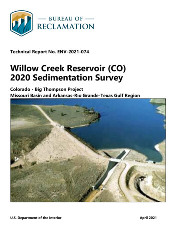
Technical Report No. ENV-2021-074Willow Creek Reservoir (CO)2020 Sedimentation SurveyColorado - Big Thompson ProjectMissouri Basin and Arkansas-Rio Grande-Texas Gulf RegionU.S. Department of the InteriorApril 2021
Mission StatementsThe Department of the Interior (DOI) conserves and manages theNation’s natural resources and cultural heritage for the benefit andenjoyment of the American people, provides scientific and otherinformation about natural resources and natural hazards to addresssocietal challenges and create opportunities for the Americanpeople, and honors the Nation’s trust responsibilities or specialcommitments to American Indians, Alaska Natives, and affiliatedisland communities to help them prosper.The mission of the Bureau of Reclamation is to manage, develop,and protect water and related resources in an environmentally andeconomically sound manner in the interest of the American public.AcknowledgementsThe authors would like to acknowledge the participation of Dr. Luke Javernick(River Science, Canon City, Colorado). Dr. Javernick collected above water datausing structure from motion with photographs taken from an unmanned aerialvehicle. He also collected bathymetry in addition to that collected by Reclamationpersonnel and aided with bathymetry measurements through the ice. RiverScience also produced the final mapping product.Kent Collins and Travis Hardee (Sedimentation and River Hydraulics Group,Technical Service Center [TSC], Bureau of Reclamation) assisted with datacollection. Northern Water provided the boat used for the November survey andpersonnel to assist with the February survey through ice. The authors would liketo acknowledge the constructive comments noted by the peer reviewers.DisclaimerNo warranty is expressed or implied regarding the usefulness or completeness ofthe information contained in this report. References to commercial products donot imply endorsement by the Bureau of Reclamation and may not be used foradvertising or promotional purposes.Cover: Willow Creek Reservoir, Colorado (Reclamation)
Form ApprovedOMB No. 0704-0188The public reporting burden for this collection of information is estimated to average 1 hour per response, including the time forreviewing instructions, searching existing data sources, gathering and maintaining the data needed, and completing and reviewing thecollection of information. Send comments regarding this burden estimate or any other aspect of this collection of information,including suggestions for reducing the burden, to Department of Defense, Washington Headquarters Services, Directorate forInformation Operations and Reports (0704-0188), 1215 Jefferson Davis Highway, Suite 1204, Arlington, VA 22202-4302. Respondentsshould be aware that notwithstanding any other provision of law, no person shall be subject to any penalty for failing to comply with acollection of information if it does not display a currently valid OMB control number.PLEASE DO NOT RETURN YOUR FORM TO THE ABOVE ADDRESS.REPORT DOCUMENTATION PAGE1. REPORT DATE (DD-MM-YY)2. REPORT TYPE30-04-2021report4. TITLE AND SUBTITLETechnical Report No. ENV-2021-074Willow Creek Reservoir (CO) 2020 Sedimentation SurveyColorado - Big Thompson ProjectMissouri Basin and Arkansas-Rio Grande-Texas Gulf Region6. AUTHOR(S)Robert C. Hilldale3. DATES COVEREDNovember 2020 and February 20215a. CONTRACT NUMBER5b. GRANT NUMBER5c. PROGRAM ELEMENT NUMBER5d. PROJECT NUMBER5e. TASK NUMBER5f. WORK UNIT NUMBER7. PERFORMING ORGANIZATION NAME(S) AND ADDRESS(ES)Bureau of ReclamationTechnical Service CenterSedimentation and River Hydraulics GroupBuilding 67, Mail Code: 86-68240Denver, Colorado9. SPONSORING/MONITORING AGENCY NAME(S) AND ADDRESS(ES)Northern Colorado Water Conservancy District (Northern Water) providedfunding for River Science to collect and process data and provide the digitalsurface.12. DISTRIBUTION/AVAILABILITY STATEMENT8. PERFORMING ORGANIZATIONREPORT NUMBERENV-2021-07410. SPONSOR/MONITOR'SACRONYM(S)11. SPONSOR/MONITOR'S REPORTNUMBER(S) ir.html13. SUPPLEMENTARY NOTESThis survey was conducted as a joint effort between Reclamation, Northern Water, and River Science.14. SHORT ABSTRACTThe 2020 bathymetric survey of Willow Creek Reservoir (CO) was combined with above water survey data collectedwith a drone and processed using structure-from-motion (River Science 2021) to produce a combined digital surface ofthe reservoir. The above water data were collected in November 2020. Analysis of this survey indicates that at the top ofthe conservation pool (elevation 8,130 feet, RPVD) the reservoir has a surface area of 308 acres and a storage capacity of9,801 acre-feet. Since the original filling in 1953, the reservoir is estimated to have lost 752 acre-feet of storage capacity(7.1%) due to sedimentation. The dead storage pool volume has reduced to 77 percent of the original dead storagevolume. The sedimentation level at the dam is at 8,035 feet (RPVD), which is 100% of the height between the originalreservoir bottom and the top elevation of the dead storage pool. This indicates minimal sedimentation directly inupstream of the dam.15. SUBJECT TERMSWillow Creek Reservoir (Colorado) survey, sedimentation, capacity16. SECURITY CLASSIFICATION OF:Unclassifieda.REPORTUb.ABSTRACTUTHIS PAGEU17.LIMITATIONOFABSTRACT18.NUMBEROF PAGES70U19a. NAME OF RESPONSIBLE PERSONRobert C. Hilldale19b. TELEPHONE NUMBER303-445-3135Standard Form 298 (Rev. 8/98)Prescribed by ANSI Std. Z39.18
BUREAU OF RECLAMATIONTechnical Service Center, Denver, ColoradoSedimentation and River Hydraulics Group, 86-68240Technical Report No. ENV-2021-074Willow Creek ReservoirColorado (CO) 2020Sedimentation SurveyDigitally signed by ROBERT HILLDALEROBERTHILLDALEDate: 2021.04.29 11:35:22 -06'00'Prepared by: Robert C. Hilldale, MS, PE, Hydraulic Engineer, Sedimentation and RiverHydraulics Group, 86-68240Digitally signed by D. BRADLEYD.BRADLEYDate: 2021.04.29 12:33:11 -06'00'Prepared by: D. Nathan Bradley, Ph.D., Geologist, Sedimentation and River HydraulicsGroup, 86-68240Digitally signed by KENT COLLINSKENTCOLLINSDate: 2021.04.30 07:20:11 -06'00'Checked by: Kent Collins, PE, Hydraulic Engineer, Sedimentation and River HydraulicsGroup, 86-68240signed by TRAVIS HARDEETRAVIS HARDEE DigitallyDate: 2021.04.30 06:08:53 -07'00'Peer Reviewed by: Travis Hardee, MS, Hydraulic Engineer, Sedimentation and RiverHydraulics Group, 86-68240Digitally signed by DALE LENTZDALELENTZDate: 2021.04.30 09:57:42 -06'00'Peer Reviewed by: Dale Lentz, MS, PE, Civil Engineer, Hydrology and Water OperationsGroup, MB-4600
Willow Creek Reservoir (CO) 2020 Sedimentation SurveyAcronyms and USGSpercentAcoustic Doppler Current ProfilerColorado-Big Thompsoncubic feet per secondColoradofoot or feetGeographic Information SystemGlobal Positioning SystemHydrologic Unit Codesquare milesNorth American Datum, established 1983North American Vertical Datum, established 1988National Geodetic SurveyNational Inventory of DamsNatural Resources Conservation ServiceOnline Positioning User ServiceBureau of ReclamationReclamation Project Vertical DatumReservoir Sedimentation InformationReal-Time KinematicStructure from MotionSound Navigation And RangingTechnical Service CenterUnmanned aerial vehicle (drone)U.S. Geological Survey
Willow Creek Reservoir (CO) 2020 Sedimentation SurveyExecutive SummaryWillow Creek Dam and Reservoir are on Willow Creek approximately 3 miles east of LakeGranby, which lies between the towns of Grand Lake and Granby, Colorado. This location isin the Rocky Mountains, 60 miles northwest of Denver, Colorado. Willow Creek Reservoir isoperated in conjunction with the Colorado-Big Thompson (CBT) project, which carries waterfrom the western slope of the Rockies to the Front Range. The survey included the full extentof the reservoir with limited resolution due to time constraints.A bathymetric survey of Willow Creek Reservoir was conducted in November 2020 andFebruary 2021 with these primary objectives:1. Estimate reservoir sedimentation volume since the original reservoir filling began in1953,2. Determine new reservoir surface area and storage capacity tables for the full elevationrange of dam and reservoir operations,3. Obtain an updated map of Willow Creek Reservoir for reservoir routing purposes,and,4. Obtain an updated survey for comparison to future surveys to track sedimentationfollowing the East Troublesome Fire that burned 91 percent of the watershed.The bathymetric survey was conducted from a boat using an acoustic Doppler currentprofiler (ADCP) and a single beam depth sounder that was interfaced with real-timekinematic (RTK) global positioning system (GPS) instruments (for navigation andpositioning) to map the reservoir bottom. The 2021 bathymetric survey of Willow CreekReservoir was combined with aerial data collected in November 2020 using an unmannedaerial vehicle (UAV, or drone) to produce a combined digital surface of the reservoir bottom.Due to the rapid response to survey this reservoir ahead of it freezing over, a multibeamtransducer was not able to be utilized for this survey. The TSC boat was being repaired andthere was no time to properly outfit the vessel of opportunity (provided by Northern Water)to accommodate the multibeam transducer.This survey was conducted over two separate trips between November 17 – 22, 2020 andFebruary 2 – 4, 2021. The reservoir water surface elevation ranged between 8,119.03 and8,119.15 feet (Reclamation Project Vertical Datum, or RPVD) during the Novemberbathymetric survey, which is just under 11 feet below the top of the conservation poolelevation of 8,130 feet (RPVD). The ice elevation during the February survey wasapproximately 8,118.9 feet (RPVD). The above-water topographic data were measured onNovember 21 and 22, 2020.iii
Willow Creek Reservoir (CO) 2020 Sedimentation SurveyAnalysis of the combined data sets indicate the following results: At reservoir water surface elevation 8,119.00 feet RPVD, which is 6.48 feet belowNAVD88 [North American Vertical Datum, established 1988] (GEOID18), thereservoir surface area was 222 acres with a storage capacity of 6,871 acre-feet. At the top of the surcharge pool elevation (8,132.0 feet, RPVD), the reservoir has asurface area of 326 acres and a storage capacity of 10,436 acre-feet. Since the originalfilling of the reservoir in 1953, the reservoir is estimated to have lost 741 acre-feet ofstorage capacity (7.1 percent) due to sedimentation. This volume represents asediment yield rate of 0.1 acre-feet per square mile per year (acre-feet/mi2/year),which is considered a very low sedimentation rate as defined in Reclamation’sSedimentation Manual (Bureau of Reclamation 2006). By 2021, the dead storage pool volume had reduced to 77 percent of the original deadstorage volume. However, accumulated sediment has not reached the dam. Measuredbed elevations near the dam were as much as 2 feet below the stated original riverbedelevation of 8,037 feet (RPVD). This disparity may be due to construction activitieswhen the dam was built or differences in surveying techniques.iv
Willow Creek Reservoir (CO) 2020 Sedimentation SurveyA summary description of the dam, reservoir, and survey results is presented in Table ES-1.Table ES-1. Reservoir Survey Summary InformationReservoir InformationReservoir NameWillow Cr. Res. (CO)RegionOwnerArea Office ManagerArea OfficeStreamWillow CreekVertical DatumCountyGrandTop of Dam (ft)StateCOSpillway Crest (ft)Lat (deg min sec)40 08 50.00Power Penstock Elevation (ft)Long (deg min sec)105 56 31.24Low Level outlet (ft)HUC41401Hydraulic Height (ft)HUC814010001Total Drainage Area (mi2)NID IDCO01670Date storage beganDam PurposeStorage, C-BT operations Date for normal operationsHUC Hydrologic Unit Code; NID National Inventory of DamsOriginal DesignStorage AllocationSURCHARGEFLOOD CONTROLMULTIPLE USECONSERVATIONINACTIVEDEADSurvey SummarySurvey Type et, RPVD)8,132‘------‘------8,1308,1178,077No. ofRangelines orContourIntervalsN/AN/ASurface MB&ARTEastern CORPVD8,1408,130N/A8,07795.013319531953Gross 1,486ContributingSedimentDrainage tReservoirElevation(feet)RemainingPortion ofDead Storage(%)13313307528,0378,03510077NotesThe 2021 survey noted several survey points below 8,037 feet (RPVD), the streambed elevation at thetime of the original survey. This is likely due to construction activities near the dam after the survey orperhaps survey methods.v
Willow Creek Reservoir (CO) 2020 Sedimentation SurveyContentsPageExecutive Summary .iiiContents .vii1. Introduction .12. Watershed Description .32.1. Location and Drainage . 32.2. Geology . 42.3. Vegetation and Land Management . 62.4. Climate and Runoff . 62.5. The East Troublesome Fire, 2020 . 72.6. Dam Operations and Reservoir Characteristics. 83. Reservoir Survey Methods and Extent . 113.1. Survey Methods . 113.2. Survey Control, Datum, and Monuments . 124. Reservoir Surface Area and Storage Capacity . 155. Sedimentation Observations . 176. Conclusions and Recommendations . 196.1. Survey Methods and Data Analysis . 196.2. Recommendation for Next Survey . 19References . 21Appendix A Hydrographic Survey Equipment and Methods . A-1Appendix B Above Water Survey Methods, “Willow Creek Reservoir Elevation Model”, River Science,February 11, 2021 . B-1Appendix C Pre-Dam Reservoir Maps. C-1Appendix D 2020 Reservoir Maps . D-1TablesTable ES-1. Reservoir Survey Summary Information .vTable 1. Willow Creek watershed characteristics from USGS StreamStats (USGS, 2021). . 3Table 2. Surface geology of the Willow Creek watershed (Horton, 2017). . 6Table 3. Historical summary of reservoir surface area and storage capacity data. . 16vii
Willow Creek Reservoir (CO) 2020 Sedimentation SurveyFiguresFigure 1. Location map of Willow Creek Reservoir and Dam, Colorado. . 2Figure 2 Aerial photograph of Willow Creek Reservoir. . 2Figure 3. The watershed above Willow Creek Dam. . 4Figure 4. Surface geology of the Willow Creek watershed (Horton, 2017). . 5Figure 5. The East Troublesome Fire burned 91 percent of the Willow Creek Watershed. . 7Figure 6. Plot of Willow Creek Reservoir elevations for water years 2019 & 2020. . 8Figure 7. Historic Willow Creek Reservoir water surface elevations (RPVD). . 9Figure 8. Map of bathymetric survey data coverage. . 12Figure 9. Photograph of GPS base stations used by River Science and Reclamation November 2020. . 13Figure 10. Photograph of GPS base stations used by River Science and Reclamation February 2021. . 13Figure 11. Plot of Willow Creek Reservoir surface area and storage capacity versus elevation. . 15Figure 12. Profile of Willow Creek Reservoir bottom. . 18viii
Willow Creek Reservoir (CO) 2020 Sedimentation Survey1. IntroductionWillow Creek Dam and Reservoir are on Willow Creek about 3 miles east of Lake Granbyand 60 miles northwest of Denver, Colorado (Figure 1). Willow Creek Dam and Reservoirare operated by Northern Colorado Water Conservancy District (Northern Water) as part ofthe Colorado – Big Thompson Project, which provides supplemental water for irrigation ofabout 720,000 acres of land, municipal, and industrial use, hydroelectric power, and wateroriented recreation (Bureau of Reclamation, 1981).All rivers transport sediment particles (e.g., clay, silt, sand, gravel, and cobble) and reservoirstend to trap sediment, diminishing the reservoir storage capacity over time. Reservoirsedimentation affects all elevations of the reservoir, even above and upstream of the full poolelevations. Cobble, gravel, and sand particles tend to deposit first forming deltas at theupstream ends of the reservoir while silt and clay particles tend to deposit along the reservoirbottom between the delta and dam.Periodic reservoir surveys measure the changing reservoir surface area and storage capacityand provide information for forecasting when important dam and reservoir facilities will beimpacted by sedimentation.As part of ongoing operations and sediment monitoring activities, with special concern forincreased sedimentation due to the 2020 East Troublesome Fire, Northern Water requestedRiver Science (Canon City, Colorado) conduct a bathymetric and above water survey of thereservoir. Northern Water and Reclamation’s Missouri Basin Region requested that theTechnical Service Center’s (TSC) Sedimentation and River Hydraulics Group (86-68240)provide assistance as needed to complete this survey ahead of icing over for the winter.Survey efforts were delayed due to limited access during the fire. The survey included theextent of the reservoir with limited resolution due to time constraints. The recent survey wasconducted from November 17 – 22, 2020 and February 2 – 4, 2021. During the November2020 survey the delta portion of the reservoir was covered in ice too thick to obtain a SoundNavigation And Ranging (SONAR) survey. The survey crew returned to the reservoir inFebruary to obtain reservoir bottom elevations using a weighted survey tape lowered to thereservoir bottom through holes bored through the ice. Figure 2 shows an image of WillowCreek Reservoir. Specific details of the surveys are provided in Section 3, Appendix A, andAppendix B of this report. Appendices C and D contain historical and current maps,respectively. The survey was conducted with these primary objectives:1. Estimate reservoir sedimentation volume since the original reservoir filling began in 1953,2. Determine new reservoir surface area and storage capacity tables for the full elevation rangeof dam and reservoir operations,3. Provide an updated, accurate map of the reservoir for flood routing, and4. Make the newly updated map available for future comparisons of sedimentation volume,anticipating increased sedimentation following the East Troublesome wildfire.1
Willow Creek Reservoir (CO) 2020 Sedimentation SurveyFigure 1. Location map of Willow Creek Reservoir and Dam, located 60 miles northwest of Denver,Colorado.Figure 2 Aerial photograph of Willow Creek Reservoir showing the centerline profile and GPS baselocation.2
Willow Creek Reservoir (CO) 2020 Sedimentation Survey2. Watershed Description2.1 Location and DrainageThe watershed upstream of the Willow Creek Dam has a total contributing drainage area of133.4 square miles (mi2). Basin elevation ranges from 12,300 feet (ft) in the headwaters to8,130 ft at the top of the conservation pool. The entire basin contributes sediment to thereservoir as there do not appear to be any dams upstream of the reservoir and only about0.4 percent of the basin is occupied by lakes (Figure 3).Table 1. Willow Creek watershed characteristics from US Geological Survey (USGS) StreamStats (USGS, 2021).Watershed CharacteristicValueDrainage Area133.4 mi2Unregulated Drainage Area133.0 mi2Mean Annual Precipitation24.8 inMean Basin Elevation9,514 ftMaximum Elevation12,300 ftMinimum Elevation (at top of conservation pool)8,130 ftPercent of Impervious Area determined from NLCD2001 Impervious dataset2.8 %Percent of drainage area covered by forest54.6 %3
Willow Creek Reservoir (CO) 2020 Sedimentation SurveyFigure 3. The watershed above Willow Creek Dam has a total drainage area of 133 mi2 and asediment-contributing drainage area of 133 mi2 (U.S. Geological Survey, 2021).2.2 GeologyThe surface geology in the Willow Creek watershed consists primarily of the Tertiary arkosicconglomerate and shale of the Coalmont Formation. At the eastern side of the watershed asequence of upturned Mesozoic volcanic and sedimentary rocks rests unconformably on thepre-Cambrian igneous and metamorphic basement. The Mesozoic sequence is overlain byinterlayered Tertiary volcanic and sedimentary rocks in the vicinity of the reservoir and bybouldery gravel mantling Pliocene erosion surfaces further to the north. The western half ofthe reservoir is underlain by the Cretaceous Pierre Shale. Basalt flows and Miocene toPliocene sandstones and shales of the Troublesome Formation underly the eastern half of thereservoir. At the dam site, the bedrock is the sandstones and shales of the TroublesomeFormation (Figure 4, Table 2) (Horton, 2017).4
Willow Creek Reservoir (CO) 2020 Sedimentation SurveyFigure 4. Surface geology of the Willow Creek watershed (Horton, 2017).5
Willow Creek Reservoir (CO) 2020 Sedimentation SurveyTable 2. Surface geology of the Willow Creek watershed (Horton, 2017).NameMajor ComponentsArkose, Conglomerate, ShaleArea(mi2)94.4Percent ofwatershed70.7%Coalmont FormationPierre Shale, undividedShale12.99.6%Bouldery gravel on old erosionsurfacesWindy Gap Member of Middle ParkFormationBiotitic gneiss, schist, and neiss, hypabyssal, FelsichypabyssalBasalt1.61.2%1.61.2%Sandstone, Siltstone1.41.0%Mesozoic rocksClastic1.00.7%Volcanic rocks in northwesternColoradoColorado GroupMafic-volcanic0.70.5%Shale0.50.4%Glacial driftUnconsolidated0.00.0%Landslide depositsMiddle Tertiary intrusive rocksBasalt flows and associated tuff,breccia, and conglomerate of latevolcanic bimodal suiteTroublesome Formation2.3 Vegetation and Land ManagementThe watershed is primarily undeveloped. Forests (54.6 percent of area), shrubland(33.7 percent), and grasslands (7.2 percent) cover 95.5 percent of the basin area. 91 percentof the basin is public land managed by the U.S. Forest Service (84 percent) and Bureau ofLand Management (7 percent).2. 4 Climate and RunoffThe Willow Creek watershed has a cold, relatively dry climate. The nearby town of Granby,about 5 miles south, has a climate classified as sub-arctic due to the high elevation (Dfc inthe Köppen–Geiger climate classification system). Inflows to the reservoir are from WillowCreek, which along with its tributaries, comprises nearly all the total drainage area. WillowCreek watershed is ungauged upstream of the reservoir, USGS 09021000 is immediatelydownstream of the dam. StreamStats (U.S. Geological Survey 2021) estimates that meanannual flow in Willow Creek is 87.7 cubic feet per second (cfs), which corresponds to amean annual runoff volume of 63,492 acre-feet. The Willow Creek Reservoir capacity at thetop of the conservation pool (elevation 8,130 ft) in 2021 is estimated to be 9,801 acre-feet.The ratio of reservoir storage capacity to the mean annual runoff is 0.15, meaning that theentire reservoir can store about one sixth of the average annual Willow Creek runoff.6
Willow Creek Reservoir (CO) 2020 Sedimentation Survey2.5 The East Troublesome Fire, 2020The East Troublesome wildfire originated about 15 miles west of Willow Creek Reservoir onapproximately Oct. 14, 2020 and ultimately burned approximately 91 percent of the WillowCreek Watershed (Figure 5). This proportion was determined in Arc GIS (ESRI, Redlands,California) by intersecting the Willow Creek watershed polygon (StreamStats, USGS) andthe East Troublesome fire 7d/arcgis/rest/services/East Troublesome/FeatureServer, sourced from Northern Water) to obtain a watershed burn polygon. Only thenorthern-most portion of the watershed remained unburned. Within a week of initiation, thefire was spreading rapidly, expanding at a maximum rate of 87,093 acres between theafternoons of October 21 and October 22. The rapid spread was driven by high winds andfueled by beetle-killed trees. An early winter snowstorm during October 24-26 dramaticallyslowed the spread of the fire and the it was declared contained on November 30, 2020.Ultimately, the East Troublesome Fire burned a total area of 193,812 acres, making it thesecond largest fire in Colorado history (source: https://inciweb.nwcg.gov/incident/7242/).Figure 5. The East Troublesome Fire burned 91 percent of the Willow Creek Watershed in October andNovember, 2020.7
Willow Creek Reservoir (CO) 2020 Sedimentation Survey2.6 Dam Operations and Reservoir CharacteristicsWillow Creek Reservoir provides 3,353 acre-feet of operating capacity (active conservation)between elevations 8,117 and 8,130 ft (RPVD). Water from Willow Creek Reservoir isdiverted via Willow Creek Pump Canal and Pumping Plant to Lake Granby for storage. Thiswater is then pumped from Lake Granby to Shadow Mountain Reservoir and gravity fed toGrand Lake and then through the Alva B. Adams tunnel to the eastern slope of the RockyMountains.Willow Creek Dam is an earth and rock dam with a structural height of 127 ft and a crestlength of 1,100 ft. Dam construction was completed in 1953 and began storing water in thatsame year. Historic records of water level began October 1, 1953. Due to the small reservoirvolume relative to runoff volume, the reservoir is often operated to fill multiple timesthroughout each year. An example of this is shown in Figure 6. Operation of Willow CreekReservoir is coordinated with the needs of Lake Granby and the Colorado - Big ThompsonProject. Reservoir levels are generally kept within the active conservation pool (8,117 to8,130 ft, RPVD). Historic water elevation records 1953 to present are shown in Figure 7.There have been no known sediment management activities in this reservoir.Figure 6. Plot of Willow Creek Reservoir elevations for water years 2019 & 2020, demonstrating themultiple fill cycles per year.The reservoir is widest from 1,000 to 4,000 ft upstream of the dam, where the average widthis about 2,000 ft. Upstream of the widest portion the reservoir, it narrows to between 250 and400 ft. The delta portion of the reservoir is generally 1,200 ft wide (reference Figure 2).8
Willow Creek Reservoir (CO) 2020 Sedimentation SurveyFigure 7.
Reservoir Name Willow Cr. Res. (CO) Region MB&ART Owner Area Office Manager Area Office Eastern CO Stream Willow Creek Vertical Datum RPVD County Grand Top of Dam (ft) 8,140 State CO Spillway Crest (ft) 8,130 Lat (deg min sec) 40 08 50.00 Power Penstock Elevation (ft) N/A HUC4 1401 Hydraulic Height (ft) 95.0