Transcription
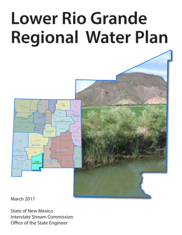
Lower Rio GrandeRegional Water PlanMarch 2017State of New MexicoInterstate Stream CommissionOffice of the State Engineer
Cover photograph: Tonuco Drain, Tonuco Mountains south of Rincon, north ofRadium Springs, New Mexico
Table of ContentsExecutive Summary . ES-11. Introduction . 12. Public Involvement in the Planning Process . 42.1 The New Mexico Interstate Stream Commission’s Role in Public Involvement in theRegional Water Plan Update Process . 42.2 Public Involvement in the Lower Rio Grande Region Planning Process. 62.2.1 Identification of Regional Steering Committee Members . 62.2.2 Regional Water Plan Update Meetings . 92.2.3 Current and Future Ideas for Public Outreach during Implementation of theRegional Water Plan Update. 133. Description of the Planning Region . 133.1 General Description of the Planning Region. 133.2 Climate . 143.3 Major Surface Water and Groundwater Sources. 143.4 Demographics, Economic Overview, and Land Use . 164. Legal Issues . 164.1 Relevant Water Law. 164.1.1 State of New Mexico Law . 164.1.2 State Water Laws and Administrative Policies Affecting the Region . 324.1.3 Federal Water Laws . 354.1.4 Tribal Law . 374.1.5 Local Law . 384.2 Relevant Environmental Law. 404.2.1 Species Protection Laws . 404.2.2 Water Quality Laws . 424.3 Legal Issues Unique to the Region and Local Conflicts Needing Resolution . 484.3.1 Ongoing or Threatened Litigation that May Affect Water Management . 484.3.2 Local Conflicts Needing Resolution . 484.3.3 Legal Issues Unique to the Region . 485. Water Supply . 495.1 Summary of Climate Conditions. 535.1.1 Temperature, Precipitation, and Drought Indices . 535.1.2 Recent Climate Studies . 635.2 Surface Water Resources . 645.3 Groundwater Resources . 755.3.1 Regional Hydrogeology . 755.3.2 Aquifer Conditions . 84Lower Rio Grande Regional Water Plan 2017i
5.4 Water Quality . 885.4.1 Potential Sources of Contamination to Surface and Groundwater . 935.5 Administrative Water Supply. 1115.5.1 2010 and 2060 Administrative Water Supply . 1115.5.2 Drought Supply . 1156. Water Demand . 1186.1 Present Uses . 1196.2 Demographic and Economic Trends . 1236.3 Projected Population Growth . 1266.4 Water Conservation. 1286.5 Projections of Future Water Demand for the Planning Horizon . 1356.5.1 Water Demand Projection Methods . 1356.5.2 Lower Rio Grande Projected Water Demand . 1397. Identified Gaps between Supply and Demand . 1408. Implementation of Strategies to Meet Future Water Demand . 1438.1 Implementation of Strategies Identified in Previously Accepted Regional Water Plan . 1458.2 Water Conservation. 1458.3 Proposed Strategies (Water Programs, Projects, or Policies). 1458.3.1 Comprehensive Table of Projects, Programs and Policies . 1468.3.2 Key Strategies for Regional Collaboration . 1498.3.3 Key Program and Policy Recommendations . 152References .164Lower Rio Grande Regional Water Plan 2017ii
List of Figures1-1Location of Lower Rio Grande Water Planning Region. 23-1Regional Map . 153-2Land Ownership . 194-1NMOSE-Declared Groundwater Basins and Groundwater Models . 335-1Climate Stations . 555-2Average Temperature, Jornada Exp Range and State University Climate Stations. 575-3Average Annual Precipitation (1980 to 2010) . 585-4Annual Precipitation, Jornada Exp Range and State University Climate Stations . 595-5Snow Depth and Snow Water Equivalent for April . Not applicable5-6Palmer Drought Severity Index, New Mexico Climate Divisions 5 and 8 . 615-7Major Surface Drainages, Stream Gages, Reservoirs, and Lakes . 665-8Minimum and Median Yield 1950 through 2013 . 705-9aAnnual Streamflow for Selected Gaging Stations on the Rio Grande . 715-9bAnnual Streamflow for Selected Gaging Stations on the Rio Grande . 725-10a Geology and Physiographic Provinces . 805-10b Geology Explanation . 815-11U.S. Geological Survey Wells and Recent Groundwater Elevation Change . 855-12Hydrographs of Selected Wells . 865-13Water Quality-Impaired Reaches . 905-14Potential Sources of Contamination. 966-1Total Regional Water Demand by Sector, 2010 . 1206-2Groundwater Points of Diversion . 1227-1Available Supply and Projected Demand . 1428-1Key Strategies and Regional Values for the Lower Rio Grande Region .144Lower Rio Grande Regional Water Plan 2017iii
List of Tables2-1Steering Committee Members, Lower Rio Grande Water Planning Region . 82-2Lower Rio Grande Region Public Meetings . 103-1Summary of Demographic and Economic Statistics for the Lower Rio Grande WaterPlanning Region . 175-1Lower Rio Grande Climate Stations . 545-2Temperature and Precipitation for Selected Climate Stations, Lower Rio Grande WaterPlanning Region . 565-3Palmer Drought Severity Index Classifications . 605-4aUSGS Stream Gage Stations . 675-4bUSGS Stream Gage Annual Statistics for Stations with 10 or More Years of Record . 685-5USGS Stream Gage Average Monthly Streamflow for Stations with 10 or More Years ofRecord . 695-6Reservoirs and Lakes (greater than 5,000 acre-feet) Supplying the Lower Rio Grande WaterPlanning Region . 745-7Dams with Dam Safety Deficiency Rankings. 765-8Total Maximum Daily Load Status of Streams in the Lower Rio Grande Water PlanningRegion . 915-9Municipal and Industrial NPDES Permittees in the Lower Rio Grande Water PlanningRegion . 955-10Groundwater Discharge Permits in the Lower Rio Grande Water Planning Region . 975-11Superfund Sites in the Lower Rio Grande Water Planning Region . 1025-12Leaking Underground Storage Tank Sites in the Lower Rio Grande Water Planning Region . 1035-13Landfills in the Lower Rio Grande Water Planning Region . 1085-14Projected Groundwater Supply in Closed Basins within Doña Ana County in 2060, Based onObserved Rate of Decline . 1135-15Projected Drought Groundwater Supply in the Closed Basins of the Lower Rio GrandeWater Planning Region in 2060 . 117Lower Rio Grande Regional Water Plan 2017iv
6-1Total Withdrawals in the Lower Rio Grande Water Planning Region in 2010 . 1196-2Comparison of Projected and Actual 2010 Population . 1266-3Lower Rio Grande Water Planning Region Population Projections July 1, 2010 to July 1,2060 . 1276-42010 Water Withdrawals for Drinking Water Supply Systems and Rural Self-SuppliedHomes . 1296-5Projected Water Demand, 2020 through 2060 Lower Rio Grande Water Planning Region . 1397-1Water Use and Estimated Availability in the Lower Rio Grande Water Planning Region. 1438-1Implementation Status of Strategies Identified in Accepted Plan, Lower Rio Grande WaterPlanning Region . 1468-2New Project, Policy or Program Ideas Gathered During the Regional Water Plan UpdateProcess . 1508-3Key Collaborative Programs, Projects, and Policies, 2017 Lower Rio Grande RegionalWater Plan. 153List of Appendices2-AMaster Stakeholder List2-BSingle Comment Document: Summary of Comments on Technical and Legal Sections2-CPublic Input, Interviews and Surveys6-AEnvironmental Water Demand Statement6-BList of Individuals Interviewed6-CProjected Population Growth Rates, 2010 to 20408-ARecommended Projects, Programs, and PoliciesNote: Appendix designations indicate corresponding section in planLower Rio Grande Regional Water Plan 2017v
List of Acronyms Fdegrees Fahrenheitac-ft/yrAMOAWRMacre-feet per yearAtlantic multidecadal oscillationActive Water Resource ManagementBBERBLMBureau of Business and Economic ResearchBureau of Land ManagementCERCLAcfscfu/100 mLCIDCRRWUACWAComprehensive Environmental Response, Compensation, and Liability Actcubic feet per secondcolony-forming units per 100 millilitersCarlsbad Irrigation DistrictCamino Real Regional Water Utility AuthorityClean Water ActDBS&ADWSDaniel B. Stephens & Associates, Inc.Domestic Well StatuteEPAESAU.S. Environmental Protection AgencyEndangered Species ActFEMAft bgsFYFederal Emergency Management Agencyfeet below ground surfacefiscal yearGISgpcdgpmGWQBgeographic information systemgallons per capita per daygallons per minuteGround Water Quality Bureau [New Mexico Environment Department]ICIPIPCCInfrastructure Capital Improvement PlanIntergovernmental Panel on Climate ChangeMCLMCLGMDWCAmgdMSGPmaximum contaminant levelmaximum contaminant level goalmutual domestic water consumers associationmillion gallons per dayMulti-Sector General PermitNASSNCDCNational Agricultural Statistics ServiceNational Climatic Data CenterLower Rio Grande Regional Water Plan 2017vi
SNPLNRCSNWSNational Environmental Policy ActNew Mexico Administrative CodeNew Mexico Bureau of Geology & Mineral ResourcesNew Mexico Environment DepartmentNew Mexico Interstate Stream CommissionNew Mexico Office of the State EngineerNew Mexico Statutes AnnotatedNew Mexico State UniversityNew Mexico Water Quality Control CommissionNational Oceanic and Atmospheric AdministrationNational Pollutant Discharge Elimination SystemNational Priorities ListNatural Resources Conservation ServiceNational Weather ServicePDOPDSIPPPPSTBPVACDPacific decadal oscillationPalmer Drought Severity Indexproject, program, and policyPetroleum Storage Tank Bureau (NMED)Pecos Valley Artesian Conservancy DistrictRWPregional water planSDWASSPASWCDSafe Drinking Water ActS.S. Papadopulos & Associates, Inc.soil and water conservation districtTDSTMDLtotal dissolved solidstotal maximum daily loadU.S. EPAUNMUSBRUSDAUSFWSUSGCRPUSGSUSTUWBU.S. Environmental Protection AgencyUniversity of New MexicoU.S. Bureau of ReclamationU.S. Department of AgricultureU.S. Fish and Wildlife ServiceU.S. Global Change Research ProgramU.S. Geological Surveyunderground storage tankunderground water basinWQAWRCCWRRIWater Quality Act (New Mexico)Western Regional Climate CenterWater Resources Research InstituteLower Rio Grande Regional Water Plan 2017vii
Executive SummaryThe Lower Rio Grande Water Planning Region, which includes all of Doña Ana County(Figure ES-1), is one of 16 water planning regions in the State of New Mexico. Regional waterplanning was initiated in New Mexico in 1987, its primary purpose being to protect New Mexicowater resources and to ensure that each region is prepared to meet future water demands.Between 1987 and 2008, each of the 16 planning regions, with funding and oversight from theNew Mexico Interstate StreamCommission (NMISC), developed a planto meet regional water needs over theensuing 40 years. The Lower Rio GrandeRegional Water Plan was completed andaccepted by the NMISC in 2003.The purpose of this document is toprovide new and changed informationrelated to water planning in the Lower RioGrande region and to evaluate projectionsof future water supply and demand for theregion using a common technicalapproach applied to all 16 planningregions statewide. Accordingly, thisregional water plan (RWP) updatesummarizes key information in the 2003plan and provides updated informationregarding changed conditions andadditional data that have becomeavailable.Figure ES-1. Lower Rio Grande Water Planning RegionBased on updated water use (Figure ES-2) data from 2010, Figure ES-3 illustrates the totalprojected regional water demand under high and low demand scenarios, and also shows theadministrative water supply and the drought-adjusted water supply. The administrative watersupply is based on 2010 withdrawals of water and is an estimate of future water supplies thatconsiders both physical availability and compliance with water rights policies. The Lower RioGrande planning region includes several mined basins that could be impacted by reductions torecharge resulting from long-term drought. The region also relies on surface water supplies thatare vulnerable to drought. Also important is the predicted decline of the aquifers in the closedbasins due to continued pumping. The estimated shortage in 2060 during a drought year isexpected to range from 217,000 to 243,000 acre-feet. The Lower Rio Grande region would liketo see a balanced approach to dealing with these shortfalls by promoting regional values (such aspreserving the agriculture industry, sustaining rural communities, and restoring the river) whileLower Rio Grande Regional Water Plan 2017ES-1
increasing and protecting supply (through desalination, pollution control, and stormwatercapture) and reducing and managing demand (through adjudication of water rights andimproving system efficiency).0.4%9%2%0.1%1%Commercial (self-supplied)Domestic (self-supplied)Industrial (self-supplied)Irrigated agricultureLivestock (self-supplied)Mining (self-supplied)87%Power (self-supplied)Public water supplyReservoir evaporationTotal usage: 449,996 acre-feetFigure ES-2. Total Regional Water Use, 2010500,000450,000Administrativewater supplySupply / Demand (acre-feet)400,000350,000300,000250,000Severe droughtadjusted andphysically limitedwater supply *200,000150,000100,00050,00002020High demand projectionLow demand projection2030204020502060* Based on the ratio of the minimum streamflow of record to the 2010 administrative watersupply and modeling conducted by the New Mexico Office of the State Engineer.Figure ES-3. Available Supply and Projected DemandLower Rio Grande Regional Water Plan 2017ES-2
Planning MethodFor this RWP, water supply and demand information was assessed in accordance with a commontechnical approach, as identified in the Updated Regional Water Planning Handbook: Guidelinesto Preparing Updates to New Mexico Regional Water Plans (where it is referred to as acommon technical platform) (Handbook). This common technical approach outlines the basisfor defining the available water supply and specifies methods for estimating future demand in allcategories of water use: The method to estimate supply (referred to as the administrative water supply in theHandbook) is based on withdrawals of water as reported in the New Mexico Water Use byCategories 2010 report prepared by the New Mexico Office of the State Engineer(NMOSE). Use of the 2010 data provides a measure of supply that considers bothphysical supply and legalrestrictions (i.e., the water isCommon Technical Approachphysically available for withdrawal,To prepare both the regional water plans and the stateand its use is in compliance withwater plan, the State has developed a set of methods forwater rights policies) and thusassessing the available supply and projected demandreflects the amount of waterthat can be used consistently in all 16 planning regionsin New Mexico. The objective of applying thisavailable for use by a region.common technical approach is to be able to efficientlydevelop a statewide overview of the balance betweensupply and demand in both normal and droughtconditions, so that the State can move forward withplanning and funding water projects and programs thatwill address the State’s pressing water issues. An estimate of supply during futuredroughts is also developed byadjusting the 2010 withdrawal databased on physical supplies availableduring historical droughts. Projections of future demand in nine water use categories are based on demographic andeconomic trends and population projections. Consistent methods and assumptions foreach category of water use are applied across all planning regions.Public InvolvementThe updated Handbook specifies that the RWP update process “shall be guided by participationof a representative group of stakeholders,” referred to as the steering committee. Steeringcommittee members provided direction for the public involvement process and relayedinformation about the planning effort to the water user groups they represent and other concernedor interested individuals.In addition to the steering committee, the water planning effort included developing a masterstakeholder list of organizations and individuals interested in the water planning update. This listwas developed from the previous round of water planning and then expanded through efforts toLower Rio Grande Regional Water Plan 2017ES-3
identify representatives from water user groups and other stakeholders. Organizations andindividuals on the master stakeholder list were sent announcements of meetings and the RWPupdate process and progress.Over the two-year update process, eight meetings were held in the Lower Rio Grande region.These meetings identified the program objectives, presented draft supply and demandcalculations for discussion and to guide strategy development, and provided an opportunity forstakeholders to provide input on the strategies that they would like to see implemented. Allsteering committee meetings were open to the public and interested stakeholders, andparticipation from all meeting attendees was encouraged.Key Water IssuesThe key water supply updates and issues currently impacting the Lower Rio Grande regioninclude the following: The Rio Grande stream system is fully appropriated. In general, any new water uses thatimpact the flow of the Rio Grande must be offset through return flow, the transfer ofexisting water rights, and/or supplementation by a new source of water. No mechanismis presently in place to allow transfers of Rio Grande Project water from the ElephantButte Irrigation District (EBID) to non-agricultural uses. Groundwater pumping and depletions in New Mexico and Texas impact the flows of theRio Grande and affect the operations of the Rio Grande Project. This issue continues tobe a source of controversy and conflict among New Mexico, Texas, the U.S. Bureau ofReclamation (USBR), and the two U.S. irrigation districts supplied by the Rio GrandeProject (EBID in New Mexico and El Paso County Water Improvement District #1[EPCWID#1] in Texas). In 2013 the State of Texas initiated a lawsuit in the U.S. Supreme Court over the RioGrande Compact, specifically water management and water use by New Mexico belowElephant Butte Dam, that names New Mexico and Colorado as defendants. The UnitedStates has joined in this lawsuit. The outcome of this lawsuit, whether through settlementor court order, may have significant impacts on water management in the Lower RioGrande region. An Operating Agreement for the Rio Grande Project was finalized in 2008 as part of thesettlement of litigation between EBID, EPCWID #1, and USBR in Texas Federal DistrictCourt and has been implemented since that time. Implementation of this agreement hasreduced EBID’s allocation of Rio Grande Project water in full-supply years by more than150,000 acre-feet, and this large decrease has led to increased dependence ongroundwater for farmers seeking to utilize their adjudicated water rights. Many questionsLower Rio Grande Regional Water Plan 2017ES-4
persist regarding the fairness and sustainability of the Operating Agreement as it has beenimplemented. The New Mexico Attorney General sued the USBR in 2011 regarding thisOperating Agreement and the USBR’s unauthorized release of New Mexico Compactcredit water in Elephant Butte Reservoir to EPCWID#1. The judge in the case hasstayed, or suspended, any action in this lawsuit pending action by the U.S. SupremeCourt in Texas v. New Mexico, Original No. 141. Continued conflict associated with thisAgreement is likely. Under the National Environmental Policy Act, on January 4, 2017, the Bureau ofReclamation issued a Record of Decision (ROD) implementing one of the alternatives itexamined in its Final Environmental Impact Statement on the 2008 OperatingAgreement. The alternative adopted provides for continued Rio Grande Projectoperations under the terms of the 2008 Operating Agreement. The outcome implementedby the ROD remains controversial and should continue to be monitored as it relates towater supply in the region. Recent drought and high levels of groundwater pumping may cause increasedconcentration of salts in the soils and aquifers of the Rincon and Mesilla valleys, andincreased groundwater salinity may limit the usefulness of this water for someapplications in the future. The demand for water in the Lower Rio Grande region has increased through time due toincreasing population and increasing cultivation of high-water-demand crops such asalfalfa and pecans. The population of the Lower Rio Grande planning region is expected to expand fromapproximately 209,000 in 2010 to almost 350,000 in 2060. The increasing demandfor municipal water is likely to result in water rights transfers from agriculturethrough willing seller-willing buyer agreements. The great majority of water use in the Lower Rio Grande surface water basin is forirrigation, but the feasibility of fallowing otherwise irrigated lands during droughtperiods is complicated by the fact that about 30 percent of irrigated lands in theLower Rio Grande basin are planted in permanent crops such as pecan orchards thatwould be severely stunted or lost if not irrigated.Salinity of Rio Grande Project water has long been a source of controversy between NewMexico and Texas. In 2008 the Rio Grande Compact Commission, together with NMISCand the New Mexico Environment Department (NMED), assisted in the formation of amulti-state Río Grande Project
PVACD Pecos Valley Artesian Conservancy District RWP regional water plan SDWA Safe Drinking Water Act SSPA S.S. Papadopulos & Associates, Inc. . The Lower Rio Grande Water Planning Region, which includes all of Doña Ana County (Figure ES-1), is one of 16 water planning regions in the State of New Mexico. Regional water