Transcription
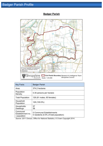
Committee and dateSouth Planning Committee25 September 2018Development Management ReportSummary of ApplicationApplication Number: 17/05303/MAWParish:Worfield & Rudge andClaverleyProposal: The phased extraction of sand and gravel, inclusive of mineral processing, allancillary works, equipment and associated infrastructure and progressive restorationSite Address: Land near Shipley, Bridgnorth Road, Shipley, ShropshireApplicant: JPE HoldingsCase Officer: Graham Frenchemail: planningdmc@shropshire.gov.ukRecommendation: Grant Permission subject to the conditions and legal obligations setout in Appendix 1.Figure 1: site locationREPORT1.THE PROPOSAL1.1The applicant JPE Holding Ltd is applying for full planning permission for the phasedextraction of sand and gravel from the Site with progressive restoration and aftercare.Contact: Tim Rogers (01743) 258773
Planning Committee – 25 September 2018Land near Shipley, Bridgnorth Road,Shipley, ShropshireThe current planning consent for mineral production from the company’s nearby quarryat Seisdon (circa 2.7km southeast of the Site) is due to end such that export of mineralmust cease by 31st December 2018. The company states that the current proposals willallow continuity of mineral supply to its established local markets following the closure ofSeisdon.1.2The Proposed Development’ comprises the phased extraction, processing and exportfrom Site of c.3.5 million tonnes of saleable sand and gravel aggregate (the total amountexcavated would be 4.13mt but this would be reduced by mineral processing). Themineral would be exported from the site at an average annual rate of c.250,000 tonnes.Mineral production would last for a period of c.14 years, with an initial preparatory periodof up to 1 year and a final c. 2 year restoration period. Initial works would involveformation of screening mounds around the periphery of the site and installation of theplant site, access road and related infrastructure.1.3The applicant states that the deposit is geologically similar to that at Seisdon and wouldbe capable of supplying the same market. Around 50% of the reserve is fine to very finebuilding sand. This can be used for mortar and as plastering sand which comprises acore part of the applicant’s existing trade from Seisdon Quarry. Around 25%-30% isestimated to be sharp (coarse) sand for use primarily in concreting and asphalt products.The rest of the reserve would produce 10mm, 20mm and 40mm gravel. The workablesand and gravel deposit falls mainly in central and eastern parts of the Site and rangesup to 30m deep in places, averaging 17.9m. The western part of the site does not containworkable mineral. The maximum extraction depth of 106m AOD would only occur over3 hectares and this would remain over 10m above the regional groundwater table whichfluctuates between 93mAOD – 96mAOD. Working gradients at the edge of the extractionarea would not exceed 1 in 3.1.4The equipment used at the Site would primarily consist of long-arm excavators (around2 no.), backacters (around 2 no.), front-loaders (around 4 no.), articulated trucks (around3 no.), static wash plant, and (mobile) mineral processing plant. Provision may also bemade for a conveyor to aid in the transport of material across the Site. If required, thiswould be established during the middle of the operational time period. No blasting wouldbe required. A new access route connecting to the A454 Bridgnorth Road would beplaced in a shallow cutting near the southern boundary of the site and would includewheel wash facilities.1.5The mineral processing and wash plant and mineral stocking areas would be establishedon lower land within the western margin of the Site. The primary processing methodwould be screening. Any requirement for crushing would be undertaken infrequently /intermittently on a campaign basis. Topsoil and subsoil storage mounds and overburdenstocks would be established according to the phasing of operations. Soil makingmaterials would also be saved for use in restoration. Soils would be replaced to anaverage depth of 1.5-2m across the site. Freshwater and silt lagoons would facilitatewater storage and processing operations.1.6The site would be restored progressively to a combination of agricultural land, with natureconservation interest and enhanced habitat diversity including species rich grassland,acid grassland / heath mosaic and woodland. The amount of best and most versatileagricultural land would remain unchanged. No importation of material would be required.Contact: Tim Rogers (01743) 258773
Planning Committee – 25 September 2018Land near Shipley, Bridgnorth Road,Shipley, ShropshireProposed hours of operation would be between 7am and 6pm Monday to Friday andbetween 7am to 1pm on Saturdays, similar to those permitted at Seisdon Quarry.1.7All vehicle access would be via the A454 Bridgnorth Road. The access proposals allowfor a right turn lane and improvements to the junction layout with the A454. All works canbe undertaken on publicly owned highways land under the jurisdiction of ShropshireCouncil Highways. The proposals are likely to result in an average of circa 96 individualHGV movements on average (48 return movements) per operational day assumingstandard 20 tonne loads, 48 week working year and 5½ day working week.1.8Environmental Statement: The application is supported by an Environmental ImpactAssessment (EIA) which considers matters including noise, dust / air quality, traffic,ecology, landscape, soils, cultural heritage and the water environment. A ScopingOpinion issued by Shropshire Council on 16th August 2016 (ref: 16/01952/SCO) providesadvice on the scope and content of any Environmental Statement. The applicant’sEnvironmental Statement concludes that the proposed development is unlikely to resultin any significant adverse environmental impacts. Following the initial planningconsultation process additional information was requested by the Planning Authorityunder Regulation 25 of the 2017 EIA Regulations and this has been the subject of furtherplanning consultations. Matters addressed by the Environmental Statement areconsidered in section 6 below.2.SITE LOCATION / DESCRIPTION2.1The Site (NGR SO 81533 96443) is located within the Green Belt on the easternboundary of Shropshire (see figure 1). It is 2km south-southwest of the Staffordshirevillage of Pattingham, c.5km west-southwest of Wolverhampton and c. 9km eastnortheast of Bridgnorth. The Site will have direct access on to the A454 Bridgnorth Roadwhich links Bridgnorth to Wolverhampton. The planning application area totals 44.53haof agricultural land, of which 23ha would be subject to mineral extraction operations.2.2Currently the site comprises a mix of arable and pasture uses. Land use to the immediatesouth of the Site comprises agricultural land and a residential dwelling (Naboth’sVineyard). The residential curtilage of the property is located 90m south of the edge ofthe landscaped edge of the quarry site and 130m south of the proposed extraction limit.A paddock owned by the property shares a boundary with the application site. A propertyknown as Ridge View is located on the north side of the A454 some 280m east of theproposed site access. The hamlet of Shipley, Shipley Hall and Thornescroft Restaurantare located approximately 0.5km southwest and west of the Site’s boundary. Land useto the southeast of the Site comprises agricultural land, the Gardenland’s Garden Centre(Wyevale Nurseries), Walford and North Shropshire College and a residential property.Land use to the north comprises a large block of mixed woodland (‘Alder Coppice’,known locally as Cannebuff) and agricultural land. Other scattered development primarilyfollows the A454 Bridgnorth Road and adjoining roads, including farmsteads andcommercial farming buildings.2.3The landform of the Site comprises a gently undulating south facing slope, which leadsup to the localised highpoint of ‘Cannebuff’ north of the Site. Ground levels vary betweenapproximately 115mAOD in the south west and 136m AOD at the northern site boundary.There are no public rights of way within the site and no statutory designations, other thanContact: Tim Rogers (01743) 258773
Planning Committee – 25 September 2018Land near Shipley, Bridgnorth Road,Shipley, ShropshireGreen Belt, though an area of ancient woodland is located to the immediate north. TheSite is on a major aquifer and within a total catchment protection zone.3.REASON FOR COMMITTEE DETERMINATION OF APPLICATION3.1The proposals comprise Schedule 1 EIA development and the Council’s Scheme ofDelegation requires that such applications are determined by the Committee.4.COMMUNITY REPRESENTATIONS4.1aClaverley Parish Council (26/02/18): Objection. The following comments are made:i.Hydrology: Hydrological changes may substantially alter ground water and surface waterquantity and quality. The supply of water to individual boreholes, pools and businessescould be seriously affected and there is great concern about the sustainability of the moatand monastic fish pool at the Grade I Listed Ludstone Hall as a result of the disturbanceto the water table as it is a site source to Claverley Brook. There has been a precedentwith regards to hydrology disturbance in the parish. When Hilton bore hole was sunk itresulted in mains water having to be supplied to two thirds of the parish as private watersupplies dried up. Because of the serious implications for private water supplies, anindependent hydrology report should be obtained prior to determination of this planningapplication.ii.Road safety: The significant increase in traffic from the proposed development wouldexacerbate the safety risks along the A454 which is a very busy road. The proposedentrance to the site is close to the entrance to Naboths Vineyard which will pose ahazard. The report on the local road network contains inaccuracies and uses out of datedata. The Parish Council fears the estimate of 100 lorry movements per day is likely tobe exceeded and there would also be additional vehicles movements to and from theproposed site. The number of slow moving agricultural vehicles pulling out on to the A454adds to the impact on the safety of road users. The likelihood of mud being left on theroad as the lorries leave the site is another concern.iii.Archaeology: As this is a site of archaeological interest, the Parish Council is concernedthe proposed development could have an adverse effect on the site and supports thecomments of 23/11/2017 made by Shropshire Council Archaeology (HistoricEnvironment) that an archaeology field evaluation of the proposed site be undertakenand submitted to the Local Planning Authority prior to the planning application beingdetermined.iv.Damage to ancient woodland and wildlife: The Parish Council is concerned the proposeddevelopment would have a detrimental impact on the ancient woodland with a damagingeffect on the woodland ecosystem. Protected animal species would be at risk. The ParishCouncil supports the contents of the Woodland Trust's letter of objection dated18/12/2017 which states a minimum boundary of 50m between the woodland and theproposed site with a suggested boundary of 100m in order to protect the ancientwoodland from disturbance and pollution.v.Noise and Dust Pollution: The Parish Council is concerned about the inevitable effectsof noise and dust on those living and working in the vicinity of the proposed site.Contact: Tim Rogers (01743) 258773
Planning Committee – 25 September 2018Land near Shipley, Bridgnorth Road,Shipley, Shropshirevi.In conclusion, Claverley Parish Council considers this inappropriate development in theGreen Belt. The proposed site has not been allocated as being a preferred site for theextraction of sand and gravel in Shropshire Council's SAMDev Plan and both Shropshireand Staffordshire Councils have sufficient sites to supply sand and gravel. No specialcircumstances have been put forward to justify approval and Claverley Parish Councilconsiders this application should be refused. Claverley Parish Council would like torequest a site visit is arranged for members of the Planning Committee beforedetermination of this planning application.4.1b.(Comments 14/06/18) Councillors believe that this will have a significant impact upon thevolume of traffic that will use the A454 Bridgnorth to Wolverhampton Road. This the veryroad which is under consideration in conjunction with application 17/05303/MAW.Councillors have already expressed concern that the proposal by JPE Holdings, ifgranted, will generate a very high number of vehicle (both lorry and other vehicle)movements per day. This alone gives rise to our belief that this road which is alreadyheavily used and dangerous will have this danger factor intolerably amplified. This isinevitable, given that there are numerous entry and exit points on this stretch of road andthat the proposed access to the site is on a blind portion of the road. The prospect of theconstruction of the Orbital Road, points up even more concern. This section of the A454will effectively become a “feeder road” to the new motorway. The traffic movements willincrease well beyond that which we currently experienced. Councillors of Worfield &Rudge of firmly of the opinion that this new (resurrected) plan to proceed with thecompletion of the Orbital Road cannot be ignored in the consideration of 17/05303/MAW.They would urge you to consider this latest Highway information when the application istaken.4.1c.(Comments 17/07/180 Claverley Parish Council continues to object to this application onthe following grounds:i.Need for Aggregates: Claverley Parish Council has seen no evidential needdemonstrated for the sand and gravel from this quarry application:- Site is not in current SamDev as a preferred abstraction site- Shropshire minerals land bank exceeds annual demand for more than the required7 years ( and this is before Woodcote Wood site being granted approval for 2.25million tons).- South Staffs has a 12 year supply and to quote their consultation document "thecessation of sand and gravel supply at Seisdon Quarry can be meet from alternativesources within Staffordshire"- Over supply could affect economic viability of existing quarry sites.ii.Hydrology: The second hydrology report commissioned by the applicant also does notknow where the water that flows from Grange Farm adjacent to the application sitecomes from. This water is a site source tributary for the Grade I Listed Ludstone Hallpools, moat and Claverley Brook. Further unexplained points are:- No operational daily water volume requirements for dust suppression, sand washing,wheel washing, etc provided.- No information as to where operational water is coming from.Contact: Tim Rogers (01743) 258773
Planning Committee – 25 September 2018-Land near Shipley, Bridgnorth Road,Shipley, ShropshireNo impact assessment on the local hydrology of the removal of 4.25 million tons ofpressure from above the ground water aquifer (3.5 million tons aggregates / 0.75 mtspoil)iii.Ancient Woodland: The removal of the one side of this hill top adjacent to the ancientwoodland effectively under cutting it would leave it literally high and dry.iv.Visual Impact: The site viewed from the eastern side from the A454 between FurnessGrange Farm entrance and Bennets Lane is the first view of Shropshire for visitors anddaily commuters. From this elevated position no screening measures will be effective tohide this scar on the horizon topped off with the sand and gravel screening machinery4.2aWorfield & Rudge Parish Council 05/02/18 (adjacent parish): Objection. The followingcomments are made:i.Quality of Paperwork: We are concerned that some of the factual information and dataused in the reports issued in the presentation of this application contain multipleinaccuracies and out of date facts. This is particularly apparent in the report on LocalRoad Network. Comparisons are drawn which are inequitable. See the Air Qualityevaluation which fails to differentiate between industrial and agricultural environment.The reports are inadequate in defining the impact on the A454. This applies both in termsof a heavy increase in lorry movements on and off this road due to site traffic and to theessential need to consider the design of the access road. These factors will have animportant and considerable impact on road safety. (Please note the incorrect statementthat the speed is limited to 50mph at the site entrance. The actual limit being currentlyset at 60mph). The numerous inaccuracies that we can see must indicate that thesupporting documents should be regarded as unreliable and might be considered asbeing deliberately misleading. Based upon the above, Councillors have concern for theintegrity of the other many reports which focus on the various important informationtopics that are presented by the applicant. Councillors suspect that the figures for lorrymovements on and off this site are “conservative” to say the least. Traffic surveys atother similar sites, some of which are smaller in scale, demonstrate a very muchincreased level of activity. The economics of the operation of such a site would lead usto believe that there would be in excess of the stated number of vehicle movements perday generated. The figures stated in the application are deliberately intended to reducethe worry about road safety on the A454. Please see further criticism at item 3 below).ii.Effect on water supply and water table: This topic must be considered in two importantaspects. First it should be noted that a number of households in the vicinity of this areaderive their entire water supply from bore holes. It is crucial that there should be nodetriment to this water supply as a result of 17/05303/MAW.Second - Feed from streams and underground sources also sustain the viability of manywater features, ponds and wildlife habitat. This will affect several properties. One of thesewhich is of note, being the moat at Historic Ludstone Hall. This rare Grade I listedproperty (the moat is also listed) must be preserved. The effect upon the springs andunderground aquafers from the disturbance which will be caused by the proposedprocess of mineral extraction will inevitably have consequences for the sustainability ofthese ponds and pools.Contact: Tim Rogers (01743) 258773
Planning Committee – 25 September 2018Land near Shipley, Bridgnorth Road,Shipley, Shropshireiii.Road safety: The application indicates that there will be some 100 lorry movements perday to and from this site. We dispute this figure as being deceptively low. There will alsobe other car and smaller vehicle traffic which will be generated. The entrance to the siteis via the A454 close to the current entrance to Naboths Vineyard. This constitutes anappreciable hazard to road users. The main road at this point is a de-restricted, verybusy, “A” class road. Shortly beyond this junction traveling east, the speed is limited to50 miles per hour. The reason for this restriction (on the Staffordshire side of the countyboundary) is because of a proven high risk roadway which has been the cause ofnumerous RTA’s in the past. The danger spots being the cross road at The Fox atShipley and the two drives which serve the garden centre. Indeed at the proposedentrance to this proposed new facility it is noteworthy that the road is blind in the easterndirection because of the contour of the terrain. On the western approach along the A454this council has in the past pointed out the hazardous junction at the bottom of Red Hillat Rudge Road crossroads. It would be timely to acknowledge the hazard faced bydrivers entering into and exiting from The Inn at Shipley. This restaurant has twin drivesand sits in close proximity to the entrances of six other properties. All these causeconcern for the inexperienced and experienced driver alike. All of these hazards – bothin Shropshire and on the Staffordshire side of the county boundary will definitely be mademore dangerous with the addition of traffic which will be incumbent upon the operationof a quarry. It should be noted that there will be an increase in the lorry traffic on all localroads as a consequence should this application is granted. Many of these roads areentirely unsuitable for heavy lorries. Currently great impact is felt on these roads as aconsequence of the agricultural harvest. This would still also have to be accommodatedin addition to the additional lorry traffic created. All this would make an existingdangerous road even more dangerous for all road users. It is hoped that these concernswill be noted when consideration of the proposed use of this position to access the sitefor such a high volume of traffic which will be a factor every working day of the plant.iv.Noise and dust pollution: It is an inevitable consequence of the operation of a plant suchas this that there will be a problem with both noise and dust. This is an irrefutable fact.Those who dwell, farm, or trade within the vicinity will be affected by these two problems.This causes concern for councillors.v.Historic importance: The site has proved to be of great archaeological and historicinterest. It is a heritage site where many ancient artefacts have been found on the land.It is important that this great legacy is not lost in a questionable commercial frameworkwhich is probably providing the driving force behind the application.vi.Restoration and landscaping: The application sets out the time line for the use of theproposed facility. It also includes information about the restoration and landscaping atthe completion of the operation. Councillors and electors need to be able to be confidentthat should this application be successful that these pledges be carried out with diligence.This is prime rural landscape, coupled with this historic and archaeological significancerespect must be insisted upon in order to inflict as little harm as possible.vii.It must be noted that at the time of a public meeting to consider this application, held on4th January, it was noted that many householders reported that they had not beencorrectly informed and felt that they were being denied an opportunity to make their viewsknown in the normal planning procedure.Contact: Tim Rogers (01743) 258773
Planning Committee – 25 September 2018Land near Shipley, Bridgnorth Road,Shipley, Shropshire4.2bWorfield & Rudge Parish Council 14/06/18 further comments.At the June meeting of Worfield & Rudge Parish Council it was noted with interest thatthe scheme to construct the Western Orbital Link Road has returned to the agenda.Councillors believe that this will have a significant impact upon the volume of traffic thatwill use the A454 Bridgnorth to Wolverhampton Road. This the very road which is underconsideration in conjunction with application 17/05303/MAW. Councillors have alreadyexpressed concern that the proposal by JPE Holdings, if granted, will generate a veryhigh number of vehicle (both lorry and other vehicle) movements per day. This alonegives rise to our belief that this road which is already heavily used and dangerous willhave this danger factor intolerably amplified. This is inevitable, given that there arenumerous entry and exit points on this stretch of road and that the proposed access tothe site is on a blind portion of the road. The prospect of the construction of the OrbitalRoad, points up even more concern. This section of the A454 will effectively become a“feeder road” to the new motorway. The traffic movements will increase well beyond thatwhich we currently experienced. Councillors of Worfield & Rudge of firmly of the opinionthat this new (resurrected) plan to proceed with the completion of the Orbital Road cannotbe ignored in the consideration of 17/05303/MAW. They would urge you to consider thislatest Highway information when the application is taken.4.3Pattingham & Patshull Parish Council (Adjoining parish). Object for the followingreasons:- The quarry application does not meet with South Staffs, or Shropshire DistrictCouncil Site Allocations and Management of Development Plan. Land at Shipleydoes not feature in sand & gravel reserves and this application can only be viewedas a commercial opportunity.- Increase in heavy lorries on a dangerous stretch of A road with a risk of quarry lorriestaking short cuts through local villages like Pattingham or along Burnhill Green Road.- Dust hazard, noise and air pollution, specifically to nearby homes.- Hydrology reports are not sufficient. Natural springs and water courses will beaffected and some nearby homes rely on bore holes for their water supply.- Too close to ancient woodland at Cannebuff and the impact on wildlife and naturalhabitats.4.4Environment Agency (15/12/17): No objection. The following comments are made:i.Site context: The site is located upon an isolated sand and gravel deposit (glacio-fluvialdeposits) which is classed as a Secondary A aquifer. The superficial gravel is underlainmostly by the Kidderminster Formation (gravelly sandstone) bedrock, with a small areaunderlain by the Bromsgrove Sandstone in the west beyond a fault. Both formations areclassed as Principal Aquifers. The site sits within a Source Protection Zone (SPZ) III(total catchment). This site is located above a Water Framework Directive (WFD)groundwater body, WFD drinking water protected area and is within 400m of a surfacewatercourse. The site is considered to be of high sensitivity and could present potentialpollutant/contaminant linkages to controlled waters. The site falls within theWorcestershire Middle Severn CAMS (Catchment Abstraction Management Strategy)with the Kidderminster Formation making up the Wombourne GWMU (GroundwaterManagement Unit). There is no water available for new abstractions from the sandstone.The proposed mineral extraction presents a risk to groundwater which is particularlysensitive in this location because the proposed development site is within SPZ 3 and islocated upon Principal Aquifer. The maximum depth of excavation is proposed to beContact: Tim Rogers (01743) 258773
Planning Committee – 25 September 2018Land near Shipley, Bridgnorth Road,Shipley, Shropshirelimited to 106m AOD and will operate with a significant freeboard above the water tablebased on the information provided. However, in contrast to the above, the EnvironmentalRisk Assessment (Table 9.5) states that this is only proposed as an initial working depth,with the final working depth to be agreed after operational monitoring, with a minimum2m buffer zone. As suggested by the applicant, we would recommend that you imposea condition to secure the maximum initial working depth to a level of 106 m AOD. AMonitoring scheme condition could be imposed to provide ongoing operational evidenceto confirm the water level which may require/enable the final working depth to beamended.ii.Potential Impact upon shallow/perched water table: Your EIA scoping letter identifies theneed to consider possible drawdown effects in any shallow/ perched water tables, springlines etc. The ES confirms that as the site will not be wet worked and only perched wateris likely to be affected by quarry activities the potential risk to local groundwaterabstractions is consider to be minimal (low risk). While the report has confirmedconsultation with your Council for the private water supply records, it is not clear to whatextent local residents have been contacted with regard to possible unlicensedabstractions, to support the above conclusion. Given the concerns raised by localresidents during public consultation and following a review of the information submitted,we would recommend that a water features survey be completed to consider all suchpossible abstractions (and any water features) located within 1km radius of theexcavation. This will inform a more robust EIA. These should be identified and detailsought to establish whether the abstraction is situated within the shallower Secondaryaquifer or deeper Principal aquifer. The data obtained should be used to revise theConceptual Site Model and hydrogeological impact assessment where necessary. Thiswill inform the final ES conclusion. Particular concerns were raised by a local residentabout spring-fed fish ponds and pools at Shipley Hall and Grange Farm to the southwest, therefore more detailed comments should be made by the applicant regardingpotential risks of derogation of these springs which are within the proposed workingdepth of the quarry. Further information should be provided to confirm the risk and anyavoidance/mitigation measures, including agreement for protection of such supplieswhere relevant and necessary.iii.Flood risk / water management: We have no comments on the FRA based on the locationwithin Flood Zone 1 (low probability of fluvial risk) based on our indicative flood map forplanning. We would recommend that you seek the views of your Flood and WaterManagement team with regard to surface water quantity (including climate changeallowance for peak rainfall) and other sources of flooding. We note the informationsubmitted confirms that “proposals (are) likely to retain more surface water in thelandscape at the site, thus flood risk outside the site not increased whilst protectingprevalent groundwater regimes”. Presumably the use of less permeable silt/clay fractionsin the low level restoration could increase runoff of surface water and potentially reducerecharge to the aquifer. We acknowledge the other water management systems asproposed in section 9.5.2.10 of the ES (chapter 9). Part of the mineral processingoperations will rely on a mains water supply, of which the used water will be whollyrecycled for re-use on Site with other operations. As no wet working is required there willbe no need for dewatering, aside from implementation of the permissible 20m3 deminimis daily abstraction rate.Contact: Tim Rogers (01743) 258773
Planning Committee – 25 Se
Shipley, Shropshire Contact: Tim Rogers (01743) 258773 The current planning consent for mineral production fromthethesitecompany's nearby quarry at Seisdon (circa 2.7km southeast of the Site) is due to end such that export of mineral must cease by 31st December 2018. The company states that the current proposals will