Transcription
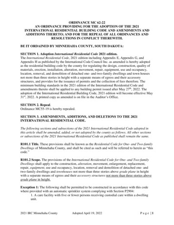
RECEIVEDby OAH on June 4, 2018ORDINANCE NO. 2018-5AN AMENDED ORDINANCE OF THE CITY OF BUFFALO, MINNESOTA ANNEXINGLAND LOCATED IN BUFFALO TOWNSHIP, WRIGHT COUNTY, MINNESOTA PURSUANTTO MINNESOTA STATUTES§ 414.033 SUBDIVISION 2(1) PERMITTING ANNEXATIONBY ORDINANCE FOR CITY OWNED PROPERTYWHEREAS, THE City of Buffalo is the fee owner of certain parcels of real propertylocated in Buffalo Township, all of which are legally described in the Exhibit Aattached hereto and incorporated herein, (collectively, the "Property" );WHEREAS, said parcels are unincorporated and abut the municipal limits of theCity of Buffalo;WHEREAS, one parcel of said property is located within a flood plain orshoreland area and the City's land use controls comply with Minn. St. Chapter103F;WHEREAS, the City Council of the City of Buffalo held a public hearing on thismatter on September 18, 2017 at 7:00 p.m. Written notice of the public hearingwas given by certified mail to the Township of Buffalo; andWHEREAS, the provisions of Minnesota Statutes§ 414.033 Subd. 13 are notapplicable annexations under Subd. 2( 1).NOW, THEREFORE, THE CITY COUNCIL OF THE CITY OF BUFFALO HEREBY ORDAINSAS FOLLOWS:1. The City Council hereby determines that the Property as hereinafterdescribed abuts the municipal limits of the City of Buffalo, is owned by the Cityof Buffalo, and is therefore urban or suburban in character or about to becomeso.
2. None of the Property is now included within the limits of any city, or in anyarea that has already been designated for orderly annexation pursuant toMinnesota Statute§ 414.0325.3. The corporate limits of the City of Buffalo , Minnesota, are hereby extended toinclude the Property described in Exhibit A attached hereto and incorporatedherein by reference.A copy of the corporate boundary map showing the Property to be annexedand its relationship to the corporate boundaries is attached hereto as Exhibit B.4. That the population of the area legally described and hereby annexed iszero.5. The parcels are tax exempt and no reimbursement for property taxes is dueto Buffalo Township.6. That pursuant to Minnesota Statutes§ 414.036 there are no specialassessments or debt incurred by the Town on the subject Property for whichreimbursement is required.7. That the City Administrator of the City of Buffalo is hereby authorized anddirected to file a copy of this Ordinance with the Municipal BoundaryAdjustment Unit of the Office of Administrative Hearings, the MinnesotaSecretary of State, the Wright County Auditor, and the Buffalo Township Clerk.8. That this Ordinance shall be in full force and effect and final upon the datethis Ordinance is approved by the Office of Administrative Hearings.
PASSED AND ADOPTED by the City Council of the City of Buffalo, Minnesota, this21st day of May, 2018.ATTEST:I·n T. Auger, City Administrator
EXHIBIT AAIRPORT PARCELSPIO: 202-000-332203The East 3/8 of NW ¼ of NW ¼ lying North of the South 453 feet and lying Westerly ofa line described as follows: Commencing at the NW corner of the E 3/8 of NW ¼ of NW¼, thence South along the West line 585.03 feet to the point of beginning, thenceSoutherly 8 29'22"Left a distance of 283.12 feet to the North line of the South 453 feetand there terminating. Section 33, Township 120, Range 25.Acreage: .14PIO: 202-000-332204The East 3/8 of NW¼ of NW¼ of Section 33, Township 120, Range 25, Wright County,Minnesota lying North of the South 453 feet except that part lying Westerly of a linedescribed as follows:Commencing at the NW corner of the E 3/8 of NW ¼ of NW ¼, thence South along theWest line of said East 3/8 of the NW¼ of NW¼, a distance of 585.03 feet to the actualpoint of beginning of the line to be described, thence Southerly deflecting 8 29'22" left adistance of 283.12 feet to the North line of said South 453 feet of the NW ¼ of the NW¼ and there terminating.Also that part of the North 7/10 of the West 5/8 of the NW1 /4 of the NW1 /4 of Section33, Township 120, Range 25, Wright County, Minnesota lying easterly of a line drawnsoutherly from a point on the north Line of said North 7/10 of the West 5/8 of the NW ¼of the NW¼ distant 87.29 feet West of the northeast corner of said North 7/10 of theWest 5/8 of the NW¼ of the NW¼ distant 585.03 feet south of the northeast corner ofsaid North 7/10 of the West 5/8 of the NW ¼ of the NW 1/4.Acreage: 10.23PIO: 202-000-332401A tract of land in the SE ¼ of the NW ¼ of Section 33, township 120 North, Range 25West, Wright County, Minnesota described as follows:The west 50.00 feet of said SE¼ of the NW ¼, as measured at a right angle, togetherwith the west 257.00 feet of the south 103.00 feet of said SE ¼ of the NW ¼, asmeasured at right angles.Acreage: 2.00PIO: 202-000-333100A tract of land in the East Half of the Southwest Quarter of Section 33, Township 120North, Range 25 West, Wright County, Minnesota, described as follows:
Beginning at the northwest corner of said East Half of the Southwest Quarter, thence onan assumed bearing of South 00 degrees 47 minutes 38 seconds West along the westline of said East Half of the Southwest Quarter, a distance of 1229.10 feet; thenceSouth 89 degrees 18 minutes 41 seconds East a distance of 49.76 feet; thence South07 degrees 50 minutes 32 seconds East a distance of 1011 .19 feet; thence North 89degrees 18 minutes 41 seconds West a distance of 201.60 feet to said west line of theEast Half of the Southwest Quarter; thence South 00 degrees 47 minutes 38 secondsWest, along said west line a distance of 396.56 feet to the southwest corner of said EastHalf of the Southwest Quarter; thence South 89 degrees 58 minutes 13 seconds East,along the south line of said East Half of the Southwest Quarter, a distance of 333.99feet to the west line of the east 990.00 feet, as measured at a right angle, of said EastHalf of the Southwest Quarter; thence North 00 degrees 35 minutes 55 seconds East,along said west line of the east 990.00 feet of the East Half of the Southwest Quarter, adistance of 440.00 feet to the north line of the south 440.00 feet, as measured at a rightangle, of said east Half of the Southwest Quarter; thence South 89 degrees 58 minutes13 seconds East, parallel with said south line, a distance of 142.46 feet; thence North12 degrees 15 minutes 33 seconds East a distance of 581 .32 feet; thence North 01degrees 02 minutes 46 seconds West a distance of 519.41 feet; thence South 88degrees 57 minutes 14 seconds West a distance of 210.00 feet; thence North 01degrees 02 minutes 46 seconds West a distance of 108.22 feet; thence North 72degrees 53 minutes 22 seconds West a distance of 323.44 feet; thence North 00degrees 47 minutes 38 seconds East, parallel with said west line of the East Half of theSouthwest Quarter, a distance of 791 .35 feet; thence South 89 degrees 25 minutes 35seconds East a distance of 207.00 feet; thence North 00 degrees 47 minutes 38seconds East, a distance of 107.00 feet to the north line of said East Half of theSouthwest Quarter; thence North 89 degrees 25 minutes 35 seconds West, along saidNorth line, a distance of 257.00 feet to the point of beginning.Acreage: 16.73PIO: 202-000-333302The West Half of the Southwest Quarter of Section 33, Township 120, Range 25,except the railroad right-of-way and subject to the easements of lands taken by theState of Minnesota for highway purposes, and except therefrom the following:1. The East 400 feet of the Northwest Quarter of the Southwest Quarter of Section33, Township 120, Range 25, containing 12.1 acres, more or less.2. All that part of the West Half of the Southwest Quarter of Section 33 lying Southand West of the railroad right-of-way.PIO: 202-000-333403That part of the E ½ of the SW ¼ of Section 33, township 120, Range 25, WrightCounty, Minnesota described as follows:
Commencing at the Northwest corner of said E ½ of the SW ¼ ; thence South along theWest line of said E ½ of SW ¼, a distance of 1229.10 feet to the actual point ofbeginning; thence East deflecting 90 degrees 06 minutes 19 seconds left, a distance of49.76 feet; thence Southerly deflecting 81 degrees 28 minutes 09 seconds right, adistance of 1011 .19 feet; thence West deflecting 98 degrees 31 minutes 51 secondsright, a distance of 201 .59 feet to the West line of said E 1/2 of the SW¼ ; thence Northalong said West line, a distance of 1000.00 feet to the point of beginning.Acreage: 2.88TOTAL ACREAGE: 31 .98
EXHIBIT BMAP
l-11JI'L1d[l[l1BUFFALO TOWNSHIP PARCELS/BUFFALO CORPORATE LIMITSEXHIBIT CBuffalo-RUO U ROU1Subject Parcelsc:J Parcelsc:J City of Buffalo Corporate Limits re.;! !c, ::-- -:: ro-:.:. 1-I rJl-,. --. r.wr
LAND LOCATED IN BUFFALO TOWNSHIP, WRIGHT COUNTY, MINNESOTA PURSUANT TO MINNESOTA STATUTES§ 414.033 SUBDIVISION 2(1) PERMITTING ANNEXATION BY ORDINANCE FOR CITY OWNED PROPERTY . Secretary of State, the Wright County Auditor, and the Buffalo Township Clerk. 8. That this Ordinance shall be in full force and effect and final upon the date
