Transcription
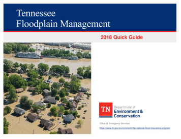
TennesseeFloodplain Management2018 Quick GuideOffice of Emergency al-flood-insurance-program
Table of ContentsTable of Contents2Flood Map Revisions Processed by FEMA27Introduction4Letter of Map Change (LOMC) Information28About This Guide5Letter of Map Change (LOMC) Information, Continued29Useful Resources and Common Acronyms6Community Flood Map Changes30Tennessee’s Disaster Declarations7Community Flood Map Changes, Continued31Overview: National Flood Insurance Program (NFIP)8Levee Analysis and Mapping Procedures (LAMP)32Why Communities Regulate the Floodplain9Levee Analysis and Mapping Procedures (LAMP), Continued33Effects of Non-Participation in the NFIP10Levee Analysis and Mapping Procedures (LAMP), Continued34Community Responsibilities11Levee Analysis and Mapping Procedures (LAMP), Continued35Community Rating System (CRS)12Levee Analysis and Mapping Procedures (LAMP), Continued36Be Prepared for Flood Emergencies13Levee Analysis and Mapping Procedures (LAMP), Continued37Turn Around Don't Drown 14Risk MAP Products38Flood Map Information15Risk MAP Products, Continued39Nature Doesn’t Read Flood Maps16Building Sites Higher Than the BFE40FEMA’s Map Service Center – msc.fema.gov17Activities in SFHAs That Require Local Permits and Approvals41Annual Chance Floods18Some Key Floodplain Development Permit Review Steps42Riverine Floodplains19Applying for a Floodplain Development Permit43Understanding the Riverine Floodplain20Safer Uses of the Floodplain44Understanding the Floodway21Pre-FIRM and Post-FIRM Structures45Understanding the Floodway, Continued22Think Carefully Before You Seek a Floodplain Variance46Flood Hazard Designations23Freeboard: Build Higher, Reduce Damage, Save on Insurance47Use the Stream Flood Profile to Determine BFEs24Freeboard: Go Above the BFE48Approximate Zone A25Elevation Certificate and Its Purpose49Approximate Flood Zones and Unnumbered A Zones26Completing the Elevation Certificate50T ENN E S S E E Q UI C K G UI DE 2
Documentation is Important – for You and Your Community51Post-Damage Considerations76Development Can Increase Flooding52Substantial Damage Estimator77The Adverse Impacts of Floodplain Fill53Post-Flood Compliance Funding78Required “No-Impact” Certification54More Expansive Flood Mitigation Projects79How to Elevate your Floodplain Building55Flood Insurance: Property Owner’s Best Protection80Approximate Zone A Procedures56Flood Insurance: Property Owner’s Best Protection, Continued81Compaction of Floodplain Fill (A Zones)57Factors that Affect Flood Insurance Rates82Enclosures Below the Lowest Floor58Learning More About Floodplain Management83Crawlspace Details (A Zones)59Learning More About Flood Insurance84What is a Basement?60Useful Resources85The Lowest Floor61Selected Definitions86Manufactured Homes Require Special Attention62Selected Definitions (continued)87Utility Service Outside Buildings63Selected Definitions (continued)88Utility Service Inside Enclosures64Accessory (Appurtenant) Structures65Recreational Vehicles66Septic Tanks67Private Water Crossings68Improving Your Floodplain Building69Non-Substantial Improvements70Substantial Improvement: Renovation Only71Substantial Improvement: Lateral Addition Only72Substantial Improvement: Addition Plus Other Work73Elevating Pre-FIRM Buildings74Easy and Low-Cost Protection Options for Older Homes75T ENN E S S E E Q UI C K G UI DE 3
IntroductionThe Tennessee State National Flood Insurance Program (NFIP) Office is pleased to provide this Quick Guide tohelp our citizens understand what floodplain management is and why floodplain development is regulated.Counties and local communities regulate development in floodplains to: Protect people and property Ensure that federal flood insurance and disaster assistance are available Save tax dollars Reduce liability and lawsuits Reduce future flood lossesFloods have been, and continue to be, a destructive natural hazard in terms of economic loss to the citizens ofTennessee. Since 1978, federal flood insurance policyholders in Tennessee have received over 343 million inclaim payments. Though that figure represents many insurance payments, most of the state’s flood-prone propertiesdo not have flood insurance. As of November 2017, only about 29,000 buildings located in high-risk floodplain areasin Tennessee had a flood insurance policy.T ENN E S S E E Q UI C K G UI DE 4
About This GuideThe Tennessee State National Flood Insurance Program (NFIP) Officeprepared this Quick Guide to help you understand more about whyand how communities in the state of Tennessee manage floodplains toprotect people and property.Flood-prone communities adopt ordinances that detail the rules andrequirements for floodplain development. In case of conflict, theapplicable ordinance, and not this publication, must be followed. Forquestions, contact your local planning, permit, engineering, orfloodplain management official.The State NFIP Office coordinates the NFIP with Tennessee’s local communities. For more information about thetopics covered in this Quick Guide go to -insurance-programThis publication is supported with funding from the Department ofHomeland Security Federal Emergency Management Agency(FEMA). It does not necessarily reflect views of that agency.T ENN E S S E E Q UI C K G UI DE 5
Useful Resources and Common AcronymsThe American Red Cross addresses disaster safety, being prepared, andrepairing homes (Disaster Services): www.redcross.orgFEMA has developed materials to help families and businesses prepare for floodsCommon Acronyms BFE Base FloodElevation EC Elevation Certificate FEMA FederalEmergency ManagementAgency FIRM Flood InsuranceRate Map ICC Increase Cost ofCompliance NFIP National FloodInsurance Program SFHA Special FloodHazard Area (1% AnnualChance Floodplain)and recover from disasters: www.fema.gov/resource-document-libraryAssociation of State Floodplain Managers: www.floods.orgTennessee Association of Floodplain Managers: http://web.tnafpm.comTennessee Society of Surveyors: https://www.taps-inc.com/NFIP regulations: regulationsCommunity Rating System (CRS) Resource am-community-rating-systemTennessee Emergency Preparedness: http://www.tnema.org/ReadyTN/Tennessee Post Disaster Guide: T ENN E S S E E Q UI C K G UI DE 6
Tennessee’s Disaster DeclarationsPresidential Flood Disaster DeclarationsNumber of Declarations by County (1998-2017)01–34–56–8Not all flood events are declared major disasters.Many floods are local, affecting only small areas or a few watersheds.T ENN E S S E E Q UI C K G UI DE 7
Overview: National Flood Insurance Program (NFIP)The National Flood Insurance Program (NFIP) was created by Congress in 1968 to protect lives and property fromflooding and to reduce the financial burden of providing disaster assistance. The NFIP is administered by FEMA.Nationwide, over 20,000 communities participate in the NFIP including 400 Tennessee communities. The State ofTennessee now requires all towns and cities including unincorporated areas of counties that have a FEMA identifiedSpecial Flood Hazard Area within their jurisdictional boundaries to participate in the NFIP prior to June 30, 2012.The NFIP is based on an agreement between the federal government and participating communities. Thepartnership involves: Flood Insurance – Property owners in participating communities are eligible to purchase federal floodinsurance for buildings and contents. Flood Hazard Maps – In partnership with FEMA, various partners produce flood maps in accordancewith FEMA standards. The maps are used by communities, insurance agents and others. Regulations – Communities must adopt and enforce minimum floodplain management regulations sothat development, including buildings, is undertaken in ways that reduce exposure to flooding.To learn more about the NFIP, floodplain management and flood insurance go ood-insurance-program.To learn more about the effects of not participating in the NFIP see the next page.T ENN E S S E E Q UI C K G UI DE 8
Why Communities Regulate the Floodplain Protect people and property. Knowing where high-risk flood areas are in your community enablesresidents and businesses to make reasonable decisions regarding the purchase of flood insurance andprotecting flood-prone property, creating a more sustainable and resilient community. To ensure federal flood insurance and disaster assistance are available. A communitymust participate in the National Flood Insurance Program (NFIP) for residents and businesses to be eligibleto purchase federal flood insurance through the NFIP. If your community does not participate, floodinsurance through the NFIP is not available and eligibility for federal disaster assistance is limited. Inaddition, homeowners may find it hard to secure, renew, or extend a mortgage loan. Please visit the NFIPCommunity Status Book site (https://www.fema.gov/cis/TN.html) to find out if your community participatesin the NFIP. To save tax dollars. Every flood disaster affects your community’s budget. By building resiliently, we’llhave fewer problems the next time it floods. Remember, federal disaster assistance isn’t available for allfloods. Even when the President declares a disaster, and federal grant funding is made available, you andyour community may still be required to pay a portion of the costs associated with disaster responseincluding repairing, rebuilding, and cleanup. To reduce future flood losses to Tennessee communities. Sustainable development thatcomplies with or exceeds the minimum floodplain management requirements is better protected againstflood-related damage.T ENN E S S E E Q UI C K G UI DE 9
Effects of Non-Participation in the NFIPCommunities with Special Flood Hazard Areas (SFHAs) that choose not to participate, that withdraw, or that havebeen suspended from the NFIP, may cause undue difficulties for their citizens, especially in the aftermath of adamaging flood event. The following apply to non-participating communities: Federal flood insurance is not available. This also applies to communities without SFHAs that don't participate. Federal grants or loans are not available for any reconstruction, repair, construction, rehabilitation or additions ofstructures in SFHAs. This includes grants and loans from the Federal Housing Administration, Farmer's Home Administration,Housing and Urban Development, Environmental Protection Agency, Small Business Administration, Veterans Administrationand Health and Human Services. Federally backed mortgages are not available for buildings in SFHAs. Federal disaster assistance is not provided for permanent restorative construction of insurablebuildings in SFHAs. This means that homes and public buildings damaged by flood are not eligible for federal disasterassistance. Eligible applicants may receive those forms of disaster assistance that are not related to permanent repair andreconstruction of buildings. Lenders must notify borrowers. Lenders may make conventional loans but they must notify the buyer or lessee thattheir property is in a SFHA, that NFIP flood insurance is not available and that the property in a SFHA is not eligible forFederal disaster relief in a flood-related declared disaster. Discounted flood insurance for older buildings is no longer available. The Flood Insurance Rate Map andappropriate actuarial rates go into effect regardless of whether the community participates. Buildings in SFHAs will beactuarially rated if the community later decides to join the NFIP. This could lead to extremely expensive insurance.The local government may be held liable for not participating in the NFIP because that action denies citizens theopportunity to purchase flood insurance and because it does not take positive steps to reduce the exposure of lifeand property to danger in the face of authoritative scientific and technical data.T ENN E S S E E Q UI C K G UI DE 10
Community ResponsibilitiesTo participate in the National Flood Insurance Program (NFIP), a community agrees to: Adopt and enforce a flood damage prevention ordinance Require permits for all development in the floodplain Ensure that all development is reasonably safe from flooding Estimate Base Flood Elevations (BFEs) where not determined by FEMA Require new or substantially improved homes and manufactured homes to be elevated above the BFE Require other structures be flood proofed or elevated above the BFE Determine if flooded buildings are substantially damaged Conduct field inspections; cite and remedy building or code violations Require elevation certificate surveys to document NFIP compliance Review requests for variances Resolve non-compliance issues and violations Advise FEMA and the state when updates to flood maps are needed Maintain records of all development within the Special Flood Hazard AreaFor more information about the NFIP as it relates to local communities, visit FEMA’s website atwww.fema.gov/information-state-local-officials.T ENN E S S E E Q UI C K G UI DE 11
Community Rating System (CRS)The goals of the NFIP and the Community Rating System (CRS) are to provide flood insurance to propertyowners, to encourage flood loss reduction activities by communities, and to save taxpayers’ money. As a part ofNFIP, the CRS provides both incentives and tools to further these goals. Examples of actions your community cantake to reduce the cost of your insurance premiums include: Preserve open space in the floodplain Enforce higher standards for safer development Undertake engineering studies and prepare flood maps Obtain grants to mitigate flooding to flood-prone structures through buyouts, structural elevation, andother flood damage reduction activities Maintain drainage systems Implement measures that protect life and property through flood warning and response programs Educate the public about flood hazards, flood insurance, and how to reduce flood damageCommunity officials can request assistance from CRS specialists to help with eligibility requirements and theapplication process. Visit the online CRS Resource Center: nity-rating-systemProperty owners in 14 Tennessee local jurisdictions that qualify for the CRSreceive flood premium discounts ranging from 5% to 10%.T ENN E S S E E Q UI C K G UI DE 12
Be Prepared for Flood EmergenciesWhen disaster strikes, you may not have much time to act. Prepare now for asudden emergency to protect yourself and your family from the next flood or otherdisaster.Develop an Emergency Preparedness Checklist to help you get started. Learn your flood risk by contacting your community’s engineering or planning office Ask how you would be warned of a flood emergency or other natural disaster Learn your community’s evacuation routes and shelter locations if evacuated Learn about workplace and school emergency plans and create a family emergency plan Put together a disaster kit with supplies to last three days. Don’t forget to include a copy of critical familyrecords stored in a waterproof containerAdditional Resources: To learn more about preparing for disasters, visit the Tennessee emergency preparedness website athttp://www.tnema.org/ReadyTN/preparedness.html Flood hazard risk information can be found for individual buildings at https://msc.fema.gov/ Other natural hazard information (for hazards such as earthquakes, wildfires, severe weather, winterweather, etc.) can be found at https://www.ready.gov/T ENN E S S E E Q UI C K G UI DE 13
Turn Around Don't Drown Learn about flood risks and follow these safety rules: When flooding is expected, stay away from creeks, streams, and riversNEVER drive through flooded roads—they may be washed outIt takes less than 12 inches of flowing water to wash away a passenger carBe especially cautious at night when it is harder to determine flood depth and recognize dangersMore than half of the deaths from flooding each year occur in vehiclesVisit tadd.weather.gov for more advice.T ENN E S S E E Q UI C K G UI DE 14
Flood Map InformationThere are two locations where the general public can view flood maps and obtain flood map information: FEMA’s Flood Map Service Center (MSC) at http://msc.fema.gov/. The MSC can also be reached at(877) 336-2627. Downloads of official flood maps and flood insurance studies, both effective and historic, areavailable. Historical flood map information is useful for various reasons, including determining the 100-yearflood elevation used for permitting purposes by the local community on previous FEMA studies. Tennessee’s Property Viewer at http://tnmap.tn.gov/assessment/. This site contains digitallyaccessible flood hazard data, maps, and property data reports that are database driven. The website alsoprovides geospatial base map data and imagery available for download. The State of Tennessee providesthis website as a public service to the citizens of Tennessee.T ENN E S S E E Q UI C K G UI DE 15
Nature Doesn’t Read Flood MapsEveryone lives in a flood zone, and everyone needs flood insurance. For persons living in a high-risk flood area,there is at least a one in four chances of flooding during a 30-year mortgage. Floods are the most common naturaldisaster in the United States, yet most homeowners’ insurance does not cover flood damage. If you wait until a floodis on its way, it will be too late because there is generally a 30-day waiting period before a flood policy takes effect.Consider safety—protect your home or business by building higher.T ENN E S S E E Q UI C K G UI DE 16
FEMA’s Map Service Center – msc.fema.govBase Flood Elevation (BFE)is the water surface elevation of the base floodat approximate locations (in feet above thevertical datum shown on the map).Shaded Zone Xis the 0.2%-annual-chance (500-year) floodplain(formerly Zone B).Unshaded Zone Xis all other areas considered low risk (formerlyZone C).Zone AEis the 1%-annual-chance (100-year) floodplainwith BFEs (formerly Zones A1‒A30).Cross Section location.The Floodway is the hatched area.Zone Ais (unnumbered) is the flood hazard areawithout Base Flood Elevations (BFEs).T ENN E S S E E Q UI C K G UI DE 17
Annual Chance FloodsThe 1%-annual chance flood, also called the BaseFlood and commonly called the 100-year flood, (thatdoes not mean the 100-year flood occurs only onceevery 100 years) has been selected by the NFIP asthe basis for delineation of Special Flood HazardAreas on Digital Flood Insurance Rate Maps(DFIRMs). The Special Flood Hazard Area is thebasis for floodplain regulations administered byTennessee communities.The boundary of the floodplain delineated for the0.2%-annual chance flood (also called the 500-yearflood) is shown on the NFIP flood maps.Terms andDefinitionsThe Base Flood is the 1%-annual chance flood (commonly calledthe 100-year flood). The 1%-annual chance flood has a 26% chanceof occurring during a 30-year period.The 0.2%-annual chance flood (or 500-year flood) has a 6% chanceof occurring during a 30-year period.T ENN E S S E E Q UI C K G UI DE 18
Riverine FloodplainsHow riverine models are created: Hydrology (flows) are derived using historic records, detailed studies, or regression calculations Riverine cross-sections are created using field survey and LiDAR topographic data Obstructions, ground cover, bridges, culverts, dams, encroachments, and other hydraulic features areentered into the model Flood levels are calculated based on theflows and the hydraulic modeling The flood levels are intersected with theground topography to determine the limitsof floodingT ENN E S S E E Q UI C K G UI DE 19
Understanding the Riverine FloodplainTerms and eaofFor floodplains with Base Flood Elevation (BFE) information, check the FloodInsurance Study to find the Flood Profile which shows water surface elevationsfor different frequency floods. For Zone AE, the Flood Insurance Study (FIS)profile must be used on the Elevation Certificate to determine the BFE.thefloodplain subject to inundation bythe base flood and/or flood-relatederosion hazards. SFHAs are shownon Flood Insurance Rate Maps(FIRMs) as Zones A, AE, A1-A30,AH, AO, and AR for riverinefloodplain areas. Coastal flood zonesare V, VE, and V1-V30.The floodway is the area of thefloodplain where floodwaters usuallyflow faster and deeper.The base flood means the floodhaving a 1% chance of beingequaled or exceeded in any givenyear (also called the “100-yearfloodplain”).T ENN E S S E E Q UI C K G UI DE 20
Understanding the FloodwayThe Floodway includes the channel of a river or other watercourse and the adjacent land areas that must bereserved in order to pass the base flood discharge without increasing flood depths. Computer models of thefloodplain are used to simulate “encroachment” or development in the flood fringe to predict where and how muchthe Base Flood Elevation would increase if the floodplain is allowed to be developed.Any project in a floodway must be reviewed by the local community’s engineering or planning office to determine ifthe project will increase flood heights. An engineering analysis must be conducted before a permit can be issued.The community's permit file must have a record of the results of this analysis which can be in the form of aNo-Impact Certification. The No-ImpactCertification must be supported by technicaldata and signed by a registered professionalengineer. The supporting technical datashould be based on the standard stepbackwater computer model used to developthe floodway shown on the Flood InsuranceRate Map (FIRM).A Floodway or Non-Encroachment Area canexist above overtopped bridges or culverts.T ENN E S S E E Q UI C K G UI DE 21
Understanding the Floodway, ContinuedBefore a local permit can be issued for proposed development in the floodway, a “No Rise/No Impact”certification must be submitted prior to any work initiated (see page 50). You will need a ProfessionalSurveyor to provide an Elevation Certificate together with a Professional Engineer's signed and sealedHydraulic and Hydrologic (H&H) Study to make sure your proposed project won't increase flood levels. Bothmust be licensed in the State of Tennessee.T ENN E S S E E Q UI C K G UI DE 22
Flood Hazard Designations.Flood hazard areas identified on the Flood Insurance Rate Map areidentified as a Special Flood Hazard Area (SFHA). SFHA are defined asthe area that will be inundated by the flood event having a 1-percentchance of being equaled or exceeded in any given year. The 1-percentannual chance flood is also referred to as the base flood or 100-yearflood. SFHAs are labeled as Zone A, Zone AE, Zone AH, Zone AO,Coastal Zones V, Zone VE, and Zones V1-V30 are not in Tennessee.Moderate flood hazard areas, labeled Zone X (shaded) are also shown onthe FIRM, and are the areas between the limits of the base flood and the0.2-percent-annual-chance (or 500-year) flood. The areas of minimalflood hazard, which are the areas outside the SFHA and higher than the elevation of the 0.2-percent-annual-chanceflood, are labeled Zone X (unshaded).AAEAHAOX (unshaded)X (shaded)Areas of 1% annual chance flood determined by approximate methods; base flood elevations not determinedSFHAs inundated by 1% annual chance flood; base flood elevations are shownAreas of 1% annual chance shallow flooding (usually ponding) where average depths are between 1 and 3 feet;whole-foot base flood elevations are shownAreas of 1% annual chance shallow flooding where average depths are between 1 and 3 feet (usually sheet flow onsloping terrain); average whole-foot depths are shownAreas determined to be outside the 0.2% annual chance floodplainAreas of 0.2% annual chance flood; areas subject to 1% annual chance flood with average depths less than 1 footor with contributing drainage area less than 1 square mile; and areas protected by levees from base floodT ENN E S S E E Q UI C K G UI DE 23
Use the Stream Flood Profile to Determine BFEsFlood profiles can be usedto determine the BFE at aspecific site. Profiles alsoshowestimatedwatersurface elevations for floodsother than the 1%-percentannual change flood.On the FIRM, locate yoursite by measuring thedistancealongthecenterline of the streamchannel from a crosssection or bridge, forexampleThe FEMA Flood Insurance Study (FIS) is a report that contains detailed flood elevationdata in flood profiles and data tables. FIS flood profiles provide detailed informationabout BFEs, stream bed locations, and cross section locations. Flood profiles areavailable on the FEMA Map Service Center website, where users can look up sitespecific flood hazard information.Scale that distance on theflood profile and read up tothe profile of interest, thenacross to determine thebase flood elevation.T ENN E S S E E Q UI C K G UI DE 24
Approximate Zone AApproximate A zones are drawn based on existinginformation, not engineering studies. FEMA checkedwith the U. S. Army Corps of Engineers, the U. S.Geological Survey, the State, local offices, and historicrecords. When existing information was lacking, anapproximate delineation was performed.Tennessee local floodplain ordinances identifyApproximate A zones as those A zone areas on theFIRM included in the FIS for which no BFEs areprovided. See next page for information on determiningif structures sited within Approximate A Zones will bereasonably safe from flooding.T ENN E S S E E Q UI C K G UI DE 25
Approximate Flood Zones and Unnumbered A ZonesSome floodplains are delineated using approximate methods and therefore do not have specified Base FloodElevations (BFEs). For assistance, contact your community’s planning, engineering, or permit office. If unknown, toobtain a BFE or base flood depth, please contact your regional, U.S. Army Corps of Engineer (USACE) orTennessee Valley Authority (TVA) offices to learn if that data is available.The FEMA publication Managing Floodplain Development in Approximate Zone A Areas (FEMA 265) is useful forengineers and community officials and is located here: ven if the estimated BFE indicates flooding mightbe only a foot or two deep, it is recommended thatthe lowest floor be at least three (3) feet above thehighest adjacent grade. Not only does this improveflood protection, but lower flood insurancepremiums may apply.T ENN E S S E E Q UI C K G UI DE 26
Flood Map Revisions Processed by FEMALetter of Map Changes (LOMCs) are documents issued by FEMA that revise or amend the flood hazardinformation shown on the FIRM without requiring the FIRM to be physically revised and re-published.Letters of Map Revision (LOMRs), Letters of Map Revision Based on Fill (LOMR-Fs) andLetters of Map Amendment (LOMAs) are all forms of LOMCs that are issued for a property, orproperties, on the revised FIRM panel.The most accurate information available is used to make flood maps, including topographic base maps anddetailed engineering methods or methods of approximation. Map revisions are issued when technical datais submitted to support the changes. Various map changes are processed directly by FEMA and are listedbelow and additional information can be found at https://www.fema.gov/letter-map-changes : Letter of Map Amendment (LOMA) is an official amendment to an effective FIRM that maybe issued when a property owner provides additional technical information from a professionalland surveyor or civil engineer, such as ground elevation relative to the BFE. Lenders may waivethe flood insurance requirement if the LOMA removes a building site from the SFHA because natural ground at the site is ator above BFE. Letter of Map Revision Based on Fill (LOMR-F) is an official revision to an effective FIRM that is issued to documentFEMA’s determination that a structure or parcel of land has been elevated by fill above the BFE, and therefore is no longer inthe SFHA. Lenders may waive the insurance requirement if the LOMR-F removes a building site from the SFHA. Conditional Letter of Map Revision (CLOMR) is a letter commenting on whether a proposed project, if built asshown on the submitted documentation, would meet the standards for a map revision. Communities may require thisevidence prior to issuing a permit, and the Certificate of Occupancy/Compliance should be withheld until receipt of the finalLOMR based on “as-built” documentation and certification. Letter of Map Revision (LOMR) is an official revision to an effective FIRM that may be issued to change floodinsurance risk zones, SFHAs and floodway boundary delineations, BFEs, and other map features. Lenders may waive theinsurance requirement if the approved map revision shows buildings to be outside of the SFHA.T ENN E S S E E Q UI C K G UI DE 27
Letter of Map Change (LOMC) InformationThere are multiple sets of forms available on the FEMA website to assist in therequest for a Letter of Map Change (LOMC). These forms can be found atwww.fema.gov/flood-mapping-related-forms. Letter of Map Amendment (LOMA), MT-EZ form: This formshould be used to request that FEMA remove a single structure or alegally recorded parcel of land or portions thereof, described by metesand bounds certified by a Registered Professional Engineer or LicensedLand Surveyor, from a designated Special Flood Hazard Area (SFHA) via Letter of Map Amendment(LOMA) Letter of Map Revision Based on Fill (LOMR-F), MT-1 form: This form should be used to assistrequesters (community officials, individual property owners, and others) in gathering the information thatFEMA needs to determine wh
FEMA's Map Service Center - msc.fema.gov 17 Annual Chance Floods 18 Riverine Floodplains 19 Understanding the Riverine Floodplain 20 Understanding the Floodway 21 Understanding the Floodway, Continued 22 Flood Hazard Designations 23 Use the Stream Flood Profile to Determine BFEs 24 Approximate Zone A 25