Transcription
Open Source GIS SoftwareA Guide for Understanding Current GIS Software SolutionsImage from: Open Source GIS: A GRASS GIS Approach by Markus Neteler and Helena Mitasova Springer PressNorth Carolina Geographic Information Coordinating CouncilGIS Technical Advisory CommitteeDecember 2017
PrefaceThis document was created for the NC Geographic Information and Coordinating Council(GICC) (https://it.nc.gov/gicc) by the GIS Technical Advisory Committee (TAC) for thepurpose of summarizing the functionality of commonly used open source GIS softwarepackages and tools.The target audience for this document includes small or large organizations that areconsidering implementing open source GIS software solutions but need to confirmfunctionality to meet their specific requirements.AcknowledgementsThank you to the many people that helped draft this document. It relied on the following keyparticipants:Doug Newcomb - USFWSDaniel Madding - NCDA&CSProfessor Scott Madry - UNC-CHEd Shipman - NCDOTJeff Essic - NCSUHelena Mitasova - NCSUJeff Brown - CGIADavid Giordano - CGIAFrank ObusekOverviewThis guidance document evaluates open source GIS software solutions as full solutions,or as partial solutions in combination with proprietary software. Solutions include desktopGIS, geospatial database, geospatial server, and mobile data collection functions.This document is intended to inform state and local government and non-governmentalorganizations to support decisions about GIS software solutions. It is a snapshot basedon research, observations, experience, judgments and opinions of volunteer advisors tothe TAC. It is not intended to be comprehensive and should not be the only source forinformed decisions about GIS software solutions. The observations and statements in thisdocument do not represent endorsement of any specific product or vendor.2
Table of ContentsGlossary of Terms and Acronyms4Understanding the Advantages of Open Source4Case Studies:State - North Carolina State Board of ElectionsFederal - The National Geospatial-Intelligence Agency6Geospatial Software Packages:8QGISQGIS -- Semi-Automatic Classification Plugin for QGISGRASS-- the Geographic Research Analysis Support SystemGeoNodeGeoServerPostgreSQLPostGISGeospatial Tools:Intermaps ROAM17Web References18Appendix A:Desktop GIS Functionality Matrix19Appendix B:Other Resources for Open Source Application Developers263
Glossary of Terms and AcronymsCommercial-off-the-shelf (COTS) COTS software and services are built and deliveredfrom a vendor. They are standard products that can be purchased, licensed, or leased bythe public.Open Source Software (OSS) is computer software with its source code made availablewith a license in which the copyright holder provides the rights to study, change, anddistribute the software to anyone and for any purpose. Open source software is oftendeveloped in a collaborative public manner.Open Source Geospatial Foundation (OSGeo) is a non-profit and non-governmentalorganization whose mission is to support and promote the collaborative development ofopen geospatial technologies, data, education and training. QGIS, GRASS, PostGIS,GDAL, and GeoServer (and others) are projects of OSGeo (osgeo.org).General Public License (GPL) is a free and widely used software license standard,which guarantees end users the freedom to run, study, share, and modify the software.The license was originally written by the Free Software Foundation (FSF) for the GNUProject and grants the recipients of a computer program the rights of the Free SoftwareDefinition. The GPL is a copyleft license, which means that derivative work can only bedistributed under the same license terms.Understanding the Advantages of Open SourceThere are multiple considerations when evaluating and implementing geospatial tools,including the organization’s mission, support needs, level of technical capabilities,information technology (IT) policies, budget, and more. Open source tools can provideexcellent capabilities, stable operation, a quick learning curve, and support options. Eachorganization should consider its specific requirements and capabilities beforeimplementing any such tools.There are multiple advantages in using open source geospatial software and tools. Theprimary benefits are lower cost and access to source code. Open source software isgenerally licensed under GNU or Creative Commons license structures, which allow forthe free sharing of the software with certain restrictions on the inclusion of fees or othercharges. There is no initial or recurring cost of use, and the user is free to share, alter,improve, and distribute the code but cannot charge a fee for doing so.4
Commercial geospatial software can be expensive and can require annual license fees.Furthermore, it rarely allows end users to acquire or view the source code. This couldlimit users’ understanding of what the code and/or tools are doing. Open source makessource code available, and the community can contribute and share without the financialand strict licensing requirements of commercial software. Open source also allows forfree knowledge and technology sharing and puts the end user communities in charge ofdevelopment if they wish to do so. Individual user communities such as transportation,engineering, archaeology, and others can develop specific tools that are not of broadcommercial interest and that are not generally developed or supported by commercialvendors.Open source also allows additional security capabilities, as the source code can beviewed, and concerns such as malware and trap doors are easier to locate. Open sourcegeospatial tools are now comparable to commercial systems in many regards and exceedthem in several specific capabilities, such as voxel and true 3-D capabilities. Softwaresupport, training, and other services are now widely available.Another benefit is that additional users beyond trained GIS specialists can now benefitfrom using geospatial data and tools. Workers within agencies can begin using thesetools, and many open source GIS software packages are smaller (in terms of MB on acomputer), easier to learn, and can be easily configured for specific users and tasks,including tablets and field data collection.Users must be aware that open source and commercial software providers havesomewhat different perspectives on technical support. Commercial software support is aservice for licensed users. The open community takes more responsibility for involvementin issues such as submitting bug reports and participating in guiding the development ofthe open source tools themselves. Reliance on an open community for technical supportmay not be suitable for all end users. Options are available to engage a service providerfor technical support for an open source solution.5
Case StudiesThis paper describes two use cases as examples of implementing open source GISsoftware.Use Case #1State GovernmentNorth Carolina State Board of ElectionsThe North Carolina State Board of Elections (NCSBE) has decided to move to an opensource platform for their GIS applications. There were three factors that contributed tothat decision: cost, functionality, and maintenance. Initially, when most think of opensource versus vendor solutions, they think free vs. paid, but that is not typically the case.For an open source solution, while there might not be a cost to acquire software (frontend), there may be costs to implement the solution (back-end). For NCSBE, the cost ofsupporting an open source software solution is less than the cost of the current vendorGIS software solution.The next factor is functionality. Many vendors offer a wide variety of functionality in theirGIS offerings that may be driven by commercial factors more than user preferences. Theopen source community typically drives functionality based on user needs, desires, andpreferences in ways that can result in feature-rich platforms.Finally, NCSBE is looking at maintenance options. Open source platforms typically offera wide variety of paid and community support. These support options are great for allsizes of organizations from large to small, and typically even the paid support vendorsoffer some limited software health options for free. NCSBE decided to migrate from Esrisoftware with a Microsoft SQL Server database to a PostgreSQL database. The decisioncame about due to the complexity of the database structure Esri uses to store their dataand tables in the database system; the table layout is very cryptic and widespread forthose who want to access the data layer for added functionality. Storing the data inPostgreSQL while using QGIS on the front-end has streamlined the data dictionary,allowing for non-GIS database administrators to help with data maintenance, recovery,and reporting.6
Use Case #2Federal GovernmentThe National Geospatial-Intelligence AgencyCost is not always the main factor in choosing an open source solution. Some large,well-funded, organizations such as Monsanto, New York City’s Department ofInformation Technology & Telecommunications (NYC DoITT), and the NationalGeospatial-Intelligence Agency (NGA) have strict procedures on what software can beinstalled on their IT infrastructure. In the case of NGA, a system security breach couldbe devastating not only to the organization but also to the Nation’s security.Software security is of primary concern to NGA. By policy, NGA must thoroughly reviewall software for adherence to stringent security policies. This can be very resourceintensive and time consuming.Commercial software packages typically have frequent update cycles. These can createsignificant workload and delays for the reviewing agencies, especially when access tosource code is impeded. Additionally, commercial vendors are normally hesitant torelease their proprietary information for review. Open source software code is freelyavailable for review and security auditing, thus providing a much easier path for securitypolicy driven code review. To organizations like the National Geospatial-IntelligenceAgency, these combined issues are frequently of higher consideration than simple costcomparisons.NGA’s approach was to engage a vendor for implementation of open source GIS softwaresolutions. In April 2017, NGA awarded Boundless Spatial Inc. a contract to support theirGEOINT mission. For more details on the contract visit:Sources:https://boundlessgeo.com/press ards-boundless-36m-contract7
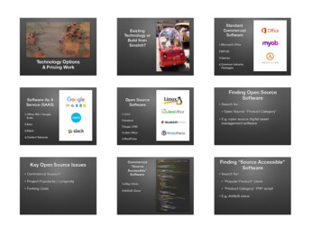
Open Source Geospatial Software PackagesThe Technical Advisory Committee reviewed and evaluated the most commonly usedopen source geospatial software packages: QGIS including a semi-automaticclassification plugin, the Geographic Research Analysis Support System (GRASS),GeoNode, GeoServer, PostgreSQL, and PostGIS.QGISQGIS, previously known as Quantum GIS, is an open sourcedesktop GIS application that supports viewing, editing, andanalysis of geospatial data (http://qgis.org). It functions asGIS software, allowing users to analyze and edit spatial information in addition tocomposing and exporting graphical maps. QGIS is comparable to Esri’s ArcMap. QGISsupports both raster and vector datasets, GPS data, and remote sensing imagery suchas LiDAR and satellite images. Also, QGIS is cross-platform, meaning it can be installedon different ореrаtіng ѕуѕtеmѕ, including Windows, Mac, and Linux. This gives QGIS anadvantage over ArcGIS, which can only be installed on Windows OS. Vector data formatssupported include Esri shapefiles and coverages, personal geodatabases (with a plugin),DXF, MapInfo, PostGIS, and other formats. QGIS can generate and consume webservices, including Web Map Service (WMS) and Web Feature Service (WFS).Integration with other open source GIS packages, including PostGIS, GRASS GIS,SAGA, and MapServer is easy and a common configuration. QGIS also has an extensiveset of plugins, which extend its core capabilities. These plugins can geocode using theGoogle Geocoding API and can perform geoprocessing functions, which are similar tothe standard tools found in ArcGIS. QGIS also interfaces with PostgreSQL/PostGIS andMySQL databases.Concerning user comments and lessons learned, QGIS contains a very powerful suite ofdesktop geospatial tools that can be easy to learn. Use can be expanded by increasingthe number of occasional or non-specialist users due to its ease of use and lack of cost.The primary advantages of QGIS are no-cost acquisition, open architecture, simplicity oflearning and using, expandability using plugins, a vibrant user and developmentcommunity, and the ability to develop specific tools for different applications.Disadvantages include uncertainty about the cost of technical support, uncertainty thatthe free software does not offer functionality and quality equivalent to commercialproducts, and fear that the software is ‘buggy’ or will frequently crash. However, theseconcerns are generally unfounded.8
For users with limited or no GIS experience, QGIS may be easier to learn and start usingthan commercial equivalents. Many QGIS training options are available, including books,YouTube videos, and QGIS tutorials and materials from the qgis.org website. Manyuniversities around the country teach classes using QGIS and offer periodic shortcourses; commercial training options also exist. For example, UNC Chapel Hill offersQGIS and GRASS short courses each semester, which are offered for free and are opento all.QGIS - Semi-Automatic Classification PluginThe Semi-Automatic Classification Plugin (SCP) is a free open source plugin for QGISthat allows for the supervised classification of remote sensing image data. It providesseveral tools for the download of free image data, the processing and analytics of imagedata, post-processing of thematic data, and raster band calculation. The SCP for QGISis developed and managed by Luca Congedo, who is a PhD. student in Landscape andEnvironment at Sapienza University in Rome, Italy. The SCP for QGIS is used globallyand in NASA training related to remote sensing. Similar to other open source softwaresystems and tools, the SCP encourages community participation in open source onlineforums for software support and development. Several online forums are available forSCP on FaceBook, Google , and YouTube.The overall objective of SCP is to provide a set of software tools for raster processing tocreate a workflow for land cover classification that can be used by both experienced andcasual users of remote sensing data. The SCP for QGIS includes tools for collectingtraining data, batch downloading imagery, pre-processing of image data, post-processingof raster data, band calculation, batch processing, and customized scripting. The onlinesupport documentation includes a community forum, user manual in fourteen languages,tutorial, video demonstrations, and support.Sources:www.qgis.org/en/site/Congedo Luca (2016).Semi-Automatic Classification Plugin User 9
GRASSGRASS GIS, commonly referred to as GRASS (Geographic ResourcesAnalysis Support System), is a free and open source GIS software suiteused for geospatial data management and analysis, image processing,graphics and maps production, spatial modeling, and data visualization. Ithas been under continuous development since 1982 and supports native64-bit, cross platform implementation of computational tools for raster andvector data. GRASS is currently used in academic and commercialsettings around the world as well as by many governmental agencies and environmentalconsulting companies. It is a founding member of the Open Source GeospatialFoundation (OSGeo) (https://grass.osgeo.org). GRASS is a comparative product to Esri’sArcMap desktop software, but is more focused on raster data analysis.GRASS includes modules to perform basic and advanced raster data functions such asraster algebra, terrain analysis, optimization using cost surfaces and least cost pathtracing, watershed and stream extraction from large DEMs, and viewshed analysis. Morespecialized tools include solar irradiation modeling, regression analysis between rasterlayers, landscape pattern metrics, surface water flow, and erosion modeling. Manyanalyses can be performed using a voxel (3D) raster data model as well as the standardpixel (2D) raster data model.For image analysis, GRASS GIS can perform supervised classification, unsupervisedclassification via object segmentation, atmospheric correction of satellite imagery,principal components analysis, and several common vegetation index analyses.Vector data in GRASS GIS supports full topology and attribute management. Specificmodules provide tools for basic vector data operations such as buffers, clipping andoverlays, spatial interpolations, proximity analysis, and network analysis. LiDAR data canalso be processed as point data or converted to raster data via binning.Both raster and vector data can be managed as temporal datasets for analyzing datachanges over time or interpolating missing data.See a table showing a comparison of the GIS functionalities available in QGIS, ArcGIS,and GRASS, in Appendix A below.Sources:https://grass.osgeo.org/10
GeoNodeGeoNode is a geospatial content management system andweb platform that enables the creation, management, sharing,and publication of geospatial data and interactive maps. Itbrings together mature and stable open source software underone interface and can be installed on a user system orsubscribed to as a cloud-hosted service at AcuGIS (https://www.acugis.com/geonodehosting.html). GeoNode is a comparative product to Esri’s ArcGIS Online.Geonode can be installed on either Linux or Windows servers, but there are somedifferences in installation requirements. The current and stable version of GeoNode isversion 2.6 (May 2017). GeoNode is written in Django, https://www.djangoproject.com, aPython-based web framework.Installation on Linux currently uses 64-bit technology; the current Windows installationdiffers by requiring the 32-bit version of the Java 8 JRE. Detailed installation instructionsfor Ubuntu Linux, CentOS Linux, and Windows can be found all and rg11
GeoServerGeoServer is a powerful map and feature server for sharing,analyzing, and editing geospatial data. Designed forinteroperability, it publishes data from a wide variety of spatialdata sources using open standards. GeoServer forms a core component of theGeospatial Web.Geoserver is a comparative product to Esri’s ArcGIS Server and will run on Windows,Linux, MacOS, or any platform that supports a Java 8 environment.GeoServer is the reference implementation of the Open Geospatial Consortium (OGC),Web Feature Service (WFS), and Web Coverage Service (WCS) standards as well as ahigh performance certified compliant Web Map Service (WMS). By leveraging openstandards, GeoServer ensures interoperability with a wide array of open source andproprietary software products as well as online services such as Google Maps. It is simpleto integrate with both new and existing desktop, mobile, and web applications.12
Features of GeoServer include: Support for many back-end data formats (ArcSDE, Oracle Spatial, DB2, MicrosoftSQL Server, Shapefile, GeoTIFF, and many more). Multiple output formats (Esri Shapefiles, KML, GML, GeoJSON, PNG, JPEG, TIFF,SVG, PDF, GeoRSS). Fully-featured web administration interface and REST API for easy configuration. Configurable role-based security subsystem based on Spring Security. Java J2EE application works with Jetty, Tomcat, JBoss, and others. A robust community that has developed many extensions for GeoServer, includingMBTiles support, Mapbox Vector Tile output, WPS, and DXF output, among manyothers.PostgreSQLPostgreSQL is a powerful open source object-relational databasesystem. It has more than 15 years of active development and a provenarchitecture that has earned a reputation for reliability, data integrity, andcorrectness. It runs on all major operating systems, including Linux,UNIX (AIX, BSD, HP-UX, SGI IRIX, macOS, Solaris, Tru64), andWindows. It is fully ACID compliant (Atomicity, Consistency, Isolation,Durability), has full support for foreign keys, joins, views, triggers, and stored procedures(in multiple languages). It has native programming interfaces for C/C , Java, .Net, Perl,Python, Ruby, Tcl, ODBC, among others, and exceptional documentation.An enterprise class database, PostgreSQL features include Multi-Version ConcurrencyControl (MVCC), parallel queries, logical replication, point in time recovery, tablespaces,asynchronous replication, nested transactions (save points), online/hot backups, asophisticated query planner/optimizer, and write-ahead logging for fault tolerance. Itsupports international character sets, multibyte character encodings, Unicode, and it islocale-aware for sorting, case-sensitivity, and formatting. It is highly scalable both in thequantity of data it can manage and in the number of concurrent users it canaccommodate. There are active PostgreSQL systems in production environments thatmanage more than 4 terabytes of data.The PostgreSQL SQL implementation conforms to the ANSI-SQL:2008 standard. It hasfull support for subqueries (including sub-selects in the FROM clause) and readcommitted and serializable transaction isolation levels. While PostgreSQL has a fullyrelational system catalog which supports multiple schemas per database, its catalog isalso accessible through the Information Schema as defined in the SQL standard. By being13
compliant with open standards, PostgreSQL is much easier to integrate with both opensource and proprietary software.PostgreSQL provides full text search support for JSON and JSONB (binary JSON) data,and its Foreign Data Wrappers (FWD) allow PostgreSQL to attach to external data tables(CSV, MySQL, Oracle, MSSQL Server, MongoDB, etc.). PostgreSQL’s Hstore extensionallows it to store and query NoSQL key-value data, which is very useful in cases such assemi-structured data or rows with many attributes that are rarely tgresql.org/wiki/Foreign data wrappersPostGISWhile Microsoft SQL Server (MSSS) and Oracle have native spatialcapacity, PostgreSQL derives its spatial capability from an extension,PostGIS. PostGIS is the most complete implementation of the SimpleFeatures (officially Simple Feature Access), which is both an OpenGeospatial Consortium (OGC) and International Organization forStandardization (ISO) standard ISO 19125.1 MSSS also implements this standard. Thesyntax for a spatial query is very similar between PostGIS and MSSS. PostgreSQL issupported and used by many GIS softwares, including QGIS, ArcMap, ArcGIS Server,Manifold, Grass, and GeoServer, to name a very few. 2 Esri deploys PostgreSQL with itsGeoEvent Server product and recommends the use of PostgreSQL as the back-end forthe temporal storage. PostgreSQL/PostGIS are mature products with long-term support.Similar to SQL Spatial, PostGIS adds spatial data types (geometry, geography, raster,and others) to the PostgreSQL database. It also adds functions, operators, and indexenhancements that apply to these spatial types. These functions, operators, indexbindings, and types augment the power of the core PostgreSQL DBMS, making it a fast,feature-plenty, and robust spatial database management system. PostGIS offers featuresrarely found in other competing spatial databases such as Oracle Locator/Spatial andSQL Server.PostGIS follows the Open Geospatial Consortium Simple Features for SQL Specificationand has been certified as compliant with the “Types and Functions” profile. PostGIS isopen source software, released under the GNU General Public License.PostGIS is a spatial database extender for PostgreSQL object-relational databases. Itadds support for geographic objects allowing location queries to be run in SQL.14
Key features PostGIS provides: Processing and analytic functions for both vector and raster data for splicing,dicing, morphing, reclassifying, and collecting/unioning with the power of SQLraster map algebra for fine-grained raster processing Storage of GIS data (vector and raster) in an RDBMS Supports both geography as well as geometry (planer) Spatial query of both vector and raster 3 In addition to X and Y being spatial, M and Z are also spatial Extensive time capabilities that can be used as M values Runs on Windows and Unix-like OS’s (Linux, Mac, etc.) Free Software (GNU 2 license or later) Available with vendor support Available as a hosted solution in the cloud Spatial reprojection SQL callable functions for both vector and raster data Support for importing/exporting Esri shapefiles via both command line and GUIpackaged tools and support for more formats via other 3rd-party open source tools Packaged command-line for importing raster data from many standard formats:GeoTiff, NetCDF, PNG, JPG, to name a few Rendering and importing vector data support functions for standard textual formatssuch as KML, GML, GeoJSON, GeoHash, and WKT using SQL Rendering raster data in various standard formats GeoTIFF, PNG, JPG, NetCDF,to name a few, using SQL Seamless raster/vector SQL callable functions for extrusion of pixel values bygeometric region, running stats by region, clipping rasters by a geometry, andvectorizing rasters 3D object support, spatial index, and functions Network topology support Packaged Tiger loader/geocoder/reverse geocoder/utilizing US Census Tiger dataPostGIS-related PostgreSQL optional extensions include: pgRouting (http://pgrouting.org): extends PostGIS to support geospatial routingsuch as driving distance, shortest path distance, and traveling salesman, whichcan take into consideration various costs such as speed and turn restrictions. ogrfdw (https://github.com/pramsey/pgsql-ogr-fdw): is a PostgreSQL foreign datawrapper built on GDAL/OGR. It allows reading other spatial and non-spatial datasources as tables in PostgreSQL. Vector data gets translated to PostGIS geometrytype.15
Also, pgpointcloud (https://github.com/pgpointcloud/pointcloud) is a PostgreSQLextension and loader for storing point cloud data in PostgreSQL; it includes anextension for casting between point cloud data type and PostGIS geometry.Sources:1. Wikipedia, Simple Features, https://en.wikipedia.org/wiki/Simple Features2. Wikipedia, PostGIS, https://en.wikipedia.org/wiki/PostGIS3. PostGIS, Chapter 8, https://postgis.net/docs/reference.html16
Geospatial ToolsThe committee reviewed one geospatial tool related to mobile GIS. Other resources ofinterest to open source application developers are described in Appendix B.IntraMaps RoamIntraMaps Roam is a simple data collection application built using QGIS.Roam is built as a stand-alone, fully packaged Python application witheverything included. QGIS is not required to be installed on the users’machines. It is a free and open source application for tablet use andprovides a field-friendly interface on top of QGIS. Similar to ArcGISCollector, it offers a 100 percent offline solution for data collection and general field use.It currently runs on Windows devices and can run from source on Linux; Android tabletscan be supported once QGIS is ported to Qt5. Point, line, and polygon geometries aresupported. It has simple-to-use forms for field use, configurable displays, GPS capture,logging, and tracking capabilities.The link below is an example ROAM site for Los Angeles County, cts/open-source-gisThe site includes: Free software downloads Tutorials Sample scripts for updating tablet basemap layers from the Los Angeles CountyGIS Data Portal Utilities for synchronizing edits from multiple tablet users Github code: http://roamdocs.readthedocs.io/en/latest17
Web ReferencesComparing ArcGIS to QGIS in 27 esComparing ArcGIS Desktop to ArcMap Functionality matrixhttps://www.esri.com/ functionalitymatrix.pdfNGA Contract with Boundlesshttps://boundlessgeo.com/press ards-boundless-36m-contractFOSS4G, Free and Open Source Software for Geospatialhttps://wiki.osgeo.org/wiki/FOSS4G18
Appendix ADesktop GIS Functionality MatrixQGISArcGIS Desktop(Advanced)GRASSYes, withGDALYesUnknownYesYesYesYesYesYesYes, withExtensionNoDisplay LAS (Lidar Data Files)Yes, withPluginYes, withExtensionYesImport LAS data as pointsYes, withPluginYes, withExtensionYesImport LAS data and bin to rasterYes, withPluginYes, withPluginYes, withExtensionYesDirectly import LAZ compressed LASYesYesYesYes, withPluginYesUnknownYesYesYesYesYesYesGIS FunctionalityDisplay Earth Resources LaboratoryApplications Software (ELAS) datasetsConsume Enhanced CompressionWavelet (ECW)Geospatial Data Abstraction Library(GDAL)Reshape existing featuresCut polygon featuresBuffer featuresCreate new features19
QGISArcGIS t topology errorsYes, withPluginYesYesAdd rule to topologyYes, withPluginYesYesYesYesYesYesYesYesYesYesYesYesAdd Web Map Service to a data viewYesYesYesAdd Web Feature Service to a dataviewYesYesNoGIS FunctionalityCreate new features from the bufferCreate new polygonsModify each selected row individually oras a group (Attributes Dialog)Split linesExplode (multipart) featuresSimplify featuresCan create topology rulesCreate topologyValidate topologySnapping geometryCreate a Database View20
QGISArcGIS Desktop(Advanced)GRASSRead/
For an open source solution, while there might not be a cost to acquire software (front-end), there may be costs to implement the solution (back-end). For NCSBE, the cost of supporting an open source software solution is less than the cost of the current vendor GIS software solution. The next factor is functionality.