Transcription
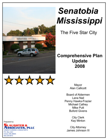
SenatobiaMississippiThe Five Star CityComprehensive PlanUpdate2008MayorAlan CallicottBoard of AldermenLana NailPenny Hawks-FrazierMichael CatheyMike PuttBuford GivensPrepared by:City ClerkKay MintonCity AttorneyJames Johnson III
City of SenatobiaComprehensive PlanTABLE OF CONTENTSIntroduction 1Population Characteristics .5Historic Population .5Population Growth 6Existing Population .7Day Time Population .8Population Projections 9Age .10Race and Ethnicity .12Educational Attainment .13Income and Employment Characteristics 17Households 17Median Household Income .17Poverty 19Percent of Income Spent on Housing .19Employment .21Labor Force 21Occupations .22Residential Employment by Industry .25Major Industries 28Unemployment Rate 31Retail Sales .33Existing Land Use 36Vacant Land .36Residential .38Commercial .40Industrial 42Public and Semi-public 44Water .45Other Land Uses not on Existing Land Use Map: 100-year Floodplain .45Comparison with Previous Comprehensive Plan .46Housing Characteristics .49Housing .49i.
City of SenatobiaComprehensive PlanCommunity Facilities 53Fire Services .53Police Services .55City Buildings 57Other Government Building and Offices .58Parks and Recreation 58Water System .61Sanitary Sewer System .63Solid Waste .64Gas System .64Education .64Senatobia Municipal School District .64Private School Facilities .66Library Services 66Hospital Facilities-North Oak Regional Medical Center .68Summary 68Transportation 70Introduction 70Functional Classification and Existing Corridors .70Traffic Counts 75Commuting Patterns 76Other Modes of Transportation .77Changes from the previous Transportation Plan .78Recommendations for Implementation .78Vision, Goals, Objectives, and Policies 83Overview .83The Vision of the City of Senatobia .83Guiding Principles 84Community Character .84Land Use Goals, Objectives and Policies .85Housing Goals, Objectives and Policies .86Economic Development .88Community Facilities .89Transportation Goals and Policies 91Future Land Use Plan .94Changes from Previous Plan .94Future Land Use Categories .96Other Required Land Use Categories .101Implementation Recommendations and Plan Maintenance .104Implementation Tools .104Plan Maintenance 108ii.
City of SenatobiaComprehensive PlanList of Maps, Figures and TablesMap 1.Map 2.Figure 1.Table 1.Table 2.Table 3.Table 4.Table 5.Figure 2.Table 6.Table 7.Table 8.Table 9.Figure 3.Table 10.Figure 4.Table 11.Table 12.Table 13.Table 14.Table 15.Table 16.Figure 5.Table 17.Figure 6.Figure 7.Figure 8.Figure 9.Table 18.Senatobia Base Map 3Senatobia Planning Area Map .4Historic Population in Tate County, Mississippi 1880-2000 .5Historic Population for the Senatobia, Coldwater and Tate County 18902000 5Migration into Senatobia, 2000 6Migration into Senatobia, 1990 7Fall Enrollment for Northwest Community College System 8Population Projections for the City of Senatobia 9Age and Sex Residents of the City of Senatobia, 2000 10Percentage of Population by Age within the City of Senatobia, 2000 .11Percentage of Population by Age Group in the City of Senatobia, TateCounty and the State of Mississippi 12Race and Ethnicity in Senatobia, Mississippi Over Time .12Percentage of Population with High School Diploma or Equivalency andwith Bachelor's Degree or Higher for Selected Places and Counties,200014Educational Attainment for Residents (age 25 and older) of the City ofSenatobia, 2000 15Educational Attainment for the Population Aged 25 and Older in the Cityof Senatobia, Tate County, the State of Mississippi and the MemphisMetropolitan Statistical Area, Over Time .15Educational Attainment for Residents (age 25 and older) of the City ofSenatobia, 1990 16Comparison of Income, 2000 17Comparison of Income, 1990 18Median Household Income of Households in Senatobia and Tate County.18Selected Monthly Owner Costs as a Percentage of Household Incomein 1999 19Mortgage Status of Senatobia and Tate County Households, 1999 20Gross Rent as a Percent of Housing Income in 1999 20Civilian Labor Force in Tate County, 1990-2006 22Employment of Senatobia Residents 16 years of Age and Older, byOccupation, 2000 .23Occupation of Residents of the City of Senatobia, 2000 .23Occupation of Residents of Tate County, 2000 .24Occupation of Residents of Senatobia, 1990 25Employment of Senatobia Residents by Industry, 2000 26Employment of Residents age 16 Years of Age and Older of Senatobia,Tate County and Mississippi, by Industry, 2000 .27iii.
City of SenatobiaComprehensive PlanFigure 10.Figure 11.Figure 12.Figure 13.Figure 14.Table 19.Table 20.Figure 15.Figure 16.Figure 17.Figure 18.Figure 19.Map 3.Figure 20.Figure 21.Figure 22.Figure 23.Figure 24.Figure 25.Table 21.Table 22.Table 23.Table 24.Table 25.Figure 26.Table 26.Table 27.Table 28.Table 29.Table 30.Table 31.Table 32.Table 33.Table 34.Employment of Tate Residents, 2000 .Employment of Senatobia Residents by Industry, 1990 Establishment Based Employment in Tate County, 1990-2006 Establishment Based Employment in Tate County, 2006 .Establishment Based Employment in Tate County, 2001 .Establishment Based Employment in Tate County, 1990 and 2006 Annual Average Unemployment Rate for Tate, DeSoto, and PanolaCounties and the State of Mississippi, 1990-2006 Unemployment Rates for Tate, DeSoto and Panola Counties and theState of Mississippi, 1990-2006 .Gross Retail Sales in Senatobia, 1990-2006 Gross Sales Revenues for Tate County and the Cities of Senatobia andColdwater, 1999-2006Sales Tax Diversions to Selected Cities, 1998-2006 Sales Tax Diversions to Senatobia, by Month, 2003-2007 Existing Land Use Map .Residential Land Uses in Senatobia Existing Duplexes & Zoning in Senatobia Existing Commercial Land Uses .Existing Commercially Zoning in Senatobia Existing Industrial Land Use Locations in Senatobia Existing Industrial Zoning .Existing Land Use Inside City of Senatobia Zoning Inside City of Senatobia Number of Housing Units in Senatobia and Tate County, Over Time .Type of Housing Stock in the City of Senatobia, 1990-2000 Age of Housing Stock in Senatobia and Tate County Value of Selected Owner-Occupied Units in Senatobia and Tate County,2000 Rating Factors Considered by the State Rating Bureau .Location and Size of Senatobia Fire Stations and Equipment Located atEach Station Number of Crimes in the City of Senatobia, Over Time Projected Need for Certified Officers Based Upon Resident PopulationProjections .Standards for City and County Parks Recognized by the MississippiState Comprehensive Outdoor Recreation Plan (SCORP) .City of Senatobia Owned and Operated Wells .Water Storage Tanks within the City's Water Storage System Projected Need for Wastewater Treatment Based Upon ResidentPopulation Projections .Average Daily Attendance by Grade for Senatobia Municipal SchoolDistrict 1535456575961626365iv.
City of SenatobiaComprehensive PlanTable 35.Projections of Space & Collection Needs For the Senatobia Branch ofthe First Regional Library System Map 4.Transportation Plan Map Map 5.Road Classifications Map Figure 27. Existing Transportation Corridors Table 36. Road Standards Table 37. Traffic Counts in Senatobia, 1996-2006 .Map 6.Future Land Use Map 67717374747695v.
City of SenatobiaComprehensive PlanAdopted 10-07-08INTRODUCTIONThe City of Senatobia is the County Seat of Tate County. Senatobia is located innorthern Mississippi, approximately 35 miles from the City of Memphis,Tennessee. Senatobia is located along Interstate 55. Major transportationroutes within the City, beside Interstate 55, include U.S. Highway 51 andMississippi Highway 4, and the CN Rail line.The City of Senatobia is located within the northern reaches of the Yazoo RiverBasin. This basin is the largest watershed within the State of Mississippi and thebasin includes eight major sub-basins and four major reservoirs.The land area in which Senatobia is located is defined as the Mississippi ValleyLoess Hills and Plains region. The area is characterized by rolling hills andhighly erosive loess soils.This Comprehensive Plan for Senatobia was developed in accordance withgenerally accepted planning principles. The generalized Base Map for Senatobiais shown in Map 1. The planning area was defined as a geographic areaapproximately one to three miles outside the City limits. This ComprehensivePlanning Area, shown in Map 2, was determined to be the immediate area ofinfluence, or the area of interest for the city over the next 20-25 years. Plannersdeveloped a parcel-based map of the City of Senatobia, which was utilized tomap existing land uses within the City. This map was utilized to develop a futuretransportation plan and a future land use plan for the City of Senatobia. Alsoland use was reviewed, within the municipal limits of the City of Senatobia andwithin the planning area. An existing land use survey was performed via awindshield survey of this area to determine growth and development patterns ofSenatobia.This document is an update to the City of Senatobia‘sComprehensive Plan adopted by the Senatobia Board of Aldermen in 1999.A Comprehensive Plan is a document that, in broad terms, is a policy statementto guide the future placement and development of community facilities and it isthe basis for a community‘s subdivision and zoning regulations, official maps andamendments to the subdivision and zoning ordinances. The ComprehensivePlan identifies a future vision for the community, determines the projected growthfor the community and identifies policies to plan, direct and accommodate thegrowth.The Mississippi legislature, through Mississippi Code §17-1-1 defines thoseminimum elements required to be addressed within a Comprehensive Plan.These include:Goals and objectives for the long-range (20 to 25 years) development ofthe City. Required goals and objectives shall address at a minimum:residential, commercial and industrial development; parks, open space1
City of SenatobiaComprehensive PlanAdopted 10-07-08and recreation; street or road improvements, public schools andcommunity facilities.A land use plan that designates in map or in policy form the proposedgeneral distribution and extent of the uses of land for residences,commerce, industry, recreation and open space, public and quasi-publicfacilities and lands.A transportation plan depicting in map form the proposed functionalclassifications for all existing and proposed streets, roads and highwaysfor the area encompassed by the land use plan and for the same timeperiod. Functional classifications shall consist of arterial, collector andlocal streets, roads and highways.A community facilities plan as a basis for a capital improvements programincluding, but not limited to, the following: housing; schools; parks andrecreation; public buildings and facilities; and utilities and drainage.The 2008 Update to the City of Senatobia Comprehensive Plan is organized inthe following manner:Chapter 1 IntroductionChapter 2 Population CharacteristicsChapter 3 Income & Employment CharacteristicsChapter 4 Existing Land UseChapter 5 Housing CharacteristicsChapter 6 Community Facilities CharacteristicsChapter 7 TransportationChapter 8 Vision, Goals, Objectives, & PoliciesChapter 9 Future Land UseChapter 10 Implementation & Plan MaintenanceChapters 1 through 6 address the existing conditions of Senatobia, whileChapters 7 through 10 address the proposed future conditions for Senatobia.Taken together, the text, maps, tables and figures represent an attempt bySenatobia‘s leadership to move successfully toward a positive future.2
City of SenatobiaComprehensive PlanAdopted 10-07-08Blank Page for Map 1---Senatobia Base Map3
City of SenatobiaComprehensive PlanAdopted 10-07-08Blank Page for Map 2---Senatobia Planning Area Map4
City of SenatobiaComprehensive PlanAdopted 10-07-08POPULATION CHARACTERISTICSHistoric PopulationThe City of Senatobia was chartered and became a Mississippi municipality onFebruary 10, 1860. Census data gathered for the City of Senatobia indicatesSenatobia has always been the largest of the communities within Tate County.As the County Seat, and as the center for transportation for the county,Senatobia grew at a rate faster that the other communities within the County.Figure 1. Historic Population in Tate County, Mississippi 1880 – 2000.Historic Population in Tate County, Mississippi,1880 to 2000Population30,00025,000Tate rSource: U.S. Bureau of CensusTable 1. Historic Population for the Senatobia, Coldwater and Tate County,1890 to 2000YearSenatobiaColdwaterTate 1,15655720,61818901,07751819,253Source: U.S. Department of Commerce, Bureau of the Census, 20005
City of SenatobiaComprehensive PlanAdopted 10-07-08The estimated population of the City of Senatobia in 2000 was 6,682 people. Atthe turn of the century, the population of Senatobia was 1,156 people. The Cityhas grown steadily since 1890, with a decrease in population occurring only twicewithin its history. Census data indicates that Senatobia had decreases inpopulation between 1910 and 1920 and between 1980 and 1990.Growth rates within the City of Senatobia have been significant, over the historyof the City. Between 1950 and 1960, the population within the City increased by54.6%, between 1960 and 1970, the population within the City increased by30.3%. Between 1970 and 1980, the population within the City increased by18.0% and between 1990 and 2000, the City experienced a growth rate of 40%.Population GrowthAs the City has grown, it gained a large percentage of the population of theCounty. Near the turn of the twentieth century, most of the population within TateCounty lived in the rural areas of the county. Only about 5.6% of the populationlived within the City of Senatobia. As farming changed, people moved from therural areas of the County into the urban areas within the County. By 2000,slightly more than one-quarter of the population within Tate County lived withinthe City of Senatobia.Migration has always been a steady, influential contributor to the populationgrowth within the City of Senatobia. The City of Senatobia captured newresidents as they moved from farming into other economic ventures in the earlyhistory of the community. In the past four decades, migration into the communityhas come from people moving their homes to be within commuting distance tothe Memphis region.Table 2. Migration into Senatobia, 2000City of SenatobiaNumberPopulation 5 Same house in 1995Different house in 1995Same countyDifferent countySame stateDifferent stateElsewhere in 19956,3482,8483,4871,3612,1261,31880813Tate CountyMississippi% of Populationover the age of 5% of Populationover the age of 5% of Populationover the age of 90.358.540.622.518.09.48.61.0Source: U.S. Department of Commerce, Bureau of the Census, 2000Census data indicated that 3,487 people, aged five years and older movedbetween 1995 and 2000. This accounted for nearly 55% of the City‘s populationage 5 and older in 2000. Most of the new residents to Senatobia moved to theCity from other places within Mississippi. About 40% of the people who lived in adifferent house in 1995 lived within Tate County. Another 40% of the people who6
City of SenatobiaComprehensive PlanAdopted 10-07-08moved to Senatobia between 1995 and 2000, moved to Senatobia from anothercounty in Mississippi. About 20% of the people living in Senatobia in 2000, andwho had relocated between 1995 and 2000, moved to Senatobia from anotherstate.Table 3. Migration into Senatobia, 1990Population 5 Same house in 1985Different house in 1985Same countyDifferent countySame stateDifferent stateElsewhere in 1985City of SenatobiaNumber% of Populationover the age of 9.0%51212.0%7-Tate County% of Populationover the age of 01310.0%1,8319.0%15--NumberSource: U.S. Department of Commerce, Bureau of the Census, 1990Not surprisingly, about 54% of residents responding to the Census in 1990indicated that they had moved in the previous five years. About one-quarter ofthe population over the age of five reported moving from a home within TateCounty. About one-third of the population of the City indicated that they hadmoved into Senatobia in the previous five years from a different county—mostnew residents had moved from another county in Mississippi.Census data from both decades illustrates that migration into the City is a veryimportant part of the City‘s population growth. Between 1990 and 2000, 2,126people indicated that they had moved to Senatobia from an area outside of TateCounty—this equates to about one in three people in the community. Between1980 and 1990, about 1,355 people moved into Senatobia from areas outside ofTate County—this equates to about one-third of the City population in 1990.Besides natural growth and migration into the City of Senatobia, the Cityincreased its land area and population through annexation. During the last twodecades, the City has annexed land adjacent to the City limits on threeoccasions. In each case, the city annexed land in response to and in anticipationof the consistent population growth that the City experienced.Existing PopulationThe estimated population for the City of Senatobia for 2006, including therecently annexed area is approximately 7,448 people. This estimate is basedupon the existing population estimates developed by the Census Bureau, and itassumes the same growth rate of 2.93% per year for the City of Senatobia andthe recently annexed area.7
City of SenatobiaComprehensive PlanAdopted 10-07-08Day Time PopulationCity public safety officials estimate that the City‘s population increases by 40%each day due to the presence of workers, students and visitors to the City.Northwest Community College, Magnolia Heights School and major employerswithin the City contribute to this increase in daytime population.The main campus of Northwest Community College is located in Senatobia. Thethree-campus community college is a two-year school that provides bothvocational and academic/technical educations. Northwest Community College isthe largest community college in terms of district—serving students in elevencounties (Benton, Calhoun, DeSoto, Lafayette, Marshall, Quitman, Panola,Tallahatchie, Tate, Tunica and Yalobusha). Northwest Community College hasthree campuses- in Senatobia, in DeSoto County and in Oxford.The primary campus of the Northwest Community College System is located inSenatobia. The campus is approximately 247 acres and can provide housing forup to 900 students, but it is also estimated that most students utilizing theSenatobia campus commute to Northwest. Nearly 90% of the students of theNorthwest Community College system are in-district students, according toenrollment figures from 2004-2005. And about 6.1% of students were fromoutside of the district, but from Mississippi and about 3.8% of the students werefrom out-of-state.Table 4. Fall Enrollment for Northwest Community College SystemTotalFall 20066,294Fall 20056,289Fall 20046,328Fall 20036,121Fall 20025,850Fall 20015,376Source: Office of Research and Planning, Board of Trustees of State Institutions ofHigher Learning from data from the State Board for Community and Junior Colleges.Information from the State Board for Community and Junior Colleges indicatesthat enrollment, based upon fall class enrollment within the NorthwestCommunity College System has increased by 17.1% between Fall 2001 and Fall2006.Additionally, data from the 2004-2005 academic year indicated that nearly 80%of the students enrolled at Northwest were in the academic curriculum, while15.7% were taking classes in technical subjects and nearly 5% were takingsubjects within vocational classes.About 465 students commute from outside the City of Senatobia to the MagnoliaHeights School each school day. The private school has children from prekindergarten through grade twelve.8
City of SenatobiaComprehensive PlanAdopted 10-07-08Population ProjectionsPlanners developed population projections for the City of Senatobia. Theseprojections are based upon an apportionment method. This method defines therelationship between the population growth of the City and the County anddetermined the City population based upon the projected growth for the County.Planners utilized population projections for Tate County developed by theMississippi Institutions of Higher Learning, Center for Policy Research andPlanning. The projections for Tate County were developed in 2005. Theseprojections predict that by 2010, the population of Tate County will be 27,973people and by 2020, the population of Tate County will be 30,149 people.Utilizing these projections for County growth and the historical rate of growth ofthe City within the County, it was determined that the population for the City ofSenatobia will be 7,944 people by 2010, 9,195 people by 2020 and 10,538people by 2030.Table 5. Population Projections for the City of Senatobia20102020Population for Senatobia7,9449,195203010,538Source: Slaughter and Associates, PLLC based upon data from Office of Research andplanning, Board of Trustees of State Institutions of Higher Learning from data from the StateBoard for Community and Junior Colleges.Population is projected to grow by approximately 18.8% between 2000 and 2010,15.7% between 2010 and 2020, and 14.6% between 2020 and 203. The citymay anticipate a projected rate of population growth of approximately 57.7%between 2000 and 2030.The City has several unique and special places where a semi-permanentpopulation lives within group settings. These include the dormitories ofNorthwest Community College, the Baddour Center, the Senatobia ConvalescentCenter and the North Oaks Regional Medical Center. Through the utilization of aland use projection tool, planners determined that population living in institutionalhousing arrangements will likely see an increase in population from 181 people in2000 to 240 people in 2020. Additionally, the population living in other groupliving arrangements will likely see an increase in population from 947 people in2000 to 1,714 people in 2020.Planners made several assumptions upon which the population projections aremade. These include:Population within the City of Senatobia will continue to grow.The City population will continue to grow as a proportion of the Countypopulation —historically this growth has averaged about 2.1 % per year.9
City of SenatobiaComprehensive PlanAdopted 10-07-08Population projections are subject to uncertainty. The assumptions that form thebasis of these projections are historical trends, which may or may not bereplicated within the future. Therefore, the limitations of the projections shouldbe kept in mind when making decisions based upon the population projections.From time to time, decision-makers should review and revise these projections.AgeThe City of Senatobia tends to be unique in its age characteristics. A significantproportion of the City‘s population is between the ages of 18 and 21, likely due tothe location of Northwest Community College in Senatobia. The City also has asignificant proportion of its population of young working age, between the ages of30 and 39.In general, the population in the City of Senatobia is composed of young adultsand young working age residents. The figure that follows portrays the age andthe sex of the population in Senatobia in 2000. The figure is not characteristic ofthe typical age/sex pyramid for the United States. The typical representation ofage and sex within the United States would be represented by a pyramid that isconstrictive. There would be larger percentage of the population in the older agebrackets, specifically in the non-child-bearing years.The graphic, which represents age and sex in Senatobia, is moderately reflectiveof an expansive population. There tends to be a high proportion of thepopulation under 18 and a significant proportion of the population withinchildbearing years. The graphic indicates that there are a significant number ofcity residents between the ages of 18 and 21, between the ages of 22 and 29,between the ages of 30 to 39 and between the ages of 40 and 49.Figure 2. Age and Sex of Residents of the City of Senatobia, 2000.Age and Sex of Residents of the City of Senatobia, 2000Over 8070 to 7965 to 6960 to 6450 to 5940 to 4930 to 3925 to 2922 to 2418 to 2115 to 1710 to 145 to 9under 5-800-600-400-200Over 8070 to 7965 to 6960 to 6450 to 5940 to 4930 to 3925 to 2922 to 2418 to 2115 to 1710 to 145 to 9under 50FemaleMale200400600Source: U.S. Department of Commerce, Bureau of the Census10
City of SenatobiaComprehensive PlanAdopted 10-07-08Figure 2 indicates that the City may anticipate slow growth due to natural growth,but the City will continue to experience the bulk of its growth from in-migration—from families and individuals choosing to move to the City of Senatobia.A majority of the population in the City of Senatobia is composed of young adultsand young working age residents. More than one-half (52%) of the City‘spopulation in 2000 was between the ages of 18 and 49. Comparably about 45%of the population within Tate County was between the ages of 18 and 49 andonly 46% of the population within the State of Mississippi was between the agesof 18 and 49.Table 6. Percentage of Population by Age within the City of Senatobia,2000SenatobiaTate CountyMississippiNumberPercentage of TotalCity PopulationNumberPercentage of TotalCounty PopulationUnder 54256%1,7407%5 to 94857%1,8907%10 to 144637%2,0368%15 to 172864%1,2025%18 to 211,07816%2,1038%22 to 242664%8723%25 to 294727%1,5546%30 to 3986113%3,53614%40 to 4978912%3,61814%50 to 595769%2,86011%60 to 641793%1,0644%65 to 691823%8413%70 to 793345%1,2945%Over 802804%7603%Source: U.S. Department of Commerce, Bureau of the CensusPercentage of TotalState Population8%5%5%6%8%5%8%8%17%12%5%4%6%4%Another attribute of the population of the City of Senatobia is the number ofyoung adults between the ages of 18 and 21. Fully 16% of the population of theCity of Senatobia falls within these three years. The presence of NorthwestCommunity College is a likely reason for this exceptionally high proportion ofresidents within th
Alan Callicott Board of Aldermen Lana Nail Penny Hawks-Frazier Michael Cathey Mike Putt Buford Givens City Clerk Kay Minton City Attorney James Johnson III Comprehensive Plan Update 2008 Senatobia Mississippi The Five Star City. City of Senatobia . Standards for City and County Parks Recognized by the Mississippi State Comprehensive Outdoor .