Transcription
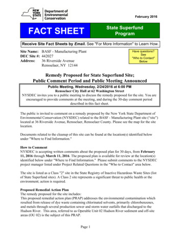
February 2016FACT SHEETState SuperfundProgramReceive Site Fact Sheets by Email. See "For More Information" to Learn How.Site Name: BASF - Manufacturing PlantDEC Site #: 442027Address:36 Riverside AvenueRensselaer, NY 12144Have questions?See"Who to Contact"BelowRemedy Proposed for State Superfund Site;Public Comment Period and Public Meeting AnnouncedPublic Meeting, Wednesday, 2/24/2016 at 6:00 PMRensselaer City Hall at 62 Washington StreetNYSDEC invites you to a public meeting to discuss the remedy proposed for the site. You areencouraged to provide comments at the meeting, and during the 30-day comment perioddescribed in this fact sheet.The public is invited to comment on a remedy proposed by the New York State Department ofEnvironmental Conservation (NYSDEC) related to the BASF - Manufacturing Plant site (“site”)located at 36 Riverside Avenue, Rensselaer, Rensselaer County. Please see the map for the sitelocation.Documents related to the cleanup of this site can be found at the location(s) identified belowunder "Where to Find Information."How to CommentNYSDEC is accepting written comments about the proposed plan for 30 days, from February11, 2016 through March 11, 2016. The proposed plan is available for review at the location(s)identified below under "Where to Find Information." Please submit comments to the NYSDECproject manager listed under Project Related Questions in the "Who to Contact" area below.The site is listed as a Class "2" site in the State Registry of Inactive Hazardous Waste Sites (listof State Superfund sites). A Class 2 site represents a significant threat to public health or theenvironment; action is required.Proposed Remedial Action PlanThe remedy proposed for the site includes:This proposed remedial action plan (PRAP) addresses the environmental contamination whichresulted from release of dye waste containing chlorinated solvents, primarily chlorobenzenes,and metals through several production sewer and storm water outfalls that discharged to theHudson River. This area, referred to as Operable Unit 02 Hudson River sediment and off-siteareas (OU 02) is the subject of this PRAP.Page 1
The areal extent of OU 02 is shown on Figure 1.The BASF Manufacturing Plant is referred to as Operable Unit 01 Main Plant (OU 01). ARecord of Decision was issued September 11, 2003 for OU 01.Additional DetailsThe Department has selected dredging to remove the contaminated sediment, includingrestoring the dredged areas with appropriate riverbed material (acting as a cover system).Dredged sediments will be disposed off-site at a facility permitted to accept the material.Some sediment may be treated on the BASF site prior to off-site disposal. Monitoring of otherareas being covered by natural deposition has also been selected.Summary of the InvestigationBased on the results of the investigation of the off-site areas of the BASF Manufacturing PlantSite, the presence of volatile organics, metals and poly-chlorinated biphenyls (PCBs) havecontaminated Hudson River sediment. The sediment contamination presents a significantthreat to fish and wildlife. The primary contaminants of concern which will drive the cleanupof sediment are chlorobenzenes and lead. BASF will be performing the cleanup. The estimatedcost to implement the remedy is 41,300,000.NYSDEC developed the proposed remedy after reviewing the detailed investigation of the siteand evaluating the remedial options in the “feasibility study” submitted under New York’s StateSuperfund Program by BASF Corporation.Next StepsNYSDEC will consider public comments as it finalizes the remedy for the site. The selectedremedy will be described in a document called a "Record of Decision" that will explain why theremedy was selected and respond to public comments. A detailed design of the selected remedywill then be prepared, and the cleanup will be performed.NYSDEC will keep the public informed throughout the investigation and cleanup of the site.BackgroundLOCATION: The BASF Manufacturing Plant Site is located within the City of Rensselaer. Thesite is located approximately 0.25 miles west of the intersection of Routes 9 and 9J adjacent tothe Hudson River.SITE FEATURES: The 45.32 acre site (OU 01) is an open area. The off-site area includesindustrial areas, residential areas, railroad tracks and the Hudson River.CURRENT ZONING AND LAND USE: The vacant OU 01 area is zoned industrial. The OU 02off-site areas include a residential neighborhood located to the north (Fort Crailo), the AlbanyMolecular Research, Inc. (former Sterling Drug Site 1, Site 442009, industrial) also to the north,Railroad (Amtrak/CSX) tracks to the east, the BASF Closed Landfill (Site V00521, industrial) tothe south east, the Rensselaer Iron and Steel Inc. (industrial) and Albany Port Commissionparking lot to the south. The Hudson River is to the west.PAST USE OF THE SITE: Dyes and pharmaceuticals were manufactured at the BASFManufacturing Plant Site OU 01 since the 1890's. Soil and groundwater contamination originatedPage 2
from numerous sources including four tanks that stored chlorobenzene.OPERABLE UNITS: The site was divided into two operable units (OU). OU 01 ManufacturingPlant on-site and OU 02 Hudson River sediment and off-site areas. An operable unit represents aportion of a remedial program for a site that for technical or administrative reasons can beaddressed separately to investigate, eliminate or mitigate a release, threat of release or exposurepathway resulting from the site contamination.OU 01, Manufacturing Plant, consists of the on-site source area of contamination. OU 02,Hudson River sediment and off-site areas, consists of media off-site which may have beenimpacted by contaminant migration.SITE GEOLOGY AND HYDROGEOLOGY: Groundwater flow direction is north towardsAlbany Molecular Research, Inc. and west towards the Hudson River. The depth to the shallowwater bearing unit averages from five feet (along the eastern boundary) to 15 feet (near theHudson River). A clay layer separates this shallow groundwater from a deeper water bearing unit.The clay layer is approximately 18 feet below the ground surface at the former lagoons (where itis 40 feet thick) and approximately five feet below the ground surface at the eastern boundary(where it is ten feet thick). The deep water bearing unit is a ten foot thick layer of sand justabove a layer of glacial till, which is just above the shale bedrock.Additional site details, including environmental and health assessment summaries, are availableon NYSDEC's website haz/details.cfm?pageid 3&progno 442027State Superfund Program: New York's State Superfund Program (SSF) identifies and characterizessuspected inactive hazardous waste disposal sites. Sites that pose a significant threat to public healthand/or the environment go through a process of investigation, evaluation, cleanup and monitoring.NYSDEC attempts to identify parties responsible for site contamination and require cleanup beforecommitting State funds.For more information about the SSF, visit: http://www.dec.ny.gov/chemical/8439.htmlFOR MORE INFORMATIONWhere to Find InformationProject documents are available at the following location(s) to help the public stay informed.Rensselaer Public LibraryAttn: Jane Chirgwin676 East StreetRensselaer, NY 12144phone: 518-462-1193Page 3
Who to ContactComments and questions are always welcome and should be directed as follows:Project Related QuestionsJohn StrangDepartment of Environmental ConservationDivision of Environmental Remediation1130 North Westcott RdSchenectady, NY d Health QuestionsSteven KarpinskiNew York State Department of HealthBureau of Environmental Exposure InvestigationEmpire State Plaza Corning Tower - Room 1787Albany, NY 12237518-402-7860BEEI@health.ny.govWe encourage you to share this fact sheet with neighbors and tenants, and/or post this factsheet in a prominent area of your building for others to see.Receive Site Fact Sheets by EmailHave site information such as this fact sheet sent right to your email inbox.NYSDEC invites you to sign up with one or more contaminated sitescounty email listservs available at the following web page:http://www.dec.ny.gov/chemical/61092.html. It’s quick, it’s free,and it will help keep you better informed.As a listserv member, you will periodically receive site-related information/announcements forall contaminated sites in the county(ies) you select.Note: Please disregard if you already have signed up and received this fact sheet electronically.Page 4
SD011SD01 9ALBANYRENSSELAERNORTHERNFS STUDYAREATextSITESOUTHERNFS STUDYAREALegendApproximate Extent ofProperty BoundariesStudy ReachFS Sediment Area1 INCH 3000 FEET01,500USGS 7.5 MINUTE TOPOGRAPHICQUADRANGLES ALBANY, EASTGREENBUSH, TROY SOUTH AND DELMARNEWYORK3,000P:\Projects\Jobs\Indl Service\Project Files\BASF-0760\Rensaleer NY\GIS\2015 GIS\MXD\Figure 1 locus NewLogo.mxd6,000IFeetSite LocusHudson River OU-2Proposed Remedial Action PlanBASF CorporationRensselaer, New YorkSCALESee InsetDATE2/16PROJECT NO.60135950Figure Number1
Schenectady, NY 12306 518-357-2390 john.strang@dec.ny.gov Site-Related Health Questions Steven Karpinski New York State Department of Health Bureau of Environmental Exposure Investigation Empire State Plaza Corning Tower - Room 1787 Albany, NY 12237 518-402-7860 BEEI@health.ny.gov Who to Contact