Transcription
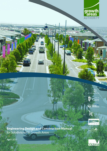
Engineering Design and Construction Manualfor Subdivision in Growth AreasApril 2011
April 2011Growth Areas AuthorityLevel 2935 Collins StreetMelbourne Victoria 3000PHONE: (03) 9651 9600E-MAIL: info@gaa.vic.gov.auWEBSITE: www.gaa.vic.gov.auCopyright Growth Areas Authority 2011This document is subject to copyrightUse of copying of this document in whole or part without acknowledgement ofthe Growth Area Authority constitutes an infringement of Copyright Act 1968
4.6Contents74.74.84.94.10Classification of Road and NeighbourhoodStreets38Road Reserves40Public Open Space Requirements42Drainage Provision43Easements4595.Functional Layout Plans5.15.25.35.45.55.65.75.85.9Requirement for Functional Layout Plans46Principles46FLP Process47FLP Response Timeline47FLP Submission Content48Specific Sites – Out of Sequence50Applicable Standards50Presentation50Format for FLP Submission506.Engineering Design Plans516.16.26.36.46.56.66.76.8Detailed Engineering DesignDesign Submission ContentSubmission PresentationCo-ordinates and LevelsApproved Design PlansEngineering Submission ProcessTimeline for Responses to Design PlansRevisions51525354545556567.Landscaping Plans577.17.27.3GeneralContents of Landscape PlansFormat of Landscape Submissions5757578.Construction Requirements588.18.2Approvals Prior to Commencement58Construction Process Following Approvals589.Certification and Compliance599.19.29.39.49.59.69.7Certification of Plan of SubdivisionsCertification of StructuresProvision of As Constructed DataEngineering Infrastructure ComplianceLandscape Works ComplianceBushfire Management WorksStatement of Compliance59595960636566FOREWORD6DEFINITIONSPART AOVERVIEW AND roundPrinciplesObjectives of the ManualStructure and Content of the ManualImplementationExceptionsContext and Challenges9991010121213PART BFRAMEWORK AND PROCEDURES 232.Planning Framework232.12.22.32.4Planning Hierarchy23State and Local Framework23Land Development Objectives and Goals inGrowth Areas25Land Subdivision Process253.Planning Permits3.1Planning Permit Application for 13Documentation Requirements for PlanningPermit Applications27Preliminary Consultation29Environmental Assessment29Heritage Assessment29Plan of Subdivision30Developer Contributions30Public Transport30Strategic and Arterial Roads31Waterways and Main Drainage31Sewer, Water and Recycled Water31Utility Services31Traffic Assessment314.Engineering Framework324.14.24.34.44.5Planning RequirementsSubdivision LayoutBushfire ManagementTraffic AssessmentRoad Safety Design Audits3234353738262646PART CENGINEERING DESIGN10. Road Design6710.167Introduction67
1310.14Design CriteriaSight DistanceHorizontal AlignmentVertical AlignmentStandard Cross-SectionCross fallKerb and ChannelFootpaths & Nature StripsAccess to Frontage AllotmentsVehicular CrossingsUtility AllocationsRoundaboutsIntersection Threshold Treatments6768686971737476788080808011.Pavement copeDesign ReferencesQualified ConsultantsPavement Design ParametersSubgrade & EarthworksPavement MaterialsDesign TrafficFlexible Pavement DesignRigid Pavement DesignSubsurface Pavement Drains818283848690929410010112.Earthworks Design10212.112.212.3GeneralPlanning & Engineering RequirementsEarthworks and Filling Requirements10210210313.Drainage nning & LayoutComputation of RunoffRainfall IntensityAverage Exceedance ProbabilityTime of ConcentrationRunoff Coefficient CHydraulicsHydraulic Grade LinePipe Grade and AlignmentMinimum Cover (to top of pipe)Pipe FrictionMinimum Pipe SizePipe JointsPipe Flow Velocity and GradeAnchor BlocksAlignment at 1411413.1813.1913.2013.2113.2213.2313.24Pit LocationsKerb InletsPit Head lossesProperty ConnectionsSurface DrainageWater QualitySub Surface Drainage11511511511511611711714.Utility Service Conduits11814.114.2Utility Service ConduitsFibre to the Premise (FTTP) Network11811915.Structural Elements12115.115.215.315.4General121Design Criteria121Construction Supervision & Certificates123Bridges12416.Associated 6.916.1016.11GeneralPrinciplesWater SupplyRecycled WaterSewerGasElectricityTelecommunications and DataPublic LightingPermanent Survey MarksStreet Name Signs125125125126126126126127127130130PART D: CONSTRUCTION17. Construction Framework13113117.117.2Introduction131Construction of Works- Planning Framework17.317.4Order of PrecedenceRoles of the Parties13113213218.Pre-commencement Procedures13318.1Construction Environmental Management Plan18.218.3Traffic Management PlanPre-Commencement Meeting13413419.Construction Procedures13519.1Contractor Integrated Management System19.219.319.4Occupational Health and SafetyCouncil InspectionsHours of Work133135135136136
19.519.619.719.819.9Site AccessProtection of Property and ServicesSanitary AccommodationProtection of RoadsManagement of Traffic13713713713713720.Site Management13820.120.220.320.420.520.6Tree and Vegetation PreservationWeed Importation and TransportationContainmentLivestockUnauthorised DisposalFires13813913913913913921.General Technical Conditions Relating toWorks14021.121.221.3GeneralSurvey Marks and Set-Out WorksTopsoil and Allotment Filling22.Subdivision Works Specifications 14322.122.2Basis for Standard SpecificationList of Standard Specifications14314323.Construction General14723.123.223.323.423.523.6Quality ManagementSiteProgram and ProgressProsecution of WorkOff SiteInsurance and Incident Reporting14714714915015415624.Quality Systems15724.124.224.324.424.524.624.724.8Quality Assurance Specification - General157Quality Assurance Requirements157Construction Hold Points157Drainage Witness Points160Access160Audits160Inspection and Test Plans (ITP’s)160Traceability16125.Finalising the Works25.125.225.325.425.5.As Constructed Information162Certification of Final Levels162Cleaning up of Works162Cleaning of Asphalt Pavement and Drains162Final Re-peg162Appendices163140140140162Table 1:Table 2:Table 3:Table 4:Table 5:Table 6:GENERAL MINIMUM EASEMENT WIDTHS41Table 7:Table 8:Table 9:PROJECT RELIABILITY LEVELSOPERATING SPEEDSVERTICAL GRADESROAD ELEMENTSADDITIONAL ROAD ELEMENTSMINIMUM VICROADSPRE-QUALIFICATION LEVELS63656768MINIMUM INCREASE IN DESA798189UNBOUND GRANULAR PAVEMENTSON NON-EXPANSIVE SUBGRADES91Table 10:ASPHALT PAVEMENTS ONNON-EXPANSIVE SUBGRADES92Table 11:UNBOUND GRANULAR PAVEMENTS ONEXPANSIVE SUBGRADES93Table 12:ASPHALT PAVEMENTS ON EXPANSIVESUBGRADESTable 13:Table 14:Table 15:Table 16:Table 17:Table 18:Table 19:Table 20:Table 21:Table 22:Table 23:Table 24:94RIGID PAVEMENT DESIGN METHOD96AVERAGE EXCEEDANCE PROBABILITIES102TIMES OF CONCENTRATION103LAND USE FRACTION IMPERVIOUS105“C” VALUES107FRICTION FACTORS108ACCEPTABLE VELOCITIES109DURABILITY CRITERIA117VIC ROADS SPECIFICATION –STANDARD CLAUSESHOLD POINTSDRAINAGE WITNESS POINTSTYPICAL DESIGN TRAFFIC DATA140154156161
FOREWORDThe Growth Areas Authority (GAA) in partnership with Councils, land ownersdevelopers, service and utility providers, and key stakeholders are responsible forcreating new communities in Melbourne’s growth areas. Our objectives are to createnew suburbs that are not only affordable but are great places to live and the firstchoice of Victorians.A key objective of the GAA and growth area Councils is to streamline the planningprocess for creating new communities to increase certainty, reduce costs and reduceregulatory burden to all stakeholders in the land development processSubdivision, engineering and construction approvals are vital parts of the overalldevelopment process. Local government, developers, contractors and consultantshave identified a shared belief that time and cost savings and increased certainty forall stakeholders can be achieved in these parts of the planning process through agreedcommon processes for approvals and shared engineering infrastructure standards andspecifications across Melbourne’s growth areas.This Engineering Design and Construction Manual outlines a series of sharedengineering standards and specifications, prepared by the GAA, the municipalitiesof Casey, Cardinia, Hume, Melton, Whittlesea and Wyndham and the Office of LocalGovernment following consultation with key stakeholders.6
DEFINITIONSAnnual ExceedanceProbability (AEP)The probability of exceedance of a given stormwaterdischarge within a period of one year.Approved DrawingsRoad, Drainage, Earthworks and other drawings which arerequired to be approved by Council under the SubdivisionsAct and have been approved. For the purpose of thisdefinition Approval shall mean drawings having beenstamped with Council’s approval stamp and signed by aCouncil officer delegated with the authority to approvedrawings.A-SpecSuite of specifications for the delivery of newly constructedassets as Digital data in a GIS ready format. Streamlinesstakeholder processes for receiving, handling and storage ofinfrastructure data related to newly constructed assets.Average RecurrenceInterval (ARI)The average or expected value of the period betweenexceedance of a given event or discharge.CarriagewayThe distance between the inverts of kerbs.Consulting EngineerA person or company employed by a developer to providedesign and/or construction administration services for landsubdivision.ContractorA company or individual appointed by the Developerto construct the infrastructure works of the subdivisiondevelopment.CouncilThe relevant Growth Area municipal organisation and itsvarious associated departments within whose boundariesthe infrastructure is to be constructed.Council SupervisorThe person nominated by the Council to liaise with theSuperintendent during the execution of the works. TheCouncil Supervisor shall issue any written or verbal advice tothe Superintendent in relation to the quality and executionof the works.DaysDays refer to calendar days unless specifically notedotherwiseDDADisability Discrimination ActDesign Engineer orDesignerUnless approved otherwise by the Council, all road anddrainage designs shall be undertaken by a qualified CivilEngineer, experienced in the field, who shall hereafter bereferred to as the Design Engineer or Designer.Dial Before You DigA national community service providing information toprevent damage and disruption to essential services i.e.electricity, gas, water sewer, communications, recycledwater and drainage.D-SpecDrainage specifications under the “A-Spec” system.Gap FlowThe gap flow is the difference in runoff which resultsfrom a 1% AEP event less the discharge capacity of theunderground reticulated piped drainage system.7
8InfrastructurePhysical works including roads, paths, public lighting,playground and recreation equipment, landscaping anddrainage systems (including retardation and treatment).ManualThe Engineering Design and Construction ManualPaper RoadA Road reserve created on a Plan of Subdivision for thepurpose of creating a residential address, emergency vehicleaccess or pedestrian and bicycle access. Usually located atthe front of allotments overlooking public open space whenvehicle access is available from a rear laneway.Pathway ReserveGenerally a narrow open space reserve located betweenprivate property and linking reserves such as roads andopen space on either side.Referral AuthorityAn agency or relevant authority to whom developmentplans are required to be referred as a part of a developmentprocess, including application for planning permits andCertifications of Plans of SubdivisionResCodeResCode is a state-wide package of provisions for residentialdevelopment. ResCode is not a single document but agroup of provisions incorporated as Clause 56 of theCouncil Planning Scheme.Responsible AuthorityThe Authority responsible for the administration of therelevant Planning Scheme.Road ReserveThe Road Reserve is a road as defined by the RoadManagement ActRoad VergeThe distance between the invert of kerb and the near roadreserve boundarySuperintendentAll road and drainage construction surveillance andauditing shall be undertaken by a suitably qualified andexperienced person appointed by the Developer, who shallhereafter be referred to as the Superintendent and whoshall liaise with and inform the Council Supervisor at allrelevant stages of the work.Water Sensitive UrbanDesign (WSUD)The integration of urban water cycle management andstormwater drainage within planning and design is knownas Water Sensitive Urban Design
PART AOVERVIEW AND BACKGROUND1.1.1INTRODUCTIONBACKGROUNDThis Manual is a product of the Victorian Growth Areas Infrastructure EngineeringStandardisation Project, and delivers a set of consistent standardised, best practicedocuments that outline approval and supporting processes for the planning, designand construction of subdivision infrastructure.The standards, specifications and processes have been developed by collaborationbetween the Growth Areas Authority and Councils in Melbourne’s growth areas, inconsultation with industry representatives.Adopted standards will generally be applied by planning permits allowing subdivisionfollowing the approval of a Precinct Structure Plan.A consistent approach to design standards and construction specifications will ensuregrowth area Councils, landowners, developers and consultants clearly understand theexpectations and commitments that are outlined in this manual. Clear expectationswill result in a more efficient process of approval, implementation and certification,avoiding delays that can arise from interpreting and responding to different standardsacross the growth areas.1.2PRINCIPLESIn preparing the manual the following principles were considered: Ensuring that the guidelines, standards and specifications are achievable; Providing flexibility to encourage innovation and best practice, and take intoaccount regional or localised conditions within the growth areas. Current Victorian Standards for residential development contained inPrecinct Structure Planning Guidelines and Clause 56 of the VictorianPlanning Provisions. The need to harmonise the procedures and timelines of the variousinfrastructure and service agencies with local government procedures andstandards.9
1.3OBJECTIVES OF THE MANUALThe primary objectives of the manual are: To clearly document Council requirements for the planning, design anddevelopment of subdivision infrastructure; To standardise development submissions as much as possible and thus toexpedite Council engineering approvals; To recognise and deal with the various issues currently impacting on theland development industry, in particular sustainability, integrated watermanagement, timeliness and affordability; and To ensure that minimum design criteria are met in regard to the design andconstruction of infrastructure within the municipalities.Achieving these objectives requires cooperation of all relevant parties with ongoingopen communication and commitment to achieving best practice.1.4STRUCTURE AND CONTENT OF THE MANUALFor clarity and reproduction purposes, the manual has been structured into thefollowing sections to separate procedures and design issues from constructionrequirements. Parts A, B and C outline the engineering design and approvals process. Thiswill generally follow the completion of Precinct Structure Planning and issueof a Planning Permit for a development proposal. Part D outlines a construction framework and processes that will usuallyfollow the planning and engineering approvals stages. Preliminaryspecification clauses are based on Section 160 of the standard VicRoadsspecifications.The manual contains the following elements: Charts, forms and tables provided to assist in clarity and understanding ofthe written clauses. Functional Layout Plan process preceding the detail design process. Whilebeing mandatory if it is a requirement of a planning permit, this process ishighly recommended in other cases to facilitate faster documentation andapprovals of engineering designs. Planning permit submission documentation requirements in Part B areincluded for context. Land subdivision flowchart in Appendix A is included for context. Road pavement design charts in Appendix B provide consistency in10
the interpretation and application of design codes in determining roadpavement composition. The design submission form in Appendix C will prompt both the designerand the council regarding the required contents of design submissions. Standard Drawings in Appendix D cover the majority of infrastructure typesrequired in most growth area scenarios. Each Council will have additionalstandard drawings that may need to be referred to where the standarddrawings in this manual do not cover particular proposals. Appendix E contains a list of relevant agencies and references that arerecommended for use during the approval and construction process. Detailed construction specifications in Appendix F are based on relevantVicRoads specifications. These will not generally need to be reproduced inhard copy form. Road elements within Section 10 indicate the basic components of roadcross sections. Generally, road cross sections will be specified in the PSP forparticular road types. Guidance on the determination of road cross sectionsis provided in the Precinct Structure Planning Guidelines and associatedRoad Note.11
1.5IMPLEMENTATIONThe implementation of the manual will be supported by: A communication plan that targets key stakeholders in the process; Periodic updates to the standards to ensure best practice; and Periodic review of the procedures to achieve continuous improvement.The Manual has been developed specifically to address Melbourne’s growth areas. Alonger term goal of the State Government is to establish state wide standards andprocedures. The manual may be revised and updated to achieve this goal.The Manual is a living document, formatted to allow for revision and amendment fromtime to time.An initial review of the manual will be undertaken twelve months after its’ adoptionand implementation.1.6EXCEPTIONSThe Manual establishes a consistent approach to the design and approval ofengineering infrastructure for subdivision in Melbourne’s growth areas. Deviationfrom the criteria listed in this Manual may be considered in exceptional circumstances,provided that proponents can demonstrate that: The objectives and requirements of the relevant PSP and planning permit areachieved. The objectives and intent of the manual will be achieved. A net community benefit is derived.Approval of exceptions within the above framework is at the discretion of the relevantCouncil.12
1.7CONTEXT AND CHALLENGESKey drivers in the preparation of this manual are the consideration and adoption ofcurrent best practice where applicable, and a philosophy where best practice is thenorm rather than the exception.There are many challenges which need to be considered in the planning, designand delivery of our newest suburbs. Some of these challenges are outlined below toprovide context to the design and construction processes which are outlined further inthis manual.1.7.1Innovation and Continuous ImprovementStandards and processes outlined in this manual have been developed based onreviewing current approaches and modifying these where necessary to address newand emerging needs and challenges.Innovation will need to be considered and encouraged where necessary to addresschanging needs over time.A continuous improvement approach will be adopted through an ongoingconsultation process and modification of the standards prescribed in this manualbased on experience gained through its’ implementation.1.7.2Integration and CollaborationSustainability and liveability objectives of the community can be achieved throughthe planning and delivery of infrastructure for our newest suburbs in an integratedand collaborative way, adopting a partnership approach between planners, engineers,government, non-government agencies, service authorities and land developers.Our collective goals are: Understand our impacts. Favour Improvements Share what is learnt.This leads to continuous improvement, spreading awareness and advancing ourunderstanding of critical issues while focussing on transforming short-term trade offsinto longer term benefits.13
1.7.3SustainabilityIncreasing urbanisation and economic growth provide significant community benefitbut they can also present a range of challenges.There is a growing aspiration to ensure cities reduce their ecological footprint in orderto become more sustainable and to improve their structure and function to makethem more liveable.We need to recognise and act on the connections between climate, environmentalquality, security, energy use, equity and prosperity.To build sustainable communities our collective aims are: Improve environmental quality Build prosperous economies Improve prospects for our children.Design and construction of our newest suburbs is a critical element and, if undertakencorrectly, can be a key influence in achieving sustainability and improving liveability.1.7.4Quality AssuranceDevelopment and implementation of a quality assurance system for subdivisiondesign and approvals is outside the scope of this version of the manual, howeverit is supported in principle provided this results in higher quality outcomes and astreamlining of processes to reduce time requirements.Quality assurance will therefore be considered for inclusion in future reviews of thismanual.Due to the wider implications, quality assurance will be referred to a proposed statewide standardisation process for consideration.14
1.7.5Occupational Health and SafetyThe requirements of the Occupational Health and Safety Act (the Act) andRegulations must be adhered to in all construction activities related to subdivisiondevelopment, including the supervision and execution of the works.A third party accredited integrated management system (CCF or similar) incorporatingquality, safety and environmental aspects is a minimum requirement for all contractors.All people who undertake construction work (including supervision) must hold therelevant qualification (construction induction card or similar) in accordance with theregulations.In regard to occupational health and safety: Contractors have a direct contractual relationship with the land developerand are bound by the relevant acts and regulations to implementappropriate occupational health and safety systems during the executionand delivery of the works. Council staff have a role in assessing and approving engineeringdocumentation including works specifications, and also in monitoring thequality of the infrastructure to be ultimately handed over to the Council.While having no direct contractual relationship with the contractor, Councilstaff are bound by the relevant acts and regulations and need to ensurean appropriate level of safety is implemented at all times during theconstruction of works. Consultants who supervise the construction of works are bound by therelevant acts and regulations and need to ensure an appropriate level ofsafety is implemented at all times during the construction of the works.15
1.7.6Environmental ManagementBest practice approaches are necessary in order to help protect environmental qualityfrom degradation resulting through subdivision development.A best practice environmental management approach can be defined as:“the best combination of techniques, methods, processes or technology used inan industry sector or activity that demonstrably minimizes the environmentalimpact of that industry sector or activity”.Knowledge of environmental management, implementation of effective managementpractices and modern advanced technology enables us to manage our activities tominimize our impact on the environment.All practitioners should strive to improve their knowledge of best practiceenvironmental management and implement this knowledge through their activitiesrelating to subdivision development.1.7.7PracticabilityInnovative or improvement measures should be assessed against measures used byothers within the same industry or social sector, and the expected environmentalfinancial and social impacts resulting from implementing these measures.The practicability of each action needs to be assessed on a case by case basis to ensurethat the unique environmental, social and financial aspects of each action are fullyconsidered. Practicable actions are not necessarily the lowest financial cost options,but are generally considered to be what is affordable in the context of relevantindustry or social sector. Implementation in a practicable manner will ensure thatsocial and financial values are considered and sustained and environment protectionmaximized.The many values and needs of our community need to be considered from a variety ofcontexts including the ability of communities and businesses to pay both financiallyand socially.16
1.7.8Weed ManagementManagement measures to prevent the spread of weeds should form an integralpart of any environmental management plan prepared for a subdivision proposal.Site assessments are recommended to determine the presence of noxious weedsincluding those declared under the Catchment and Land Protection Act 1994 and, ifapplicable, appropriate measures considered to ensure compliance with sections 70A(“Removing particular vehicles or other things onto or from a road”) and71 (“Spread of Noxious weeds”) of that Act.1.7.9Protection of WaterwaysVictoria’s water environments are diverse and are among the state’s most valuableassets. Victoria’s water environments: Support diverse marine life. Sustain a way of life by providing drinking water, water for agriculture andother essential activities that support our well being and economy. Are of great environmental and cultural value to all Victorians, especiallyindigenous people as the traditional custodians of Victoria’s land and waters. Are of great value to rural communities which often see our waterenvironments as their lifeblood.The value of our waterways is important to present and future generations. In spite ofincreasing populations and levels of development in urban catchments, many streamsstill retain significant natural value and provide important environmental, commercialand recreational benefits.The health of these environments is affected as land use intensifies which can thenthreaten the very features that make them so attractive and valuable. Adverse effectsinclude salt, dirt or nutrients, algal blooms, aquatic pest plants and animals.Land development has the potential to increase pollutant loads (e.g. litter, sediments,nitrogen, phosphorus, hydrocarbons and heavy metals) into the stormwater drainagesystem, while the magnitude of peak stormwater flows or the discharge of untreatedstormwater can have adverse affects on the ecological, amenity, recreational andeconomic values of receiving waters.Protection of waterways largely depends upon improved management of pollutioncarried by stormwater. In response to this, better management of stormwater withinurban catchments has now become an essential component of land developmentthrough improved water quality management systems.17
1.7.10 Integrated Water ManagementAn integrated approach to the management of our water resources (i.e. potablesupply, sewage, stormwater, rainwater, ground water) is a critical element to thecreation of better suburbs and it needs to be considered when planning and designingfor our newest suburbs.Integrated water management forms a key consideration during the FrameworkPlanning and Precinct Structure Planning processes, and each PSP will contain anintegrated water management plan which outlines the IWM requirements for theparticular precinct. An integrated approach to the management of water involves abroad range of stakeholders at a regional, precinct, development and domestic scale.This approach seeks opportunities beyond “business as usual” to foster innovation andprovide better environmental, health and liveability outcomes in all aspects of watermanagement, supply and disposal.Guidance on Integrated Water Management is provided in the Precinct StructurePlanning Guidelines and associated Integrated Water Management Note.Incorporation of IWM into subdivision designs will be influenced by what is containedin the relevant PSP and planning permit.In general, the management and integration of stormwater will be the primary IWMelement influenced by this manual, however other elements will have an indirectrelationship and need to be considered. Typically, the following IWM elements relate tothe design and construction of subdivision developments: Water Sensitive Urban Design treatments within roads and open space. Stormwater harvesting systems Integration with Melbourne Water Drainage Schemes including reticulateddrainage, retarding basins, wetlands and similar treatments. Integration with water authority or catchment authority projects i.e. waterrecycling schemes, sewer mining, aquifer recharge and regional stormwaterharvesting schemes.18
1.7.11 Stormwater and Water Sensitive Urban DesignClause 56 of the Victorian Planning Provisions (urban runoff management objectivesand Standard C25) requires that stormwater run-off from residential subdivisions inan urban area comply with the Urban Stormwater – Best Practice EnvironmentalManagement Guideline (BPEMG).Management of stormwater is an important and essential component of an overallintegrated water management approach for residential subdivision development.Key principles of Water Sensitive Urban Design (WSUD) outlined in the BPEMG are: Protect Natural Systems Integrat
24.3 Construction Hold Points 157. 24.4 Drainage Witness Points 160 24.5 Access 160. 24.6 Audits 160 24.7 Inspection and Test Plans (ITP's) 160. 24.8 Traceability 161 25. Finalising the Works 162 25.1 As Constructed Information 162. 25.2 Certification of Final Levels 162
