Transcription
UVic Garry Oak Meadow Restoration ProjectMagnus BeinER 390 – Final ProjectRestoration of Natural SystemsUniversity of Victoria
Table of ContentsTABLE OF CONTENTS . 2INTRODUCTION . 3ACKNOWLEDGEMENTS . 3ACCOMPLISHMENTS . 4SITE ANALYSIS . 7METHODS . 7OVERVIEW OF LOCALITY AND SITE . 7ECOLOGICAL CONDITIONS OF SITE AND ENVIRONS. 9Parent Material and Soil. 9Hydrology. 10Flora. 11CULTURAL CONDITIONS OF THE SITE . 13CONCLUSION . 14PARTICIPATION AND POLICY. 15OUTREACH . 15ADVISORY . 16DESIGN CHARETTE . 16Methods and Materials . 17Materials . 18Results . 181. Plant Selection Group. 193. Field Trial Experimental Design Group. 214. Education and Outreach Group . 225. Landscaping Group . 23PARTICIPATION AND POLICY INTREPRETATION . 24RESTORATION SITE DESIGN . 25LANDSCAPE ELEMENTS . 26VEGETATION . 26ACCESS AND SERVICES . 28IMPLEMENTATION AND RECOMMENDATIONS FOR MANAGEMENT . 29SITE WORK . 29BASELINE DATA COLLECTION . 29LEVEE AND BERME . 29FIELD TRIALS . 30PROPAGATION PLAN . 30MAINTENANCE, CARE, AND MANAGEMENT NEEDS . 31REFERENCES . 33
IntroductionThis restoration project will be the first demonstration restoration to take place oncampus and symbolizes the University's acknowledgement of the ecological and culturalsignificance of the Garry oak (Quercus garryana) ecosystems on campus.The purpose of this project is to research appropriate methods for Garry oak meadowrestoration on a highly degraded meadow that had been converted into an agriculturalfield. A community participation and consultation process was initiated to include inputfrom experts, municipalities, community members and students. The results of thisprocess have proven to be the basis of this report.The University of Victoria has a unique opportunity to implement restoration andresearch in this ecosystem, as it is the only campus in Canada that houses theseecosystems. This project could provide valuable hands on educational opportunities forstudents while at the same time contributing biological and ecological research that canbe applied to larger scale restoration projects.The Garry oak ecosystem located on the southwest corner of the University of Victoria(UVic) campus is a remnant of the surviving 1-5% of Garry oak ecosystems. Theseecosystems are among the most endangered in Canada and a recent analysis suggests thatof the area estimated to once exist in the Greater Victoria region, only 5% remain (Lea,2002). The Garry Oak Ecosystems Recovery Team has prepared a strategy to address thisdrastic loss. Coordinated action is needed to address the past, current and future losses ofthese ecosystems and their species (GOERT, 2002).A multifaceted approach is being taken towards the restoration of this meadow. A varietyof operational trials are planed to study the most appropriate methods for restoring aGarry oak meadow from scratch. There is virtually no information reported on this topic.Two prairie restorations were found that have been implemented and researched at FortLewis in the South Puget Sound area and Yellow Island of the San Juan Islands, USA.These restoration experiments looked at the reduction of invasive species and recruitmentof native species in Garry oak prairie landscapes. Results and interpretations from theserestorations were used in the planning of this proposal as it is aimed at the eradication ofagronomic grass species and the reintroduction and recruitment of native species.AcknowledgementsThis work is based on an initial plan by Lisa Heinbuch. The Garry Oak MeadowRestoration Project has been a fruitful partnership between Restoration of NaturalSystems program, Facilities Management, and members of the UVic and surroundingcommunity. Don Eastman, Tony James, and Lynn Bartle, with assistance from LisaHeinbuch and Magnus Bein, students of the RNS program, have been the core organizersleading the project. The following table is a list of participants in the project:NameBob MaxwellBrenda BeckwithAffiliationConsulting soil scientist, RNS instructorPhd. Candidate, Environmental Studies
Carolyn MacDonaldCheryl BryceChris Hyde-LayDan BellDon EastmanEric HiggsGeri PoissonGraham Watt-GremmHal GibbardHeather NicolJames MiskellyJoe AntosLisa HeinbuchLynn BartleMagnus BeinMatt FairbarnsMichael MeagherNancy BrownNancy TurnerPatty MackPierre d'EstrubeRichard HebdaTony JamesTrevor LantzMunicipality of SaanichSonghees First NationOak Bay ParksOak Bay ParksRestoration of Natural SystemsEnvironmental StudiesRestoration of Natural Systems studentUvic Sustainability ProjectGarry Oak Meadow Preservation SocietyMt. Tolmie Rate Payer AssociationGraduate studentDept. BiologyRestoration StudentFacilities ManagementRestoration StudentConservation Data Centre, ProvinceGarry Oak Ecosystem Recovery TeamFacilities ManagementEnvironmental StudiesMt. Tolmie Rate Payer AssociationGarry Oak Meadow Preservation SocietyRoyal BC MuseumFacilities ManagementEnvironmental StudiesAccomplishmentsMembers of the university community including students and faculty have been involvedin their areas of expertise and passion. Some local residents and government have beeninvolved such as members of the Mount Tolmie rate-payers association and staff of OakBay parks and Saanich Environmental Planning. Moreover people from the Garry oak“community” have been involved representing volunteer groups, such as Garry OakMeadow Preservation Society as well as consultants from provincial agencies such as theRoyal BC Museum and the Conservation Data Centre. The Acknowledgements show thefull list of all the participants and their affiliations.October 2001“Garry Oak Ecosystems at the University of Victoria; Research, Restoration andConservation Area Proposal,” a directed studies research report written by CarmelJorgenson, synthesized history, ideas, and vision for the UVic Garry Oak ecosystems inproposed policy for the protection, restoration, and research of the Garry Oak area. Thisreport is available from the Restoration of Natural Systems library.July 2002A committee within Facilities Management including Dr. Don Eastman, Lynn Bartle, andTony James, agreed to reclaim the open meadow site. The major step was taken byforming a multi-stakeholder advisory group to support the planning and research of therestoration project. Research activities were completed including a soil survey, ecosystemmapping, and archival review.
August 2002Bob Maxwell, retired soils scientist from the BC Ministry of Environment, Lands andParks, was contracted to provide a soils review for the proposed restoration site as well ason the fill material intended to be used in the berm. His report investigated the soil typeand suitability for restoration and provided management considerations.October 2002Terrestrial Ecosystem Mapping (TEM) of the Garry oak Ecosystem on the southwestcorner of campus was completed. The methodology is a provincial standard (RIC 1998)and includes analyses of site vegetation and soils. Garry oak classifications were doneusing Del Meidinger's “Oak Associations,” this material is available at the RNS library.January, 2003The advisory group successfully contributed to the project: Invite Songhees First Nation to name the project and site. Need for a larger natural areas planning framework. Need for a working relationship with union employees, students and volunteers. Restoration of Natural Systems Program committed to be an ongoing steward of theproject. Need for clear and shared goals and objectives for the site and draft goal, objectives,and vision.These concerns resulted in composing a draft restoration plan and invitation of moremembers to the advisory, in particular a representative from the Songhees First Nations.February 2003Garry Oak research colloquium at Pacific Forestry Centre, involved many experts andcommunity members interested in Garry Oak ecosystems. Lisa Heinbuch presented theproject and plan. Feedback indicated that the UVic restoration project was going to proveto be a novel enterprise. No project of this nature has been completed at its scale inBritish Columbia.April 2003Over 800 native plants were obtained from a native plant nursery on discount as well asdonated by volunteers.July 2003The advisory group convened to review the vision, goal, and objectives, verify therestoration plan, and discuss next steps in light of new information. With someclarifications and changes the group has accepted the plan with several key conditions.The group specifically decided: A final revision to the vision, goal, and objectives (presented below). To preserve the sites potential as a wet meadow (avoid sub-soiling and filling). To select plants from the same provenance in order to conserve genetic diversity. To use organic methods of exotic species control.
To proceed installing a narrow berm and trials for the work yard prior to engagingfield trials.October 2003A restoration design charette and open house was held at the university with a totalattendance of 25 participants and 50 drop-ins. Participants helped refine, confirm, andfeedback on the plans in one of five break-out groups.
Site AnalysisSite analysis is completed to coordinate the restoration plan with the actual location andobserve proposed targets represented by actual examples. This section describes thecontext of the restoration site and locality, ecological and cultural conditions of therestoration site, a review of existing reference or model sites, and offsite factors thatinfluence the site and area. The methods employed to obtain information/data areexplained along with results (including context, cultural history )MethodsField work, literature and map review, and personal communications generated a soundpicture of the restoration site and adjoining areas in the context of the region. Surveyingand ground-truthing; ground inspections; and soil pits were completed in the field byMagnus Bein, Lisa Heinbuch, and Bob Maxwell, respectively. Field data was partly usedfor terrestrial ecosystem mapping procedure by the Ecosystems Working Group,Terrestrial Ecosystems Tasks Force (1998).Literature, maps, and some unpublished information provided general informationapplied to understanding the site and area. Environment Canada (2003) provided climatedata that was used to in a water budget model by Dingman (2002). Unpublished sourceswere found on campus vegetation change and plant inventory from the UVic herbarium.Personal communications and site visits conducted with advisors also provided relevantbackground. Cheryl Bryce confirmed First Nations uses of the site and area (Pers. Comm.2003). Matt Fairbarns recommended target plant species and reference site upon visitingthe site and Uplands Park (Pers. Comm. 2003). Adolf and Oldriska Ceska did anassessment on the invasive and at risk plant species on Mt. Tolmie (Pers. Comm. 2003).Overview of locality and siteThe proposed restoration site is located at the corner of Cedar Hill Cross Road andUniversity Drive on the southwest corner of the UVic campus in an approximately fourhectare complex of fields and Garry oak and associated plant communities. TheUniversity of Victoria is located on southern Vancouver Island in the District of Victoriawithin South Saanich and Oak Bay municipalities, British Columbia, in the traditionalterritory of the Songhees First Nation. Several important aspects of the southeasternregion of Vancouver Island have a bearing on the area and therefore the restoration site.First, it has a Mediterranean like climate; the Olympic Mountains and the mountains ofVancouver Island create a rain shadow effect as well the Georgia Straight moderatetemperatures, shaping the regional climate. The region has mild wet winters and warmdry summers (Environment Canada 2004). Table 1 displays 30 year normal annualtemperate and precipitation data from an Environment Canada weather station atGonzales Hill in Victoria. The climate of the lower lying areas of the region has anannual precipitation of 626 mm, with lowest at 14 mm in July, and highest in Decemberat 108 mm. Yearly mean temperature is 13 C at its maximum and 6.9 C at its minimum.
July and August demonstrate the highest temperatures ranging from a low of11-12 C to ahigh of 20 C. The lowest temperatures occur in January, ranging from 2.6-6.7 C.Table 1: Mean temperature extremes ( C) and precipitation (mm) from 30 year climatenormal collected at Gonzales Hill weather station. Source: Environment Canada (2004).Jan Feb Mar Apr May Jun Jul Aug Sep Oct Nov DecTemp Min2.6 3.6 4.2 5.889.9 11 12 10 7.9 5.13Temp Max6.7 8.4 10 13 16 18 20 20 18 14 9.3 6.9Precipitation104 69 45 33 25 19 14 21 31 60 99 108Second, the southeastern region of Vancouver Island is part of the coastal Douglas-firbiogeoclimatic zone, which comprises only 0.3 percent of the land area in BC(Nuszdorfer et al. 1991). The extent of the zone is moderated by climatic and geographiccontrols, yielding characteristic vegetation communities depending on soil nutrient andwater conditions. Wetter sites and late seral stages typically contain a mix of CoastalDouglas-fir, Western red cedar, big-leaf maple, and red alder, with an under-story ofsalmonberry, thimbleberry, sword fern, and salal. Garry oak and arbutus trees in a shrubherb landscape of grasses, wildflowers, and thickets of snowberry and rose characterizesites with very shallow soils, dry conditions, and early seral stages. Species such asScotch broom, English holly, Himalayan blackberry, and English ivy are prevalent wherethere has been anthropogenic disturbance. The plant communities in turn form habitat,components of the broader ecosystems in the zone. Natural areas of this zone are ofsignificant conservation value because much of this zone has been destroyed anddegraded (Caskey and Henigman 2002).Third, the zone represents the northern-most occurrence of Garry oak ecosystems(Erikson, 1993). Garry oak ecosystems occupy a small portion of this biogeoclimaticzone. These ecosystems are some of the most endangered in Canada and are threatenedby habitat loss from human development, invasive species, and the suppression oftraditional land management practices (Fuchs 2001).Fourth, traditional land management practices were an intrinsic ecological process inproducing the "prairies of the west," as it was know by early settlers and colonialists. TheSonghees People played a fundamental role in the landscape through traditionalmanagement practices such as burning and the selective harvesting of root vegetablessuch as great camas (Camassia leichtlinni) (Beckwith 2002; Turner, 2002).At the UVic campus and in the surrounding neighbourhoods Garry oak vegetationcommunities (as well as coastal Douglas-fir communities) were once the dominantlandscape, now replaced by development and exotic species (Ketcheson et al. 1975). Themain patches of Garry oak at the Gordon Head campus and vicinity are presently foundin the south west corner of the campus near Mount Tolmie and in the southeast, asnarrow band along Mystic Vale. These patches are remnant from a more extensivesavanna landscape of prior times (Lea 2002; Capital Regional District 2004).
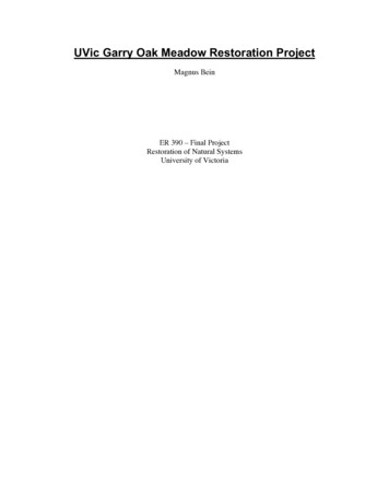
Figure: UVic Natural AreasThe site lies in the municipality of Oak Bay between N48 27'35.2", W123 18'57.4" andN48 27'33.6", W123 18'52.6" at an elevation of 69 metres (University of Victoria 1990).The total area of this site is approximately 3500 m2. It is part of a grass field that occursin the southwest area of Garry oak ecosystems. Adjacent land-uses to this site are a workyard, the Finnerty Gardens, Oak Bay transportation right of way, Hydro right of way, aroad, a bus stop, and gravel trails.Ecological Conditions of Site and EnvironsParent Material and SoilThe campus lands are legacy of long-term geological processes. Bedrock exposed andburied around the campus is Wark gneiss, a metamorphic rock of various igneous andpossibly sedimentary minerals (Muller 1980). The gneiss has been scoured, broken, andburied over periods of glaciations and sea level change. Pleistocene deposits of an earlierglaciation are overlain with the Capilano sediments, which form the parent material ofpresent day soils (Monahan and Geo 2000). The sediments have three characteristicfacies: a soft to firm grey clay; a brown clay; and sand. Around the University ofVictoria, the Capilano Sediments are glacio-marine clayey silts known as the VictoriaClay, quite common all around Victoria. At the sample site, less than 5 m of VictoriaClay overlie Pleistocene deposits greater than 10 m thick. Blanketing these deposits issilty diamicton deposited directly by glaciers of over 1 m thick (Blyth & Rutter 1993).At the restoration site, the ground is relatively flat with some hummocks. There are anumber of soil disturbances including planting and then transplanting ornamental trees,
vehicle compaction and tire rutting, and installation of a water pipe. It is possible therewas contamination and disturbance during construction of Cedar Hill Cross Road andinstallation of telephone poles. There was a temporary structure in a small are to theSouthwest of the site, of which a compacted gravelly bed remains.Bob Maxwell (2002) found the following characteristics from three soil pits at therestoration site. The Ah horizon is 25-30 cm of medium brown (dry) sandy loam with aroot mat, or turf, to 15 cm. The surface soils are very dark brown and likely include finecharcoal in the matrix indicative of historical aboriginal burning. This surface is likely abeach strand with aeolian sands resting on a compact silty subsoil. The subsoil horizon at35-55cm consists of a grayish white dry very compact clay loam. It is mottled, reflectinga fluctuating water table, and is slightly cemented. This layer will restrict both root andwater penetration.The grass field had a shallower Ah surface soil and the colour was not as dark brown asthe pits near the oak trees. His interpretation was that the soils near the forest appear to beunmodified from to plowing or scalping. Near surface bedrock likely precluded farmtillage. He concluded that the soils are characteristic of Group 6 deep clayey soils andbiophysical zone 9 grassland over clayey soils described in the Saanich oak sites GORPproject (Maxwell and Giasson, 2002).Based on the findings from field sampling, soil moisture and nutrient regimes mayclassified based on Green and Klinka (1994). The soil moisture regime is moist with astrongly fluctuating water table. The main determinants of this are the flat laying surfaceof the site, fine particle size of the earth fraction, and mottles present 35 cm below groundlevel. The soil nutrient regime is rich to very rich, due to a thick Ah horizon and earthworms which form a Mull humus layer.HydrologyThe climate around the university governs a hydrological pattern representative of theCoastal-Douglas Fir biogeoclimatic zone. Using a water balance model (Dingmann 2002)and nearby weather station data (Table 1) a water budget for the campus may beprojected. Figure 1 displays precipitation, snow pack, available water, soil water, actualevapotranspiration, surplus water, potential evapotranspiration, and water deficits in mmof water monthly. Water from rain and snow melt, soil moisture, and potential and actualevapotranspiration interplay to yield monthly surplus or deficit in the water balance of theregions.
12010080PercipitationSnow packAvailable WaterSoil WaterActual evapotranspirationSurplus waterPotential evapotranspirationWater Figure 1: Water balance in mm of water over a year using temperate and precipitationclimate normal from Environment Canada (2004). Water balance model based on Dingman(2004).Precipitation occurs year round. Minimum is in July and maximum is in December. Snowonly occurs in December and January; rain still has same maximum and minimum. Rainand snow melt has values at the same as PPT, except from Dec to Feb. Soil water is atcapacity from December to March with a steady decline from April to September, andrecharges over October and November. Potential evapotranspiration equals actualevapotranspiration from October to March; in the other months of the year, actualevapotranspiration is lower than potential evapotranspiration being limited by availablewater. Surplus water occurs from December to May, with maximum in January, andminimum in March. Deficit occurs from April to September, with minimum in April,maximum in July.The restoration site is situated in a buffer location to the headwater wetland complex ofthe urban Bowker Creek watershed. These headwater wetlands occur on the UViccampus and are characterized by shallow ground water flow. The site, with a shallow claylayer probably has same ground water source. The site once flooded before installation ofdrains, suggesting it may have been a wet meadow. Within the site are several puddle topond sized vernal pools (diameters a half to five metres). The site has the potential toflood in the winter and dries out quickly in the summer. No flooding occurs duringrelatively dry winters due to drainage tiles.FloraThe vegetation near and around the site is fragmented, degraded, and managed. There area range of plant associations, including managed gardens and mowed lawns, grass field,wild flower meadows, wooded shrub thickets, and forest. The main physiognomic typesare grass-forbe communities; woodland savanna; and forest.
The Grass-Forbe communities are fields of mostly exotic species with primarily grassesthat include patches and invading/remnant native species. There are scattered shrubswhich are also mostly exotic like English hawthorn, apple, scotch broom. Some shrubsare native and include Scouler's willow and black hawthorn. These fields are mowed afternative species have set seed.The Woodland Savanna communities are a mix of in grown thickets and anthropogenicgardens and lawns. The anthropogenic patches maintain a canopy of mostly native treesincluding Quercus garryana and Arbutus menziesii. All other plants in these areas areexotic, except for the ornamental native plants, and pioneering species like piggy backplant. The native Garry Oak – Indian Plum thickets are undergoing succession withDouglas-fir and grand fir invasion. Pockets of shallow soil occur intermittently aroundexposed bedrock where moss - miner's lettuce communities occur. Other pockets ofnative camas community occur in gaps and trail edges. Established English hawthorn andapple trees are scattered around the Woodlands in some instances forming a contiguousgrove. Exotic blackberry form continuous population in highly disturbed sites. Finallyivy, laurel leaf Daphne pervade all the woodland areas.Beyond woodlands there is a stand of forest dominated by Douglas-fir and grand fir, withsome other canopy trees like bog leaf maple and oak. In the undertory are Indian plum,red oisier dogwood, English holly.Matthew Fairbarns provided information at the Research Colloquium that there is a redlisted species, Carex tumulicola, found in the Garry oak meadow along Gordon HeadRoad. Adolf Ceska verified it on March 25 during a telephone conversation.
Figure : Garry oak and associated plant communities in the southwest corner of the UVicGordon Head campusThe site supports limited species of plants. The site consists of low growing agronomicgrass species such as Orchard grass (Dactylis glomerata), Kentucky bluegrass (Poapratensis), and Sweet vernalgrass (Anthoxanthum odoratum). Many other invasivegrasses and weeds are also found on site.Also observed at the site are at least three species of fungi. Meadow mushroom (Agaricuscampestris) was observed at a high density in the fall 2003. Also at small densities aspecies of puffball and an unidenitified black mushroom were see.The site is bordered to the east by a dense thicket of snowberry (Symphoricarpos albus),Nootka rose (Rosa nutkana), Indian plum (Oemleria cerasiformis) and red-osierdogwood (Cornus stolonifera). There is a mixed forest of Douglas-fir (Pseudotsugamenziesii) and Garry oak (Quercus garryana) beyond the thicket. To the north is FinnertyGardens, composed of a variety of ornamental plant species.According to the moisture and nutrient regime Green and Klinka (1994) predict aWestern red cedar - Vanilla-leaf site series as the climax vegetation. The tree speciesrepresentative of this vegetation community are: Abies grandis, Psuedotsuga menziesii,Acer macrophyllum, Alnus rubra, and Cornus nuttallii. Gaultheria shallon, Holodiscusdiscolor, Mahonia nervosa, Oemlaria serasiformis, Symphoricarpos albus, and Rubusursinus are typical shrubs. The characteristic herbs are Polystichum minutum, Achlystriphylla, Tiarella trifoliata, and Lactuca muralis. Finally Kindbergia spp., Leucolepismenziesii, and Plagiomnium insigne are common mosses. Many of these species occur inadjacent areas like Abies grandis, Psuedotsuga menziesii, Oemlaria serasiformis, andSymphoricarpos albus. Acer macrophyllum seedlings and Kindbergia have been observedat the site.FaunaNo formal animal inventory has been conducted and findings are based on casualobservations during site visits and un-published reports by members of the campuscommunity.Several individual bats (Myosotis sp.), European rabbit (Orctolagus cuniculus), andEastern gray squirrel have been observed from the site. Butterflys and earthworms areknown at the site. Also known to occur around the campus are deer, birds,
Terrestrial Ecosystem Mapping (TEM) of the Garry oak Ecosystem on the southwest corner of campus was completed. The methodology is a provincial standard (RIC 1998) and includes analyses of site vegetation and soils. Garry oak classifications were done using Del Meidinger's "Oak Associations," this material is available at the RNS library.