Transcription
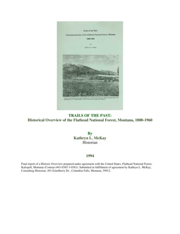
TRAILS OF THE PAST:Historical Overview of the Flathead National Forest, Montana, 1800-1960ByKathryn L. McKayHistorian1994Final report of a Historic Overview prepared under agreement with the United States, Flathead National Forest,Kalispell, Montana (Contract #43-0385-3-0363). Submitted in fulfillment of agreement by Kathryn L. McKay,Consulting Historian, 491 Eckelberry Dr., Columbia Falls, Montana, 59912.
TABLE OF CONTENTSIntroductionAcknowledgementsPrevious WorkMethodologyPhysical EnvironmentAbbreviations Used in TextIntroductionThe Fur TradeIntroductionThe Fur TradeMissionary Activity and Early ExplorationIntroductionMissionary ActivityRailroad SurveysInternational Boundary SurveysOther Early ExplorationsMiningIntroductionOil FieldsCoal DepositsPlacer and Lode MiningGeneralProspector's LifePlacer and Lode Mining in the FlatheadSettlement and AgricultureIntroductionSettlement Up to 18711871-18911891 to World War IIWorld War II to PresentForest Reserves
IntroductionForested Land on the Public Domain up to 1891Creation of the Forest ReservesGLO Administration of the Forest Reserves, 1898-1905Forest Supervisors and Rangers on the Flathead and Lewis & Clarke Forest Reserves, 1898-1905Forest Service Administration, 1905-1960IntroductionQualifications of Early Forest Service WorkersDaily Work of Early Forest Service EmployeesForest Service FoodWinter WorkFamiliesInjuriesSpecial-Use PermitsForestry Research and EducationWorld WarsAdministrative SitesBoundariesNorthern Pacific RailroadGlacier National ParkGlacier View and Other Proposed DamsHungry Horse DamTransportationIntroductionEarly TrailsWagon RoadsRailroadsAutomobilesForest Service TrailsForest Service Trail Construction and MaintenanceForest Service Use of Pack AnimalsForest Service RoadsCommunicationsIntroductionTelephoneRadioFire Detection and Suppression
IntroductionFire Behavior and HistoryEarly GLO and Forest Service Fire Policy1910 Fires in the Northern RockiesFire DetectionFire SuppressionCooperative Fire EffortsTimber HarvestingIntroduction1800s to 1905Timber TrespassesLogging on Private Lands, 1905-1942Railroad TiesForest Service Logging, 1905-1942GeneralSwan ValleyMiddle ForkSouth ForkNorth Fork and North of Columbia FallsLogging During and Shortly After World War IIInsect, Disease, and Windstorm Damage to TimberLogging in the 1950sLogging MethodsTimber Cruising and ScalingHarvestingSkidding and HaulingRiver DrivesMechanization of LoggingLogging CampsThe IWW StrikesMultiple Use-Sustained Yield Act of 1960Forest HomesteadsIntroductionForest Homestead Act of 1906Stillwater Area HomesteadsNorth Fork HomesteadsMiddle Fork HomesteadsSouth Fork HomesteadsSwan Valley HomesteadsGrazing and Other Commodities
IntroductionGrazing in the Flathead ValleyGeneral Forest Service GrazingGrazing on the Flathead National ForestOther CommoditiesHunting, Fishing, Trapping, and Wildlife ManagmentIntroductionHuntingFishingTrappingForest Service Wildlife ManagementThe Civilian Conservation Corps (CCC) EraIntroductionCCCBlister RustRecreation and Wilderness AreasIntroductionGeneral RecreationRecreation in the Lake McDonald AreaFlathead National Forest Recreation up to World War IIDownhill SkiingFlathead National Forest Recreation after World War IICreation of Primitive and Wilderness AreasBob Marshall WildernessMission MountainsJewel BasinConclusionTimelineGlossaryBibliographyIndex (omitted from the online edition)
LIST OF FIGURESFigure 1. Map of Flathead National Forest and vicinityFigure 2. Fur trading posts in northwestern Montana and vicinityFigure 3. Locations of Native American tribes, ca. 1853Figure 4. Fort Connah on the Flathead Indian Reservation, 1865Figure 5. John PalliserFigure 6. Placing an international boundary markerFigure 7. Historic mining districts in northwestern Montana and vicinityFigure 8. Kintla oil well, 1904Figure 9. Star Meadow mining district, showing locations of minesFigure 10. Nick Moon, ca. 1895Figure 11. Post offices in the Flathead Valley areaFigure 12. Towns that have had post offices in the Flathead Valley areaFigure 13. Counties in western Montana: 1889, 1904, 1918, 1925Figure 14. Street scene in Kalispell, ca. 1895Figure 15. McCarthysville, 1918Figure 16. Lewis & Clarke Forest Reserve boundaries in 1898Figure 17. Flathead Forest Reserve boundaries in 1898Figure 18. Supervisors of Flathead and Blackfeet National Forests, 1898 to presentFigure 19. William Brennen, first supervisor of the Blackfeet National ForestFigure 20. Frank Liebig standing on rock cairn at Swiftcurrent Pass, 1906
Figure 21. Frank Geduhn at foot of Logging Lake, ca. 1907Figure 22. Flathead and Blackfeet National Forest ranger districts ca. 1954Figure 23. Cartoon drawn in 1930Figure 24. Jack Clack wearing the packframe that he designedFigure 25. Winter camp near Calbick Creek, 1936Figure 26. Echo Ranger Station, 1924Figure 27. Flathead National Forest cartographic survey, 1960Figure 28. Administrative sites on the Flathead National ForestFigure 29. Big Prairie Ranger Station, 1913Figure 30. Elk Park packers' camp, ca. 1924Figure 31. Drawing of Moran Ranger Station, ca. 1918Figure 32. Construction at Spotted Bear Ranger Station, 1925Figure 33. Big Prairie Ranger Station complex, ca. 1917Figure 34. Big Prairie Ranger Station complex, 1990Figure 35. Location of proposed Glacier View dam and reservoirFigure 36. Location of proposed Spruce Park dam, reservoir, and tunnelFigure 37. Map of reported Native American trails in Flathead Valley areaFigure 38. Major roads and trails in Montana after 1850Figure 39. Freighter on Fort Steele-Kalispell trailFigure 40. Mary Ann and State of Montana at Demersville, 1891Figure 41. Map of Flathead County ca. 1905Figure 42. Railroad routes in Montana, 1887, 1898, 1910Figure 43. Primary roads and trails in Flathead National Forest area, 1898
Figure 44. Primary roads and trails in Flathead National Forest area, 1908 and 1912Figure 45. Primary roads and trails in Flathead National Forest, 1928 and 1927Figure 46. Fitting the abutment timbers on the Big Prairie bridge, 1922Figure 47. Equipment for a five-man Forest Service trail crew in 1935Figure 48. The Beatty trail graderFigure 49. Theodore W. (Toad) Paullin and a "short string," 1967Figure 50. Toussaint Jones packing a hot water heaterFigure 51. South Fork road near Upper Twin Creek, 1926Figure 52. Trails and roads in the Trail Creek area, 1912Figure 53. Trails and roads in the Trail Creek area, 1928Figure 54. Trails and roads in the Trail Creek area, 1948Figure 55. Trails and roads in the Trail Creek area, 1963Figure 56. Fool Hen Bridge on North Fork Road (west side), 1953Figure 57. Bulldozer working on Martin Creek access road, 1946Figure 58. Harry Gisborne using a heliograph, 1915Figure 59. Forest Service worker in the Spotted Bear LookoutFigure 60. Alidade stand and iron mine phone on Six Mile lookout, ca. 1920Figure 61. Forest Service worker repairing telephone line, 1926Figure 62. South Fork Road near Wounded Buck Creek, 1926Figure 63. List of some of the major fires in the Flathead National Forest areaFigure 64. Areas burned on the Blackfeet and Flathead National Forests, 1910Figure 65. Areas burned by major fires on the Flathead National Forest, 1889-1949Figure 66. Railroad speeder, 1921
Figure 67. List of emergency fire-season rations, 1914Figure 68. "Seen area" photograph taken from Standard LookoutFigure 69. Spotted Bear Lookout, 1923Figure 70. Locations of all known lookout sites on the Flathead National ForestFigure 71. Hornet Peak Lookout, 1923Figure 72. LA-style lookout, Flathead National ForestFigure 73. C. J. Hash taking a reading on Salmon lookout, 1926Figure 74. Portable water pump in use on Wolf Creek fire, 1924Figure 75. Putting final touches on fire line, Tango Creek fire, 1953Figure 76. Half Moon fire burning over Teakettle Mountain, 1929Figure 77. Half Moon fire of 1929, acres burned and fire suppression costsFigure 78. Sawmill on Whitefish LakeFigure 79. Butte & Montana Commercial Company mill, ca. 1895Figure 80. Interior of State Lumber Company sawmill, LaSalle, Montana, 1898Figure 81. List of some of the sawmills in Flathead County in 1907Figure 82. Timber types in the Flathead River drainage, 1922Figure 83. Production of small mills vs. large mills in Montana, 1921-1948Figure 84. Annual production of Christmas trees in Montana, 1936-49Figure 85. Original Somers sawmill, built 1901Figure 86. Somers Lumber Company workers and triangular railroad tiesFigure 87. Annual production of sawed cross ties in Montana, 1925-47Figure 88. McMillan & Kerr tie mill in Patrick gulch near Kalispell 1930Figure 89. Hauling railroad ties by truck, Eureka, 1929
Figure 90. Location and relative production sawmills in northwest Montana, 1948Figure 91. Working circles on the Flathead National Forest, ca. 1960Figure 92. 1924 estimates of timber on the Blackfeet and Flathead National ForestsFigure 93. Timber sales on Flathead National Forest, May 1926-January 1929Figure 94. Location of Coram Experimental ForestFigure 95. Hypothetical timber sale in the Bob Marshall WildernessFigure 96. Volume of timber cut on Flathead National Forest, 1935-1960Figure 97. Number of sawmills and lumber production in MontanaFigure 98. Relation of allowable cut to annual cut, 1916-1957Figure 99. Scaling logsFigure 100. Sawyers felling a Douglas-fir with a cross-cut sawFigure 101. Larch butts discarded on ACM sale, Seely Lake, Montana, 1908Figure 102. Frank Motichka and logging crew, ca. 1910Figure 103. Loading logs on to GNRR 40 miles west of Kalispel, 1939Figure 104. Logging railroads in Flathead Valley areaFigure 105. Shay locomotiveFigure 106. Logs in Stillwater River near Olney, 1924Figure 107. Splash dam on outlet of Whitefish LakeFigure 108. Log drive on Middle Fork of the FlatheadFigure 109. Wannigan on Stillwater River near the end of a log driveFigure 110. Willis March logging truck, 1920sFigure 111. Floor plan of railroad cars used at a logging camp, ca. 1934Figure 112. Logging camp known as Camp 3, Fortine, Montana
Figure 113. Loggers standing in front of load of logsFigure 114. Interior of kitchen at the State Mill logging campFigure 115. Map of a homestead in the upper Swan ValleyFigure 116. Extensive classification of land along Bear Creek, 1910sFigure 117. Homestead of Ralph and Esther Day in the North ForkFigure 118. Percentage of alienated land within the Flathead National ForestFigure 119. Bill and Emma Adair in front of their cabin, ca. 1940Figure 120. Theo and Anna ChristensenFigure 121. School near Polebridge, ca. 1921Figure 122. Grazing on the national forests, 1905-1956Figure 123. Grazing permits on Montana national forests, 1942Figure 124. Grazing permits on the Flathead National Forest, 1901-1956Figure 125. North Fork homesteader Mae Sullivan with dead grizzly bear, ca. 1930Figure 126. North Fork homesteaders holding up a string of fish, prior to 1910Figure 127. Trappers with pelts, 1934Figure 128. Chaunce Beebe, Biological Survey trapper and hunterFigure 129. Estimates of big-game animals, Flathead National Forest, 1919-1941Figure 130. Rangers on winter elk survey in the South Fork, 1927Figure 131. Sun River and Spotted Bear Game PreservesFigure 132. CCC camps on Flathead National Forest and state forests, 1933-1942Figure 133. Elk Park (Bridgehead) CCC camp, 1935Figure 134. Flathead CCC camp, ca. 1940Figure 135. Auto camping in western Montana, ca. 1920
Figure 136. Camp Tuffit, Lake Mary RonanFigure 137. Boaters on Holland Lake, 1936Figure 138. Trail Riders on meadow below Danaher Ranger Station, 1946Figure 139. Belton (West Glacier) seen from the south, ca. 1914Figure 140. Glacier National Park visitation, 1911-1957Figure 141. Recreational use on Flathead and Blackfeet National Forests, 1930Figure 142. View southwest across Big Salmon Lake from the outlet, 1934Figure 143. Primitive areas on Flathead and Lewis & Clark National forests, 1936Figure 144. Mission Mountains, ca. 1922
ACKNOWLEDGEMENTSMany people provided generous assistance with this project. Their help locating documents andtheir thoughtful comments made the process of pulling together the information much easier andmore enjoyable than it otherwise would have been. The enthusiasm of many Flathead NationalForest employees and retirees about the project and its findings was very encouraging andsustaining.Flathead National Forest personnel were extremely cooperative throughout the project. GaryMcLean, Forest Archaeologist, provided unlimited access to his considerable files and researchmaterials collected over the years, and he suggested contacts for specific research questions.Gerry Bergerson provided work space and gave cheerful assistance whenever requested. Thecontract administrator, Jacqueline Jensen, was a pleasure to work with. Employees on the variousranger districts provided access to their historical material and answered questions with goodcheer. These included Bryan Nichols, Howard McMillan, Ted Richardson, Arne Brosten, DaleJorgenson, Fred Flint, Jane Packer, Don Hauth, Menno Troyer, Dave Miller, Doug Law, andothers.Jud Moore, public information officer at the Forest Service Regional Office in Missoula, wasvery generous with his time and knowledge about the extensive historic files and photographskept at the Regional Office.Librarians and archivists provided invaluable assistance in tracking down obscure documents. Atthe top of the list are the librarians and staff in the reference department of the Flathead CountyLibrary, especially Rita, Barbara, Nancy, and Kim. They processed pages of Inter-Library Loanrequests, allowed me easy access to the Montana files and the microfilm collection, and strove toanswer my obscure questions. Their good cheer and persistence make it a pleasure to do researchin the library.Other librarians, archivists, and curators were also very helpful. These include Dale Johnson andChris Mullin at the University of Montana Mansfield Library; Derryll White at the Fort SteeleArchives in British Columbia; Brian Shovers at the Montana Historical Society library; DeirdreShaw at Glacier National Park; and Nathan Bender at the Special Collections division of theRenne Library, Bozeman. Various staff members at the Federal Records Center in Seattle and theNational Archives in Suitland, Maryland, were surprisingly uncomplaining about requests forboxes of papers stored in high, remote corners of their warehouses.Local historian and retired teacher Henry Elwood provided invaluable support in a number ofways. He graciously shared his historic photograph collection with me. He also answered"history trivia questions" with great care and posed thoughtful questions that led me in newdirections. Mark White, Libby District Archaeologist on the Kootenai National Forest,generously shared his relevant research material, leads on sources he has identified, and hisenthusiasm for the history of northwestern Montana. Frank Gregg of Whitefish, President of theStumptown Historical Society, generously allowed me to look through the society's excellent
photograph collection. Lee Downes, long-time resident of the North Fork, provided informationon historic trapping, grazing, and other topics in the area.And finally, I owe unlimited gratitude to the five people who volunteered to review andcomment on the first draft of the overview. Their comments and queries improved the finalproduct tremendously, although quite a few of their excellent questions remain - alas unanswered in this document. These five brave souls were George Wilson (retired from theGlacier View Ranger District), Henry Elwood (historian in Kalispell, Montana), Nancy Renk(historian in Sandpoint, Idaho, and co-author of the Kootenai National Forest overview), MarkWhite (Libby District Archaeologist), and Pat Bik (historian in Helena, Montana). To each ofthese reviewers, thank you, thank you, thank you!
PREVIOUS WORKCultural resource surveys of the Flathead National Forest have been conducted since 1974. Theinventory forms and site records that have been prepared over the years provide excellentmaterial on the history of the Flathead National Forest. The surveys have been conducted by bothForest Service cultural resource specialists and by private consultants. Most of the Forest'scultural resource surveys have been project specific and performed in order to comply withfederal laws. This has tended to bias the known information somewhat.In 1991 Historical Research Associates completed a large study of Forest Service administrativesites in Region One. The document and the associated National Register nominations (Caywoodet al. 1991) proved very helpful for this project. Historic overviews of other Forests also aided indeveloping the context for the Flathead National Forest. The recently completed history of theNorthern Region of the Forest Service (Baker et al. 1993) is also helpful for providing a broadercontext for local developments. Particularly relevant will be the historical overview of theKootenai National Forest (not yet completed when this overview was prepared).Some of the local histories of the Flathead Valley contain a great deal of information notavailable elsewhere. These include books and articles by Henry Elwood (particularly Elwood1976, 1980) and the articles and other material in the 10 volumes compiled by Samuel Johns(Johns 1943)Other sources that provide invaluable information include Charlie Shaw's history of the FlatheadNational Forest (Shaw 1967), Flora Mae Bellefleur Isch's thesis on the upper Flathead Valley(Isch 1948), Patricia Bick's history of homesteading on the east side of the North Fork (Bick1986), the collection of reminiscences by Region One Forest Service retirees (USDA FS 194476), Pat Taylor's written descriptions of work on the Flathead National Forest in the 1930s(Taylor 1986), and a number of the interviews (oral histories) conducted by the FlatheadNational Forest and the Montana Historical Society.The Montana files at the Flathead County Library are arranged by subject and fill several filecabinets. These include a great variety of published and unpublished information on the area'shistory. The library also is the repository for many of the articles cited in the Flathead RiverBasin Bibliography that otherwise would be difficult to find.
METHODOLOGYKathryn L. McKay was the project historian and principal investigator for the project. She holdsan M. A. from the University of Delaware in American History, specializing in the History ofTechnology. She has extensive prior research experience in the project area through thefollowing projects: National Register nominations for four historic districts and 50 individuallyeligible properties in Kalispell, Montana; three seasons working as an archaeological technicianon the Flathead National Forest; teaching classes on the history of the North Fork of the Flatheadfor Glacier Institute and Elderhostel; and miscellaneous smaller research projects on FlatheadValley history.The project historian conducted research at a wide variety of repositories. Sources consultedincluded books, articles, government documents, unpublished manuscripts, oral history tapes andtranscripts, maps, and photographs. All sources used in the overview have been compiled into anannotated bibliography included with the overview. The repositories of sources that are relativelydifficult to find are noted in the bibliography.The project historian visited the following libraries and archives:Forest ServiceRegion One Archives, MissoulaFlathead National Forest Supervisor's Office, KalispellBigfork Ranger Station, BigforkGlacier View Ranger Station, Columbia FallsHungry Horse Ranger Station, Hungry HorseSpotted Bear Ranger Station, Spotted BearTally Lake Ranger Station, WhitefishLibrariesFlathead County Library, KalispellGlacier National Park Library and Archives, West GlacierMansfield Library, University of Montana, MissoulaRenne Library, Montana State University, BozemanMontana Historical Society Library, HelenaNational Archives, Suitland, MDPhotograph CollectionsFlathead National Forest, KalispellUSDA Forest Service, Region One, MissoulaStumptown Historical Society, Whitefish
Glacier National Park, West GlacierUniversity of Montana, MissoulaMontana Historical Society, HelenaHenry Elwood (private), KalispellSources such as newspapers could not be researched in depth because of time constraints,although local newspapers were searched under specific dates in order to learn more aboutcertain events. Some historic themes have not been covered much in the existing literature, sothere is less material available on these subjects (for example, grazing and trapping on theFlathead National Forest, or strikes at Flathead Valley sawmills other than IWW-led strikes).This document is an overview; uneven treatment of the various subjects is likely to exist. Thiscan be remedied by more intensive research at a later date.No fieldwork was conducted for the overview. The author, however, is familiar with the historicsites on the Forest; this knowledge supplemented the written documentation available fromreports, site files, and other research materials.The research and writing of the overview were done by the project historian between October1993 and June 1994. It took approximately 200 person-days to prepare the overview.
ENVIRONMENTGeneral SettingThe Flathead National Forest today occupies over 2.3 million acres in the northern RockyMountains of northwestern Montana. The Canada/United States boundary is the northern border.Approximately 130 miles of boundary are shared with Glacier National Park along the North andMiddle Forks of the Flathead River. The Flathead Indian Reservation lies west of the southernend of the Forest. The Forest is also bounded by the Lewis and Clark National Forest on the east,the Lolo National Forest on the south, and the Kootenai National Forest on the west. TheStillwater, Coal Creek, and Swan River State Forests are located within the area of this study,and it also includes portions of Flathead, Lake, Lewis and Clark, Lincoln, Missoula, and Powellcounties. The Flathead National Forest manages 51% of the land in Flathead County.The natural resources of the project area have attracted people to the area and have both limitedtheir efforts and contributed to their successes. Major communities in the area include Kalispell,Columbia Falls, and Whitefish.ClimateThe weather in the project area is cool and maritime-influenced. Annual precipitation varies from16" in the valley bottoms to more than 100" on the mountain tops. On the valley bottoms abouthalf of the precipitation falls as snow, whereas at the higher elevations up to 80% is snow. Airtemperatures range from -40 F to over 100 F. The growing season ranges from over 90 days toless than 60 days, depending primarily on elevation and exposure.TopographyThe topography typifies that of glaciated lands, featuring high alpine basins and broad U-shapedvalleys. All three types of glaciation - continental, alpine, and valley - occurred in the projectarea. The highest mountain peaks in the area are just over 10,000' in elevation; the elevation ofthe Flathead Valley is approximately 3,000'. The major mountain ranges generally run northsouth.Glaciation from the last ice age, which ended approximately 10,000 years ago, influenced theshape of the land as well as the composition of the soil. The bedrock is mostly metasedimentaryargillites, quartzites, and limestones from the Precambrian era. Most of the mountain ranges havebeen formed by block faults. The Rocky Mountain Trench extends from British Columbiasoutheast through today's towns of Eureka, Kalispell, and St. Ignatius. The soils in the projectarea are young and silty in texture. A volcanic ash surface mantle ranges from 4" to 8" inthickness.Flathead Lake is the largest natural freshwater lake west of the Mississippi. Five major streamsystems feed the Flathead River drainage, which eventually flows into the Columbia Riversystem. The three forks of the Flathead River (North, South, and Middle) drain a major portion
of the project area. The Stillwater River empties into the main stem of the Flathead River a shortdistance north of Flathead Lake. The Swan River flows north and also empties into FlatheadLake. The Hungry Horse Darn has created the Hungry Horse reservoir on the lower end of theSouth Fork of the Flathead River. There is also a dam on the Swan River near its mouth.Much of the terrain in the project area has slopes greater than 60%. Generally, the lands withgentle slopes are lower in elevation and have a longer growing season. There are no knowngeothermal features in the project area.VegetationElevation, precipitation, topography, and temperature extremes have resulted in diverse plantcommunities that support a wide variety of plant and animal life. In the wooded areas, thesubalpine fir series is the dominant habitat type, but the forest vegetation ranges from the warmdry ponderosa pine/bunchgrass type to the cool-moist whitebark pine type. Most of the landbelow 7,000' in elevation is capable of supporting tree cover. The occasional exceptions are bogsand wet meadows, dry meadows, shrub fields, talus slopes, rock outcrops, and avalanche chutes.The existing vegetation shows the influence of wildfire. Extensive stands of even-aged lodgepolepine are prevalent throughout the Forest. Fire's influence is also shown in vegetative mosaics,affecting species composition, age class, and life form.Wildlife and FishThe Flathead National Forest provides habitat for approximately 250 species of wildlife and 22species of fish. Wildlife that inhabits the Forest includes elk, mule deer, whitetailed deer, moose,Rocky Mountain goat, grizzly bear, black bear, cougar, gray wolf, wolverine, lynx, coyote, graysquirrel, pileated woodpecker, bald eagle, peregrine falcon, and various fur-bearing mammals.Native fish species include bull trout, cutthroat trout, mountain whitefish, and several others.Introduced species include rainbow and brook trout, arctic grayling, kokanee salmon, andnorthern pike.MineralsThe dominant mineral activity on the Flathead National Forest today is oil and gas leasing.Approximately 1.2 million acres are either leased or under lease application. There are no knownactive mining operations on the Forest.(compiled from FNF "Forest Plan" 1985; Alt 1986)
ABBREVIATIONS USED IN TEXTACM Anaconda Copper Mining Company (also known as the Amalgamated CopperCompany)BFboard feetBMButte & Montana Commercial CompanyCCC Civilian Conservation CorpsGLO General Land OfficeGNRR Great Northern RailwayHBC Hudson's Bay CompanyIWW Industrial Workers of the WorldMBF thousand board feetMMBF million board feetNMFA Northern Montana Forestry AssociationNPRR Northern Pacific RailroadUSGS United States Geological Survey
INTRODUCTION(Northern Region News banner, 7 March 1938)The history of the Flathead National Forest is closely tied to that of the Flathead Valley. Thishistoric overview attempts to place developments on the Flathead National Forest into thebroader context of developments in the Flathead Valley and beyond, both within and outside theForest Service. The changing uses of Flathead National Forest lands reflect larger social andtechnological changes occurring in the United States at the same time. This overview does notaddress Native American use of the land in any detail because that important topic is to be thesubject of a prehistoric overview of the Flathead National Forest.In 1897 the U. S. Congress created the two forest reserves that later became known as theFlathead National Forest. Until the 1940s, the major management activities on the Forestcentered on fire detection and suppression, trail building, the installation of an extensivebackcountry telephone network, running big-game surveys, and the administration of foresthomestead applications and a limited number of commercial timber sales. World War II markeda turning point in the management of the Flathead and other national forests. Subsequently,timber sale volumes increased dramatically, as did the public demand for recreation, and thesystem of fire detection changed from its previous emphasis on manned lookouts to the use ofaerial patrols.In the past several decades, competing interests in the resources of the national forests have ledto conflicts over how best to manage the natural and man-made resources within the Forests. Thepublic has become increasingly involved in the decision-making process as the various "multipleuses" of the national forests are weighed and day-to-day and long-term management decisionsare made. The term "ecosystem management" has recently become popular to describe theagency's broader perspective on managing the land for which it is responsible. Change, as usual,is in the wind, due to relatively recent federal laws and to a new generation of professionalsworking within the Forest Service.An understanding of human attitudes, policies, and actions on the land in the past improvesdecisions made today. This overview relies heavily on written documents to provide anunderstanding of the impacts of humans on the land in the Flathead Valley area from the years1800 to 1960. Much can also be learned from the land itself, its vegetation and topography, andthe physical remains of past human activity.
The physical evidence of the history of the Flathead National Forest is varied, and it is oftenfascinating to visit on site. Although some cultural resources have been destroyed by wildfireand many others by natural deterioration or intentional demolition, other resources remain toenlighten us today. Some of these are described briefly in the chapter introductions that follow.In addition, many names of mountains, creeks, and other natural features reflect earlier uses ofthe area, while others memorialize specific people.It is difficult, in today's world of highway
Auto camping in western Montana, ca. 1920 . Figure 136. Camp Tuffit, Lake Mary Ronan Figure 137. Boaters on Holland Lake, 1936 Figure 138. Trail Riders on meadow below Danaher Ranger Station, 1946 Figure 139. Belton (West Glacier) seen from the south, ca. 1914 Figure 140. Glacier National Park visitation, 1911-1957


