Transcription
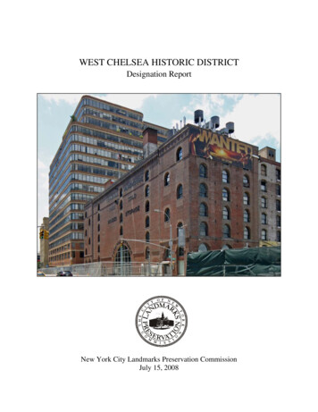
WEST CHELSEA HISTORIC DISTRICTDesignation ReportNew York City Landmarks Preservation CommissionJuly 15, 2008
Cover: Terminal Warehouse Company Central Stores (601 West 27th Street) (foreground),Starrett-Lehigh Building (601 West 26th Street) (background), by Christopher D. Brazee (2008).
West Chelsea Historic DistrictDesignation ReportEssay researched and written byChristopher D. Brazee & Jennifer L. MostBuilding Profiles & Architects’ Appendix byChristopher D. Brazee & Jennifer L. MostEdited by Mary Beth Betts, Director of ResearchPhotographs byChristopher D. BrazeeMap byJennifer L. MostCommissionersRobert B. Tierney, ChairPablo Vengoechea, Vice-ChairStephen F. ByrnsDiana ChapinJoan GernerRoberta Brandes GratzChristopher MooreMargery PerlmutterElizabeth RyanRoberta WashingtonKate Daly, Executive DirectorMark Silberman, CounselSarah Carroll, Director of Preservation
TABLE OF CONTENTSWEST CHELSEA HISTORIC DISTRICT MAP. 1TESTIMONY AT THE PUBLIC HEARING . 2WEST CHELSEA HISTORIC DISTRICT BOUNDARIES . 2SUMMARY. 4THE HISTORICAL AND ARCHITECTURAL DEVELOPMENT OF THE WEST CHELSEAHISTORIC DISTRICT . 6Early History and Development . 6Manufacturing in Manhattan. 9Manufacturing in West Chelsea. 11Warehousing in Manhattan . 14Warehousing in West Chelsea . 17Industrial Architecture in West Chelsea . 18Post-Industrial West Chelsea . 23FINDINGS AND DESIGNATION . 26BUILDING PROFILES. 28West 25th Street, Nos. 501-555 (North Side, between Tenth & Eleventh Avenues) . 28West 25th Street, Nos. 564-568 (South Side, between Tenth & Eleventh Avenues) . 40West 26th Street, Nos. 513-559 (North Side, between Tenth & Eleventh Avenues) . 40West 26th Street, Nos. 500-534 (South Side, between Tenth & Eleventh Avenues) . 49West 26th Street, Nos. 601-649 (North Side, between Eleventh & Twelfth Avenues). 54West 26th Street, Nos. 600-626 (South Side, between Eleventh & Twelfth Avenues). 57West 27th Street, Nos. 547-559 (North Side, between Tenth & Eleventh Avenues) . 57West 27th Street, Nos. 510-514 & 536-556 (South Side, between Tenth & Eleventh Aves) . 57West 27th Street, Nos. 601-651 (North Side, between Eleventh & Twelfth Avenues). 62West 27th Street, Nos. 600-650 (South Side, between Eleventh & Twelfth Avenues). 62West 28th Street, Nos. 548-560 (South Side, between Tenth & Eleventh Avenues) . 62West 28th Street, Nos. 600-654 (South Side, between Eleventh & Twelfth Avenues). 66Tenth Avenue, Nos. 259-273 (West Side, between West 25th & West 26th Streets) . 66Eleventh Avenue, Nos. 210-218 (East Side, between West 24th & West 25th Streets). 70Eleventh Avenue, Nos. 239-243 (West Side, between West 25th & West 26th Streets) . 73Eleventh Avenue, Nos. 244-260 (East Side, between West 26th & West 27th Streets). 76Eleventh Avenue, Nos. 245-259 (West Side, between West 26th & West 27th Streets) . 80Eleventh Avenue, Nos. 262-280 (East Side, between West 27th & West 28th Streets). 80Eleventh Avenue, Nos. 261-273 (West Side, between West 27th & West 28th Streets) . 83ARCHITECTS’ APPENDIX. 90ILLUSTRATIONS . 106
West Chelsea Historic DistrictWest Chelsea Historic DistrictBorough of Manhattan, NYLandmarks Preservation CommissionW 29th StCalendaring: March 18, 2008Public Hearing: May 13, 2008Continued Public Hearing: June 3, 2008Designated: July 15, 2008W 28th St547514 510513W 26th St600500273534ioimagg239Joe D626244200/hwayEleventh AveHigSideWest649536Tenth AveW 27th St650Tax Map Lots in Historic DistrictHighwwelfthay / T218568 564555W 25th St501259651Boundary of Historic District548280238279654Existing Historic DistrictsWest Chelsea Historic DistrictueAven210ManhattanQueensW 24th St0.05MilesGraphic Source: New York City Department of City Planning, MapPLUTO, Edition 06C, December 2006. Author: JM. July 15, 2008.Brooklyn
Landmarks Preservation CommissionJuly 15, 2008, Designation List 404LP-2302TESTIMONY AT THE PUBLIC HEARINGOn May 13, 2008, the Landmarks Preservation Commission held a public hearing on theproposed designation of the West Chelsea Historic District (Item No. 1). The hearing had beenduly advertised in accordance with the provisions of law. Ten witnesses spoke in favor of thedesignation as proposed, including representatives for Council Speaker and Councilmember forDistrict 3 Christine Quinn, Borough President Scott Stringer, State Senator Thomas Duane,Manhattan Community Board 4, Assemblymember Richard Gottfried, the Historic DistrictsCouncil, the Municipal Art Society of New York, the New York Landmarks Conservancy, theCouncil of Chelsea Block Associations, and Save Chelsea. One of these speakers expressedinterest in expanding the boundaries to include additional properties not within the proposeddistrict. The owners and/or representatives of two properties (a total of ten speakers) wereopposed to including their properties or portions of their properties in the proposed district.Representatives of two properties (a total of five speakers) took no position on the proposeddistrict. One witness, representing an owner, asked for zoning changes in order to support theproposed district. One owner asked that the hearing be continued. On June 3, 2008, theLandmarks Preservation Commission held a continued public hearing on the West ChelseaHistoric District (Item No. 1). The continued hearing had been duly advertised in accordancewith the provisions of law. Four witnesses spoke in favor of the designation as proposed,including representatives for the Roebling Chapter of the Society for Industrial Archeology andthe Chelsea Waterside Park Association. The owners and/or representatives of two properties(a total of eight speakers) were opposed to including their properties or portions of theirproperties in the proposed district. Representatives of one of these properties testified againstinclusion at the previous public hearing; the continued public hearing was requested by theowner of the second property. Two letters were also presented to the Commission in support ofthe proposed designation.WEST CHELSEA HISTORIC DISTRICT BOUNDARIESThe West Chelsea Historic District consists of the property bounded by a line beginningat the intersection of the northern curbline of West 28th Street and the eastern curbline of theWest Side Highway (aka Joe DiMaggio Highway, Twelfth Avenue), extending easterly along thenorthern curbline of West 28th Street to a point formed by its intersection with a line extendingnortherly from the eastern property line of 548-552 West 28th Street (aka 547-553 West 27thStreet), continuing southerly across the roadbed, along said property line, and across the roadbedto the southern curbline of West 27th Street, easterly along said curbline to a point formed by itsintersection with a line extending northerly from the eastern property line of536-542 West 27th Street, southerly along said property line to the southern property line of534 West 27th Street, easterly along said property line and the southern property lines of532 through 516 West 27th Street, to the western property line of 510-514 West 27th Street,2
northerly along said property line to the southern curbline of West 27th Street, easterly along saidcurbline to a point formed by its intersection with a line extending northerly from the easternproperty line of 510-514 West 27th Street, southerly along said property line to the southernproperty line of 510-514 West 27th Street, westerly along a portion of said property line to theeastern property line of 513 West 26th Street, southerly along said property line and across theroadbed to the northern curbline of West 26th Street, easterly along said curbline to the westerncurbline of Tenth Avenue, southerly along said curbline and across the roadbed to the southerncurbline of West 25th Street, westerly along said curbline to a point formed by its intersectionwith a line extending northerly from the eastern property line of 210-218 Eleventh Avenue(aka 564-568 West 25th Street), southerly along said property line to the southern property line of210-218 Eleventh Avenue (aka 564-568 West 25th Street), westerly along said property line tothe eastern curbline of Eleventh Avenue, northerly along said curbline and across the roadbed tothe northern curbline of West 25th Street, easterly along said curbline to a point formed by itsintersection with the western property line of 551-555 West 25th Street, northerly along saidproperty line to the northern property line of 551-555 West 25th Street, easterly along saidproperty line and the property lines of 549 through 543 West 25th Street to the western propertyline of 518-534 West 26th Street, northerly along said property line to the southern curbline ofWest 26th Street, westerly along said curbline and across the roadbed to the western curbline ofEleventh Avenue, southerly along said curbline to a point formed by its intersection with a lineextending easterly from the southern property line of 239-243 Eleventh Avenue (aka 600-626West 26th Street), westerly along said property line to the western property line of 239-243Eleventh Avenue (aka 600-626 West 26th Street), northerly along said property line to thesouthern curbline of West 26th Street, westerly along said curbline to the eastern curbline of theWest Side Highway (aka Joe DiMaggio Highway, Twelfth Avenue), northerly across theroadbed and along said curbline to the point of the beginning.3
SUMMARYThe West Chelsea Historic District, located along the Hudson River waterfront inManhattan, is a rare surviving example of New York City’s rapidly disappearing industrialneighborhoods. During much of the nineteenth and twentieth centuries, the area was home to someof the city’s and the country’s most prestigious industrial firms. The Otis Elevator Company, theCornell Iron Works, the John Williams Ornamental Bronze and Iron Works, and the ReynoldsMetal Company all had a presence in West Chelsea. The district encompasses all or parts of sevenblocks, approximately 30 structures in total dating from 1885 to 1930.West Chelsea was first developed with a mixture of working-class residences and industrialcomplexes beginning in the late 1840s, at the moment when Manhattan was becoming the mostimportant center of manufacturing in the United States. Rows of simple tenements were erected inclose proximity to large iron works, lumber and coal yards, steam-powered saw mills, and stonedressing operations. Many of the goods produced by the neighborhood’s manufacturers werepurchased locally by the city’s burgeoning construction industry. Few traces of this early period ofdevelopment survive. The small stable building at 554 West 28th Street, which was erected in 1885for Latimer E. Jones’ New York Lumber Auction Company, is the only reminder within thehistoric district of the lumber yards that were once a prominent feature of the neighborhood.West Chelsea experienced a second wave of development around the turn of the twentiethcentury. By the 1920s, nearly all of the area’s original small-scale buildings had been replaced withlarger, more substantial industrial structures. Many were built at least in part as speculativeventures. The structure at 548 West 28th Street, for example, was commissioned in 1899 by realestate investor Augustus Meyers and was soon leased to the Berlin Jones Envelope Company. Thearchitect, William Higginson, was a prolific designer of factory buildings—including severallocated in the DUMBO Historic District. The building possesses many of the features of theAmerican Round Arch style that characterized industrial architecture at the turn of the twentiethcentury, including a simple brick facade, arched openings, rhythmically placed windows recessedbetween vertical brick piers, horizontal banding, and a corbelled brick cornice. The Cornell IronWorks building at 555 West 25th Street (1891) and the Conley Foil Company building at 521-537West 25th Street (1900-01), the latter built on a site formerly occupied by the Cornell Iron Worksafter the company moved its heavy manufacturing operations out of Manhattan, both employ manyof the same architectural elements. The John Williams Ornamental Bronze and Iron Works openedtheir own modern factory building at 549 West 26th Street in 1900-01, replacing a row of fourtenements that dated to 1852. A few years later, from 1901-07, the firm demolished an old foundrybuilding and several other tenements on West 27th Street, erecting a pair of large industrialstructures in their place. While the John Williams firm occupied some of the space in their newbuildings, several of the floors were leased to other industrial businesses such as the Meyer SniffenCompany, which manufactured metal plumbing supplies.The pace of redevelopment in West Chelsea quickened during the second decade of thetwentieth century as new industries moved into the neighborhood. In 1910, the H. Wolff BookManufacturing Co. opened its new factory at 518 West 26th Street on a parcel of land that hadpreviously been occupied by the Cornell Iron Works. It was the first of several publishing-relatedfirms that would settle in the neighborhood, and in 1914 the New York Times proclaimed the areabetween West 23rd and West 42nd Streets the new center of the city’s printing industry. The Wolffbuilding was also one of the first structures within the historic district to take advantage of theemerging technology of reinforced concrete that was revolutionizing the design of industrial4
buildings in the early twentieth century. The reinforced concrete internal structure of the buildingoffered substantial improvements in fireproofing, floor load capacities, and vibration dampening.The material also allowed for larger windows that increased light and ventilation in factorybuildings, and for fewer columns and overhead beams, thereby increasing available storage spacein warehouses. While reinforced concrete would soon surpass all others as the preferred materialfor industrial building construction, similar advantages were obtained from the older technology ofthe steel internal frames, as was employed in the construction of the Zinn Building at 210 EleventhAvenue. Erected in 1910-11, the Zinn Building was originally owned by a firm involved in themanufacture of metal novelties. Much of the space in the building was soon leased to publishersand lithographers, further enhancing the neighborhood’s status as a center of the printing trades.The Otis Elevator Company Building at 260 Eleventh Avenue, erected in 1911-12 and designed bythe noted architectural firm of Clinton & Russell, was also constructed with a steel frame. Thestructure originally housed the corporate headquarters of the famed elevator manufacturer, as wellas a regional sales office and fabrication facilities for the firm’s construction, repair, and researchand development departments.In addition to its manufacturing operations, West Chelsea also became a major center ofwarehousing and freight handling activity beginning in the late nineteenth century. The TerminalWarehouse Company opened its massive Central Stores complex in 1891 on land recentlyreclaimed from the Hudson River. Its owners were closely associated with the New York Centraland Hudson River Railroad, whose tracks entered directly into the building through the massiveround-arch entrance fronting Eleventh Avenue. In subsequent years, the waterfront propertyimmediately surrounding the Central Stores was converted to freight-related uses by railroadcompanies that had moved to the area after being displaced by the construction of the Gansevoortand Chelsea Piers. The Baltimore & Ohio Railroad (B&O) purchased the land bounded by West25th and West 26th Streets in 1897, and in 1912-13, improved its operations by erecting a largereinforced concrete warehouse at the northeast corner of the yard. At the time of its opening, it wassaid to be the largest concrete building in New York City and the first to employ flat plateconstruction techniques. The R.C. Williams & Co. Building at 259 Tenth Avenue, erected in 192728 as a storage warehouse for the wholesale grocery firm, was located so as to take advantage ofthe elevated freight track, now known as the High Line, which would run directly behind thebuilding upon its opening in 1933. Designed by renowned architect Cass Gilbert, the reinforcedconcrete building features a more purely functional aesthetic than many of its neighbors. The blockimmediately between the Central Stores and the B&O freight yard was acquired in 1900 by theLehigh Valley Railroad and was used as an offline freight yard until it was improved in 1930-31 bythe erection of the Starrett-Lehigh Building. This structure endures as one of the great earlyModernist designs in the country, whose cantilevered floor slabs, continuous strips of windows,and innovative interior circulation pattern represent a radical new approach to industrialarchitecture.The ensemble of buildings within the West Chelsea Historic District reflects importanttrends in the development of industrial architecture in the United States and in New York City.They convey a well-defined sense of place and a distinct physical presence which sets theneighborhood apart from other parts of Midtown Manhattan. Despite a decline in industry andfreight-related activity in West Chelsea during the mid-twentieth century, the historic district stillretains nearly all of its historic building stock, and represents a unique and enduring part of NewYork City’s architectural and cultural heritage.5
THE HISTORICAL AND ARCHITECTURAL DEVELOPMENTOF THE WEST CHELSEA HISTORIC DISTRICTEarly History and Development1The West Chelsea Historic District, located along the Hudson River waterfront betweenWest 25th and 28th Streets in Manhattan, is comprised mostly of landfill that occurred in the midand late-nineteenth century. The original high water mark ran just west of Tenth Avenue andnearly all of the land within the historic district was once under water. The land that did exist inthe district was granted by British Governor Edmund Andros to Mary Remmersen in 1680.2 Theproperty was then deeded to Egbert Hereman in 1692, and his heirs sold several parcels to JacobSomerindyck—who had married Egbert’s daughter Sarah—between 1722 and 1743. In 1750,Thomas Clarke purchased the land from Somerindyck and established a great rural estate on theproperty, which he named Chelsea. Clarke’s holdings stretched from approximately EighthAvenue to the Hudson River between West 20th and 28th Streets. Upon Clarke’s death in 1776,the estate passed to his wife Mary, who in turn divided the land between her heirs when shepassed away in 1802. The property lying south of what is now West 24th Street went to herdaughter Charity, wife of Episcopal Bishop Benjamin Moore. This land was later developed bytheir son, Clement Clarke Moore, as an affluent residential neighborhood, the heart of whichcomprises the Chelsea Historic District. The property north of West 24th Street, including all ofthe land that originally existed in the West Chelsea Historic District, was placed in trust forMary’s grandson, Thomas B. Clarke, and his heirs. Thomas B. Clarke apparently ran intofinancial trouble soon after being named in his grandmother’s will. He petitioned the New YorkState Legislature several times between 1814 and 1817 for the right to disposes of half of theland held in trust in order to support himself and his children. In the ensuing years, Clarkeentered into a series of agreements in which he sold or mortgaged a significant portion of thesouthern half of his property—that portion lying between West 24th and West 26th Streets—inexchange for the forgiveness of debts he had accrued.3 It is unclear if Mary Remmersen, Egbert1Information in this section is based on the following sources: Ancestry.com, 1790 United States Federal Census [databaseonline] (Provo, UT: Generations Network, 2004), New York, Harlem Division, 132; Ancestry.com, 1790 United States FederalCensus [database online] (Provo, UT: Generations Network, 2004), New York, Out Ward, 128; Ancestry.com, 1800 FederalCensus [database online] (Provo, UT: Generations Network, 2004), New York, Ward 7, 274; Ancestry.com, 1850 United StatesFederal Census [database online] (Provo, UT: Generations Network, 2004), New York, Ward 16, 404-05; “Davidson, Henry J.,”Appletons’ Annual Cyclopaedia and Register of Important Events of the Year 1890 (New York: D. Appleton and Company,1891), 642; Elizabeth Blackmar, Manhattan for Rent, 1785-1850 (Ithaca, NY: Cornell University Press, 1989); J.H. Colton,Topographical Map of the City and County of New-York (New York: J.H. Colton & Co., 1836); Mathew Dripps, Plan of NewYork City (New York: Mathew Dripps, 1852); Matthew Dripps, Plan of New York City (New York: Mathew Dripps, 1867);Benjamin C. Howard, Reports of Cases Argued and Adjudged in the Supreme Court of the United States, January Term, 1850(New York: The Banks Law Publishing Co., 1905), 495; “Many Buildings in Chelsea Area,” New York Times (January 4, 1914)S5; Minutes of the Common Council, 1784-1831 19 (New York: City of New York, 1917); “New Buildings in Chelsea District,”New York Times (September 15, 1912) X14; William Perris, Maps of the City of New York (New York: William Perris, 1852-54);William Perris, Maps of the City of New York (New York: William Perris, (1857-62); Reports of Cases Argued and Determinedin the Court of Chancery of the State of New York 1 (New York: Gould, Banks & Co., 1846), 18; I.N. Phelps Stokes,Iconography of Manhattan Island, 1498-1909 6 (New York: Robert H. Dodd, 1928); Towle v. Remsen, 70 NY 303; United StatesCoast Survey, Map of New-York Bay and Harbor and the Environs (Washington D.C.: United States of America, 1844).2Stokes, 83. The land had been granted by Dutch Governor Peter Stuyvesant to Paulus Leentersen van der Grift and AllardAnthony in 1663, but this grant was later revoked and the estate came under British royal control after their conquest of NewNetherlands. It also appears that Mary Remmersen and her husband Gerrit had been in possession of the property as early as 1678.3The children received little or no support from their father and over the course of the ensuing decades they entered into anumber of law suits in which they attempted to recover some of the property, many of which they won. The record of these legal6
Hereman, or Jacob Somerindyck owned slaves, although census records indicate that severalmembers of the Somerindyck family did in the late-eighteenth century.4 The Clarke familyowned several slaves during the eighteenth century; Mary Clarke is listed as owning four in 1790and six in 1800.5 It does not appear that her grandson, Thomas B. Clarke, ever owned slaves.Development in the West Chelsea Historic District began in earnest during the 1830s.The City approved plans for opening Tenth Avenue between West 14th and West 28th Streets in1830, and all encumbrances were to be removed by April of the following year.6 Within months,local property owners began to petition the city for the right to fill in the land west of theavenue.7 In May of 1831, Beverly Robinson, a lawyer closely associated with the Clarke family,requested a grant from the City for an underwater parcel between West 24th and West 25thStreets.8 The heirs of Thomas B. Clarke received similar grants to fill in the three blocksimmediately to the north in 1836 and 1837, and they hired James N. Wells, the primarydeveloper of residential Chelsea, to oversee the work.9 The timing on these latter grants provedto be unfortunate, however, as the Panic of 1837 and the ensuing economic depression brought avirtual halt to real estate activity in the city, including the infill projects in West Chelsea.10 It wasnot until the 1850s that the blocks within the West Chelsea Historic District were filled toEleventh Avenue, and it would take several decades more for the infill to reach its current extentat the West Side Highway (aka Joe DiMaggio Highway, Twelfth Avenue).11Like other waterfront neighborhoods in the city, the area developed during this time witha mixture of residences and industrial complexes.12 Lumber, coal, and stone yards, as well as sawmills and pottery works, were erected in close proximity to rows of working-class houses. Deedsfiled with the New York City Register indicate that some of these houses were built under longterm ground leases, while others were owned outright by their occupants.13 Most of thecases provides a fairly detailed account of the early history of the area. See especially Charles A. Williamson and Catharine, hisWife, Plaintiffs, v. Joseph Berry in Howard, 495.4Ancestry.com, 1790 United States Federal Census [database online] (Provo, UT: Generations Network, 2004), New York,Harlem Division, 132.5Ibid, New York, Out Ward, 128; Ancestry.com, 1800 Federal Census [database online] (Provo, UT: Generations Network,2004), New York, Ward 7, 274.6Minutes of the Common Council, 230.7According to a series of acts passed by the New York State Legislature in 1730, 1807, and 1826, the City of New York tookownership of the land underwater extending 400 feet beyond the low tide mark. It could in turn grant this land to private propertyowners—with the owners of adjacent upland lots receiving preemptive rights to any grants made by the city. Another act passedin 1837 extended the city’s jurisdiction along the western edge of the Island of Manhattan out to the West Side Highway (aka JoeDiMaggio Highway, Twelfth Avenue ), as created by the Commissioner’s Plan in 1811.8Minutes of the Common Council, 686. The grant lies just outside the boundaries of the historic district. Robinson also helpeddevelop the “Chelsea Cottages” at 437-459 West 24th Street (designated New York City Individual Landmarks) on the formerClarke estate.9Cumming and Pollack v. Williamson and Others, in Reports of Cases Argued and Determined in the Court of Chancery of theState of New York, 18.10Towle v. Remsen, 70 NY 303.11Colton; United State Coast Survey; Dripps (1852), 9; Perris (1852-54), 89, 92; Perris (1857-62), 87, 90; Dripps (1867), 9.12Blackmar notes that by the second quarter of the nineteenth century, Manhattan’s elite were already moving to residentialneighborhoods that were spatially segregated from commerce and industry. The city’s working class, on the other hand,continued to occupy mixed-use neighborhoods into the twentieth century.13The plot of land at 510 West 27th Street, for example, was leased in 1846 by John Norris, listed in the deed as a laborer, fromCharles and Catherine Williamson for 21 years at 50 per year. The terms of the lease stipulated that Norris was to construct adwelling house within a year and that the building was to be at least two stories tall; industrial uses, including iron works andfoundries, were explicitly forbidden. Norris’ neighbor, Bartholomew Doyle, at 514 West 27th Street purchased his plot of landoutright the same year for 900.7
residential structures in the area were designed from the beginning to house multiple families.14Historic maps from the period also show that many of the tenements erected in West Chelsea hadsmaller buildings at the rear of the lot.15There was a steady turnover of industrial and residential tenants in West Chelseathroughout the second half of the nineteenth century. The property at 518-534 West 26th Street isa prime example. In 1844, the land was purchased by the contractors Thomas Cumming andJames Pollock, who apparently improved the property and in turn sold it to John H. Mott andIsaac Ayres of the firm Mott & Ayres (also called the Chelsea Iron Works). Their businessapparently ran into financial difficulties only a few years later and in 1856 the property was soldat auction to Uriah Hendricks, himself an established manufacturer of metal goods. It is unclearif Hendricks, whose Soho Copper Works had moved to New Jersey in 1813, ever occupied theproperty. Reports from the period indicate it may have instead been occupied for a time by theNovelty Iron Works, the city’s largest iron manufacturer whose main operations occupied fiveacres at the foot of East 12th Street.16 By the late 1860s, however, the Cornell Iron Works hadmoved into the space and w
Eleventh Avenue (aka 600-626 West 26th Street), northerly along said property line to the . Metal Company all had a presence in West Chelsea. The district encompasses all or parts of seven blocks, approximately 30 structures in total dating from 1885 to 1930.