Transcription
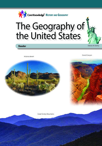
History and GeographyThe Geography ofthe United StatesReaderStatue of LibertyGrand CanyonArizona desertGreat Smoky Mountains
THIS BOOK IS THE PROPERTY OF:STATEBook No.PROVINCEEnter informationin spacesto the left asinstructed.COUNTYPARISHSCHOOL DISTRICTOTHERISSUED TOYearUsedCONDITIONISSUEDRETURNEDPUPILS to whom this textbook is issued must not write on any page or markany part of it in any way, consumable textbooks excepted.1. T eachers should see that the pupil’s name is clearly written in ink in thespaces above in every book issued.2. The following terms should be used in recording the condition of thebook:New; Good; Fair; Poor; Bad.
The Geography ofthe United StatesReader
Creative Commons LicensingThis work is licensed under aCreative Commons Attribution-NonCommercial-ShareAlike4.0 International License.You are free:to Share—to copy, distribute, and transmit the workto Remix—to adapt the workUnder the following conditions:Attribution—You must attribute the work in thefollowing manner:This work is based on an original work of the CoreKnowledge Foundation (www.coreknowledge.org) madeavailable through licensing under a Creative CommonsAttribution-NonCommercial-ShareAlike 4.0 InternationalLicense. This does not in any way imply that the CoreKnowledge Foundation endorses this work.Noncommercial—You may not use this work forcommercial purposes.Share Alike—If you alter, transform, or build upon this work,you may distribute the resulting work only under the same orsimilar license to this one.With the understanding that:For any reuse or distribution, you must make clear toothers the license terms of this work. The best way todo this is with a link to this web /4.0/All Rights Reserved.Core Knowledge , Core Knowledge Curriculum Series ,Core Knowledge History and Geography and CKHG are trademarks of the Core Knowledge Foundation.Trademarks and trade names are shown in this bookstrictly for illustrative and educational purposes and arethe property of their respective owners. References hereinshould not be regarded as affecting the validity of saidtrademarks and trade names.ISBN: 978-1-68380-216-7Copyright 2018 Core Knowledge Foundationwww.coreknowledge.org
The Geography ofthe United StatesTable of ContentsChapter 1The United States . . . . . . . . . . . . . . . . . . . . . . . . . . . . . . . . 2Chapter 2New England. . . . . . . . . . . . . . . . . . . . . . . . . . . . . . . . . . . . . . 8Chapter 3The Mid-Atlantic Region. . . . . . . . . . . . . . . . . . . . . . . . 16Chapter 4The South. . . . . . . . . . . . . . . . . . . . . . . . . . . . . . . . . . . . . . . . . 24Chapter 5The Midwest . . . . . . . . . . . . . . . . . . . . . . . . . . . . . . . . . . . . . . 32Chapter 6The Great Plains. . . . . . . . . . . . . . . . . . . . . . . . . . . . . . . . . 38Chapter 7The Rocky Mountain Region. . . . . . . . . . . . . . . . . . . 44Chapter 8The Southwest. . . . . . . . . . . . . . . . . . . . . . . . . . . . . . . . . . . . 52Chapter 9The West Coast . . . . . . . . . . . . . . . . . . . . . . . . . . . . . . . . . . . 58Chapter 10 Alaska and Hawaii . . . . . . . . . . . . . . . . . . . . . . . . . . . . . . . 66Cool Facts. . . . . . . . . . . . . . . . . . . . . . . . . . . . . . . . . . . . . . . . . . . . . . . . . . . . . . 74Glossary. . . . . . . . . . . . . . . . . . . . . . . . . . . . . . . . . . . . . . . . . . . . . . . . . . . . . . 76
The Geography of the United StatesReaderCore Knowledge History and Geography 5
Chapter 1The United StatesExploring the United StatesThe Big Questionof America The United States,How does theexcluding Alaska and Hawaii,narrator describe thestretches about three thousandlocation of the UnitedStates in relation tomiles from coast to coast—or eastEarth’s hemispheres,to west. Because of its great size,continents, andoceans?it is often divided into smallergeographicalVocabularyareas, or regions. The states in eachregion have many things in common,region, n. an areaof Earth’s surfacesuch as geography, includingthat has someclimate, natural resources,unique geographiccharacteristic thateconomic activity, and othersets it apart fromimportant geographical conditions.other areasgeography, n. thephysical and humanfeatures of a placenatural resource,n. something fromnature that is usefulto humansMission: Explore EarthAs you know, Admiral Zorg, the spaceshipthat I command has been exploring theplanet known as Earth for almost a year. Wehave discovered that Earth is very differentfrom our planet Proteus.2
3PACIFICOCEANAKCAORNVWAUTCOMexicoNMWYMTTXNESDND500 st CoastGulf of MexicoALTNINNational capitalNew EnglandGreat PlainsRocky MountainLAARMOWICanadaThis map shows the regions of the United States. Which region is your state located in?HIAZID0Regions of the United StatesNCVAPANHMARICTWSEMidwestSouthwestAlaska and HawaiiNWashington,D.C.MDDENJATLANTICOCEANNYVTME
We have studied its interesting physical features and life forms andreported our observations to you. Now, as our year of exploringdraws to a close, there is one last place to explore—the UnitedStates of America.We will explore and report on each area of the United States. Ineach report we will answer questions such as: Which states makeup each region? What does the land look like in this region? Whatplants and animals live there? What is the weather like? What kindsof jobs do people do? What do people eat and drink? What dothey do for fun?These are the regions we will report from: New England, theMid-Atlantic, the South, the Midwest, the Great Plains, the RockyMountains, the Southwest, and the West Coast. There are alsotwo states that do not belong to a region because they are notconnected to any other state. They are called Alaska and Hawaii.We will send a separate report about these two states.We will gather information for our reports through observation.When we have questions, we will talk to some of the people wemeet. (Of course, we will always remember to be disguised ashumans!)Right now, as I record this audio message, we are flying over ahuge body of water called the Atlantic Ocean. The next land wesee will be the United States of America.A Vast and Varied CountryThe United States of America is reported to be a huge country.Earthlings in other places have described it as having a great4
variety of landforms and life forms. Inaddition to the indigenous peoples whohave lived there for thousands of years,and the descendants of the first Europeansettlers, I have heard that people travelfrom all over the world to live there.As we fly over the Atlantic Ocean, we will belooking at maps of the United States. TheseVocabularylandform, n. anatural physicalfeature on Earth’ssurfaceindigenous,adj. native to aparticular regionor environmentNative Americans lived in the United States for thousands of years before the firstEuropean settlers arrived.5
maps will help us find the places we want to go. They will also helpus to identify the different regions of this vast country.You remember, Admiral, that Earth is shaped like a globe, or sphere.Earthlings divide their world into half-globes, or hemispheres. Theyspeak of an Eastern Hemisphere and a Western Hemisphere.The United States is in the Western Hemisphere on the continentcalled North America. A continent is a large landmass thatsometimes has islands off its shores. North America is made up ofCanada, the United States, and Middle America, which includesMexico, Central America, and the Caribbean islands.Looking at our maps, we see that, excluding Alaska and Hawaii, theUnited States stretches all the way across the continent of NorthAmerica—a distance of about three thousand miles. On each sideof the country, there is a huge body of water called an ocean. Onthe east side, the United States is bordered by the Atlantic Ocean.On the west side, it is bordered by the Pacific Ocean.The United States also controls territories beyond these borders. Inthe Caribbean Sea, which is south of the United States, Puerto Ricoand the U.S. Virgin Islands are U.S. territories. In the Pacific Ocean,Guam, American Samoa, and the Northern Mariana Islands are allU.S. territories. We will not be sending reports about these territories.Lieutenant Koola just informed me that she has sighted land belowus. She is pretty sure that it is the state of Maine in the northeasternUnited States. Our map shows that the country is divided into fiftysmaller units, or states. I expect that’s why the country is called theUnited States!6
Each of the fifty states has its own government and its own capitalcity. This is because the United States is a democracy. In other words,it has a system of government in which the people rule throughelected representatives. The head of the national government,or all fifty states, is called the president. He lives in a place calledWashington, D.C., which is the capital of the United States.Now we are flying low over the coast of Maine. Through ourspaceship’s porthole, I can see huge, gray waves crashing againstrocky cliffs. We will look for a place where people live and landnearby. We are all very excited to meet our first Americans. Inmy next report, I hope to have plenty to tell you about thisinteresting country.I have given the order to turn on the invisibility shield and startour descent.Waves break on the coast of Maine.7
Chapter 2New EnglandExploring New England We beganThe Big Questionour exploration of the United StatesHow might beingin the region called New England.close to the oceanThis region is in the northeasternhave helped thedevelopment ofpart of the United States. It iscertain industries inmade up of six states: Maine, NewNew England?Hampshire, Vermont, Massachusetts,Connecticut, and Rhode Island. The Atlantic Oceanborders all of these states except one—Vermont.In addition to the ocean, there are also mountains, hills, forests, andlakes in New England. Lieutenant Koola landed our ship in a forestclearing close to a town. The town had many wooden houses and asmall harbor with sailboats. Because we were disguised as humans,the people we met were friendly toward us.We were hungry after our long journey across the ocean, so we askedsomeone to recommend a good place to go for a meal. As you know,one of the things we like to find out about a place is what food thepeople who live there eat.8
70 W73 WThe New England RegionNWESCanadaP e n obscot River46 NMaineBurlingtonMount WashingtonMontpelierUMOVermontPNI A cutNew HavenLongProvidenceCranstonndd SouIslan44 NPortland050 milesState capitalMajor cityMountain peakManchesterMassachusettsAugustaATLANTIC e Island42 NThe Appalachian Mountains, a majorfeature of this region, are among theoldest mountains on Earth.9
When we were all seated in a nearby restaurant, we decided to tryone of the area’s special foods. The server said, “What about somelobster?” Because we had never heard of lobster, we thought weshould give it a try.Imagine our surprise when the server brought each of us a red,bug-like creature with long antennae and mean-looking claws. Bytalking to the server, we learned that lobsters come from the sea,so they are not really bugs. We were relieved to hear that!The server mentioned that many people in this part of Mainemake their living by catching lobster. We asked him where wecould go to find out more about the area. He said, “You could trythe public library.” We did not know what a public library was, butwe were curious. The waiter gave us directions, and after we leftthe restaurant, we went to find the library.A lobsterman shows off his catch.10
Learning at the LibraryThe library turned out to be a brick building on the main street intown. When we went inside, we realized that we had made a greatdiscovery. A public library, Admiral, is a place full of books andmagazines where people can go to read without paying anything.Public libraries also have computers. In a public library, you canfind information on any subject.In America, there are thousands and thousands of these libraries.Almost every town or city has at least one. As soon as we foundthis out, we realized that we had another wonderful way to findinformation. We might even visit the public library in every newplace we visit.In terms of climate, New England has four very different seasons.It has a cool spring, a warm summer, a crisp fall, and a long, cold,snowy winter.You may wonder why the area is called New England. It is becausein the 1600s, people from England crossed the Atlantic Ocean andsettled in the area. They also settled farthersouth, all the way down the Atlantic Coast.VocabularyIn fact, thirteen English colonies wereindustry, n. abusiness thatmanufactures aproduct or providesa serviceestablished. Over time, building ships andfishing became important industries inNew England.Then, in the late 1700s, many people in the thirteen coloniesdecided they wanted to be independent. They wanted to starta country of their own. In the year 1776, they declared their11
independence from Great Britain. The colonists fought a waragainst Great Britain for their freedom, which the Americans callthe Revolutionary War. It is also known as the American Revolution.The colonists defeated the British and called their new countrythe United States of America. Although their country is not part ofGreat Britain anymore, the people of the United States did keep theEnglish language, which is spoken by almost all Americans today.After a few days of studying in the library, we were anxious tobegin exploring again. We knew that we would miss the smallMaine town and its kind people. Even more, we would miss thedelicious lobster.Mountains and SkyscrapersAfter taking off, we turned the ship southwest, toward themountainous states of New Hampshire and Vermont. Flying lowover the mountains, we were greeted by a spectacular sight.Because in the Northern Hemisphere it was Earth’s season ofautumn, the trees’ green leaves had changed color. Some of thetrees were gold, some red, some purple. Every hillside was ablazewith different colors.As we flew down for a closer look, Lieutenant Koola pointed tosome of the most brilliantly colored trees. “Do you see thosetrees?” she asked. “A book I was reading said that those are sugarmaples. A sweet liquid called maple syrup is made from the sap ofthose trees.” You really have to hand it to the Americans, Admiral.They seem to be able to make tasty food out of almost anything—even tree sap and big bugs from the ocean!12
Visitors come from all over the world to enjoy the brilliantly colored leaves of autumn inNew England.From Vermont, we flew south, across the western part of the stateof Massachusetts. There, we enjoyed the sight of more rolling hillsand colorful trees. But we were eager to see the city of Boston,which we knew was the capital of Massachusetts and the biggestcity in New England. So we turned back east, toward the coast.Boston looks nothing at all like the small town we visitedin Maine. It is a huge, busy city full of tall modern buildingscalled skyscrapers. But parts of the city are very old. In fact,Boston was one of the first important cities in the country.When we went to Boston’s public library to study, we discoveredthat it was the oldest public library in the United States. We alsolearned that there is a local university called Harvard, which wasthe first college founded in America. Today, Boston is famous for13
being a center of education, with dozens of colleges scatteredaround town.Boston is also a city full of history. The American Revolution brokeout in the Boston area. When we walked through the city on theFreedom Trail, we saw many places that are important in the storyof the American Revolution.We visited Faneuil Hall, an old brick building where revolutionariesgave speeches against the British. We also saw the house of PaulRevere. When British troops began to march toward Concord to tryto capture certain revolutionaries, Revere rode out in the middle ofthe night to warn people that the British were coming. A famousold poem talks about “the midnight ride of Paul Revere.”During the American Revolution, Paul Revere warned colonists that the British troops wereon the move.14
We could have spent a lot more time inBoston, but we knew we had to fly on andexplore the Mid-Atlantic region. So wereturned to our ship and headed southand west. Right now we are over the twosouthern states of New England—RhodeIsland and Connecticut. We can see fromVocabularyport, n. a town orcity built around aharbor, where shipscan dockpopulated, adj.having people livingin the areaour map that Rhode Island is by far thesmallest of the fifty states. It is less than fifty miles across. BothConnecticut and Rhode Island have port towns, as well as somelarger cities.But speaking of cities, Admiral, the crew is getting excited becauseour next stop is the most populated city in the United States—New York, New York.15
Chapter 3The Mid-Atlantic RegionExploring the Mid-Atlantic RegionThe Big QuestionAs you recall from my last message,What are the mainAdmiral, we were excited becausefeatures of New Yorkwe were on our way from NewCity and Washington,D.C.?England to New York City. New YorkCity is in the Mid-Atlantic region ofthe United States. This region is located near the middleof the Atlantic coastline. It includes five states—NewYork, New Jersey, Pennsylvania, Delaware, Maryland—and the city of Washington, D.C., which is the capital ofthe United States.New York City, as you may recall, is the most populated city inAmerica and one of the most populated cities on Earth. It is made upVocabulary“densely populated,”(phrase) having manypeople living in asmall area16of five areas called boroughs—Manhattan,the Bronx, Brooklyn, Queens, and StatenIsland. Manhattan is the most denselypopulated borough.
80 WThe Mid-Atlantic Region75 W45 NCanadaNEWSLake OntarioNew YorkMohawk R iv erAlbanyBuffaloHudson RiverErieerRivPennsylvaniaeA llARivomac erPotNewarkhann PhiladelphiaaerRivAPPLANIAH HarrisburgCSMarylandBaltimoreAnnapolisWashington, D.C.There are many portcities in the Mid-Atlanticregion. Two of these portcities—Philadelphia,Pennsylvania, and Trenton,New Jersey—are locatedon the Delaware River.0Long IslandSoundNew YorkTrenton40 NePittsburghONINSusquMUTAaware reNational capitalState capitalMajor cityChesapeakeBay100 miles17
Well, the first thing wenoticed were theextremely tall buildings,or skyscrapers, inManhattan. There are somany skyscraperspacked so closelytogether that when youwalk between them,you can hardly see theTo really appreciate New York City you have tolook up!sky itself.New York City is very, very crowded. Many people come to visitand to live in this famous city. Most of the time the sidewalks arepacked with people, and the streets are packed with cars.Everyone seems to be in a hurry.A large wave of people came to live in NewYork City in the 1800s. These immigrantscame from countries all around the world.Many moved to New York City because theywere looking for a better way of life. YouVocabularyimmigrant, n. aperson from onecountry who movesto another countryto livesee, Admiral, the United States is a countryof immigrants. Since the country’s beginning, people have comefrom faraway places to make their homes in America.For many immigrants, the first thing they saw when they sailedinto New York Harbor was a gigantic metal statue called the Statueof Liberty. This statue is in the shape of a woman holding up atorch. It is supposed to stand for the freedom that Americans18
enjoy. We took a ferryboat out tothe statue and discovered that youcan walk up inside it. By the timewe got to the top of the 354 steps,we were exhausted!Things to Do in New York CityWhen immigrants moved to NewYork City, they brought along thedifferent kinds of food they ateback home. That means you canget almost any kind of Earth foodimaginable when visiting the city.The crew enjoyed sampling manyThe Statue of Liberty is a symbol offreedom and was a welcoming sightto the immigrants who arrived inNew York.of these different dishes. In the area called Chinatown, we ateseveral of the crispy snacks called egg rolls. In Little Italy, we pickedup some sweet treats called cannoli. At a hot-dog stand, we hadPolish sausages called kielbasa.But there is more to do in New York than eat. Lots more! New YorkCity is full of cultural attractions—concert halls, theaters andmuseums. In Manhattan, Broadway is famous for its theaters,where you can watch musicals and plays.I especially liked the Metropolitan Museum of Art, which is also inManhattan. There, you can see some of the most famous artEarthlings have ever made. Because she is so interested in plants andanimals, Lieutenant Koola preferred the Museum of Natural History.19
She showed me the bigskeletons of someextinct Earth animalscalled dinosaurs.Both of these museumsare located near a largespace called CentralPark. The park also haslakes, fields, a theater, azoo, and other places forpeople to gather or play.The New York Public Library is a grand building in theheart of the city.Of course, we also went to the library. We found the New YorkPublic Library in an impressive building guarded by two stonelions. We spent some time there looking up facts about New Yorkand the other states of the Mid-Atlantic region. We found out, forexample, that the area has a climate pretty much like NewEngland’s. However, the summers are hotter and the winters arenot quite so cold.We also learned that the states of New York, New Jersey,Pennsylvania, Delaware, and Maryland are among the mostheavily populated states in the country. Their many large cities arecenters of industry and government.In fact, the headquarters of the national government is in a placecalled Washington, D.C., located in the southern part of the region.We decided to make Washington, D.C., our next stop.20
Exploring the CapitalWashington, D.C., is the only American city that is not in a state. Itis the capital of the entire country. That means it cannot be part ofany one state because that state would hold too much power. Sothe city is its own district, or area: the District of Columbia. That iswhy Washington is referred to as Washington, D.C. Using D.C. alsostops people from confusing Washington state with the city ofWashington.On the way to Washington, D.C., we flew over some of the otherinteresting cities in the area. In Pennsylvania, we flew overPhiladelphia. In Maryland, we flew over Baltimore.We also flew over a body of water called Chesapeake Bay, whichwas covered with hundreds of small fishing boats. We had readthat wonderful seafood comes from this bay. Chesapeake Bay isespecially famous for its crabs, which are supposed to be sort oflike lobsters, but smaller and rounder.When we arrived in Washington, D.C., wenoticed the city has wide, straight streetscalled avenues. There are a lot of grandbuildings where the people who run thegovernment work. Maybe the grandestbuilding is the U.S. Capitol with its largewhite dome. This is where Congress makesAmerica’s laws. Congress is made up ofelected lawmakers from every state.Vocabularybay, n. a part of asea or ocean thatextends into landCongress, n. thelaw-making branchof the Americangovernmentthat is made upof the House ofRepresentatives andthe Senate21
To the west of the Capitol is a long grassyarea called The National Mall. Usually, whenAmericans talk about a mall, they mean ashopping center full of stores. But TheNational Mall is definitely not a shoppingcenter! Instead, it is a place where Americansgather for different kinds of celebrations.VocabularyThe National Mall,n. a tree-lined parkin Washington, D.C.,that is surroundedby museums,monuments,and governmentbuildingsRight in the middle of The National Mall is a huge stone obeliskmore than five hundred feet tall. An obelisk is a four-sided shaftthat narrows to a pyramid-like point. This one is called theWashington Monument. It was built in honor of America’s firstpresident, George Washington. As you may recall, Admiral, thepresident is the head of the national government.At the far end of The NationalMall is the Lincoln Memorial.This structure honorsanother great Americanpresident, Abraham Lincoln.Lincoln was president duringthe 1860s. Inside thememorial is a very largestatue of Lincoln, three orfour times the size of a realhuman being. He is seated ina chair, and looks veryserious and commanding.22Abraham Lincoln was a great American leader.
The National Mall in Washington, D.C., is lined with famous attractions and historicalbuildings. The Capitol is located at one end of the Mall.Near The National Mall is the house where today’s president lives.When we saw it, we thought he was lucky to live in the elegantwhite house with tall pillars in front of the door. Americans call thepresident’s home the White House.When it was time for some studying, we went to the Library ofCongress. This is the biggest library in the United States. There, welooked up facts about the next region: the South.23
Chapter 4The SouthExploring the South When we leftThe Big QuestionWashington, D.C., Admiral, we did notHow might physicalhave to travel far to reach the nextgeographical featuresregion. The South is a large regioncontribute to thedevelopment ofwith interesting cultural diversity asregional culture?well as striking physical geographicalfeatures. Across the landscape thereare mountains, rivers, valleys, andVocabularysandy beaches. The twelve states“geographicalthat make up the South are Virginia,features,” (phrase) theNorth Carolina, South Carolina,different kinds ofGeorgia, Florida, West Virginia,landforms, waterways,or physical characteristicsKentucky, Tennessee, Alabama,in a regionMississippi, Arkansas, and Louisiana.The South has a different climate from the northern states wehave reported on. It is much hotter, especially in the summer. Thedifference in climate means that Southern farms grow different cropsfrom those grown on northern farms.In the 1800s, the two most important crops for Southern farmers werecotton and tobacco. These crops had to be picked by hand. This was24
0WSN150 milesEWestVirginiaGREAT SMOKYMOUNTAINSTennesseeNorth CarolinaCharlotteRaleighVirginiaGulf of MexicoNew OrleansMobileMontgomeryAlabamaMiamiWashington, D.C.75 WState capitalMajor cityNational parkATLANTIC OCEANChesapeake BayRichmondNorfolkVirginia 80 W Potomac RGreat Smoky MountainsSouth CarolinaNational oFrankfortCharlestonLexington85 WKentuckyNashvilleMemphis90 WerTwo large bodies of water border the South—the Gulf of Mexico and the Atlantic Ocean.BatonRougeLouisianaLittle RockArkansasThe Southern RegionMississippiRiverRivB95 WDRILUEOUGEMNSNTAIer2525 N30 N35 N
terribly hard work that few people wanted to do. So the Southernplanters had people brought over from Africa to work on the farms.But these people did not come willingly. They were victims of theslave trade that flourished at this time.In the northern states especially, many people disapproved ofslavery. For this, and other reasons, there was conflict between theNorth and the South. Eleven Southern states decided to form theirown country and left the United States. This conflict resulted in theCivil War, which lasted from 1861 to 1865.The Civil War ended with the defeat of the South. The Southernstates came back into the Union, and slavery was abolished.Though many African Americans moved from the South to otherparts of the country inthe decades after theCivil War, they still had asignificant influence onSouthern culture,especially on Southernart, literature, music,dance, and food.Next, we flew south andwest to a mountainousarea shared by thestates of West Virginia,Virginia, and NorthCarolina. The sceneryhere is very wild. The26Enslaved workers were used to grow cotton, tobacco,and other crops in the South.
mountains are part of the great Appalachian Mountains, whichreach all the way into New England.In the South, the Appalachians are known by different names.In Virginia they are called the Blue Ridge Mountains, and in NorthCarolina and Tennessee, the Great Smoky Mountains.We landed our ship in a place the map called Great SmokyMountains National Park. After landing, we found a man wearingan odd round hat. He explained that hewas a park official, or ranger. He told usthat a national park was a place thegovernment had set aside so that peoplecould come and enjoy nature. This wasonly one of dozens of national parks, heexplained. We asked why the mountainsVocabularynational park, n.a piece of land thatis protected by thefederal governmentbecause of its naturalbeauty or historicalimportanceSometimes there is a blue haze above the Great Smoky Mountains.27
here were called “smoky.” The ranger explained that because ofthe hazy, blue fog on their tops, Native Americans named themthe “place of the blue smoke.” We spent several peaceful hourswalking through the woods that cover the hills.Enjoying the Southern CoastNext, we flew northward along the East Coast. The coasts ofVirginia, North Carolina, and South Carolina are covered withsandy beaches. We enjoyed walking in the fresh sea air andobserving the behavior of the people on
The Geography of the United States History and GeoGrapHy Great Smoky Mountains . Enter information in spaces to the left as instructed. CONDITION ISSUED TO ISSUED RETURNED Year Used PUPILS to whom this textbook is issued must not write on any page or mark any part of it in any way, consumable textbooks exce