Transcription
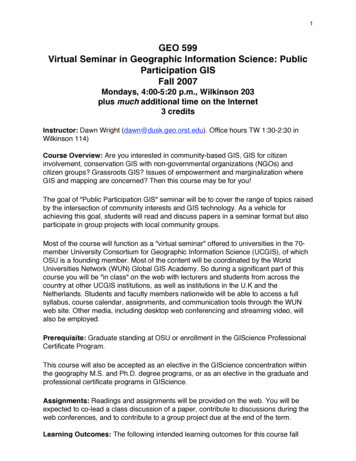
Introduction to Geographic InformationSystems (GIS) and Mappingby Jeff Blossom, Center for Geographic Analysis, Harvard UniversityOctober 30, 2016jblossom@cga.harvard.eduhttp://gis.harvard.edu
Me - Jeff Blossom- M.A. degree in Geography from DenverUniversity- Geographic Information Specialist- CartographerWork at the Harvard Center for GeographicAnalysis, helping professors and students createmaps and geographic analysis.
Center for Geographic Analysis (CGA) Founded in 2006 A member organization of theInstitute for Quantitative SocialScience (IQSS) Serves the entire University –anyone with a HUID
Our missionTo support research and education thatrelies on geographic information.
What is GIS?Geographic Information System (GIS) defined:A collection of computer hardware and softwaredesigned for capturing, storing, updating,,manipulating, analyzing, displaying, andpublishing all forms of geographically referencedinformation. People performing different roles are required. Common methodologies are applied within a GIS.5
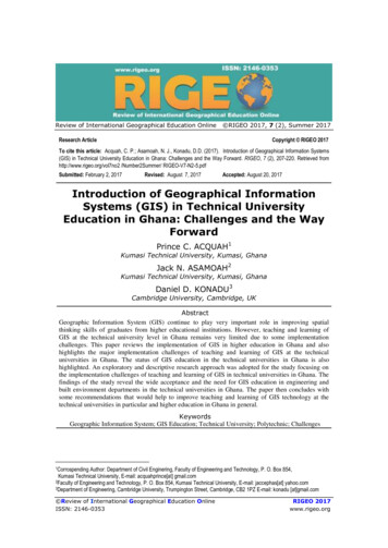
Geographic Coordinate System – a commonreference used to map things on Earth.- Use lines of longitude and latitude.42.3744,-71.1166 isthe latitude,longitude locationof Harvard Yard- Any location on Earth can be represented bythe intersection of a longitude, latitude line.6
Geographic Coordinate System – a commonreference used to map things on Earth.** There are also other coordinate systems that use units of meters or feetinstead of longitude and latitude **
Demonstration: Finding latitude, longitude with google maps. Mapping information with batchgeo.com
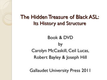
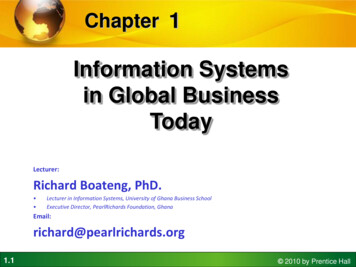
Geographic InformationSystems (GIS)Geographic feature representation:points, lines, polygonsLines – U.S. InterstatesPolygons – U.S. StatesPoints – U.S. City centersPolygons – Building footprints. Raster – Aerial image
Geographic Information Systems (GIS)Information about the geographic features – stored intabular formLines – U.S. InterstatesPoints – U.S. CitiesPolygons – U.S. States
Geographic Information System (GIS)- Hardware- Software- Data- Methodology- People- ManagementA common set oftools and proceduresA well managed systemof informationData FilesDatabase
What is GIS?(Geographic Information Systems)A pan-able and zoom-able map – so that little girlcan see places above Argentina and Chile.
An intelligent map to answer your questions:How to get from place A to place B (network routing)?
An intelligent map to answer your questions:What exist at the same location (overlay)?
An intelligent map to answer your questions:Where are the hot spots ?
A spinning globe with elevated terrain – so to give youa realistic view of places on earth. and more
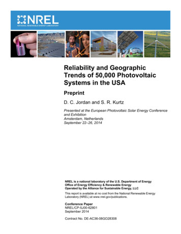
Why Maps?Maps are a form of communication that show:Geographic contextNevadaKansas
Why Maps?Maps are a form of communication that show:Similarities and differences between places
Why Maps?Maps help us reconstruct history, or plan for the future.20
Why Maps?Maps help us conceptualize, reconstruct history, illustrate the present, or planfor the future.
QuantumGIS – Desktop GIS software. Runs onWindows, Mac, user friendly. A step by step tutorial onusing it: http://maps.cga.harvard.edu/qgis/
ArcGIS – Desktop software for Windows. Themost robust GIS software available.
GIS on the web todayFusion Tables
GIS software demo – ArcMap
Doing GIS requires datasets in GIS format.One nice source to get global geographic datafrom: http://www.diva-gis.org/gdata
GIS data ortation, demographic, crime, economic,elevation, weather, air quality, geology, soils .http://hgl.harvard.edu – Harvard Geospatial Library
GIS data sourcesHistoric maps can also be data sources
GIS project samples
32
through-time/
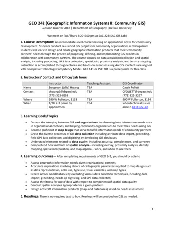
The GlobalPositioning SystemConstellation GPS is a global navigation satellitesystem developed by the U.S.Department of Defense, managed bythe U.S. Air Force. Free for anyone touse. Provides geographic locations at anytime, anywhere. 24 - 32 earth orbiting satellites
A GPS satelliteContains solar panels for power, an atomic clock, and aradio transmitter that continuously broadcasts the timeand the satellite’s position.36
A GPS mapping receiver
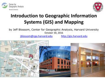
Latitude, longitude coordinates from Paul Salopek’sGPS:
Paul’s route on a web map
-walk/walking-tours/walking-jeddah/
http://www.telstudies.org/images/map2.jpg
Source: Photo from the Roads of Arabia: Archaeology and History of the Kingdom of Saudi Arabia exhibit in the Louvre bythe Saudi Commission for Tourism & Antiquities
CGA Service Projects: GIS AnalysisNew York City Real Estate Analysis52
Thank you! Questions?
Geographic Information System (GIS) defined: A collection of computer hardware and software designed for capturing, storing, updating,, manipulating, analyzing, displaying, and publishing all forms of geographically referenced information. People performing different roles are re