Transcription
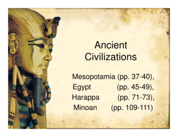
AncientCivilizationsMesopotamia (pp. 37-40),Egypt(pp. 45-49),Harappa(pp. 71-73),Minoan(pp. 109-111)
MapsObjectivesMesopotamiaIndiaEgyptGreeceBronze AgeCivilizationsTimelineProjects Summarize how geography affectedcultural development Describe city-states Describe early religious beliefs, socialstructure, and technology Explain the influence of ancientcivilizations on later civilizations
3000 BC to 1000 BCEgypt’sOld gyptGreeceSumerianAkkadianZhouDynastyShang iteEgypt’sNew KingdomBabylonMinoanBronze 00 BC2500 BC2000 BC1500 BC1000 BCPrevious
Key TermsMapsMesopotamiaIndiaEgyptGreeceBronze AgeCivilizationsTimelineProjects gypt
MapsMesopotamiaIndiaEgyptGreeceBronze AgeCivilizationsTimelineProjectsAncient Civilizations(3000 – 2000 BC) 4 Major Civilizations grow around 3000 BC– Mesopotamia– Harappa– Minoans– Egypt Why civilization developed?– Challenges (environmental and people)– Increase of food supply broughtspecialization of labor– Religion brought people together with acommon identity
Bronze AgeMapsMesopotamiaIndiaEgyptGreece Ancient civilizations generally grewaround water sources– Why?Bronze AgeCivilizationsTimelineProjects Water provided source for food The first forms of government werethought to be theocracy and monarchy– Theocracy is government by religion, whilemonarchy is government by a king or queen– Why would theocracy be one of the firstforms of government? Ancient civilizations thought that gods controllednatural occurrences
MapsBronze AgeMesopotamiaIndiaEgyptGreeceBronze AgeCivilizationsTimelineProjects Initially, city-states emerged from theNeolithic age– City-State: A city and the area nearbywhich is controlled by it These grew into empires as city-statesbegan to dominate those around them– Empire: An area dominated by another Dynasties of ruling families dominated earlymonarchial governments– Dynasty: A ruling family which passes itspower from generation to generation
MapsBronze AgeMesopotamiaIndiaEgyptGreeceBronze AgeCivilizationsTimelineProjects As a government grew, normally abureaucracy would be established tohelp the ruler run the government– Bureaucracy: A group of unelectedofficials who help run the government Most of the early societies developedinto patriarchal societies– Patriarchal: Male-dominated Most also had polytheistic religions– Polytheistic: Having more than one god
3000 BC to 1000 BCEgypt’sOld gyptGreeceSumerianAkkadianZhouDynastyShang iteEgypt’sNew KingdomBabylonMinoanBronze 00 BC2500 BC2000 BC1500 BC1000 BCPrevious
MapsMesopotamiaIndiaEgyptGreeceMesopotamiaBronze AgeCivilizationsTimelineProjectsBackMesopotamia
MapsMesopotamiaIndiaEgyptGreeceBronze AgeCivilizationsTimelineProjectsBackMesopotamia
MapsMesopotamian GeographyMesopotamiaIndiaEgyptGreece The land between the Tigris and EuphratesRivers is called Mesopotamia.Bronze AgeCivilizationsTimelineProjects It is a part of what is called the FertileCrescent. The silt from flooding made it very good forfarming. However, floods were unpredictable whichmade farming difficult
MapsMesopotamian DevelopmentMesopotamiaIndiaEgyptGreeceBronze AgeCivilizations As villages grew into cities, such asUruk, societies changed intocivilizationsTimelineProjects In Mesopotamia, the cities wereindependent and fought with each other Kings and priests vied for control withinthe cities
MapsAge of the EmpireMesopotamiaIndiaEgyptGreeceBronze AgeCivilizationsTimelineProjects Sargon of Akkad– Around 2350 BC, Sargon defeated all the citystates of Sumer– Though they spoke differently, the Akkadiansadapted many of the Sumerians ways of living– By controlling all of Mesopotamia, Sargon createdthe first empire– It lasted 200 years but had constant internalfighting and famine
Life in Sumerian SocietyMapsMesopotamiaIndiaEgyptGreeceBronze AgeCivilizationsTimelineProjects The Sumerians social classes––––Kings and priestsWealthy merchantsNormal SumeriansSlaves Women could have the same jobs as menand could join the priesthood but could notbe educated Culturally the greatest epic written during thistime was the story of Gilgamesh
MapsMesopotamian ReligionMesopotamiaIndiaEgyptGreece Mesopotamians believed their god livedwithin their cityBronze AgeCivilizations– Ziggurats were built as homesTimelineProjects They believed their gods were allpowerful but with human failings– Humans existed to please the gods
MapsSumerian TechnologyMesopotamiaIndiaEgyptGreeceBronze AgeCivilizationsTimelineProjects Sumerians invented many things– Cuneiform Used mainly for record keeping– Wheel– Plow– Sundial– Arch– Bronze– 60 base system of math (timemeasurements)
3000 BC to 1000 BCEgypt’sOld gyptGreeceSumerianAkkadianZhouDynastyShang iteEgypt’sNew KingdomBabylonMinoanBronze 00 BC2500 BC2000 BC1500 BC1000 BCPrevious
MapsThe Land of AfricaMesopotamiaIndiaEgyptGreeceBronze AgeCivilizationsTimelineProjects Africa is the second largest continent It has several distinct zones– Sahara– The “hump” of Africa– Great Rift Valley– Congo River Basin– KalahariMildzoneDesertSavanahRainForest
MapsThe Climate of AfricaMesopotamiaIndiaEgyptGreeceBronze AgeCivilizationsTimelineProjects Africa has four distinct climate zones– North and southern coasts are mild– Deserts– Rain ForestMild– SavannaszoneDesertSavanahRainForest
MapsMesopotamiaIndiaEgyptGreeceBronze AgeCivilizationsTimelineProjects
Key TermsMapsMesopotamiaIndiaEgyptGreeceBronze AgeCivilizationsTimelineProjects SavannaNileLower EgyptUpper EgyptOld KingdomIntermediate sHieratic Script
MapsMesopotamiaIndiaEgyptGreeceEgyptBronze AgeCivilizationsTimelineProjectsEgypt
EgyptMapsMesopotamiaIndiaEgyptGreeceMediterranean SeaLowerNileBronze AgeRed SeaCivilizationsTimelineProjectsBackUpperNile
MapsImpact of GeographyMesopotamiaIndiaEgyptGreeceBronze AgeCivilizationsTimelineProjects Egyptian history begins with the Nile River. Egypt is split into to parts:– Lower Egypt (near the Mediterranean Sea)– Upper Egypt (Southern part) Like Mesopotamia, the Nile River flooded yearly Unlike Mesopotamia it was predictable– Flood, plant, harvest; flood, plant, harvest The Nile was worshipped as a God
MapsEnvironmental ChangesMesopotamiaIndiaEgyptGreeceBronze AgeCivilizationsTimelineProjects Living off the Nile could be dangerous– If it flooded not enough, the harvest would bereduced– If it flooded too much, mud buildings could bedestroyed– Wildlife could be brought upriver However, the desert and seas isolated earlyEgyptians from warfare in the FertileCrescent
MapsMesopotamiaIndiaEgyptGreeceThe Course of EgyptianHistory Ancient Egyptian history is divided intothree parts:Bronze AgeCivilizationsTimelineProjects– Old Kingdom– Middle Kingdom– New Kingdom The time between each one is calledthe intermediate period.
MapsEgypt Unites Into a KingdomMesopotamiaIndiaEgyptGreece According to legend, Menes united allof EgyptBronze AgeCivilizationsTimelineProjects He created a double crown to show hiscontrol of all Egypt Egypt would eventually have 31dynasties spanning 2,600 years A dynasty is a family of rulers, who’sright to rule s past down the family.
MapsThe Old KingdomMesopotamiaIndiaEgyptGreeceBronze AgeCivilizations The Old Kingdom lasted from 2700 to 2200 BC. The ruler of Egypt is known as the Pharaoh, and wasconsidered a god.TimelineProjects The Pharaoh had absolute power, but ruled through abureaucracy. The Pharaoh was also the head of the religion so thegovernment was a form of theocracy and monarchy
MapsBuilders of PyramidsMesopotamiaIndiaEgyptGreece Egyptians were fascinated with theafterlifeBronze AgeCivilizationsTimelineProjects The Pharaohs built huge tombs to holdthe things they would use in the afterlife These generally took the shape of apyramid in the Old Kingdom period
MapsThe end of the Old KingdomMesopotamiaIndiaEgyptGreeceBronze AgeCivilizationsTimeline Power of the Pharaohs declined in 2180 BC Regional governors began to grow in powerand civil wars broke outProjects When a severe drought broke out around,the Old Kingdom ended and the firstintermediate period began
MapsLife in Egyptian SocietyMesopotamiaIndiaEgyptGreeceBronze AgeCivilizationsTimelineProjects Pharaoh at the top Wealthy landowners, militarycommanders, government officials “Normal” Egyptians Slaves Women had many of the same rightsas men
MapsReligion and LifeMesopotamiaIndiaEgyptGreeceBronze AgeCivilizationsTimeline Egyptians were polytheistic– Ra – Sun God– Horus – God of Light– Isis – MotherhoodProjects Believed that Osiris (God of the dead) wouldjudge them by weighing their heart against afeather People were embalmed by mummification
MapsEgyptian WritingMesopotamiaIndiaEgyptGreeceBronze AgeCivilizationsTimelineProjects While Mesopotamia used cuneiform,Egyptians used hieroglyphics– Pictures as opposed to symbols– Pictures could represent sounds as wellas ideas– From this a simplified form called Hieraticscript came into being. Egyptians used papyrus, a reed thatwhen dried out became a paper-likesheet
MapsArt and ArchitectureMesopotamiaIndiaEgyptGreece Obviously the pyramids and templesare examples of great architecture.Bronze AgeCivilizationsTimelineProjects The Egyptians also started a new styleof two-dimensional painting. They had advanced mathematics, a365 day lunar calendar, and medicaltechniques.
3000 BC to 1000 BCEgypt’sOld gyptGreeceSumerianAkkadianZhouDynastyShang iteEgypt’sNew KingdomBabylonMinoanBronze 00 BC2500 BC2000 BC1500 BC1000 BCPrevious
MapsMesopotamiaIndiaEgyptGreeceBronze AgeCivilizationsTimelineProjects
Key TermsMapsMesopotamiaIndiaEgyptGreeceBronze AgeCivilizationsTimelineProjects MonsoonHimalayanIndian paPersian Gulf
MapsMesopotamiaIndiaEgyptGreeceIndiaBronze AgeCivilizationsTimelineProjectsBackIndia
layaMountainsIndusRiverBronze ianOceanDeccanPlateau
MapsMesopotamiaIndiaEgyptGreeceRivers, Mountains andMonsoons The area of India is called the IndianSubcontinentBronze AgeCivilizationsTimelineProjects The Himalayan Mountains guard the fertileplain made by the Ganges and Indus Rivers Below it is a subcontinent called the Deccan(a peninsula) Seasonal winds called monsoons dominateIndia’s climate
MapsMesopotamiaIndiaEgyptGreeceBronze AgeCivilizationsTimelineProjectsMonsoon
MapsEnvironmental ChangesMesopotamiaIndiaEgyptGreeceBronze AgeCivilizationsTimelineProjects The Indus Valleycivilization faced many ofthe same challenges asEgypt and Mesopotamia– Yearly floods– Floods were unpredictable Also, they had deal withthe wet and dry seasonsbrought by the monsoons The mountains howevergave good protectionfrom invaders
Earliest ArrivalsMapsMesopotamiaIndiaEgyptGreeceBronze AgeCivilizationsTimelineProjects By 3200 BC farming villages began toemerge Around 2500 BC in the Indus Valley, citieswere being built This is called the Harappa Civilization They used sophisticated city planning––––Cities were in a grid systemFeatured citadels in the centerResidential areas were separate from commercialPlumbing and sewage systems were emplaced
MapsCulture and TradeMesopotamiaIndiaEgyptGreeceBronze AgeCivilizationsTimelineProjects Housing tended to be uniform– Social class differences were not great Artifacts such as toys were found– Shows prosperous and stable society Stamps were used to identify goods– Shows they conducted extensive trade Trade extended as far as the PersianGulf
MapsMesopotamiaIndiaEgyptGreeceMysterious End to Indus ValleyCulture 1750 BC the great cities fall. Why?Bronze AgeCivilizationsTimelineProjects– Indus River changed course– Land became overused– Invaders or warfare– Disease– Natural disaster
3000 BC to 1000 BCEgypt’sOld gyptGreeceSumerianAkkadianZhouDynastyShang iteEgypt’sNew KingdomBabylonMinoanBronze 00 BC2500 BC2000 BC1500 BC1000 BCPrevious
Key TermsMapsMesopotamiaIndiaEgyptGreeceBronze AgeCivilizationsTimelineProjects GreeceAnatoliaSpartaOlympusMinoanCreteKnossos
MapsMesopotamiaIndiaEgyptGreeceGreeceBronze AgeCivilizationsTimelineProjectsGreece
MapsMesopotamiaIndiaEgyptGreeceBronze AgeCivilizationsTimelineProjectsBackGreece
MapsMesopotamiaIndiaEgyptGreeceGeography Shapes GreekLife Greece consists of a mountainouspeninsula with over 1400 small islandsBronze AgeCivilizationsTimelineProjects It civilization was shaped by the sea– Provides transportation– Provides food Sea travel was also important for trade
MapsThe LandMesopotamiaIndiaEgyptGreeceBronze AgeCivilizationsTimelineProjects ¾ of Greece is mountainous– Difficult to unite into a country– From Sparta, 60 miles from Olympus, it took 6days to get there With this topography, city-states grew inisolated areas Only 20% of the land was farmable As City-States grew, more land becamenecessary– Colonization began of Anatolia
MapsThe ClimateMesopotamiaIndiaEgyptGreece Climate is mild (48 to 80 degrees)Bronze AgeCivilizationsTimeline This encouraged outdoor activitiesProjects Public life became an integral part ofGreece culture
MapsThe Minoan CivilizationMesopotamiaIndiaEgyptGreeceBronze AgeCivilizationsTimelineProjects By 2800 BC, a civilization grew up onthe island of Crete A great capital rose in Knossos This capital of the Minoans was a greatsea trading center The civilization was wiped out in 1430BC by either volcanos, earthquakes orbandits, or all three
MapsMinoan CultureMesopotamiaIndiaEgyptGreeceBronze AgeCivilizationsTimelineProjects Had written language (Linear A) but ithas not be deciphered Religion was polytheistic and focusedmainly on goddesses rather than gods A common theme in the culture is thebull and bull jumping Minoan Culture is represented in Greekmyths such as King Minos andTheseus and the Minotaur
3000 BC to 1000 BCEgypt’sOld gyptGreeceSumerianAkkadianZhouDynastyShang iteEgypt’sNew KingdomBabylonMinoanBronze 00 BC2500 BC2000 BC1500 BC1000 BCPrevious
ProjectsMapsMesopotamiaIndiaEgyptGreeceBronze AgeCivilizationsTimelineProjects Compare and contrast two of the four civilizations discussed. (1)Write a fictional story about a person living in the time of one of the civilizations.(1)Develop a “newspaper” from the time. (2-4)Write a poem about the civilizations. (1)Compare and contrast the geography of two or more of the civilizations. (1)Develop a travel brochure or guidebook for a time traveler to each civilization.(1)Day in the life of a Scribe journal entries – journal/diary entries that describe thedaily tasks of a scribe and their civilization. (1)Facebook the civilizations or the people in it. (1)Make maps and graphs showing the geography and social structures of thecivilizations. Include a description of each to point out the significantcharacteristics. (1-2)Use heraldry to develop a “standard” for each civilization. Include a symbolchart to explain each color and figure. (1)Develop a picture book covering the important aspects of each civilization. (2-3)Design a game based on one of the major civilizations covered. (1-2)
MapsMesopotamiaIndiaEgyptGreeceBronze AgeCivilizationsTimelineProjectsMAPS
MapsMesopotamiaIndiaEgyptGreeceMesopotamiaBronze AgeCivilizationsTimelineProjectsBackMesopotamia
MapsMesopotamiaIndiaEgyptGreeceBronze AgeCivilizationsTimelineProjectsBackMesopotamia
MapsMesopotamiaIndiaEgyptGreeceEgyptBronze AgeCivilizationsTimelineProjectsEgypt
EgyptMapsMesopotamiaIndiaEgyptGreeceMediterranean SeaLowerNileBronze AgeRed SeaCivilizationsTimelineProjectsBackUpperNile
MapsMesopotamiaIndiaEgyptGreeceGreeceBronze AgeCivilizationsTimelineProjectsGreece
MapsMesopotamiaIndiaEgyptGreeceBronze AgeCivilizationsTimelineProjectsBackGreece
MapsMesopotamiaIndiaEgyptGreeceIndiaBronze AgeCivilizationsTimelineProjectsBackIndia
layaMountainsIndusRiverBronze ianOceanDeccanPlateau
MapsMesopotamiaIndiaEgyptGreeceBronze AgeCivilizationsTimelineProjectsTimelines
3000 BC to 1000 BC2500 BC3000 BCAfricaOld KingdomMiddle KingdomHarappaSouthwest AsiaAsiaEuropeMiddle EastNew KingdomAryanXiaZhouShangMinoanSumerian1000 BC1500 BC2000 BCMycenaeAkkadianBabylonHittites PhoeniciaPrevious
Egyptian history begins with the Nile River. Egypt is split into to parts: – Lower Egypt (near the Mediterranean Sea) – Upper Egypt (Southern part) Like Mesopotamia, the Nile River flooded yearly Unlike Mesopotamia it was predictable – Flood, plant, harvest;