Transcription
REPUBLIC OF CROATIAMINISTRY OF THE SEA, TRANSPORT ANDINFRASTRUCTUREClass: 342-01/11-01/66File no. : 530-03-11-2Zagreb, 27th December 2011.By the Decision of the Minister of the sea, transport and infrastructure Class: UP/I- 342-01/11-01/66 File no.:530-03-11-1 of 2 November 2011, Commission for the conduct of marine safety investigation was establishedconcerning the accident of the fishing vessel "Golub" which occurred on 1st November 2011. about 01:28 hrs atthe position approximately 5 M southwest of Pula.The following persons were appointed Commission members:1.2.3.4.5.Joško Vlašić, B.Sc., Chairman of the CommissionCpt. Loris Diminić, memberĐani Mohović, Ph.D., memberVlado Frančić, M.Sc. memberIvica Grgurić, B.Sc. memberPursuant to the Ordinance on Investigation of Marine Accidents (Official Gazette, nos. 09/07, 118/2011) theCommission conducted a marine safety investigation and is presenting the Minister with the following report:MARINE ACCIDENT REPORTCOLLISION OF THE MOTOR VESSEL "JOERG N" AND THE FISHING VESSEL "GOLUB"FOREWORDGoal of a marine safety investigation is to establish possible causes and deciding factors which contributed to themarne accident and which have to be put right for the purpose of improving and developing safety of navigationand preventing future accidents, as well as to put forward safety recommendations based on analyses andconclusions following safety investigations, which can concern amendment of regulations, improvement ofworking practices aboard, methods for conducting inspections, ship operation, occupational health and safety,maintenance and repair methods, crew drilling, procedures for assistance from the shore and emergencypreparedness and so on.Safety recommendations are intended for those directly involved and having the possibility to applyrecommendations, primarily to ship owners, ship management companies, recognised organisations, maritimeauthorities, VTS service, exceptional circumstances or first aid units, the International Maritime Organisation(IMO) and/or the European Commission, all with the purpose of preventing marine accidents in the future.This marine safety investigation report has been composed in conformity with Appendix I of the Ordinance onInvestigation of Marine Accidents (hereinafter the Ordinance).1
Pursuant to provisions of Article 8 paragraph 1 of the Ordinance, a marine safety investigation has to beindependent of criminal or other investigations conducted for the purpose of establishing responsibility orapportioning blame. Therefore, no assumptions of possible blame are stated in this report, and the report may notbe used for the purpose of establishing any legal responsibility.As provided in Article 12 of the Ordinance, in the safety investigation the Commission followed the methodologyfor investigation of maritime accidents and incidents in accordance with the Code for the Investigation of MarineCasualties and Incidents annexed to Resolution A.849(20) of the IMO Assembly of 27 November 1997, in itsup-to-date version.As provided in Article 13 paragraph 2 of the Ordinance, records of the Commission including witnesses'statements and other statements, opinions and notes which the Commission drew up or received during aninvestigation of a marine accident, reports disclosing the identities of persons who provided evidence in thecourse of investigation of a marine accident, as well as medical or private information concerning persons whoparticipated in an accident, are used only for the purposes of the marine safety investigation, except when judicialauthorities establish that the benefit of their disclosure surpasses the negative domestic and international effectwhich such a disclosure could have on the investigation or on future investigations.In accordance with the provisions of Article 20 paragraph 1 of the Ordinance, the Ministry of the Sea, Transportand Infrastructure will ensure that safety recommendations provided by the Commission are duly taken intoconsideration by those who they are intended for and where appropriate, and that they are acted upon inaccordance with the law of the Republic of Croatia and international regulations.The safety investigation into the concerned accident is based on the provision that such an investigation shouldbe conducted in all cases after a serious or very serious accident involving a vessel sailing under Croatian flagand, considering that one vessel was totally lost in it, this accident can be categorised as very serious.In the conduct of the safety investigation the investigators used available data and information from vessels,interviews with crew members, relevant documents and certificates, as well as records from all services thatparticipated in activities following the accident, and especially the records obtained from the VTS centre. Data andinformation from the Voyage Data Recorder of the "Joerg N" were not available to the investigation commission.1SUMMARY OF FACTS OF THE MARINE ACCIDENTstOn 1 November 2011, at 01:28 hrs, the M/V "Joerg N", under Maltese flag, collided with the F/V "Golub", underCroatian flag, at the position approximately 5 M southwest of Pula (φ 44 47.3' N, λ 013 44.8' E). After thecollision, due to severe damage of the hull, the F/V "Golub" soon sank, and the M/V "Joerg N" continued itsvoyage without changing its course or speed, since the officer on the watch-keeping duty failed to notice theimpact with the fishing vessel.The F/V "Golub" crew members abandoned the ship by boarding the ship’s working boats and sailed unharmed tothe Bunarina marina (Pula).After having received a call on the VHF radio station from the National Maritime Rescue Coordination Centre inRijeka and in conformity with the received instruction, the M/V "Joerg N" proceeded towards its destination portRijeka where it arrived about 07:00 hrs on the same day.2FACTSRecords and documents used in the description of facts were collected from the harbourmaster's offices Rijekaand Pula, the Croatian Register of Shipping, the Meteorological and Hydrological Service - Weather and ClimateObservation Service - Ship Log and Sea Temperature Data Processing Section - Split, the Maritime RescueCoordination Centre in Rijeka, the Rijeka VTS, and the Istarska County 112 Centre.2
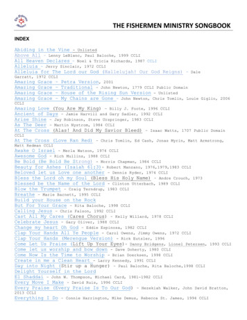
2.1 "Golub" fishing vessel informationShip's nameFlagPort of registryNavigation categoryCall signIMO numberYear and place of buildVessel typeOwnerManagerHull materialMinimum number of crew membersLength between perpendiculars (Lpp)Length overall (Loa)BreadthDepthDraftFreeboardGross tonnage - GTNet tonnage - NTDisplacementSpeedPropulsion typeTypes and number of propulsion machineryMachine manufacturer and powerNumber and type of propellerLicence and type"Golub"CroatiaZadarNational navigation (Category 5)9A9344N.A.1949. PulaFishing motor vessel (cutter)Rade Palaškov, Labin, Presika 161Redžep Raimović, Pula, Baližerka 144Wood3 - master, helmsman and engineer18.18 m20.50 m5.89 m3.46 m2.74 m0.76 m7422127 t7 knInternal combustion engineDIES, ST1 (1 main engine)Schwermaschinenbau K.Liebknecht 220 kW at 750 rpm1 with fixed bladesSKL 6 NVD 26AFigure 1. "Komarča" fishing vessel ("Golub" fishing vessel's "sister ship")3
The F/V "Golub" is equipped in conformity with the technical rules of the Croatian Register of Shipping. Itsnavigation equipment included the following: magnetic compass, VHF radio station1 and propeller revolutionindicator. In addition to the above, there was non-mandatory equipment installed and operational aboard such as the GPS device, the "Simrad" sonar, the "Fish 12" data plotter. Fishing vessels with registered lengthless than 24 m are not obliged to have a radar device, and the "Goldstar" radar, which, according to themaster's statement, had been previously installed, was not onboard at the time of the accident and was notoperational since it was being serviced. The ship is intended for purse seine catching of pelagic fish all yearround in the territorial sea and the exclusive economic zone of the Republic of Croatia. The ship consists ofone continuous deck with a superstructure, one chimney, and one mast with a net-lifting device. Summer loaddraft amounts to 2.74 m, and the freeboard is 0.76 m. Speed of the empty ship is 8 knots (kn), and when it isloaded 7 kn. One (1) right-handed propeller with four (4) fixed blades is installed. According to the above, thisship falls under classic fishing vessels (purse seiners) of this category. There are no special or prominentcharacteristics of the above equipment which would influence the manoeuvrability of the ship or navigationsafety.2.2 "Joerg N" informationShip's nameFlagPort of registryNavigation categoryCall signIMO numberKeel laying dateYear and place of buildVessel typeOwnerManagerHull materialMinimum number of crew membersLength between perpendiculars (Lpp)Length overall (Loa)BreadthDepthDraftGross tonnage - GTNet tonnage - NTDisplacementTotal load bearing capacityCapacitySpeedTypes and number of propulsion machineryMain engine and powerNumber and type of propeller1"Joerg 8, VVeihai City, PR ChinaMulti-purpose cargo ship (reinforced for the transport of heavycargo)Erste MLB Bulktransport GmbH & Co, Nussbaumvwg 7,49808 Lingen, Germany (No. 4148174)Team Ship Management GmbH & Co. KG, Barkhausenstr. 2t.i.m.e port II, 27568, Bremerhaven, GermanySteel1084.95 m89.97 m15.41 m33.90 m5.80 m355615356359 t4456 t2076 m310 kn1 main engine, 1 bow thrusterZJMD-MAN B&W SL28/32A-F -1.960 kW1 with fixed bladesAccording to the master's statement, at the time of the accident the VHF radio station was switched off, and then heswitched it on to send a distress signal, but he did not have enough time.4
Figure 2. The "Joerg N" vessel2.3 Information about the voyagea) The F/V "Golub"Port of departure/arrivalPula, departure 31st October 2011 about 19:00 hrsCargo informationFishing net on the stern part of the shipCrew8 crew members (master and 7 fishermen/seamen - did not embark in thecapacity of crew members, and the majority of them is without a seaman's book,or any certificate of competence or proficiency). In addition, the crew had noseafaring or fishing experience.Of the above mentioned crew members, only two men had valid certificates:1. Master: Advanced fire-fighting (STCW VI/3) Master on a ship of up to 50 GT in national voyage (HRII/1) Basic safety (STCW VI/1) Chief engineer on a ship powered by main propulsion machinery of upto 500 kW in national voyage (HR III/4) Chief engineer on a fishing vessel powered by main propulsionmachinery of up to 500 kW (R-HR VI/5) Master of a fishing vessel in national voyage and in the EFPZ (R-HRVI/1)2. 1 ordinary seaman (fisherman): Basic safety (STCW VI/1)b) The M/V "Joerg N"Port of departure/arrivalMonfalcone/Rijeka 31.10.2011 at 16.55 hrsCargo informationShip in ballastCrew10 crew members (master, first officer, second officer, chief engineer,helmsman, 2 ordinary seamen, ordinary seaman/cook, oilman, electrician) - allwith valid seaman's books and valid certificates of competence or certificatesof proficiency)5
2.4 Information on the marine accidentType of marine accidentCollisionDate and time1st November 2011. at 01.28 hrsLocation of the marine accidentApproximately 5 m southwest of Pula, φ 44 47.3' N, λ 013 44.8' EMeteorological conditionsMostly clear, without wind (quiet), calm sea, visibility 8 - 9 km,air temperature 10 C (meteorological report on 1 November2011. for HMO Pula)Activities onboard "Joerg N"The accident happened during the voyage of the ship "JoergN" from the port Monfalcone towards the Port of RijekaInformation on persons' activities on "Joerg N" Second officer on the bridge on navigational watch, - crewmember on watch-keeping duty (helmsman - according to thecrew list) was occupied by washing ship's hallways in thesuperstructureActivities onboard "Golub"Ship at anchor; lighting for the purpose of catching fish.Information on persons' activities on "Golub"1 crew member on navigational watch: keeping watch on thedeck, and from time to time watching the TV in the drawingroom. The rest of the crew was sleeping.Consequences (for persons, property, environment) The sinking of the fishing vessel (total loss of ship) withoutthe injured and without sea pollution (besides the wreckage ofequipment from the fishing vessel). Total amount of fuel onthe fishing vessel at the time of collision is estimated at 400 I.2.5 Assistance from the shore and emergency preparednessWho participated112 Centre, Rijeka Maritime Rescue Coordination Centre,Pula and Rijeka harbourmaster's offices, maritime police, dutyinspector of the Directorate for Seafaring Safety and SeaProtectionQuickness of responseAt 01:40 hrs, the crew of the fishing vessel establishes amobile phone connection by calling 112. The 112 serviceinforms the Rijeka MRCC.At 01.50 hrs, the Rijeka MRCC informs the Pula HMO, theRijeka maritime police, the department for transport at theRijeka HMO, the duty inspector of the Directorate for SeafaringSafety and Sea ProtectionAt 02.05 hrs, the Rijeka MRCC contacts "Joerg N" through theRijekaradio CRSAt 03:45 hrs - the Pula HMO sent, through the Rijekaradio CRS,the call "SECURITE" (possible oil leakage and possible floatingremains of the fishing vessel)Measures taken onboard "Joerg N"At 02:05 hrs, a call by MRCC was received with the instructionto continue the planned voyage towards the destination portin Rijeka.6
2.6Characteristics of the navigation area and the surrounding vessel trafficThe navigation area in which the collision occurred includes the area between the extreme south-western partof the Istrian peninsula and the traffic separation scheme which had been set up more to the west. The place ofcollision is located approximately 6 m south of the island V. Brijun, 4.2 m southwest of the nearest land (theIstrian peninsula), 6.4 m from the Porer cliff, 7.5 m from the position south of the Albanež shoal where shipswhich navigate toward ports in the Kvarner Bay change course, and approximately 6.8 m from the border of theraffic separation scheme where ships which use the scheme sail northwest.Ships navigating in the collision area sail from the area of north-Adriatic ports towards the ports in the KvarnerBay and the other way round, and call to ports in the Pula Bay. Fishing vessels navigate in this area all yearround, and during the summer there are, in addition to cargo and fishing vessels, also yachts and pleasurecrafts navigating towards nautical ports in the immediate or wider area.Depths in this area range from approximately 38 to 42 m, and dangers for navigation in the immediateenvironment are well marked by navigation marks.To the port of "Joerg N" (closer to mainland), the ship called "Bremen" navigated with the approximate courseof 150 . At 00:58 hrs "Bremen" was located approximately abeam "Joerg N" at a distance of 3.5 M andnavigated at a speed of 9.6 kn (approximately the same speed as "Joerg N"). Distance between these twoships was being constantly reduced, and at the time of the collision between "Joerg N" and "Golub" it amountedto approximately 1.5 M.At the time of collision there were also other fishing vessels anchored in this area (approximately 1 m furthersouth from the place of collision).2.7 Weather conditionsAccording to the report of the Meteorological and Hydrological Service - Weather and Climate ObservationService - Ship Log and Sea Temperature Data Processing Section - Split, of 4th November 2011, the generalweather situation on 1st November 2011. southwest of Pula was such that the weather was under the influenceof an anticyclonic ridge which lingered over the Adriatic.In such meteorological circumstances, on 1st November 2011. from 00:00 till 04:00 hrs it was mostly clear in theconcerned area. The wind was slight and changing. Sea was calm (sea 0 - 1 - waves up to 0.1 m). Visibility wasreduced because of mist and amounted to 8 - 9 km.3RECONSTRUCTION OF THE MARITIME ACCIDENTOn 1st November 2011, at approximately 01:28 hrs, the M/V "Joerg N" hit the "Golub" fishing vessel at theapproximate position φ 44 47.3' N, λ 013 44.8' E. "Joerg N" navigated at the speed of approximately 10knots, whereas the F/V "Golub" was anchored and was ligthing for the purpose of catching fish. Since theofficer on the watch-keeping duty, as well as other crew members, failed to notice the collision with the fishingvessel, the "Joerg N" motor vessel continued its voyage without changing its course or speed. As a result of thedamage it suffered, the fishing vessel sank on the spot within the period of approximately 2 - 3 minutes. Thefishing vessel's crew abandoned the vessel in working boats before it sank, and arrived ashore in these boatsat the Bunarina marina. At 02:05 hrs "Joerg N" was informed about the collision by the Maritime RescueCoordination Centre in Rijeka, which received the information on the collision at 01:40 hrs from the 112 service.The 112 service had been called over a mobile phone by a member of the fishing vessel's crew after theytransferred to working boats. Since all the persons from the fishing vessel were safe in working boats and didnot request rescuing (medical aid), there was no search or rescuing operation, and "Joerg N" was ordered tocontinue its voyage towards its destination - the Port of Rijeka."Joerg N" left port the previous day, 31st October 2011, at 16:55 hrs from the Italian port of Monfalcone towardsthe Port of Rijeka in ballast with the intention of loading artificial fertiliser in Rijeka, whereas the "Golub" fishingvessel left port the previous evening, 31st October 2011, at about 19:00 hrs from the Port of Pula for its usualfishing activities."Joerg N" navigated on the course of 125 at the speed of approximately 10 knots. Shippositions were plotted onto the nautical chart at 1 hour intervals.7
Figure 3. Copy of the nautical chart with the plotted "Joerg N" routeFor the purpose of reconstructing the maritime accident through all its segments with a chronological course ofevents preceding the accident, as well as those occurring during the accident, segments of traffic imagescreated at characteristic times by the VTS and showing the navigation of "Joerg N" and the position of "Golub"were used. Shown below are characteristic positions of the ships before and after the collision, as well as themoment of collision itself.Figure 4. Voyage of "Joerg N" before entry into the North Adriatic traffic separation zone (31 Nov at 19:33)8
Figure 5. Voyage of "Joerg N" at entry into the North Adriatic traffic separation zone (31 Nov at 20:46)Figure 6. Change of course by "Joerg N" to approximately 130 (31 Oct at 22:07)9
Figure 7. Continued voyage of "Joerg N" on a course of 130 (31 Oct at 23:21Figure 8. Continued voyage of the "Joerg N" motor vessel on the course of 130 ‐ the "Golub" fishing vessel is situated over port bowfrom the "Joerg N" motor vessel (01 Nov at 00:58)10
Figure 9. Change of course of the "Joerg N" motor vessel to approximately 125 ‐ the "Golub" fishing vessel is situated dead ahead of"Joerg N" (1 Nov at 01:00)Figure 10. Continued voyage of "Joerg N" on the course of 125 (1 Nov at 01:14)11
Figure 11. Continued voyage of "Joerg N" on the course of 125 (1 Nov at 01:18)Figure 12. Continued voyage of "Joerg N" on the course of 125 (1 Nov at 01:23)12
Figure 13. The moment immediately before the collision (1 Nov at 01:28)Figure 14. The moment of collision (1 Nov at 01:28)13
Figure 15. The moment immediately after the collision – fishing vessel radar signal is present (1 Nov at 01:30)Figure 16. The moment immediately after the collision – fishing vessel radar signal is lost (1 Nov at 01:31)14
Figure 17. Navigation of the "Joerg N" ship after the collision – change of course to approximately 129 (1 Nov at 01:46)These pictures give the basis for the reconstruction of the "Joerg N" ship naviga
1 REPUBLIC OF CROATIA MINISTRY OF THE SEA, TRANSPORT AND INFRASTRUCTURE Class: 342-01/11-01/66 File no. : 530-03-11-2 Zagreb, 27th December 2011. By the Decision of the Minister of the sea, transport