Transcription
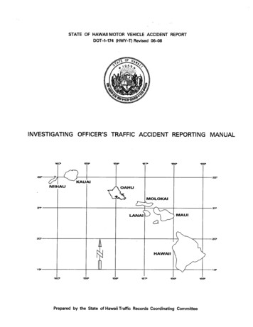
STATE OF HAWAII MOTOR VEHICLE ACCIDENT REPORTDOT-1-174 (HWY-T) Revised 06-08INVESTIGATING OFFICER'S TRAFFIC ACCIDENT REPORTING MANUAL1st. REVISION - SEPTEMBER 2009Original Publication - May 2008Prepared by the State of Hawaii Traffic Records Coordinating Committee
TABLE OF CONTENTSPage No.Introduction .1State of Hawaii Motor Vehicle Accident Report Form .11General Guidelines 31Specific Instructions .37SECTION I. Page One Instructions 43SECTION II. Page Two, Unit Information Instructions .57SECTION III. Page Three, Unit Information (Cont.) Instructions 71SECTION IV. Diagram Page Instructions .81SECTION V. All Persons Page Instructions 85SECTION VI. Narrative Page Instructions .91SECTION VII. CMV Supplement Instructions .95GLOSSARY 101APPENDIX A, What is a Motor Vehicle Traffic Accident? .125APPENDIX B, The State Highway System, List of Highways by Island,by Route Number and by Highway Name .141APPENDIX C, County Highways, List of Highways by Island, by Route Number,and by Highway Name .161APPENDIX D, State of Hawaii Motor Vehicle Accident Report Sample .171APPENDIX E, State of Hawaii Routes by Highway Name and Milepost Reference .183APPENDIX F, Locating Major Traffic Accidents . .191SUPPLEMENT, State Highways by Honolulu Police Districtiii
INTRODUCTIONInvestigating Officer’s Reporting ManualState of Hawaii Motor Vehicle Accident ReportDOT-1-174(HWY-T) Revised 06-081
2
INTRODUCTIONThe State Traffic Records Coordinating Committee (TRCC) has designed this manualto provide instructions and guidance to complete the revised State of Hawaii MotorVehicle Accident Report (MVAR), DOT-1-174(HWY-T) Revised 06-08. This is the firstmajor revision of the MVAR since 1985. The changes were made to standardize thecollection of data at the motor vehicle traffic accident scene. Accurate and uniformreporting on the MVAR will provide the data needed for the development of traffic safetyprojects to lessen the number and severity of motor vehicle traffic accidents in the State ofHawaii. The data derived from the MVAR will also help to develop proper traffic safetylaws and ordinances.The manual includes guidelines from the Model Minimum Uniform Crash Criteria(MMUCC). The purpose of the MMUCC is to provide a data set for describing motorvehicle accidents in a process that will generate the information necessary to improvehighway safety within each state and nationally. The implementation of MMUCC is acollaborative effort involving the National Highway Traffic Safety Administration (NHTSA),the Federal Highway Administration (FHWA), the Federal Motor Carrier SafetyAdministration (FMCSA) and the Governors Highway Safety Association (GHSA – formerlyNAGHSR).The American National Standard, Manual on Classification of Motor Vehicle TrafficAccidents, 7th Edition, (ANSI D16.1-2007), is also used in this manual as a guideline todefine and classify motor vehicle traffic accidents. The primary purpose of the Manual onClassification of Motor Vehicle Traffic Accidents is to promote uniformity and comparabilityof motor vehicle traffic accident data.This manual is designed to give simple instructions and references to complete theMVAR. However, there will be times when the instructions in this manual may not beadequate to help record unusual accidents. If such a situation occurs, use your bestjudgment and experience to complete the MVAR. Please remember that this manualcannot cover every type of question which might be raised about a motor vehicle accident.Examples will be provided in the manual whenever possible to clarify the instructions.The MVAR will be used if the motor vehicle traffic accident is a major traffic accident. Amajor traffic accident is an accident in which the total property damage (damages to allinvolved vehicles, fixed objects, animals, etc.) on a public trafficway amounts to more than 3,000, or one in which an accident involves injury or death. A copy of the MVAR must besent to the State of Hawaii, Department of Transportation, Highways Division, TrafficBranch. The copy of the MVAR may be either a hard copy or an electronic copy.The MVAR can be used for minor motor vehicle traffic accidents if the police agencywishes to use this report form. If the MVAR is used to report a minor motor vehicle trafficaccident, the bubble for Minor 02, Field 8, Report Type, must be filled in. No copy of a3
minor should be sent to the State of Hawaii, Department of Transportation, HighwaysDivision, Traffic Branch, unless it involves damage to government property (guardrails,traffic signs, traffic control signs and devices, bridge railings etc.).Statutory Requirements for the MVARThe State of Hawaii must collect motor vehicle traffic accident data to meet themandated requirements of the U.S. Department of Transportation under 23 USC 148,Highway Safety Improvement Program. The State of Hawaii must also meet therequirements of the Hawaii Administrative Rules, Title 19, Department of Transportation,Subtitle 5, Motor Vehicle Safety Office, Chapter 126, Identification and Surveillance ofAccident Locations.The purpose of the MVAR is also required by HRS, Chapter 291C, (Statewide TrafficCode), Part II, Accidents and Accident Reports. Section 291C-16, Immediate notice ofaccident, states:“(a) The driver of a vehicle involved in an accident resulting in injury or death of any ortotal damage to all property to an extent of 3,000 or more shall immediately by thequickest means of communication give notice of the accident to the nearest policeoffice. If sent to the site of the accident, a responding police officer shall file a writtenreport if it appears at the time that the accident has resulted in the injury or death of anyperson, or total damage to all property to an apparent extent of 3,000 or more.(b) Whenever the driver of a vehicle is physically incapable of giving an immediatenotice of an accident as required in subsection (a) and there was another occupant inthe vehicle at the time of the accident capable of doing so, such occupant shall makeor cause to be given the notice not given by the driver.”Four Components of the Motor Vehicle Accident Report (MVAR)The motor vehicle accident report (MVAR) records the data needed at the scene of amotor vehicle involved traffic accident. The report classifies information about the fourcomponents of a motor vehicle traffic accident: the road, the vehicle, the people involvedand the sequential unstabilized events of the accident. The MVAR reporting is strictlyfact finding. Therefore, include only factual information on the report. Do notinclude opinions.Road ComponentThe road component is an important part of a traffic accident investigation. Identifyingthe location of an accident is necessary for the engineer to determine where inadequaciesin the road, traffic control devices and the environment may have contributed to thefrequency or severity of accidents.4
There are four steps to identify the location of an accident:1. Determine where the accident occurred.Determine where the first harmful event occurred (where the first damage or injurytook place). The first harmful event may not be where the most serious damage orinjury occurred. The first harmful event may not be on the road (roadway orshoulder) but on the roadside. The first harmful event is usually the first contactbetween vehicles, or contact with non-motorists (pedestrian or bicyclist) or with afixed object.2. Name of the road on which the accident occurred.Record the name of the highway or street on which the accident occurred. Use thename on street signs or on maps. If a route number is known, also record thisinformation on the report.If a highway is divided, add the nominal direction of traffic flow on the highwayname. For example, an accident on a section of H-1 might be noted as “H-1Westbound” or “H-1 Eastbound”.Accidents at intersections require designating one of the intersecting roads as theone which the accident occurred. If each vehicle were traveling on the same road,locate the accident on this road. If the vehicles involved in the accident were ondifferent roads approaching the intersection, the accident is located on the mostimportant roadway according to the following list of priorities:1. Interstate (H-1, H-2, or H-3).2. Other U.S. route numbered highway (H201, Rt 61, Rt 63, etc.).3. Other state route numbered highway (Puuloa Road, Radford Drive,etc.).4. County numbered road (Kaukonahua Road, Waikoloa Road, etc.).5. Other county or city street.6. All others.If two roads are in the same category of importance, locate the accident on theroad from which vehicle initiating the harmful event approached the intersection.3. Referencing the accident location on the road.Report at what location on the specified road the accident (first harmful event)occurred. If an accident occurred at an intersection, simply name the intersectingroads. For example, “Rt 92, Nimitz Highway at Kalihi Street”, or “KapiolaniBoulevard at Ward Avenue”.5
If an accident occurred between intersections, locate the accident by distance anddirection from some permanent and identifiable landmark such as the following:Milepost MarkerTunnelsOverpasses or Underpasses of major highways or streetsNamed intersecting roadsNamed bridges over important rivers or other significant geographicalfeature.Do not use utility pole numbers or addresses to locate accidents.Examples of how to locate accidents by distance and direction:H-1 Westbound, 0.5 mile east of Kaonohi Street overpass.Route 61, Pali Highway Northbound, 150 feet north of Pali Tunnel(north end).Route 19, Hawaii Belt Road, 0.2 mile north of Milepost Marker 25.Route 83, Kamehameha Highway, 200 feet south of Waikane ValleyRoad.King Street, 250 east of Pensacola Street.Measure reference distance in feet if less than 1,000 feet and in miles if longer.Use an automobile odometer for longer distances (it registers to 1/10 of a mile).4. Name of the city or town.Record the name of the geographical area where the accident occurred.Examples:KailuaKalihiHawaii KaiWaikaneKaimukiKapoleiVehicle ComponentThe motor vehicle involved in a traffic accident is identified by the following:Registered owner’s nameVehicle license numberVehicle Identification Number (VIN)Vehicle make6
Vehicle modelVehicle model yearVehicle body typeVehicle colorThe amount of damage is one measure of the severity of an accident. The followingare levels of damage severity:Disabling damageFunctional damageMinor damageNo damageThe following are additional motor vehicle data that are recorded:Commercial vehicle useInitial impact pointVehicle direction of travel prior to the accidentVehicle factors contributing to the accidentPeople ComponentThere are four types of people who are part of the people component of a motor vehicletraffic accident:Driver of the involved motor vehiclePassenger in the involved motor vehicleNon-motorist involved in the accident (bicyclist or pedestrian)Witness who was at the scene of the accidentAll persons involved in the accident must be identified. The driver license is used toidentify the driver of the involved motor vehicle. The following information are required ofall drivers and non-motorist involved in the accident:NameAgeSexAddressPhone numberOccupation (driver, bicyclist or pedestrian)Driver license number or other official identification (driver, bicyclist orpedestrian)Employer’s name and phone number (driver, bicyclist or pedestrian)Auto insurance company name (driver only)7
Auto insurance policy number and expiration date (driver only)Driver license class, restrictions, endorsements (driver only)Driver license status (driver only)A driver or non-motorist (bicyclist or pedestrian) will be given an alcohol and/or drugtest if required.Each person involved will be identified by their position (motorist and non-motorist).The following are the additional information that will be collected about each personinvolved in the accident:Unit number which the involved person is assignedPosition locationAgeSexEjection (does not apply to pedestrian)Safety equipment usage (does not apply to pedestrian)Air bag deployment (does not apply to bicyclist or pedestrian)Injury severityArea of injuryMedical care at the sceneTransport to medical facilityInjury conditionEMS numberHuman behavior (driver, bicyclist or pedestrian)Distractions (driver, bicyclist or pedestrian)Vision obstruction (driver, bicyclist or pedestrian)Other contributing factors (driver, bicyclist or pedestrian)Sequential Unstabilized Events ComponentThe sequential unstabilized events component identifies what happened during themotor vehicle traffic accident and indicates the first harmful event which caused damage orinjury.This component describes the vehicle action(s) from the first unstabilized event to finalstabilized condition.Vehicle actions include:Direction of travel prior to the accident.Vehicle maneuver before and during the accident.8
The first harmful event includes:Non-collision events such as overturning, fire/explosion, submersion,run-off roadway, etc.Collision with fixed objects such as guardrail, median, fence, curb, tree, trafficSignal, traffic sign, fire hydrant, mailbox, etc.Collision with animal.Collision with pedestrian or bicyclist.Collision with other motor vehicle in transport such as head-on, rear-end,Broadside, sideswipe, and angle accidents.9
10
STATE OF HAWAII MOTOR VEHICLE ACCIDENT REPORT FORMDOT-1-174(HWY-T) Revised 06-0811
12
STATE OF HAWAII MOTOR VEHICLE ACCIDENT REPORTReport Number:Page 1 of DOT-1-174A (HWY-T) Rev. 06/08(1) Crime Code(2) County(8) Report Type(3) District(4) Beat(5) WatchPED(10) Number OfWITN KILLED INJ(9) Total InvolvedMVMajor (01)Minor (02)MCMOPBC(16) Times PoliceSent(6) Date/Time/Day Occurred(11) Tow(12) Hit & RunNo (01)Yes (02)(13) Fire(14) PhotoNo (01)Yes (02No (01)Yes (02)No (01)Yes (02(18) Weather Conditions (Select up to 2)(15) Select OneNone (00)Bridge (01)Sent(19) Light/LightingArriveClear (01)Hazy, Fog, Smoke (04)Snow (07)Daylight (01)Spot Illumination (04)Dark/No Lights (07)Cloudy (02)Windy, SevereCrosswind (05)Blowing Sand/Soil (08)Dawn (02)ContinuousLighting (05)Dark/Unknown (08)Rain (03)Sleet/Hail (06)Unknown (09)Dusk (03)Dark/Lights Off (06)Unknown (09)(20) Location(21) Traffic Level(22) Trafficway Description(23) GPS LocationSchool (01)Recreational (05)Light (01)2-Way, Undivided (01)2-Way, Divided, Median Barrier (04)Business (02)Farm/Fields (06)Medium (02)Residential (03)No Development (07)Heavy (03)2-Way, Undivided with Cont.Left Turn Lane (02)1-Way Trafficway (05)Industrial (04)Other (08)2-Way, Divided, Unprotected Median (03)Other (06)LOC(24) Name of Street or Highway(27) Route No.(28) Mile Post Marker(25) City/Town(29) Distance and Direction(26) Work ZoneOn Roadway - Not at Intersection10 Left or Inner Lane11 Right or Outer Lane12 Other Main Lane13 Merge/Transition Lane14 Acceleration Lane15 Deceleration Lane16 Left Turn Lane17 Right Turn Lane18 Bikeway19 Bus/HOV/Zipper LaneOff Roadway20 Left Shoulder21 Right Shoulder22 Left Roadside23 Right Roadside24 Median(31B) ActionOff Roadway (Cont.)25 Median Crossover26 Outside ROW(Trafficway)Off Roadway - Other30 Driveway31 Private Road32 Parking LotOther Roadway40 Entrance/Exit Ramp41 Railway Crossing42 Midblock Crosswalk43 HOV Crossover Lane44 Gore45 Separator46 Parking Lane47 Emergency Escape Ramp48 Other (Specify inSynopsis Block)Enter the Location of theFIRST HARMFUL EVENT (31A)(31) Sequence of EventsUnit/0(31B) Action#UnitUnit/0Yes (02)(30) Refer (Mile Marker, Intersection, Etc.)(31A) Location of First Harmful EventIntersection01 Intersection Area02 Driveway AccessLatitudeLongitudeNo (01)UnitTunnel (02)Ramp (03)Arrive(17) Times EMS#(7) Date/Time/Day Reported(31B) ActionNon-Collision01 Overturn/Rollover onRoadway02 Overturn/Rollover offRoadway03 Submersion04 Fire/Explosion05 Jackknife06 Ran Off Roadway07 Cargo/Equipment Loss orShift08 Fell/Jumped from MotorVehicle09 Downhill Runaway10 Separation of Units11 Cross Median/Centerline12 Equipment Failure13 Thrown or Falling Objects14 Other Non-Collision (Specifyin the Synopsis Block)Collision with Object/Animal20 Overhead Cables21 Guardrail Face22 Guardrail End23 Culvert24 Ditch25 Bridge Overhead Structure26 Bridge Pier or Support27 Bridge Rail28 Building29 TunnelCollision with Object/Animal(Cont.)30 Curb31 Embankment/Retaining Wall32 Fence33 Utility Pole/Light Support34 Traffic Signal/Sign Post35 Other Post/Pole/Support36 Impact Attenuator/CrashCushion37 Concrete Traffic Barrier38 Other Traffic Barrier39 Tree (Standing)40 Hydrant41 Mailbox42 Animal43 Other (Specify in the SynopsisBlock)Collision with Person50 Unknown51 Crossing in Crosswalk52 Crossing Outside Crosswalk53 Crossing no Crosswalk54 Darting Out55 Walking in Roadway56 Playing/Exercising in Roadway57 Directing Traffic58 Pushing/Working on Vehicle59 Getting On/Off Vehicle60 Roadwork61 Other (Specify in SynopsisBlock)Collision with Bicycle or Moped70 Unknown71 Riding in Bikeway72 Riding Outside of Bikeway73 Riding in Road/No Bikeway74 Riding off Roadway75 Crossing Roadway76 Fell In/On Roadway77 Other (Specify in SynopsisBlock)Collision with MV in Transport(Except Moped)80 Head On81 Rear End82 Sideswipe - Same Direction83 Sideswipe - OppositeDirection84 Angle - Same Direction85 Angle - Opposite Direction86 Angle - Not Specified87 Broadside88 Rear to Side89 Rear to Rear90 Other (Specify in SynopsisBlock)Collision with MV - Other100 MV in Other Roadway101 Railway Vehicle (Train/Engine)102 Parked MV103 Work Zone/MaintenanceEquip.Enter the Sequence Number of the FIRST HARMFUL EVENT (31C)Enter the Sequence Number of the MOST HARMFUL EVENT (31D)Officer’s Rank and NameOfficer’s ID NumberDate/TimeSupervisor’s Rank and NameSupervisor’s ID NumberThis report is prepared for the State of Hawaii Department of Transportation federally mandated 23 USC148, Highway Safety Improvement ProgramDate/Time
14
Page ofDOT-1-174B (HWY-T) Rev. 06/08(32) Unit No.STATE OF HAWAII MOTOR VEHICLE ACCIDENT REPORT(33) No. of Occ.Report Number:UNIT INFORMATION(34) Unit Class(35) RacePassenger Car (01)School Bus (09)Farm Vehicle/Equipment (17)White (01)Hawaiian (08)Passenger Van (02)Other Bus (10)Motor Coach (18)Black (02)Samoan (09)Pickup Truck (03)Motorcycle (11)Motor Home (19)American Indian (03)Tongan (10)SUV/MPVH (04)Motor Scooter (12)Recreational Vehicle (20)Chinese (04)Vietnamese (11)Cargo Van 10,001 lbs. (05)Moped (13)Other (21)Japanese (05)Filipino (12)Other Truck 10,001 lbs. (06)Bicycle (14)Unknown (22)Korean (06)Unknown (13)Truck 10,000 lbs. (07)Pedestrian (15)Puerto Rican (07)Other (14)Transit Bus (08)Maint./Construct. Equipment (16)(36) Last Name(37) First Name(38) MI(39) SexM (01)(41) Street No.(42) Street Name(45) CityF (02)(43) St., Pl., Blvd., Etc.(46) State(47) Zip CodeFed. Govt. Civ. (07)Student - H.S. (14)U.S. Army (01)State Govt. (08)Student - Col. (15)U.S. Navy (02)County Govt. (09)U.S. Tourist (16)U.S. Air Force (03)Foreign Govt./Civ. (10)Foreign Tourist (17)U.S. Marines (04)Retired (11)Police Officer (18)U.S. Coast Guard (05)Student - Elem. (12)Other (19)Other Military (06)Student - Inter. (13)Not Stated (20)Passed (01)Yes (02))-(52) Other Phone/Pager Number-((53) Driver’s License Number)-(54) St./Juris. (55) Class (56) Restrict.(58) CDL TypeDoes Not Apply(03)Failed (02)(51) Work Phone Number((86) SFST ResultsRefused (03))(50) Employer/Company NameUnemployed (00)No (01)(44) Apt/Suite Number(48) Home Phone Number((49) Occupation(85) SFST GIVEN
Auto insurance policy number and expiration date (driver only) Driver license class, restrictions, endorsements (driver only) Driver license status (driver only) A driver or non-motorist (bicyclist or pedestria
