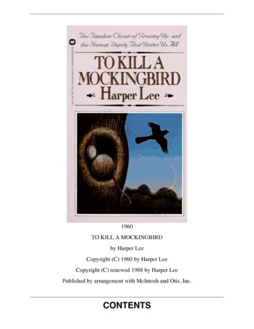
Transcription
Chapter 4 – List of the Preparers of this Final Environmental ImpactStatementThe Forest Service employees who prepared this EIS are listed below in alphabetical order:Jim Burton—Fire Team LeaderAlan Clingenpeel—Forest HydrologistJack Cowart—GIS SpecialistBetty Crump—Plan Revision EcologistJerry Davis—Forest Wildlife BiologistMeeks Etchieson—Forest ArcheologistTom Ferguson—Trails and Wilderness CoordinatorRobert Flowers—Plan Revision Recreation SpecialistRoger Fryar—Assistant Fire Team LeaderFinis Harris—Forest SilviculturistLarry Hedrick—Integrated Resources Team LeaderSusan Hooks—Forest BotanistAlett Little—Plan Revision Team LeaderJudith Logan—Zone Air SpecialistKen Luckow—Forest Soil ScientistSarah Magee—Realty SpecialistCaroline Mitchell—Editorial AssistantLea Moore—Civil EngineerJohn Nichols—Forest GeologistBill Pell—Planning and Recreation Team LeaderRon Perisho—Forest NEPA CoordinatorDarrel Schwilling—Forest Landscape ArchitectElaine Sharp—Forester Lands/Special UsesJames D. Smith—Forest Health ProtectionRichard Standage—Forest Fisheries BiologistPete Trenchi—Plan Revision AnalystGregg Vickers—Fire PlannerMike White—Technical Services Team LeaderRay Yelverton—Sales Forester286Ouachita National Forest
Chapter 5 – Distribution ListCopies of the EIS were distributed to the following individuals from the Ouachita National Forest’sPlan Revision mailing list who requested particular formats of the documents (as of September 9,2005). Individuals who did not make such a request received notification of document availability.IndividualsBill AbernathyFrank AckerL. AlexanderBettie AndersonDot AroundsGarland BakerBill BallardMark BarreVernon BatesBetty BeaverRichard BeckLonnie BeggsDave BelakovichJohn BenderGlen BishopJerry BlackMilburn BlantonElizabeth BoazKent BonarPaul BotteronMary BournePete BradfordDarrel BrattonLes BrelsfordClifford BrewerJames BriggsAl BrooksBobby BrownMichelle BrownTerry BryantJimmie BufordFred BurrowsJohn BurwellHelen BuxtonSeth BuysFrank CaldwellJohn CallahamKevin CarrBilly CarrollAdam CastleEdith ChambersJ.D. ChambersPhil ChitwoodCharles CleavesJerry ColemanJoseph ColgroveMary CookSean CouchDavid CoxBruce CozantKen CrawfordJim CrouchPaul DahlJohn DaleDonald DanielsL. DavidRobert DavisJohn DenningtonSonny DickeyMark DiffeeBill DinkinesFrances DobbsBill DoddDavid DoddJim DoddRay DonaldsonMark DonnellyMarth DotyTripp DunnLarry DurrMartha DzukowskiPaul EasleyDavid EdwardsChris ElderCharles EllisRay EwingDavid FalcettiA. FarmerRick FarmerBilly FisherVan ForgaJim FranzDave FrazierBob FryarCarlton FryarJimmy FryarCandace FurnissCharlie GagenGregg GalbraithCasey GalvinFinal Environmental Impact StatementMike GarrettJohn GeddieJim GiffordJoe GlennMilford GordonPat GordonRichard Gordon, Jr.Nicholos GraudsJames GreenKevin GreenCarol GriffeeRobert GriswoldMark GuthrieBill HamMike HamiltonBobby HandJim HardestyMac HardyAnita HarperJimmy HarperJoe HarperJohn HarrisJimmy HartA.G. HarveyAlfred HarveyMichael HarveyJames HavniearWilliam HawsBob HeinemannJ. HelmJohn HendersonFred HerpichTheresa HerrickCharles HerringJohn HeustonSally HubbardDon HudsonSteve HughesRonald HunterJim HusmanBill JohnstonCharles JonesLarry JonesAlan JordanMark Kannady287
K. KellyBill KempJames KennamerRoger KetchumDavid KimballTim KingLeo KnoernschildKurt KransJ.D. KrouseBasil KyriakakisMelvin LambertGeorge LandrumDon LangdonRoy LaxsonRicky LeeBob LimbirdJames LoeselJimmy LoutonTim LoveRobert LovettR. LybrandVicki LyonsGabrielle MahyBill ManleyRosendo MarinT. MarkhamGerald MartinJames MartinRon MastersRonnie MayberryRay McCulloughAllen McDowellPatrick McFarlinJulia Ann McKinneyTom McKinneyBob McLaneGary McLaughlinDean McNewtonRebecca McPeakeWarren MilesOttis MooreDavid MorrisJoe MudeDonald MullerJulie MullinsOlen MurdockBill MurphyDennis NixDan NolanJames OryM. OzanichJerry ParkerPat Parnell288Bob PaulkGene PeckJeffery PitmanJames RagsdaleJohn RamseyCoy ReedJerry RephanCharles ReynoldsHardie ReynoldsDon RichardsonRoy RichardsonMary RiveraRicky RobinsonCarroll RoseDoyle RowlandRichard RurupAlvin RussonVernon RyanVictor RyanDoug SandersTony ScalfLoyd SchniedersKlaus SchwarznauFrank ScottHolly SellsRay Settle, IIIShingo ShibataRobert ShielsRobert ShortWilliam SimsJim SlabaughWalter SlaightTed SmethersBill SmithEdward SmithHarold SmithMary Sue SmithStan SpeightDirk StandridgeJon Alan StandridgeJim StanleyDale SteeleJack StevensBill StewardMarvin StewartJoe StoeckelTodd StonePaul StoverAlfred StrakshusJoyce StroopeLoy SullivanDonnie SummitRon SuttlesFred TadlockDonald TaylorJ. TaylorTerry TerrellBilly TerryAlan TeschnerMonty ThackerR.J. ThackerDave ThessingRick ThomasWillard ThomasonGary ThreadgillMichael ThurmonSherman TippyTim TomlinsonCharlie TransueBill TuckerJuanita TurnerJack UpchurchCarroll E. Walls, Sr.M. WalstonJames WatsonDennis WeaverJohn WehuntBeth WelnaJ.L. WestonBo WhiteCharline WhiteMichael WhiteDon White, Jr.Don WhitlowJ. WilkePaul WilkinsChuck WilliamsJerry WilliamsPaul WilliamsDennis WilsonSteve WilsonPaul WiseCharles WoodJames WoodJames WoodsMark WootenHenry WrightGeorge Wynne, IITerrie YandellCharles YoungCyrus YoungDouglas ZollnerOuachita National Forest
Distribution List – Governments, Agencies, and Other OrganizationsNative AmericanCaddo Indian Tribe of OklahomaCherokee Nation of OklahomaChickasaw Nation of OklahomaChoctaw Nation of OklahomaMuscogee Creek Nation Tribe of OklahomaOsage Tribe of OklahomaQuapaw Tribe of OklahomaSeminole Tribe of OklahomaWichita and Affiliated Tribes of OklahomaFederal AgenciesAdvisory Council on Historic PreservationDepartment of ArmyEnvironmental Protection AgencyFederal Aviation AdministrationFederal Highway AdministrationNatural Resources Conservation ServiceRural Utilities ServiceU.S. Air ForceU.S. Army Corp of EngineersU.S. Department of TransportationU.S. NavyUSDA Forest ServiceUSDA, National Agricultural LibraryUSDI Bureau of Land ManagementUSDI Department of the InteriorUSDI Fish and Wildlife ServiceUSDI Geological SurveyUSDI National Park ServiceFinal Environmental Impact Statement289
Distribution List – Governments, Agencies, and Other OrganizationsElected OfficialsArkansasHonorable Blanche LincolnHonorable Mark PryorHonorable Marion BerryHonorable Vic SnyderHonorable John BoozmanHonorable Mike RossOklahomaHonorable Don NicklesHonorable James InhofeHonorable Tom CoburnHonorable John SullivanHonorable Tom ColeHonorable Frank LucasState Government AgenciesArkansas Archeological SurveyArkansas Coop Extension ServiceArkansas Department of Environmental QualityArkansas Department of Highway & TransportationArkansas Department of Parks & TourismArkansas Forestry CommissionArkansas Game & Fish CommissionArkansas Geological CommissionArkansas Natural Heritage CommissionArkansas Natural Scenic Rivers CommissionArkansas State Clearing HouseArkansas State Plant BoardOklahoma Archeological SurveyOklahoma Conservation CommissionOklahoma Department of AgricultureOklahoma Department of CommerceOklahoma Department of Environmental QualityOklahoma Department of Tourism and RecreationOklahoma Department of TransportationOklahoma Department of Wildlife ConservationOklahoma Forestry AssociationOklahoma Geological SurveyOklahoma Native Plant SocietyOklahoma Scenic Rivers Commission290Ouachita National Forest
Distribution List – Governments, Agencies, and Other OrganizationsLocal/Regional Government EntitiesArkansasGovernor of ArkansasAshley County JudgeGarland County JudgeHot Spring County JudgeHoward County JudgeLogan County JudgeMontgomery County JudgePerry County JudgePike County JudgePolk County JudgeSaline County JudgeScott County JudgeSebastian County JudgeYell County JudgeOklahomaGovernor of OklahomaLeFlore County CommissionersMcCurtain County CommissionersPublic LibrariesBooneville Public LibraryBroken Bow Public LibraryBuckley Public Library – PoteauCrossett Public LibraryGarland County Public LibraryGlenwood Branch LibraryHeavener Public LibraryHoward County LibraryIdabel Public LibraryMalvern/Hot Spring County LibraryMax Milam Library - PerryvilleMontgomery County LibraryPolk County LibrarySaline County Public LibraryScott County LibrarySebastian County Public LibraryTalihina Public LibraryYell County LibraryFinal Environmental Impact Statement291
Distribution List – Governments, Agencies, and Other OrganizationsOrganizationsArkansas Chapter of the Wildlife SocietyArkansas Nature ConservancyArkansas Wilderness Steering CommissionArkansas Wildlife FederationEquestrian UnlimitedForest Conservation CouncilForest In Holders Guardian HabitatHeartwoodHot Springs Bicycle AssociationLeague Of Women VotersMena Nature ClubNational Wild Turkey FederationOklahoma Wildlife FederationOuachita Watch LeagueOzark SocietyQuail UnlimitedSierra ClubThe Nature ConservancyWildlife Management InstituteYell County Wildlife FederationBusiness/IndustryAllstate Timber Products, Inc.Arkansas Forestry AssociationClarksville Wood Products, Inc.Crouch & AssociatesDavis Petroleum ServicesFamily Garden NurseryGeorgia Pacific Corp.Green Bay Packaging, Inc.Miller-PattersonMills Oil CompanyMoore Forest Products, Inc.Sullivan Lumber CompanyWeyerhaeuserWillhite Forest Products, Inc.292Ouachita National Forest
Distribution List – Governments, Agencies, and Other OrganizationsEducationArkansas State UniversityArkansas Tech UniversityCarl Albert State CollegeGarland County Community CollegeHenderson State UniversityOklahoma State UniversityOuachita Baptist UniversitySouthern Arkansas UniversityUniversity of ArkansasUniversity of Arkansas, Little RockUniversity of Arkansas, MonticelloUniversity of OklahomaMediaArkansas Democrat GazetteArkansas Times MagazineAssociated Press - ARAssociated Press - OKBooneville DemocratBroken Bow BannerBroken Bow NewsDaily OklahomanGlenwood HeraldHeavener LedgerHot Springs Sentinel RecordHugo Daily News-OKJournal RecordLaVilla NewsMcCurtain County GazetteMena StarMontgomery County NewsPoteau News/SunSoutheast TimesSouthwest Times RecordSW Times Record-OKTalihina AmericanTexarkana GazetteTulsa TribuneTulsa WorldValliant LeaderVillage VoiceWaldron NewsYell County RecordFinal Environmental Impact Statement293
Glossary of Commonly Used TermsAaccessibility: The relative ease or difficulty of getting from or to someplace, especially the abilityof a site, facility, or opportunity to be used by persons of varying physical and mental abilities.activity: A measure, course of action, or treatment that is undertaken to directly or indirectlyproduce, enhance, or maintain forest and rangeland outputs or achieve administrative orenvironmental quality objectives.adit: A horizontal or nearly horizontal passage driven (excavated) from the surface to access theore body for mining purposes. Sometime referred to as a tunnel; however, a tunnel is technicallydifferent in that it is open to the surface at both ends.affected environment: The relationship of the physical environment to the changes that will ormay take place as a result of human activity.age-class distribution: An age-class is a distinct aggregation of trees originating from a singlenatural event or regeneration activity, or a grouping of trees, e.g., a 10-year age class, as used ininventory or management. An age-class distribution is the location and/ or proportionaterepresentation of different age classes in a forest.air pollution: The presence of substances in the atmosphere, particularly those that do notoccur naturally. The substances are generally contaminants that substantially alter or degradethe quality of the atmosphere. The term is often used to identify undesirable substancesproduced by human activity, that is, anthropogenic air pollution. Air pollution usually designatesthe collection of substances that adversely affect human health, animal, and plants; deterioratesstructures; interferes with commerce; or interferes with the enjoyment of life.air quality (PSD) class: Three broad classifications established by the Clean Air Act to helpprevent significant deterioration of air quality for all areas of the country that are known (orassumed) to be attaining National Ambient Air Quality Standards.Class I: Geographic area designated for the most stringent degree of air quality protectionfrom future degradation of air quality. These congressionally-designated areas includewilderness areas over 5000 acres in size that were established as of August 7, 1977.wilderness areas and national parks where identified air quality related values mightbecome (or currently are) adversely affected by even a small increment of additional airpollution. To date, there are 156 such areas, nation-wide.Class II: Geographic area designated for a moderate degree of protection fromfuture air quality degradation. Any area that is not a Class I area is considered Class II.Class III: Geographic areas designated for the least protection from future air qualitydegradation. No Class III areas have been designated to date.allocation: The assignment of management prescriptions or combination of managementpractices to a particular land area to achieve the goals and objectives of the alternative.allowable sale quantity (ASQ): The quantity of timber that may be sold from the area ofsuitable land covered by the Forest Plan for a time period specified by the Forest Plan. Thisquantity is usually expressed on an annual basis as the “average annual allowable sale quantity.”294Ouachita National Forest
alternative: In forest planning, a mix of policies, plans, or projects proposed for decisionmakingdesigned in response to public issues or management concerns.analysis area: A collection of lands, not necessary contiguous, sufficiently similar in character,that they may be analyzed at the forest plan level.aquatic habitat types: The classification of instream habitat based on location within channel,patterns of water flow, and nature of flow controlling structures. Habitat is classified into anumber of types according to location within the channel, patterns of water flow, and nature offlow controlling structure. Riffles are divided into three habitat types: low gradient riffles, rapids,and cascades. Pools are divided into seven types: secondary channel pools, backward pools,trench pools, plunge pools, lateral scour pools, dammed pools, and beaver ponds. Glides, thethird habitat type, are intermediate in many characteristics between riffles and pools. It isrecognized that as aquatic habitat types occur in various parts of the country, additional habitattypes may have to be described. If necessary, the regional fishery biologist will describe anddefine the additional habitat types.arterial roads: Roads that provide service to large land areas and usually connect with publichighways or other forest arterial roads to form an integrated network of primary travel routes. Thelocation and standard are often determined by a demand for maximum mobility and travelefficiency rather than specific resource management service. They are usually developed andoperated for long-term land and resource management purposes and constant service. Theseroads generally serve areas more than 40,000 acres.authorized use: Specific activity or occupancy, including a ski area, historical marker, or oil andgas lease, for which a special authorization is issued.Bbasal area (BA): the area, in square feet, of the cross section of a single tree measured at 4.5feet above ground, usually expressed as square feet per acre.best management practice (BMP): A practice, or a combination of practices determined to bethe most effective and practical means of preventing or reducing the amount of pollutiongenerated by non-point sources to a level compatible with water quality goals.biodiversity: The variety of life, including the variety of gene pools, species, plant and animalcommunities, ecosystems, and the processes through which individual organisms interact withone another, and their environments.biological control: The use of natural means, or agents, to control unwanted pests. Examplesinclude introduced or naturally occurring insects, bacteria, or fungi that act as predators,parasites, or disease agents of pests. Biological controls can sometimes be alternatives tomechanical or chemical means.CC-factor: As expressed in the Region 8 Modified Universal Soil Loss Equation, C-Factor is theforest management factor in the equation to describe the ratio of soil loss from a site withspecified forest management actions causing reduced plant cover to that of the undisturbedforest condition.canopy cover: The percent of a fixed area covered by the crown of an individual plant speciesor delimited by the vertical projection of its outermost perimeter. Small openings in the crown areincluded. Used to express the relative importance of individual species within a vegetationcommunity, or to express the canopy cover of woody species. Canopy cover may be used as ameasure of land cover change or trend. Often used for wildlife habitat evaluations.Final Environmental Impact Statement295
canopy: The cover of branches and foliage formed collectively by the crown of adjacent treesand other woody growth.capability: The potential of a land area to produce resources, supply goods and services, andallow resource uses under an assumed set of management practices and a given level ofmanagement intensity. Note: capability depends upon the current condition and site conditionsincluding climate, slope, land form, soil and geology, and the application of managementpractices and protection from fire, insects, and disease.class I areas: See air quality class.clearcutting: The harvesting in one cut of all trees on an area for the purpose of creating a newstand. The area harvested may be a patch, stand, or strip large enough to be mapped orrecorded.collector road: Roads that serve smaller land areas and are usually connected to a forestarterial or public highway. They collect traffic from forest local roads or terminal facilities. Thelocation and standard are influenced by long-term multi-resource service needs, and travelefficiency. Forest collector roads may be operated for constant or intermittent service, dependingon land-use and resource management objectives for the area served by the facility. Theseroads generally have two or more local roads feeding into them and generally serve an areaexceeding 10,000 acres.commercial thinning: Any type of thinning producing merchantable material at least equal tothe value of the direct cost of harvesting.commodity outputs: A resource output with commercial value. All resource products that arearticles of commerce.commodity: Tangible or physical output, such as timber, livestock, minerals, water, etc.common variety minerals: Common Variety Mineral Materials (CVMM) - Authority for thedisposal of mineral materials is provided by the Materials Act of July 31, 1947 (30 U.S.C. 601 etseq.), as amended. Common variety mineral materials include sand, gravel and building stone.On the Ouachita National Forest in Arkansas, per Section 323 of P.L. 100-446 (10 9/27/1988) italso includes deposits of quartz mineral. This includes quartz crystal used for esthetic purposes,high quality chemically pure quartz used for high-tech industrial purposes, novaculite, tripoli andother forms of quartz mineral. Common variety mineral materials are also referred to as "Salable"minerals and are available for sale by the Forest Service under contracts and permits issued byDistrict Rangers.concern level: A particular degree or measure of viewer interest in the scenic qualities of thelandscape as viewed from travelways and use areas, rated level 1 (highest concern) to 3 (lowestconcern).construction: The displacement of vegetation, soil and rock, and the installation of man-madestructures involved in the process of building a facility.Continuous Inventory of Stand Conditions (CISC): the USDA Forest Service, SouthernRegion’s forest stand database containing descriptive and prescriptive data about mappedstands of forest land.conversion (forest management): A change from one forest type to another in a stand on landthat has the capability of both forest types.coppice: A method of regenerating a stand in which all trees in the previous stand are harvestedand the majority of regeneration is from stump sprouts or root suckers.296Ouachita National Forest
critical habitat: Habitat as defined by the U.S. Fish and Wildlife Service to be essential to meetthe needs of an endangered species.cultural resources: Physical remains of districts, sites, structures, buildings, networks or objectsthat were used by humans. They may be historic, prehistoric, archaeological, architectural orspiritual in nature. Cultural resources are non-renewable.Ddecommission: To stabilize or restore a road to a more natural state without any furthermaintenance. The entrance is obscured and the wheel tracks or pathway is no longer continuousand suitable for travel. The travel way has been removed from the transportation system. Theroad prism is not necessarily returned back to its original contours.defined stream channel: A channel which exhibits evidence of annual scour.demand: The amount of an output that users are willing to take at specified price, time periodand condition of sale.den trees: Living or dead trees with cavities used by wildlife.desired condition: An expression of resource goals that have been set for a unit of land. Writtenas a narrative description of the landscape as it appears when goals have been achieved.developed recreation area: Relatively small, distinctly defined area where facilities are providedfor concentrated public use. Examples include campgrounds, picnic areas, and swimming areas.developed recreation: Recreation that requires facilities that in turn result in concentrated useof an area. Examples of recreation areas are campgrounds and ski areas; facilities in theseareas might include roads, parking lots, picnic tables, toilets, drinking water, and buildings.diameter at breast height (dbh): the standard method for measuring tree diameter at 4.5 feetfrom the ground.dispersed recreation: A general term referring to recreation use outside a developed recreationsite, this includes activities such as scenic driving, rock climbing, boating, hunting, fishing,backpacking, and recreation in primitive environments.disturbance (ecology): Any relative discrete event in time that disrupts the ecosystem,community, or population structure and changes resources, substrate availability, or the physicalenvironment.diversity: The distribution and abundance of different plant and animal communities and specieswithin the area covered by a land and resource management plan.dominant: Trees with crowns extending above the general level of the main canopy of evenaged groups of trees. They receive full light from above, and partly from the sides.Eearly successional: Vegetative condition typically characterized by low density to no canopycover and an abundance of herbaceous ground cover. May include forest 0 to 10 years of age,maintained openings, pastures, balds, or open woodlands.Final Environmental Impact Statement297
ecosystem management: An ecological approach to natural resource management to assureproductive, healthy ecosystem by blending social, economic, physical and biological needs andvalues.ecosystem: A complete interacting system of organisms and their environment.effects: Results expected to be achieved, or actually achieved, relative to physical, biologicaland social (cultural and economic) factors resulting from the achievement of outputs. Examplesof effects are tons of sediment, pounds of forage, person-years of employment, income, etc.There are direct effects, indirect effects and cumulative effects.endangered species: Any species of animal or plant that is in danger of extinction throughout allor a significant portion of its range. Plant or animal species identified by the Secretary of theInterior as endangered in accordance with the 1973 Endangered Species Act.endemic: Species restricted to a particular geographic area. Usually limited to one or a fewsmall streams or a single drainage.environment: All the conditions, circumstances, and influences surrounding and affecting thedevelopment of an organism, or group of organisms.environmental analysis: An analysis of alternative actions and their predictable short and longterm environmental effects, which include physical, biological, economic, social andenvironmental design factors and their interaction. (36 CFR 219.3)environmental impact statement: A disclosure document revealing the environmental effectsof a proposed action, which is required for major federal actions under Section 102 of theNational Environmental Policy Act, and released to the public and other agencies for commentand review. Final Environmental Impact Statement (FEIS) is the final version of the statementdisclosing environmental effects required for major federal actions under Section 102 of theNational Environmental Policy Act.environmental impact: Used interchangeably with environmental consequence orenvironmental effect.epidemic: Applied to a population of pests that build up, often rapidly, to highly abnormal andgenerally injurious levels.erosion: The wearing away of the land surface by the action of wind, water, or gravity.essential habitat: Habitat in which threatened and endangered species occur, but which has notbeen declared as critical habitat. Occupied habitat or suitable unoccupied habitat necessary forthe protection and recovery of a federally designated threatened or endangered species.evapotranspiration: The transfer of water vapor to the atmosphere from soil and water surfaces(evaporation), and from living plant cells (transpiration).even-aged management: The application of a combination of actions that results in the creationof stands in which trees of essentially the same age grow together. Managed even-aged forestsare characterized by a distribution of stands of varying ages (and, therefore, tree sizes)throughout the forest area. The difference in age between trees forming the main canopy level ofa stand usually does not exceed 20 percent of the age of the stand at harvest rotation age.Regeneration in a particular stand is obtained during a short period at or near the time that astand has reached the desired age or size for regeneration and harvested. Clearcut,shelterwood, or seed tree cutting methods produce even-aged stands. (36 CFR 211.3)even-aged: A forest (stand) composed of trees having no, or relatively small, differences in age.298Ouachita National Forest
existing road: All existing roads, owned or administered by various agencies, which are whollyor partly within or adjacent to and serving the National Forests and other areas administered bythe Forest Service, or intermingled private lands (ref: FSM 7705.21). These roads may or maynot be included on the current Forest transportation inventory, but are evident on the ground asmeeting the definition of a road.existing wilderness: Those areas already designated as wilderness by Congress.Ffacility: A single or contiguous group of improvements that exists to shelter or support ForestService Programs. The term may be used in either a broad or narrow context; for example, afacility may be a ranger station compound, lookout tower, leased office, work center, separatehousing area, visitor center, research laboratory, recreation complex, utility system, ortelecommunications site.federally listed: Any plant or animal species listed as threatened or endangered under theEndangered Species Act.felling: The cutting down of trees.Final Environmental Impact Statement (FEIS): The statement of environmental effectsrequired for major Federal actions under Section 102 of the National Environmental Policy Actfire condition class: Based on coarse scale national data, classes measure general wildfirerisk:Class One: Fire regimes are usually within historical ranges. Vegetation composition andstructure are intact. The risk of losing key ecosystem components from the occurrence of fireis relatively low.Class Two: Fire regimes on these lands have been moderately altered from their historicalrange by increased or decreased fire frequency. A moderate risk of losing key ecosystemcomponents has been identified.Class Three: Fire regimes on these lands have been significantly altered from their historicalreturn interval. The risk of losing key ecosystem components from fire is high. Fire frequencieshave departed from historical ranges by multiple return intervals. Vegetation composition,structure, and diversity have been significantly altered.fire regime: A generalized description of the role a fire plays in the ecosystem. It is characterized by fire frequency, predictability, seasonality, intensity, duration, scale (patch size), andregularity or variability. Five combinations of fire frequency exist.fire use: The combination of wildland fire use and prescribed fire application to meet resourceobjectives.floodplains: The lowland and relatively flat area adjoining inland waters, including at a minimum,that area subject to a one percent or greater chance of flooding in any given year, and soilinundated by the 100-year flood.forage: All browse and non-woody plants that are available to livestock or game animals usedfor grazing or harvested for feeding.foreground: The area between the viewer and the middle ground in a landscape; generally from0 to 1/2 mile distance.Final Environmental Impact Statement299
Forest and Rangeland Renewable Resources Planning Act of 1974: An act of Congressrequiring the preparation of a program for the management of the national forests’ renewableresources, and of land and resource management plans for units of the National Forest System.It also requires a continuing inventory of all National Forest System lands and renewableresources.forest health: The perceived condition of a forest derived from concerns about factors as i
Wildlife Management Institute Yell County Wildlife Federation Business/Industry Allstate Timber Products, Inc. Arkansas Forestry Association Clarksville Wood Products, Inc. Crouch & Associates Davis Petroleum Services Family Garden Nursery Georgia Pacific Corp. Green Bay Packaging, Inc. Miller-Patterson Mills Oil Company