Transcription
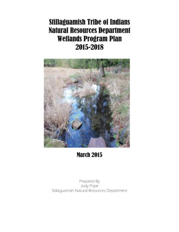
Stillaguamish Natural Resources DepartmentStillaguamish Tribe of IndiansNatural Resources DepartmentWetlands Program Plan2015-2018March 2015Prepared ByJody PopeStillaguamish Natural Resources Department
Stillaguamish Natural Resources DepartmentTable of ContentsPurpose:. 2Overall Goal Statement and Time Frame for Plan: . 3Overview of the Stillaguamish Watershed . 4Core Element: Monitoring and Assessment . 7Core Element: Voluntary Restoration and Protection . 9Project Summary:. 12Potential Partnerships. 14Potential Funding Opportunities . 15Responsible Parties for Plan Implementation . 14Appendix: I approved tribal resolution . 151Wetlands Program PlanJanuary 2015
Stillaguamish Natural Resources DepartmentPurpose:The purpose of the Stillaguamish Wetlands Program is to inventory and protect wetlandecosystems by developing strategies that provide and promote protection of intact areas,restore and monitor areas where processes have been altered, and reduce the risk fordegradation from future activities among tribally owned land.Natural Resources Department Mission Statement:The Stillaguamish Tribe's Natural Resources Department came into being as a resultof U.S. v. Washington, Civil 9213, and better known as the Boldt Decision of 1974. Inthis case, which was affirmed by the U.S. Supreme Court, Puget Sound Indian Tribeswho signed treaties with Isaac Stevens in the late 1800's retained the right to take up to50% of all harvestable (beyond what is required to ensure reproductive success) fish andshellfish resources within their respective Usual and Accustomed (U&A's) fishing areas.Because the welfare of Treaty Tribes is the responsibility of the U.S. Government (Truststatus), it became the responsibility of the Bureau of Indian Affairs (BIA) to manage fish,shellfish, and other natural resources for the benefit of the Tribes. Seeing the benefit ofhaving each Tribe manage its own resources, the BIA entered into contracts with theTribes for the purpose of providing management of fish and shellfish resources withintheir respective U&A's.The mission of the Natural Resources department is therefore to manage, protect, andconserve those natural resources that are required to sustain healthy populations of fish,shellfish, and wildlife within the Stillaguamish Tribe's U&A (Stillaguamish Watershed).In addition, the Tribe's contract with the BIA provides for enrollment of tribal membersfor the purpose of certifying an individual's right to take fish, shellfish, and wildlife forcommercial as well as ceremonial purposes, and contains provisions for establishingenforcement of laws and regulations that the Tribe may promulgate for the purpose ofconducting or curtailing commercial and/or ceremonial harvests of fish, shellfish, andwildlife."The river is alive. It is an essential part of our lives. When it is vibrant and healthy, ourwell-being is preserved. We must heal and protect this precious resource, not just for ourown tribal treaty rights, but because it's a wise and respectful thing to do for everyonewho lives here."2Wetlands Program PlanJanuary 2015
Stillaguamish Natural Resources DepartmentOverall Goal Statement and Time Frame for Plan:The Stillaguamish Tribe plans to develop and begin to implement the wetland programover the next four years (2015-2018). Tribally-owned lands in the short term will beidentified, monitored and assessed for wetland habitat and ecosystems condition duringthe initial phase of the program. Once a thorough investigation of aquatic resources hasbeen completed, the data will be used to prioritize wetlands for restoration, designrestoration projects and generate objectives for regulations in the long term. A short termgoal for the program, and the focus of this document, is to develop a baseline assessmentof the wetlands on tribally owned lands to improve our natural resource management andfuture decision making for development. In the long term, the wetland program willbegin to implement priority needs determined from the initial assessment and baselinedata collected. The program will compliment and work with the Timber, Fish andWildlife program (TFW) in regulating forest practices within the StillaguamishWatershed and provide recommendations that comply with Washington State Forest andFish laws. The wetland program will also complement activities occurring in the Tribe’sClimate Change Program, Wildlife Program, and beaver relocation effort. A long termgoal and with extended funding, the wetland program will allow for the inventory,assessment, and monitoring of wetland habitat and resources throughout theStillaguamish watershed. In support of this, the Stillaguamish Tribe Natural ResourcesDepartment will work toward these goals by employing the following actions andactivities over the next four years.3Wetlands Program PlanJanuary 2015
Stillaguamish Natural Resources DepartmentOverview of the Stillaguamish WatershedThe Stillaguamish River is the fifth largest tributary to Puget Sound. The StillaguamishWatershed drains an area of approximately 700 square miles and includes more than3,112 miles of river, stream, and marine shore habitat. Elevations in the watershed rangefrom sea level to about 6,854 feet on Three Fingers Mountain. The river enters PugetSound at Stanwood, 16 miles north of Everett in northwestern Snohomish County. Thewatershed drains into both Port Susan and Skagit Bay. It is also part of the WhidbeyBasin, which includes Skagit Bay, Saratoga Passage, Port Susan, and Deception Pass.The Stillaguamish Watershed can be divided into three general regions: the North Fork,South Fork, and Lower Mainstem. The two forks join in Arlington, 18 river miles fromthe mouth. Pilchuck, Deer, Boulder, and Canyon Creeks are the four largest tributaries tothe Stillaguamish River system. The watershed (figure 1) includes land governed bySnohomish County and Skagit County, the cities of Arlington, Stanwood, and GraniteFalls, and the Stillaguamish and Tulalip Tribes. Federal, state, and private forest landuses occupy the majority of the watershed.The local climate is typically maritime with cool, wet winters and mild summers. Rainfallis highly variable throughout the watershed, with average annual rainfall ranging from 30inches per year in the western lowlands of the watershed to 150 inches per year at higherelevations in the eastern portion of the watershed. Approximately 75% of theprecipitation falls between October and March. Precipitation and stream flows are highestin late autumn and winter as a result of rainstorms and rapid snowmelt during warmerrainstorms (called rain-on-snow events). The lowest flows occur usually during thesummer dry period from July through October.Currently, the Tribe has approximately 64 acres of reservation land, an additional 592acres of property in tribal trust and 1214.36 acres of tribally owned lands dispersedthroughout the Stillaguamish Watershed extending into both Skagit and Snohomishcounties (figure 2).4Wetlands Program PlanJanuary 2015
Stillaguamish Natural Resources DepartmentFigure 1: Stillaguamish watershed in Washington State.5Wetlands Program PlanJanuary 2015
Stillaguamish Natural Resources DepartmentFigure 2: Stillaguamish Tribe of Indians tribal property throughout the Stillaguamishwatershed (current as of 1/29/2015).6Wetlands Program PlanJanuary 2015
Stillaguamish Natural Resources DepartmentCore Element: Monitoring and AssessmentGoal: Deliver a commitment to inventorying, monitoring, and assessing wetland resources, including valuable fish and wildlifehabitat on tribal properties throughout the Stillaguamish Watershed.Objective: Develop a program that protects and conserves tribal wetlands and values. The activities and actions described below areto provide guidance and support and are subject to revisions depending on tribal needs and funding.Action (a): Define wetlands monitoring objectives and strategiesActivityIdentify and develop wetland data needs for tribal lands. The tribe iscontinually adding and updating the property list.Identify available funding opportunities/sources for specific wetlandmonitoring projects e.g. WPDG.Develop a wetlands monitoring strategy document (WMSD) thatincorporates monitoring indicators, sites and schedule/process forimplementation by collecting baseline data to supplement on-goingwetland projects.Examine how to integrate wetlands monitoring strategies into existingwater quality (WQ) monitoring program and efforts as s Program PlanJanuary 2015
Stillaguamish Natural Resources DepartmentAction (b): Develop a wetlands monitoring, assessment and sampling plan design and strategyActivity20152016Inventory, collect, and evaluate current wetlands on tribally-ownedX*Xproperty. Establish baseline of wetland condition and function usingEPAs Water Monitoring and Assessment Program for Wetlands(MAPW) 1 level 1 assessment working towards level 2 and 3 in longterm and collaborate with the tribe’s WQ program for input on wetlandfunction (landscape hydrology, water quality, and habitat). Followguidance found in EPAs documents referenced below234. Level 1 datawill be geographically referenced in database to lay the groundwork as auseful planning tool and monitoring system.Examine all wetlands on tribally-owned lands using level 1 analysis.X*XEstablish baseline map as well as continually update as new propertiesbecome acquired.Use base map and updated wetland inventory maps as a baseline forXincorporating wetland regulation language into the Stillaguamish Tribe’scritical areas guidance document (CAGD). The monitoring datacollected will help to inform and identify high priority areas, help todevelop future plans for recovery of wetlands and help to create wetlandspecific WQ standards.Work towards expanding the WMSD to identify objectives and goals toaddress the core element framework for regulation and water qualitystandards for wetlands suggested by EPA. Use baseline monitoring datato help inform the WQ program.2017X2018XXXXXXX* to be started if 2015 funding allows.8Wetlands Program PlanJanuary 2015
Stillaguamish Natural Resources DepartmentAction (c): Monitor wetland resources on tribally-owned landsActivityStep 1: Identify monitoring and/or functional assessment methods,research and review existing methods, metrics and/or protocols to beused for site specific data collection. Researching current available dataannually.Step 2: Using existing GIS data, begin the implementation ofmonitoring on tribal property. This will include evaluatingenvironmental consequences at a level 1 analysis (including on-theground data collection, e.g. vegetation identification) as well asincorporating some level 2 (e.g. rapid assessment, field testing) andlevel 3 assessments by reviewing tools and methods provided by EPAsguidance documents referenced below.Step 3: Continually monitor and assess wetlands throughout theimplementation process. Using EPA’s guidance documents listed above.Design a data management system to support program objectives and tohelp inform decision making.Train environmental staff by attending any applicable wetlands trainingsand/or conferences. Included training might be wetland delineation,herbology of native people, building partnerships for watershedprotection, wetlands biocriteria, water quality monitoring, bird andamphibian identification and use of global position systems (GPS) andGIS software. As well as participation in the Intertribal Wetland Forummeeting and TWG.2015XX2016X2017X2018XXXXXXXXXXXXX8Wetlands Program PlanJanuary 2015
Stillaguamish Natural Resources DepartmentCore Element: Voluntary Restoration and ProtectionGoal: Work to maintain and support healthy wetlands on tribal properties through restoration, protection and conservation.Objective: Develop and improve tribal wetland restoration and protection goals, work to educate other tribal programs, members anddepartments, identify high priority wetlands/aquatic resource sites for preservation and restoration (cultural, spiritual, economic,ecological) and work to expand our program to incorporate the entire Stillaguamish watershed.Action (A): Develop prioritized wetland protection and restoration project list. Continue monitoring efforts on tribalproperty using collected baseline condition data.Activity2015201620172018Prioritize restoration projects. This will help to reduce loss and identifyXXXthe types and sources of impacts affecting wetlands.Maintain monitoring efforts on tribal property and newly purchasedXXXlands.Conduct annual assessments of wetlandsXXXX9Wetlands Program PlanJanuary 2015
Stillaguamish Natural Resources DepartmentAction (b): Management and Protection of wetland resources on tribally-owned landsActivity2015Using baseline data collected to improve management of wetlandresources on tribally-owned lands by completing aquatic wetland typingfollowing the USFWS Cowardian system protocols and provide the datato update the NWI inventory maps. Work with the WQ program tocomplete the HGM class overlay to identify hydrogeomorphic class ofwetlands, identify hydrology, habitat and water quality functions.Make recommendations for better management of wetlands on triballyowned lands and provide suggestions for proposed land purchases.Using baseline condition data, improve protection of identified wetlandresources on tribally-owned lands by identifying high priority wetlandacquisitions and recommend land use protections for identified sensitivewetland areas.Incorporate wetlands protection and community understanding ofwetlands values, functions and cultural practices into Education andOutreach programs.142016X2017X2018XXXXXXXXXX
Stillaguamish Natural Resources DepartmentAction (c): Identify impaired wetlands and potential restoration projectsActivityUsing a biotic indicator approach, identify impairment and prioritizewetland sites for restoration on tribally-owned lands.Using a checklist of landscape condition (e.g. buffer size, development,site features, and appearance); identify the areas where the mostimpaired wetlands exist.Identify specific needs and appropriate methods for each wetlandrestoration project.2015Action (d): Review tribal wetlands protection goals, objectives and restoration effortsActivity2015Hold a series of coordination meetings with tribal representatives andother responsible parties to review, analyze, monitor, and assessstrategies created over the last three yearsReview and track the progress made using the tribal wetland protectiongoals and objectives for Stillaguamish Tribally-owned landsAnalyze data and information obtained through program plan,coordinate with the WQ program and share with interested parties andfunding agenciesUse previously identified impaired and prioritized wetlands to establishbaseline management and restoration objectives and goalsEvaluate progress in meeting monitoring objectives XXXXX11Wetlands Program PlanJanuary 2015
Stillaguamish Natural Resources DepartmentAction (e): Expand wetland Monitoring efforts to encompass watershed wideActivityUse lessons learned in years one through three to develop monitoring,restoration and protection plans at the watershed scale. Include inputfrom co-managers and other applicable parties.Pursue and identify Federal, State, local and other funding sources tohelp cover costs to expand and continue to monitor wetland resourceswithin the Stillaguamish River watershed.2015201620172018XXXEPA Guidance Documents:1) Application of Elements of a State Monitoring and Assessment Program for Wetlands:http://water.epa.gov/grants funding/wetlands/upload/2006 4 19 wetlands Wetland Elements Final.pdf2) Monitoring and Assessment: nitoring.pdf3) Wetland Bio- Assessment Glossary: g index.cfm4) Wetlands Modules: modules12Wetlands Program PlanJanuary 2015
Stillaguamish Natural Resources DepartmentProject Summary:The Stillaguamish Tribe plans to develop and implement the wetlands program over thenext four years (2015-2018). The short term goals for the program are outlined in thisdocument and will consist of performing assessment of wetland condition and function,using guidance from EPA. Landscape assessment (level 1) and rapid wetland assessment(level 2) will be performed and intensive site assessment (level 3) at identified highpriority sites. We will evaluate wetland function by collaborating with the tribe’s waterquality program on tribally-owned lands. Once, initial assessments are complete (usingexisting GIS and followed by ground truthing), we will use a biotic indicator approach todetermine impairment. Based on impairment results, we will prioritize wetland sites forprotection and restoration. In addition to these goals, the program will also complimentand work with the timber, fish and wildlife (TFW) program in regulating forest practiceswithin the watershed and provide recommendations that comply with Washington stateforest and fish laws. The program will also support some of our valued projects andprograms such as; climate change, wildlife, water quality/toxics as well as salmonrecovery and beaver relocation projects. For example, the results of our monitoringefforts will help to inform the climate change vulnerability and adaptation plans. Theseefforts will also help to identify drainages for beaver relocation. Wetland inventory datawill also help to inform the wildlife conductivity and corridor project. If funding wereavailable, we could conduct some passive water sampling for chemicals of emergingconcern (CECs) at prioritized sites. The long term goals of the program are to assesswetland condition and function throughout the entire Stillaguamish Watershed andcontinually update the wetland inventory efforts on tribally-owned properties. In supportof this, the Stillaguamish Tribe Natural Resources Department will work toward thesegoals over the next four years.13Wetlands Program PlanJanuary 2015
Stillaguamish Natural Resources DepartmentPotential PartnershipsWithin Organization Planning Department (STECO)- provideproperty and GIS dataFish Hatchery- housed on large wetlandcomplexCultural Department- provide list ofsignificant plant and culturally significantsitesOutside Organizations Bureau of Indian Affairs (BIA)- funding andintertribal wetland forum (IWF)Citizen science groups- volunteer laborDepartment of Ecology (DOE)- data sourceand fundingEnvironmental Protection Agency (EPA)provide methods, protocols, and fundingNOAA Fisheries-data sourcePoint Elliot Treaty Tribes- informationsharing, funding sources, project ideas, staffassistance,Snohomish County- data sourceSkagit Valley Community College- studentinternsU.S. Fish and Wildlife Service- data sourceUnited States Geological Survey (USGS)WQ data sourceUniversity of Washington (UW)- provideclimate change dataWashington Department Fish and Wildlife(WDFW)- data sourceWashington Department of Natural Resources(DNR)- data sourceWestern Washington University (WWU)-datasource, student intern14Wetlands Program PlanJanuary 2015
Stillaguamish Natural Resources DepartmentPotential Funding Opportunities Tribal Charitable FundsSeattle City Light (SCL)Puget Sound Energy (PSE)Washington Department of Transportation (WSDOT)Natural Resources Conservation Service (NRCS)United States Fish and Wildlife Service (WSFW)Department of Ecology (DOE)Bureau of Indians Affairs (BIA)319 Grant (EPA)Wetland Program Development Grant (WPDG)14Wetlands Program PlanJanuary 2015
Stillaguamish Natural Resources DepartmentResponsible Parties for Plan ImplementationThe personnel from the Stillaguamish Tribe of Indians who will be responsible for theWetland Program Plan implementation are presented below in Table 1.Project PersonnelTitleResponsibilityJen SevignyProject Biologist,Stillaguamish Tribe NRDOversees all activities and actionswith the Wetland Program Planjsevigny@stillaguamish.comJody PopeProject Lead,Stillaguamish Tribe NRDResponsible for field activitiesassociated with implementationof program plan. Such as initialassessment, GIS, and anyrestoration projectsjpope@stillaguamish.comJoan KnappAccountantResponsible for fund accountingjknapp@stillaguamish.comGina GrayStillaguamish NaturalResources DepartmentDirectorOversees and approves allprograms and projects associatedwith the natural resourcesdepartment and employeesggray@stillaguamish.comBecky FauverEPA Region 10 WetlandsProgram CoordinatorEPA Region 10 s Program PlanJanuary 2015
Stillaguamish Natural Resources DepartmentAppendix: I approved tribal resolution16Wetlands Program PlanJanuary 2015
Stillaguamish Natural Resources Department17Wetlands Program PlanJanuary 2015
Stillaguamish Natural Resources Department 3 Wetlands Program Plan January 2015 Overall Goal Statement and Time Frame for Plan: The Stillaguamish Tribe plans to develop and begin to implement the wetland program over the next four years (2015-2018). Tribally-owned lands in the short term will be
