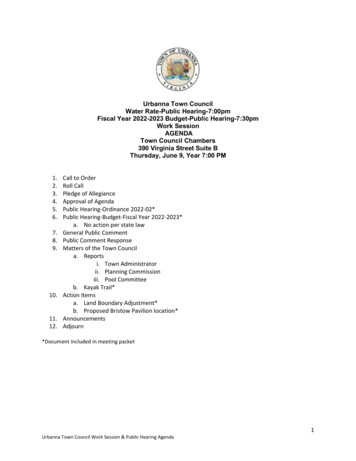
Transcription
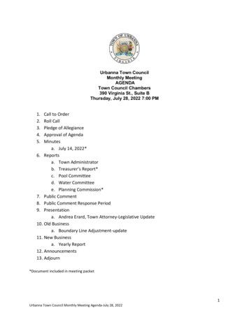
Urbanna Town CouncilWater Rate-Public Hearing-7:00pmFiscal Year 2022-2023 Budget-Public Hearing-7:30pmWork SessionAGENDATown Council Chambers390 Virginia Street Suite BThursday, June 9, Year 7:00 PM1.2.3.4.5.6.7.8.9.10.11.12.Call to OrderRoll CallPledge of AllegianceApproval of AgendaPublic Hearing-Ordinance 2022-02*Public Hearing-Budget-Fiscal Year 2022-2023*a. No action per state lawGeneral Public CommentPublic Comment ResponseMatters of the Town Councila. Reportsi. Town Administratorii. Planning Commissioniii. Pool Committeeb. Kayak Trail*Action Itemsa. Land Boundary Adjustment*b. Proposed Bristow Pavilion location*AnnouncementsAdjourn*Document included in meeting packetUrbanna Town Council Work Session & Public Hearing Agenda1
This page intentionally left blank
Agenda Item SummaryJune 9, 2022Agenda Item: #4-Approval of agendaFiscal Impact: NAStaff Recommendation: Approve agenda as presentedCouncil Action Requested: YesSample Motion:Motion to approve the agenda as presented.(Or if an amendment or amendments are made)Motion to approve agenda as amended.
This page intentionally left blank
Agenda Item SummaryJune 9, 2022Agenda Item: #5-Public Hearing Ordinance No. 2022-02Background:Water RatesWater rates for the Town of Urbanna were increased January 1, 2020, for the first time in 11 years. AWater and Wastewater Rate Report as prepared by Draper Aden Associates, and USDA data were usedto prepare the aforementioned increase. The Draper Aden report is a report that is produced annuallyfor use by water and wastewater systems in Virginia to provide an indication of trends in water andwastewater rates. This annual report is a good source of information of current rates of a cross sectionof water service providers in the state. At the time of the last increase, the water committee committedto reviewing rates on a yearly basis. In 2020, the report was delayed by COVID, and both the 2020 and2021 reports were used to ascertain the rate increase required to provide for infrastructure upgrades, anew well, and maintenance of our current system. As current construction costs have increasedsubstantially over the last two years, a 4.5% increase in 2020, and a 4% increase in 2021 (per the DraperAden Reports) were combined to give our “best guess” to the proposed water rate increase for thetown’s water system. Again, water rates will be reviewed yearly to ensure whether revenue is sufficientto maintain our system for our customers.Increase 8.5% for UrbannaCurrent Bi Monthly RatesIn Town 39.70 first 6000 gallons3.69 each 1,000 gallons thereafterOut of Town 76.57 first 6000 gallons7.37 for each 1,000 gallons thereafterMiddlesex Water Authority ratesTranslated to bi-monthly billing90.00 first 6000 gallons10.00 for each 1,000 gallons thereafterProposed Bi-Monthly Rates 43.07 first 6000 gallons4.00 each 1000 gallons thereafter 83.08 first 6000 gallons8.00 each 1000 gallons thereafter
Real Estate Tax RatesTown of Urbanna Proposed Real Estate Tax for FY 2023The Town was informed by the Commissioner of Revenue for Middlesex County that the total value ofreal property subject to Real Estate taxation within the Town had increased by 20.1 percent as of themost recent assessment. In order for the town to receive the same total amount of real estate taxes, asin the prior fiscal year when the tax rate was 23 cents per 100.00 valuation, but substituting the newassessment, the Town would have to lower the tax rate to 19.1 cents per 100.00.Increased expenses of operations however dictated that a larger total real estate tax collection of 27,000 was necessary. Therefore, a proposed tax rate 21 cents per 100.00 was determined to besufficient to satisfy those needs. This is a 2 Cent per 100.00 decrease in the Town’s real estate tax ratefrom the prior year. By way of comparison the Middlesex real estate tax rate will be decreased by 1 centper 100.00 valuation which also experienced an increased assessment albeit at a lower percentage.The difference between the 19-cent rate and the 21-cent represents about a 10% increase in the taxrate. Individual property taxes may however increase greater than or less than the above percentagebased on the individual property’s assessment.Staff Recommendation: ApproveCouncil Action Requested: YesSample Motion:Move to approve Ordinance No. 2022-2 as presented*Ordinance attached
ORDINANCE NO. 2022-02 - UNCODIFIED ORDINANCEBE IT ORDAINED by the Urbanna Town Council at its regular meeting on June 9, 2022 thatthe following tax rates shall be effective for tax year 2022 and shall be retroactive to January 1, 2022:Real PropertyPersonal PropertyCurrent Rate 0.23/ 100 of 100% of assessed valuation 0.37/ 100 of 100% of assessed valuationProposed Rate 0.21/ 100 of 100% 0.37/ 100 of 100%BE IT FURTHER ORDAINED by the Urbanna Town Council at its regular meeting on June9, 2022 that the following tax rates shall be effective as of July 1, 2022:In-Town Water Rates:Gallons0-6,0006,001 & UpResidential and Commercial Water/Sewer Rate ScheduleOut-of-Town Water RatesGallons0-6,0006,001 & UpCurrent Rate 39.70 minimum 3.69/1,000 gal over 6,000Rate with Proposed increase 43.07 minimum 4.00/1,000 gal over 6,000Current Rate 76.57 minimum 7.37/1,000 gal over 6,000Rate with Proposed increase 83.08 minimum 8.00/1,000 gal over 6,000
This page intentionally left blank
Agenda Item SummaryJune 9, 2022Agenda Item: #6-Public Hearing-Proposed Budget Fiscal Year 2022-2023Background: Beginning in February, the Finance Committee began developing the proposedbudget, using information from staff, other committees, and past data. Line items to includeself-funding activities have been added.Summary budget attached.Full budget can be found on the Town website urbannava.gov or in the Town office.Staff Recommendation: NACouncil Action Requested: No action per state law. Vote to take place June 23, 2022.
This page intentionally left blank
BUDGET FOR FISCAL YEAR 2022-2023Pursuant to §15.2-2506, Code of Virginia (1950), public notice is hereby given that the Urbanna Town Councilshall conduct a public hearing on June 9, 2022 at 7:30 PM in the Council Chambers at 390 Virginia Street.The purpose of the public hearing is to receive public comment on the proposed FY2022-20232 Budget forthe Town of Urbanna. Pursuant to§ 15.2-2506, Code of Virginia (1950), the following synopsis of the pro- posed budget is provided forinformative and planning purposes:General FundEXPENDITURES:General Government AdministrationMiddlesex Fire DepartmentOther Public SafetyPublic WorksBuildings & Grounds, Pool OperationsPlanning/Community DevelopmentTOTAL GENERAL FUND EXPENSES 329,288 15,200 2,000 110,500 55,406 67,097 579,491The real estate property tax rate will be reduced from 0.23 to 0.21 per 100 assessed value. The personal property tax rate will remain at 0.37 per 100 of clean trade-in value.REVENUES:General Property TaxesOther Local TaxesRevenue from PropertyOther RevenueTOTAL GENERAL FUND REVENUE 290,800 247,950 1,200 39,541 579,491Water FundEXPENDITURES:General AdministrationSystem OperationsReserveTOTAL WATER FUND EXPENSES 58,299 95,881.26 166,219.74 320,400The proposed in-town bi-monthly water rate schedule for FY2022-2023 is as follows:Minimum Usage 6,000 Gallons 43.07Over 6,000 Gallons 4.00 per thousand gallonsThe proposed out-of-town bi-monthly water rate schedule for FY2022- 2023 is as follows:Minimum Usage 6,000 GallonsOver 6,000 Gallons 83.08 8.00 per thousand gallons
REVENUES:Charge for ServicesOther Water Fund RevenueTOTAL WATER REVENUES 320,000 400 320,400Taber Trust FundEXPENDITURES:Middlesex Volunteer Fire DepartmentContribution to LibraryMiddlesex Rescue SquadTransfer to Pool ReserveTOTAL TABER TRUST FUND EXPENDITURES REVENUES:Trust Income 88,20010,00010,00010,20058,00088,200Upton’s Point MarinaEXPENDITURES:General AdministrationOperationsImprovementsTOTAL UPTON’S POINT MARINA EXPENDITURES 24,760 19,490 85,000 129,250REVENUESTOTAL UPTON’S POINT MARINA REVENUES 129,250Self-Funding Community ActivitiesFarmers Market, Second Saturday,Flags & Banners DonationsExpenses 6,000 6,000DMV SelectTotal Expenses 46,421REVENUES:FeesUnexpended prior appropriationsTotal Revenues 10,000 36,421 46,421
Agenda Item SummaryJune 9, 2022Agenda Item: #9a-ReportsBackground: Administrative and Committee reportsFiscal Impact: NAStaff Recommendation: NACouncil Action Requested: NAReports ScheduledTown Administrator-Garth WheelerPlanning Commission-Merri HansonPool Committee-Garth Wheeler
This page intentionally left blank
Agenda Item SummaryJune 9, 2022Agenda Item: #9b-Urbanna Creek Trail-Intermediate Trail MarkersBackground: Attached is the current draft of the proposed trail markers for the intermediatelevel of the Urbanna Creek Trail kayak tour.Fiscal Impact: TBDStaff Recommendation: N/ACouncil Action Requested: Discussion only at this time.Document attached
This page intentionally left blank
1. N 37 degree 38.031, W 076 degree 34.278, 90-foot water depth. Burton’s Steamboat Wharf was runby the steamboat agent Aubrey Burton and named Burton’s Wharf for Aubrey’s father Columbus (Lum)Burton. The wharf was originally called Palmer’s Wharf as Alfred Palmer was owner and dock-masterfrom the 1840s until the Burton’s purchased the wharf about 1880. Local canneries, farmers andmerchants received and shipped from the wharf their goods to markets in Baltimore, Norfolk andFredericksburg via steamboat. Passengers bound for any location in Tidewater Virginia and Marylandcould book a state room and even arrange for their cars to accompany them aboard the steamers. Oncea year at this site, the James Adam Floating Theater came each summer to town and moored in thisspot. It was an annual event in town from 1915 until it burned in 1941. After being towed from the lastriver town from which it played, it would arrive to Urbanna on a Sunday afternoon. There was greatexcitement among the town’s young people when the theater could be seen on the horizon. It was builton top of a barge and towed by two tugboat, Elk and Trouper. The Trouper was the largest tug and usedto tow, while the Elk was used more in the docking process. The captain of the Elk was Will Canon ofUrbanna. Town youngsters did odd jobs for the theater and were rewarded with free .35 passes forevening shows. Charlie Hunter and Beulah Adams were theater stars and Edna Ferber wrote in 1926 thenovel Show Boat based on her experience on the James Adams Floating Theater. The floating theatercame into Urbanna Creek each summer until the year before it burned in 19412. N 37 degree 37.994, W 078 degree 34.278, water depth 9’ - The broom factory was a single-storycement block building with oyster shells around the entire building. The business was owned andoperated by R. O. and Ed Smith of Saluda. It closed about 1930.3. N 37 degrees 37.975, W 076 degrees, W 34.305 water depth 9’ - The Swirley Top was built by Mr. andMrs. A. H. Henkel in 1950. This was the first fast-food take-out business in town. The business had asmall building beside the main building for playing pool and sitting around. The business was later run byCatherine Payne Via and under her ownership the best banana milkshakes “in the world” could bepurchased. When Urbanna Bridge was moved away from the foot of Watling Street in 1957 to its currentsite, the business continued to operate for a number of years but closed in the mid-1960s as trafficwaned with the change in the road.4. N 37 degrees 37.976, W 076 degrees, 34.277, water depth 9’ - The River Rink was built in the 1930sout over the water atop oak pilings and was a two-story structure. The first story contained a skatingrink, snack bar, lounge, galley and pinball and slot machines. The second story had a bowling alley androoms for the owner and employees. The River Rink burned in 1947.5. N 37 degrees 37.980, W 076 degrees 34.322, water depth 4.5’ - On August 7, 1858, the Urbanna TollBridge Company was formed with the sole purpose of building a wooden bridge across Urbanna Creek.The bridge entered Urbanna at this site. The private company was formed to build the bridge to offsetefforts by the county to move commerce to more centralized locations in the county. Through areferendum county voters succeeded in 1849 to remove the county seat from Urbanna to Saluda. Thefirst bridge was completed in 1859 and was one lane with room in the center of the bridge for two carsto pass. The 1859 bridge was replaced with a new bridge in 1910. That bridge was replaced with a twolane bridge in 1926 and in 1928 Urbanna Bridge was taken into the Virginia Highway System. Theconcrete bridge across the creek today was built in 1957. Located near where Bridge Marina’s salesbuilding was Thornton’s Store. It was one of just a few businesses in town owned by an AfricanAmerican. Washington (Wash) Thornton owned the general merchandise store and barber shop and hisfather had run it before him. Wash was the Urbanna Bridge draw span operator for many years too ashis business was right next to the bridge. His store clientele was mostly African-American. He allowed
Black oystermen to moor their oyster boats along his shoreline and many boats were left there to die.The bones of several log canoes are buried in the mud below what is today Urbanna Bridge marina. Thestore was torn down to build the marina.6. N 37 degrees 37.872, W 076 degrees, 34.315, water depth 7’ - The waters of Urbanna Creek haveprovided a livelihood for generations of watermen. Since man first laid eyes on Chesapeake Bay, wehave looked to it for food and nourishment. When the Baptist movement first began in the early 1700s,new members of the denomination looked to the creeks and streams to provide a spiritual type ofnourishment. This location was the annual baptismal spot for members of the all-Black Lebanon BaptistChurch founded in 1891 and once located just outside of Urbanna on Old Virginia Street. Usually once ayear, Blacks congregated on the hill leading down to the bridge and creek water to be baptized. Carswere lined up on both sides of the road up to Rosegill hill. When signaled a long line of children andadults dressed in white ropes would walk single file down to the creek. After some preaching and sweetgospel music, they were immersed in the water as an expression of their faith in Jesus Christ. On theother side of the creek, white children sitting on the hillside watched with interest and, for the mostpart, with reverence.7. N 37 degrees 37.859, W 076 degrees 34.130, water depth 5’ - Barn Landing was on Rosegill Farm andused as a schooner and deck boat landing for the hauling and delivery of bulk freight - lumber, fertilizer,coal, watermelons, and other bulk commodities.8. N 37 degrees 37.929 W 076 degrees 34.150, water depth 5’ 8” - Several yards from the site of BarnLanding are the bones of the Kate H. Tighlman, a two-mast sailing schooner. After World War II, with thedecline of the schooner era and rise of overland trucking, the vessel was beached and left to die onRosegill shore. The boat was owned by sea captain R. O. Smith Sr. who lived on Oakes Landing Road nearSaluda. The centerboard trunk and rips of the vessel could still be seen in the shallows into the 2020s.9. N 37 degrees 38.173, W 076 degrees 34.085, water depth 5’ - The paths from Rosegill down toUrbanna Creek were used by many generations of people and animals. As late as the early 1950s,boaters had to maneuver around Rosegill’s fine herd of Galloway Illinois Buffalo cattle that in the heat ofsummer would meander down the path to swim in the cool waters of Urbanna Creek.10. N 37 degrees, 38.173, W 076 degrees, 34.085, water depth 5’ - Along the Rosegill path leading downto the boathouse in the summer of 1863 John Taylor Wood, nephew to Confederate president JeffersonDavis, launched a series of naval attacks and used Urbanna Creek as his staging grounds. After thecapture of two Union vessels, the Rosegill home was used as a makeshift hospital to care forConfederate, and captured Union and former enslaved troops. When it was implied that the Blacktroops would not be treated, mistress and owner of Rosegill Eliza Bailey, who was originally from NewYork State made it clear that all would be treated in her house - or none.11. N 37 degrees 38.258, W 076 degrees 38.258, W 076 degrees 34.104, water depth 7’ - Round smoothballast stones used to define walkways and gardens in the Town of Urbanna are a reminder of thecolonial shipping business that was so much a part of the town’s economy. Near this site in several feetof water are piles of ballast stones that were thrown overboard from colonial ships. The ballast wasthrown into the creek and replaced with hogshead of tobacco weighing a thousand pounds each.12. N 37 degrees, 38.319, W 076 degrees 34.159, water depth 3.5’ - Bailey Point was named for Capt.John Bailey of Rosegill. There was an old pine tree on this point used for over 100 years as a gallows
tree. During colonial days the tree was used to hang piratesor their body parts as reminders to thosewilling to break laws that there was swift and definitive justice in Urbanna and throughout the Virginiacolony. The tree was used as a hanging tree into the 19th century when Urbanna was the county seat ofMiddlesex County. The town was the Middlesex County seat from 1748 to 1853.The tree was visiblefrom the river and creek and people came down to the water’s edge and watched from boats to witnessthe hangings. The tree was still standing into the 1930s and referred to then by locals as the gallowstree.13. N 37 degrees 38.401, W 076 degrees 34.152, water depth 5’ From the beginning of the Town ofUrbanna’s public beach in the 1940s an Urbanna lad came of age when he was able to swim across thecreek to Rosegill beach and back to the town beach. The lure of this site brings many people to its sandbut it is private property and its use for generations by boaters and swimmers speaks to the generosityof past and present owners of Rosegill.14. N 37 degree 38.451, W 076 degrees 34.120, water depth 11’ - Originally there was an island sandbaron the west side of the entrance to Urbanna Creek. After the Civil War, Jimmy Chandler homesteadedthe spit by building a small shack up on pilings out on the sandbar. Later on, as sand filled in andconnected the land to Urbanna, three cottages were built on the spit. The cottages were owned by Mrs.Arthur Chapman, Lewis Kucion and Dr. W. P. Jones. A stone jetty was built in the late 1800s todiscourage upriver sand from filling in the channel and to collect along the spit. Several other cottageswere built there over time but only one of the original cottages are standing today. With theintroduction of central sewage in the 1960s, landowners agreed to become part of the incorporatedTown of Urbanna. Today, some of the finest homes in town are on the island, as some locals still call theland today.15. N 37 degrees 38.47, W076 degrees 34.184, water depth 5’ 6” - Donaldson’s Steamboat Wharfextended out into the creek at this location and the old shirt factory stood on the high ground above thebend in the creek. The business founded as the Urbanna Manufacturing Plant in 1902 made overalls andwork shirts and was later converted to the Urbanna Beach Hotel. There was a pavilion on the shorebelow the hotel and music with live bands and dances were held there. When live music was notavailable there was a jukebox and young and old enjoyed themselves there at very little expense. A pierextended into the creek and visitors came regularly by boat. Later, the old hotel was purchased by C. D.Dameron who operated it as the Urbanna Lodge and Motel into the 1970s. Dameron built the firstswimming pool in town in the early 1960s. Although the old shirt factory building has been demolishedthe swimming pool is still there as part of Queen Anne’s Cove Condominiums.16. N 37 degrees 38.380, W 076 degrees 34.215, water depth 10’ Taylor’s Wharf was the site of one ofthe most famous murders in Urbanna’s history. Louis Crockett from Tangier Island killed Clifton Ward ofUrbanna after a dispute arose during a card game aboard a boat. The state Supreme Court ruled on thecase after the defense demanded a mistrial. During the three-day trial jurors were eposes at night at theUrbanna Beach Hotel within sight of where the murder took place. Virginia law allows jurors to visit thecrime site but the defense just owe notified and also allowed to attend. The other issue under appealwith the Supreme Court were partially over whether or not the charge of murder should be reduced tomanslaughter on grounds of self-defense. The Supreme Court held that the defendant had, in fact,committed a “. . . deliberate and premeditated, murder, prompted solely by a desire for vengeance.17. N 37 degrees 38.380, W 076 degrees 34.215, water depth 10’ - The Urbanna town swimmingbeach was located at this site. The beach was wide and sandy. Pilings were installed enclosing the
swimming area and fish net was attached to the pilings to keep stinging nettles out. Later on, frameswith small mesh wire were used to accomplish the same effect. A pier with a diving boardcomplimented this activity. Many children learned to swim here under the direction of Mr. Bill Joneswhose patience extended but so far. When a child was ready to swim but still had doubts, Mr. Jonesmethod of learning was “sink or swim.” A many a lad was thrown into deep-water by Mr. Jones withthose instructions. No one ever drowned! The beach land was privately owned and leased by the townfor a dollar a year from landowners of “Terrapin Hill” who owned the beachfront.18. N 37 degrees 38.336, W076 degrees 34.225 - Near this site H. S. Chowning & Co. owned a cementmanufacturing plant that made concrete building blocks and well curving. There was a pier out in thecreek for unloading sand and cement delivered to the plant by boat. Huge barges were towed across theriver to collect tons of white sand that when brought back to Urbanna was off-loaded by wheelbarrows.Cement blocks were hauled from the plant on Chesapeake Bay sail powered schooners and motorizeddeck boats and delivered throughout the region. There was a six-inch pipe free-flowing artesian well onthe site used to make the blocks. During and long after the plant closed, town children using the publicbeach wore a path to the well to use the cool flowing water that contained a bit of sulfur in it to sooththe pain from stinging nettles. If beach sand rubbed across the hurt did not relieve the pain, a race tothe well was the next relief step - and look out for those sand briars! Also near this site was a cotton gin.The cotton gin building was made of galvanized corrugated sheet metal and was two stories high. Therewas Fordson tractor powered device used to separate seed from cotton and a large mechanical pressused to bale the cotton. Pre-World War II, town children recalled that when the cotton gin was not inoperation, they would jump from the inside second floor level into the large pen that held clean and unbaled cotton. When the plant closed, the press was moved to Barnhardt Duck Farms, once located acouple miles outside of town and was used to bail duck feathers.19. N 37 degrees 38.291, W 076 degrees 34.204, water depth 11’ - Along this beach shore was thestaging area for the Urbanna Labor Day Boat Races. The annual races were held on Urbanna Creek from1940 to 1966. Outboard and inboard hydroplane boats raced for cash and trophies. Outboard raceswere on Saturday and inboard races on Sunday. The American Powerboat Association (APA) for yearswarned that the race course was too short and was dangerous. Finally, the APA sanction for inboardraces was revoked in 1966. The races were sponsored by the Urbanna Booster’s Club and MiddlesexLions Club. The organizers held the outboard races in 1966, but opted to stop the event in 1967. Duringthe early years, there was a beauty pageant and a yacht parade with decorated boats. One year a boatwas decorated with a large swan that was carrying the queen of the races and her court. Another yearthere was a staged battle between the Merrimack and Monitor. Blanks were fired from canons andfirecrackers were shot off to give the effect of gun fire. For most of the years, the race course waslocated on the eastern side of the bridge but for a few years races were held on the western side of thebridge. The bridge was shutdown to automobile traffic and loaded with spectators from one end to theother watching and cheering the races.20. N 37 degrees 38.236, W 076 degrees 34.224, water depth 10’ - At the turn of the 20th century,Standard Oil Co. had a bulk storage plant at this site. It was later known as Urbanna Esso bulk plant. Asan ESSO plant it was managed by J. T. Thrift starting in 1922 and oil was delivered by oil barges until1965 when trucking took over the business. Prior to barges, gasoline and oil were delivered in barrels onsailing schooners. The Standard Oil Dock had also been used as a steamboat wharf and prior to beingcalled Standard Oil Dock it was named Gressitt and Yates Wharf and later, Gressitt’s Wharf. Jon D.Gressitt ran a general merchandise store near the site and was a “planter and shipper of shell oystersand agent for Standard Oil Co.” as was detailed on one of Gressitt’s invoices dated March 9, 1910. The
wharf was later run in the 1960s by Beryl “Dick” Newman a Medal of Honor recipient in World War II.The concrete bridge across Urbanna Creek today is named in his honor.21. N 37 degrees 38.224, W 076 degrees 34.248 - During colonial times, Jamison’s Cove had enoughwater depth for ocean going sailing craft to moor. English ships came annually bringing supplies to townmerchants and residents from Scotland and England. Ships were able then to get up in the cove tooffload supplies and load hog-heads of tobacco. The waters just south of Jamison Cove entrance wasused by oyster grower Russell Davis as state leased private oyster grounds. During times when the creekand river were frozen solid, Davis kept a large supply of oysters on these grounds. During long freezes hehad his crew punched holes in the ice and while standing on the ice, would tong up oysters. They wouldgather the bushels needed to supply his customers when all other growers were stuck in the ice. Duringthese times, he kept a man on shore 24-hours a day with a shotgun to discourage any thievery.22. N 37 degrees 38.195, W076 degrees 34.253, water depth 5’ - This is the site of the ferry landingbetween Irvington and Urbanna. Beginning on May 15, 1924, a private ferry named Frances B. Garrettran three days a week across the Rappahannock River. Prior to this, a colonial ferry had operated formany years that came from directly across the Rappahannock River to Urbanna. It was known asChowning’s Ferry. Ferries ran across the river at different locations in the county until the Robert O.Norris Bridge opened at Grey’s Point on August 30, 1957 connecting Lancaster and Middlesex counties.23. N 37 degrees 38.159, W076 34.247, water depth 7.5’ - Over the years many businesses located onthis site that today houses Oyster Harbor Condominiums. J. W. Hurley and Son Seafood ran a generalmerchandize store on this site and were packers of “oysters and fruit.” Hurleys’ oyster shucking housewas one of the largest in the region with over 50 shuckers working in the plant at a time. The famous“Boyd’s Favorite Urbanna Brand Tomatoes” were canned in the Hurley tomato packing plant. Later, theyopened Hurley’s Hotel and Restaurant that was noted for serving fresh caught fish and crabs. Therestaurant was later demolished to make way for Norris Granary later known as Southern StatesGranary elevators that held, corn, wheat and soybeans purchased from local farmers and hauled to largefacilities in Norfolk and Salisbury, Md. Town boys of the 1960s can remember shaky and “don’t lookdown” mid-night climbs to the top of the elevators to collect pigeon eggs from nests to hatch out inhomemade incubators and to grow the birds to complete their Boy Scout bird study merit badges.Before the granary was the town’s ice plant that was located here. This plant made block ice weighing300 pounds a standard size for commercial ice. It was sold locally to seafood packers and was alsodelivered house-to-house in town in a wheelbarrow. John Street who lived on Watling Street deliveredice via wheelbarrow and had a scale and ice pick to chip the ice off the block. He was noted for allowingsmall children of the town to ride atop the ice as he pushed the wheelbarrow down the street. The plantwas owned by a Mr. Kennard who hauled ice up and down the Rappahannock River to steamboatwharves in his ice boat named Drannek, Kennard spelled backwards. The plant was loud as it was run bya single cylinder Diesel engine with a flywheel, eight or nine feet in diameter and it made a “great big’popping noise when it was pulling the compressor to make ice. Another business was Powell’s Mill. Themill was a two-story frame building used to supply flour and cornmeal in the area. It was originallyRosegill Patent Roller Mills manufactures of high-grade flour and meal, shorts, chop and bran.” That millwas originally located on Rosegill millpond outside of Urbanna. The mill building, along with the patentrollers, were moved in 1909 to this location and traded as the Middlesex Manufacturing Co., advertising“the finest patent roller mill in the area.” The name of the mill was later changed to Powell’s Mill and“Powell’s Pride Flour” was the chief product.
24. N 37 degrees 38.129, W 076 degrees 34.295, water depth 5.5’ - At this location was the Texaco OilDock that was used for bulk storage of gasoline and fuel oil and there was a warehouse for storage oflubrication oil and associated products. Petroleum products were delivered by tankers at the pier headand pumped to storage tanks on the property. Wilber J. Revere
Pursuant to §15.2-2506, Code of Virginia (1950), public notice is hereby given that the Urbanna Town Council shall conduct a public hearing on June 9, 2022 at 7:30 PM in the Council Chambers at 390 Virginia Street. The purpose of the public hearing is to receive public comment on the proposed FY2022-20232 Budget for the Town of Urbanna.
