Transcription
Prepared in cooperation with the Bureau of Land Management andthe Great Plains Landscape Conservation CooperativeSouthern Great Plains Rapid Ecoregional AssessmentVolume II. Species and AssemblagesOpen-File Report 2018–1109Version 1.1, December 2018U.S. Department of the InteriorU.S. Geological Survey
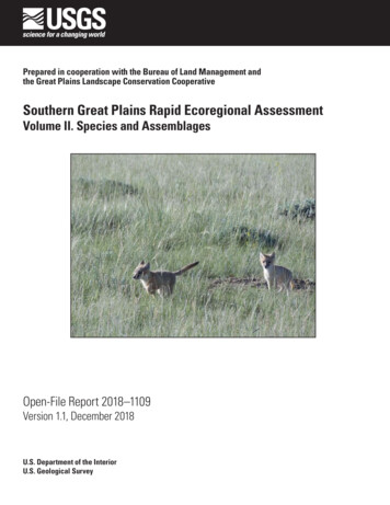
Cover. Swift foxes at Rock River, Wyoming. Photograph by Sandra Taylor, Bureau of Land Management (Creative Commons Attribution 2.0 Generic).
Southern Great Plains RapidEcoregional Assessments—Volume II. Species and AssemblagesBy Gordon C. Reese, Natasha B. Carr, and Lucy E. BurrisPrepared in cooperation with the Bureau of Land Managementand the Great Plains Landscape Conservation CooperativeOpen-File Report 2018–1109Version 1.1, December 2018U.S. Department of the InteriorU.S. Geological Survey
U.S. Department of the InteriorRYAN K. ZINKE, SecretaryU.S. Geological SurveyJames F. Reilly II, DirectorU.S. Geological Survey, Reston, Virginia: 2018First release: 2018Revised: December 2018 (ver. 1.1)For more information on the USGS—the Federal source for science about the Earth, its natural and livingresources, natural hazards, and the environment—visit https://www.usgs.gov or call 1–888–ASK–USGS.For an overview of USGS information products, including maps, imagery, and publications,visit https://store.usgs.gov.Any use of trade, firm, or product names is for descriptive purposes only and does not imply endorsement by theU.S. Government.Although this information product, for the most part, is in the public domain, it also may contain copyrighted materialsas noted in the text. Permission to reproduce copyrighted items must be secured from the copyright owner.Suggested citation:Reese, G.C., Carr, N.B., and Burris, L.E., 2018, Southern Great Plains Rapid Ecoregional Assessment—Volume II. Species and assemblages (ver. 1.1, December 2018): U.S. Geological Survey Open-File Report 2018–1109, 134 p., https://doi.org/10.3133/ofr20181109.ISSN 2331-1258 (online)
iiiAcknowledgmentsThe impetus and oversight for this project was provided by the Southern Great Plains RapidEcoregional Assessment advisors including Steve Tryon, Melanie Barnes, Kevin Miller, GeorgeThomas, Patrick Rich, Charles Schmidt, David Herrell, Mark Coca, Carolyn Russell, Dan Baggao,Becky Peters, Robert Pawelek, Kristen Wobbe, and Jason Frels of the Bureau of Land Management and Nicole Athearn and Jonathan Hayes of the Great Plains Landscape ConservationCooperative. We greatly appreciate reviews of maps and the manuscript provided by GeorgeThomas and Valerie Williams of the Bureau of Land Management; Anne Bartuszevige, PlayaLakes Joint Venture; T. Luke George, Bird Conservancy of the Rockies; Reesa Conrey, ColoradoParks and Wildlife; Michael Wunder, University of Colorado Denver; Stephen Dinsmore, IowaState University; Mary Bomberger Brown, University of Nebraska; David Augustine, U.S. Department of Agriculture Agricultural Research Service; Paul Hartfield and Clay Nichols, U.S. Fish andWildlife Service; Paul Cryan, David Eads, Stephen Germaine, Timothy Grabowski, David Haukos,Larry Igl, Catherine Jarnevich, Daniel Manier, Michael O’Donnell, Douglas Ouren, Brian Reichert,Katherine Schoenecker, Susan Skagen, and Marsha Sovoda, U.S. Geological Survey.The following organizations developed or contributed to the datasets used in the Rapid Ecoregional Assessment: the Bureau of Land Management, Bureau of Meteorology (Australia),Colorado Division of Water Resources, Colorado Natural Heritage Program, CommonwealthScientific and Industrial Research Organization, Community Earth System Model Contributors (National Science Foundation, Department of Energy, National Center for AtmosphericResearch), eBird, Global Biodiversity Information Facility, IHS, Kansas Biological Survey, KansasGeological Survey, Kansas Natural Heritage Inventory, National Agricultural Statistics Service,Natural Heritage New Mexico, Nebraska Department of Natural Resources, Nebraska NaturalHeritage Program, New Mexico Office of the State Engineer, Oklahoma Natural Heritage Inventory, Oklahoma Water Resources Board, Playa Lakes Joint Venture, South Dakota Departmentof Environment and Natural Resources, South Dakota Natural Heritage Database, Texas Commission on Environmental Quality, Texas Natural Diversity Database, Texas Parks and WildlifeDepartment, Texas Tech University, Texas Water Development Board, U.S. Army Corps ofEngineers, U.S. Census Bureau, U.S. Department of Transportation, U.S. Environmental Protection Agency, U.S. Forest Service, U.S. Geological Survey, World Climate Research Programme’sWorking Group on Coupled Modelling, Wyoming Natural Diversity Database, Wyoming WaterDevelopment Commission, and the Wyoming State Engineer’s Office.
vContentsAcknowledgments.iiiExecutive Summary.1Chapter 1. Introduction and Overview.3Introduction.3Southern Great Plains Rapid Ecoregional Assessment.3Reports and Organization.5References Cited.6Chapter 2. Methods Overview for Species.7Assessment Framework.7Baseline Habitat for Evaluating Change Agents.8Mapping Baseline Habitat .9Management Questions.13References Cited.13Chapter 3. Arkansas River Shiner.15Introduction.15Rapid Ecoregional Assessment Components Evaluated for the Arkansas River Shiner.15Management Questions and Results.17Summary.21References Cited.21Chapter 4. Ferruginous Hawk.23Introduction.23Rapid Ecoregional Assessment Components Evaluated for the Ferruginous Hawk.23Management Questions and Results.25Summary.30References Cited.30Chapter 5. Lesser Prairie-Chicken.33Introduction.33Rapid Ecoregional Assessment Components Evaluated for Lesser Prairie-Chicken.33Management Questions and Results.35Summary.40References Cited.40Chapter 6. Snowy Plover.43Introduction.43Rapid Ecoregional Assessment Components Evaluated for the Snowy Plover.43Management Questions and Results.45Summary.49References Cited.49Chapter 7. Mountain Plover.51Introduction.51Rapid Ecoregional Assessment Components Evaluated for the Mountain Plover.51Management Questions and Results.53Summary.58References Cited.58
viChapter 8. Long-Billed Curlew.61Introduction.61Rapid Ecoregional Assessment Components Evaluated for the Long-Billed Curlew.61Management Questions and Results.63Summary.68References Cited.68Chapter 9. Interior Least Tern.71Introduction.71Rapid Ecoregional Assessment Components Evaluated for the Interior Least Tern.71Management Questions and Results.73Summary.77References Cited.77Chapter 10. Burrowing Owl.79Introduction.79Rapid Ecoregional Assessment Components Evaluated for the Burrowing Owl.79Management Questions and Results.81Summary .86References Cited.86Chapter 11. Black-Tailed Prairie Dog.89Introduction.89Rapid Ecoregional Assessment Components Evaluated for the Black-Tailed Prairie Dog.89Management Questions and Results.91Summary.96References Cited.96Chapter 12. Tree-Roosting Bat Assemblage.99Introduction.99Rapid Ecoregional Assessment Components Evaluated for the Tree-Roosting Bat Assemblage.99Management Questions and Results.101Summary.106References Cited.106Chapter 13. Swift Fox.109Introduction.109Rapid Ecoregional Assessment Components Evaluated for the Swift Fox.109Management Questions and Results.111Summary .116References Cited.116Chapter 14. Mule Deer .119Introduction.119Rapid Ecoregional Assessment Components Evaluated for the Mule Deer.119Management Questions and Results.121Summary.126References Cited.126Chapter 15. Synthesis—Ecological Communities and Species.129Introduction.129Management Questions and Results.130Summary.134References Cited.134
viiFigures1–1. Southern Great Plains Rapid Ecoregional Assessment boundary.43–1. Predicted distribution of baseline habitat for Arkansas River shiners.173–2. Aquatic development index for Arkansas River shiner baseline habitat.183–3. Total length of Arkansas River shiner baseline habitat by aquaticdevelopment index class.193–4. Total length of Arkansas River shiner habitat by stream-segment size class forbaseline and relatively undeveloped conditions.193–5. Landscape-level summaries for Arkansas River shiner habitat.204–1. Predicted distribution of baseline habitat for ferruginous hawks.254–2. Terrestrial development index for ferruginous hawk baseline habitat.264–3. Area of ferruginous hawk baseline habitat by terrestrial developmentindex class.274–4. Area of ferruginous hawk habitat by patch size class for baseline andrelatively undeveloped conditions.274–5. Patch size of ferruginous hawk habitat.284–6. Landscape-level summaries for ferruginous hawk habitat.295–1. Predicted distribution of baseline habitat for lesser prairie-chickens.355–2. Terrestrial development index for lesser prairie-chicken baseline habitat.365–3. Area of lesser prairie-chicken baseline habitat by terrestrial developmentindex class.375–4. Area of lesser prairie-chicken habitat by patch size class for baseline andrelatively undeveloped conditions.375–5. Patch size of lesser prairie-chicken habitat.385–6. Landscape-level summaries for lesser prairie-chicken habitat.396 –1. Predicted distribution of baseline habitat for snowy plovers.456 –2. Aquatic development index for snowy plover baseline habitat.466 –3. Area of snowy plover baseline habitat by aquatic development index class.476 –4. Landscape-level summaries for snowy plover habitat.487–1. Predicted distribution of baseline habitat for mountain plovers.537–2. Terrestrial development index for mountain plover baseline habitat.547–3. Area of mountain plover baseline habitat by terrestrial developmentindex class.557–4. Area of mountain plover habitat by patch size class for baseline and relativelyundeveloped conditions.557–5. Patch size of mountain plover habitat.567–6. Landscape-level summaries for mountain plover habitat.578–1. Predicted distribution of baseline habitat for long-billed curlews.638–2. Terrestrial development index for long-billed curlew baseline habitat.648–3. Area of long-billed curlew baseline habitat by terrestrial developmentindex class.658–4. Area of long-billed curlew habitat by patch size class for baseline and relativelyundeveloped conditions.658–5. Patch size of long-billed curlew habitat.668–6. Landscape-level summaries for long-billed curlew habitat.679–1. Estimated distribution of baseline habitat for interior least terns.739–2. Aquatic development index for interior least tern baseline habitat.74
��4.Area of interior least tern baseline habitat by aquatic development index class.75Landscape-level summaries for interior least tern habitat.76Predicted distribution of baseline habitat for burrowing owls.81Terrestrial development index for burrowing owl baseline habitat.82Area of burrowing owl baseline habitat by terrestrial development index class.83Area of burrowing owl habitat by patch size class for baseline and relativelyundeveloped conditions.83Patch size of burrowing owl habitat.84Landscape-level summaries for burrowing owl habitat.85Predicted distribution of baseline habitat for black-tailed prairie dogs.91Terrestrial development index for black-tailed prairie dog baseline habitat.92Area of black-tailed prairie dog baseline habitat by terrestrial developmentindex class.93Area of black-tailed prairie dog habitat by patch size class for baselineand relatively undeveloped conditions.93Patch size of black-tailed prairie dog habitat.94Landscape-level summaries for black-tailed prairie dog habitat.95Predicted distribution of baseline habitat for the bat assemblage.101Terrestrial development index for bat assemblage baseline habitat.102Area of the bat assemblage baseline habitat by terrestrial developmentindex class.103Area of the bat assemblage habitat by patch size class for baseline and relativelyundeveloped conditions.103Patch size of the bat assemblage habitat.104Landscape-level summaries for the bat assemblage habitat.105Distribution of baseline habitat for swift foxes.111Terrestrial development index for swift fox baseline habitat.112Area of swift fox baseline habitat by terrestrial development index class.113Area of swift fox habitat by patch size class for baseline and relativelyundeveloped conditions.113Patch size of swift fox habitat.114Landscape-level summaries for swift fox habitat.115Distribution of baseline habitat for mule deer.121Terrestrial development index for mule deer baseline habitat.122Area of mule deer baseline habitat by terrestrial development index class.123Area of mule deer habitat as a function of patch size for baseline andrelatively undeveloped conditions.123Patch size of mule deer habitat.124Landscape-level summaries for mule deer habitat.125Relatively undeveloped terrestrial areas in the Southern Great Plains.130Relatively undeveloped aquatic areas summarized by sixth-level watershed,in the Southern Great Plains.132Percentage of area by terrestrial development index class for each conservationelement and for the Southern Great Plains overall.133Percentage of area by aquatic development index class for each conservationelement and for the Southern Great Plains overall.133
��2.5–3.5–4.6 –1.6 –2.6 –3.6 –4.7–1.7–2.7–3.7–4.8–1.8–2.Priority species and species assemblages.5Published models used for mapping baseline habitat.8Presence-only occurrence data used to model habitat suitability with MaxEnt.10Variables used to model habitat suitability with MaxEnt.11Percent contribution of habitat variables included in MaxEnthabitat suitability models.12Minimum thresholds in habitat suitability scores used to map baseline habitat.13Key ecological attributes and associated indicators used to address coremanagement questions for Arkansas River shiners.16Anthropogenic change agents and associated indicators used to address coremanagement questions for Arkansas River shiners.16Landscape-level variables used to address the integrated managementquestion for Arkansas River shiners.16Management questions addressed for Arkansas River shiners.16Key ecological attributes and associated indicators used to address coremanagement questions for ferruginous hawks.24Anthropogenic change agents and associated indicators used to address coremanagement questions for ferruginous hawks.24Landscape-level variables used to address the integrated managementquestion for ferruginous hawks.24Management questions addressed for ferruginous hawks.
Southern Great Plains Rapid . Ecoregional Assessments— Volume II. Species and Assemblages. By Gordon C. Reese, Natasha B. Carr, and Lucy E. Burris Prepared in cooperation with the Bureau of Land Management . and the Great Plains Landscape Conservation Cooperative. Open-File Report 2018-1109. Version 1.1, December 2018. U.S. Department of .