Transcription
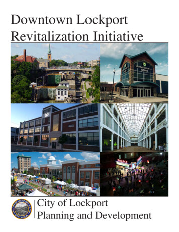
City of MiddletownDRAFTDowntown Revitalization Initiative
AFTRD
AFTRD
AFTRD
AFTRDLegendMiddletown BIDCity BoundaryFigure 1. Regional ContextMiddletown Downtown Revitalization Initiative (DRI)01 mi
NSMITGROKHOGDENThrallParkTLASCHOOLATTTLART BEACOPROSRAILROADJOHL AKNFRALINDENENKLKNAErie WayParking dletownCity HallMiddletownCity LSGRANFigure 2. DRI Area (Middletown BID)Middletown Downtown Revitalization Initiative (DRI)0500
AFTRD
AFTRD
AFTRD
mmonweWaalttkihAnsveAveJohn ChorleyElementary SchoolWCoisnerAveAveh StStedAveanin roCollegeStandaAveRayWawGOrange AveDeAveyrnBaSteltonhceFuHillsideCemeteryHigint tlengehaonMMiddletownCommunityCampusMiddletownHigh SchoolTwin TowersMiddle SchoolinAFTkeIrwLaCoHigttahlageStndAveSprFletcher DavidgeParkoatStLinden onalIndustrialParkUtilityMiddletown BIDCity BoundaryFigure 3. Land Use Map - CitywideMiddletown Downtown Revitalization Initiative (DRI)00.250.5001Miles0.25500Miles
GROLKHThrallParkGROVETLASCHOOLTLART YBEATTCOURLIBEIEM ONNDTGOMNORTHLE cademy2-3FamilyWASHINGTONAvenueParkMulti Community dletown BIDGANDVIEWFigure 4. Land Use Map - DRI AreaMiddletown DRI: Downtown Profile and AssessmentMiddletown Downtown Revitalization Initiative (DRI)Figure 3. Institutional Uses ParksSTESPRAGMOTHILLSIDEOAKENLITTSingle ANFORDACADEILLSource: Orange County Land Use Data, City of Middletown 00500500Feet1,000
AFTRD
WILGROICCEKHThrallParkSCHOOLCOURBEATTIEM ONTGOMERYGROVENORTH!!((2 HPROSKIN1. Temple Sinai42. Middletown Christian(!3. YMCA/Liberty Street Elementary4. Middletown Elks Lodge5. Seventh Day AdventistCAN6. Shortline Bus TerminalTRELL7. Adult Home Erie Station8. Thrall Library19. Alternative High School(!10. Middletown Fire11. DMV MiddletownCOU12. Middltown PoliceRTLAND13. Mulberry House14. Edwin Welling House15. OC Social Services16. Southeast Towers3(!17.Avenue Elementary School/Parks & RecreationLIBE18. Post Office MiddletownRTY19. College Hill ApartmentsLAK20. The PromenadeE21. Hillside Cemetery22. Festival Square23. Jerry’sParkKNAPP24. Run4Downtown A(!HARDMiddletownCity HallMiddletownCity SOUTHUNGLSGRGENANDVIEWMILHillside CemeteryG(!201921!(UESTESPRAGEASTFULTONFigure 5. Parks and Institutional Uses- DRI AreaMiddletown Downtown Revitalization Initiative (DRI)0500
AFTRD
AFT D R
AFTRD
GROLKHThrallParkGROVETLASCHOOLCOURLIBEBEATTIEM RT YNDRAILROADJOHLAKNDENEErie WayParking FORDTONKINGMiddletownCity HallMiddletownCity LINGROABIDWILBURBENJAMINWAWAYANDASOUTHHillside CemeteryDLegendUNCity Owned MONINGSTOParamountTheaterMULRDDHAHOUSource: Orange County Land Use Data, City of MiddletownFigure 6. City-Owned PropertiesMiddletown Downtown Revitalization Initiative (DRI)0500
GROThrallParkSCHOOLM ALLKCOURCEENICRELChase Bank 135 North EBEATTIEFuture Heritage TrailCOURTLART YNDRAILROADJOHLAKNDENEErie WayParking LotLINFRANKLMPPROBFuture Skateboard ParkAFTERTWoolworth BuildingLibraryPOTTompkins BuildingHARDWILCOXCENTERESHENRY11 King StreetFutureHeritage TrailHANFORDIAMGRANT2-8South StreetSBERRYRMTONWILLMiddletownCity CourtILLBENKINGMiddletownCity ANDVIEWBIDCity Owned AYANDASOUTHHillside LSIDEOAKENFort KnoxLEACADEHAGTONLITTCANALClassic OUNInteractive Museums BuildingACME BusNAIINKNAVacantSource: Orange County Land Use Data, City of MiddletownFigure 7. Underutilized and Vacant PropertiesMiddletown Downtown Revitalization Initiative (DRI)0500
AFTRD
AC-2C-3C-3AI-1I-1AI-2I-3Single- Family ResidenceTwo-Family ResidenceTwo Family-Owner OccupiedSuburban Residential (Low Density)Suburban Residential Bonus DensitySuburban Residential Bonus DensityUrban Residential (High Density)Multiple Residence ParklandHigh Rise Multiple ResidenceLimited Neighborhood BusinessLimited BusinessGeneral BusinessLimited General BusinessLight IndustryLight industrial/General BusinessHeavy IndustryHeavy Industry (Restricted)Figure 8. Zoning MapMiddletown Downtown Revitalization Initiative (DRI)0500
AFTRD
AFTRD
3.0Total2.53Owner occupied2.82.42.8Renter occupied2.9 2.92.72.721Downtown MiddletownCity of MiddletownOrange CountyRAFT014,0005 personhousehold12,000D10,0008,0006,0004 personhousehold3 personhousehold4,0002 personhousehold2,0001 personhousehold020002010201520202025203014,00075 years12,00065 to 74years55 to 64years45 to 54years35 to 44years25 to 34years15 to 20252030
AFTRD
AFTRD
Homeowner vacancy rate12%10%8%6%10.1%9.8%8.2%8.7%Renter vacancy 20142000Single family2014City of MiddletownAFTDowntown Middletown20102-4 unit buildingDowntown Middletown5 unit building48.4%R24.0%City of Middletown48.8%DOrange County0%Mobile home, vehicle, 4.9% 2.5%100%
8%20.0%20%4.9%R0%17.6%14.2%Downtown MiddletownCity of 1.5%Orange County5 bedrooms4 bedrooms3 bedrooms2 bedrooms1 bedroomNo bedroom
AFTRD
vate Sector
AFTRD
70%Orange County60%New York FT2002 2003 2004 2005 2006 2007 2008 2009 2010 2011 2012 2013 201425%Living in City,EmployedOutsideEmployed inCity but LivingOutside20%15%10%Living andEmployed inCity5%0%2002 2003 2004 2005 2006 2007 2008 2009 2010 2011 2012 2013 2014
AFTRD
AFTRD
LK ILINGROTRECOUPRGROVECANLW ILK ie WayParking y HallMiddletownCity ANRRAILAMNJBEGRMunicipal LParamountTheaterNParking LotSource: Orange County Land Use Data, City of MiddletownFigure 9. Parking LotsMiddletown Downtown Revitalization Initiative (DRI)0500
AFTRD
To: Park ETLAMONTGOMNORTHLENOXHIGHLANDOGDENKILLCOURTLART YNDRAILROADTo: Galleria atCrystal RunBus TerminalJOHL ROSWILTo: Senior WayNDENENKLKNAErie WayParking LotLINFRANAIINMPPROBAFTERTTo: Big LotsLibraryPOTORCHARDNRYWILCOXCENTERTo: Community NGMiddletownCity HallMiddletownCity CourtLLMIBENYWASHINGTONTo: Myrtle untTheaterMULRDDHAHOUSTERLINGMid City Transit Bus RoutesGDROALSUNDVIEWMILTo: SUNY OrangeGRANGENRoute 1Route 2Route 3Route 4RAILWILBURBENJAMINWAWAYANDASOUTHHillside CemeterySource: Orange County Land Use Data, Transit OrangeFigure 10. Public TransportationMiddletown Downtown Revitalization Initiative (DRI)0500
AFTRD
AFTRD
CoWisnerAoatmmonweWaaltt kihAnsveAveJohn ChorleyElementary SchoolveAvh cademyTouroCollegeStdaAveRanayWawGOrange ghStin SFuHillsideCemeteryHcet icMiddletownHigh SchoolTwin TowersMiddle IrwLaCoHigttahlageStndAveSprFletcher DavidgeParkStLinden AveStarhavenAveWattsParkDolLegend100-Year Floodplain500-Year FloodplainWetlandLakeParkMiddletown BIDCity BoundaryFigure 11. Flood ZonesMiddletown Downtown Revitalization Initiative (DRI)00.250.501500Miles
AFTRD
AFTRD
O&W StationLINDEN PAFTAVE.L.NORTHAJohn G. BeakesCBNAIME.DSOUTHDHILLSIDERW. MAINABCDHillsideCemeteryWebb HortonHouse(SUNY Orange)Source: Orange County Land Use Data, City of MiddletownFigure 12. Historic Properties MapMiddletown Downtown Revitalization Initiative (DRI)0500
RAFTWest side of North Street, 1901 (left) and 2016 (right) showing earlier wood-framed buildings replaced by masonry buildings.Photo credit (left): Historical Society of Middletown and the Wallkill Precinct, Inc.DFranklin Square looking northeast, 1933 (left) and 2016 (right) showing loss of buildings along North Street and changes in facadesignage styles. Photo credit (left): Historical Society of Middletown and the Wallkill Precinct, Inc.East Main Street near Orchard Street, looking east, 1939 (left) and 2016 (right) showing the transition to smaller scale commercial andresidential uses along the perimeter of the Business Improvement District. Photo credit (left): Library of CongressFigure 13. Historic PhotosMiddletown Downtown Revitalization Initiative (DRI)0500
RAFTWest Main Street at Canal Street, looking eastward to Franklin Square, 1888 (left) and 2016 (right). The facade of Bull’s Opera House hasbeen covered with metal panels while the commercial buildings on the south side of the street maintain their variation in massing andtreatment. Photo credit (left): Historical Society of Middletown and the Wallkill Precinct, Inc.Example of a large commercial building on North Street thatretains unified facade elements.DMixed-use buildings on West Main Street at Franklin Squareretain the majority of historic facade elements.Examples of mixed-use and commercial buildings that retain original historic elements and older changes to the facades: South Street(left), North Street (center) and Center Street (right).Figure 13. Historic PhotosMiddletown Downtown Revitalization Initiative (DRI)0500
AFTR D
AFTRD
AFTRD
AFTRD
AFTRD
AFTRD
AFTRD
AFTRD
AFTRD
AFTRD
AFTRD
AFTRD
AFTRD
AFTRD
AFTRD
GROICWKHOGDENThrallParkTLASCHOOLCOURLIBETLANDRT YRAILROAD6JOHL AKNNKLINROBAFTERT10LibraryLLMIPOTDE2City CourtBERRYGLEIn Progress Projects:Academy6. Transportation CenterAvenueWAPark III SegmentSHeritage7.Trail,PhaseHINGTON8. Complete Streets/ADAimprovements at 25 intersections*9. Woolworth’s building redevelopment10. Orchard Street Parking Lotdevelopment11. Middletown Skateboard Park12. Soccer complex13.Paramount Theater ountTheaterBENRecently Completed Projects: RANT1. King Street Pedestrian WalkwayHOU2. Da Tang SupermarketSTON3. Clemson Brothers’ Brewery4. Equilibrium Brewery5. The MillL15D5RDHARD1City l/PlannedProjects:14. Relocation of City Courthouse15. Student Housing (Location TBD)16. Middletown Community CampusRedevelopment *17. Phase II Improvements atGENUNGSkateboard Park* Project not mappedSource: Orange County Land Use Data, City of AErie WayParking LotLINFRA736DENEHABEATTIEM e 22. Current Projects in DRI AreaMiddletown Downtown Revitalization Initiative (DRI)0500
AFTRD
AFTRD
AFTRD
AFTRD
AFTRD
AFTRD
AFTRD
AFTRD
TAFRD
TAFRD
AFTRD
1. Temple Sinai 2. Middletown Christian 3. YMCA/Liberty Street Elementary 4. Middletown Elks Lodge 5. Seventh Day Adventist 6. Shortline Bus Terminal 7. Adult Home Erie Station 8. Thrall Library 9. Alternative High School 10. Middletown Fire 11. DMV Middletown 12. Middltown Police 13. Mulberry House 14. Edwin Welling House 15. OC Social .
