Transcription
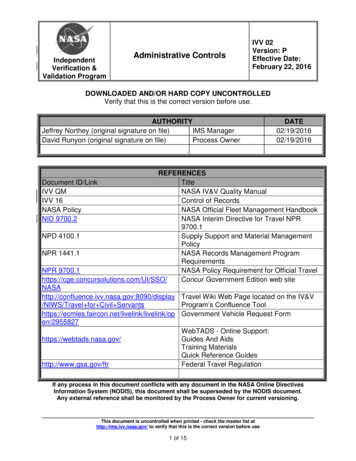
TerraKey Terra FactsJoint with Japan and CanadaOrbit:Type: Near-polar, sun-synchronousEquatorial Crossing: 10:30 a.m.Altitude: 705 kmInclination: 98.1 Period: 98.88 minutesRepeat Cycle: 16 daysTerra URLterra.nasa.govDimensions: 2.7 m 3.3 m 6.8 mMass: 5,190 kgPower: 2,530 WSummaryThe Terra (formerly called EOS AM-1) satellite is theflagship of NASA’s Earth Science Missions. Terra is thefirst EOS (Earth Observing System) platform and provides global data on the state of the atmosphere, land, andoceans, as well as their interactions with solar radiationand with one another.Instruments Clouds and the Earth’s Radiant Energy System(CERES; two copies) Multi-angle Imaging SpectroRadiometer (MISR) Moderate Resolution Imaging Spectroradiometer(MODIS) Measurements of Pollution in The Troposphere(MOPITT) Advanced Spaceborne Thermal Emission and Reflection Radiometer (ASTER)Points of ContactDesign Life: 6 yearsLaunch Date and Location: December 18, 1999, from Vandenberg Air Force Base, California Vehicle: Atlas Centaur IIAS expendable launchvehicleRelevant Science Focus Areas(see NASA’s Earth Science Program section) Atmospheric CompositionCarbon Cycle, Ecosystems, and BiogeochemistryClimate Variability and ChangeEarth Surface and InteriorWater and Energy CyclesWeather Terra Project Scientist: Marc Imhoff, NASAGoddard Space Flight CenterRelated Applications Terra Deputy Project Scientist: Si-Chee Tsay, NASAGoddard Space Flight Center Other Key Personnel Terra Program Scientist: Garik Gutman, NASAHeadquarters Terra Program Executive: Lou Schuster, NASAHeadquarters(see Applied Science Program section)Agricultural EfficiencyAir QualityCarbon ManagementCoastal ManagementDisaster ManagementEcological ForecastingEnergy ManagementHomeland SecurityInvasive SpeciesPublic HealthWater ManagementMission TypeEarth Observing System (EOS) SystematicMeasurementsEarth Science Reference Handbook[ Missions: Terra ]225
Terra Science Goals Provide the first global and seasonal measurements of the Earthsystem, including such critical functions as biological productivity of the land and oceans, snow and ice, surface temperature,clouds, water vapor, and land cover. Improve our ability to detect human impacts on the Earth system and climate, identify the ‘fingerprint’ of human activity onclimate, and predict climate change by using the new globalobservations in climate models. Help develop technologies for disaster prediction, characterization, and risk reduction from wildfires, volcanoes, floods, anddroughts. Start long-term monitoring of global climate change and environmental change.Terra Mission BackgroundThe Terra mission provides comprehensive global measurementsfor quantitatively monitoring Earth’s land, oceans, and atmosphere.Terra, along with other EOS spacecraft (Landsat 7, Aqua, andICESat) acquires many of the measurements required to advanceunderstanding of the Earth system. Terra flies in a near-polar, sunsynchronous orbit that descends across the equator in the morning.After launch in December 1999, Terra’s equator crossing timewas changed from around 10:45 a.m. local time to 10:30 a.m. 5minutes after a series of inclination maneuvers. This crossing timeis expected to be maintained for the rest of the mission.Terra’s orbit follows the Worldwide Reference System, as dothe orbits of Landsat 7 (USGS), Earth Observing-1 (EO-1, NASA),and Satelite de Aplicaciones Cientificas-C (SAC-C, ArgentinaComisión Nacional para el Ahorro de Energia [CONAE]), allcrossing the equator within 30 minutes of each other. These fourspacecraft compose the ‘Morning Constellation,’ thus facilitatingjoint use of Terra data and the data from its companion missions.The Aqua spacecraft, launched in May 2002, flies in an ascendingorbit with a 1:30 p.m. equatorial crossing time, which enables studyof diurnal variability with the MODIS and CERES instruments onboth Terra and Aqua. For additional information about the Terraspacecraft and links to each of its five instruments, the reader isinvited to visit the Terra Project Science homepage at: terra.nasa.gov.Each Terra instrument was developed under the supervisionof a science team that also provides algorithms for analysis of thedata and derivation of Earth-system measurements. The scienceteams validate these products and use them in scientific investigations. Terra has five complementary scientific instruments: ASTERfor close-up land studies, CERES for a broad view of long- andshortwave radiation, MOPITT for studies of pollution, MISRfor bidirectional-reflectance studies of clouds, aerosol, and landfeatures, and MODIS for global analysis of land, ocean, and atmosphere properties and their interactions. The MODIS and CERES226[ Missions: Terra ]Terra InstrumentsASTERAdvanced Spaceborne ThermalEmission and Reflection RadiometerA 3-radiometer sensor package withthree vis/near-IR, six shortwave, and 5thermal-infrared channels with 15, 30,and 90-m resolution, respectively, and a60-km swath. Provided by the JapaneseMinistry of Economy, Trade, and Industry (METI), designed to make detailedmaps of land surface temperature,emissivity, reflectance and elevation.CERESClouds and the Earth’s Radiant EnergySystemA 3-channel, broadband radiometer(0.3 to 100 µm, 0.3–5 µm, 8–12 µm)designed to measure major elements ofthe Earth’s radiation balance.MISRMulti-angle Imaging SpectroRadiometerA 36-channel instrument; nine pushbroom cameras with discrete viewangles (to 70 ) in four spectral bands(0.443–0.865 m) with resolutions of275 m to 1.1 km, designed to measureclouds, aerosols and vegetation cover.MODISModerate Resolution ImagingSpectroradiometerA 36-band spectroradiometer measuring visible and infrared radiation(0.4–14.5 µm with spatial resolutionsof 250 m, 500 m, and 1 km at nadir)for derivation of products ranging fromland vegetation and ocean chlorophyllfluorescence to cloud and aerosol properties, fire occurrence, snow cover onland, and sea ice in the oceans.MOPITTMeasurements of Pollution in TheTroposphereAn 8-channel cross-track-scanning gascorrelation radiometer operating at threewavelengths (2.2, 2.3, and 4.7 μm),designed to measure carbon monoxideand methane in the atmosphere.Earth Science Reference Handbook
instruments extend the measurements of their heritagesensors—the Advanced Very High Resolution Radiometer(AVHRR), the Coastal Zone Color Scanner (CZCS), andthe Earth Radiation Budget Experiment (ERBE)—butwith a higher quality of calibration and characterization.Over the course of the mission, Terra’s MODIS andMOPITT instruments have experienced some anomalies.The MODIS instrument power supply and scientificformatting equipment experienced problems in 2001 and2002, respectively, and were switched to redundant units.MOPITT experienced the loss of four of its channels in2001, resulting in a reduction of carbon monoxide profiling capability. Despite these problems MOPITT is acquiring science data for both carbon monoxide and methane.ASTER, MISR, and CERES have operated throughoutthe mission with no significant problems.The amount of downloaded data from Terra’s instruments is about 195 Gb of Level 0 data each day, whichrepresents about 850 terabytes when processed to higherlevel science products. Currently, the majority of plannedTerra science products are available through the EOS DataGateway. At this point in the mission, most products arecalibrated and validated and have been given the label of‘validated’ data. This means that a data product has beenevaluated and quality checked and is considered readyfor routine scientific research uses. Nonetheless, validation research is continuing throughout the lifetime of theTerra mission, and it is reasonable to expect that Terra dataproducts will continue to be improved over time. For thelatest information on the status and availability of datafrom Terra (and similarly for other EOS missions), see:eosdatainfo.gsfc.nasa.gov/terra.Early in the Terra mission, instrument-team scientistscalled for a series of on-orbit pitch-over maneuvers toallow Terra’s instruments to view cold deep space or thesunlit lunar surface. Data from the deep-space maneuverswere required to enable CERES to confirm offsets for itslongwave-radiation measurements and enable MODIS toadequately characterize response as a function of mirrorscan angle. ASTER, MISR, and MODIS science teamsdesired measurements of the lunar surface for radiometriccalibration purposes. The maneuver required a reversepitch during eclipse (spacecraft night) within about 33minutes.The first Terra deep-space calibration maneuverwas successfully performed on March 26, 2003, followed by an identical and flawless maneuver with themoon in the viewing plane of the instruments on April14, 2003. NASA’s EO-1 Advanced Land Imager (ALI)and Hyperion instruments and OrbView’s Sea-Viewing Wide Field-of-view Sensor (SeaWiFS) acquireddata of the moon around the time of Terra’s maneuver.Intercomparisons with these instruments are planned.Analysis of the measurements from the deep spaceand lunar maneuvers are currently underway, and final results may lead to a plan for a third maneuver.Earth Science Reference HandbookThrough satellite and other observations, the scientificcommunity now has unprecedented quantitative data setsto study Earth as a system and answer the questions ofhow is Earth changing and how will humans be affectedby these changes. Terra, as the flagship observatory forNASA’s Earth Observing System, is contributing valuable new data, leading to new insights about the Earthsystem.Terra PartnersThe Terra Project Office, located at NASA GSFC, manages Terra development. GSFC was responsible for thedevelopment of the satellite and the development andoperation of the ground operations system. Spacecraftoperations are performed at a Mission Operations Centerat GSFC.[ Missions: Terra ]227
ASTERAdvanced Spaceborne Thermal Emission and ReflectionRadiometerASTER BackgroundASTER is a facility instrumentprovided for the Terra platformby Japan’s Ministry of Economy,Trade and Industry (METI). Itprovides high-spatial-resolution (15- to 90-m) multispectralimages of Earth’s surface andclouds in order to better understand the physical processes that affect climate change. WhileMODIS and MISR monitor many of the same variables globally,and on a daily basis, ASTER provides data at a scale that can bedirectly related to detailed physical processes. These data bridgethe gap between field observations and data acquired by MODISand MISR, and between process models and climate and/or forecastmodels. ASTER data are also used for long-term monitoring oflocal and regional changes on Earth’s surface, which either leadto, or are in response to, global climate change, e.g., land use,deforestation, desertification, lake and playa water-level changes,and other changes in vegetation communities, glacial movement,and volcanic processes.Clouds are one of the most important variables in the globalclimate system. With its high spatial resolution, broad spectralcoverage, and stereo capability, ASTER provides essential measurements of cloud amount, type, spatial distribution, morphology,and radiative properties.ASTER provides radiative (brightness) temperature, and themultispectral thermal infrared (TIR) data can be used to derivesurface kinetic temperature and spectral emissivity. Radiative temperature is an element in the surface heat balance. Surface kinetictemperature can be used to determine elements of surface-processmodels, sensible heat flux, latent heat flux, and ground heat conduction. Surface temperatures are also related to thermophysicalproperties (such as thermal inertia), vegetation health, soil moisture,temporal land classification, e.g., wet vs. dry, vegetated vs. baresoil, and evapotranspiration.ASTER operates in three visible and near-infrared (VNIR)channels between 0.5 and 0.9 µm, with 15-m resolution; six shortwave infrared (SWIR) channels between 1.6 and 2.43 µm, with30-m resolution; and five TIR channels between 8 and 12 µm,with 90-m resolution. The instrument acquires data over a 60-kmswath whose center is pointable cross-track 8.55 in the SWIRand TIR, with the VNIR pointable out to 24 . An additional VNIRtelescope (aft pointing) covers the wavelength range of Channel 3.By combining these data with those for Channel 3, stereo viewscan be created, with a base-to-height ratio of 0.6. ASTER’s pointing capabilities are such that any point on the globe is accessibleat least once every 16 days in all 14 bands and, on average, every4 days in the three VNIR channels.ASTER data products exploit combinations of VNIR, SWIR,and TIR for cloud studies, surface mapping, soil and geologic228[ Missions: Terra ]Key ASTER FactsJapan provided the instrument, whichprovides high-resolution images of theland surface, water, ice, and clouds andhas same-orbit stereo capability.Heritage: Japanese Earth ResourcesSatellite-1 (JERS-1), Optical Sensor(OPS), and LandsatInstrument Type: Multispectral imagingradiometer for reflected and emittedradiation measurements of the Earth’ssurfaceAbsolute Radiometric Accuracy: 4% inVNIR and SWIR bandsAbsolute Temperature Accuracy: 3 Kin 200–240 K range, 2 K in 240–270 Krange, 1 K in 270–340 K range, and 2 Kin 340–370 K range for TIR bandsSwath: 60 km at nadir; swath centeris pointable cross-track, 106 km forSWIR and TIR, and 314 km for VNIRSpatial Resolution: VNIR (0.5–0.9 µm),15 m [stereo (0.7–0.9 µm), 15 m horizontal, 25 m vertical]; SWIR (1.6–2.43 µm),30 m; TIR (8–12 µm), 90 mDimensions:VNIR: 57.9 cm 65.1 cm 83.2 cmSWIR: 72.3 cm 134 cm 90.6 cmTIR: 73 cm 183 cm 110 cmCommon Signal Processor (CSP)/VEL(electronics): 33.4 cm 54 cm 31.5 cmMaster Power Supply (electronics):30 cm 50 cm 32 cmMass: 421 kgDuty Cycle: 8% (VNIR and SWIR,daylight only), 16% (TIR)Power: 463 W (average), 646 W (peak)Data Rate: 8.3 Mbps (average),89.2 Mbps (peak)Thermal Control: 80 K Stirling-cyclecoolers, heaters, cold-plate/capillarypumped loop, and radiatorsThermal Operating Range: 10–28 CField of View (FOV) (all pointing is nearnadir, except VNIR has both nadir and27.6 backward from nadir): VNIR: 6.09 (nadir), 5.19 (backward), SWIR and TIR:4.9 Instrument IFOV: VNIR: 21.5 µrad (nadir), 18.6 µrad (backward), SWIR: 42.6µrad (nadir), TIR: 128 µrad (nadir)Earth Science Reference Handbook
studies, volcano monitoring, and surface temperature, emissivity,and reflectivity determination. VNIR and SWIR bands are usedfor investigation of land-use patterns and vegetation, VNIR andTIR combinations for the study of coral reefs and glaciers, andVNIR for digital elevation models (DEMs). TIR channels are usedfor study of evapotranspiration and land and ocean temperature.The stereoscopic capability yields local surface DEMs and allowsobservations of local topography, cloud structure, volcanic plumes,and glacial changes.ASTER URLKey ASTER Facts(cont.)Spectral Range: 14 multispectral bandsfrom visible through thermal infraredDirect Readout: NoPrime Contractor: NEC (systemsintegration, VNIR, and Common SignalProcessor)Subcontractors: MELCO (SWIR andcryocooler), Fujitsu (TIR and cryocooler),and Hitachi (master power supply)asterweb.jpl.nasa.govJapan ASTER Science Team LeaderHiroji Tsu, Geological Society of JapanU.S. ASTER Science Team LeaderMichael Abrams, NASA Jet Propulsion Laboratory/CaliforniaInstitute of TechnologyCERESClouds and the Earth’s Radiant Energy SystemThe CERES instrument is described in the Aqua section.MISRMulti-angle Imaging SpectroRadiometerProvides top-of-atmosphere bidirectional reflectances and albedos, cloudtop heights and cloud-tracked winds, cloud classifiers and masks, aerosoloptical depths and particle properties, surface bidirectional reflectances,albedos, leaf-area index, and fractional absorbed photosynthetically active radiation.Key MISR FactsBuilt by the NASA Jet PropulsionLaboratoryHeritage: Galileo, Wide-Field/PlanetaryCameraInstruments: Nine charge-coupleddevice (CCD) cameras fixed at nineviewing angles out to 70.5 at theEarth’s surface, forward and afterwardof nadir, including nadirSpectral Bands: Four spectral bandsdiscriminated via filters bonded to theCCDsSwath: 380 km viewed in common by allnine camerasSpatial Sampling: 275 m, 550 m, or1.1 km, selectable in-flightRepeat Cycle: Global coverage in 9daysDimensions: 0.9 m 0.9 m 1.3 mMass: 149 kgDuty Cycle: 50%Power: 83 W (average), 131 W (peak)MISR BackgroundMISR routinely provides multiple-angle, continuous-sunlightcoverage of Earth with moderately high spatial resolution.The instrument obtains multidirectional observations of eachscene within a time scale ofminutes, thereby under almostidentical atmospheric conditions. MISR uses nine individual CCD-based pushbroom camerasto observe Earth at nine discrete view angles: one at nadir, pluseight other symmetrical views at 26.1 , 45.6 , 60.0 , and 70.5 Earth Science Reference HandbookThermal Control: Passive cooling andactive temperature stabilizationThermal Operating Range: 0–10 CFOV: 60 (along-track) 15 (cross-track)Data Rate: 3.3 Mbps (orbit average),9.0 Mbps (peak)Direct Broadcast: No[ Missions: Terra ]229
forward and aftward of nadir. Images at each angle areobtained in four spectral bands centered at 446, 558, 672,and 866 nm. Each of the 36 instrument data channels (4spectral bands 9 cameras) is individually commandable to provide ground sampling of 275 m, 550 m, or 1.1km. The common swath width of all 9 MISR cameras isabout 380 km, providing global multi-angle coverage ofthe entire Earth in nine days at the equator, and 2 days atthe poles. The instrument design and calibration strategiesmaintain absolute radiometric uncertainty to 4%. This ismet through the bimonthly use of an onboard calibratorand annual field calibration exercises that make use ofsurface measurements and data from the MISR airbornesimulator, AirMISR.MISR images are acquired in two observing modes:Global and Local. Global Mode provides continuousplanet-wide observations, with all of the nadir channelsand the red band of all of the off-nadir cameras operating at 275-m resolution and everything else operating at1.1-km resolution. Local Mode provides data at 275-mresolution in all spectral bands and all cameras for selected380-km 300-km regions. In addition to data productsproviding radiometrically calibrated and geo-rectified images, Global Mode data are used to generate the standardLevel 2 Top-of-Atmosphere (TOA)/Cloud Products andAerosol and Surface Products. Level 3 monthly, seasonal,and annual summary products are generated from Level1 and Level 2 inputs.The purpose of the TOA/Cloud Product suite is to enable study, on a global basis, of the use of remotely sensedradiances for inferring cloud properties and albedos, taking into account the effects of cloud-field heterogeneity,altitude, and three-dimensional morphology on the solarradiance and irradiance reflected to space. These productsalso provide angular signature and stereoscopic cloudidentifiers that are particularly useful over challengingareas such as snow- and ice-covered surfaces. The aerosol parameters contained within the Aerosol and SurfaceProducts enable study, on a global basis, of the magnitude and natural variability in space and time of sunlightabsorption and scattering by different aerosol types overmany kinds of surfaces, including bright-desert sourceregions. These products also provide atmospheric correction inputs for surface-imaging data acquired by MISRand other instruments that are simultaneously viewing thesame portion of the Earth. The surface parameters withinthe Aerosol and Surface Product are designed to enableimproved measures of land-surface characteristics, usingbidirectional and hemispherical reflectances to distinguishsurface texture and to take into account canopy structurein retrieving global leaf-area index and fractional absorbedphotosynthetically active radiation.MISR URLwww-misr.jpl.nasa.gov/230[ Missions: Terra ]MISR Principal InvestigatorDavid J. Diner, NASA Jet Propulsion Laboratory/California Institute of TechnologyMODISModerate Resolution Imaging SpectroradiometerThe MODIS instrument is described in the Aqua section.MOPITTMeasurements of Pollution in The TroposphereUses pressure modulation and length modulation to obtaincarbon monoxide (CO) concentrations with three independentpieces of information represented by values on seven pressurelevels, as well as CO and methane (CH4) columns.MOPITT BackgroundThe MOPITT experiment is provided undera Memorandum of Understanding with theCanadian Space Agency (CSA). MOPITTmeasures emitted andreflected infrared radiance in the atmospheric column which, when analyzed,permits retrieval of tropospheric CO profiles and totalcolumn amounts of CO and CH4.Both CO and CH4 are produced by biomass systems,oceans, and human activities. CO is intimately connectedwith the hydroxyl radical (OH) chemical cycle in thetroposphere and moves both vertically and horizontallywithin the troposphere. CH4 is a greenhouse gas and isincreasing on an annual basis. MOPITT measurementsallow studies of the global and temporal distributions thatdrive energy budget and source/sink studies. Since humanactivities have a significant influence on both CO and CH4concentrations, a better understanding of the role of theseconstituents is essential to understanding anthropogeniceffects on the environment.MOPITT operates on the principle of correlationspectroscopy, i.e., spectral selection of radiation emissionor absorption by a gas, using a sample of the same gas asa filter. The instrument modulates sample-gas density bychanging the length or the pressure of the gas sample in theoptical path of the instrument. This modulation changesthe absorption profile in the spectral lines of the gas inthe cell as observed by a detector. The modulated-gassample acts as an optical filter, which selectively picksEarth Science Reference Handbook
out the parts of the atmospheric absorption lines of that gas in theatmosphere. The detector thus observes a signal highly correlatedwith the abundance of the sample gas in the atmosphere.Atmospheric sounding and column CO are mapped by using thermal and reflected solar channels in the regions of 4.7 and2.3 µm, respectively. Column CO and CH4 are measured using solarchannels viewed through modulation cells to sense solar radiationreflected from the surface. The solar channels are duplicated in theinstrument at different correlation-cell pressures, to allow a failurein one channel without compromising the column measurement.MOPITT is designed as a scanning instrument. The field of4 pixels, aligned along the direction of motion, and each 1.8 (or22 km at nadir) on a side, is scanned through a cross-track scanangle of 26.1 , or 29 pixels, to give a swath width of 640 km. Thisswath leaves gaps in coverage between successive orbits using thenominal 705-km altitude and 98.2 inclination orbit.MOPITT was launched on the Terra spacecraft on December18, 1999, and was activated in March 2000. Performance to May2001 was excellent, at which point a problem with the detectorcooling system degraded the instrument performance somewhat.However, data are still being obtained by the instrument, and studieshave shown that the performance has only been slightly degradedthroughout most of the measurement region. MOPITT data for COhave been taken and processed regularly for the entire mission.The data products include CO soundings, which are retrievedwith 10% accuracy provided by up to three independent piecesof information and are represented by values on seven pressurelevels between 0 and 14 km. These soundings are taken at laterallyscanned sampled locations with 22-km horizontal resolution.MOPITT CO data for the first 5 years of the MOPITT mission(March 2000 through May 2005) have been released as validated.Problems were discovered with some ancillary data beginning inJune 2005, and as of early 2006 the data from June 2005 onwardare being reprocessed with an updated algorithm.Key MOPITT FactsJoint with CanadaHeritage: Measurement of Air Pollutionfrom Satellites (MAPS), PressureModulator Radiometer (PMR),Stratospheric and Mesospheric Sounder(SAMS), and Improved Stratosphericand Mesospheric Sounder (ISAMS)instrumentsInstrument Type: Eight-channelradiometerCO Concentration Accuracy: 10%CH4 Column Abundance Accuracy: 1%Swath: 640 km (29 fields of view)Spatial Resolution (each pixel):22 km 22 km (at nadir)Dimensions: 115 cm 93 cm 57 cm(stowed), 115 cm 105 cm 71 cm(deployed)Mass: 192 kgPower: 250 W (average), 260 W (peak)Duty Cycle: 100%Data Rate: 28 kbpsThermal Control: 80 K Stirling-cyclecooler, capillary-pumped cold plate andpassive radiationThermal Operating Range: 25 C(instrument), 100 K (detectors)Instrument IFOV: 22 km across track,88 km along track (1.8 7.2 4 pixels)MOPITT URLsSpectral Range: Correlationspectroscopy utilizing both pressureand length-modulated gas cells, withdetectors at 2.3, 2.4, and 4.7 µmUniversity of htmlDirect Broadcast: No; Rapid Responseprocessing availableNational Center for Atmospheric Researchwww.eos.ucar.edu/mopitt/Prime Contractor: COM DEVThe Canadian Space Agency providedthe instrumentMOPITT Principal InvestigatorJames Drummond, University of Toronto, CanadaEarth Science Reference Handbook[ Missions: Terra ]231
Terra ReferencesASTER ReferencesFujisada, H., and A. Ono, 1991: Overview of ASTERdesign concept. Proc. SPIE, 1490.Fujisada, H., and A. Ono, 1992: Observational performance of ASTER instrument on EOS AM-1 spacecraft, inA. B. Kahle, E. J. Njoku, F. D. Palluconi, A. R. Gillespie,S. J. Hook, C. M. Hayden, K. Tsuchiya, and J. Dozier,eds., Advances in Remote Sensing of Earth’s Surface andAtmosphere, Pergamon Press, New York, 147–150.Toutin, T., 2002: Three-dimensional topographic mappingwith ASTER stereo data in rugged topography. IEEETrans. Geosci. Remote Sens., 40 (10), 2241–2247.Yamaguchi, Y., A. B. Kahle, H. Tsu, T. Kawakami, and M.Pniel, 1998: Overview of Advanced Spaceborne ThermalEmission and Reflection Radiometer (ASTER). IEEETrans. Geosci. Remote Sens., 36, 1062–1071.Zhu, G., and D. G. Blumberg, 2002: Classification usingASTER data and SVM algorithms–the case study of BeerSheva, Israel. Rem. Sens. Environ., 80 (2), 233–240.MISR ReferencesDiner, D. J., J. C. Beckert, T. H. Reilly, C. J. Bruegge,J. E. Conel, R. Kahn, J. V. Martonchik, T. P. Ackerman,R. Davies, S. A. W. Gerstl, H. R. Gordon, J-P. Muller,R. Myneni, P. J. Sellers, B. Pinty, and M. M. Verstraete,1998: Multi-angle Imaging SpectroRadiometer (MISR)description and experiment overview. IEEE Trans. Geosci.Remote Sens., 36, 1072–1087.Diner, D. J., J. C. Beckert, G. W. Bothwell, and J. I. Rodriguez, 2002: Performance of the MISR instrument duringits first 20 months in Earth orbit. IEEE Trans. Geosci.Remote Sens., 40, 1449–1466.Also see the collection of 17 MISR-related papers in theSpecial Section on MISR, 2002: IEEE Trans. Geosci.Remote Sens., 40.Drummond, J. R., 1992: Measurements of Pollution inthe Troposphere (MOPITT), in J. Gille and G. Visconti,eds., The Use of EOS for Studies of Atmospheric Physics,North Holland, Amsterdam, 77–101.Drummond, J. R., and G. S. Mand, 1996: The Measurements of Pollution in The Troposphere (MOPITT) instrument: Overall performance and calibration requirements.J. Atmos. Ocean. Tech., 13, 314–320.Kar J., H. Bremer, J. R. Drummond, Y. J. Rochon, D.B. A. Jones, F. Nichitiu, J. Zou, J. Liu, J. C. Gille, D.P. Edwards, M. N. Deeter, G. Francis, D. Ziskin, and J.Warner, 2004: Evidence of vertical transport of carbonmonoxide from Measurement of Pollution in The Troposphere (MOPITT). Geophys. Res. Lett., 31, L23105,doi:10.1029/2004G021128.Lamarque, J.-F., D. P. Edwards, L. K. Emmons, J. C. Gille,O. Wilhelmi, C. Gerbig, D. Prevedel, M. N. Deeter, J. Warner, D. C. Ziskin, B. Khattatov, G. L. Francis, V. Yudin, S.Ho, D. Mao, J. Chen, and J. R. Drummond, 2003: Identification of CO plumes from MOPITT data: Applicationto the August 2000 Idaho-Montana forest fires. Geophys.Res. Lett., 30 (13), 1688, doi:10.1029/2003GL017503.Liu, J., J. R. Drummond, Q. Li, J. C. Gille, and D. C.Ziskin, 2005: Satellite mapping of CO emission fromforest fires in northwest America using MOPITT measurements. Rem. Sens. Environ., 95, 502–516.Pan, L., D. Edwards, J. C. Gille, M. W. Smith, and J. R.Drummond, 1995: Satellite remote sensing of troposphericCO and CH4. Appl. Opt., 34, 6976.Pan, L., J. C. Gille, D. P. Edwards, P. L. Bailey, and C. D.Rodgers, 1998: Retrieval of tropospheric carbon monoxide for the MOPITT experiment. J. Geophys. Res., 103,32,277–32,290.Wang, J., J. Gille, P. L. Bailey, J. R. Drummond, andL. Pan, 1999: Instrument sensitivity and error analysisfor the remote sensing of tropospheric carbon monoxide by MOPITT. J. Atmos. Ocean. Tech., 16, 465–474.See CERES and MODIS references in the Aqua section.MOPITT ReferencesBremer, H., J. Kar, J. R. Drummond, F. Nichitiu, J. Zou,J. Liu, J. C. Gille, M. N. Deeter, G. Francis, D. Ziskin,and J. Warner, 2004: Spatial and temporal variation ofMOPITT CO in Africa and South America: A comparisonwith SHADOZ ozone and MODIS aerosol. J. Geophys.Res., 109, D12304, doi:10.1029/2003JD004234.232[ Missions: Terra ]Earth Science Reference Handbook
Terra Data ProductsFor more information about the data products please see the EOS Data Products Handbook, Volume 1 (revised January2004) available at: eos.nasa.gov/eos homepage/for scientists/data products/. Future updates regarding data products anddata availability should be available through the URLs provided in the instrument sections.Product Name orGroupingProcessing CoverageLevelSpatial/Temporal CharacteristicsASTERData Set Start Date: March 8, 2000Reconstructed, Unprocessed1AInstrument DataRegional up to 78060 km 60 km scenesper day (daytime forall channels, daytimeand nighttime TIRchannels, nighttimeSWIR and TIR channelsfor volc
and Satelite de Aplicaciones Cientificas-C (SAC-C, Argentina Comisión Nacional para el Ahorro de Energia [CONAE]), all crossing the equator within 30 minutes of each other. These four spacecraft compose the 'Morning Constellation,' thus facilitating joint use of Terra data and the data from its companion missions.