Transcription
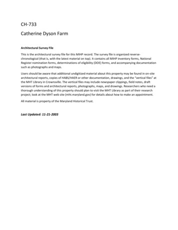
CH-733Catherine Dyson FarmArchitectural Survey FileThis is the architectural survey file for this MIHP record. The survey file is organized reversechronological (that is, with the latest material on top). It contains all MIHP inventory forms, NationalRegister nomination forms, determinations of eligibility (DOE) forms, and accompanying documentationsuch as photographs and maps.Users should be aware that additional undigitized material about this property may be found in on-sitearchitectural reports, copies of HABS/HAER or other documentation, drawings, and the “vertical files” atthe MHT Library in Crownsville. The vertical files may include newspaper clippings, field notes, draftversions of forms and architectural reports, photographs, maps, and drawings. Researchers who need athorough understanding of this property should plan to visit the MHT Library as part of their researchproject; look at the MHT web site (mht.maryland.gov) for details about how to make an appointment.All material is property of the Maryland Historical Trust.Last Updated: 11-21-2003
Catherine Dyson FarmCH-733DuboisPrivate1885Established in 1885, the Catherine Dyson Farm is a representative example of a VictorianFarmstead in Charles County. Now consisting of 40 of its original 125 acres, the farm includes afarmhouse directly on Roundhill Road surrounded by a typical array of outbuildings including ameathouse, dairy, garage, shed, comcrib, chicken house, equipment shed, and three tobaccobarns. The farmhouse is a two-story, five bay Victorian dwelling with a wrap-around porchextending to the rear of the two-story kitchen wing. The principal elevation is adorned withdouble decorative cross-gables and scrollsawn porch brackets.
Maryland Historical TrustMaryland Inventory ofHistoric Properties Form1. Name of PropertyhistoricInventory No.CH-733(indicate preferred name)Catherine Dyson Farmother2. Locationstreet and number8346 Roundhill Roadcity, townCharlotte HallcountyCharles3. Owner of Propertynot for publicationXvicinity(give names and mailing addresses of all owners)nameMark C. Cordstreet and numberPO Box 348city, townCharlotte Halltelephonestate301-396-5815zip codeMD20622-03484. Location of Legal Descriptioncourthouse, registry of deeds, etc. Charles County Courthousetax map and parcel: 57 p. 31city, townliberLaPlata2428folio4325. Primary Location of Additional DataContributing Resource in National Register DistrictContributing Resource in Local Historic DistrictDetermined Eligible for the National Register/Maryland RegisterDetermined Ineligible for the National Register/Maryland RegisterRecorded by HASS/HAERHistoric Structure Report or Research ReportOther6. esiteobjectOwnershipxpublicprivatebothCurrent ucationfunerarygovernmenthealth careindustryResource nsportationwork in progressunknownvacanUnot in itesstructuresobjectsTotalNumber of Contributing Resourcespreviously listed in the Inventory0
7. DescriptionInventory insalteredPrepare both a one paragraph summary and a comprehensive description of the resource and its various elements as itexists today.Established in 1885, the Catherine Dyson Fann consists 40 of its original 125 acres, on the south side of the old road leading fromLaPlata to Charlotte Hall, now Roundhill Road. The Fann is anchored by a two-story frame farmhouse that sits directly on theroad and was constructed around the turn of the 20th century. The dwelling surrounded by a typical array of domestic andagricultural outbuildings including a meathouse, dairy, garage, shed comcrib, chickenhouse, equipment shed, a gable-roof barnwith shed addition and two gambrel roof tobacco barns.The dwelling represents a unique elaboration of a typical L- plan, a house form built extensively in Charles County after the CivilWar. The front elevation faces north and consists of five symmetrical bays on the second floor above a centered doorway. Thegable roof is adorned with a pair of decorative cross-gables containing a single Gothic- inspired 4-light window in a lancetwindow. A wrap-around porch extends the full width of the front elevation and extends to the east wall. The hipped roof porch,adorned with turned wooden posts and scrollsawn brackets, shelters a first floor bay window to the east of the entrance door andtwo 2/2 windows to the west.The east gable and wing elevation represents the most visually prominent side elevation . door and the farm lane passed nextto this wing on its way to the rear of the farm The gable contains a square 4-light window set in a lancet frame, matching thosefound on the front elevation. The main block includes two first floor and two second story asymmetrical windows. The servicewing includes a single second floor and a single first floor window and door. The wrap-around porch continues throughout thiselevation to shelter the rear entrance door, which is connected to the lane by a cement sidewalk. However, the brackets on thefront and side elevation differ in style.The entire structure has been reclad in asbestos shingle siding and. The roof is covered in asphalt and is pierced by three interiorchimney flues with corbelled caps. The cornice is boxed. Several large trees adorn the small yard. The interior was not availableat the time of the survey.The two gambrel roof tobacco barns are noteworthy in that they both include late Victorian ornamentation in the form ofweathervanes and lighting rods placed along the roof ridge. Both have metal roofs, vertical board siding and hinged ventilators.
8. SignificanceInventory No.PeriodAreas of Significance1600-16991700-1799x 1800-1899x 1900-1999- communicationscommunity planningconservationSpecific dates1885-1932Construction dates1885-1932CH-733Check and justify creationethnic tryinventionlandscape architecturelawliteraturemaritime industrymilitaryArchitect/Builderperforming cial historytransportationother:UnknownEvaluation for:National RegisterMaryland Registerxnot evaluatedPrepare a one-paragraph summary statement of significance addressing applicable criteria, followed by a narrative discussion ofthe history of the resource and its context. (For compliance reports, complete evaluation on a DOE Form - see manual.)The Catherine Dyson Farm is a well-preserved example of a relatively prosperous late 19th, early 20th century farm in CharlesCounty. In 1885 Thomas and Ann Carrico sold 125 acres known by the name of Bird's Head or Davis' Enlargement to CatherineDyson, the wife of William W. Dyson. Catherine's will of 1932, leaves "the home farm upon which I now reside and of which Iam the owner in fee simple" to her two sons William W. and George P. Dyson. In 1969, William sold his portion to his brotherGeorge and his wife Minnie. The property is owned by heirs of the Dyson family today. Tax records indicate a construction date of1925.Charles County has remained largely agricultural since the time of European colonization. Before the Civil War large plantationsrelying on enslaved labor were typical and could include as much as 1000 acres. After the Civil War, Charles County's economycollapsed. Large farms were divided, and planters struggled to keep their farms viable. In 1870 there were 545 farms in CharlesCounty. By 1900 that number had more than tripled at 1900 farms. Farm size continually decreased as large farms, containing over500 acres, were divided. The most dramatic increase was seen in the number of farms under fifty acres, which more than doubledbetween 361 farms in 1880 and 728 farms in 1920. lines, the limited extent of the railroad system made the continued use ofsteamboat wharfs necessary in many parts of the county. Numerous steamboat lines continued to ply the Potomac, Patuxent, andWicomico Rivers. The heyday of the steamer lasted from around 1880 to 1920. Over the course of this period, several dozensteamboat companies served Charles County's numerous wharves. Among these were the Weems Line, the Potomac SteamNavigation Company, Ephraim S. Randall, and the successor to the Weems Line, the Maryland and Virginia Steamboat Company.Tobacco cultivation which had been the predominant cash crop since the 17th century, remained so in the early 20th century.However, largely due to improved transportation, some agricultural diversification took place during the late-19th and early-20thcentury. Increasingly farmers produced a variety of crops including honey, assorted vegetables, and orchard products that weresold at local or regional markets. These market gardens increased in value from a meager 580 in 1880 to 69,610 in 1910. Dairyproduction increased from 53,878 inl870 to over 140,000 in 1920. The total number of chickens raised locally doubled within onedecade from 55,330 in 1880 to 109, 551 in 1890. By 1910 that number had increased to 184,389. An agricultural depressionduring the early years of the 20th century prompted some farmers to begin the cultivation of tomatoes and other canning crops. Inconjunction with this agricultural diversification, a small canning industry took hold in the county. The first cannery in CharlesCounty was opened in La Plata in 1883, and in the same year A.T. Whiting Co. operated a packing establishment at Rock Point forcanning tomatoes, com and other vegetables. By 1920 there were twenty-nine manufacturing facilities in the county.Modernization of agricultural equipment also affected the output of county farmers. Reapers, threshers, and hailers as well assteam-powered and combustion equipment arrived from the railroad in the early-20th century, allowing farmers to produce moregoods using fewer farm hands. Improved fertilizers shipped from plants in Baltimore enhanced the county's soils, increasing theiryield.
9. Major Bibliographical ReferencesInventory No.CH-73310. Geographical DataAcreage of surveyed property 39.78 -Acreage of historical setting125Quadrangle nameCharlotte hallQuadrangle scale1:24 000Verbal boundary description and justificationThe Catherine Dyson Fann is associated with Charles County Property Tax Map 57 parcel 31.11. Form Prepared Byname/titleCathy Hardy/Historic Sites SurveyororganizationCharles County Planningdatstreet and number 200 Baltimore Streetcity or town3/18/2002telephonestatLaPlataMD301-396-5815zip code 20646The Maryland Inventory of Historic Properties was officially created by an Act of the MarylandLegislature to be found in the Annotated Code of Maryland. Article 41, Section 181KA,1974supplement.The survey and inventory are being prepared for information and record purposes onlyand do not constitute any infringement of individual property rights.return to:Maryland Historical TrustDHCD/DHCP100 Community PlaceCrownsville MD 21032410-514-7600
MARYLAND INVENTORY OF HISTORIC PROPERTIESCONTINUATION SHEETSection 8Page lInventory No. CH-733Catherine Dyson Farmname of propertyCharles County. MDcounty and stateChain of Title:1997Mary E. Cord, (cousin of Minnie C. Dyson) trustee of the Testamentary Trust for thebenefit of Mary Catherine Dyson (daughter of Minnie C. Dyson) as established in item 4will of Minnie C. Dyson. WB51:128 to Mark C. Cord2428/432 See 2048/519, 19941979Last will and testament of Minnie C. Dyson. Power of attornery to Mary E. Cord forbenefit of daughter Mary Catherine DysonWB51/1281977George P. and Minne C. Dyson to Robert J. and Mary E. CordSecond549/271969William W. Dyson and Cornelia Dyson, wife to George P. and Minne C. Dyson wifeFirst: 62.2986 acres; Second: 19.1474 acres210/3901932Will of Catherine Dyson. To my two sons William W. and George P. Dyson the homefarm upon which I now reside and of which I am the owner in fee simple together withall the livestock, tobacco, implements and other personal property.GAW 21/1721885Thomas A. Carrico and Ann E. Carrico, wife to Catherine Dyson, wife of WilliamW. Dyson, "Bird's Head" or "Davis' Enlargement" 125 acres.BGS 7/686
MARYLAND INVENTORY OF HISTORIC PROPERTIESCONTINUATION SHEETSection .2.Page lInventory No. CH- 133Dyson Farmname of propertyCharles County. Marvlandcounty and stateMajor Bibliographic References:Brown, Jack D., et al. Charles Countv. Maryland. A History.Charles County Bicentennial Committee, 1976.Charles County Land Records, Charles County Courthouse, LaPlata, Maryland;Maryland State Archives, Annapolis, Maryland.Klapthor, Margaret Brown. The History of Charles Countv. Marvland.LaPlata, MD: Charles County Tercentenary, Inc., 1958.
RESOURCE SKETCH MAPDateName·Address: S ' tlo1\ 2-oa Z.f?.[ OtJc-.r1-1;e:.f.1. j1'JSfZ.o\J!UPHI t.-L.-E}ltz-.v\t2-o.-.nCH - 73?;,North arrow Charles County, Mari;landCtt"kfZ.l.4'fTE Vicinity' 1 tjIL a1 ·. l " -.;.!Il,n .--.au\ l "'i. 111·a -. 1.il i:t"'"""'.J-a'i- .S .:N.;.;. ;, .,:;.i I" :] ()l m- ---·-"""''. . ,. .,.-- . \{cL4.ILI2:: ci;. ·· IJw1e;"7r"',.- : ·. 1.·, ' ·10--. .' 11"':·:. ·.[ 3.·:. ' ,.B, Ta,f -----'.,·,,1. '1m. ·'' .:w'ii\'. ,. - · . -.:: :.-lll - ""·-1·. -,. . . ·l,. .,' II.ill - (\jrm!l. II'"i,I1 l! i&I.\Q!'01-4. ;II!I!\\I\\ l: Not drawn to scale B.:i,\
IfII\/. 11a· ::::-::::-::::: I)'-.JCH- ]! 3Charles County, MDName: Pi4of'J F !U.I\Location: O\l l ? V1C,. Quad: c t\"kU.rc:
c. ct\ -\-; b. '-' o.T ";\\.a seC "r:\ 5 Co l mo,,(1\\G dj ()() Y'f\'O \\edU» - \/tJ',,.,,,,oPlo
\\ -\" 3\)'\-S"µ o :: uc::;-e(,'-'of\(c;,CoC\Achc\i""'D,,\;.o'd\""Y\ DS \A oL/)Dll-1 C;()U 111 tv N'f tLA::-1/A no lI. Fb
\.). -\ 'l, :,l) '( ::n-' "f0.'f """' ".l \.\Se.c "o \-es C.oC. a . c!y\\l,o.: \'V\\moo \\.Pot; ltlJotJ, et lV-- b
-\ '3\')'\ 'SJ \1Sv- m' '::: u. '5 eC. ""o '( \e5 Co , "' \:)C. a c&y\\').':): """ 05"' 0l}l"1E:- : D I L.f)I ?, lOO 5Wt-foPh
f'\\.:. - '?": \) '\\ - \Jf'f'·n :.tu- \,::l\.""'S '-o\'{'(\l)
-\ '3 14St '"' f o. u e.C \QS Co, Dc &1\\ o 0 91atJ,IPtJFbSY\ OI-CO tJf}
All material is property of the Maryland Historical Trust. Last Updated: 11-21-2003 . Catherine Dyson Farm CH-733 Dubois Private 1885 Established in 1885, the Catherine Dyson Farm is a representative example of a Victorian Farmstead in Charles County. Now consisting of 40 of its original 125 acres, the farm includes a farmhouse directly on Roundhill Road surrounded by a typical array of .