Transcription
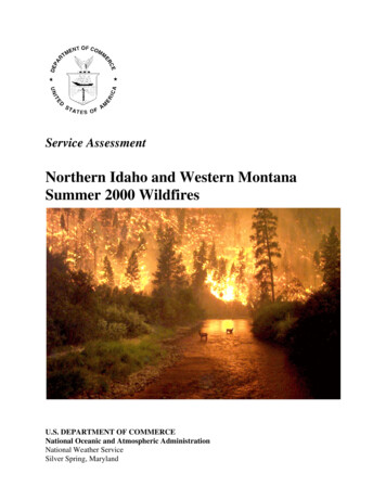
Service AssessmentNorthern Idaho and Western MontanaSummer 2000 WildfiresU.S. DEPARTMENT OF COMMERCENational Oceanic and Atmospheric AdministrationNational Weather ServiceSilver Spring, Maryland
Cover: The photograph was taken on August 6, 2000, on the East Fork of the Bitterroot Riveron the Sula Fire Complex. (Courtesy of John McColgan, Alaskan Type I Incident ManagementTeam, Bureau of Land Management, Alaska Fire Service)
Service AssessmentNorthern Idaho and Western MontanaSummer 2000 WildfiresFebruary 2001U.S. DEPARTMENT OF COMMERCEDonald L. Evans, SecretaryNational Oceanic and Atmospheric AdministrationScott B. Gudes, Administrator (Acting)National Weather ServiceJohn J. Kelly, Jr., Assistant Administrator
PrefaceFederal and state land management organizations recognized the wildfires of 2000 as historicin both extent and duration. Due to the impact of these wildfires, a Service Assessment Teamexamined the warning and forecast services provided by the National Weather Service (NWS) to firecontrol agencies, emergency managers and the public in northern Idaho and western Montana. Forthe purpose of this document, Northern Rockies will be used interchangeably with northern Idahoand western Montana. While the wildfires threatened many parts of the country, the ServiceAssessment centered on the Northern Rockies due to the unprecedented magnitude of thesuppression effort, the extraordinary level of weather services provided and the critical role timelyand consistent weather information played in fire fighter and public safety and suppression activities.Service assessments provide a valuable contribution to our ongoing efforts to improve thequality and timeliness of our products and services for the protection of life and property. Findingsand recommendations from this assessment will help to improve techniques, products and services.February 2001ii
Table of ContentsPagePreface . . . . . . . . . . . . . . . . . . . . . . . . . . . . . . . . . . . . . . . . . . . . . . . . . . . . . . . . . . . . . . . . . . . . . iiService Assessment Team . . . . . . . . . . . . . . . . . . . . . . . . . . . . . . . . . . . . . . . . . . . . . . . . . . . . . . ivAcronyms . . . . . . . . . . . . . . . . . . . . . . . . . . . . . . . . . . . . . . . . . . . . . . . . . . . . . . . . . . . . . . . . . . . viService Assessment Report . . . . . . . . . . . . . . . . . . . . . . . . . . . . . . . . . . . . . . . . . . . . . . . . . . . . . . 1Facts . . . . . . . . . . . . . . . . . . . . . . . . . . . . . . . . . . . . . . . . . . . . . . . . . . . . . . . . . . . . . . . . . . . . . . . 17Findings and Recommendations . . . . . . . . . . . . . . . . . . . . . . . . . . . . . . . . . . . . . . . . . . . . . . . . . 21Best Practices . . . . . . . . . . . . . . . . . . . . . . . . . . . . . . . . . . . . . . . . . . . . . . . . . . . . . . . . . . . . . . . . 25Appendix ATeam Charge, September 22, 2000 . . . . . . . . . . . . . . . . . . . . . . . . . . . . . . . . . A-1Appendix BIncident Command System (ICS) Overview . . . . . . . . . . . . . . . . . . . . . . . . . . . B-1Appendix CProduct Examples . . . . . . . . . . . . . . . . . . . . . . . . . . . . . . . . . . . . . . . . . . . . . . . C-1Appendix DIMET Survey . . . . . . . . . . . . . . . . . . . . . . . . . . . . . . . . . . . . . . . . . . . . . . . . . . D-1iii
Service Assessment TeamOn September 22, 2000, the Assistant Administrator for Weather Services, John J. Kelly,Jr., activated a Service Assessment Team to review NWS performance in supporting wildfireoperations in the Northern Rockies. (See Appendix A for Team Charge.) The Team assembledin Boise, Idaho, on September 24 and met with wildfire resource managers located at theNational Interagency Fire Center (NIFC) and the Boise Weather Forecast Office (WFO)personnel. The Team traveled to Missoula, Montana, and met with personnel involved in thewildfire suppression effort in northern Idaho and western Montana. Interviews were conductedwith the Montana State Forester, the Montana State Director for Fire and Aviation, the WesternMontana Department of Emergency Services Coordinator, Forest Service Region 1 DeputyRegional Forester, members of the Multi-Agency Coordination (MAC) group for the NorthernRockies, Incident Commanders, NWS Meteorologists in Charge (MICs) and IncidentMeteorologists (IMETs) at WFOs Missoula, Great Falls, Billings, Montana; Spokane,Washington; and Pocatello, Idaho. The team also surveyed all the IMETs who supported theNorthern Rockies wildfire suppression efforts.The Team was comprised of the following individuals:D. Gregory HarmonTeam Leader, Meteorologist in Charge, Weather Forecast OfficeSioux Falls, South DakotaPhillip D. BothwellSenior Development Meteorologist, Storm Prediction Center(SPC), Norman, OklahomaSteven W. BrownMeteorologist in Charge, WFO Reno, NevadaNancy A. DeanMeteorologist in Charge, WFO Eureka, CaliforniaTodd A. HeitkampWarning Coordination Meteorologist (WCM), WFO Sioux Falls,South DakotaVince KolarEmergency Manager, Cascade County, MontanaPatrick J. SlatteryCentral Region Headquarters, Public Affairs, Kansas City,Missouriiv
Other contributors:Donald ArtleyMontana State Forester and Chairman of the National WildfireCoordinating Group, Missoula, MontanaDavid GoensMeteorologist in Charge, WFO Missoula, MontanaLinda KremkauNWS Headquarters, Office of Climate, Water and WeatherServices, Silver Spring, MarylandWilliam LernerNWS Headquarters, Office of Climate, Water and WeatherServices, Silver Spring, MarylandKathy McAllisterU.S. Forest Service (USFS) Region 1 Deputy Regional Forester,Missoula, MontanaTim MurphyMontana State Director for Fire and Aviation, Missoula, MontanaRick OchoaStaff Meteorologist to NIFC, Boise, IdahoBill ThomasDistrict One Representative for the Montana Disaster andEmergency Services, Missoula, MontanaThe Service Assessment Team also acknowledges the NIFC staff and the many otherswho took time to provide the Team with valuable information contained in this Report.Upper Nine Mile Complex in theLolo National Forest, Montana.(Courtesy of NIFC)v
PNIFCNOAANWSRAWSSPCUSFSWCMWFOAdvanced Technology Meteorological UnitCriminal Justice Information NetworkClimate Prediction CenterHydrometeorological Prediction CenterIncident Command SystemIncident MeteorologistLaw Enforcement Teletype SystemMulti-Agency CoordinationModernization and Associated RestructuringMeteorologist in ChargeNational Warning SystemNational Centers for Environmental PredictionNational Interagency Fire CenterNational Oceanic and Atmospheric AdministrationNational Weather ServiceRemote Automated Weather StationStorm Prediction CenterU.S. Forest ServiceWarning Coordination MeteorologistWeather Forecast Officevi
Service Assessment ReportIntroductionFederal and state land management organizations recognized the wildfires of 2000 ashistoric in both extent and duration. Through late September, more than 79,700 wildfiresscorched over 6.8 million acres of public and private land. This exceeds the 10-year average of66,120 wildfires and 3.1 million acres burned annually. The number, size and intensity of thesewildfires stretched land management suppression resources to the limit, threatened entirecommunities and caught the attention of the public and media throughout the world. Thesuppression effort was likely the largest peacetime mobilization of resources in our Nation’shistory. The U.S. military provided valuable resources to the suppression effort.The wildfire season started in the early spring in the southeast United States andprogressed west and north as hot, dry, summer weather settled over the western half of thecountry. The first IMET of the season was dispatched to a wildfire in Louisiana on March 9,2000. IMETs are meteorologists who, in addition to their regular forecasting duties, are speciallytrained to provide onsite weather support to fire fighting teams. IMETs were deployed onsite in16 states from March through September. This involved a record 64 IMETs dispatched246 times for a record 1,772 IMET days. Routine and specific fire weather services wereprovided nationwide for an extended period.The focus of this Service Assessment Report is limited to NWS services provided to thewildfire suppression effort in northern Idaho and western Montana from mid-July to midSeptember. The Northern Rockies was chosen due to the unprecedented duration and magnitudeof the suppression effort, the extraordinary level of services provided and the critical role timelyand consistent weather information played in fire fighter and public safety and suppressionactivities.In the Northern Rockies, a 3-year period of dry weather and above normal temperaturescreated tinder dry forests that led to this prolonged wildfire season. A mid-summer series oflightning storms and strong winds caused an unusually large number of wildfire starts with swiftwildfire spread. Initial relief to the critical wildfire situation came in the form of coolertemperatures and rain over the Labor Day weekend. More than one million acres burned and firedanger forced federal and state officials to close millions of acres of public land for extendedperiods. Interstate commerce was impacted and the interstate freeway was closed at times.Thick smoke filled valleys for extended periods, disrupting the lives of residents and visitors. Arecord 40 to 50 Incident Management Teams were in the Northern Rockies at one time. Some ofthese teams came from Australia, Canada and New Zealand. All were provided quality weatherinformation and services from the NWS.1
Fire Weather ServicesFire weather services date back to the 1910s. The growth and changes in the NWS FireWeather Program have been linked to the evolving needs of land management agencies coupledwith the inclusion of new technologies and forecasting concepts. Prior to the NWSmodernization and associated restructuring (MAR), only the Missoula and Billings officesprovided fire weather services in Montana and northern Idaho. Two fire weather forecasters inMissoula and one fire weather forecaster with part-time help from the MIC at Billings providedfor 8- to 12-hour support during the fire season. With the MAR completion, fire weatherservices are now provided around the clock by trained meteorologists at all four offices in thearea: Missoula, Great Falls, Billings and Spokane.In the late 1980s and 1990s, the NWS began upgrading IMET support. Deployment ofIMETs onsite to wildfires changed from slow and restrictive trucks and campers to an air mobilesystem. Air Transportable Mobile Units renamed Advanced Technology Meteorological Units(ATMUs) include a Communications Module (satellite dish) and a Field Support Module (pilotballoon). The number of stored ATMUs has increased from 22 to 25 across the continentalUnited States, with three other units in Alaska. There are also 15 ATMU Lites (satellite dishonly) assigned to selected NWS offices. More remains to be done. Some fire weather laptopcomputers used by IMETs do not have the connections needed for the ATMU satelliteequipment. Remote weather data can be obtained from 26 portable Remote Automated WeatherStation (RAWS) weather observing platforms owned by land management agencies and deployedto wildfires as needed. RAWS provides valuable real-time weather information to WFOforecasters, IMETs and fire management officials. However, not all IMETs in the NorthernRockies had access to these systems due to the lack of sufficient RAWS units, and not all unitsare configured the same. For example, some RAWS do not have satellite interrogationcapability, limiting access to weather data.NWS offices have traditionally developed new capabilities to enhance weather services toland managers. One recent example is the development of a Web-based Spot Forecast service(see WFO Products and Services for an explanation of the Spot Forecast Program). Pioneered atWFO Missoula, it is an interactive graphic request-reply program, providing site-specific weatherinformation to land managers up to 20 percent faster than manual methods. This efficiency isespecially important for initial wildfire suppression. Another example is the Web-based currentweather map available from the WFO Great Falls Fire Weather Home Page. This map,developed for the 2000 fire season, displays color contoured relative humidity, wind andtemperature and is automatically updated every 20 minutes using fire weather RAWS, aviationweather observations and data from the Montana Department of Transportation. The mapprovides a one-stop, near-real-time source for the latest weather conditions.2
Preconditions and Significant Weather EventsAs mentioned before, a 3-year period of dry weather and above normal temperaturescreated tinder dry forests that led to this prolonged wildfire season across northern Idaho andwestern Montana. During the winter of 1999-2000, there was less snow and rain than usual. Thesnowpack was at or below 70 percent of normal (Figure 1). Warm spring temperatures causedwhat snow there was to melt early. Rainfall in May and June was below normal and by summerforests became tinder dry. See Figure 2 for precipitation deficits across the area. The moistureremaining in trees and vegetation (i.e., fuel moisture) reached record low values by mid-July. Atmany locations in the Northern Rockies, fuel moisture fell below 10 percent of normal.Figure 1. Snowpack in the western United States as of May 1, 2000.(Courtesy of U.S. Department of Agriculture, Natural ResourceConservation Service)3
Figure 2. Monthly Accumulated Precipitation Deficits, October 1999 to August 2000, forIdaho and Montana. (Courtesy of Larry Bradshaw of the USFS Intermountain Fire SciencesLaboratory)A period of widespread rain occurred the first week of July but provided only temporaryrelief. A persistent area of high pressure in the upper levels of the atmosphere developed overthe western United States and remained in place through August. This produced daytime sunnyskies, hot temperatures and low relative humidity that further dried the fuels. While nighttimetemperatures cooled in the valleys, higher elevations remained warm with continued lowhumidity. This helped keep the forests at dangerously dry levels. The spark that ignited theexplosive fire development came on July 13 in the form of dry thunderstorms (dry thunderstormsare storms that produce less than a tenth of an inch of rain).The July 13 lightning event was the first of several significant lightning or wind eventsthat occurred over the next 6 weeks across the Northern Rockies. Conditions were so dry acrossthe region that one land manager stated he had never seen such efficient wildfire producinglightning during his 30-year career.Figure 3 shows the number of new fire starts each day in the Northern Rockies from Julyto mid-September. Nearly 3,900 fires were ignited; all but 10 were caused by lightning. Oncethe fires started, periodic strong winds and low relative humidity caused widespread containment4
and suppression problems. The most critical weather days for wildfire starts or spreads wereJuly 13, and August 9, 10 and 19.Figure 3. New fire starts in the Northern Rockies, July to mid-September 2000.Data gathered from daily NIFC Incident Reports. (Storm Prediction Center, NationalOceanic and Atmospheric Administration [NOAA])NWS Performance OverviewFire control representatives interviewed by the Service Assessment Team unanimouslystated that the unprecedented wildfire season in the Northern Rockies was matched by an equallyunprecedented level of timely, accurate and consistent NWS products. These included routineweather products, as well as special products and services tailored to the needs of individual firecontrol managers. Extensive coordination among WFOs and IMETs resulted in a consistentweather message. Kathy McAllister, USFS Region 1 Deputy Regional Forester, indicated theForest Service could not have achieved its wildfire suppression goals and accomplished the fireline safety it had throughout the long and tiring fire season without the outstanding cooperation,expertise and service from the NWS. Ms. McAllister concluded the relationship between USFSRegion 1 and the NWS is perhaps the best in the country. (See Figure 4 for USFS Region 1map.)5
Figure 4. U.S. Forest Service Region 1. (Courtesy of USFS)The unprecedented level and quality of NWS service was a direct result of committed andtalented people working with new technological tools. Service before self was the norm amongNWS employees committed to meeting the needs of the fire suppression community. Forty-onedifferent IMETs were dispatched 105 times for a total of 915 IMET days in USFS Region 1.This was about two-thirds of all the IMETs used during the 2000 fire season. Some came fromas far away as Florida and Alaska. Many of these forecasters were called more than once forduty, each time working long hours for an extended period. A typical IMET workday can extendbeyond 16 hours. Prolonged IMET deployment, up to 14 days, can be exhausting. This servicecommitment was not limited to IMETs but included the staffs at WFOs. In several cases, NWSpersonnel adjusted or canceled approved annual leave to help relieve operational pressuresbrought about by the extreme fire season.This fire season reaffirmed the importance of the Staff Meteorologist position to NIFC.This individual is the liaison between NWS and NIFC officials. The understanding of landmanagers’ needs and the skill in communicating current and future weather conditions to forestryofficials led to a high level of confidence and trust. The Staff Meteorologist is also responsiblefor the selection and deployment of IMETs to fire sites. This was accomplished efficientlydespite the record number of IMETs involved.The escalating wildfire situation and the likely need for multiple NWS on-site supportservices was recognized early. Assistant Administrator for Weather Services John J. Kelly, Jr.,and Regional Directors ensured IMETs were available as needed. While some suppression6
resources were in short supply, all requests for IMETs were satisfied not only for the NorthernRockies but across the entire country.As mentioned before, four days were critical wildfire days. The August 9, 10 and 19episodes were preceded by timely Fire Weather Watch and Red Flag Warning products. FireWeather Watches were in effect in advance of the July 13 lightning event. However, the watcheswere canceled and Red Flag Warnings not issued. Scattered dry thunderstorms were forecast butland managers and forecasters believed moisture from recent rains would limit fire starts. TheJuly 13 lightning triggered numerous fires and clearly indicated the forests were critically dry.On August 9, very low relative humidity, hot temperatures and strong winds caused the fires toexpand, forcing hundreds of residences to be evacuated. More than 100,000 acres burned duringa 2-day period ending August 9 (i.e., approximately 10 percent of total acreage destroyed duringthe entire season). In excess of 13,000 lightning strikes on August 10 triggered more than 500new fires. The August 19 wind event was predicted by the NWS nearly a week in advance,allowing for significant pre-positioning of fire fighting resources.The allocation of limited fire fighter personnel, fire suppression resources and publicsafety was dependent on accurate and timely weather information. One MAC group leaderstated, “All MAC group decisions are based on weather. The information from the NWS wasinstrumental in achieving its tactical suppression goals with no loss of life or serious injury.” SeeAppendix B for the role of the MAC group. The cooperation and trust between NWS personneland land managers grew as the wildfire situation worsened in the Northern Rockies. Local NWSmanagers and IMETs recognized the need for a coordinated “weather message” whencommunicating with fire control managers. Daily group coordination calls were initiated by theNWS Western Region Meteorological Services Division and involved IMETs, the NIFC StaffMeteorologist and affected WFOs. This helped facilitate consistent weather forecasts. MontanaGovernor Marc Racicot remarked to the Missoula MIC that he was impressed with the detail andconsistent weather information he received from IMETs as he traveled from fire to fire. TheGovernor’s remarks were echoed by several key fire control managers. The Service AssessmentTeam did not receive any negative comments from those interviewed. Based on the informationand data gathered from this assessment, weather services exceeded the expectations of firecontrol managers in northern Idaho and western Montana and aided in fire fighter and publicsafety and suppression activities.7
National Centers for Environmental Prediction (NCEP)Products and ServicesClimate Prediction Center (CPC)The CPC products most used before and during the fire season were the 6- to 10-Day,30-Day and 90-Day Temperature and Precipitation Outlooks.Some WFOs routinely appended 6- to 10-Day Temperature and Precipitation Outlooks tothe Fire Weather Zone Forecast, providing valuable planning information for land managers.This product was also important for the MAC group. Since the MAC group makes broadstrategic decisions, longer range weather forecasts were critical. On August 12, the WFOMissoula MIC briefed the MAC group on the potential for strong gusty westerly winds on orabout August 19. The MAC group was sensitive to this long-range wind forecast because ofpublic interest in the anniversary of a historical wind event for the Northern Rockies. OnAugust 20, 1910, strong winds resulted in more than two million acres of land burned in 2 daysand the deaths of almost 100 fire fighters and citizens. Based on the strong wind forecast, theMAC group decided to pre-position 75 fire engines, 15 hot shot fire fighting crews, 60 bulldozersand 6 Blackhawk helicopters. NIFC approved the resource order. Resources came from as faraway as Massachusetts and Delaware. The wind event occurred on August 19, as forecast, andthose pre-positioned resources were put to good use controlling new fires while they were stillsmall.Fire control vehicles from Massachusetts pre-positioned for theAugust 19 wind event. (Courtesy of WFO Missoula, MT.)8
Another example of the utility of the 6- to 10-Day Outlook was the one issued onAugust 25 for the Labor Day weekend. This gave the first indication of a change in theprolonged hot, dry weather across the Northern Rockies. The information led to a shift in firemanagers’ resource planning. The graphic portion of the Outlooks proved to be an excellentNWS briefing tool for fire control managers.WFO forecasters, land managers and emergency managers used CPC’s 30- and 90-DayTemperature and Precipitation Outlooks prior to the start of the 2000 fire season. Informationcontained in these Outlooks enabled land managers to establish contingency plans for theupcoming fire season. The Outlooks were accurate in detailing warmer, drier weather thannormal across the Northern Rockies.Another product issued by CPC is the U.S. Threats Assessment graphic, a Web-basedproduct covering weather conditions in the 3- to 10-day range. The Threats Assessment was notroutinely used by WFO forecasters, IMETs or land managers in the Northern Rockies whothought it did not add to information available from other NWS products. The ThreatAssessment was available to emergency managers and the general public through WFO Internethome pages.Hydrometeorological Prediction Center (HPC)HPC is responsible for basic weather forecast guidance out to 7 days and for quantitativeprecipitation forecasts out to 5 days. Use of the HPC guidance products varied among IMETsand WFO forecasters in the Northern Rockies. Some forecasters found the HPC narratives toobroad to support the detail needed in fire weather products; others used the information as a basisfor local forecasts. HPC graphics, such as location of fronts and high and low pressure systems,aided in daily briefings to fire control officials.Storm Prediction Center (SPC)SPC issues Fire Weather Outlooks describing areas where fire danger is high to extremeand, combined with expected thunderstorms producing at least 100 cloud-to-ground lightningstrikes and less than one-tenth of an inch of rain, pose a threat of wildfires.Many IMETs and forecasters that served in the Northern Rockies indicated Fire WeatherOutlooks were too broad in detailing critical fire weather areas and provided little newinformation. Therefore, the product was not used by a majority of the meteorologists. Since thiswas the first operational year for the Fire Weather Outlook and to determine if this perception byforecasters was correct, SPC provided product verification on 10 important weather events thatimpacted the Northern Rockies from mid-July to September. The SPC correctly forecast 9 out of10 events in its Day 1 Fire Weather Outlook and 7 out of 10 events in the Day 2 period.9
WFO Products and ServicesAll WFOs with a Fire Weather Program issue a suite of fire weather products and providea variety of services to land management agencies. Products include Fire Weather ZoneForecasts, Fire Weather Watches, Red Flag Warnings and Spot Forecasts. Appendix C showsexamples.The basic product is the twice daily Fire Weather Zone Forecast. This 5-day forecastprovides weather information to fire control agencies and any IMETs assigned onsite to fires inthe forecast area. These forecasts allow land management agencies to effectively marshalresources and prepare for meeting fire weather threats.During the fire emergency for northern Idaho and western Montana, the extended 3- to5-day portion of the Fire Weather Zone Forecast proved critical. For example, forecasters alertedfire control managers verbally and through the Zone Forecast on August 19 of a significant windevent. This forecast confirmed the 6- to 10-Day Outlook mentioned before, and validated theheightened state of readiness and marshaling of additional fire fighting resources. However, theinclusion of wind information in the extended forecast is not uniform across the country.Fire Weather Watches are issued when there is a high potential for severe fire weatherconditions in a 12- to 72-hour time frame. Information includes wind, fuel moisture,temperature, relative humidity and the likelihood of dry thunderstorms. This product providesland managers with the information to prepare for critical weather events that will impact firebehavior.Red Flag Warnings are issued when severe fire weather conditions are expected to occurwithin 24 hours. Issuance criteria are established by a WFO and the local land managementorganizations prior to each fire season. Red Flag Warnings are normally disseminated to the landmanagement agencies and headlined in the Fire Weather Zone Forecasts. During this wildfireemergency, these warnings were also broadcast over the National Warning System (NAWAS) tostate emergency service warning points. An indicator of the severe fire weather conditions forthe 2000 season was the 500 Red Flag Warnings issued for the Northern Rockies—2 ½ times theseasonal average. The importance of Red Flag Warnings is exemplified by those issued for thelightning event of August 10. With lead times of more than 18 hours, these warnings providedfire control agencies with time to react to the approaching threat.The above three products, Fire Weather Zone Forecast, Fire Weather Watch and RedFlag Warning, all contain fire weather zone numbers but do not always include correspondinggeographic references. This caused confusion for fire control officials from outside the localarea.10
Spot forecasts are requested by land management agencies to obtain weather informationto aid the initial attack on new fires or for fires that are not staffed with an IMET. Theseforecasts contain highly specific information tailored for the fire area, including winds (impact oflocal terrain such as mountain slopes, time of wind shifts due to weather systems or terrain, etc.),temperature and humidity (times of minimum and maximum) and a 12-hour outlook. For Julyand August 2000, the Missoula, Great Falls, Billings and Spokane WFOs issued a total of623 Spot Forecasts. Most of these were prepared and disseminated in less than 30 minutes. Thisrapid production was due to the use of a Web-based software program. This program was anefficient way for fire control agencies to use the Internet to request a Spot Forecast and for theservicing WFO to prepare and return the forecast. However, not all Western Region WFOs usedthis new capability in 2000 and offices outside the Western Region do not have access to thesoftware and data base.Many aircraft were involved in the fire suppression effort. The fires produced areas ofdense smoke, hindering aircraft operations and safety. The NWS responded by providing dailyaviation weather briefings. This service was well received and contributed to an accident-freeaviation record throughout the fire suppression effort in the Northern Rockies.The extensive fire activity in northern Idaho and western Montana generated the addedresponsibility to transmit fire weather information to emergency managers and the general public.In order to accomplish this, NWS managers added additional fire weather shifts and usedovertime as needed. Several offices minimized or eliminated the use of IMETs on midnightshifts during the fire weather season. These IMETs focused on meeting the weather needs ofland managers and were available to be dispatched to fires.IMET Products and ServicesThe NWS IMETs go through a well-defined training and certification program. Thisprogram includes a week-long workshop, local on-station training, completion of an IMET taskbook and hands-on experience at an ongoing wildfire or prescribed burn. The number ofcertifi
CJIN Criminal Justice Information Network CPC Climate Prediction Center HPC Hydrometeorological Prediction Center ICS Incident Command System IMET Incident Meteorologist LETS Law Enforcement Teletype System MAC Multi-Agency Coordination MAR Modernization and Associated Restructuring MIC Meteorologist in Charge NAWAS National Warning System