Transcription
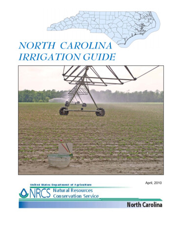
United StatesDepartment ofAgricultureNationalEngineeringHandbookPart 652Irrigation GuideNaturalResourcesConservationServiceIrrigation Guide(210-vi-NEH, September 1997)v
Part 652Irrigation GuideIssued September 1997The United States Department of Agriculture (USDA) prohibits discrimination in its programs on the basis of race, color, national origin, sex, religion,age, disability, political beliefs, and marital or familial status. (Not all prohibited bases apply to all programs.) Persons with disabilities who requirealternative means for communication of program information (Braille, largeprint, audiotape, etc.) should contact USDA’s TARGET Center at (202) 7202600 (voice and TDD).To file a complaint, write the Secretary of Agriculture, U.S. Department ofAgriculture, Washington, DC 20250, or call 1-800-245-6340 (voice) or (202)720-1127 (TDD). USDA is an equal employment opportunity employer.vi(210-vi-NEH, September 1997)
PrefacePart 652Irrigation GuideIrrigation is vital to produce acceptable quality and yield of crops on aridclimate croplands. Supplemental irrigation is also vital to produce acceptable quality and yield of crops on croplands in semi-arid and subhumidclimates during seasonal droughty periods. The complete management ofirrigation water by the user is a necessary activity in our existence as asociety. Competition for a limited water supply for other uses by the publicrequire the irrigation water user to provide much closer control than everbefore. The importance of irrigated crops is extremely vital to the public'ssubsistence.Today's management of irrigation water requires using the best informationand techniques that current technology can provide in the planning, design,evaluation, and management of irrigation systems. Support for many of thevalues included in this chapter come from field research, established designprocesses, and many system designs and evaluations over many years. Fieldevaluations must always be used to further refine the planning, design,evaluation, and management process. This design guide in the NaturalResources Conservation Service (NRCS), National Engineering Handbookseries provides that current technology.Irrigation Guide, Part 652, is a guide. It describes the basics and process forplanning, designing, evaluating, and managing irrigation systems. It provides the process for states to supplement the guide with local soils, crops,and irrigation water requirement information needed to plan, design, evaluate, and manage irrigation systems.Irrigation Guide, Part 652, is a new handbook to the family of references inthe NRCS, National Engineering Handbook series. It is written for NRCSemployees who provide technical assistance to the water user with concerns for both water quantity and quality. Other technical personnel forFederal, State, private, and local agencies will also find the guide useful as abasic reference when providing technical assistance relating to planning,designing, evaluating, and managing irrigation systems. College and university instructors will also find the guide useful as a classroom reference.In addition to the irrigation Guide (part 652), chapters in the NationalEngineering Handbook irrigation section (now part 623) describe: Soil-plant relationships and soil water properties that affect movement, retention, and release of water in soil Irrigation water requirements Planning farm irrigation systems Measurement of irrigation water Design of pumping plants Design criteria and design procedures for surface, sprinkler, andmicro irrigation methods and the variety of systems for each methodthat can be adaptable to meet local crop, water, and site conditionsand irrigation concerns(210-vi-NEH, September 1997)i
AcknowledgmentsPart 652Irrigation GuidePart 652, Irrigation Guide, is an addition to the National Engineering Handbook series. The document was initially prepared by Elwin A. Ross, irrigation engineer, NRCS, Engineering Division, Washington, DC, (retired) withprimary input and review from Leland A. Hardy, irrigation engineer,Midwest National Technical Center, NRCS, Lincoln, Nebraska, (retired).Principal NRCS staff who contributed to the development and review ofthis publication were:John Brenner, irrigation engineer, North Platt, NebraskaJerry Walker, irrigation engineer, Temple, TexasCarl Gustafson, state conservation engineer, Amherst, MassachusettsDavid Nelson, assistant state conservation engineer, Amherst,MassachusettsJohn Dalton, agricultural engineer, Bozeman, Montana (retired)Jim Suit, state conservation engineer, Bozeman, MontanaState conservation engineers coordinated a multidiscipline (representingsoils, agronomy, water quality, and water management) review in all states.William J. Carmack, national water management engineer, (retired),Ronald L. Marlow, water management engineer, NRCS, Washington, DC,and Thomas L. Spofford, irrigation engineer, NRCS, National Water andClimate Center, Portland, Oregon provided leadership and coordination.Editing and publication production assistance were provided by the Technical Publishing Team, NRCS, National Cartography and Geospatial Center,Fort Worth, Texas. Final technical review was provided by Elwin A. Rossand Leland A. Hardy.ii(210-vi-NEH, September 1997)
Part 652Irrigation GuideIrrigation GuideContents:Chapter 1IntroductionChapter 2SoilsChapter 3CropsChapter 4Water RequirementsChapter 5Selecting an Irrigation MethodChapter 6Irrigation System DesignChapter 7Farm Distribution ComponentsChapter 8Project and Farm Irrigation Water RequirementsChapter 9Irrigation Water ManagementChapter 10Conservation Management Systems and Irrigation PlanningChapter 11Economic EvaluationsChapter 12Energy Use and ConservationChapter 13Quality of Water SupplyChapter 14Environmental ConcernsChapter 15Resource Planning and Evaluation Tools and WorksheetsChapter 16Special Use Tables, Charts, and ConversionsChapter 17Glossary and ReferencesIndex(210-vi-NEH, September 1997)iii
Chapter 15Resource Planning and EvaluationTools and WorksheetsPart 652Irrigation GuideChapter 15Resource Planning andEvaluation Tools 1Water quality, water management, and irrigation evaluation tools15–1652.1502Irrigation system selection, design, costs, and evaluation tools15–2652.1503Irrigation system planning, design, and evaluation worksheets15–3652.1504Blank worksheets15–5Irrigation Planning Worksheet . 15–7Irrigation System Inventory Worksheet . 15–9Sprinkler Irrigation System Planning/Design Worksheet . 15–15Irrigation Water Management Plan–Sprinkler Irrigation System . 15–21Soil Water Holding Worksheet . 15–25Worksheet, Soil-Water Content . 15–26Determination of Soil Moisture and Bulk Density (dry) Using Eley . 15–27Volumeter and Carbide Moisture TesterTypical Water Balance Irrigation Scheduling Worksheet . 15–28Surface Irrigation System Detailed Evaluation Graded Border . 15–29WorksheetProfile and Cross Section . 15–37Cylinder Infiltrometer Curves . 15–38Cylinder Infiltrometer Test Data . 15–39Advance and recession curves . 15–40Cylinder Infiltrometer Curves . 15–41Depth infiltrated curve . 15–42Surface Irrigation System Detailed Evaluation Level Border . 15–43and Basins WorksheetSoil Water Intake Curves . 15–49Surface Irrigation System Detailed Evaluation Graded . 15–51Furrow WorksheetSurface Irrigation System Detailed Evaluation Furrow Worksheet . 15–57Advance and recession curves . 15–61Flow volume curves . 15–62Soil water intake curves . 15–63Surface Irrigation System Detailed Evaluation Contour Ditch . 15–65Irrigation System Worksheet(210-vi-NEH, September 1997)15–11115–i
Chapter 15Resource Planning and EvaluationTools and WorksheetsPart 652Irrigation GuideSoil Water Intake Curves . 15–71Cylinder Infiltrometer Test Data . 15–72Sprinkler Irrigation System Detailed Evaluation Periodic Move and . 15–73Fixed Set Sprinkler SystemLateral move system catch can data . 15–79Sprinkler Irrigation System Detailed Evaluation Center Pivot . 15–81Lateral WorksheetCenter pivot lateral evaluation, distribution profile of catch . 15–88Sprinkler Irrigation System Detailed Evaluation Contonuous Move, . 15–89Large Sprinkler Gun TypeMicro Irrigation System Detailed Evaluation Worksheet . 15–95Pumping Plant Detailed Evaluation Worksheet . 15–99Pump performance curve . 15–104Soil Description . 15–105Cylinder Infiltrometer Test Data . 15–106Soil water intake curves . 15–107Intake curve overlay . 15–108Accumulated intake vs. time . 15–109Intake families as used with furrow irrigation . 15–110652.150515–11215–iiEstimating Soil Moisture by Feel and Appearance(210-vi-NEH, September 1997)15–111
Chapter 15Chapter 15Part 652Resource Planning andIrrigationEvaluationGuideTools and WorksheetsResource Planning and EvaluationTools and Worksheets652.1500 GeneralChapter 15 lists and describes resource planning andevaluation tools and worksheets commonly used bythe Natural Resources Conservation Service (NRCS).These tools and worksheets can assist the irrigationplanner in: Addressing irrigation related environmentalconcerns relating to soil, water, air, plants, andanimals. Providing technical assistance to the farmer andirrigation decisionmaker in irrigation system—planning, design, cost analysis,evaluation, and management. Providing technical assistance for evaluating andplanning river basin, watershed, and projectactivities.652.1501 Water quality,water management, andirrigation evaluation toolsComputer software programs and models include:NRCS (SCS) Scheduler—NRCS Scheduler is acomputer assisted method to predict up to 10 daysahead when irrigation will be needed. Predictions arebased on daily climatic data from a weather stationand calculated plant water use. Periodic calibration toactual soil moisture is used to maintain accuracy.Developed by Michigan State University with supportfrom NRCS.FIRI—Farm Irrigation Rating Index is used to evaluate effects of existing irrigation systems and management, and to evaluate changes. Changes can be improvements or reversals in management techniquesand system condition. Developed by NRCS WestNational Technical Center.SIDESIGN—Subsurface Irrigation Design programinvolves an analysis of providing water table controlfor irrigation through buried conduits. Developed byMichigan State University with support from NRCS.NLEAP—Nitrate Leaching and Economic AnalysisPackage. The model provides site specific estimates ofnitrate leaching potential under agricultural crops andimpacts on associated aquifers. Irrigations are included as precipitation events. This model is generallyused as a planning tool. Developed by the AgriculturalResearch Service (ARS), Water Management ResearchLaboratory, Fort Collins, Colorado.CREAMS—A field scale model for Chemical, Runoff,and Erosion from Agricultural Management Systems.This mathematical model evaluates nonpoint sourcepollution from field-size areas. Developed by ARSlaboratories in Chickasha, OK, West Lafayette, IN, andAthens, Georgia.(210-vi-NEH, September 1997)15–1
Chapter 15Resource Planning and EvaluationTools and WorksheetsGLEAMS—Groundwater Loading Effects of Agricultural Management Systems. GLEAMS uses CREAMStechnology to evaluate surface chemical response,hydrology, and erosion. It provides a water budget ofprecipitation, crop evapotranspiration, runoff, deeppercolation, soil moisture, and irrigation applications.Crop evapotranspiration is checked and adjusted forlocalized conditions. Developed by University ofGeorgia in cooperation with ARS, Southeast Watershed Laboratory, Tifton, Georgia.WEPP—Water Erosion Prediction Program is proposed to provide an analysis of precipitation andirrigation related erosion and sediment deposition.When complete, WEPP will include furrow and bordersurface irrigation and periodic move, fixed, and continuous move sprinkle irrigation systems. The FUSED,RUSLE, and SPER programs are available for field useuntil WEPP is validated and available. Being developedby ARS, National Erosion Laboratory, (Purdue University), West Lafayette, Indiana; and (University ofNebraska), Lincoln, Nebraska.SWRRB—This basin scale water quality model process considers surface runoff, return flow percolation,evapotranspiration, transmission losses, pond storage,sedimentation, and crop growth. Crop evapotranspiration must be checked and may need to be localized.Developed by ARS, Temple, Texas.EPIC—Process considers climate factors, hydrology,soil temperature, erosion, sedimentation, nutrientcycling, tillage, management, crop growth, pesticideand nutrient movement with water and sediment, andfield scale costs and returns. Crop evapotranspirationis checked and adjusted for local conditions. Developed by ARS, Temple, Texas.DRAINMOD—An evaluation tool for analysis of watertable control for subsurface drainage systems. Included is an estimated value for upward water movement (upflux) based upon specific soil series. Developed by North Carolina State University with supportfrom NRCS.Instream Water Temperature Model—The modelprovides a process to predict instream water temperature based on either historical or synthetic hydrological, meteorological parameters, streamside vegetation,and stream channel geometry.15–2Part 652Irrigation Guide652.1502 Irrigation systemselection, design, costs,and evaluation toolsMany programs are available from commercial sourcesand Universities. Most need to be purchased, but someare available as cooperative agency programs. A fewrequire site licenses to use multiple program copies atseveral locations at one time. Several irrigation programs are available from ARS, universities, and theU.S. Bureau of Reclamation. Some of the more common programs available include: REF-ET—Reference crop Evapotranspirationmodel, from Utah State University. SIRMOD—Surface Irrigation Model includessurge and conventional analysis for furrowirrigation, from Utah State University. CPNOZZLE—Center Pivot Nozzling and surfacestorage program, from University of Nebraska. SPACE—Sprinkler Profile And Coverage Evaluation program evaluates all sprinkler heads manufactured and currently available, from CaliforniaAgricultural Technology Institute, CaliforniaState University. SRFR—Surface irrigation simulation programuses zero inertia and kinematic wave relationships to model surface irrigation, from ARS,Phoenix, Arizona. AGWATER—Surface irrigation system (furrow,border) model using measured advance time andfield specific information for management improvements (inflow, time of set, length of run),from California Polytechnic State University. PUMP—Centrifugal pump selection program,from Cornell Pump Company, Portland, Oregon. CATCH3D—Sprinkler pattern overlap evaluationand 3D plot program, from Utah State University. Water Management Utilities, Interactive Simulation of One-Dimensional Water Movement inSoils, IRRIGATE—An irrigation decision aid,potential evapotranspiration, citrus irrigationscheduling. CMLS—Chemical Movement in Layered Soils,from University of Florida. Flowmaster—Open channel flow and pressurepipeline design program, from Haestad Methods,Inc., Waterbury, Connecticut. KYPIPE2—Pipe network flow analysis program,from Haestad Methods, Inc., Waterbury, Connecticut.(210-vi-NEH, September 1997)
Chapter 15Resource Planning and EvaluationTools and WorksheetsPart 652Irrigation Guide652.1503 Irrigation system planning, design, andevaluation worksheetsExample evaluations and blank worksheets are included at the back of this chapter. They may be copiedand used as needed. They include:Irrigation PlanningIrrigation PlanningIrrigation System InventoryIrrigation System DesignSprinkler Irrigation System Planning/DesignIrrigation System EvaluationWalk Through Sprinkler Irrigation System AnalysisSprinkler Irrigation Systems EvaluationPeriodic Move Sprinkler—Side Wheel-roll,Lateral Tow, Hand Move and Fixed (Solid)Set SystemsContinuous/Self Move Sprinkler—PivotSystemPumping Plant EvaluationElectric Motor PoweredNatural Gas Engine PoweredMicro Irrigation Systems EvaluationSurface Irrigation Systems EvaluationGraded BordersBasins, Level BorderGraded FurrowsLevel furrowsIrrigation Water ManagementIrrigation Water Management PlanSoil Moisture—Feel and Appearance Method,Speedy Moisture Meter and Eley VolumeterCrop and Soil Data for Irrigation WaterManagementCheckbook Method of Irrigation SchedulingPan Evaporation Method of Irrigation Scheduling(210-vi-NEH, September 1997)15–3
Chapter 1515–4Resource Planning and EvaluationTools and Worksheets(210-vi-NEH, September 1997)Part 652Irrigation Guide
Chapter 15Resource Planning and EvaluationTools and WorksheetsPart 652Irrigation Guide652.1504 Blank worksheets(210-vi-NEH, September 1997)15–5
Chapter 1515–6Resource Planning and EvaluationTools and Worksheets(210-vi-NEH, September 1997)Part 652Irrigation Guide
Part 652Irrigation GuideChapter15Resource Planning and EvaluationU.S. Departmentof AgricultureTools and WorksheetsNatural Resources Conservation ServicePage 1 of 2Irrigation Planning WorksheetOWNER/OPERATORFIELD OFFICEJOB DESCRIPTIONLOCATIONASSISTED BY DATESoil—Data for limiting soilSoil seriesPercentof area(%)Cumulative AWC1 ft(in)2 ft(in)4 ft(in)3 ft(in)5 ft(in)Depth torestrictivelayer 1Intakefam., grp.max. rate1Actual observed depth in the fieldMaximum time between irrigations for any method/system based on peak crop ETCropManagementroot zone(ft)TotalAWC(in)Maximum net replacementMADpercent(in)(in/d)(days)Peak dailycrop ET(in/d)Maximumirrigationfrequency(days)Minimum system flow requirement for irrigation systemDepth of irrigation applicationSystem descriptionNet(Fn) (in)Efficiency(%)Gross(Fg) (in)Peak dailycrop ET(in/d)Max. irrig.frequency(days)Minimum system flow requirementtotal flow(gpm)(ft3/s)Minimum dependable flow available to system gpm, ft3/s, inches, etc.Total irrigated area acres. Total operating hours per day .(210-vi-NEH, September 1997)15–7
Page 2 of 2U.S. Department of AgricultureNatural 15Resources Conservation ServiceChapterResource Planning and EvaluationPart 652ToolsandWorksheetsIrrigation GuideIrrigation Planning Worksheet—ContinuedNAMEDATE PREPARED BYWeighted monthly crop evapotranspirationThe following process is used where more than one one crop is grown under the same irrigation system; i.e., several fields, farm group, district.Monthly crop evapotranspiration - ETcAcresCrop(ac)Depth1Volume 2Depth1Volume 2Depth1Volume 2Depth1Volume Weighted average crop ET3Computed peak daily crop evapotranspiration 4Highest weightedPeak perioddepth appliedmonthly averageaverage daily(fn) (in)crop ETcrop ET(in)(in)Net irrigation1 Calculated monthly crop ET, inches.2 Calculated volume of water needed monthly crop ET ac x ETc acre-inches.3 Calculated weighted monthly crop ET Total Volume/ Total Area inches.4 Determined from table 2-55, Part 623, Chapter 2, Irrigation Water Requirements, or from formula:ETd 0.034 ETm1.09 Fn-0.09,Where:ETd average daily peak crop ETETm average crop ET for peak monthFn15–8 net depth of water application per irrigation(210-vi-NEH, September 1997)
U.S. Department of AgricultureNaturalConservation ServiceResource Planning and EvaluationChapter Resources15Part 652ToolsandWorksheetsIrrigation GuideIrrigation System Inventory WorksheetOWNER/OPERATORPage 1 of 6FIELD OFFICEJOB DESCRIPTIONLOCATIONASSISTED BY DATE(Collect and fill out only portions of this form that apply and are needed)Area irrigated acresCropsCrops now grownTypical planting dateTypical harvest dateTypical yield (unit)()()()()Age of plantingCultivation and other cultural practicesWaterWater source(s)irrigation organizationWater available (ft3/sec, gpm, miners inches, mg/da)Seasonal total water available (ac-ft, million gal)Water availabilitycontinuousrotationdemandfixed scheduleTypical water availability times (schedule and ordering procedure)Method of determining when and how much to irrigate:Is flow measuring device maintained and used?Method of measuring water flow rateWater quality:SedimentElectrical conductivityDebris, mossmmhos/cmSARComments(210-vi-NEH, September 1997)15–9
U.S. Department of AgricultureNatural Resources Conservation ServiceChapter 15Page 2 of 6Resource Planning and EvaluationPart 652Toolsand WorksheetsIrrigation GuideExample IrrigationSystemInventory Worksheet—ContinuedNAMEDATE PREPARED BYSoils (principal soil in field)Soil # 1Map symbolSoil series & surface texturePercentage of field (%)DepthArea (acres)AWC (in/in)TextureAWC (in)Cum AWC (in)AWC (in)Cum AWC (in)AWC (in)Cum AWC (in)Depth to water table or restrictive layer 1Intake family/intake group/max application rateCommentsSoil # 2Map symbolSoil series & surface texturePercentage of field (%)DepthArea (acres)AWC (in/in)TextureDepth to water table or restrictive layer 1Intake family/intake group/max application rateCommentsSoil # 3Map symbolPercentage of fieldDepthSoil series & surface texture(%)Area (acres)AWC (in/in)TextureDepth to water table or restrictive layer 1Intake family/intake group/max application rateComments1 If restrictive for root development or water movement15–10(210-vi-NEH, September 1997)
Chapter 15U.S. Department of AgricultureNatural Resources Conservation ServicePart 652Irrigation GuideResource Planning and EvaluationTools and WorksheetsPage 3 of 6Irrigation System Inventory Worksheet—ContinuedNAMEDATE PREPARED BYWater supply and distribution systemSupply system to field (earth ditch, lined ditch, plastic pipeline, etc.):TypeSizeCapacity (ft3/sec, gpm, miners inches, mgal/day)(lb/in2)Pressure/Elevation at head of field or turnout(ft)System conditionEstimated conveyance efficiency of supply system (%)In-field distribution system (earth or lined ditch, buried pipe, surface portable pipe, lay flat tubing):TypeSizeCapacityTotal available static head (gravity) (ft)System conditionEstimated efflciency of delivery system (%)CommentsWater application systemExisting sprinkler system (attach design and/or system evaluation. if available):Type system (center pivot, sidewheel-roll, hand move, traveler, big gun)Manufacturer name and modelTower spacing (pivot or linear) (ft)End gun (pivot)?Wheel size (sidewheel-roll) diameterType of drivePressure at lateral entrance (first head) (lb/in2)Mainline diameter/lengthLateral diameter/lengthLateral spacing (S1)Sprinkler head spacing (Sm)Sprinkler make/modelNozzle size(s)by(lb/in2)Design nozzle pressuretypeWetted diameter (ft)(Attach sprinkler head data for pivot)Maximum elevation difference:Along lateralBetween setsApplication efficiency low 1/4 (Eq) (%)(Estimated or attach evaluation)Wind - Prevailing direction and velocityComments(210-vi-NEH, September 1997)15–11
Page 4 of 6U.S. Department of AgricultureNatural 15Resources Conservation ServiceChapterResource Planning and EvaluationPart 652Tools andWorksheetsIrrigation GuideIrrigation SystemInventoryWorksheet—ContinuedNAMEDATE PREPARED BYExisting surface system (attach system evaluation if available)Type of system (graded border, level border, graded furrow, level furrow, contour levee, contour ditch, wild flooding)Leveled fields:Field slope:In direction of irrigationCross slopeSmoothness:RoughSmoothBorder or levee widthLength of run:ft/ftft/ftftVery smoothLaser equipment usedFurrow/corrugation/rill spacingMinimumftMaximumyesinftAverageNumber of furrows or borders per setBorder or levee dike heightsApplication efficiency, low 1/4 (Eq)% (Estimated or attach evaluation)General maintenance of systemDrainage, tail water reuse facilitvMethod for collection and disposal of field runoff (tailwater, precipitation)Final destination of runoff waterSurface/subsurface drainage systemEnvironmental impacts of existing drainage systemExisting micro irrigation system (Attach design or system evaluation if available)Type of system:Drip emittersMini spray/sprinklersSpacing between discharge devices along distribution lateralsLine source(ft, in)Laterals - diameter, lengthMain lines and submains - diameter, length, etc.Spacing between distribution laterals(ft, in)Average application device discharge pressure (lbs/in2)Are pressure compensating devices required?yesnoAre pressure compensating devices used?yesnoAverage application device discharge(gph, gpm)Area irrigated by one irrigation set(acres)Typical irrigation set time(hr, min)Maximum elevation difference with one irrigation set(ft)Type and number of filters usedIrrigation is initiated by:manual controlprogrammed timerclock timerComments:15–12(210-vi-NEH, September 1997)nosoil moisture sensing deviceft
Page 5 of 6U.S. Department of AgricultureNatural ResourcesConservation ServiceChapter15Resource Planning and EvaluationPart 652Tools andWorksheetsIrrigation GuideIrrigation SystemInventoryWorksheet—ContinuedNAMEDATE PREPARED BYExisting subsurface irrigation systemWater table control type and number of system or segmentsWater table control devicesBuried lateralsflashboarddiameterfloatspacingdepthsWater table elevation(s): ExistingPlannedMonthElevationDepth below surfacePumping plantPump(Attach pump characteristic curves and/or pump system analysis if available)Pump elevation above mean sea level (approx) (ft)Pump ial flowModelElectric motor RPMEngine operating RPMPump design dischargeft or lb/in2gpm @Impeller sizeImpeller diameterPressure at outlet of pump or inlet to pipelineDischargegpmNumber of impellerslb/in2dateHow measureddateValves, fittingsPower unitRated HPat RPMGear or belt drive mechanismType (direct, gear, belt)RPM at driverRPM at pumpEnergy (A pump evaluation is required to get this data)Energy input (from evaluation)(KW) (gal/hr) (mcf)Pumping plant efficiency (from evaluation) (%)Energy cost per acre foot (from evaluation)General condition of equipment, problems(210-vi-NEH, September 1997)15–13
Chapter15U.S. Departmentof AgricultureNatural Resources Conservation ServiceResource Planning and EvaluationTools and WorksheetsPart 652Irrigation GuidePage 6 of 6Irrigation System Inventory Worksheet—ContinuedNAMEDATE PREPARED BYIrrigation managementIrrigation scheduling method(s)Typical number of irrigations per seasonTypical time between irrigationsSet times or time per revolutionMethod of determining soil moistureTypical water application per (set, revolution, pass)Source, availability and skill of irrigation laborComments about management of the existing system and reasons for improvement. What are the objectives of the irrigation decisionmaker?What management level is planned?Other observations and comments15–14(210-vi-NEH, September 1997)
Part 652Irrigation GuideChapter15Resource Planning and EvaluationU.S. Departmentof AgricultureNatural Resources Conservation ServiceTools and WorksheetsPage 1 of 5Sprinkler Irrigation System Planning/Design WorksheetNAMEDATE PREPARED BYDISTRICT COUNTY ENGR JOB CLASSInventoryWater source Amount available ft3/sec gpm acre-ftPower source: Electric volts, phase; Internal combustion engine fuel type;Seasonal variationOtherSoils Data0-11Depth to 1Available water capacity, AWC(in/ft depth)DesignSoil Series2-31-23-4Inhibiting layer(ft)4-5Sprinkler intake rate(in/hr)Water table(ft)Actual observed depth in the field.Crop Evapotranspiration (Monthly)MonthAcresCropsTotals (1)Depth(
planning, designing, evaluating, and managing irrigation systems. It pro-vides the process for states to supplement the guide with local soils, crops, and irrigation water requirement information needed to plan, design, evalu-ate, and manage irrigation systems. Irrigation Guide, Part 652, is a new handbook to the family of references in