Transcription
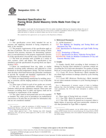
dian HillsDakota RidgeCentennialCherry Creek Arapahoe RdRdArapahoeFoxfieldCentennialInvernessColumbine ValleyColumbineKen nStonegateAuroraBrickCenterArapahoe CountyComancheCreek§ 470Lone TreeParkerElected Officials& StakeholdersBustang tlePinesNorthCastlePinesCastleRockThe PineryFranktownPonderosaParkElbert CountyElizabethDouglasCountyKiowaI-25 PEL: CO Springs Denver South ConnectionTour GuidePerry ParkLarkspurElbert§ October 7, 201625WestcreekPalmerLakeWoodmoorMonumentBlack ForestGleneagleTeller CountyWoodland ParkCascade-ChipitaParkEl radoSpringsPlanning and Environmental Linkages (PEL) Study
CentennialCherry Creek Arapahoe shMeridianStonegateWelcome!AuroraArapahoe County§ 470Lone TreeBrickCenterComancheCreekParkerOrganizations represented on this tour:CastlePinesNorthCastlePinesliaCastleRockThe PineryFranktownDouglasCountyrkLarkspur§ 25PalmerLakeWoodmoorMonumentGleneagleAir Force AcademyCastle Pines North Metro DistrictCity of Castle PinesCity ofPonderosaColoradoSpringsParkCity of Lone Tree Elbert CountyColorado ElizabethDepartment of TransportationKiowaColorado High Performance Transportation Enterprise BoardColorado House of RepresentativesColorado State SenateColorado Transportation CommissionDenver Regional Council of GovernmentsDouglas County ElbertEl Paso CountyFederal Highway AdministrationPerry Park Metropolitan DistrictPikes Peak Area Council of GovernmentsTown of Castle RockTown of LarkspurTown of MonumentTownof PalmerLakeBlack ForestEl PasoCountyPeytonUS House of RepresentativesAirForceAcademypage 1ColoradoSpringsColoradoSpringsI-25 PEL: CO Springs Denver South Connection
CentennialCherry Creek Arapahoe shMeridianStonegateAuroraBrickCenterProject BackgroundArapahoe County§ 470ComancheCreekLone The PineryFranktownDouglasCountyBetween Monument and C-470, I-25 experiences congestion on numerous days throughout the week.Weekday and weekend travel delays and unreliability frustrate travelers now and will only get worseas Colorado’s population grows from 5 to more than 8 million in the next 20 years. Congestion, high(75 mph) speeds, and climbing grades contribute to severe crashes and can lead to long periods ofhighway closures.CDOTPonderosainitiated this Planning and Environmental Linkages (PEL) Study to identify immediate andParklonger-termsolutionsto this vital stretch of highway connecting Colorado Springs and the DenverElbert CountySouth area.ElizabethThis stretch of I-25 between Monument and C-470 is important to corridor communitiesand travelers. I-25 is the onlyKiowanorth-south interstate route through Colorado, connecting the state’slargest population and employment centers; providing access to recreation and cultural amenities; andsupporting Homeland security and the military, interstate commerce, and tourism. This PEL study isthe first step to analyze and address safety, travel reliability, and mobility issues. Action is coming andwe need your help.rkLarkspurElbert§ PEL Study Vision25PalmerLakeWoodmoorMonumentBlack ForestGleneagleEl PasoCountyConduct a collaborative PEL process thatresults in a stakeholder supported roadmapfor implementing projects to improve safety,travel reliability, and mobility on this vitalstretch of I-25 between Colorado Springs andthe Denver South area.PeytonAirForceAcademypage 2ColoradoSpringsColoradoSpringsI-25 PEL: CO Springs Denver South Connection
CentennialCherry Creek Arapahoe shMeridianStonegateAuroraBrickCenterWhy is CDOT conducting this PEL study?Arapahoe County§ 470ComancheCreekLone The PineryCDOT is focused on developing a clear and supported plan of action for this critical stretch of I-25and, more importantly, forwarding projects that provide immediate and long-term benefits. AlthoughCDOT is fully committed to implementing improvements on I-25, the nature, timing, and funding ofthose projects is unknown. This PEL will lay the ground work for future improvements by: Helping to identify, define, and prioritize projects based on the corridor’s greatest needs.FranktownPonderosa Identifyingsignificant environmental constraints that may influence design options and/or delayParkElbert withCountylengthy environmental reviews.project developmentElizabethKiowaidentifying necessary financing and funding options to implement Clarifying project costs andimprovements.DouglasCounty Providing a framework for CDOT to engage with local corridor communities, regional travelers, andother interested stakeholders to understand their concerns and ideas for improvements.rkLarkspurElbert§ 25PalmerLakeConducting a thorough and inclusive analysis of theissues through the PEL process will save time in thelong-run if the recommended solutions alleviatetransportation problems, are supported, and reflectcommunity needs and values.WoodmoorMonumentBlack ForestGleneagleEl PasoCountyPeytonAirForceAcademypage 3ColoradoSpringsColoradoSpringsI-25 PEL: CO Springs Denver South Connection
CentennialCherry Creek Arapahoe sh11MeridianStonegateAurora§ k5The PineryFranktownComancheCreekC-470/I-25 InterchangeArapahoe CountyLone Tree2BrickCenter1The I-25/C-470/E470 interchange connects Colorado Springs and Denver South communities tosignificant regional destinations, including the I-70 mountain corridor and Denver International Airport.The I-25: CO Springs Denver South PEL study limits extend north to the interchange in recognitionof the prominent corridor travel pattern between Colorado Springs and the Denver metro area, theimportance to regional mobility of maintaining a seamless connection between C-470/E470 and I-25,and the importance of maximizing the substantial transportation investments underway and planned forthese roadways.PonderosaParkElbert ert§ 251011PalmerLakeWoodmoorMonumentBlack Forest12GleneagleEl PasoCountyPeytonAirForceAcademypage 4Shahn Sederberg CDOTColoradoSpringsColoradoSpringsI-25 PEL: CO Springs Denver South Connection
CentennialCherry Creek Arapahoe sh11MeridianStonegateAurora§ k5ComancheCreekI-25 Lane Balance ProjectArapahoe CountyLone Tree2BrickCenterThe I-25 Widening (Lane Balance) from Lincoln Avenue to County Line Road Project added 2 additionaltravel lanes (from 6 to 8) to I-25 between Lincoln Avenue and County Line Road. The project addresseda gap between the 8-lane TREX improvements, which ended at County Line Road north of C-470, andthe 8-lane South I-25/US85 EIS improvements, which ended at Lincoln Avenue south of C-470.The PineryFranktownPonderosaParkElbert ert§ 251011PalmerLakeWoodmoorMonumentBlack Forest12GleneagleEl PasoCountyPeytonAirForceAcademypage 5ColoradoSprings1ColoradoSpringsI-25 PEL: CO Springs Denver South Connection
S YOSEMILINCOLN teBArapahoe County§ BrickCenterAI-25CentennialCherry Creek Arapahoe in the City of Lone Tree, the RidgeGate mixed use development is planned for both east and west ofI-25. At 3,500 acres, RidgeGate will take several decades to develop and will ultimately have 12,000 newhomes, a variety of commercial and office development, and 30,000 residents. Construction is well underwayon the west side of I-25, with the Sky Ridge Medical Center, Lone Tree Recreation Center, Lone Tree ArtsCenter, Charles Schwab campus, and a variety of commercial and residential developments completed, andfull build out expected within the next couple of years. RTD began construction of the SE light rail extensionfrom Lincoln to RidgeGate earlier this year. The RidgeGate station will be a hub for additional mixed usedevelopment on the east side of I-25, which will build out for decades to come.CLone TreeMERIDIANCOMMONSComancheCreekDDBLUFFSREGIONAL liaThe Pinery5PonderosaParkFranktownElbert CountyC-470LegendPARK MEADOWS stleRockATE PARKWAYA6Kiowa7I-25AFuture Light Rail/Transit StationCity CenterBLincoln Commons MixedUse DistrictCommercial - Mixed UseCRecreational CenterResidential - Mixed UseDNeighborhood ParkRural ResidentialESky Ridge Medical CenterFRidgeGate Parkway InterchangeOpen SpaceI N T E R N AT I O N A LGWillow Creek ParkPublic UseHCottonwood Creek ParkIHappy Canyon ParkJBadger Gulch ParkTO DENVERAIRPORTE-470North8T.PEORIA ST.rkCSMERIDIANI N T E R N AT I O N A LBUSINESSCENTERQULONE TREEGOLFCOURSE9§ 25April 2013LINCOLN AVENUECoventry Development Corporation1041 Third AvenueNew York, New York 10065212-752-6164MERIDIANGOLF CLUBwww.ridgegatecolorado.comDisclaimer: This map is for illustration purposes only. It is an example of where certain types of usesmay be located in the future. However, the exact location of roads, parks, trails, housing, schools andBother uses shown on the map hasnot been finalized and must still be reviewed and approved by theCity of Lone Tree.AD10270 Commonwealth Street, Suite BLone Tree, CO 80124720-279-2581MERIDIANCOMMONS1390 Lawrence Street, Suite 200Denver, Colorado 80204303-623-5186I-2510ElbertS YOSEMITE ST.EBELarkspurG11EACPalmerLakeDBLUFFSREGIONAL PARKWoodmoorIHFEGDGRIMonumentBlack Forest12ATE PARKWAYJAGleneagleEl PasoCountyPeytonAirForceAcademypage 6ColoradoSpringsLegendColoradoSpringsI-25 PEL: CO Springs Denver South ConnectionAFuture Light Rail/Transit StationCity CenterBLincoln Commons MixedUse DistrictCommercial - Mixed UseCRecreational CenterResidential - Mixed Use
CentennialCherry Creek Arapahoe sh1MeridianStonegateAurora§ ck5The PineryComancheCreekLocal Transportation ProjectsArapahoe CountyLone Tree2BrickCenter3The City of Lone Tree and Douglas County continue to partner on new roadway projects and corridorenhancements to meet Denver South’s growing population, employment, and transportation demands.These have included the I-25 and Castle Pines Parkway interchange reconstruction; new Hess Road;new RidgeGate Parkway; Peoria Street extension; and Lincoln Avenue interchange improvements,corridor widening, and intersection enhancements, to name a few. These improvements providealternate routes and reduce congestion on major arterials. These improvements also reduce traveltimes and improve safety for local and regional travelers. Furthermore, a quality transportationsystemPonderosahelps to attract major employers like Charles Schwab, enhancing economic vitality.ParkFranktownElbert ert§ 251011PalmerLakeWoodmoorMonumentBlack Forest12GleneagleEl PasoCountyPeytonAirForceAcademypage 7Charles Schwab CampusColoradoSpringsColoradoSpringsI-25 PEL: CO Springs Denver South Connection
CentennialCherry Creek Arapahoe sh1MeridianStonegateAurora470Lone Rock5Castle Pines Development ProjectsArapahoe County§ ComancheCreekBrickCenterWith a population of approximately 10,000 residents and growing, the City of Castle Pines wasincorporated in 2008. In 2009, the City annexed property on the east side of I-25. The Lagae Ranchand Castle Pines Town Center developments underway on the west side of I-25 and the Canyonsdevelopment on the east side of I-25 will double the size of the City at build out.The tialPonderosaParkElbert CountyElizabethDouglasCounty6KiowaCastle Pines7VillageSquare8LagaeRanchrkLarkspur9 249 acres 631 dwelling units 400,000 SF mixed useElbert§ The Canyons 3,343 acres 2,500 dwelling units 2.1 M SF mixed useCastle PinesTown Center2510 354 acres 675 dwelling units 500,000 SF mixed use11PalmerLakeWoodmoorMonumentBlack Forest12GleneagleEl PasoCountyPeytonAirForceAcademypage 84ColoradoSpringsColoradoSpringsI-25 PEL: CO Springs Denver South Connection
CentennialCherry Creek Arapahoe sh1MeridianStonegateAurora§ kDouglasCounty55The PineryFranktown6ComancheCreekCastle Rock Development ProjectsArapahoe CountyLone Tree2BrickCenterThe Town of Castle Rock has added nearly 36,000 residents since 2000 and continues to grow quicklywith an expected population of 60,000 by 2020. Currently, because of the topography of the area,many of the residential developments are physically separated from each other. Retail and serviceoriented commercial uses are now beginning to develop in the outlying residential areas to serveindividual developments. The I-25 corridor serves primarily the higher intensity and larger scalecommercial and industrial uses and is a main travel route connecting new and established residentialareas throughout the Town. The recently opened Castle Rock Parkway/I-25 interchange was designedand constructedto relieve a significant amount of the traffic volume from the Founders/MeadowsPonderosaParkcorridor. Promenade,a new commercial and residential development, is currently in construction nearElbert Countythe new interchange. Community identity, small town flavor, clean environment, and natural scenicElizabethbeauty are some of the qualitiesof Castle Rock emphasized in the Town’s 2020 Master Plan.Kiowa78rkLarkspur9Elbert§ 251011PalmerLakeWoodmoorMonumentBlack Forest12GleneagleEl PasoCountyPeytonAirForceAcademypage 9ColoradoSpringsColoradoSpringsI-25 PEL: CO Springs Denver South Connection5
CentennialCherry Creek Arapahoe shMeridianStonegateAurora§ 470ParkerCastlePinesNorthliaCastleRockThe PineryFranktownDouglasCountyComancheCreekCorridor Infrastructure IssuesArapahoe CountyLone TreeCastlePinesBrickCenterI-25 through the study area is a high-speed facility with tight horizontal curves and steep verticalgrades. A mixture of 8-lane, 6-lane, and 4-lane sections are present. The 4-lane section, referred toas “the Gap” by some stakeholders, has been a particular area of focus because two lanes providelimited options for drivers to maneuver around slow moving vehicles, crashes, or other obstacles,especially when traffic volumes are high. A lack of alternate routes and a disconnected frontage roadsystem further complicate travel. Frontage roads, where available, parallel freight railroad tracks withclosely spaced, at-grade intersections. If a crash or other emergency forces closure of the lanes or thePonderosaentire highway,drivers can be stuck for hours. Snow plows and emergency vehicles have little room toParkElbert County Several of the 12 interchanges in the study have substandard horizontalmaneuver or stage operations.Elizabeth and inadequate acceleration and deceleration lanes, which also affects mainlineramp geometryKiowamobility as cars enter and exitthe highway. Within the corridor, two closed rest stops (one nowused as a truck chain-up area), port of entry/truck weigh stations, and a Bustang Park & Ride providechallenges for vehicles accessing the interstate but also present opportunities to optimize thosefunctions at these or alternate locations within the corridor.rkLarkspurElbert§ 25PalmerLakeWoodmoorMonumentBlack ForestGleneagleEl PasoCountyPeytonAirForceAcademypage 10ColoradoSpringsColoradoSpringsI-25 PEL: CO Springs Denver South Connection
CentennialCherry Creek Arapahoe dshMeridianStonegateAurora§ 470Lone ockDouglasCounty5“The Gap”Arapahoe CountyThe PineryFranktown6678rkComancheCreekParkThe number of lanesElberton aCountyfreeway segment influence the speed at which drivers can travel. As the numberof lanes increases,drivers are afforded a higher level of comfort and the opportunity to position theirElizabethKiowa to avoid slower moving vehicles. This ability to maneuver is mostvehicles within the traffic streamimpacted when slow moving vehicles pass slower moving vehicles, reducing speeds for both lanes. Butwith just two lanes and high rates of speed, corridor traffic operations within this section are volatile.Even minor disruptions such as entering ramp traffic or lane changing causes traffic shockwaves. Thetraffic stream has limited ability to dissipate these disruptions, which often leads to serious breakdownand queuing.Elbert§ 251011PalmerLakeWoodmoorMonumentBlack Forest12GleneagleEl PasoCountyPeytonAirForceAcademypage 11ColoradoSprings6For 16 miles between Monument and Castle Rock, I-25 is a 4-lane freeway section (2 lanes in eachdirection). This stretch where I-25 narrows between Colorado Springs and the Denver South area hasbeen referred to as “the Gap.” Largely undeveloped, views along this stretch of I-25 are expansive withdrivers able to see snowcapped Pikes Peak in the distance and rural ranches reminiscent of the settlementof the West. However, current congestion levels and high-profile traffic incidents regularly interrupt thisscenic drive, and corridor travelers and political leaders are anxious for corridor improvements. The4-lane capacityis seen not just as an impact to commuters but also tourism and the gsI-25 PEL: CO Springs Denver South Connection
CentennialCherry Creek Arapahoe dshMeridianStonegateAurora§ k5Grade ChangesArapahoe CountyLone Tree2BrickCenterThe PineryFranktownComancheCreekI-25 has long stretches of climbing grades in both the north and southbound directions. Trucks, whichhave a hard time negotiating the grades and curves in the corridor, comprise 5 to 7 percent of thetraffic but contribute disproportionately to congestion. Along the two-lane section traveling south fromPlum Creek Parkway to Monument, the grade is generally climbing. Trucks travel 10 to even 20 milesper hour slower than automobiles in these climbing sections. When trucks attempt to pass slowermoving trucks, corridor speeds slow, traffic backs up, and safety concerns with varying speeds arise.PonderosaParkElbert bert§ 251011PalmerLakeWoodmoorMonumentBlack Forest12GleneagleEl PasoCountyPeytonAirForceAcademypage 12ColoradoSprings7ColoradoSpringsI-25 PEL: CO Springs Denver South Connection
CentennialCherry Creek Arapahoe shMeridianStonegateAurora§ 470ParkerCastlePinesNorthliaCastleRockThe PineryFranktownComancheCreekCorridor Mobility & Operations IssuesArapahoe CountyLone TreeCastlePinesBrickCenterAverage daily traffic (ADT) along I-25 south of C-470 ranges from 122,000 to 63,000, with the highestvolumes on the north end of the corridor. The corridor is a major lifestyle and employment corridorfor commuters between the Denver metropolitan area and Colorado Springs, and approximately halfof the corridor trips are through trips with origins and destinations outside the study area. This trendis expected to continue as the primary travel demand is coming from the Colorado Springs area andEl Paso County, which by 2040 is projected to be the state’s most populous county. Congestion isprevalenttoday, and by 2035, CDOT projects that the entire stretch of highway will operate near orPonderosaParkabove capacity.Elbert � 25PalmerLakeWoodmoorMonumentBlack ForestGleneagleEl PasoCountyPeytonAirForceAcademypage 13ColoradoSpringsColoradoSpringsI-25 PEL: CO Springs Denver South Connection
CentennialCherry Creek Arapahoe Stonegate2§ eliabilityArapahoe CountyLone TreeliaThe PineryFranktownBrickCenterComancheCreek8With an increasing number of residents and drivers on our roadways, nearly all Colorado driversexperience – and plan around – traffic congestion as part of their daily activities. However, on manyprimary roadways like interstates, travel times vary greatly from day to day, and travelers are lesstolerant of unexpected delays. Comments and complaints received from corridor travelers nearlyevery day on this stretch of I-25 suggest that unexpected congestion and delays from incidents, weather,work zones, special events, fluctuations in demand, or other factors are especially frustrating. Travelersrememberthe bad days and report the bad days are becoming more common, even the norm. ThePonderosaParkFederal Highway Administration and departments of transportation across the country have come toElbert Countyrefer to unexpected traffic delays as a reliability KiowaThe PEL study will collect andanalyze data that characterize the reliability of travel in this corridor.Reliability measures will be included to assess how well proposed solutions address the needto provide a predictable and improved travel experience. The PEL study will also be looking atopportunities to improve operations in the short-term to reduce congestion and provide morepredictable travel times for users.788Travelers tend to remember the few bad days they spent in traffic,Elbertrather than the average time for travel throughout the year.Larkspur9§ 251011PalmerLakeWoodmoorMonumentBlack Forest12GleneagleEl PasoCountyPeytonSource: FHWA.2016. Travel TimeReliability Overview.AirForceAcademypage 14ColoradoSpringsColoradoSpringsI-25 PEL: CO Springs Denver South Connection
CentennialCherry Creek Arapahoe dshMeridianStonegateAurora§ k5The PineryFranktownComancheCreekAlternate Routes / Frontage RoadsArapahoe CountyLone Tree2BrickCenterDue to limited alternate routes and discontinuous frontage roads, incident management on I-25 ischallenging. This is particularly true when vehicles are diverted off I-25 at the Greenland interchangewhere the detour route along Noe Road and Spruce Mountain includes dirt roads and a passive railroadcrossing without an active warning device, such as flashing lights. The sparse number of dynamic messagesigns between Monument and Castle Rock do not provide adequate coverage for drivers to get thenecessary information in a timely fashion to make informed travel decisions. When drivers do divert tolocal roads to avoid delays on I-25, they often travel circuitously through local communities on roads notPonderosadesignedfor highway volumes or the mix of vehicles that includes heavy trucks.ParkElbert bert§ 251011PalmerLakeWoodmoorMonumentBlack Forest12GleneagleEl PasoCountyPeytonAirForceAcademypage 15ColoradoSprings9ColoradoSpringsI-25 PEL: CO Springs Denver South Connection
CentennialCherry Creek Arapahoe shMeridianStonegateAurora§ 470ParkerCastlePinesNorthliaCastleRockThe PineryFranktownDouglasCountyComancheCreekCorridor Safety IssuesArapahoe CountyLone TreeCastlePinesBrickCenterCDOT uses the concept of Level of Safety of Service (LOSS) to quantify the magnitude of safetyproblems and potential for improvements. LOSS reflects how the roadway segment is performing inregard to its expected crash frequency and severity for specific levels of daily traffic. LOSS III indicatesa moderate to high potential for crash reduction, and LOSS IV indicates a high potential for crashreduction.Through the I-25 PEL study limits, nearly 30 percent of the corridor operates at LOSS III or LOSS IV.Many locationsin the corridor have a high number of crashes, with multiple fatalities over the past fivePonderosaParkyears. Reduced safetyperformancelikely results from a combination of road geometry, tight curves,ElbertCountycongestion,Elizabethhigh travel speeds, and inclement weather conditions.KiowarkLarkspurElbert§ 25Number of Fatal Crashes (2010 to 2014)PalmerLakeWoodmoorMonumentBlack ForestGleneagleEl PasoCountyPeytonAirForceAcademypage 16ColoradoSpringsColoradoSpringsI-25 PEL: CO Springs Denver South Connection
CentennialCherry Creek Arapahoe dshMeridianStonegateAuroraBrickCenterSevere CrashesArapahoe County§ 470ComancheCreekLone ock5The PineryFranktownPonderosaParkElbert ert§ 10251011PalmerLakeWoodmoorMonumentBlack Forest12GleneaglePeyton“We need drivers to follow the directions of the emergency responders so wecan clear the blocked stuck cars and jackknifed semis and reopen the highway,” Micki Trost with Colorado Emergency Management said.AirForceAcademypage 17El PasoCountyColoradoSpringsColoradoSpringsI-25 PEL: CO Springs Denver South Connection10
CentennialCherry Creek Arapahoe shMeridianStonegateAurora§ 470ParkerCastlePinesNorthliaCastleRockThe PineryFranktownComancheCreekCorridor Environmental IssuesArapahoe CountyLone TreeCastlePinesBrickCenterThe I-25 corridor between Colorado Springs and the Denver South area is characterized by scenicvistas, open spaces, and small communities bookended by the state’s two largest urban areas. Becauseof the limited development through the middle of the corridor, promoted by significant conservationeasements and public open space lands, the study area is rich in natural resources and recreationalamenities. Streams and wetlands meander along and under the highway and provide riparian habitatfor protected wildlife species. One of the state’s most important paleontological sites, the Castle RockRain Forest,straddles the highway. Community interest and regulatory issues may limit options toPonderosaParkexpand the highway Elbertfootprintthrough these sensitive lbert§ 25PalmerLakeWoodmoorMonumentBlack ForestGleneagleEl PasoCountyPeytonAirForceAcademypage 18ColoradoSpringsColoradoSpringsI-25 PEL: CO Springs Denver South Connection
CentennialCherry Creek Arapahoe dshMeridianStonegateAuroraBrickCenterOpen Space & Conservation EasementsArapahoe County§ 470ComancheCreekLone ock5The PineryFranktownPonderosaParkElbert ert§ 25101111PalmerLakeWoodmoorMonumentBlack Forest12GleneaglePeytonGreenland and open space history videoAirForceAcademypage 19El PasoCountyColoradoSpringsColoradoSpringsI-25 PEL: CO Springs Denver South Connection11
48got,edhingthetog.dGreenland TrailTake Plenty of Water &Know Your LimitationsWater is available at thetrailhead. The 4.6-miletrail from Greenland toCounty Line Road is fairlylevel, then crosses theroad and loops for about1 mile to the trailhead inPalmer Lake. The 8.5-mileKipps Loop has about500 feet of elevation gain.Map and Trail TipsDress in LayersWeather changes rapidly near the Palmer Divide.Be Courteous and CommunicateTrail users have varying abilities and modes oftravel, so be friendly and not startle others whenpassing.Enjoy viewing wildlife throughout the open space.You may expect to see elk, mule deer, coyotes, turtles,leopard frogs, foxes, porcupines, thirteen-lined groundsquirrels and many varieties of birds. Please keep arespectful distance.Keep Right & Pass LeftThis rule of thumb will eliminate indecision. Step tothe right side of the trail if you stop.Stay on Designated TrailsWildlife and native plants will survive better.Keep Dogs on LeashHelp lessen conflicts with other trail users andwildlife and protect your own dog’s safety.Douglas CountyObey Open SpaceRules & RegulationsOpen SpaceAn abbreviated set isavailable at the trailhead.Complete rules available at www.douglas.co.usmaalovainthbyTake Plenty of Water &Know Your LimitationsWater is available at thetrailhead. The 4.6-miletrail from Greenland toCounty Line Road is fairlylevel, then crosses theroad and loops for about1 mile to the trailhead inPalmer Lake. The 8.5-mileKipps Loop has about500 feet of elevation gain.Map and Trail TipsWeather changes rapidly near the Palmer Divide.Be Courteous and CommunicateTrail users have varying abilities and modes oftravel, so be friendly and not startle others whenpassing.Keep Right & Pass LeftpositthsapoindYolesqreThis rule of thumb will eliminate indecision. Step tothe right side of the trail if you stop.Stay on Designated TrailsHelp lessen conflicts with other trail users andwildlife and protect your own dog’s safety.fopapeinfforrawhoaDress in LayersKeep Dogs on LeashRespect Private PropertyLand outside the fences is privately owned.Bearproof trash cansare at the trailhead.Greenland TrailWildlife and native plants will survive better.Respect Private PropertyPack Out Your LitterTips For the TrailCourtesy John FielderingGreenland TrailThis magnificent landscape has been protected withmany partners for its conservation values. The scenic viewshedalong I-25, historical value, natural resources and recreationalvalues are tremendous. The 17,000 acres east of I-25 is protectedin private conservation easements. West of I-25, 3,600 acres withthe Greenland trail is open to the public. Adjacent land protectedby Douglas County will be opened as trails are built.At the Greenland trailhead, you will find plenty of parkingfor car
Arapahoe Rd. uV. 470 § 25 § 470. d. Teller County Arapahoe County Clear Creek County Douglas County Elbert County El Paso County Jefferson County Park County. Centennial Colorado Springs Aurora Kiowa Elizabeth Littleton Castle Pines North Parker Lone Tree Larkspur Castle Rock Woodland Park Palmer Lake Monument Colorado Springs .