Transcription
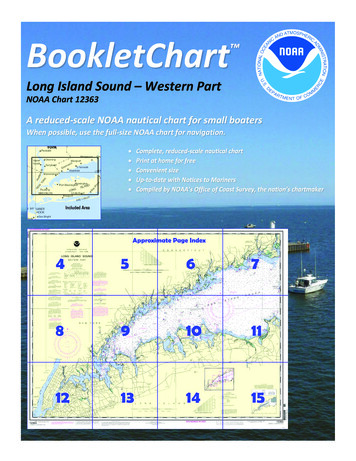
BookletChart Long Island Sound – Western PartNOAA Chart 12363A reduced-scale NOAA nautical chart for small boatersWhen possible, use the full-size NOAA chart for navigation.
Published by theNational Oceanic and Atmospheric AdministrationNational Ocean ServiceOffice of Coast Surveywww.NauticalCharts.NOAA.gov888-990-NOAAWhat are Nautical Charts?Nautical charts are a fundamental tool of marine navigation. They showwater depths, obstructions, buoys, other aids to navigation, and muchmore. The information is shown in a way that promotes safe andefficient navigation. Chart carriage is mandatory on the commercialships that carry America’s commerce. They are also used on every Navyand Coast Guard ship, fishing and passenger vessels, and are widelycarried by recreational boaters.What is a BookletChart ?This BookletChart is made to help recreational boaters locatethemselves on the water. It has been reduced in scale for convenience,but otherwise contains all the information of the full-scale nauticalchart. The bar scales have also been reduced, and are accurate whenused to measure distances in this BookletChart. See the Note at thebottom of page 5 for the reduction in scale applied to this chart.Whenever possible, use the official, full scale NOAA nautical chart fornavigation. Nautical chart sales agents are listed on the Internet athttp://www.NauticalCharts.NOAA.gov.This BookletChart does NOT fulfill chart carriage requirements forregulated commercial vessels under Titles 33 and 44 of the Code ofFederal Regulations.Notice to Mariners Correction StatusThis BookletChart has been updated for chart corrections published inthe U.S. Coast Guard Local Notice to Mariners, the National GeospatialIntelligence Agency Weekly Notice to Mariners, and, where applicable,the Canadian Coast Guard Notice to Mariners. Additional chartcorrections have been made by NOAA in advance of their publication ina Notice to Mariners. The last Notices to Mariners applied to this chartare listed in the Note at the bottom of page 7. Coast Pilot excerpts arenot being corrected.For latest Coast Pilot excerpt visit the Office of Coast Survey website hart.php?chart 12363(Selected Excerpts from Coast Pilot)Western Long Island Sound is that portion ofthe deep navigable waterway between theshores of Connecticut and New York and thenorthern coast of Long Island westward ofthe line between Bridgeport and Old FieldPoint.This region has boulders and broken ground,with little or no natural change in the shoals.The waters are well marked by navigationalaids so that strangers should experience nodifficulty in navigating them. As all broken ground is liable to be strewnwith boulders, vessels should proceed with caution when in the vicinityof broken areas where the charted depths are less than 6 to 8 feetgreater than the draft. All of the more important places are enteredthrough dredged channels. During fog, vessels are advised to anchoruntil the weather clears before attempting to enter. The numerousoyster grounds in this region are usually marked by stakes and flags.These stakes may become broken off and form obstructions dangerousto small craft which, especially at night, should proceed with cautionwhen crossing oyster areas.The effect of strong winds, in combination with the regular tidal action,may at times cause the water to fall several feet below the plane ofreference of the charts.About 1.3 miles northward of Eatons Neck Light the ebb runs about 5hours longer than the flood. The current has a velocity of 1.4 knots; theflood sets 283 and the ebb sets 075 .The direction and velocity of the currents are affected by strong windswhich may increase or diminish the periods of flood or ebb. Directionsand velocities from Point Judith to Throgs Neck for each hour of the tidalcycle will be found in Tidal Current Charts, Long Island Sound and BlockIsland Sound. Currents in East River are described in the latter part ofthis chapter.These waters are more protected than the eastern Sound resulting infewer gales. However, winters are colder and summers warmer due tothis sheltering effect. Fog is not so frequent either and tends to burn offquicker than farther east. Winter winds of 16 knots or more are likelyabout 12 to 15 percent of the time and are predominantly from the westthrough northwest. Harbors such as Cold Spring, Oyster Bay, Hempsteadand Manhasset offer additional shelter. In summer thunderstorms maydevelop on 4 to 5 days per month. These are most likely during theafternoon or evening.In Long Island Sound the north and south shores are equally subject tofog, except that on spring and summer mornings, when there is little orno wind, fog will often hang along the Connecticut shore while it is clearoffshore and southward.In the western end of Long Island Sound, although fogs are liable tooccur at any time, they are not encountered so often nor do theygenerally last so long as farther eastward.Old Field Point, about 5 miles southward of Stratford Shoal (MiddleGround) Light, is a low bluff with a light and an abandoned tower on itssummit. Boulders extend a short distance off the point, and the lightshould be given a berth of about 0.3 mile, even by small craft. A gongbuoy is 0.6 mile northward of the point. Depths of 14 to 18 feet arefound about 0.4 mile northward of the light.Smithtown Bay, a broad open bight on the south side of the sound,extends 7 miles westward from Crane Neck Point. Rocky shoals extend 1mile in places from the shore, the water shoaling from 51 feet in places.Stamford Harbor, Dangers.–The Cows comprise a cluster of rocks,almost bare at low water, about 0.8 mile south-southeast of ShippanPoint. Between them and the point is an area of foul ground and rocksbare and awash that extends 0.4 mile southward of Shippan Point. Alighted bell buoy is about 0.2 mile south of The Cows. Harbor Ledge,about 200 yards south of the west breakwater, consists of rocks and aledge marked by a private lightNorthport Basin, Caution.–Eatons Neck Basin Channel is maintainedexpressly to enhance the Eatons Neck Coast Guard Station’s rescueresponse. Further, Eatons Neck Basin has become one of the mostcongested small-boat anchorages in the area in the summer. Marinersare cautioned that heavy wakes from rescue craft departing the stationmay be experienced by small craft anchoring in this area. Shoals withdepths of 4 to 18 feet extend about 0.9 mile northward of Eatons Neckand broken ridges extend northward for another 1.8 miles. Thenorthern end of each area is marked by a buoy.U.S. Coast Guard Rescue Coordination Center24 hour Regional Contact for EmergenciesRCC Boston2Commander1st CG DistrictBoston, MA(617) 223-8555
Lateral System As Seen Entering From Seawardon navigable waters except Western RiversPORT SIDEODD NUMBERED AIDSGREEN LIGHT ONLYFLASHING (2)FLASHINGOCCULTINGQUICK FLASHINGISOPREFERRED CHANNELNO NUMBERS – MAY BE LETTEREDPREFERRED CHANNELNO NUMBERS – MAY BE LETTEREDPREFERRED CHANNEL TOSTARBOARDTOPMOST BAND GREENPREFERRED CHANNELTO PORTTOPMOST BAND REDGREEN LIGHT ONLYRED LIGHT ONLYFLASHING (2)FLASHINGOCCULTINGQUICK FLASHINGISORED LIGHT ONLYCOMPOSITE GROUP FLASHING (2 1)COMPOSITE GROUP FLASHING (2 1)812"1"Fl G 6sLIGHTGR "A"Fl (2 1) G 6sG "9"Fl G 4s5DAYBEACON"2"Fl R 6sRG "B"Fl (2 1) R 6sG"5"UCGR"U"RGN "C"GRC "S"CANG6RG"G"NUNFor more information on aids to navigation, including those on Western Rivers, please consult the latest USCG Light List for your area.These volumes are available online at http://www.navcen.uscg.govRN "6"NUNR "8"Fl R 4sLIGHTED BUOYLIGHTLIGHTED BUOYGC "1"CANSTARBOARD SIDEEVEN NUMBERED AIDS2DAYBEACONR"2"
VHF Marine Radio channels for use on thewaterways:Channel 6 – Inter-ship safety communications.Channel 9 – Communications between boats andship-to-coast.Channel 13 – Navigation purposes at bridges, locks, andharbors.EMERGENCY INFORMATIONChannel 16 – Emergency, distress and safety calls toCoast Guard and others, and to initiate calls to othervessels. Contact the other vessel, agree to another channel, and then switch.Channel 22A – Calls between the Coast Guard and the public. Severe weatherwarnings, hazards to navigation and safety warnings are broadcast here.Channels 68, 69, 71, 72 and 78A – Recreational boat channels.Distress Call Procedures Make sure radio is on. Select Channel 16. Press/Hold the transmit button. Clearly say: “MAYDAY, MAYDAY, MAYDAY.” Also give: Vessel Name and/or Description;Position and/or Location; Nature ofEmergency; Number of People on Board. Release transmit button. Wait for 10 seconds — If no responseRepeat MAYDAY call.Getting and Giving Help — Signal other boaters using visual distress signals (flares,orange flag, lights, arm signals); whistles; horns; and on your VHF radio. You arerequired by law to help boaters in trouble. Respond to distress signals, but do notendanger yourself.HAVE ALL PERSONS PUT ON LIFE JACKETS!NOAA Weather Radio All Hazards (NWR) is a nationwide network of radio stations broadcasting continuousweather information directly from the nearest National Weather Service office. NWR broadcasts official WeatherService warnings, watches, forecasts and other hazard information 24 hours a day, 7 days a week.http://www.nws.noaa.gov/nwr/Quick ReferencesNautical chart related products and information - http://www.nauticalcharts.noaa.govQRInteractive chart catalog - .shtmlReport a chart discrepancy - hart and chart related inquiries and comments - page ContactUsChart updates (LNM and NM corrections) - http://www.nauticalcharts.noaa.gov/mcd/updates/LNM NM.htmlCoast Pilot online - htmTides and Currents - http://tidesandcurrents.noaa.govMarine Forecasts - http://www.nws.noaa.gov/om/marine/home.htmNational Data Buoy Center - http://www.ndbc.noaa.gov/NowCoast web portal for coastal conditions - http://www.nowcoast.noaa.gov/National Weather Service - http://www.weather.gov/National Hurrican Center - http://www.nhc.noaa.gov/Pacific Tsunami Warning Center - http://ptwc.weather.gov/Contact Us - tmFor the latest news from Coast Survey, follow @NOAAchartsThis Booklet chart has been designed for duplex printing (printed on front and back of one sheet). If a duplex optionis not available on your printer, you may print each sheet and arrange them back-to-back to allow for the properlayout when viewing.NOAA’s Office of Coast SurveyThe Nation’s Chartmaker
buoy is 0.6 mile northward of the point. Depths of 14 to 18 feet are found about 0.4 mile northward of the light. Smithtown Bay , a broad open bight on the south side of the sound, extends 7 miles westward from Crane Neck Point. Rocky shoals extend 1 mile in places from the shore, the water shoaling from 51 feet in places. Stamford Harbor, Dangers.