Transcription
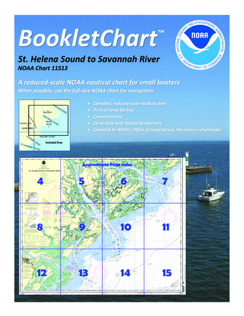
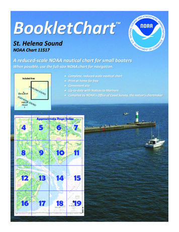
BookletChart St. Helena SoundNOAA Chart 11517A reduced-scale NOAA nautical chart for small boatersWhen possible, use the full-size NOAA chart for navigation.
Published by theNational Oceanic and Atmospheric AdministrationNational Ocean ServiceOffice of Coast Surveywww.NauticalCharts.NOAA.gov888-990-NOAAWhat are Nautical Charts?Nautical charts are a fundamental tool of marine navigation. They showwater depths, obstructions, buoys, other aids to navigation, and muchmore. The information is shown in a way that promotes safe andefficient navigation. Chart carriage is mandatory on the commercialships that carry America’s commerce. They are also used on every Navyand Coast Guard ship, fishing and passenger vessels, and are widelycarried by recreational boaters.What is a BookletChart ?This BookletChart is made to help recreational boaters locatethemselves on the water. It has been reduced in scale for convenience,but otherwise contains all the information of the full-scale nauticalchart. The bar scales have also been reduced, and are accurate whenused to measure distances in this BookletChart. See the Note at thebottom of page 5 for the reduction in scale applied to this chart.Whenever possible, use the official, full scale NOAA nautical chart fornavigation. Nautical chart sales agents are listed on the Internet athttp://www.NauticalCharts.NOAA.gov.This BookletChart does NOT fulfill chart carriage requirements forregulated commercial vessels under Titles 33 and 44 of the Code ofFederal Regulations.Notice to Mariners Correction StatusThis BookletChart has been updated for chart corrections published inthe U.S. Coast Guard Local Notice to Mariners, the National GeospatialIntelligence Agency Weekly Notice to Mariners, and, where applicable,the Canadian Coast Guard Notice to Mariners. Additional chartcorrections have been made by NOAA in advance of their publication ina Notice to Mariners. The last Notices to Mariners applied to this chartare listed in the Note at the bottom of page 7. Coast Pilot excerpts arenot being corrected.For latest Coast Pilot excerpt visit the Office of Coast Survey website hart.php?chart 11517.(Selected Excerpts from Coast Pilot)The entrance to St. Helena Sound is 7 mileswide between Bay Point, the southernextremity of Edisto Island, on the northeastand Hunting Island on the southwest. The132-foot Hunting Island Light (32 22'32"N.,80 26'16"W.), and the elevated tank on thenorthern part of Hunting Island make goodlandmarks. There are several channelsthrough the shoals which extend about 6miles seaward from the sound entrance. In1983, the buoyed channel had a reporteddepth of 15 feet; caution is advised. The mean range of tide on the barand in the entrance to the sound is about 6 feet. In 1973, a surveyrevealed depths of 1 foot to 14 feet less than those charted across theentrance to St. Helena Sound. Caution is advised in navigating this area.In 1992, a partially submerged wreck was 2.0 miles northeast of SouthEdisto River Approach Lighted Buoy A in about 32 26.0'N., 80 16.0'W.Most important of the several navigable rivers emptying into the soundare South Edisto, Ashepoo, Coosaw, Morgan, and Harbor Rivers; the firstthree are links in the route of the Intracoastal Waterway. The AshepooCombahee-Edisto (ACE) Basin National Estuarine Research Reserve andNational Wildlife Refuge are Marine Protected Areas (MPA) in thecentral portion of St. Helena Sound.South Edisto River, which empties into St. Helena Sound immediatelywestward of Bay Point, is of little commercial importance. The approachto the river is marked by buoys. The river above its junction with DawhoRiver, about 18 miles above Bay Point, is known as Edisto River. Big BayCreek is unmarked and empties into the east side of South Edisto Riverjust above Bay Point. A marina about 0.3 mile above the creek entranceon the south side has transient berths, gasoline, diesel fuel, pump-out,water, ice, and supplies. It has been reported that small craft have runaground at night when making Big Bay Creek from the northward byusing the street and house lights on Edisto Beach as guides; extremecaution is advised.Edisto Beach State Park is about 2 miles northeastward of Bay Point. Amarked channel into South Edisto River, about 3 miles southeastward ofBay Point, has depths of 12 to 16 feet over the ocean bar.An unmarked fish haven is on the northeast side of South Edisto Riverabout 4.5 miles above Bay Point in about 32 32.3'N., 80 23.3'W.The Intracoastal Waterway leads through South Edisto River fromlandcuts at Fenwick Cut and Watts Cut, about 5.3 miles and 11.3 milesabove Bay Point, respectively. This section of the river, between FenwickCut and Watts Cut, is marked in accordance with Intracoastal Waterwaymarkings. In 1983, the reported controlling depth from Bay Point to thejunction with the Intracoastal Waterway at Fenwick Cut was 10 feet, andfrom Watts Cut to Willtown Bluff, about 20 miles above Bay Point, thereported controlling depth was 10 feet.The river is usually entered from the Intracoastal Waterway; theentrance from the ocean is rarely used.Currents.–Currents at the entrance have a velocity of about 2 knots;predictions may be obtained from the Tidal Current Tables. A draft ofabout 3 feet can be taken for about 8 miles above Willtown Bluffto Jacksonboro.Ashepoo River, about 4.5 miles westward of Bay Point, flows into St.Helena Sound from northward on the west side of Otter Islands. Ahighway bridge over the river, 13 miles above the mouth, has a fixedspan with a clearance of 20 feet. The side piers of a former swing bridgeadjacent westward of the fixed bridge are used as fishing piers. Anoverhead power cable just westward of the bridge has a clearance of 63feet, and another overhead power cable 4 miles above the bridge has aclearance of 84 feet. Mariners are advised to navigate with caution,because depths vary greatly in the river.Morgan River flows into St. Helena Sound from westward. The river isabout 8 miles long and at its head connects with Chowan Creek, atributary of Beaufort River. At the divide, this passage is nearly dry atlow water where U.S. Route 21 highway bridge has a 28-foot fixed spanwith a clearance of 4 feet. The mean range of tide near the head ofMorgan River is about 7 feet. Coffin Creek is on the south side ofMorgan River near the mouth.U.S. Coast Guard Rescue Coordination Center24 hour Regional Contact for EmergenciesRCC Miami2Commander7th CG DistrictMiami, FL(305) 415-6800
Lateral System As Seen Entering From Seawardon navigable waters except Western RiversPORT SIDEODD NUMBERED AIDSGREEN LIGHT ONLYFLASHING (2)FLASHINGOCCULTINGQUICK FLASHINGISOPREFERRED CHANNELNO NUMBERS – MAY BE LETTEREDPREFERRED CHANNELNO NUMBERS – MAY BE LETTEREDPREFERRED CHANNEL TOSTARBOARDTOPMOST BAND GREENPREFERRED CHANNELTO PORTTOPMOST BAND REDGREEN LIGHT ONLYRED LIGHT ONLYFLASHING (2)FLASHINGOCCULTINGQUICK FLASHINGISORED LIGHT ONLYCOMPOSITE GROUP FLASHING (2 1)COMPOSITE GROUP FLASHING (2 1)812"1"Fl G 6sLIGHTGR "A"Fl (2 1) G 6sG "9"Fl G 4s5DAYBEACON"2"Fl R 6sRG "B"Fl (2 1) R 6sG"5"UCGR"U"RGN "C"GRC "S"CANG6RG"G"NUNFor more information on aids to navigation, including those on Western Rivers, please consult the latest USCG Light List for your area.These volumes are available online at http://www.navcen.uscg.govRN "6"NUNR "8"Fl R 4sLIGHTED BUOYLIGHTLIGHTED BUOYGC "1"CANSTARBOARD SIDEEVEN NUMBERED AIDS2DAYBEACONR"2"
VHF Marine Radio channels for use on thewaterways:Channel 6 – Inter-ship safety communications.Channel 9 – Communications between boats andship-to-coast.Channel 13 – Navigation purposes at bridges, locks, andharbors.EMERGENCY INFORMATIONChannel 16 – Emergency, distress and safety calls toCoast Guard and others, and to initiate calls to othervessels. Contact the other vessel, agree to another channel, and then switch.Channel 22A – Calls between the Coast Guard and the public. Severe weatherwarnings, hazards to navigation and safety warnings are broadcast here.Channels 68, 69, 71, 72 and 78A – Recreational boat channels.Distress Call Procedures Make sure radio is on. Select Channel 16. Press/Hold the transmit button. Clearly say: “MAYDAY, MAYDAY, MAYDAY.” Also give: Vessel Name and/or Description;Position and/or Location; Nature ofEmergency; Number of People on Board. Release transmit button. Wait for 10 seconds — If no responseRepeat MAYDAY call.Getting and Giving Help — Signal other boaters using visual distress signals (flares,orange flag, lights, arm signals); whistles; horns; and on your VHF radio. You arerequired by law to help boaters in trouble. Respond to distress signals, but do notendanger yourself.HAVE ALL PERSONS PUT ON LIFE JACKETS!NOAA Weather Radio All Hazards (NWR) is a nationwide network of radio stations broadcasting continuousweather information directly from the nearest National Weather Service office. NWR broadcasts official WeatherService warnings, watches, forecasts and other hazard information 24 hours a day, 7 days a week.http://www.nws.noaa.gov/nwr/Quick ReferencesNautical chart related products and information - http://www.nauticalcharts.noaa.govQRInteractive chart catalog - .shtmlReport a chart discrepancy - hart and chart related inquiries and comments - page ContactUsChart updates (LNM and NM corrections) - http://www.nauticalcharts.noaa.gov/mcd/updates/LNM NM.htmlCoast Pilot online - htmTides and Currents - http://tidesandcurrents.noaa.govMarine Forecasts - http://www.nws.noaa.gov/om/marine/home.htmNational Data Buoy Center - http://www.ndbc.noaa.gov/NowCoast web portal for coastal conditions - http://www.nowcoast.noaa.gov/National Weather Service - http://www.weather.gov/National Hurrican Center - http://www.nhc.noaa.gov/Pacific Tsunami Warning Center - http://ptwc.weather.gov/Contact Us - tmFor the latest news from Coast Survey, follow @NOAAchartsThis Booklet chart has been designed for duplex printing (printed on front and back of one sheet). If a duplex optionis not available on your printer, you may print each sheet and arrange them back-to-back to allow for the properlayout when viewing.NOAA’s Office of Coast SurveyThe Nation’s Chartmaker
The entrance to St. Helena Sound is 7 miles wide between Bay Point, the southern extremity of Edisto Island , on the northeast and Hunting Island on the southwest. The 132- foot Hunting Island Light (32 22'32"N., 80 26'16"W.), and the elevated tank on the northern part of Hunting Island make good landmarks. There are several channels