Transcription
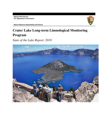
National Park ServiceU.S. Department of the InteriorNatural Resource Stewardship and ScienceCrater Lake Long-term Limnological MonitoringProgramState of the Lake Report: 2018
ON THIS PAGEMap showing some of the long-term sampling and sensor locations throughout Crater Lake.Map courtesy of the National Park ServiceON THE COVERPhotograph of Crater LakePhotograph courtesy of Caitlin Hosken and the National Park Serviceii
Crater Lake Long-term Limnological MonitoringProgramState of the Lake Report: 2018Scott Girdner1, Mark Buktenica1, Jeremy Mack11National Park ServiceCrater Lake National ParkCrater Lake, OR 97604March 2019U.S. Department of the InteriorNational Park ServiceCrater Lake National ParkCrater Lake, Oregoniii
ContentsPageFigures. viTables.viiiExecutive Summary .ixAcknowledgments.xii1.0 Introduction. 11.1 Long-term Lake Monitoring Program . 11.2 Crater Lake Overview . 21.3 Sampling Variables . 32.0 Analysis of Long-term Trends . 43.0 Special Projects.53.1 Global Lake Ecological Observatory Network (GLEON) . 53.2 Nearshore clarity: Algae blooms .63.3 Nearshore clarity: Monitoring spatial distribution of algae. 73.4 Nearshore clarity: New technology to monitor algae growth. 84.0 Optical Properties.94.1 Water Clarity: Secchi Depth (since 1978).94.2 Water Clarity: Particle Density (since 1988). 104.3 Water Clarity: Light Penetration (since 1980) . 115.0 Climate. 125.1 Present and future air temperature.125.2 Air Temperature by Season (since 1931) . 135.3 Snowpack (since 1935). 145.4 Climate and Lake Level (since 1961). 156.0 Thermal Properties. 166.1 Summer Surface Water Temperature (since 1965) .166.2 Summer water column temperature (start date depth dependent) . 17iv
6.3 Onset of Thermal Stratification (since 1966) . 186.4 Drivers of Thermal Stratification .196.5 Summer Thermocline Depth (since 1978) . 207.0 Mixing Processes .217.1 Episodic Deep-Water Mixing Events (since 1992) .217.2 Influence of Winter Mixing on Deep-Water Nitrate Storage (since 1989) .227.3 Impact of Winter Mixing on Surface Water Clarity (since 1988). 237.4 Predicting Winter Mixing in a Warming Climate . 248.0 Biological Properties. 258.1 Phytoplankton Abundance: Particle Density (since 1988) . 258.2 Phytoplankton Growth: Primary Productivity (since 1987) . 268.3 Phytoplankton Composition (since 1989) . 278.4 Zooplankton Composition (since 1985) . 288.5 Impact of Fish on Zooplankton (since 1986) . 298.6 Native Newts and Invasive Crayfish (since 2008) . 308.7 Horizontal movement of Crayfish (since 2014) . 318.8 Vertical movement of Crayfish .328.9 Why are Crayfish more abundant now? . 339.0 Year-round Lake Monitoring . 349.1 Profiling Instrument (since 2013).349.2 Profiler: Chlorophyll Results (since 2013). 359.3 Profiler: Particle Density Results (since 2013) . 36v
FiguresPageFigure 1. USGS shaded relief perspective image of Crater Lake looking southwest. . 2Figure 2. Temperature (A) and fluorescence (B) data collected from nearshore areas ofCrater Lake on July 26, 2018. . 7Figure 3. Hourly dissolved oxygen concentration measured at Cleetwood Cove,September 1-8, 2018. Blue line represents fit of locally weighted regression(bandwith 0.2). 8Figure 4. Long-term record of Secchi disk depth in Crater Lake (1978-2018). .9Figure 5. Relationship between average Cp and Secchi depth in Crater Lake. . 10Figure 6. Long-term record of apparent Secchi depth calculated from Cp in Crater Lake(1988-2018). 10Figure 7. Long-term record of depth which 1% of blue light reaches in Crater Lake(1980-2017). 11Figure 8. Observed and predicted maximum and minimum air temperatures at CraterLake National Park headquarters. . 12Figure 9. Long-term seasonal air temperature at Crater Lake National Park headquarters(1931-2018). Blue line represents fit of locally weighted regression (bandwith 0.2). . 13Figure 10. Snowpack water content at the beginning of April at Crater Lake NationalPark headquarters (19355-2018). Dashed black line represents the long-term average. . 14Figure 11. Snowfall (bottom) and surface elevation (top) measurements from CraterLake National Park, over the period 1962 to present. Blue lines represent fits of locallyweighted regressions (bandwith 0.2). Black lines represent fits of linear regression.Dashed black lines represent the long-term averages. . 15Figure 12. Long-term records of surface water temperature (A) and summer airtemperature (B) at Crater Lake National Park. Blue lines represent fits of locallyweighted regressions (bandwith 0.2). . 16Figure 13. Long-term record of water column temperature in Crater Lake. The length ofrecord is based on depth. For example, the record of surface temperature started in 1965,whereas deep water monitoring began in the late 1980s. . 17Figure 14. Long-term record of onset of thermal stratification in Crater Lake. . 18Figure 15. Chlorophyll fluorescence from 1/2017 to 1/2018 in Crater Lake. Dashed whiteline represents stratification. . 18vi
Figure 16. Relationship between spring air temperature and onset of thermalstratification in Crater Lake. . 19Figure 17. Relationship between snow depth on April 1 and onset of thermalstratification in Crater Lake. . 19Figure 18. Water temperature from 7/2015 to 1/2016 in Crater Lake. . 20Figure 19. Long-term record of summer thermocline depth in Crater Lake. 20Figure 20. Long-term record of deep-water temperature in Crater Lake. Blue circleshighlight deep-water mixing events. . 21Figure 21. Temperature data showing a deep-water mixing event in 2011 in Crater Lake. . 21Figure 22. Nitrate dynamics in Crater Lake: (A.) Concentration throughout the watercolumn and (B.) changes in deep-water nitrate concentration with (C.) correspondingdecreases in water temperature. . 22Figure 23. Comparison of average Cp throughout the top 30 m of Crater Lake, after thefive biggest mixing years and five non-mixing years. . 23Figure 24. Results of model simulations predicting water temperature in Crater Lake,under future climate conditions. 24Figure 25. Particle density change with depth in Crater Lake. .25Figure 26. Long-term record of particle density in (A) surface (1-30 m) and (B) deeperwater (31-200 m) in Crater Lake. 25Figure 27. Average carbon uptake ( SE) measured at 13 depths during mid-day in CraterLake. 26Figure 28. Long-term record of carbon uptake integrated over two intervals: 1-30 m(black) and 40-180m (blue). 26Figure 29. Long-term record of phytoplankton assemblages in Crater Lake in August attwo locations within the water column: (A) 0-20 m and (B) 60-80 m. 27Figure 30. Long-term record of zooplankton assemblages in summer in Crater Lake. . 28Figure 31. Long-term record of population dynamics of kokanee salmon and their mainfood source, Daphnia, including (A) abundance, (B) weight, and (C) percent of thepopulation that is mature. 29Figure 32. Survey results for newts and crayfish along the shoreline of Crater Lake in2008 and 2018. Circle size is relative to abundance. . 30Figure 33. Survey results for crayfish movement along the shoreline of Crater lake 20142018. Circle size is relative to abundance.31vii
Figure 34. Crayfish density in summer and average surface water temperature in winter. . 33Figure 35. Average winter air temperature measured at Park HQ from 1931-2018.Yellow box highlights the time period of crayfish surveys. Red circles indicatedtemperatures above the long-term average (dashed line). 33Figure 36. Daily measurements of chlorophyll fluorescence throughout the water columnin Crater Lake, collected by an autonomous profiling instrument. White spaces representmissing data. . 35Figure 37. Daily measurements of particle density throughout the water column in CraterLake, collected by an autonomous profiling instrument. White spaces represent missingdata. 36TablesPageTable 1. Characteristics of Crater Lake. 2Table 2. Summary of lake monitoring activities at Crater Lake. . 3Table 3. Summary of lake monitoring activities . 4viii
Executive SummaryThe goal of the long-term limnological monitoring program (LTLMP) at Crater Lake is to ensurethe health and preservation of this national treasure. The program serves as a monitoring andresearch platform to develop and communicate a better understanding of biological, physical,geochemical, and climatological processes that affect the lake. Protected areas like Crater LakeNational Park play a key role in answering important questions in ecosystem and earth sciences.Crater Lake’s isolation from direct human influence and its protected status within a National Parkmake it an ideal case-study for how a lake interacts with the surrounding environment and isaffected by longer-term changes in climate.This State of the Lake Report presents updated data related to the long-term health of the lakethrough 2018 and presents our current and evolving understanding of how the lake functions. Itincludes overall trend-analyses, which are updated on approximately five year intervals (section2.0 – Analysis of Long-term Trends). It also includes sections summarizing recent projects thatfocus on important, emerging issues, such as nearshore algae blooms and testing of noveltechnologies (section 3.0 – Special Projects). This report is primarily intended to inform parkmanagement and the general public about Crater Lake. It is not an exhaustive review of allpertinent limnological literature, but does present examples from other lakes and research studieswhere appropriate. For a more detailed scientific review, please see the 2007 HydrobiologiaJournal special issue on Crater Lake /1).As one of the clearest lakes in the world, Crater Lake is widely known for its extreme clarity andstunning deep-blue color. Concern that clarity might be declining was the impetus for initiatinglong-term studies in 1982. Analyses included in this report reaffirm that Crater Lake does not showa reduction in water clarity over time (section 4.0 – Optical Properties). Moreover, both Secchidisk depth and depth of light penetration indicate a slight increase in clarity over the last 40 years.Long-term data also shows that clarity can be highly variable from year to year, driven by variousfactors. In particular, the presence or absence of deep-water mixing in winter and thecorresponding upward flux of nutrients are dominant drivers of near-surface algal abundance andwater clarity in summer (section 7.0 – Mixing Processes).The LTLMP has started to focus additional monitoring efforts on nearshore areas of the lakefollowing an algae bloom that occurred in the back of Cleetwood Cove in fall 2016 (section 3.0 –Special Projects). This particular event appeared to be associated with calm wind conditions, overseveral days, and was quickly dissapated when winds increased. In 2017 and 2018, to determinespatial distribution of algae around the entire nearshore area of the lake, we towed our CTDinstrument around the shoreline. Temperature and algal abundance from the towed transectsshowed more spatial variability than expected with elevated algae on the north and west sides ofthe lake. Unfortunately, a towed transect that takes 5 hours to complete is inherently not designedto capture short-term fluctuations driven by wind and surface currents. In 2018, four year-roundinstruments were installed at nearshore locations around the lake to investigate mechanismsix
affecting nearshore algae. Preliminary data from summer 2018 supports the towed transect resultsshowing higher algal production on the north and west shores. It still remains to be seen whetherthe distribution of non-native crayfish, warmer surface waters, wind events, or some other factorinfluences the frequency, duration, and magnitude of nearshore algal blooms.One of the most significant long-term trends documented at Crater Lake involves increases in airtemperature and the corresponding impacts on lake thermal structure (section 5.0 – Climate andsection 6.0 – Thermal Properties). Increases in summer air temperature influence threefundamental properties of the lake: 1) an increase in summer surface water temperature by 2.9 C(5 F) since 1965; 2) earlier onset of stratification in spring by approximately 33 days; and 3) a47% reduction in the average thickness of warm water floating on the surface in summer(thermocline depth). Overall, 2018 was another warm and dry year at Crater Lake with the 10thlowest snow pack, 6th earliest snowmelt, and 13th warmest average summer air temperture onrecord (since 1931). Onset of stratification was the 12th earliest (45 years), thermocline depth the10th shallowest (37 years), and summer surface water temperature the 5th warmest (53 years).Trends in thermal properties are critical to recognize because they can affect various other lakeprocesses and parameters. Similar changes in thermal structure due to warmer air temperature havealso been noted in other large lakes of North America, Europe, and Asia.Unlike thermal properties, which indicate significant trends through time, biological variables aremore variable or exhibit cyclic change (section 8.0 – Biological Properties). For example,abundance of non-native fish has shown 9-10 year cycles, from very low, to relatively high density(up to 24 orders of magnitude). As a result, zooplankton exhibit similar cycles. The monitoringdata show that predation from kokanee salmon controls Daphnia abundance, the lake’s largestzooplankton. An important biological component of the nearshore area of the lake that has showna signficant increase is non-native crayfish and subsequent decline in the endemic Mazama newt.Signal crayfish have expanded dramatically over the last decade and are having serious impactson native taxa. Crayfish have spread to nearly 80% of the lake shoreline while newts havedisappeared from most of these same areas. Crayfish, and their impact on newts, has been the focusof collaborative studies with the University of Nevada Reno and the U.S. Geological Survey(USGS). These studies have shown that newts in Crater Lake are genteically distinct from newtsoutside the caldera and consequently have been proposed as a distinct sub-species. Studies indicatemultiple replacement mechanisms may be at work. Continued spread of crayfish will likely leadto further declines in newt abundance and distribution, and perhaps elimination.As mentioned above, mixing of the lake in winter is an important process that affects nutrientavailability and the biomass of algae and water clarity the following summer. Deep-water mixingis also the critical process that replenishes oxygen at the lake bottom that is otherwise depleted bydecomposing algae raining down from above. Long-term monitoring shows that some winters arealready too warm for deep mixing to occur. Detailed modeling by the USGS Oregon WaterSciences Center predicts that the frequency of deep-water mixing over the next 100 years could bex
greatly reduced or eliminated depending on how quickly air temperature rises. Profound ecologicalchanges to Crater Lake could occur if deep-water mixing ceases.The LTLMP has long recognized that studying Crater Lake during fall, winter, and spring is crucialfor understanding the health and functioning of the lake. As a result, the monitoring program hasincorporated year-round sampling, using high-frequency, autonomous sensors. In 2013, aninnovative, state-of-the-art profiling instrument was added to the program (section 9.0 – Yearround Lake Monitoring). This instrument provides unprecedented detail both vertically within thewater column (every 1 m), and over time scales (daily, year round) that are simply not feasiblewith traditional boat-based sampling. Similarly, dissolved oxygen sensors installed in 2018, anddiscussed above, provide a level of detail that can be used to better understand year-round algaeproduction, which in Crater Lake, is typically low. Dissolved oxygen can act as a “canaray in acoal mine” for the overall health of a lake. By adding this type of monitoring to the LTLMP,especially at a large spatial scale, we have added another tool that allows us to provide managersthe best information needed to preserve the resources of Crater Lake.RV Neuston docked at Wizard Island, Crater Lake National Park.xi
AcknowledgmentsThe long-term monitoring program is a collective effort by many scientists, managers, summertechnicians, and students. We are particularly indebted to the late Dr. Gary L. Larson who retired in2007 as the NPS and USGS Principle Investigator of the program after nearly 25 years. Gary’s directionand leadership set the stage for the successful and creditable lake monitoring and research programthat exists today. We would also like to acknowledge several researchers from the Oceanographyprogram at Oregon State University who have been key partners in integrating monitoring technologyand advancing our understanding of Crater Lake. In particular, Robert Collier, Jack Diamond, ChrisMoser, Jim McManus, and Greg Crawford. The present monitoring program is funded by Crater LakeNational Park.xii
Crater LakeLong-term LimnologicalMonitoring ProgramState of the Lake Report: 2018 – Introduction1.0 IntroductionThe overall mission of the U.S. National Park Service (NPS) has been “. to conserve the scenery and the natural and historicobjects and the wild life therein and to provide for the enjoyment of the same in such manner and by such means as will leavethem unimpaired for the enjoyment of future generations” (National Park Service Organic Act 1916). Park managers aretherefore tasked with making decisions to preserve the natural resources within parks. One tool that managers can use to aidthese decisions, is up-to-date scientific information from long-term monitoring programs that are designed to understandecological processes and how they respond to natural and anthropogenic influences.1.1 Long-term Lake Monitoring ProgramLimnological studies of Crater Lake occurred as early as 1886. Studies conducted from 1978 to 1981 suggested that waterquality might have deteriorated compared to observations made years earlier. A review of existing lake data by the NPS and apanel of limnologists in 1982 concluded that the existing data was insufficient to determine if the lake had actually changedand recommended monitoring to document the basic characteristics of the lake. In the fall of 1982, Congress passed PublicLaw 97-250 that directed the Secretary of the Interior to conduct a 10-year study on Crater Lake to examine the lake for possibledeterioration of water quality.The long-term limnological monitoring program (LTLMP) at Crater Lake began in 1983 and included four major goals:1.2.3.4.Develop a reliable database for the lake to be used for comparisons of future conditions.Develop a better understanding of physical, chemical, and biological processes occurring in the lake.Investigate the possibility of short- and long-term changes in the lake.And if changes are found, and human-caused (e.g., pollution), recommend mitigation techniques.The results from the mandated 10-year program concluded that the lake had not declined in water quality or clarity, within thelimits of the methods used and the period of time studied. Additional funding has permitted the LTLMP to continue and expandthe scope of monitoring efforts. To date, the LTLMP has spanned 35 years (1983-2018) and has amassed more than 25 datasetsthat help us understand and preserve the unique system of Crater Lake. The following annual report contains a summary ofLTLMP monitoring efforts through 2018 and provides an update on the state of our knowledge and understanding of the CraterLake ecosystem. This report is primarily intended to inform non-scientists about variables affecting the health of Crater Lake.Possible reasons for some trends are presented using statistical inferences between datasets and comparisons to other lakestudies. More detailed analysis and discussion within the context of lakes worldwide is reserved for articles submitted toscientific journals that benefit from editorial peer review.The first research expedition was conducted off of the research vessel “Cleetwood” in 1886 (NPS photo).1
Crater LakeLong-term LimnologicalMonitoring ProgramState of the Lake Report: 2018 – Introduction1.2 Crater Lake OverviewCrater Lake is located at the crest of the Cascade Mountains in southern Oregon. The lake partially fills a caldera that formedroughly 7,700 years ago following the eruption of Mt. Mazama (Figure 1). Widely known for its extremely clear water andblue color, Crater Lake is the deepest lake in the United States and 8th deepest in the world. Unlike other Cascade Mountainlakes, Crater Lake rarely freezes over in the winter due to the heat content of the enormous water volume.Figure 1. USGS shaded relief perspective image of Crater Lake looking southwest.Limnologically, Crater Lake is a large dimictic lake which means periods of vertical mixing in fall and spring, thermalstratification in summer and reverse stratification in winter. The lake is extremely unproductive (i.e., ultra-oligotrophic) withpeak chlorophyll concentration less than 2 µg/l. The remarkable water clarity allows for a summertime chlorophyll maximumtypically between 100-120 m (330-395 ft), which is astonishingly deep for a lake.Biologically, Crater Lake is home to 160 taxa of phytoplankton, 12 taxa of zooplankton, and larger organisms includingkokanee salmon, rainbow trout, signal crayfish, and Mazama newts. The latter is endemic to Crater Lake, whereas the otherswere introduced to the lake between 1888 and 1941. Although few aquatic macrophytes occur near the surface, a deep-watermoss community exists between 26-140 m (85-460 ft) that hangs like icicles on the near vertical walls of the caldera andforms thick fields on gentler slopes around Wizard Island.Table 1. Characteristics of Crater ent(Imperial)Closed (no outlet)Elevation1882 m6173 ftDepth (Maximum)592 m1943 ftDepth (Average)350 m1148 ft221 mi231 km21 mi19 trillion liters5 trillion gallonsSurface area53.4 kmShorelineVolumePrecipitation (Average)165 cm65 in1295 cm510 inSecchi depth (Average)31 m102 ftSummer surface temperature (Average)14 C57 FWinter surface temperature (Average)3.5 C38 FSnowfall (Average)2
Crater LakeLong-term LimnologicalMonitoring ProgramState of the Lake Report: 2018 – Introduction1.3 Sampling VariablesData monitored as part of the LTLMP can be grouped into four main types (Table 2): biological, physical, chemical, andclimatological. T
The goal of the long-term limnological monitoring program (LTLMP) at Crater Lake is to ensure the health and preservation of this national treasure. The program serves as a monitoring and research platform to develop and communicate a better understanding of biological, physical, geochemical, and climatological processes that affect the lake.