Transcription
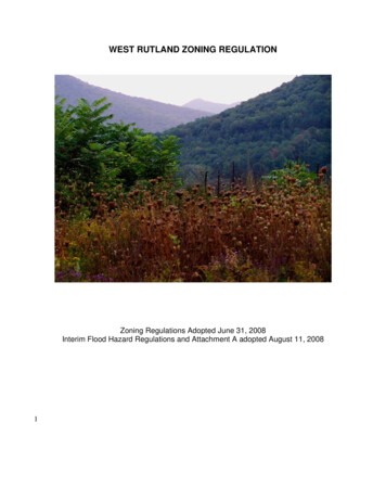
WEST RUTLAND ZONING REGULATIONZoning Regulations Adopted June 31, 2008Interim Flood Hazard Regulations and Attachment A adopted August 11, 20081
ARTICLE I: ENACTMENT, OBJECTIVES AND PURPOSE . 6SECTION 101: ENACTMENT . 6SECTION 102: PURPOSE . 6SECTION 103: OBJECTIVES AND INTENT. 6ARTICLE II: ESTABLISHMENT OF ZONING DISTRICTS AND ZONING MAP . 6SECTION 201: ESTABLISHMENT OF ZONING DISTRICTS . 6SECTION 202: ZONING MAP: . 14SECTION 203: INTERPRETATION OF ZONING DISTRICT BOUNDARIES: . 14SECTION 204: PLANNED UNIT DEVELOPMENT . 15ARTICLE III: TABLE OF USES . 18ARTICLE IV: CONDITIONAL USE PERMITS (CONDITIONAL USES) . 24SECTION 401: USES PERMITTED SUBJECT TO CONDITIONS . 24SECTION 402: APPLICATIONS FOR CONDITIONAL USE . 26SECTION 403: BOND . 26SECTION 404: CONDITIONAL USES . 27ARTICLE V: LOT SIZE, SETBACKS, YARDS, HEIGHT LIMITATIONS . 29ARTICLE VI: PARKING AND LOADING . 32SECTION 601: OFF-STREET PARKING SPACE GENERAL REQUIREMENTS: . 32SECTION 602: PARKING SPACE REQUIREMENTS. 33SECTION 603: COMMERCIAL LOADING AREAS . 34ARTICLE VII: . 34NONCONFORMING USES AND NOCONFORMING STRUCTURES . 34SECTION 701: CONSTRUCTION APPROVED PRIOR TO ADOPTION OR AMENDMENT OF REGULATIONS. 34SECTION 702: SCOPE . 34SECTION 703: CHANGE OF NONCONFORMING USE . . 34SECTION 704: EXTENSION OF A NONCONFORMING USE. . 34SECTION 705: ENLARGEMENT OF A NONCONFORMING USE. . 35SECTION 706: RESTORATION OF A NONCONFORMING USE SECTION 706: RESTORATION OF ANONCONFORMING USE . 35SECTION 707: DISCONTINUANCE OF NONCONFORMING USE . 35SECTION 708: NON-CONFORMING STRUCTURE . 35SECTION 709: MAINTENANCE OF A NON-CONFORMING STRUCTURE. . 35SECTION 710: EXPANSION OF A NON-CONFORMING STRUCTURE. . 35SECTION 711: RESTORATION OF A NON-CONFORMING STRUCTURE. . 35SECTION 712: DEVELOPMENT ON A NONCONFORMING LOT OR PARCEL . 35SECTION 713: ALTERATION OF A NONCONFORMING LOT OR PARCEL . 362
ARTICLE VIII: SIGNS . 37SECTION 801: SIGN REQUIREMENTS: A PERMIT IS REQUIRED FOR APPROVAL OF ALL SIGNS.37SECTION 802: MEASUREMENT OF SIGN AREA . 39SECTION 803: LOCATION OF SIGN . 39SECTION 804: HEIGHT RESTRICTIONS . 39SECTION 805: ILLUMINATED SIGNS . 39SECTION 806: REMOVAL OF SIGNS. 40SECTION 807: REPLACEMENT, ALTERATION OR RELOCATION . 40SECTION 808: PORTABLE SIGNS . 40ARTICLE IX: SITE PLAN APPOVAL . 40SECTION 901: SCOPE . 40SECTION 902: SUBMISSION OF SITE PLAN AND SUPPORTING DATA . 40SECTION 903: SITE PLAN REVIEW CONSIDERATIONS . 41SECTION 904: BOND: . 43SECTION 905: AMENDMENTS: . 43ARTICLE X. GENERAL REGULATION . 43SECTION 1001: COMPLIANCE WITH REGULATIONS . 43SECTION 1002: EXISTING SMALL LOTS . 43SECTION 1003: REQUIRED FRONTAGE ON, OR ACCESS TO, PUBLIC ROADS OR PUBLIC WATERS 44SECTION 1004: PROTECTION OF HOME OCCUPATIONS . 44SECTION 1005: GROUP HOME AND DAY CARE FACILITIES . 44SECTION 1006: LOT LIMITATIONS. 44SECTION 1007: LOTS IN MORE THAN ONE ZONING DISTRICT . 45SECTION 1008: REDUCTION OF LOT AREA . 45SECTION 1009: REQUIRED AREA OR YARDS . 45SECTION 1010: TEMPORARY STRUCTURES . 45SECTION 1011: DESTROYED OR DEMOLISHED STRUCTURES . 45SECTION 1012: TRAILERS/MOTOR HOMES . 45SECTION 1013: HEIGHT OF STRUCTURES . 45SECTION 1014: APPROVAL OF PLATS . 46SECTION 1015: PONDS REQUIRING PERMITS . 46SECTION 1016: SITE DEVELOPMENT . 46SECTION 1017: ACCESSORY BUILDINGS AND APARTMENTS . 46SECTION 1018: A.D.A. ACCESSIBILITY. 46SECTION 1019: PROHIBITED USES. 47SECTION 1020: VEGETATIVE BUFFER STRIPS REMOVAL OF VEGETATION ALONG CLARENDON ANDCASTLETON RIVERS . 47SECTION 1021: REMOVAL OF VEGETATION ALONG ALL OTHER RIVERS AND STREAMS . 47SECTION 1022: GOLF COURSES AND DRIVING RANGES . 47SECTION 1023 FENCES . 49SECTION 1024: MINERAL AND EARTH RESOURCE EXTRACTION . 493
SECTION 1025 OPEN STORAGE IN RESIDENTIAL DISTRICTS . 50ARTICLE XI: ADMINISTRATION AND ENFORCEMENT . 51SECTION 1101: ZONING ADMINISTRATIVE OFFICER . 51SECTION 1102: ZONING PERMITS . 51SECTION 1104: ZONING APPLICATIONS, PERMITS, ISSUANCE . 53SECTION 1105: EFFECTIVE DATE . 54SECTION 1106: CERTIFICATES OF OCCUPANCY . 54SECTION 1107: COMPLETION . 54SECTION 1108: VIOLATIONS AND ENFORCEMENT . 54SECTION 1109 NOTICE OF VIOLATION . 54SECTION 1110: EXCLUSIVITY OF REMEDY . 55SECTION 1111: SPECIAL DUTIES RELATING TO FLOOD DISTRICT PERMITS . 55ARTICLE XII: BOARD OF ADJUSTMENT . 56SECTION 1200: CREATION OF BOARD OF ADJUSTMENT . 56SECTION 1202: OFFICERS OF THE BOARD . 56SECTION 1203: MEETINGS . 56SECTION 1204: RULES OF PROCEDURE . 56SECTION 1205: MINUTES AND FINDINGS . 56SECTION 1207: GENERAL POWERS AND DUTIES OF THE BOARD . 57SECTION 1208: VARIANCES - GENERAL . 57SECTION 1209: VARIANCES - FLOOD HAZARD DISTRICT . 58SECTION 1210: VARIANCES - RENEWABLE ENERGY RESOURCE STRUCTURE . 58SECTION 1211: CONDITIONAL USES - FLOOD HAZARD DISTRICT . 59SECTION 1212: NOTIFICATIONS - FLOOD HAZARD DISTRICT . 59SECTION 1213: APPEALS TO THE BOARD . 59SECTION 1214: APPEALS FROM DECISIONS OF THE BOARD . 61ARTICLE XIII: PLANNING COMMISSION . 61SECTION 1301: CONTINUATION OF THE PLANNING COMMISSION. 61SECTION 1302: GENERAL REVIEW OF THE ZONING REGULATION . 62SECTION 1303: REVIEW OF ZONING AMENDMENTS . 62SECTION 1304: SITE PLAN REVIEW . 62SECTION 1305: ADVISORY COUNSEL TO OTHER AGENCIES . 62SECTION 1306: GENERAL RULES OF PROCEDURE . 62ARTICLE XIV: OTHER PROVISIONS . 62SECTION 1401: PENALTIES FOR VIOLATION . 62SECTION 1402: INTERPRETATION OF REGULATION . 63SECTION 1403: NOTICE OF PUBLIC HEARINGS . 63SECTION 1404 HEARINGS . 64SECTION 1405 DECISIONS . 64SECTION 1406 RECORDING REQUIREMENTS . 654
ARTICLE XVI: DEFINITIONS . 725
ARTICLE I: ENACTMENT, OBJECTIVES AND PURPOSESection 101: EnactmentIn accordance with the Vermont Planning and Development Act, Chapter 117 of Title 24 of theVermont Statutes Annotated, hereinafter referred to as the “Act”, there are hereby establishedZoning Regulations for Town of West Rutland which shall be known and cited as the “Town ofWest Rutland Zoning Regulations”.Section 102: PurposeThese regulations promote the health, safety, and general welfare of the people of WestRutland. Specific objectives are to protect and enhance the value of property, preventovercrowding of land and undue concentration of population, and to provide for orderlycommunity growth.Section 103: Objectives and IntentThe objective of the Zoning Regulations is to establish standards and policies concerningdevelopment of land, which further the goals of the West Rutland Town Plan. It is intended thatthe standards and policies established by the Zoning Regulations reflect and express a senseof community values toward West Rutland’s environment including the value of appearanceand congenial arrangement for the conduct of farming, trade, industry, residential and otheruses of land necessary to the community’s well-being insofar as such values are related to theobjectives of the adopted Town Plan.ARTICLE II: ESTABLISHMENT OF ZONING DISTRICTS AND ZONING MAPSection 201: Establishment of Zoning DistrictsThe Town of West Rutland hereby establishes the following seven (7) major Zoning Districtsand three (3) overlay Zoning Districts. The permitted uses and conditional uses allowed ineach district are as specified in Article III: Table of Uses. The minimum lot sizes, set backrequirements, lot frontages requirements and height limitations for each district are asspecified in Article V.VillageDescription: The West Rutland village area is the school, civic and cultural center of thetown. The pattern of densely settled, mixed-use, residential and commercial structures andvarious municipal buildings is similar to many traditional Vermont settlements. This area alsocontains a very high concentration of historic structures including the Marble Street HistoricDistrict, which is listed in the National Register of Historic Places.Purpose: to maintain the economic vitality and compatible mix of residential and commercialuses at the center of the community as well as preserve the historic integrity of the village.Flood Hazard Areas: There may be some land within this district that are within the FloodHazard Overlay District. Please check the Official Zoning Map.6
IndustrialDescription: There are two distinct areas that comprise this district. One is predominantlyalong the northern length of Marble Street beginning near Thrall Avenue and extending towhere the name changes to True Blue Road. The remains of the marble operations, vacantbuildings, machinery, and quarries make this a suitable location for industrialredevelopment.The other is the West Rutland Industrial Park, located on SheldonAvenue.Purpose: To allow for industrial and commercial development in order to expand the town’seconomic base.Flood Hazard Areas: There may be some land within this district that is within the FloodHazard Overlay District. Please check the Official Zoning Map.CommercialDescription: Business Route 4 between the Village and the border with Rutland Town andthe Parcel Lot Number (000442) – known as the Jagodzinski Farm.Purpose: Maintain and extend the commercial character of this area.Flood Hazard Areas: There may be some land within this district that is within the FloodHazard Overlay District. Please check the Official Zoning Map.Residential I - Neighborhood Residential DistrictDescription: Medium density residential neighborhoods that surround the Village, most ofwhich are served by municipal amenities such as water and sewer.Purpose: To provide medium density residential development including subdivisions,multifamily structures, condo/townhouse units and single-family homes.Flood Hazard Areas: There may be some land within this district that is within the FloodHazard Overlay District. Please check the Official Zoning Map and see Section 201.H.Residential II - Farming/Agricultural and Rural ResidentialDescription Rural areas outside the village, with lower density residential use and mixedagricultural uses in certain designated areas.Purpose: To provide land area for low-density residential development, farming, forestry,greenhouses, recreation and other rural land uses.Flood Hazard Areas: There may be some land within this district that is within the FloodHazard Overlay District. Please check the Official Zoning Map.Conservation IDescription: Lands generally between the 800-foot and 1000 foot contours that aresensitive to development for a variety of reasons. They are generally characterized bysignificant natural resources such as dense forests, steep hills often with shallow soils,7
wetland areas and stream banks, among others or areas of scenic, cultural or historicalsignificance.Purpose: To provide a buffer zone between the most restrictive zoning district and otherdistricts. Preservation of natural features and wildlife habitat are a priority.Conservation IIDescription: Lands above the 1,000-foot contour, or lands that are very steep, or lands thatare in the floodplain. They are generally characterized by significant natural resources suchas dense forests, steep hills often with shallow soils, wetland areas and stream banks,among others or areas of scenic, cultural or historical significance.Purpose: The most restrictive of the zoning districts. To provide land area for low-impactrecreational uses, such as nature and hiking trails and very limited residential development,farming, forestry, and recreation. Residential development above 1,000-foot contour shouldblend in with its surrounding area and minimize ecological impactFlood Hazard OverlayDescription: All lands in the Special Flood Hazard Areas in and on the most current floodinsurance studies and maps published by the Department of Homeland Security, FederalEmergency Management Agency, National Flood Insurance Program, as provided by theSecretary of the Agency of Natural Resources pursuant to 10 V.S.A. Chapter 32 § 753,which are hereby adopted by reference and declared to be part of these regulations.Purpose: It is the purpose of this district and its regulations to promote the public health,safety, and welfare, to control development of lands in areas of special flood hazard, and tominimize losses due to floods by:Restricting or prohibiting uses that are dangerous to health, safety or property in times of flood,or that cause excessive increase in flood heights or velocities;Requiring that uses vulnerable to floods, including public facilities that serve such uses beprotected at the time of initial construction, against flood damage;Protecting individuals from buying lands that are unsuitable for their intended purposesbecause of flood hazard.Ridgeline Overlay DistrictDescription: Lands above the 800 foot contours.Purpose: To provide very limited residential development which blends in with it’s surroundingsand minimizes ecological impact. Also to provide land area for low impact recreational uses.All uses or structures listed as permitted or conditional in Article III Table of Uses, exceptagriculture, forestry and municipally owned parks in the underlying zoning district are treatedas a conditional use.8
In addition to the standards set forth in Sections 401-404, when reviewing applications forconditional uses within the Ridgeline Overlay District, the Zoning Board of Adjustment shallconsider the following:Placement of Structures Careful consideration shall be given to the location of proposedstructures relative to site conditions, existing vegetation, and the location of fragile features(including but not limited to steep slopes, streams and identified habitat and natural areas).The Board may limit of restrict the location of structures to ensure that development:Is minimally visible from public reads and properties, does not stand in contrast tosurrounding landscape patterns and features, and does not serve as a visual focal point;Is located down-grade of ridgelines and prominent knolls, is designed so that the height ofany structures does not visually exceed the height of the adjacent tree canopy or ridgelineserving as the visual backdrop to the structure;Will not adversely affect natural and scenic resources and fragile areas identified in theWest Rutland Town Plan, including wetlands, streams, critical habitat, steep slopes, areasof unstable soils and/or soil types that are generally unsuitable for development and on-siteseptic disposal;Clearing and Landscaping. On wooded sited, existing forest cover shall be maintainedadjacent to proposed structures to interrupt the façade of buildings, provide a forestedbackdrop to structures, and/or soften the visual impact of new development as viewed frompublic roads and properties.The Zoning Board of Adjustment shall consider the location of proposed structures relativeto existing vegetation, and may require additional tree planting and/or limit the amount ofclearing adjacent to proposed development to provide screening and maintain a forestedbackdrop. A plan for the maintenance of remaining and proposed trees may be required.Such a plan shall address specific measures to be taken to ensure the survival and ifnecessary, replacement of designated trees during or after site development and theinstallation of all site improvements.Building Design. The Zoning Board of Adjustment shall consider the overall design of newstructures (including the proposed scale, location and materials), and my imposeconditions related to the overall design to minimize visual impacts, such as glare,contrasting colors and building material, as viewed from public roads and properties.Erosion Control. Development shall minimize the removal of native vegetation and grading.Clearing may be limited to one of more portions of the property to prevent erosion andsedimentation of streams; buffer areas may be required to protect streams, wetlands andother fragile features.Forest Management. Forest management activities shall comply with all applicable stateregulations and shall, as a minimum standard, comply with Acceptable Management9
Practices for Maintaining Water Quality on Logging Jobs in Vermont, as revised, publishedby the Vermont Department of Forests, Parks & Recreation.Site Restoration. Forest management activiti3es intended as site preparation prior todevelopment of a site, including road and driveway construction, clearing and/or grading forhouse-sites and septic systems or related work, shall be reviewed by the Board under thisbylaw. Where a landowner fails to submit such a plan for review, the Board may limitdevelopment to the non-impacted portion of the property and/or require the site to berestored or re-vegetated prior to development.Source Water Protection Overlay DistrictPurpose: The Purpose of the Source Water Protection Overlay District is to protect publichealth and safety by preserving and protecting the community’s ground water source fromincompatible uses and development. Zones within the overlay district are based on thefindings of the West Rutland Fire District Wellhead Protection Area and Source WaterProtection PlanZones: Zones within the Source Water protection Overlay DistrictZone 1 - Isolation ZoneZone 1 includes the source of West Rutland’s drinking water and is defined on the attachedmap. All of the land in this zone is owned by the Town of West Rutland. Wherever possible,the area shall be free of potential sources of contamination.The area shall remain free of any structures or uses not associated with the water sourceor recreation. No underground storage tanks are permitted in this area. No herbicides orpesticides may used in this area.No structure may be erected in Zone 1 without written approval by the West Rutland WaterDepartment. The Zoning Board of Adjustment reserves the right to review any proposedstructure according to the standards set forth in section 2.2(a).Zones 2 and 2A - Secondary ZonesDescription: Zones 2 and 2A include the area directly west and south of Zone 1 but withinthe approximate 6-month time-of-travel distance mapped around all the public water supplywell(s).Conditional Uses. The following uses are permitted only under the terms of a conditionaluse permit and must conform to provisions of the underlying zoning district and meet theperformance standards outlined in section 3.1.Expansion of existing nonconforming uses to the extent allowed by the underlying district.The applicant should consult Article III: Table of Uses to confirm nonconforming uses. TheZoning Board of Adjustment reserves the right to review all applications, with the WaterDepartment as technical advisors, and shall not grant approval unless it finds suchexpansion does not pose greater potential contamination of groundwater than the existinguse.Uses that are permitted or conditional in the underlying zone district and which are notsubject to section 2.2(b) below.10
Prohibited Uses. The following uses are prohibited within Zones 2 and 2A. (Existing useslisted as “prohibited” below may continue and may be expanded pursuant to section 2.2(a)and 2.2(a)Automobile body/repair shop;Gas station;Dry cleaner / Laundromat;Electrical/electronic manufacturing facility;Machine shop;Metal plating/finishing/fabricating facility;Chemical processing/storage facility;Wood preserving/treating facility;Junk/scrap/salvage yard;Mines/gravel pitIrrigated nursery/greenhouse stockConfined animal feeding operationsOn-site wastewater disposal systems;Equipment maintenance/fueling areas;Injection wells/dry wells/sumps - except for single-family residences directing gutter downspouts to adry well. In all cases, sumps must be encased.Underground storage tanks - except those under 300 gallon capacity, with spill, overfill, & corrosionprotection requirements in place.All other facilities involving the collection, handling, manufacture, use, storage, transfer or disposal ofany solid or liquid material or waste having potentially harmful impact on groundwater quality;All uses not permitted in the underlying zone district.Additional Requirements for Zone 2A. In addition to the requirements listed in sections 2.1and 2.2 above, the following uses are prohibited in Zone 2A:Underground storage tanksPesticides and herbicidesZone 3 - Source water recharge area.Zone 3 is defined as the area outside Zones 1, 2 and 2A, but deemed necessary to ensureadequate protection of public drinking water supplies.Permitted Uses: All uses permitted in the underlying zoning districts provided that they canmeet the Performance Standards outlined in section 3.1.11
Conditional Uses: All uses listed as conditional in the underlying zoning district may beapproved by the Zoning Board of Adjustment, with the Water Department as technicaladvisors, provided they can meet performance standards outlined for the GroundwaterProtection Overlay District and the applicable provisions set forth in Article IV: ConditionalUses.Performance StandardsThe following standards shall apply to all uses in the Source Water Protection OverlayDistrict:Any facility, other than single-two family housing, involving the collection, handling, manufacture, use,storage, transfer or disposal of any solid or liquid material or wastes, unless granted a special exceptioneither through permit or another ordinance, must have a secondary containment system which is easilyinspected and whose purpose is to intercept any leak or release from the primary containment vessel orstructure. Underground tanks or buried pipes carrying such materials must have double walls and inspectable sumps.Open liquid waste ponds containing materials referred to above will not be permitted without asecondary containment system.Storage of petroleum products in quantities less than 300 gallons at one locality must have spill, overfill,and corrosion protection requirements in place.For all permitted facilities storing more than 300 gallons for petroleum products or other hazardousmaterials, an acceptable contingency plan must be prepared for preventing contamination should floods,fire, or other natural catastrophes, equipment failure, or releases occur:For flood control, all underground facilities shall include but not be limited to a monitoring system andsecondary standpipe above the 100-year flood control level, for monitoring and recovery. For aboveground facilities, an impervious dike, above the 100-year flood level and capable of containing 100percent of the largest volume of storage, will be provided with an overflow recovery catchment area(sump).For fire control, plans shall include but not be limited to a safe fire fighting procedure, a fire retardingsystem, effective containment of any liquid runoff, and provide for dealing safely with any other healthand technical hazards that may be encountered by disaster control personnel in combating fire. Hazardsto be considered are pipes, liquids, chemicals, or open flames in the immediate vicinity.For equipment failures, plans shall include but not be limited to:Below ground level, removal and replacement of leaking parts, a leak detection system with monitoring,
Zoning Regulations for Town of West Rutland which shall be known and cited as the "Town of West Rutland Zoning Regulations". Section 102: Purpose These regulations promote the health, safety, and general welfare of the people of West Rutland. Specific objectives are to protect and enhance the value of property, prevent
