Transcription
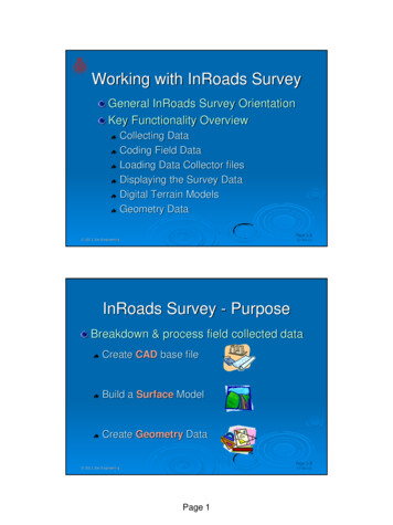
Working with InRoads SurveyGeneral InRoads Survey OrientationKey Functionality OverviewCollecting DataCoding Field DataLoading Data Collector filesDisplaying the Survey DataDigital Terrain ModelsGeometry DataPage 1-1 2011 Zen Engineering27 Oct 11InRoads Survey - PurposeBreakdown & process field collected dataCreate CAD base fileBuild a Surface ModelCreate Geometry DataPage 1-2 2011 Zen Engineering27 Oct 11Page 1
Data Collector FilesSurvey supports downloading of data frommany electronic data collectorsSDMS (.cal)Sokkia SDR (*.sdr)Trimble DC (*.dc)SMI Raw (*.raw)LISCAD GSI Format (*.gsi)Wild GRE (*.gre)AASHTO SDMS (*.sdm)Zeiss REC500 (*.zss)Geodimeter (Topography) (*.raw)Nikon (*.mwd)TopCon FC4 (*fc4) 2011 Zen EngineeringPage 1-327 Oct 11Loading Data Collector FilesThe field data filesthat InRoads Surveyreads must be ASCIIPage 1-4 2011 Zen Engineering27 Oct 11Page 2
Importing DataThe Importcommandallows theselection ofthe file to beloadedPage 1-5 2011 Zen Engineering27 Oct 11The In-Survey FieldbookThe Fieldbooklists the dataimported fromthe field infoStation &Observationdata can beviewed andeditedPage 1-6 2011 Zen Engineering27 Oct 11Page 3
Correction ‘Phase 1’The Fieldbook is ‘Cleaned Up’ in two distinctphases:Plan View – Planimetric ‘visual’ line work andgraphics the Drafting / Drawing3D – Elevational corrections via the DTMThe Plan View clean-up is first Page 1-7 2011 Zen Engineering27 Oct 11Correcting Code ErrorsThe values for any shot can be edited to allowfor necessary changes or additionsPage 1-8 2011 Zen Engineering27 Oct 11Page 4
Fieldbook EditsAny changesare made inthe In-SurveyFieldbookThe originalfield collectionfile is notchangedPage 1-9 2011 Zen Engineering27 Oct 11Graphical dataCAD is just a viewing mechanism for SurveyPage 1-10 2011 Zen Engineering27 Oct 11Page 5
In-Survey and CADStarting InRoads Survey will load the‘Defaulted’ CAD package as well as In-Survey2 Separate Programs are running!!Page 1-11 2011 Zen Engineering27 Oct 11In-Survey versus CADInRoads Survey handlesthe ‘Engineering’CAD is the viewerPage 1-12 2011 Zen Engineering27 Oct 11Page 6
Viewing Fieldbook DataThe Survey ViewSurvey Data from theMain Menu & the ViewSurvey Data toolbarallows the display ofthe field book dataThese views are‘temporary’ graphicsand can be toggled on& offPage 1-13 2011 Zen Engineering27 Oct 11Viewing Fieldbook Data (Symbology)Symbology for some ofthese graphics are underTools Survey OptionsThe Text Symbology Tabdefines the Symbols,Codes, Notes, Points,Elevations and Errors.Page 1-14 2011 Zen Engineering27 Oct 11Page 7
Viewing Fieldbook Data (Text Sizes)Text has a ‘View’ sizefor the temporary displayunder ‘Edit View ’The text size set under‘Edit ’ determine thesetting when the Surveyis committed to graphicsMicroStation text size is‘view independent’and will remain thissize independent ofzooming in or out.(sorry ACAD users)Page 1-15 2011 Zen Engineering27 Oct 11Viewing Fieldbook Data (Planimetrics)The General tabsettings deal with:Global Scale factorstied into the displaySettings related toError checkingVarious plan displayof the Fieldbook dataPage 1-16 2011 Zen Engineering27 Oct 11Page 8
Coding - Who is ?Show of hands:Who has astandard fieldcoding list?Who uses theirfield codingstandards?Page 1-17 2011 Zen Engineering27 Oct 11Coding is the Key!!Coding is how In-Survey interprets thecollected dataGood codingmakes theinterpretationmore accurateLack of, or poorcoding makes itmore difficultPage 1-18 2011 Zen Engineering27 Oct 11Page 9
The Brains of In-SurveyThe Style Managerdefines how the fieldCoding is interpretedFor CAD DisplayFor Surface creationFor GeometryPage 1-19 2011 Zen Engineering27 Oct 11Survey Field CodesEach shot collectedin the field isrepresented by anitem in this managerThe table definesthe characteristicsfor each field itemPage 1-20 2011 Zen Engineering27 Oct 11Page 10
Drafting - Who is ?Show ofhands:Who takesthe fielddata and‘draws’the surveymanually?Page 1-21 2011 Zen Engineering27 Oct 11Graphical dataCAD is usedas a viewingmechanismfor InRoadsSurveyThe CAD fileisn’t part ofthe surveydatabasePage 1-22 2011 Zen Engineering27 Oct 11Page 11
Viewing Fieldbook DataView:Plan drawingShot locationsPoint NumberPoint CodingElevationNotesError MessagesTraversesPage 1-23 2011 Zen Engineering27 Oct 11Correction ‘Phase 2’The Fieldbook is ‘Cleaned Up’ in two distinctphases:Plan View – Planimetric ‘visual’ line work andgraphics the Drafting / Drawing3D – Elevational corrections via the DTMThe Elevational Aspect clean-up is next IF 3D is required by the scope of the projectPage 1-24 2011 Zen Engineering27 Oct 11Page 12
Surfaces - Who is ?Show of hands:Who has to viewcontours of theirsurvey?Who has to build3D Surfacemodels of theirSurvey data?Page 1-25 2011 Zen Engineering27 Oct 11Surface BasicsSurvey can create a Digital Terrain Model (.dtm)from the collected field dataThe surfaces that are created can be used inInRoads, InRail, Site, Storm & Sanitary etc.There are different point Types that Survey canuse to build the 3D ModelPoint locations, Breaklines, closed shapes, Excluded Each point Type relates to the kind of data that iscollected in the field and how that data should beincorporated into the surface modelPage 1-26 2011 Zen Engineering27 Oct 11Page 13
Creating a Surface Model - DTMThe Survey Data toSurface commandcreates a DTM basedon the field dataThen use anySurface commandson the main menuThe DTM is based onthe field CodingPage 1-27 2011 Zen Engineering27 Oct 11Geometry - Who is ?Show of hands:Who has to display thegeometrics of their surveydata?Who has to input Traversing,Legal Descriptions, ControlPoints or control lines inaddition to the data collectedin the field?Page 1-28 2011 Zen Engineering27 Oct 11Page 14
Creating a Geometry File - ALGThe Survey Data toGeometry commandcreates geometrybased on the fieldcollected dataThen use anyGeometry commandson the main menuEvery shot can bepushed into the ALGPage 1-29 2011 Zen Engineering27 Oct 11Write the Drawing to CADSurvey ViewSurvey Data Write Survey Datato Graphics savesyour viewable datato the CAD fileThe Fieldbookviewing istemporary until thisstep is donePage 1-30 2011 Zen Engineering27 Oct 11Page 15
Saving a Survey Fieldbook - .fwdThe File Save As command allows you tocreate an FWD that contains all the field bookdataThe .fwd file can beopen into later Surveysessions and all thechanges & data will bepresentPage 1-31 2011 Zen Engineering27 Oct 11Key InRoads Survey File Types.XIN – Configuration fileSurvey Coding listCAD presentation controlsUnits, prism corrections & other info about the survey.FWD – Survey project fileCoordinates, Station & Observation data.DTM – 3D Surface model created from thecollected fieldbook data.ALG – Geometry Project created from thecollected fieldbook data.DGN or .DWG – CAD graphics filePage 1-32 2011 Zen Engineering27 Oct 11Page 16
Basic WorkflowCollect the field data and export an ASCII fileASCII files are imported and processed by In-SurveyImport the ASCII field data into InRoads SurveyThis creates an InRoads Survey FieldbookEdit / Correct / Add / Adjust the dataThe InRoads Survey Fieldbook contains the final workDisplay the CAD Graphics with InRoads SurveyCreate the Surface Model with InRoads SurveyCreate any Geometry with InRoads SurveyPage 1-33 2011 Zen Engineering27 Oct 11In-Survey Historical NoteIn-Survey used to be “FieldWorks”FieldWorks had very basic tools and sometimes too basicPage 1-34 2011 Zen Engineering27 Oct 11Page 17
InRoads Survey NowFieldWorks has evolved to include key ‘InRoads’functionality useful to a Survey departmentThis software evolution resulted in InRoadsSurveyPage 1-35 2011 Zen Engineering27 Oct 11InRoads LocksIn-Survey Tools LocksThese controls regulate theoutput, input or processing ofcertain In-Survey commandsThese Locks apply primarilyto the exported dataPage 1-36 2011 Zen Engineering27 Oct 11Page 18
Basic Workflow - SummaryMany types of data collectors ASCII Files can be loadedASCII files imported into Survey are not processed untilall the files have been read into memoryErrors in the data can be corrected as the files are beingprocessed or later in the FieldbookGraphics that Survey produces from the on-lineFieldbook are ‘temporary’ and are not written to a designfile until using the Write Survey Data command.Data added to a digital terrain model is controlled by theDTM feature associated with a particular field codeThe Geometry can be saved from the collected field dataPage 1-37 2011 Zen Engineering27 Oct 11Lab 1.4 - OverviewEstablishing the Project Default settingsImport a field collected fileView the imported dataGetting familiar with the In-Survey fieldbookTaking a first look at the Style ManagerExporting a digital terrain model (surface)Exporting a Geometry data fileSaving all the created data Get started on page 49Page 1-38 2011 Zen Engineering27 Oct 11Page 19
SMI Raw (*.raw) LISCAD GSI Format (*.gsi) Wild GRE (*.gre) AASHTO SDMS (*.sdm) Zeiss REC500 (*.zss) Geodimeter (Topography) (*.raw) Nikon (*.mwd) TopCon FC4 (*fc4) 2011 Zen Engineering 27 Oct 11 Page 1-4 Loading Data Collector Files The field data files that InRoads Survey reads must be