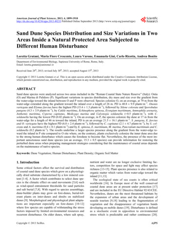
Transcription
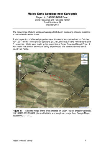
Mallee Dune Seepage near KaroondaReport to SAMDB NRM BoardChris Henschke and Rebecca TonkinRural Solutions SAOctober 2011The occurrence of dune seepage has reportedly been increasing at some locationsin the mallee in recent times.A site inspection of affected properties near Karoonda was carried out on October12th , 2011 by R Tonkin (Rural Solutions SA), B Lawson (SA MDB NRM Board) andC Henschke. Visits were made to the properties of Peter Rose and Stuart Pope. Itwas noted that similar issues are being experienced this season in dune-swalecountry at Parilla.Figure 1:Satellite image of the area affected on Stuart Pope’s property (circled),-35.130193,139.830422 (decimal latitude and longitude, image from Google Maps,accessed 21/11/11).Report on Mallee Salinity1
Figure 2:Satellite image of the area affected (circled) near Wynarka, 35.152302,139.663632 (decimal latitude and longitude, image from Google Maps,accessed 21/11/11).Figure 3:Close up satellite view of scalded area. Note light sandy areas on thedunes and greener area in the swale.Report on Mallee Salinity2
Figure 4:Dune seepage on property of S Pope, KaroondaThe photo in Figure 4 shows poor germination of a barley crop in a land-lockeddepression at the base of a sand dune. Lush crop growth is observed surroundingthe wet depression at the base of the slope where the crop has likely tapped into afresh perched watertable. There is currently no visible expression of salt in theseepage area (soil samples were taken to confirm this).Report on Mallee Salinity3
Figure 5:Soil profile within a dune seepage showing anaerobic staining on thesurface and saturated sand at 20 to 30cm.The seepage areas at Stuart Pope’s occur in land-locked depressions at the base oflarge sand dunes. Soil profiles in affected areas (Figure 5) comprise of sandy loamswith a dark anaerobic staining indicating waterlogged conditions. The topsoil isunderlain by pale brown saturated sand, containing water which appears to be quitefresh. The perched watertable overlays red slightly mottled calcareous light tomedium silty clay at 30 to 40cm.A well dug to 6 m near Stuart Pope’s farmhouse many years ago was fresh enoughto be used as a domestic water supply.The situation is different on the land located near Wynarka, currently being leased byPeter Rose. Here salinity is evident as the ground is bare and scalded (Figure 6),with salt crystals visible on the surface (Figure 7). The area is too soft for machineryto be driven over for most of the year, and so cannot be sown to crops or pasture.No plants are growing on the most severely affected parts, and around it are mostlygrowing rye-grass, brome, and thistles.Until a few years ago this area was apparently not saline although tending to beboggy, and grew good crops, but it has gradually turned saline, and the area hasbecome larger. There is concern that it may continue to expand.Report on Mallee Salinity4
Figure 6:Scalded land area leased near Wynarka.Figure 7:Bare soil with salt crystals visible on surface.Report on Mallee Salinity5
Soil pits dug with a spade showed that the general profile consists of a dark greybrown sandy loam in the topsoil (0-15 cm), showing anaerobic staining fromwaterlogging. This sandy layer has a crust on it which may contain salt crystals, andis dry to about 10cm, after which it is damp. This lies over a reddish brown sandylight clay (15-30 cm), which is wet to touch. After 30cm, there is a mixture of lightclay (becoming heavier with depth) and calcrete. The clay varies from reddish-brownat about 30cm, to cream/yellow/grey further down the profile as more lime is mixedwith the clay. The calcrete may be in large rocks (Figure 8, higher ground) or a softgravel (Figure 9, low in the scalded area). The water table is at 63 cm below thelowest part of the scald as at 16/11/11.Figure 8: Soil profile in upper scalded area near Wynarka.Report on Mallee Salinity6
Figure 9: Soil profile in lowest part of scald near Wynarka. Water has seeped intothe pit at about 63 cm.Soil samples taken from the 0-10 and 40-50 cm layers in the profile showed highsalinity in the topsoil, but much lower salinity further down (Table 1).DepthEC1:5ms/cmTexture0-10cm40-50 cm2.30.34SLSLCTextureConversionFactor9.56.5ECe –estimatedfrom 1:521.82.2Table 1: Soil salinity test results from Rose pit.This indicates that mildly saline water has been wicked up from the lower layers inthe soil and the water evaporated, leaving increasingly concentrated salt on thesurface.Report on Mallee Salinity7
Hydrological processesThe zone of dune seepage west and south of Karoonda (as mapped by PIRSA LandInformation, 2001) occurs in the Wynarka and Karoonda land systems. Thesesystems are characterised by shallow calcareous sandy loams and deep sands onsandhills. The soils are underlain by either Blanchetown Clay or sandy sediments ofthe Loxton/Parilla Sand. The Murray Group Limestone (MGL) occurs beneath theclayey sand sediments (see Figure 3). The regional aquifer occurs mainly in theMGL formation.Groundwater flow systems (GFS) operating in this area are regional flow systems inlimestone aquifers. In some areas they are overlain by local flow systems in aeoliansediments.The depth to regional groundwater is estimated at 20 to 50 metres; hence it isunlikely that there is any interaction between shallow local watertables and thedeeper limestone aquifer systems.Sand dunes (code 1 in Fig. 10) characteristically contain non-wetting sands and thispromotes surface runoff which funnels down and concentrates into hollows anddepressions at the foot of the dune (code 4 in Fig. 10). Rainfall may also infiltratethe dune in places and seep along the clay interface, eventually discharging intoland-locked depressions (‘pans’) at the base of the dune.Figure 10:Generic cross-section showing typical sequence of soils and geology inthe mallee, where 1 deep sand on sandhill, 2 calcareous sandyloam at break of slope and 4 loam over clay on a flat orswale/depression (after Maschmedt, 199?)In these seepage areas the crop suffers from ‘wet feet’ and the ‘pans’ become baredue to lack of cover. The landholders also mentioned that summer weeds used toinhabit these areas and so would help to dry them out. This is no longer the casewith more effective chemical weed control and hence these areas tend to remainbare as the excess water is no longer being used up in the ‘pans’.Report on Mallee Salinity8
The poor drainage in the landlocked depressions means that water has nowhere togo, being constrained by the surrounding sand dunes and by the sub-soil clay.There is minimal vegetative cover in the ‘pans’ to use up the excess water.It is likely that wetter seasons in the past couple of years has seen a re-emergenceof dune seepage across the mallee.The problem is locally driven and is therefore treatable with good land managementpractices.PrognosisAt Stuart Pope’s, it is unlikely that these seepage areas will expand, but may besustained by future out-of-season large rainfall events. However, it would pay tokeep an eye on the ‘pans’ to see if they become saline over time. Revegetationalong the road side or fence line would increase water use in the area, reducing therisk of developing salinity, and drawing down the water table to make it easier to getheavy machinery over the site.Subsoil boron and salinity is indicated in the Calcic Red Chromosol soils of themallee and hence it is possible that salt may begin to “wick-up” the from the deepersaline subsoil clays in the future if these areas remain wet and bare. These soils aretypically sandy loams over red calcareous sandy clays at 30cm over BlanchetownClay or clayey Parilla/Loxton sand at 80cm. The Blanchetown Clay is almostuniversally impermeable while the clay component of the Parilla/Loxton sand isgenerally sodic.At the property leased by Peter Rose, it is probable that unless action is taken, thearea will continue to expand and remain saline. Salinity is already evident, and saltwill continue to wick up from lower layers if the topsoil remains bare and water isdrawn up and evaporated from the surface.Revegetating the site with salt-tolerant species is likely to be successful as long asplants are placed in soil which is not too saline. This may require a gradualapproach, planting at the edges of the saline waterlogged area and moving in as thearea becomes drier and less salty. Once plants have established and roots haveaccessed the deeper moisture, they should do well. Salt on the surface should leachaway over time with normal rainfall.ManagementAreas affected by dune seepage are usually not very large and appear to reflect alocal waterlogging issue.If the problem is transient (i.e. comes and goes depending on seasons), it may notbe necessary to do anything.However, if the affected areas are expanding they can be managed both on-site byrevegetation with perennials and off-site by improving water use on the sand duneimmediately upslope of the discharge site.Report on Mallee Salinity9
Clay spreading, clay delving and spading are all techniques currently being trialled toimprove productivity on sand dunes. Improved productivity and water use shouldresult in less water ending up in the land-locked depressions on the flats.Future ActionA survey of the areas around Wynarka and Karoonda could be done to see if this isan increasing problem in the area. A desk-top study using GIS is possible, or a landholder survey.Increased landholder awareness now could prevent increasing problems in thefuture.Promotion of NRM activities/grants to combat salinity, waterlogging and associationproblems could assist farmers to treat these problems.Report on Mallee Salinity10
Figure 4: Dune seepage on property of S Pope, Karoonda The photo in Figure 4 shows poor germination of a barley crop in a land-locked depression at the base of a sand dune. Lush crop growth is observed surrounding the wet depression at the base of the slope where the crop has likely tapped into a fresh perched watertable.