Transcription
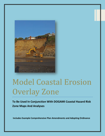
Model Coastal ErosionOverlay ZoneTo Be Used In Conjunction With DOGAMI Coastal Hazard RiskZone Maps And AnalysesIncludes Example Comprehensive Plan Amendments and Adopting Ordinance
Table of ContentsModel Coastal Hazards Overlay Zone 2Attachment A: Example Comprehensive plan Amendments .18Attachment B: Sample Adopting Ordinance language 20Attachment C: City of Newport Erosion Control Measures 23Attachment D: Astoria Erosion Control and Stormwater ManagementCode Language 25Attachment E: DLCD Geologic Report Guidelines for ShorelineProtective Structure Applications .351DLCD/OCMP Model Overlay Coastal Hazard Code
Model Coastal Hazards Overlay Zone[Note:This model code has been developed by the Oregon Coastal Management Program toaid local governments in further addressing increasing chronic coastal natural hazards. Thiscode language, or portions thereof, are intended to be used as an overlay zone and should bemodified as needed to fit with applicable zoning codes. This model overlay zone is intended tobe used with DOGAMI risk zone maps and analyses but could be modified to be used with othercredible regional hazard maps and analyses.Prior to using the model code provisions remember to review your comprehensive plan. Theprovisions in the model overlay zone are intended to be options to address a variety of chroniccoastal hazard issues; however, some comprehensive plan policies will need to be added orupdated to insure compatibility with the plan. In addition, it is prudent to seek legal counselconcurrence on all applicable provisions. ]Section 1.100 Coastal Hazard Overlay Zone(1) PurposeThe purpose of the Coastal Hazard Overlay Zone is to promote the public health,safety, and general welfare by:(a) identifying areas that may be subject to chronic coastal natural hazards includingocean flooding, beach and dune erosion, dune accretion, bluff recession, land sliding, and inletmigration;(b) assessing the potential risks to life and property posed by chronic coastal naturalhazards, including erosion and earth movement; and(c) minimizing potential public and private risks and losses to life and property due tothese chronic hazards through hazard avoidance and development requirements consistentwith Statewide Planning Goals 7, and 18 and the [applicable natural hazard section] Section ofthe [city/county] Comprehensive Plan.It is recognized that risk is ever present in identified hazard areas. The provisions andrequirements of this section are intended to provide for full identification and assessment ofrisk from natural hazards, and to establish standards that limit overall risk to the communityfrom identified hazards to a level acceptable to the community. However, it must berecognized that all development in identified hazard areas is subject to increased levels of risk,and that these risks must be acknowledged and accepted by present and future propertyowners who proceed with development in these areas.2DLCD/OCMP Model Overlay Coastal Hazard Code
(2) Applicability of Coastal Hazard Overlay ZoneThe following areas are considered potentially geologically hazardous and aretherefore subject to the requirements of this section:(a) Bluff or dune backed shoreline areas within low, medium, high or active hazardzones identified in the Department of Geology and Mineral Industries (DOGAMI) Open FileReport [place applicable DOGAMI Open File Report reference and title here].(b) Active or potential landslide areas, prehistoric landslides, or other landslide areasidentified in the DOGAMI Open File Report [place applicable Open File Report reference here]within or adjacent to hazard risk zones described in (a) above.(c) Lots or parcels where the average existing slopes are equal to or greater than 25percent within or adjacent to hazard risk zones described in (a) above.(d) Any other documented geologic hazard within or adjacent to hazard risk zonesdescribed in (a) above and on file in the office of the [City/County] of [insert applicable city orcounty name] [Building Official and/or Planning/Community Development Director]. A“documented geologic hazard area” as used in this subsection means a unit of land, which isshown by reasonable written evidence to contain geological characteristics/conditions whichare hazardous or potentially hazardous for the improvement thereof.(3) UsesWithin the Coastal Hazard Overlay Zone, all uses permitted pursuant to the provisionsof the underlying zone may be permitted, subject to the additional requirements andlimitations of this section.(4) Coastal Hazard Area Permit(a) Except for activities identified in subsection (4)(b) as exempt, any new developmentor structure in an area subject to the provisions of this section shall require a Coastal HazardArea Permit. The Coastal Hazard Area Permit may be applied for prior to or in conjunctionwith a building permit, grading permit, or any other permit required by the [city/county].(b) Except for beach or dune areas subject to the limitations of subsection (7) of thissection, the following activities are exempt from the requirement for a Coastal Hazard AreaPermit:(A) Maintenance, repair, or alterations to existing structures that do not alter thebuilding footprint or foundation;(B) An excavation which is less than two feet in depth, or which involves less thantwenty-five cubic yards of volume;(C) Fill which is less than two feet in depth, or which involves less than twenty-fivecubic yards of volume;(D) Exploratory excavations under the direction of a certified engineering geologist or3DLCD/OCMP Model Overlay Coastal Hazard Code
registered geotechnical engineer;(E) Construction of structures for which a building permit is not required;(F) Removal of trees smaller than 8-inches dbh (diameter breast height);(G) Removal of trees larger than 8-inches dbh (diameter breast height) provided thecanopy area of the trees that are removed in any one year period is less than twenty-fivepercent of the lot or parcel area;(H) Yard area vegetation maintenance and other vegetation removal on slopes lessthan 25% slopes;(I) Forest operations subject to regulation under ORS 527 (the Oregon Forest PracticesAct);(J) Maintenance and reconstruction of public and private roads, streets, parking lots,driveways, and utility lines, provided the work does not extend outside the previouslydisturbed area;(K) Installation of utility lines not including electric substations;(L) Emergency response activities intended to reduce or eliminate an immediatedanger to life, property, or flood or fire hazard; and(M) Restoration, repair or replacement of a lawfully established structure inaccordance with subsection (13) of this section.(N) Beachfront protective structures subject to regulation by the Oregon Parks andRecreation Department under OAR 736, Division 20. [Note: This exemption should be includedif the jurisdiction chooses “Option 2” in subsection (8) for the regulation of beachfrontprotective structures.](c) In circumstances where a portion of a lot or parcel is within a bluff or dune backedshoreline hazard zone or landslide risk area as identified in subsection (2), but where alldevelopment, construction, or site clearing (including tree removal) will occur on a portion ofthe lot or parcel entirely outside of the identified hazard area, no further review is requiredunder this section.(d) Application, review, decisions, and appeals on Coastal Hazard Area Permits shall bein accordance with the requirements for a [identify procedure type; a “type 2” process fordiscretionary decisions is recommended] procedure and decision making process as set forth inSection [reference applicable procedures section of local code]. Unless otherwise provided by[city/county] ordinance or other provision of law, any Coastal Hazard Area Permit so issuedshall be valid for a time period as specified in the approval decision and shall in no case bevalid for more than [add a time period such as 5 years] years.(e) In addition to a land use application form with the information required in Section[indicate general land use application submittal section here], an application for a CoastalHazard Area Permit shall include the following:4DLCD/OCMP Model Overlay Coastal Hazard Code
(A) A site plan that illustrates areas of disturbance, ground topography (contours),roads and driveways, an outline of wooded or naturally vegetated areas, watercourses,erosion control measures, and trees with a diameter of at least 8-inches dbh (diameter breastheight) proposed for removal;(B) An estimate of depths and the extent of all proposed excavation and fill work;(C) Identification of the bluff or dune backed hazard zone or landslide hazard zone forthe parcel or lot upon which development is to occur. In cases where properties are mappedwith more than one hazard zone, a certified engineering geologist shall identify the hazardzone(s) within which development is proposed based on the DOGAMI report referencedabove;(D) An engineering geologic report prepared by a certified engineering geologist whichmeets the content requirements of subsection (5); and[Note: If the jurisdiction wishes to consider other licensed professionals for hazardarea report preparation, it should consult with the Oregon Board of Geologist Examiners todetermine the appropriateness of including other related professionals such as a registeredgeologist or registered geotechnical engineer.](E) If engineering remediation is required to make the site suitable for the proposeddevelopment, an engineering report, prepared by a registered civil engineer, geotechnicalengineer, or certified engineering geologist (with experience relating to coastal processes),which provides design and construction specifications for the required remediation.(F) A draft copy of a Hazard Disclosure and Liability Waiver which sets forth thefollowing:(i) A statement that the property is subject to potential chronic natural hazards andthat development thereon is subject to risk of damage from such hazards;(ii) A statement that the property owner has commissioned an engineering geologicreport for the subject property, a copy of which is on file with the jurisdiction, and that theproperty owner has reviewed the engineering geologic report and has thus been informed andis aware of the type and extent of hazards present and the risks associated with developmenton the subject property;(iii) A statement acknowledging that the property owner assumes all risks of damagefrom natural hazards associated with the development of the subject property; and(iv) A statement releasing the jurisdiction, its agents and employees from any and allclaims which may arise as a result of damages, losses or injuries sustained by the propertyowner and his/her heirs, successors and assigns, from natural hazards.(f) A decision to approve a Coastal Hazard Area Permit shall be based upon findings ofcompliance with the following standards:5DLCD/OCMP Model Overlay Coastal Hazard Code
(A) The proposed development is not subject to the prohibition of development onbeaches and certain dune forms as set forth in subsection (7) of this section;(B) The proposed development complies with the applicable requirements andstandards of subsections (6), (7), (8) and (9) of this section;(B) The engineering geologic report conforms to the standards for such reports setforth in subsection (5) of this section;(C) The development plans which are the subject of the application conform, or can bemade to conform, with all recommendations and specifications contained in the EngineeringGeologic Report; and(D) The proposed development will be within the acceptable level of risk established bythe community, as defined in subsection (5)(b) of this section.(g) In the event the [city/county] determines that additional review of a Coastal HazardArea Permit application by an appropriately licensed and/or certified professional is necessaryto determine compliance with the provisions of this section, the [city/county] may retain theservices of such a professional for this purpose. All costs associated with this review shall beborne by the applicant in accordance with [reference city/county code section authorizing andsetting fees/charges].(h) In approving a Coastal Hazard Area Permit, the [city/county] may impose anyconditions which are necessary to ensure compliance with the provisions of this section orwith any other applicable provisions of this chapter.(i) If an engineering geologic report required by this section identifies conditions,processes or levels of risk for a specific site that are substantially different than the hazarddesignations contained in DOGAMI Open File Report [place applicable DOGAMI Open FileReport reference and title here] then the [city/county] may provide notice of such report to theDepartment of Geology and Mineral Industries (DOGAMI) and Department of LandConservation and Development (DLCD). The agencies will have 15 days to provide commentsand the [city/county] shall consider any agency comments in rendering a decision on a CoastalHazard Area Permit.[Note: The above provision providing for notice and review by DOGAMI and DLCD iscurrently under review. Jurisdictions should consult with the department before proposing thislanguage for adoption into a local code.](5) Engineering Geologic Report Standards(a) Engineering geologic reports required by this section shall be prepared consistentwith standard geologic practices employing generally accepted scientific and engineeringprinciples, and shall, at a minimum, contain the items outlined in the Oregon State Board of6DLCD/OCMP Model Overlay Coastal Hazard Code
Geologist Examiners "Guidelines for Preparing Engineering Geologic Reports in Oregon”,[insert date of issuance of current version of the published guidelines]. All Geologic Reports arevalid as prima facie evidence of the information therein contained for a period of five (5) years.Such reports are valid only for the development plan addressed in the report. The[city/county] assumes no responsibility for the quality or accuracy of such reports.(b) Engineering geologic reports required by this section shall include a statement ofthe certified engineering geologist’s professional opinion as to whether the proposeddevelopment will be within the acceptable level of risk established by the community,considering site conditions and the recommended mitigation.As used in this section, “acceptable level of risk” means the maximum risk to people andproperty from identified natural hazards deemed acceptable to the community in fulfilling itsduty to appropriately protect life and property from natural hazards. For development subjectto the provisions of this section, the acceptable level of risk is: Assurance that life safety will be protected from the identified hazard(s) for a timeperiod which exceeds the life of the associated structure, considering site conditionsand specified mitigation; and A [high likelihood] that the proposed structures will be protected from substantialdamage from the identified hazard(s) for a period of [50-70] years, considering siteconditions and specified mitigation.”Cascadia megathrust earthquake and tsunami events are exempt from this acceptable level ofrisk statement as indicated above [with the exception that this statement identified insubsection 5 (a) and 5 (b) above shall address the following threshold for Cascadia megathrustearthquakes]: It is [Likely] that life safety will be protected from the effects of a Cascadia megathrustearthquake for a time period which exceeds the life of the associated structure,considering site conditions and specified mitigation.][Note: Brackets “[]” denote policy decisions which should be considered by the localgovernment in implementing the proposed code language. To implement the aboverequirement, a jurisdiction will need to make policy decisions on selecting a minimumqualitative threshold for substantial damage risk and design life for new structures proposed inareas subject to coastal hazards. Design life should provide for a reasonable or typical lifeexpectancy for the structure, e.g. a new dwelling would generally be in the 50-70 year range. Inaddition, a jurisdiction may address life safety issues related to a Cascadia megathrustearthquake event as indicated above].7DLCD/OCMP Model Overlay Coastal Hazard Code
(c) In addition to the requirements set forth in subsection (5)(a, b), engineeringgeologic reports for lots or parcels abutting the ocean shore shall include the followinginformation, analyses and recommendations:(A) Site description:(i) The history of the site and surrounding areas, such as previous riprap or dunegrading permits, erosion events, exposed trees on the beach, or other relevant localknowledge of the site.(ii) Topography, including elevations and slopes on the property itself.(iii) Vegetation cover.(iv) Subsurface materials – the nature of the rocks and soils.(v) Conditions of the seaward front of the property, particularly for sites having a seacliff.(vi) Presence of drift logs or other flotsam on or within the property.(vii) Description of streams or other drainage that might influence erosion or locallyreduce the level of the beach.(viii) Proximity of nearby headlands which might block the longshore movement ofbeach sediments, thereby affecting the level of the beach in front of the property.(ix) Description of any shore protection structures that may exist on the property or onnearby properties.(x) Presence of pathways or stairs from the property to the beach.(xi) Existing human impacts on the site, particularly that might alter the resistance towave attack.(B) Description of the fronting beach:(i) Average widths of the beach during the summer and winter.(ii) Median grain size of beach sediment.(iii) Average beach slopes during the summer and winter.(iv) Elevations above mean sea level of the beach at the seaward edge of the propertyduring summer and winter.(v) Presence of rip currents and rip embayments that can locally reduce the elevationof the fronting beach.(vi) Presence of rock outcrops and sea stacks, both offshore or within the beach zone.(vii) Information regarding the depth of beach sand down to bedrock at the seawardedge of the property.(C) Analyses of Erosion and Flooding Potential:(i) Analysis of DOGAMI beach monitoring data for the site (if available).(ii) Analysis of human activities affecting shoreline erosion.8DLCD/OCMP Model Overlay Coastal Hazard Code
(iii) Analysis of possible mass wasting, including weathering processes, land sliding orslumping.(iv) Calculation of wave run-up beyond mean water elevation that might result inerosion of the sea cliff or foredune (see Stockdon, 1996 ).(v) Evaluation of frequency that erosion-inducing processes could occur, consideringthe most extreme potential conditions of unusually high water levels together with severestorm wave energy.(vii) For dune-backed shoreline, use established geometric model to assess thepotential distance of property erosion, and compare the results with direct evidence obtainedduring site visit, aerial photo analysis, or analysis of DOGAMI beach monitoring data.(viii) For bluff backed shorelines, use a combination of published reports, such asDOGAMI bluff and dune hazard risk zone studies, aerial photo analysis, and field work, toassess the potential distance of property erosion.(ix) Description of potential for sea level rise, estimated for local area by combininglocal tectonic subsidence or uplift with global rates of predicted sea level rise.(D) Assessment of potential reactions to erosion episodes:(i) Determination of legal restrictions of shoreline protective structures (Goal 18prohibition, local conditional use requirements, priority for non-structural erosion controlmethods).(ii) Assessment of potential reactions to erosion events, addressing the need for futureerosion control measures, building relocation, or building foundation and utility repairs.(E) Recommendations:(i) Use results from the above analyses to establish setbacks (beyond any minimumsset by this section), building techniques, or other mitigation to ensure an acceptable level ofsafety and compliance with all local requirements.(ii) Recommend a plan for preservation of vegetation and existing grade within thesetback area, if appropriate.(iii) Include a consideration of a local variance process to reduce the building setbackon the side of the property opposite the ocean, if this reduction helps to lessen the risk oferosion, bluff failure or other hazard.(iv) Recommend methods to control and direct water drainage away from the ocean(e.g. to an approved storm water system), or if not possible, to direct water in such a way so asto not cause erosion or visual impacts. In addition, the report shall specify erosion controlmeasures as necessary to conform to the requirements of subsection (9).(6) Additional Development Limitations in Coastal Hazard Areas9DLCD/OCMP Model Overlay Coastal Hazard Code
In addition to the conditions, requirements and limitations imposed by any requiredengineering geologic report, all development subject to a Coastal Hazard Area Permit shallconform to the following requirements:(a) New development [should/shall] be designed and sited in such a manner thatimprovements may be relocated in the event they are jeopardized by coastal hazards.Considerations shall include:(A) Construction techniques that will render new buildings readily moveable [shall beused/should be considered](B) Properties shall possess access of sufficient width and grade to permit newbuildings to be relocated or dismantled and removed from the site.(b) Safest site requirement: Proposed development on lots/parcels within the CoastalHazard Overlay Zone must be located within an area most suitable for development asdetermined by a certified engineering geologist as part of an engineering geologic reportprepared in accordance with subsection (5). As necessary to comply with this requirement,applicants shall consider seeking a variance to required yards or property line setbacks asauthorized in section [insert code section authorizing the granting of variances to dimensionalstandards].[Note: To best facilitate the use of this “safest site” requirement, it is recommended thatjurisdictions incorporate specific language into the local code section containing the standardsand requirements for variances which specifies that the reduction of risk from identifiedgeologic hazards can constitute a circumstance justifying a variance from yard, setback orsimilar dimensional standards.](c) Residential density limitation: Notwithstanding the residential density allowancesof the underlying zone, on lots or parcels which are developed with an existing dwelling ordwellings, the construction of additional dwelling units within the [insert hazard areas deemedappropriate and could include active, high, and medium hazard zone areas] erosion hazardzone areas is prohibited.(d) New Infrastructure Requirement: All new infrastructure (e.g., roads, water andsewer lines) shall be located landward of active and high hazard areas, whenever possible.[Note: For bluff-backed shorelines, jurisdictions may wish to consider a standardsetback to bluff edge or crest of the bluff for new construction; such a standard wouldrepresent a minimum, but could be increased if recommended by the engineering geologist.Generally, a standard setback should be based on an estimated annual erosion rate for thesubject site as identified by an engineering geologist, along with a projected design life for anew structure. A jurisdiction could also include a “buffer” distance beyond this potentialminimum erosion distance to provide an additional margin of safety. An example of a10DLCD/OCMP Model Overlay Coastal Hazard Code
standard based on an annual erosion rate for 60 years, plus a buffer distance, is providedbelow.](e) Minimum Bluff Setback Requirement: The footprint of any new structure or anyhorizontal addition requiring at least one footing in Coastal Hazard Overlay Zone area must beset back from the bluff edge a distance of 60 times the annual erosion rate (as determined bya certified engineering geologist) plus [20/or other distance determined to be an adequatebuffer] feet. If the bluff edge is not clearly defined the [City/County] shall determine the bluffedge by using the most recent LIDAR data and/or identifying the bluff break of 25% slope orgreater. In the case of a series of “stepped” bluffs the determination should be at the highestbluff edge.(7) Additional Limitations on Development on Beaches and DunesIn addition to the conditions, requirements and limitations imposed by any requiredengineering geologic report, all development subject to a Coastal Hazard Area Permit inidentified beach and dune areas shall conform to the following requirements:(a) Construction of residential, commercial, or industrial buildings is prohibited onbeaches, active foredunes, other foredunes that are conditionally stable and subject to oceanundercutting or wave overtopping, and interdune areas (deflation plains) that are subject toocean flooding.(b) Other development in these areas shall be permitted only if adequate findings areprovided to the [City/County] which demonstrate that the proposed development isadequately protected from any geologic hazards, wind erosion, undercutting, ocean floodingand storm waves; and is designed to minimize adverse environmental effects. In additionfindings shall be provided to address the following:(A) The type of use proposed and the adverse effects it might have on the site andadjacent areas;(B) Temporary and permanent stabilization programs and the planned maintenance ofnew and existing vegetation;(C) Methods for protecting the surrounding area from any adverse effects of thedevelopment; and(D) Hazards to life, public and private property, and the natural environment that maybe caused by the proposed use.[Note: Some jurisdictions address the above use prohibition/limitation and otherStatewide Planning Goal 18 requirements in a separate overlay zone or other set ofdevelopment standards with specific application only to identified beach and dune areas. Forjurisdictions that do not have a separate Goal 18 overlay, the above language will serve to11DLCD/OCMP Model Overlay Coastal Hazard Code
address the minimum dune hazard management requirements of Goal 18. Jurisdictions should,as a part of their comprehensive plan, inventory and identify in advance the areas subject tothe foredune and interdune development prohibition. To complete this inventory, (or ifnecessary, for use in case-by-case review), the following provides guidance on the suggesteduse of the DOGAMI HAZARD Maps to identify Goal 18 prohibition areas set forth in (5)(a)above:]Beach and dune development prohibition areas include:1) All dune backed shoreline areas within active and high hazard areas identified withinthe DOGAMI Coastal Erosion Hazard zone maps shall be included within thedevelopment prohibition area, and2) All dune backed shoreline areas within an area identified by FEMA FIRM maps to besubject to ocean flooding shall be included within the development prohibition area,and3) All dune backed shoreline areas within moderate hazard areas identified within theDOGAMI Coastal Erosion Hazard zone maps shall be included within the developmentprohibition area if it is determined by a qualified professional that the site is withinareas including beaches, active foredunes, other foredunes that are conditionally stableand subject to ocean undercutting or wave overtopping, and interdune areas (deflationplains) that are subject to ocean flooding. Any application for development within adesignated moderate hazard area as indicated above shall include this determination.(8) Requirements for Beachfront Protective Structures[Note: Statewide Planning Goal 18 sets forth an eligibility standard and review criteriafor beachfront protective structures. Beachfront protective structures (along with other oceanshore area improvements and activities) are regulated through Oregon Parks and RecreationDepartment’s Ocean Shore Permit process; OPRD is required to issue permits in compliancewith local plans and the Statewide Planning Goals. Local governments have the option ofimplementing the Goal 18 beachfront protective structure provisions through a local permit(which is in addition to the OPRD permit), or they may use the review of the Land UseCompatibility Statement (LUCS) for OPRD permits as a mechanism for applying the eligibilitystandard. The following subsection provides sample language for each of these options:][Option 1-Local Permit](a) A Coastal Hazard Area Permit for a beachfront protective structure shall be issuedonly where development existed on January 1, 1977, or where an exception to Goal 18,Implementation Requirement 2 has been adopted as a part of the comprehensive plan.12DLCD/OCMP Model Overlay Coastal Hazard Code
(b) For the purposes of this subsection, "development" means houses, commercial andindustrial buildings, and vacant subdivision lots which are physically improved throughconstruction of streets and provision of utilities to the lot.(c) All beachfront protective structures shall be subject to the following requirements:(A) Visual impacts shall be minimized;(B) Necessary access to the beach shall be maintained;(C) Negative impacts on adjacent property shall be minimized;(D) Long-term or recurring costs to the public shall be avoided.(E) Structures shall be designed to minimize adverse impacts on water currents,erosion, and accretion patterns; and(F) Land-use management practices and non-structural solutions to problems oferosion and flooding shall be preferred to structural solutions; structural solutions shall onlybe utilized when it i
ocean flooding, beach and dune erosion, dune accretion, bluff recession, land sliding, and inlet migration; (b) assessing the potential risks to life and property posed by chronic coastal natural hazards, including erosion and earth movement; and (c) minimizing potential public and private risks and losses to life and property due to
