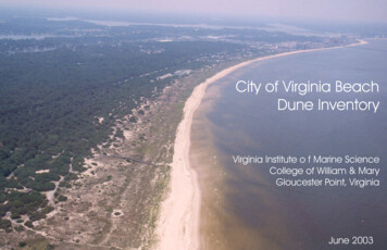
Transcription
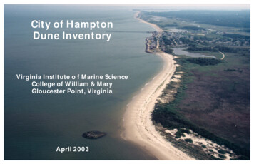
City of HamptonDune InventoryVirginia Institute o f Marine ScienceCollege of William & MaryGloucester Point, VirginiaApril 2003
City of Hampton Dune InventoryC. Scott Hardaway, Jr.1Donna A. Milligan 1Lyle M. Varnell 2George R. Thomas 1Linda M. Meneghini 1Thomas A. Barnard 2Sharon Killeen 2Shoreline Studies Program 1Department of Physical SciencesandWetlands Program 2Center for Coastal Resources ManagementVirginia Institute of Marine ScienceCollege of William & MaryGloucester Point, VirginiaThis project was funded by the Virginia Department of Environmental Quality’s Coastal Resources Management Program through Grant #NA17OZ11142-01 of theNational Oceanic and Atmospheric Administration, Office of Ocean and Coastal Resource Management, under the Coastal Zone Management Act of 1972, as amended.April 2003
List of FiguresTable of ContentsTable of Contents . . . . . . . . . . . . . . . . . . . . . . . . . . . . . . . . . . . . . . . . . . . . . . . . . . . . . . . . . . . . . . . . . . . . iList of Figures . . . . . . . . . . . . . . . . . . . . . . . . . . . . . . . . . . . . . . . . . . . . . . . . . . . . . . . . . . . . . . . . . . . . . . . iList of Tables . . . . . . . . . . . . . . . . . . . . . . . . . . . . . . . . . . . . . . . . . . . . . . . . . . . . . . . . . . . . . . . . . . . . . . . . i1INTRODUCTION . . . . . . . . . . . . . . . . . . . . . . . . . . . . . . . . . . . . . . . . . . . . . . . . . . . . . . . . . . . . . 11.1Purpose . . . . . . . . . . . . . . . . . . . . . . . . . . . . . . . . . . . . . . . . . . . . . . . . . . . . . . . . . . . . . . . 11.2Dune Act . . . . . . . . . . . . . . . . . . . . . . . . . . . . . . . . . . . . . . . . . . . . . . . . . . . . . . . . . . . . . . 12BACKGROUND . . . . . . . . . . . . . . . . . . . . . . . . . . . . . . . . . . . . . . . . . . . . . . . . . . . . . . . . . . . . . . 22.1Dune System Classification . . . . . . . . . . . . . . . . . . . . . . . . . . . . . . . . . . . . . . . . . . . . . . . . . 32.2Site Characteristics . . . . . . . . . . . . . . . . . . . . . . . . . . . . . . . . . . . . . . . . . . . . . . . . . . . . . . . 43DUNE DATA SUMMARY . . . . . . . . . . . . . . . . . . . . . . . . . . . . . . . . . . . . . . . . . . . . . . . . . . . . . . 54INVENTORY . . . . . . . . . . . . . . . . . . . . . . . . . . . . . . . . . . . . . . . . . . . . . . . . . . . . . . . . . . . . . . . . 75REFERENCES . . . . . . . . . . . . . . . . . . . . . . . . . . . . . . . . . . . . . . . . . . . . . . . . . . . . . . . . . . . . . . . 7Figure 1.Figure 2.Figure 3.Figure 4.Location of City of Hampton within Chesapeake Bay estuarine system . . . . . . . . . . . . . . . .Geographic extent of dunes in City of Hampton . . . . . . . . . . . . . . . . . . . . . . . . . . . . . . . . .Dune classification system developed by Hardaway et al. (2001) . . . . . . . . . . . . . . . . . . . .Typical profile of a Chesapeake Bay dune . . . . . . . . . . . . . . . . . . . . . . . . . . . . . . . . . . . . . .1234List of TablesTable 1.Table 2.Table 3.Identified dune sites in the City of Hampton as of 2000 . . . . . . . . . . . . . . . . . . . . . . . . . . . . 5Dune site measurements in City of Hampton as of 2000 . . . . . . . . . . . . . . . . . . . . . . . . . . . 6Dune site parameters in City of Hampton as of 2000 . . . . . . . . . . . . . . . . . . . . . . . . . . . . . . 6Appendix A. Location of Dune SitesAppendix B. Individual Dune Inventory SheetsCover PhotoLooking south from Lighthouse Point in Hampton, Virginia, June 2002, by VIMS, Shoreline StudiesProgram. HP12 is shown in the foreground while HP 8 is visible in the distance south of Grandview.i
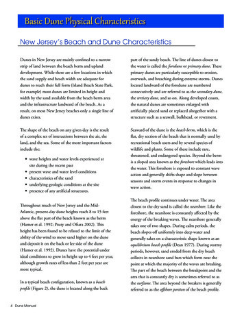
1INTRODUCTION1.1PurposeThe City of Hampton, Virginia is located along the western shore of Chesapeake Bay (Figure 1). Sixdune sites were identified along Hampton’s shoreline by site visits performed in 1999 and 2000. Most of thedunes are located along Chesapeake Bay between Old Point Comfort and Factory Point except of one site onHampton Roads (Figure 2). It is the intent of this publication to provide the user with information on thestatus of dunes in the City of Hampton. This information comes from research performed in 1999 and 2000which was presented in a report entitled “Chesapeake Bay Dune Systems: Evolution and Status (Hardaway etal., 2001). Since much of the data was collected several years ago and the beach and dune systems may havechanged, this report is intended only as a resource for coastal zone managers and homeowners; it is notintended for use in determining legal jurisdictional limits.1.2BaltimoreWashington DCDune ActCoastal dune systems of the Commonwealth of Virginia are a unique and valuable natural resource.Dunes are important to both the littoral marine system (as habitat for flora and fauna) and the adjacentlandward environment (as erosion control and protection from storms). These functions form the basis forthe Coastal Primary Sand Dune Protection Act of 1980 (Act)1 and the related resource management effortunder which the primary dune and beach components of existing dune systems are protected. Secondarydunes are not protected under the Act; however, as they are an important part of the overall dune system, theywere included in the original report (Hardway et al., 2001) and analyzed as part of a risk assessmentperformed by Varnell and Hardaway (2002). In this inventory, both primary and secondary dunes areincluded.Primary dunes must meet three criteria in order to fall under the Act’s jurisdiction:1.2.3.The General Assembly enacted the Coastal Primary Sand Dune Protection Act (the Dune Act) in 1980. TheDune Act was originally codified in Code § 62.1-13.21 to -13.28. The Dune Act is now recodified asCoastal Primary Sand Dunes and Beaches in Code § 28.2-1400 to -1420.m acR.RappahannockR.R.Substance: a mound of unconsolidated sandy soil contiguous to mean high waterMorphology: landward and lateral limits are marked by a change in grade from 10% to 10%.Character: primary dunes must support specific plant species or communities which arenamed in the Act and include: American beach grass (Ammophila breviligulata); beachheather (Hudsonia tometosa); dune bean (Strophostylis spp.); dusty miller (Artemisiastelleriana): saltmeadow hay (Spartina patens); seabeach sandwort (Arenaria peploides); seaoats (Uniola paniculata); sea rocket (Cakile edentula); seaside goldenrod (Solidagosempervirens); and short dune grass (Panicum ararum).P o torkYo1NJamesR.Norfolk/VirginiaBeachFigure 1. Location of City of Hampton within Chesapeake Bayestuarine system.1
Ches2apeaBack RiverkeBayPlate 2B12LighthousePoint8B8APlate 2AAll dunes in the Chesapeake Bay estuarine system are mobile features especially with regards tocoastal zone management. Unlike ocean dune fields that are relatively continuous features exposed to theopen ocean, the dunes of the Chesapeake form across a temporal and spatial geomorphic matrix driven bysand volume, varying wave climate, and shoreline geology. The coastal geology, in large part, determineswhether shoreline erosion acts upon the upland (high bank) or marsh (low bank). Sand supply and the longterm local wave climate are significant factors in the location of dunes. The stability or ability of adune/beach system to accrete over time is necessary for the formation of secondary dunes.Salt Ponds Creek2ShorelineStudiesProgram# Dune Site NumberPhoto base 1994 Digital OrthophotoQuarter QuadranglesPlate 1AHampton RoadsFortMonroeNPlate 1B4Coastal primary sand dunes form by the accumulation of sand due to the interaction of wind and waveaction along the shore. Sand deposited on the beach during periods of relatively low wave energy is movedlandward by onshore winds. The deposition of material above the intertidal zone allows vegetation to takeroot along the wrack line which then acts as a baffle, slowing wind speed and causing wind-borne sand tosettle and be trapped in the vegetation thereby resulting in further accretion of the dune. Therefore, the sizeand location of a primary dune is determined by the amount of sand available and the ability of wind andwaves to move it as well as the degree to which any existing vegetation can act to trap it. Thus, just asthe intensity, direction, and duration of winds and waves constantly change through the seasons, so too, docoastal dunes exist in a state of flux.Dunes act as a reservoir of sand which can buffer inland areas from the effects of storm waves and, inthe process, act as natural levees against coastal flooding. During high energy conditions, such as thenortheast storms which frequent the Eastern Seaboard, primary dunes may be subject to attack by winddriven waves aided by storm surges. The dune may be eroded, and the sand deposited in an offshore bar.Then, under low-energy conditions, the sand may move back to the beach.GrandviewCity ofHamptonBACKGROUNDNatural dunes in the Chesapeake Bay estuarine system vary in size and nature but all require that anaccreted feature, such as a beach washover or a spit, becomes vegetated above the intertidal zone. Thevegetation and a continuous beach/dune profile are required to create the jurisdictional primary dune. If thedune/beach forms across a low marsh shoreline, the system will move landward in response to storms, andonly a low primary dune will exist. If sand can accrete bayward due to shoals, spits, or man-made featuressuch as jetties and groins, then a secondary dune may develop from the original primary dune.Hardaway et al. (2001) found that the occurrence of dunes around Chesapeake Bay is due, in part, tothree factors: 1) morphologic opportunity (i.e., relatively stable setting), 2) abundant sand supply in thelittoral transport system, and 3) conducive onshore wind/wave climate. Deposited sand must remain above astable backshore to allow dune vegetation to become established. Each dune documented by Hardaway et al.(2001) has its own history of change -- growth and decay; natural and anthropogenic. Many miles of naturaldunes have been altered by development, and many have been formed in response to processes altered byman’s influence. Dunes around the Chesapeake Bay estuarine system in the localities within the Actencompass only about 40 miles of shoreline (Hardaway et al., 2001). This is about 0.4% of the total Bayshore - making it an important, but rare, shore type.Figure 2. Geographic extent of dunes in City of Hampton.2
2.1Dune System ClassificationThe Chesapeake Bay dune classification was developed in Hardaway et al. (2001) and is portrayed inFigure 3. This classification is based on factors that are unique to certain dune systems and has a basis in thedune field evolution, vegetative zones, lateral and vertical extent of primary and secondary dune features, andanthropogenic impacts.Dunes are categorized as Natural, Man Influenced, or Man Made. These three types reflect how thestate of the dune is most impacted. The parameters (A through G) are most influential in defining the statusof a given dune system. Parameter values within each category assign a range of limits or characteristics.Categories A, B, and C relate to the nature of the impinging wave climate at a given site while categories D,E, and F relate to geologic parameters. Dune parameter G relates to the type of anthropogenic influence.Fetch Exposure (A) is a qualitative assessment of the wave exposure and wave climate across openwater. Wave impact is the dominant natural process driving shoreline erosion and sediment transport alongthe Bay coasts. Riverine, Bay Influenced (A.1) is somewhere between the Open Bay exposure (A.2) andRiverine Exposure (A.3). Generally, A.1 sites have fetches of 5-10 nautical miles (nm); A.2 have fetches of 10 nm; and A.3 have fetches 5 nm.Shore Orientation (B) is the direction the main dune shore faces according to eight points on thecompass. Shoreline exposure to dominant directions of wind and waves is a component of fetch exposure(A) and wave climate as well as aeolian processes that assist in dune growth and decay.Nearshore Gradient (C) controls wave refraction and shoaling that, in turn, affect the nature of waveapproach and longshore sand transport as well as onshore/offshore transport. The presence or absence ofbars indicates the relative amount of nearshore sediment available for transport.The Morphologic Setting (D) is significant in the genesis of a particular dune site. Aerial imageryfrom VIMS SAV Archive and field observations were used to determine and classify the MorphologicSetting. Four basic categories were developed including: 1) Isolated dunes, 2) Creek mouth barrierdune/spit, 3) Spit and 4) Dune fields. Morphological Settings 1 and 4 are distinguished only by shore length(i.e. Morphologic Setting 1 500 ft and Morphologic Setting 4 500 ft) as an arbitrary boundary. Thesecategories were subdivided to reflect the nature of the setting into four subcategories which are 1) Pocket, 2)Linear, 3) Shallow Bay and 4) Salient.The Relative Stability (E) of a dune is very subjective. It is meant as a value judgement as to theoverall current and future integrity at the time of the site visit. If the site had wave cut scarps along theprimary dune face and/or was actively moving landward (overwash), it was termed LandTransgressive/Erosional (E.3). If the backshore/dune face had a slight gradient with stabilizing vegetation, itwas stable (E.2) or, possibly, accretionary (E.1).Dune Classification SystemDune Type1. Natural2. Man Influenced3. ManmadeDune ParametersA. Exposure: fetch1. Riverine, Bay Influenced2. Open Bay3. RiverineE. Relative Stability1. Stable2. Accretionary3. Land Transgressive/ErosionalB. Shore Orientation (direction of face)1. North5. South2. Northeast6. Southwest3. East7. West4. Southeast8. NorthwestF. Underlying Substrate1. Marsh/Creek Bottom2. UplandC. Nearshore Gradient (Distance to the 6 ft contour)1. 0 to 1,000 ft2. 1,000 to 3,000 ft3. Greater than 3,000 ft1. Extensive Bars2. No BarsG. Structure/Fill1. Groin2. Revetment/Bulkhead3. Breakwater4. Jetty5. Beach FillD. Morphologic Setting1. Isolated (less than 500 ft alongshore)1. Pocket2. Linear3. Shallow Bay (curvilinear)4. Salient (point)2. Creek Mouth Barrier/Spit3. Spit4. Dune Field (greater than 500 ft alongshore)1. Pocket2. Linear3. Shallow Bay (curvilinear)4. Salient (point)Figure 3. Classification system for Chesapeake Bay identified dune systems(from Hardaway et al., 2001).3
The underlying substrate (F) is a general category for the type of substrate or sediment the duneresides on and against. Two broad categories were chosen - marsh and upland. The marsh category includescreek bottoms which should be a separate category because beach/dune development can occur across themouth of a creek bottom without a true marsh. The distinction between upland and marsh was that themarsh substrate is usually a low bank that is subject to washover processes whereas the upland area offered a“backstop” to land beach/dune migration.If the site was not Natural (1), i.e. Man-influenced (2) or Man-made (3), then the nature of man’simpact was determined by the type of modification. The shore structures include Groins (G.1), Bulkheadsand Revetments (G.2), Breakwaters (G.3), Jetties (G.4), and Beach Fill (G.5). The degree of impact anygiven structure or combination of structures had on the dune site was not always clear. The Relative Stability(E) relates in part to whether man’s influence was erosive (destructive) or accretionary/stable (constructive).2.2various profile components were measured. These include: primary dune crest elevation, distance fromprimary dune crest to back of dune, distance from primary dune crest to MLW, secondary dune crestelevation, secondary dune crest to back of primary dune, secondary dune crest to back of secondary dune,distance from back of primary dune to back of secondary dune, width of secondary dune, and width ofprimary and secondary dune.During each site visit, dominant plant communities occupying the primary and secondary dunes (ifpresent) were analyzed (Figure 4). Plant species distribution is based on observed percent cover in thegeneral area of profiling and sampling within the identified dune reach.Site CharacteristicsCoastal zone profile and vegetation types presenton dunes were determined by site visit. Beach profiletransects were performed at most sites to measure theprimary and secondary dune (where present) within 100feet of the shoreline. Standard surveying and biologicalprocedures were utilized. Not all dune sites weresurveyed.Each surveyed transect used the crest of theprimary dune as the horizontal control and mean low water(MLW) as the vertical control. The primary dune crestwas determined on site. The MLW line was indirectlyobtained from water level measurements. The observedwater level position and elevation were checked againstrecorded tidal elevations at the nearest NOAA tide stationand time of day to establish MLW on the profile.The typical dune profile has several components(Figure 4). A continuous sand sheet exists from theoffshore landward and consists of a 1) nearshore region,bayward of MLW, 2 ) an intertidal beach, berm, andbackshore region between MLW and base of primary dune,3) a primary dune from bayside to landside including thecrest, and, where present, 4) a secondary dune. All profilesextended bayward beyond MLW and landward to at leastthe back of the primary dune. The secondary dune crestwas always measured but the back or landward extent ofthe secondary dune could not always be reached. Thedimensions, including lateral position and elevation ofTypical Chesapeake Bay Dune ProfileVegetation ZonesMaritime ForestAmmophilaS. PatensS. patens, shrubs, treesSea RocketSubmergedAquaticVegetationInterSecondary Dune (where present) Primary Dune Backshore tidal NearshoreBackofSecondaryDuneSecondaryDune CrestPrimaryDune CrestBack ofPrimaryDuneFront ofPrimaryDuneBeach Berm0 ft MLW0 ftFigure 4. Typical profile of a Chesapeake Bay dune system (from Hardaway et al., 2001).4
3DUNE DATA SUMMARYApproximately 2.0 miles of dune shore consisting of 6 sites (Table 1) were identified in Hampton.Previous work by Hardaway et al. (2001) had named a total of 14 possible dune sites in Hampton, but sitevisits verified just 6. The distal end of Grandview Nature Preserve, which became an island in 1998, wasoriginally identified as a potential dune site but was not visited for the original report. It likely had dunefeatures. In fact, Hampton dune sites had a wide variety of site conditions, ranging from a large dune fieldsouth of the breach at HP 12 to a small isolated dune along Hampton Roads (HP 2). Generally, dunesoccupied areas of sand accretion and stability such as around tidal creek mouths, embayed shorelines, in frontof older dune features, as washovers, as spits and against man-made structures like channel jetties or groinfields. Most of the dune sites resided along Hampton’s Chesapeake Bay coast which was once a continuous,sandy shore. This dynamic coast is exposed to open Bay waters and ocean swell conditions and has had ahistory of dynamic shore change and geomorphic evolution. Over time, the coast has been fragmented byshoreline hardening at Grandview, Buckroe Beach, and Fort Monroe. Salt Ponds Inlet was made permanentby jetties, and numerous groins have restricted sand movement alongshore. Instead of a continuous sandycoast, the beaches and dunes reside in more isolated subreaches.In Hampton, 3 of the 6 dune sites had both primary and secondary dunes. Table 2 presents themeasurements of the dune attributes. The average length of primary dune only sites was 483 ft whereas theaverage length of the primary with secondary dunes was 3,030 feet. Clearly, the wider sites were also thelongest. However, site visits occurred in 1999 and 2000; site characteristics may now be different due tonatural or man-induced shoreline change.Table 1. Identified dune sites in City of Hampton as of 2000. Site characteristics may now be different dueto natural or man-induced shoreline change.Location Dune Primary ting NorthingDateLengthSite?Site?No.(Feet)(Feet) Visited(Feet)22,629,850255,100 9/21/00220Yes42,643,450260,450 9/21/00550YesYesYes62,643,950262,500 9/21/00680YesYes72,645,750268,050 11/18/99 1,540YesYes8A’2,647,250274,750 11/18/99 2,250Yes8B’2,647,850276,700 11/18/99 1,100Yes122,649,650282,900 11/18/99 4,200YesYesYesTotal10,540*Public ownership includes governmental entities including local, state, and federal; otherwise ownership isby the private individual. Location is in Virginia State Plane South, NAD 1927‘One site with variable alongshore dune conditionsThe 3 main categories of Natural, Man-Influenced and Man-Made were used to portray a site’spotentially most influential element. In Hampton,16% are Natural, 84% are Man-Influenced, and none wereMan-Made (Table 3). In terms of shore length however, 40% are Natural and 60% are Man-InfluencedHampton’s dune sites are largely man-influenced with jetties, groins, and beach nourishment. Only the dunefield along the northern coast at Grandview Nature Preserve remains a relatively natural feature.5
Table 2. Dune site measurements in City of Hampton as of 2000. Site characteristics may now be differentdue to natural or man-induced shoreline change.Dune Site MeasurementsDunePrimary DuneSecondary A8B12(Feet)220556801,5402,2501,1004,200(ft MLW)6.812.511.610.011.610.013.8Distance from Crestlandwardto back base(Feet)1563771212568To MLW(Feet)51167179166161135169Table 3. Dune site parameters in City of Hampton as of 2000. Site characteristics may now be different dueto natural or man-induced shoreline change.Dune Site ParametersDistance FromCrestElev(ft MLW)Primary Crestlandward to profile .41744858Jurisdiction2ndCrestlandward2nd Crest seawardto 1st back ineExposure Directionof FaceAMan InfMan InfMan InfMan InfMan InfMan InfNaturalBNearshoreGradientCRiverine SoutheastSteepOpen BayEastSteepOpen BayEastSteepOpen BayEastSteepOpen BayEastSteepOpen BayEastSteepOpen Bay Northeast MediumNo BarsNo BarsNo BarsNo BarsNo BarsNo BarsNo BarsMorphologicSettingDRelative UnderlyingStability SubstrateEIsolated, pocketStableDune Field, pocket StableDune Field, linear ErosionalDune Field, linear StableDune Field, linear StableDune Field, linear ErosionalDune Field, linear StableStructureor Marsh/CBGroin, BWGroinGroinGroinGroin,JettyRevet6
4INVENTORYEach dune site is located on plates in Appendix A. The individual site inventory sheets are inAppendix B. Due to the mobile nature of dunes, their extent and morphology changes through time. Thedata presented in this report represents the status of the site at the time of assessment and to the best of theauthor’s knowledge. This information is for general management purposes and should not be used fordelineation. For detailed delineation of any dune site, the reader should contact the local wetlands board orVirginia Marine Resources Commission. See Figures 3 and 4 for description of the site parameters andmeasurements listed below.Each dune site has the following information on its inventory 19.20.21.22.Date visitedCentral site coordinates in Virginia South State Plane Grid NAD 1927Coordinates of profile originSite length in feetOwnershipSite TypeFetch ExposureShoreline Direction of FaceNearshore gradientMorphologic SettingRelative StabilityUnderlying SubstrateType of structure or fill (man-influenced only)Primary Dune Crest Elevation in feet above Mean Low Water (MLW)Landward extent of Primary Dune from Dune Crest in feetDistance from Dune Crest to MLWSecondary Dune Crest Elevation in feet above MLW (if present)Distance from Primary Dune Crest landward to profile endDistance from Secondary Dune Crest landwardPrimary Dune vegetation communitiesSecondary Dune vegetation communitiesGeneral Remarks5REFERENCESHardaway, C.S., Jr., G.R. Thomas, J.B. Glover, J.B. Smithson, M.R. Berman, and A.K. Kenne, 1992. BankErosion Study. Special Report in Applied Marine Science and Ocean Engineering Number 319.Virginia Institute of Marine Science, College of William & Mary, Gloucester Point, Virginia.Hardaway, C.S., Jr., L.M. Varnell, D.A. Milligan, G.R. Thomas, C.H. Hobbs, III, 2001. Chesapeake BayDune Systems: Evolution and Status. Technical Report. Virginia Institute of Marine Science,College of William & Mary, Gloucester Point, Virginia.Varnell, L.M. and C.S. Hardaway, 2002. An Analysis of Shoreline Development Risk for Secondary DuneSystems in Tidewater Virginia With Associated Management Recommendations. Final report to theVirginia Coastal Program. Virginia Institute of Marine Science, College of William & Mary,Gloucester Point, Virginia.Also included on the dune site inventory page is the site cross-section, if surveyed, and groundphotos, if taken. Long sites may have been represented with two or more profiles because the generalmorphology differs alongshore. Each profile was intended to be representative of that dune portion of thesite.7
Appendix ALocation of Dune SitesPlate 1Plate 2
Plate 1AHampton RoadsDyerCreekCity ofHampton2Plate 1BChesapeake BayPhoto base 1994Digital OrthophotoQuarter Quadrangles7Buckroe BeachSalt PondsDune Site46DOG BeachFt. MonroeVIMSShorelineStudiesProgramMill CreekA-1
Plate 2AChesapeake BayGrandview8BDyerCreekCity ofHampton8AWhite MarshSalt PondsChesapeake BayNorthend PointPlate 2BDune SitePhoto base 1994Digital OrthophotoQuarter QuadranglesBack RiverGrandviewNature Preserve12VIMSShorelineStudiesProgramA-2
Appendix BIndividual Dune Inventory SheetsHP 2HP 4HP 6HP 7HP 8A HP 8BHP 12
CITY OF HAMPTON DUNE SITE 2Site Information101. Date Surveyed: 21 Sep 20003. Profile Coordinates:2. Central Coordinates:N: 255,100 ftN: 255,100 ftE: 2,629,850 ftE: 2,629,850 ftVirginia South State Plane Grid NAD 1927 [4502]Primary Dune Crest54. Site Length: 220 ftMLW0-5-605. Ownership: Private6. Type:-40-20020406080Distance Offshore (ft)1001201401601ASite ParametersMan Influenced7. Fetch Exposure:Riverine8. Shoreline Direction of Face:Southeast9. Nearshore Gradient: 0 to 1,000ft10. Morphologic Setting: Isolated 500 ft Alongshore/PocketHP 211. Relative Stability: Stable21 Sep 200012. Underlying Substrate: Upland13. Structure or Fill: Groin and Breakwater21 Sep 200021 Sep 2000Site MeasurementsPrimary Dune:14. Crest Elevation (ft MLW): 6.815. Extent from Crest Landward (ft): 1516. Extent from Crest To MLW (ft): 51Secondary Dune: None17. Crest Elevation (ft MLW): N/A18. Land Extent From Primary Crest (ft): N/A19. Second Crest – Landward (ft): N/AVegetation CommunitiesLooking eastward toward the stone groin/spur atthe east boundary of the site.Looking westward along the pocket beach and dunetoward the stone breakwater.Not intended for use in determining legal jurisdictional limits.20. Primary Dune:Spartina patens (saltmeadow hay)Ammophila breviligulata (American beach grass)21. Secondary Dune:N/A22. Remarks:Site HP 2 is a pocket beach and dune bounded by arevetment on the west and a groin on the east. Since theinitial aerial assessment in 1998, a stone breakwater and groinwere installed in 2000. The site was once erosive but is nowstable.
CITY OF HAMPTON DUNE SITE 4Site Information201. Date Surveyed: 21 Sep 20003. Profile Coordinates:2. Central Coordinates:N: 260,450 ftN: 260,450 ftE: 2,643,450 ftE: 2,643,450 ftVirginia South State Plane Grid NAD 1927 [4502]Secondary Dune CrestPrimary Dune Crest10MLW0-10-1004. Site Length: 550 ft5. Ownership: Public (military)0100200300Distance Offshore (ft)6. Type:1BSite ParametersMan Influenced7. Fetch Exposure: Open Bay8. Shoreline Direction of Face:East9. Nearshore Gradient: 0 to 1,000ft/No Bars10. Morphologic Setting: Dune Field 500 ft Alongshore/PocketHP 411. Relative Stability: Stable21 Sep 200012. Underlying Substrate: Marsh13. Structure or Fill: Groin18 NOV 199918 NOV 1999Site MeasurementsPrimary Dune:14. Crest Elevation (ft MLW): 12.515. Extent from Crest Landward (ft):616. Extent from Crest To MLW (ft): 167Secondary Dune:17. Crest Elevation (ft MLW): 17.018. Land Extent From Primary Crest (ft): 5819. Second Crest – Landward (ft): 16Vegetation Communities20. Primary Dune:Ammophila breviligulata (American beach grass)Spartina patens (saltmeadow hay)21. Secondary Dune: Spartina patens (saltmeadow hay)Shrub/woodyLooking south toward the southern most groin atDOG Beach.Not intended for use in determining legal jurisdictional limits.Looking north at a middle groin.22. Remarks:HP 4 is located at DOG Beach on Fort Monroe. These siteshave evolved, in part, due to the three large broken concretegroins and a supply of sand from the north. Beach fill placednorth of Fort Monroe at Buckroe Beach eroded and wassubsequently transported south. HP 4 has a secondary dune.
CITY OF HAMPTON DUNE SITE 6Site Information151. Date Surveyed: 21 Sep 20003. Profile Coordinates:2. Central Coordinates:N: 262,500 ftN: 262,500 ftE: 2,643,950 ftE: 2,643,950 ftVirginia South State Plane Grid NAD 1927 [4502]Primary Dune Crest105MLW0-5-1004. Site Length: 680 ft5. Ownership: Public (military)01002003006. Type:1BSite ParametersMan Influenced7. Fetch Exposure: Open BayDistance Offshore (ft)8. Shoreline Direction of Face:East9. Nearshore Gradient: 0 to 1,000ft/No Bars10. Morphologic Setting: Dune Field 500 ft Alongshore/LinearHP 611. Relative Stability: Land Trangressional/Erosional21 Sep 200012. Underlying Substrate: Marsh13. Structure or Fill: Groin18 NOV 199918 NOV 1999Site MeasurementsPrimary Dune:14. Crest Elevation (ft MLW): 11.615. Extent from Crest Landward (ft):3716. Extent from Crest To MLW (ft): 179Secondary Dune: None17. Crest Elevation (ftM
dune field evolution, vegetative zones, lateral and vertical extent of primary and secondary dune features, and anthropogenic impacts. Dunes are categorized as Natural, Man Influenced, or Man Made. These three types reflect how the state of the dune is most impacted. The parameters (A through G) are most influential in defining the status