Transcription
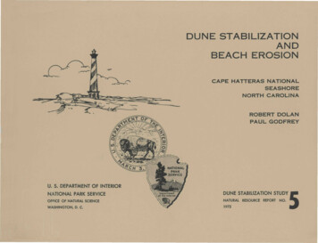
DUNE STABILIZATIONANDBEACH EROSIONCAPE HATTERAS NATIONALSEASHORENORTH CAROLINAROBERT D O L A NPAUL GODFREYU. S. DEPARTMENT OF INTERIORNATIONAL PARK SERVICEDUNE STABILIZATION STUDYOFFICE OF NATURAL SCIENCENATURAL RESOURCE REPORT NO.WASHINGTON, D. C.19725
INTRODUCTIONFrom a geological point of view, the Outer Banks ofNorth Carolina are one of the most dynamic areas under thejurisdiction of the National Park Service.The barrierislands undergo continual change in position.Because oceanicoverwash plays an essential role in this process, an unbalancedsituation is developing wherever artificial barrier dunes havebeen built.Further compounding the seriousness of the situa-tion has been the false impression of safety and stabilityoffered by the barrier dunes.Numerous structures, includingmotels, restaurants, beach cottages, park facilities, and aU.S. Navy base at Cape Hatteras have been built immediatelybehind the barrier dunes in the mistaken belief that they wouldprovide permanent protection from encroachment by the sea.Instead, the beach has steadily narrowed.Subsequently, thebarrier dune has eroded away leaving these structures withlittle protection from extreme events.The following illustrations provide, diagrammatically, asequence of events leading to the "unbalanced" conditions thatnow exist along most of the islands within the Cape HatterasNational Seashore, and three examples of corrective engineering.
PLATE I.THE NATURAL BARRIER ISLANDThe unaltered barrier system can meet the challenge of periodic extreme storms sincethere is no permanent obstruction in the path of the waves and surge. Most of the initialstress of an extreme event is sustained by the broad beaches.Because no resistance iscreated by impenetrable landforms, water flows harmlessly between the dunes and across theislands with the result that wave energy is rapidly exhausted.The combination of hightides and high waves occasionally succeeds in eroding the beach-face and low lying foredunes and carrying sand and shell inland or completely across the island and into the marshes.Because of steadily rising sea level (3 inches since 1963) the beaches have, in mostplaces, receded resulting in increased wave energy on the dunes and subsequent overwashand build-up in the interior sand flats and the marshes.has been a gradual westward movement of the islands.inlets may be opened.The net effect of this processPeriodically, during heavy storms,The natural and stabilized conditions are illustrated below.
NATURAL BARRIER ISLANDA BARB TROUGHC BERME DUNED DUNE FACE F BREACH DEPOSITBARRIER ISLAND STUDY BY ROBERT DOLAN, DEPT. OF ENVIRONMENTAL SCIENCES, UVAJ. G. CARSWELL,ILLUS.
PLATE IITHE STABILIZATION PROCESSThe frequency of destructive storms along coastal North Carolina,with accompanying oceanic overwash, precluded the establishment of apermanent road network until the 1930's.It was determined at thattime to construct a protective dune system between the proposed roadand the beach.In the period between 1936 and 1940, the CCC and WPA,under the direction of the National Park Service, erected almost3,000,000 feet of sand fencing to create a continuous barrier dunealong the Outer Banks.This was augmented in the late 1950's by theNational Park Service so that at present almost a continuous mass ofvegetation blankets the barrier island from south Nags Head to thesouthern tip of Ocracoke Island.As the system is stabilized, man builds roads and utilitiesthat establish a "line-of-development" which soon becomes a "line-of-defense."Widespread private and public property development contributes directly toincreased pressure to protect this line.It is important to stress thatthe dune lines, road lines, utility lines, or property lines have nonatural significance.
STABILIZATION PROCESSA BARC BERMB TROUGHD DUNE FACEBARRIER ISLAND STUDY BY ROBERT DOLAN, DEPT. OF ENVIRONMENTAL SCIENCES,UVAJ. G. CARSWELL, ILLUS
PLATE IIIFULLY STABILIZED SYSTEMThirty years of artificial dune stabilization has greatly alteredboth the ecological and geological structure of the Cape Hatteras sectorof the Outer Banks.A comparison of cross-sections of Hatteras Islandshow the extent to which stabilization has brought changes in beachmorphology.The most striking difference between the natural andaltered barrier islands, other than the presence of the artificial barrierdune system, is a marked difference in beach widths and the deeperinshore water depths that lead to increased wave energy dissipated on thebeach-face.Along many of the Hatteras Island stretches, altered 3 0years ago, the beach has receded to 150 feet, or almost disappeared.
FULLY STABILIZED PROCESSBARRIER ISLAND STUDY BY ROBERT DOLAN, DEPT. OF ENVIRONMENTAL SCIENCES,UVAJ. G. CARSWELL, ILLUS
PLATE IVSEVERE STRESS CONDITIONSThe beach narrowing process, combined with the presence ofpermanent dune structures, has created a situation in which high waveenergy is concentrated in an increasingly restricted run-up area, resultingin a steeper beach profile, increased turbulence, and a tendency for thebeach sand to be broken up into finer pieces and washed away.effect is increased erosion and further narrowing of the beach.The netUltimatelythe beach may all but disappear above the high water mark, and wave uprushis then applied directly to the stabilized dune.This has occurred inseveral places within the Cape Hatteras National Seashore and has resultedin a gradual undercutting of the dune front, with eventual destruction ofthe dune system and endandering of man-made structures behind the dunes.
SEVERE STRESS CONDITIONSBARRIER ISLAND STUDY BY ROBERT D O L A N , DEPT. OF ENVIRONMENTAL SCIENCES, UVA J.G. CARSWELL, ILLUS
EROSION CONTROLThe barrier islands recede when forces of erosion exceed the amountof sediment supplied to the beach-energy system.The greater the de-ficiency of sediment or the higher the wave forces (energy) the morerapid the rate of erosion.Any of the three factors, wave energy,sediment, or sea level, can vary and change the balance between erosionor deposition.Along the mid-Atlantic coast, wave energy ranges from modest tohigh, the sediment budget is mostly on the deficit side, and sea levelcontinues to rise.Unfortunately, all of these are factors that con-tribute to shoreline erosion.The photos on the opposite page illustratethe magnitude of change during an extreme event (March 1962) . This beachon Bodie Island was an experimental site when the storm occurred.Thedune face was eroded back over 100 feet, yet overwash only occurred in afew areas.Shoreline protection schemes can be summarized under three categories:protection designed to (1) inhibit direct attack by waves, such as sea walls,bulkheads, and revetments, and (2) those designed to inhibit currents thattransport sand, such as jetties and groins, and (3) artificial beachnourishment.
Before Ash Wednesday StormFive Days Later
SEA WALLSea walls are expensive and only suitable when all other means ofprotection are impractical.In principle, the sea wall is designed toabsorb and reflect wave energy, as well as elevate the problem area abovethe high water line.Unfortunately, sea walls, bulkheads, and revetmentsdo not prevent the loss of sand in front of the structure.In fact, seawalls commonly accelerate the loss of sand as the wall deflects the waveforces downward into the beach deposit.
EROSION CONTROL-SEA WALLBARRIER ISLAND STUDY BY ROBERT DOLAN, DEPT. OF ENVIRONMENTAL SCIENCES, UVAJ. G. CARSWELL, ILLUS
GROINSGroins are obstructions placed in the path of the longshore currentsfor the purpose of trapping littoral drift.These structures work onlywhen (1) littoral drift sediment is of significant volume, (2) the materialis at least sand size, and (3) only when the land down the beach fromthe groin is considered expendable.The reason for this is that groinstrap sand, and the sand gained at one place must be lost at another.Nourishment is commonly needed to fill or re-fill the groin compartmentsas the sands are lost.
EROSION CONTROL- GROINSBARRIER ISLAND STUDY BY ROBERT DOLAN, DEPT. ENVIRONMENTAL SCIENCES, UVA.d.G. CARSWELL, ILLUS
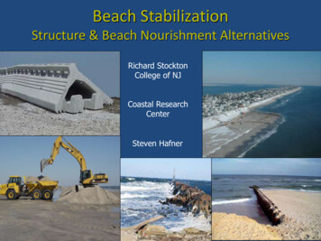
NOURISHMENTFor more than a century, coastal structures, including jetties, groins,and sea walls, have been built in the inshore zone in an effort to trap sandand protect beaches.In general, these structures have collectively aggravatedproblems rather than resulted in solutions.range of physical problems.The disadvantages span a wideArtificial beach nourishment, on the other hand,has long been considered the most desirable method of protection because:(1)Placement of sand on a beach does not alter the suitability ofthe systems for recreation.(2)Nourishment cannot affect adversely areas beyond the problem area.(3)If design failure occurs, the results of the "structure" are soondissipated.Perhaps the greatest disadvantage to artificial nourishment is that greatquantities of sand of suitable quality (type and size) are commonly not readilyavailable.In the past, sands were dredged from sounds and bays immediatelyinland from the beach, or transported from inland sources.With the recentconcern about estuarine ecology, and the fact that sound materials are generallytoo fine to be effective as beach nourishment, estuarine and bay sources areless desirable and no longer as available.The only future prospect for largequantities of sand for nourishment purposes appears to be offshore sourcesand materials dredged from the coastal inlets.
EROSION CONTROL-NOURISHMENT"BARRIER ISLAND STUDY BY ROBERT DOLAN, DEPT. OF ENVIRONMENTAL SCIENCES, UVAJ. G. CARSWELL, ILLUS
In the beginning—1936.CONCLUSIONSurvival of the natural barrierisland system along the coast of NorthCarolina requires a strategy of man-andnature rather than man-over-nature.Wehave attempted to "draw a line" and prevent the sea from passing — t h i s may bepossible in isolated areas, but the costwill be great.Since the Cape Hatterasportion of coastal North Carolina hasalready developed in places to the pointthat it would be very difficult to removethe highway, it must be maintained;however, as the barrier dunes continue tonarrow, increased overwash and inletformation can be forecast.Many of thestructures which have been built nearthe beach will surely be lost and thehighway will require re-locationwithin a few years.In the end 1972.
time to construct a protective dune system between the proposed road and the beach. In the period between 1936 and 1940, the CCC and WPA, under the direction of the National Park Service, erected almost 3,000,000 feet of sand fencing to create a continuous barrier dune along the Outer Banks. This was augmented in the late 1950's by the