Transcription
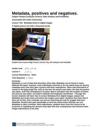
Metadata, positives and negatives.Subject Area(s) Computer Science, Data Analysis and ProbabilityAssociated Unit Cyber CitizenshipLesson Title Metadata found in digital imagesA digital picture can hide a thousand words.Student from Carson High School, Carson City, NV analyzes exif metadataGrade Level 10-11 ( 9- 12)Lesson #1 of 1Lesson Dependency - NoneTime Required 5 HoursSummaryMetadata is a set of data that describes other data. Metadata can be found in manydifferent file types; however, most individuals overlook or do not realize they are storingmetadata every time they take a picture with their smartphone. Often vital information isstored on the jpeg image file, such as the time the picture was taken, the date the picturewas taken, and if the smartphone’s location data is activated, then the location of wherethe pictures was taken, recorded in latitude and longitude coordinates. Through thislesson students will learn how to extract Metadata from digital images, analyze theMetadata and locate when and where the images were taken. Students also learn that ifthey can do this, then criminals can and are searching the web for images that haveMetadata. Student also gain knowledge on how law enforcement officials can useMetadata to catch criminals. Most importantly, students learn from this lesson to beproactive in regulating the pictures they take with their smartphones and minimize theirimage submissions to the web.Version: September 2016
Engineering ConnectionThere are many types of Engineers and regardless of their field of expertise i.e. Nuclear,Mechanical, Bio etc. all of them gather, process, analyze and disseminate information.Collecting Metadata is a fundamental skill of a Digital Forensics Engineer (DFE) who likeother engineers uses the Engineering Design Process to find solutions to a myriadamount of cyber-security problems.Engineering Category 2. Engineering analysis or partial designKeywords- Metadata - A set of data that describes and gives information about other data.- GPS - Global Positioning SystemEducational StandardsCommon Core Standards: ELA/Literacy - SL.11-12.5NV State Standards:Nevada, 2018, K-12 Computer Science Standards, 9-12.DA.S.2 (Grade 10-11): Evaluate thetradeoffs in how data elements are organized and where data is stored.Nevada, 2018, K-12 Computer Science Standards, 9-12.DA.CVT.1 (Grade 10-11): Createinteractive data visualizations or alternative representations using software tools to help othersbetter understand real-world phenomena.Nevada, 2018, K-12 Computer Science Standards, 9-12.DA.IM.1 (Grade 10-11): Createcomputational models that represent the relationships among different elements of datacollected from a phenomenon, process, or model.Connections to other Nevada Academic Content Standards (NVACS) at this grade level:Science: (9-12.DA.S.2) – HS-ETS1-3, HS-LS2-7, HS-ETS1-2 & 1-3, HS-LS4-6, HS-ETS1-2 & 13, SEP8; (9-12.DA.CVT.1) – SEP2, HS-LS2-4, HS-LS2-1 & 2-2, HS-LS3-3, HSLS4-3, HS-LS41, HS-LS4-6; (9-12.DA.IM.1) – SEP2, SEP4, SEP5, SEP8Mathematics: (9-12.DA.S.1) – SMP 4-7; (9-12.DA.CVT.1) – SMP 4 & 5; (9-12.DA.IM.1) – SMP 4&5ELA: (9-12.DA.S.2) – ELA RI.9-10.8; (9-12.DA.CVT.1) – ELA W.9-10.2a; (9-12.DA.IM.1) – ELAW.9-10.2aNational Standards:NSS-C.9-12.5 Roles Of The Citizen.ITEEA StandardsITEEA, 2000, Standard 4: Technology and Society, I (grades 9-12): The cultural, social,economic, and political effects on technology.ITEEA, 2000, Standard 6: Technology and Society, I (grades 9-12): The role of society in thedevelopment and use of technology.NGSS StandardsNGSS, 2012, Engineering Design HS-ETS1-1 (grades 9-12): Analyze a major global challengeto specify qualitative and quantitative criteria and constraints for solutions that account forsocietal needs and wants.Version: September 2016
CCSS Standards CCSS, 2010, Math, Practice MP2 Reason abstractly and quantitatively.(Grades K – 12)Pre-Requisite Knowledge - NoneLearning ObjectivesAfter this lesson, students should be able to: Define their role as a cyber-citizen in regards to the ethical practices of locating and usingmetadata attached to image files. Gather, process, analyze, and disseminate Metadata from image files Use web based tools to convert latitude and longitude coordinates to street addresses ormap location. Properly use personal electronics, responsibly regulating their own digital imagesubmissions to the web.Introduction / MotivationThe instructor goes over the course topic of Citizenship and Responsibility and facilitatesdiscussion between the students using guided questions to make the connection and relevanceof good citizenship and responsibility within the confines of the cyber world. The instructor thengoes over the topic of personal safety while in the cyber world, facilitating discussion betweenstudents. The instructor discusses with the students what metadata is and where it is found.Finally, the instructor facilitates discussion between the students about the positive and negativethings that can result from providing a picture of themselves with meta-data to the internet.The instructor will then demonstrate to the students a short quick way the bad guy could easilyfind out the meta-data from an image. The instructor uploads an image to Pic2Map an onlineEXIF viewer website located at https://www.pic2map.com/. The instructor then runs theextractor. The students will immediately see a lot of information displayed, in particular theaddress of where the picture was taken. The website also provides a satellite map of where thelocation is. The instructor further explains that even though this is a quick way to find out theinformation, it is not very safe as now the image has been uploaded to the internet and it isforever there. A better and safer way to find the metadata is to process the image the wayforensics experts would do it.The instructor explains that by downloading the Exiftool program, and using it to find the GPSlocation information from the data, and then recording that information and entering it into aGPS locator website to find the exact location and address, provides a layer of safety that onlyGPS coordinates are being entered into the internet, throughout the lesson. The instructor willthen facilitate discussion between the students on how they think the good guys i.e. policeofficials could use this skill set, as well as how they think the bad guys would use this skill set.Lesson Background & Concepts for TeachersBy examining digital photos that contain metadata, extracting that metadata, then using themeta-data to find the date, time and location that the photo was taken, the students develop amore sophisticated understanding of the concept of embedded metadata and how performingthe processes of finding the metadata can be used in both positive and negative manners.(SeeFigure 1) Higher order thinking questions which the teacher should use to solicit studentexplanations and help them to justify their explanations:Version: September 2016
- Knowing that Metadata describes data, explain what Metadata describes about a digitalimage taken with a smartphone? Time, date, GPS location.- In the description of GPS it says exact position, explain what they mean by “exactposition”? Provide an example: GPS-enabled smartphones are typically accurate to within a4.9 m (16 ft.) radius under open sky (VIEW fm?articleID 13079 ). However, their accuracyworsens near buildings, bridges, and trees.Image Figure #1Figure 1. Analyzing MetadataVocabulary / DefinitionsWordGlobal Positioning SystemImage file extension (i.e. .jpg, .png, .gif)HackerDefinitionGPS is a network of orbiting satellites thatsend precise details of their position inspace back to earth. The signals areobtained by GPS receivers, such asnavigation devices and are used tocalculate the exact position, speed andtime at the vehicle’s location.Students learn through observationthat certain image types such as .pngdoes not have sensitive metadataembedded and when uploading animage to the internet, they shouldconvert the image to a file extensionthat does not embed meta-data.By working on the project students willunderstand the ease at which cybercriminals such as “Hackers” can obtainsensitive information from digitalpictures, posted on the Internet.Version: September 2016
Computer ForensicsBy working on the project students willunderstand that extracting metadata isalso a tool used by private and publicofficials in a positive way to assist insolving criminal cases.Associated ActivitiesAfter demonstration, the instructor has the students use the computer software to practiceobtaining metadata from images provided by the instructor. Then the students will take themeta-data and enter it into the GPS location website - www.gps-coordinates.org to determinethe exact location of where the pictures were taken. After all students have been able to extractthe metadata and find the location of where the image was taken from the known picturesprovided by the instructor, they will then be directed to copy pictures from websites on theinternet, and then perform metadata extraction on those pictures. After all students haveperformed metadata extraction on internet images, the instructor will facilitate discussionbetween students on what they found and if any of the information found was concerning in therealm of cyber security.Lesson ClosureMetadata is embedded on all digital pictures taken with a smartphone. Even if thesmartphone’s GPS is turned off, the date and time are still recorded. By having thisknowledge, students can make responsible decisions about whether or not they shouldupload an image to the internet.AssessmentLesson Summary AssessmentDescriptive Title: Tracking metadata for the FBI- The instructor will provide the cadets with a rubric-based project. The project is based upon ascenario where the FBI provides a forensics team (made up of 4 to 5 students) with a thumbdrive. The thumb drive contains images of an older couple on their travels (the images areactual images that the instructor took of his own travels over the years, all images have beenchecked by the instructor to contain metadata, but not all pictures contain location data). Theolder couple is suspected by the FBI to be involved in a series of bank robberies across thenation. The FBI wants to find out if any correlation can be obtained from the metadataembedded in the pictures on the thumb drive with the locations of bank robberies that havehappened across the nation.- The student’s/team’s job is to use the Exiftool to read each picture’s metadata, and the GPSCoordinates Finder website (www.gps-coordinates.org) to locate the exact location for wherethe picture was taken. Each team member should conduct their fair share of the work. Thismeans that if there are 30 pictures and there are five (5) team members, each member shouldwork on six (6) of the images all by themselves.- Each team will access their Google Classroom, follow the link to the appropriate table folderfor their team. Once in the folder, the team will fill out the word document listing all members onthe team. The team should title the document with their team number (i.e. period - A1Table/Team 1). (0 to 50 pts possible)- Using a spreadsheet kept in their table/team folder, for each picture, teams must record theimage file name, the date the original picture was taken, the GPS Coordinates, the address ofVersion: September 2016
where the coordinates are, and a description of the location of the picture. By using the googlespreadsheet the instructor will also have access to the spreadsheet and can look at themodification history and confirm whether or not all students are doing their fair share of thework. (0 to 100 pts possible)- Using a slide presentation in their table/team folder, the team will create slides for each yearstarting from the year 2010 to 2018 or whatever the years the images were taken. Students willensure each slide will have a background of the outline of the United States (see Figure 2). Theteam will insert small circles where each picture was taken in chronological order. The team willalso insert the date next to the circle using yyyymmdd for the date format (ex. 20170227 February 27, 2017). Finally the team will insert straight lines between each circle to indicate thetravel path taken by the couple that year. By using the google slides the instructor will also haveaccess to the slide presentation and can look at the modification history and confirm whether ornot all students are doing their fair share of the work. (0 to 100 pts possible)Image Figure #2Figure 2Image file: IngramPlotPresADA Description: Young man looking at computer screenand working on a slide presentation which has the image ofthe United StatesSource/Rights: Daniel Ingram, Carson High School,Carson City, NVFigure 2. Plotting positional data, for slide presentation- Once the team has completed their work, they will print all documents, staple them togetherwith the google document on top, spreadsheet second, slides presentation last. (0 to 50 ptspossible)- Each team will be allowed fifteen (15) minutes to present their findings to the FBI (theinstructor and their classmates). After the presentation of their findings, each team member willprovide a quick outlook on what they found interesting about the project, providing both positiveand negative points, and finally what their view about metadata is now as compared to beforethe start of the lesson. (0 to 100 pts possible)ReferencesGPS Coordinates Finder website (www.gps-coordinates.org)VIEW SOURCE: cleID 13079Online EXIF viewer website located at https://www.pic2map.com/Version: September 2016
AttachmentsClass Period: Team:Date:Image Metadata Tracking Lesson Assignment RubricScenario – The Federal Bureau of Investigation (FBI) has been provided with information that an oldercouple may be responsible for several bank robberies across the nation. Currently, there is no evidencethat links the couple with the robberies; however, the FBI was able to obtain one of the couple’s thumbdrives which holds many of their digital pictures. The FBI has tasked your team with finding the date,time and location of where each picture was taken and then put together a timeline of data that the FBIwill then cross correlate with the known bank robbery dates, times, and locations.Directions – Teams will use the Exiftool to read each picture’s metadata, and the GPS CoordinatesFinder website (www.gps coordinates.org) to locate the exact location for where the picture was taken.Each team member should conduct their fair share of the work. This means that if there are 30 picturesand there are five (5) team members, each member should work on six (6) of the images all bythemselves.1. Teams will access their Google Classroom, follow the link to the appropriate table folder for theirteam. Once in the folder, the team will fill out a google document listing all members on the team. Theteam should title the document with their team number (i.e. A1 Table/Team 1). (0 to 50pts) PointsEarned2. Using a google spreadsheet kept in their table/team folder, for each picture, teams must record theimage file name, the date the original picture was taken, the GPS Coordinates, the address of where thecoordinates are, and a description of the location of the picture. (0 to 100pts) Points Earned3. Using a google slide presentation to be kept in their table/team folder, the team will create slidesfor each year starting from the year 2010 to 2017. Each slide will have a background of the outline of theUnited States. The team will insert small circles where each picture was taken in chronologicalorder. The team will also insert the date next to the circle using yyyymmdd for the date format (ex.20170227 February 27, 2017). Finally the team will insert straight lines between each circle to indicatethe travel path taken by the couple that year. (0 to 100pts) Points Earned4. Once the team has completed their work they will print all documents, staple them together withthe google document on top, spreadsheet second, google slides presentation last. (0 to 50pts) PointsEarned5. Each team will be allowed fifteen (15) minutes to present their findings to the FBI (the instructorand the other classmates). After the presentation of their findings, each team member will provide aquick outlook on what they found interesting about the project, providing both positive and negativepoints, and finally what their view about metadata is now as compared to before the start of the lesson.(0 to 100 pts possible) Points EarnedVersion: September 2016
Again, all team members must work on each of the documents with the exception of the Title Page(Google Document). The instructor will be checking the files in Google Classroom to ensure that eachstudent has entered data. All students should ensure that they use their own Google Account toaccess the documents to get credit for their portion of the assignment.ContributorsDaniel S. Ingram, Naval Science Instructor, Ed.S, Carson High School, Carson City, NVSupporting ProgramRET Site: Cyber Security Initiative for Nevada Teachers at the University of Nevada, Renosupported by the National Science Foundation. This research is supported by NSF Award#1542465.Classroom Testing InformationMarch 2017, Carson High School, Carson City NV grade 10 – 70 students, grade 11 – 65 students.Version: September 2016
Metadata, positives and negatives. Subject Area(s) Computer Science, Data Analysis and Probability Associated Unit Cyber Citizenship Lesson Title Metadata found in digital images A digital picture can hide a thousand words. Student from Carson High School, Carson City, NV analyzes exif metadata Grade Level _10-11_ ( 9- 12) Lesson # _1_ of _1_